
Wilkes Land crater
Encyclopedia
Wilkes Land crater is an informal term that may apply to two separate cases of conjectured giant impact crater
s hidden beneath the ice cap
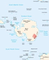
of Wilkes Land
, East Antarctica
. These are separated below under the heading Wilkes Land anomaly and Wilkes Land mascon (mass concentration), based on terms used in their principal published reference sources.
. The hypothesis was detailed in a paper by J. G. Weihaupt in 1976. Evidence cited included a large negative gravity anomaly
coincident with a subglacial topographic depression 243 km across and having a minimum depth of 848 m. The claims were challenged by C.R. Bentley in 1979.
On the basis of a paper by J.G. Weihaupt et al. (Gravity anomalies of the Antarctic Lithosphere, LITHOSPHERE, 2010, volume 2, number 6, 454–461)Bentley's challenge was proven to be incorrect, and the IMPACT DATABASE (Rajmon 2011) has now reclassified the Wilkes Land Anomaly from a "possible impact crater" to a "probable impact crater," on the basis of Weihaupt et al's 2010 publication. Several other potential impact crater sites have now been proposed by other investigators in the Ross Sea, West Antarctica, and the Weddell Sea.
 The Wilkes Land mass concentration
(or mascon) is centered at 70°S 120°E and was first reported at a conference in May 2006 by a team of researchers led by Ralph von Frese
and Laramie Potts
of Ohio State University
. The team used gravity measurements by NASA's
GRACE
satellites to identify a 300 km (186.4 mi) wide mass concentration and noted that this mass anomaly is centered within a larger ring-like structure visible in radar images of the land surface beneath the Antarctic ice cap
. This combination suggested to them that the feature may mark the site of a 480 km (298.3 mi) wide impact crater
buried beneath the ice. The possible size of the impactor could have been 55.6 km (34.5 mi) wide.
Due to the site's location beneath the Antarctic ice sheet
there are no direct samples to test for evidence of impact. There are alternative explanations for this mass concentration, such as formation by a mantle plume
or other large-scale volcanic activity. If this feature really is an impact crater, then, based on the size of the ring structure, it has been suggested by von Frese's team that the impactor could have been four or five times wider than the one that created the Chicxulub Crater
, believed to have caused the Cretaceous–Tertiary extinction event.
Because mass concentrations on Earth are expected to dissipate over time, von Frese and coworkers believe the structure must be less than 500 million years old, and also note that it appears to have been disturbed by the rift valley
that formed 100 million years ago during the separation of Australia
from the Gondwana
supercontinent. These researchers therefore speculate that it is possible that the putative impact and associated crater contributed to this separation by weakening the crust at this location. These bracketing dates also make it possible that the site could be associated with the Permian–Triassic extinction event. The Permian–Triassic extinction occurred 250 million years ago, and is believed to be the largest extinction event since the origin of complex multicellular life. Plate reconstructions for the Permian–Triassic boundary place the putative crater directly antipodal
to the Siberian Traps
, and von Frese et al. (2009) use the controversial theory that impacts can trigger massive volcanism at their antipodes to bolster their impact crater theory.
However, there are already other suggested candidates for giant impacts at the Permian–Triassic boundary, for example Bedout
off the northern coast of Western Australia
, although all are equally contentious, and it is currently under debate whether or not an impact played any role in this extinction. The complete absence of a well-defined impact ejecta layer associated with the Permian–Triassic boundary at its outcrops within Victoria Land and the central Transantarctic Mountains argues against there having been any impact capable of creating a crater the size of the hypothesized Wilkes Land impact crater within Antarctica at the Permian–Triassic boundary.
Impact crater
In the broadest sense, the term impact crater can be applied to any depression, natural or manmade, resulting from the high velocity impact of a projectile with a larger body...
s hidden beneath the ice cap
Ice cap
An ice cap is an ice mass that covers less than 50 000 km² of land area . Masses of ice covering more than 50 000 km² are termed an ice sheet....
of Wilkes Land
Wilkes Land
Wilkes Land is a large district of land in eastern Antarctica, formally claimed by Australia as part of the Australian Antarctic Territory, though the validity of this claim has been placed for the period of the operation of the Antarctic Treaty, to which Australia is a signatory...
, East Antarctica
East Antarctica
East Antarctica, also called Greater Antarctica, constitutes the majority of the Antarctic continent, lying on the Indian Ocean side of the Transantarctic Mountains...
. These are separated below under the heading Wilkes Land anomaly and Wilkes Land mascon (mass concentration), based on terms used in their principal published reference sources.
Wilkes Land anomaly
A giant impact crater beneath the Wilkes Land ice sheet was first proposed by R.A. Schmidt in 1962 on the basis of the seismic and gravity discovery of the feature made by the U.S. Victoria Land Traverse in 1959–60 (VLT), and the data provided to Schmidt by J.G. Weihaupt, geophysicist of the VLT (Geophysical Studies in Victoria Land, Antarctica,Report No. 1, Geophysical and Polar Research Center, University of Wisconsin, 1–123). Schmidt further considered the possibility that it might be the elusive source of tektites from the Australasian strewnfieldAustralasian strewnfield
The Australasian strewnfield, covering at least one-tenth of the Earth's surface, is the largest and the youngest of the tektite strewnfields. The 800,000 year-old strewnfield includes most of Southeast Asia...
. The hypothesis was detailed in a paper by J. G. Weihaupt in 1976. Evidence cited included a large negative gravity anomaly
Gravity anomaly
A gravity anomaly is the difference between the observed acceleration of Earth's gravity and a value predicted from a model.-Geodesy and geophysics:...
coincident with a subglacial topographic depression 243 km across and having a minimum depth of 848 m. The claims were challenged by C.R. Bentley in 1979.
On the basis of a paper by J.G. Weihaupt et al. (Gravity anomalies of the Antarctic Lithosphere, LITHOSPHERE, 2010, volume 2, number 6, 454–461)Bentley's challenge was proven to be incorrect, and the IMPACT DATABASE (Rajmon 2011) has now reclassified the Wilkes Land Anomaly from a "possible impact crater" to a "probable impact crater," on the basis of Weihaupt et al's 2010 publication. Several other potential impact crater sites have now been proposed by other investigators in the Ross Sea, West Antarctica, and the Weddell Sea.
Wilkes Land mass concentration
Mass concentration
In astronomy or astrophysics mass concentration or mascon is a region of a planet or moon's crust that contains a large positive gravitational anomaly. In general, the word "mascon" can be used as a noun to describe an excess distribution of mass on or beneath the surface of a planet , such as Hawaii...
(or mascon) is centered at 70°S 120°E and was first reported at a conference in May 2006 by a team of researchers led by Ralph von Frese
Ralph von Frese
Ralph R. B. von Frese is an American geophysicist at the Ohio State University who identified the Wilkes Land crater with Laramie Potts.In 1969, von Frese obtained a B.A. cum laude from Park College in physics, mathematics and German. He earned M.Sc degrees in physics and geophysics and a Ph.D....
and Laramie Potts
Laramie Potts
Laramie Potts is an American scientist at the Ohio State University who identified the Wilkes Land crater with Ralph von Frese. He is from South Africa...
of Ohio State University
Ohio State University
The Ohio State University, commonly referred to as Ohio State, is a public research university located in Columbus, Ohio. It was originally founded in 1870 as a land-grant university and is currently the third largest university campus in the United States...
. The team used gravity measurements by NASA's
NASA
The National Aeronautics and Space Administration is the agency of the United States government that is responsible for the nation's civilian space program and for aeronautics and aerospace research...
GRACE
Gravity Recovery and Climate Experiment
The Gravity Recovery And Climate Experiment , a joint mission of NASA and the German Space Agency, has been making detailed measurements of Earth's gravity field since its launch in March 2002....
satellites to identify a 300 km (186.4 mi) wide mass concentration and noted that this mass anomaly is centered within a larger ring-like structure visible in radar images of the land surface beneath the Antarctic ice cap
Ice cap
An ice cap is an ice mass that covers less than 50 000 km² of land area . Masses of ice covering more than 50 000 km² are termed an ice sheet....
. This combination suggested to them that the feature may mark the site of a 480 km (298.3 mi) wide impact crater
Impact crater
In the broadest sense, the term impact crater can be applied to any depression, natural or manmade, resulting from the high velocity impact of a projectile with a larger body...
buried beneath the ice. The possible size of the impactor could have been 55.6 km (34.5 mi) wide.
Due to the site's location beneath the Antarctic ice sheet
Ice sheet
An ice sheet is a mass of glacier ice that covers surrounding terrain and is greater than 50,000 km² , thus also known as continental glacier...
there are no direct samples to test for evidence of impact. There are alternative explanations for this mass concentration, such as formation by a mantle plume
Mantle plume
A mantle plume is a hypothetical thermal diapir of abnormally hot rock that nucleates at the core-mantle boundary and rises through the Earth's mantle. Such plumes were invoked in 1971 to explain volcanic regions that were not thought to be explicable by the then-new theory of plate tectonics. Some...
or other large-scale volcanic activity. If this feature really is an impact crater, then, based on the size of the ring structure, it has been suggested by von Frese's team that the impactor could have been four or five times wider than the one that created the Chicxulub Crater
Chicxulub Crater
The Chicxulub crater is an ancient impact crater buried underneath the Yucatán Peninsula in Mexico. Its center is located near the town of Chicxulub, after which the crater is named...
, believed to have caused the Cretaceous–Tertiary extinction event.
Because mass concentrations on Earth are expected to dissipate over time, von Frese and coworkers believe the structure must be less than 500 million years old, and also note that it appears to have been disturbed by the rift valley
Rift valley
A rift valley is a linear-shaped lowland between highlands or mountain ranges created by the action of a geologic rift or fault. This action is manifest as crustal extension, a spreading apart of the surface which is subsequently further deepened by the forces of erosion...
that formed 100 million years ago during the separation of Australia
Australia
Australia , officially the Commonwealth of Australia, is a country in the Southern Hemisphere comprising the mainland of the Australian continent, the island of Tasmania, and numerous smaller islands in the Indian and Pacific Oceans. It is the world's sixth-largest country by total area...
from the Gondwana
Gondwana
In paleogeography, Gondwana , originally Gondwanaland, was the southernmost of two supercontinents that later became parts of the Pangaea supercontinent. It existed from approximately 510 to 180 million years ago . Gondwana is believed to have sutured between ca. 570 and 510 Mya,...
supercontinent. These researchers therefore speculate that it is possible that the putative impact and associated crater contributed to this separation by weakening the crust at this location. These bracketing dates also make it possible that the site could be associated with the Permian–Triassic extinction event. The Permian–Triassic extinction occurred 250 million years ago, and is believed to be the largest extinction event since the origin of complex multicellular life. Plate reconstructions for the Permian–Triassic boundary place the putative crater directly antipodal
Antipodes
In geography, the antipodes of any place on Earth is the point on the Earth's surface which is diametrically opposite to it. Two points that are antipodal to one another are connected by a straight line running through the centre of the Earth....
to the Siberian Traps
Siberian Traps
The Siberian Traps form a large region of volcanic rock, known as a large igneous province, in the Russian region of Siberia. The massive eruptive event which formed the traps, one of the largest known volcanic events of the last 500 million years of Earth's geological history, continued for...
, and von Frese et al. (2009) use the controversial theory that impacts can trigger massive volcanism at their antipodes to bolster their impact crater theory.
However, there are already other suggested candidates for giant impacts at the Permian–Triassic boundary, for example Bedout
Bedout
Bedout , or more specifically the Bedout High, is a geological and geophysical feature centered about 250 km off the northwestern coast of Australia in the Canning and overlying Roebuck basins. Although not obvious from sea floor topography, it is a roughly circular area about 30 km in...
off the northern coast of Western Australia
Western Australia
Western Australia is a state of Australia, occupying the entire western third of the Australian continent. It is bounded by the Indian Ocean to the north and west, the Great Australian Bight and Indian Ocean to the south, the Northern Territory to the north-east and South Australia to the south-east...
, although all are equally contentious, and it is currently under debate whether or not an impact played any role in this extinction. The complete absence of a well-defined impact ejecta layer associated with the Permian–Triassic boundary at its outcrops within Victoria Land and the central Transantarctic Mountains argues against there having been any impact capable of creating a crater the size of the hypothesized Wilkes Land impact crater within Antarctica at the Permian–Triassic boundary.
External links
- Images of crater area via Ohio State University
- Giant Crater Found: Tied to Worst Mass Extinction Ever Robert Roy Britt (SPACE.com) 1 June 2006 06:07 p.m. ET
- Giant meteor spawned Australian continent, scientists say AFP (ABC.net.au) 3 June 2006. 07:21 a.m. (AEST)
- Does a giant crater lie beneath the Antarctic ice? Bibliotecapleyades.net, 2 June 2006.
- Earth Impact Database
See also
- Vredefort CraterVredefort craterVredefort crater is the largest verified impact crater on Earth. It is located in the Free State Province of South Africa and named after the town of Vredefort, which is situated near its centre. The site is also known as the Vredefort dome or Vredefort impact structure...
- Permian–Triassic extinction event
- Cretaceous–Tertiary extinction event
- Chicxulub CraterChicxulub CraterThe Chicxulub crater is an ancient impact crater buried underneath the Yucatán Peninsula in Mexico. Its center is located near the town of Chicxulub, after which the crater is named...
- BedoutBedoutBedout , or more specifically the Bedout High, is a geological and geophysical feature centered about 250 km off the northwestern coast of Australia in the Canning and overlying Roebuck basins. Although not obvious from sea floor topography, it is a roughly circular area about 30 km in...