
Engadine, New South Wales
Encyclopedia
Engadine is a suburb
in southern
Sydney
, in the state of New South Wales
, Australia
. Engadine is located 33 kilometres (20.5 mi) south of the Sydney central business district
, in the local government area of the Sutherland Shire
. Engadine incorporates the locality of North Engadine
.
Valley in Switzerland
. The wildflowers in the valley here and surrounding national parks were reminiscent of the valley and hills in Engadin.
Charles McAlister subdivided his land sometime after 1900. He continued to live in Engadine but later moved to Cronulla
, where he died in 1915. Every year in November the Lions Club of Engadine runs the McAllister Day Annual Fete at Cooper Street Reserve to honour the family that originally settled in the area.
 Originally settled for grazing land, Engadine soon became a destination for camping and day-trips from the inner-Sydney suburbs. It remained isolated until 1920 when the railway station was built (with some funds donated by the local population). Many ex-soldiers settled here after World War I
and several streets here recall this war and others as well, such as Anzac, Tobruk, Amiens, Bullecourt, Villers Brett, Nelson.
Boys Town, in the western part of the suburb was modelled on an American Boys Town
institution. The institution helps boys who have not been able to conform to the rules of society, irrespective of their religious beliefs. It was founded in 1939 by Father T.V. Dunlea who was principal from 1939 to 1951.
The post office was opened on the 1st January 1927 and the school opened in September 1932. In the 1960s, the district became more established as a residential area and Crown Land was released for private purchase. The remaining land-parcels were developed in the 1990s, in North Engadine and Woronora Heights.
to the west. Visitors to the suburb can view across the Sydney Basin
from its southern edge across to the Sydney CBD. The area also features rolling sandstone slopes and cliffs in places, with an abundance of native trees throughout. Natural landmarks include 'the Needles' and 'the Blue Lagoon' along the Woronora River
, and the Engadine Wetlands to the east of the railway station.
. A shopping centre
called Engadine Central includes supermarkets, grocery and specialty shops. There are plans to expand the shopping centre to include a modern cinema complex and major retailers.
network. It is located close to the Princes Highway
. Bus Routes 991, 992, 993 and 996 are served by Veolia NSW.
Engadine Kindy Castle
Suburb
The word suburb mostly refers to a residential area, either existing as part of a city or as a separate residential community within commuting distance of a city . Some suburbs have a degree of administrative autonomy, and most have lower population density than inner city neighborhoods...
in southern
Southern Sydney
This article refers to an area the same as a combination of St George and SutherlandSouthern Sydney is a general term which is used to describe the southern metropolitan area of Sydney, in the state of New South Wales, Australia....
Sydney
Sydney
Sydney is the most populous city in Australia and the state capital of New South Wales. Sydney is located on Australia's south-east coast of the Tasman Sea. As of June 2010, the greater metropolitan area had an approximate population of 4.6 million people...
, in the state of New South Wales
New South Wales
New South Wales is a state of :Australia, located in the east of the country. It is bordered by Queensland, Victoria and South Australia to the north, south and west respectively. To the east, the state is bordered by the Tasman Sea, which forms part of the Pacific Ocean. New South Wales...
, Australia
Australia
Australia , officially the Commonwealth of Australia, is a country in the Southern Hemisphere comprising the mainland of the Australian continent, the island of Tasmania, and numerous smaller islands in the Indian and Pacific Oceans. It is the world's sixth-largest country by total area...
. Engadine is located 33 kilometres (20.5 mi) south of the Sydney central business district
Sydney central business district
The Sydney central business district is the main commercial centre of Sydney, New South Wales, Australia. It extends southwards for about 3 kilometres from Sydney Cove, the point of first European settlement. Its north–south axis runs from Circular Quay in the north to Central railway station in...
, in the local government area of the Sutherland Shire
Sutherland Shire
The Sutherland Shire is a Local Government Area in the Southern Sydney region of Sydney, Australia. Geographically, it is the area to the south of Botany Bay and the Georges River...
. Engadine incorporates the locality of North Engadine
North Engadine, New South Wales
North Engadine is a locality in southern Sydney, in the state of New South Wales, Australia. It is located in the northern part of the suburb of Engadine....
.
History
The area was reserved for a national park in 1879, but in 1890 Charles McAlister was able to purchase land here which became known as McAlister’s Estate. After an overseas trip, the family renamed their estate ‘Engadine’ after the EngadinEngadin
The Engadin or Engadine is a long valley in the Swiss Alps located in the canton of Graubünden in southeast Switzerland. It follows the route of the Inn River from its headwaters at Maloja Pass running northeast until the Inn flows into Austria one hundred kilometers downstream...
Valley in Switzerland
Switzerland
Switzerland name of one of the Swiss cantons. ; ; ; or ), in its full name the Swiss Confederation , is a federal republic consisting of 26 cantons, with Bern as the seat of the federal authorities. The country is situated in Western Europe,Or Central Europe depending on the definition....
. The wildflowers in the valley here and surrounding national parks were reminiscent of the valley and hills in Engadin.
Charles McAlister subdivided his land sometime after 1900. He continued to live in Engadine but later moved to Cronulla
Cronulla, New South Wales
Cronulla is a beachside suburb, in southern Sydney, in the state of New South Wales, Australia. Cronulla is located 26 kilometres south of the Sydney central business district, in the local government area of Sutherland Shire....
, where he died in 1915. Every year in November the Lions Club of Engadine runs the McAllister Day Annual Fete at Cooper Street Reserve to honour the family that originally settled in the area.
World War I
World War I , which was predominantly called the World War or the Great War from its occurrence until 1939, and the First World War or World War I thereafter, was a major war centred in Europe that began on 28 July 1914 and lasted until 11 November 1918...
and several streets here recall this war and others as well, such as Anzac, Tobruk, Amiens, Bullecourt, Villers Brett, Nelson.
Boys Town, in the western part of the suburb was modelled on an American Boys Town
Boys Town
Boys Town or Boystown may refer to:*Boys Town , an organization dedicated to the housing and education of at-risk children, founded by Father Edward J...
institution. The institution helps boys who have not been able to conform to the rules of society, irrespective of their religious beliefs. It was founded in 1939 by Father T.V. Dunlea who was principal from 1939 to 1951.
The post office was opened on the 1st January 1927 and the school opened in September 1932. In the 1960s, the district became more established as a residential area and Crown Land was released for private purchase. The remaining land-parcels were developed in the 1990s, in North Engadine and Woronora Heights.
Landmarks
Engadine is bounded by The Royal National Park to the east, and Heathcote National ParkHeathcote National Park
Heathcote is a national park in New South Wales , 34 km southwest of Sydney. It lies west of the South Coast Line and the suburbs of Heathcote and Waterfall.-Description:...
to the west. Visitors to the suburb can view across the Sydney Basin
Sydney Basin
The Sydney Basin is a sedimentary basin on the east coast of New South Wales, Australia consisting of Permian and Triassic sedimentary rocks...
from its southern edge across to the Sydney CBD. The area also features rolling sandstone slopes and cliffs in places, with an abundance of native trees throughout. Natural landmarks include 'the Needles' and 'the Blue Lagoon' along the Woronora River
Woronora River
The Woronora River flows north from near Helensburgh into the Georges River between Como and Illawong.- Crossings :The river is crossed by high level and low level road bridges and a footbridge in Woronora, New South Wales...
, and the Engadine Wetlands to the east of the railway station.
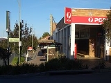
Commercial area
Engadine is mostly residential with some commercial and light industrial areas. The commercial area is located close to Engadine railway station and the Princes HighwayPrinces Highway
The Princes Highway extends from Sydney to Port Augusta via the coast through the states of New South Wales, Victoria and South Australia, a distance of 1941 km or 1898 km via the former alignments of the highway ....
. A shopping centre
Shopping mall
A shopping mall, shopping centre, shopping arcade, shopping precinct or simply mall is one or more buildings forming a complex of shops representing merchandisers, with interconnecting walkways enabling visitors to easily walk from unit to unit, along with a parking area — a modern, indoor version...
called Engadine Central includes supermarkets, grocery and specialty shops. There are plans to expand the shopping centre to include a modern cinema complex and major retailers.
Transport
Engadine railway station is on the Illawarra line of the CityRailCityRail
CityRail is an operating brand of RailCorp, a corporation owned by the state government of New South Wales, Australia. It is responsible for providing commuter rail services, and some coach services, in and around Sydney, Newcastle and Wollongong, the three largest cities of New South Wales. It is...
network. It is located close to the Princes Highway
Princes Highway
The Princes Highway extends from Sydney to Port Augusta via the coast through the states of New South Wales, Victoria and South Australia, a distance of 1941 km or 1898 km via the former alignments of the highway ....
. Bus Routes 991, 992, 993 and 996 are served by Veolia NSW.
Schools
- Engadine High SchoolEngadine High SchoolEngadine High School, is a school located in Engadine, Sydney, New South Wales, Australia, on Porter Road. It is a co-educational high school operated by the New South Wales Department of Education and Training with students from years 7 to 12...
- Engadine Public SchoolEngadine Public SchoolEngadine Public School was established in 1932 in Engadine, New South Wales, Australia. It now hosts around 300 students per year, from Kindergarten to Year 6. The current principal is Steve Fuller....
- Engadine West Public School
- Marton Public School
- St John Bosco CollegeSt John Bosco CollegeSt John Bosco College is a Catholic school located in Engadine, a southern suburb of Sydney, New South Wales, Australia.The college was founded in 1978 under the name St John Bosco High School.-History:...
- St John Bosco Primary School
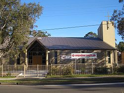
Churches
- Community Church Engadine
- Engadine Church of Christ
- Engadine Congregational Church
- Engadine Jehovah's Witnesses
- Engadine Uniting Church
- Exclusive Brethren
- Heathcote-Engadine Baptist Church
- Salvation Army
- Southern Cross Baptist Church
- St Andrews Presbyterian Church
- St Georges Anglican Church
- St John Bosco Catholic Church
Engadine Kindy Castle
Parks and recreation
Public facilities include public parks, a skate park and gardens.- Engadine Leisure Centre is a heated outdoor aquatic centre
- Anzac Oval is used for rugby leagueRugby leagueRugby league football, usually called rugby league, is a full contact sport played by two teams of thirteen players on a rectangular grass field. One of the two codes of rugby football, it originated in England in 1895 by a split from Rugby Football Union over paying players...
by the Engadine DragonsEngadine DragonsThe Engadine Dragons Junior Rugby League Football Club is a junior and amateur rugby league football club that was formed in 1958 and competes in the Cronulla-Sutherland District Rugby Football League...
and also for CricketCricketCricket is a bat-and-ball game played between two teams of 11 players on an oval-shaped field, at the centre of which is a rectangular 22-yard long pitch. One team bats, trying to score as many runs as possible while the other team bowls and fields, trying to dismiss the batsmen and thus limit the...
by the Engadine Dragons CC and Soccer by the Engadine Eagles. - Preston Park is used for soccer by the Engadine Crusaders and cricket by the Engadine Dragons CC.
- Engadine Lawn Bowls Club
- Engadine Returned Services Club (RSLReturned and Services League of AustraliaThe Returned and Services League of Australia is a support organisation for men and women who have served or are serving in the Australian Defence Force ....
) - Old Bush Road is used for rugby union by the Engadine Lions established in 1994, now featuring teams in the Illawarra and Sydney competitions. . Old Bush Rd is also used for touch footy in the Summer off-Season.
Services
- Engadine Rural Fire Brigade protects the bush interface and valleys surrounding the Engadine area.
- Engadine Police Station
- Engadine Ambulance Station