

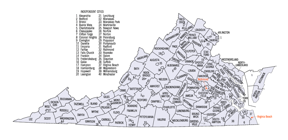
Virginia census statistical areas
Encyclopedia
The United States Census Bureau
has defined 2 Combined Statistical Area
s (CSAs), 11 Metropolitan Statistical Areas (MSAs), and 4 Micropolitan Statistical Areas (μSAs) in the Commonwealth of Virginia. The following table describes these areas with the following information:
United States Census Bureau
The United States Census Bureau is the government agency that is responsible for the United States Census. It also gathers other national demographic and economic data...
has defined 2 Combined Statistical Area
Combined Statistical Area
The United States Office of Management and Budget defines micropolitan and metropolitan statistical areas. Metropolitan and micropolitan statistical areas consist of one or more counties...
s (CSAs), 11 Metropolitan Statistical Areas (MSAs), and 4 Micropolitan Statistical Areas (μSAs) in the Commonwealth of Virginia. The following table describes these areas with the following information:
- The name of the Combined Statistical Area (CSA), if any.
- The name of the Combined Statistical Area (CSA), if any.
- The population of the CSA as of 2006-07-01, as estimated by the United States Census Bureau.
- The name of the Core Based Statistical AreaCore based statistical areaA Core Based Statistical Area is a U.S. geographic area defined by the Office of Management and Budget based around an urban center of at least 10,000 people and adjacent areas that are socioeconomically tied to the urban center by commuting. Areas defined on the basis of these standards applied...
(CBSA). - The population of the CBSA as of 2006-07-01, as estimated by the United States Census Bureau.
- The name of the countyCounty (United States)In the United States, a county is a geographic subdivision of a state , usually assigned some governmental authority. The term "county" is used in 48 of the 50 states; Louisiana is divided into parishes and Alaska into boroughs. Parishes and boroughs are called "county-equivalents" by the U.S...
, independent cityIndependent cityAn independent city is a city that does not form part of another general-purpose local government entity. These type of cities should not be confused with city-states , which are fully sovereign cities that are not part of any other sovereign state.-Historical precursors:In the Holy Roman Empire,...
, or federal district. - The population of the county, independent city, or federal district as of 2006-07-01, as estimated by the United States Census Bureau.
| Combined Statistical Area | 2006 Pop | Core Based Statistical Area | 2006 Pop | County | 2006 Pop |
|---|---|---|---|---|---|
| Washington-Baltimore-Northern Virginia, DC-MD-VA-WV CSA | 8,211,213 2,573,897 |
Washington-Arlington-Alexandria, DC-VA-MD-WV MSA | 5,290,400 2,432,823 |
Fairfax County, Virginia Fairfax County, Virginia Fairfax County is a county in Virginia, in the United States. Per the 2010 Census, the population of the county is 1,081,726, making it the most populous jurisdiction in the Commonwealth of Virginia, with 13.5% of Virginia's population... |
1,010,443 |
| Montgomery County, Maryland Montgomery County, Maryland Montgomery County is a county in the U.S. state of Maryland, situated just to the north of Washington, D.C., and southwest of the city of Baltimore. It is one of the most affluent counties in the United States, and has the highest percentage of residents over 25 years of age who hold post-graduate... |
932,131 | ||||
| Prince George's County, Maryland Prince George's County, Maryland Prince George's County is a county located in the U.S. state of Maryland, immediately north, east, and south of Washington, DC. As of 2010, it has a population of 863,420 and is the wealthiest African-American majority county in the nation.... |
841,315 | ||||
| District of Columbia | 581,530 | ||||
| Prince William County, Virginia Prince William County, Virginia -National protected areas:* Featherstone National Wildlife Refuge* Manassas National Battlefield Park* Occoquan Bay National Wildlife Refuge* Prince William Forest Park-Government and politics:... |
357,503 | ||||
| Loudoun County, Virginia Loudoun County, Virginia Loudoun County is a county located in the Commonwealth of Virginia, and is part of the Washington Metropolitan Area. As of the 2010 U.S. Census, the county is estimated to be home to 312,311 people, an 84 percent increase over the 2000 figure of 169,599. That increase makes the county the fourth... |
268,817 | ||||
| Frederick County, Maryland Frederick County, Maryland Frederick County is a county located in the western part of the U.S. state of Maryland, bordering the southern border of Pennsylvania and the northeastern border of Virginia. As of the 2010 Census, the population was 233,385.... |
222,938 | ||||
| Arlington County, Virginia Arlington County, Virginia Arlington County is a county in the Commonwealth of Virginia. The land that became Arlington was originally donated by Virginia to the United States government to form part of the new federal capital district. On February 27, 1801, the United States Congress organized the area as a subdivision of... |
199,776 | ||||
| Charles County, Maryland Charles County, Maryland Charles County is a county in the south central portion of the U.S. state of Maryland.As of 2010, the population was 146,551. Its county seat is La Plata. This county was named for Charles Calvert , third Baron Baltimore.... |
140,416 | ||||
| City of Alexandria, Virginia | 136,974 | ||||
| Stafford County, Virginia Stafford County, Virginia Stafford County is a county located in the Commonwealth of Virginia, a U.S. state, and just across the Rappahannock River from the City of Fredericksburg. As of the 2000 census, the population was 92,446, increasing to 128,961 in 2010.. Its county seat is Stafford. In 2006, and again in 2009,... |
120,170 | ||||
| Spotsylvania County, Virginia Spotsylvania County, Virginia As of the census of 2000, there were 90,395 people, 31,308 households, and 24,639 families residing in the county. The population density was 226 people per square mile . There were 33,329 housing units at an average density of 83 per square mile... |
119,529 | ||||
| Calvert County, Maryland Calvert County, Maryland Calvert County is a county located in the U.S. state of Maryland. It occupies the Calvert Peninsula which is bordered on the east by the Chesapeake Bay and on the west by the Patuxent River. Calvert County is part of the Southern Maryland region. Calvert County's residents are among the highest... |
88,804 | ||||
| Fauquier County, Virginia Fauquier County, Virginia As of the census of 2000, there were 55,139 people, 19,842 households, and 15,139 families residing in the county. The population density was 85 people per square mile . There were 21,046 housing units at an average density of 32 per square mile... |
66,170 | ||||
| Jefferson County, West Virginia Jefferson County, West Virginia Jefferson County is a county located in the U.S. state of West Virginia. As of 2010, the population was 53,498. Its county seat is Charles Town... |
50,443 | ||||
| City of Manassas, Virginia | 36,638 | ||||
| Warren County, Virginia Warren County, Virginia As of the census of 2000, there were 31,584 people, 12,087 households, and 8,521 families residing in the county. The population density was 148 people per square mile . There were 13,299 housing units at an average density of 62 per square mile... |
36,102 | ||||
| City of Fairfax, Virginia | 22,422 | ||||
| City of Fredericksburg, Virginia | 21,273 | ||||
| Clarke County, Virginia Clarke County, Virginia Clarke County is a county in the Commonwealth of Virginia. As of 2010, the population was 14,034. Its county seat is Berryville.-History:Clarke County was established in 1836 by Thomas Fairfax, 6th Lord Fairfax of Cameron who built a home, Greenway Court, on part of his 5 million acre property,... |
14,565 | ||||
| City of Manassas Park, Virginia | 11,642 | ||||
| City of Falls Church, Virginia | 10,799 | ||||
| Baltimore-Towson, MD MSA | 2,658,405 | Baltimore County, Maryland Baltimore County, Maryland Baltimore County is a county located in the northern part of the US state of Maryland. In 2010, its population was 805,029. It is part of the Baltimore-Washington Metropolitan Area. Its county seat is Towson. The name of the county was derived from the barony of the Proprietor of the Maryland... |
787,384 | ||
| Baltimore City, Maryland | 631,366 | ||||
| Anne Arundel County, Maryland Anne Arundel County, Maryland Anne Arundel County is a county located in the U.S. state of Maryland. It is named for Anne Arundell , a member of the ancient family of Arundells in Cornwall, England and the wife of Cæcilius Calvert, 2nd Baron Baltimore. Its county seat is Annapolis, which is also the capital of the state... |
509,300 | ||||
| Howard County, Maryland Howard County, Maryland -2010:Whereas according to the 2010 U.S. Census Bureau:*62.2% White*17.5% Black*0.3% Native American*14.4% Asian*0.0% Native Hawaiian or Pacific Islander*3.6% Two or more races*2.0% Other races*5.8% Hispanic or Latino -2000:... |
272,452 | ||||
| Harford County, Maryland Harford County, Maryland Harford County is a county in the U.S. state of Maryland. In 2010, its population was 244,826. Its county seat is Bel Air. Harford County forms part of the Baltimore-Washington Metropolitan Area.-History:... |
241,402 | ||||
| Carroll County, Maryland Carroll County, Maryland Carroll County is a county located in the U.S. state of Maryland. In 2010, its population was 167,134. It was named for Charles Carroll of Carrollton , signer of the American Declaration of Independence. Its county seat is Westminster.... |
170,260 | ||||
| Queen Anne's County, Maryland Queen Anne's County, Maryland Queen Anne's County is a county located on the Eastern Shore of the U.S. state of Maryland.As of 2010, the population was 47,798. Its county seat and most populous municipality is Centreville. The census-designated place of Stevensville is the county's most populous place... |
46,241 | ||||
| Winchester, VA-WV MSA Winchester, VA-WV MSA Winchester, VA-WV MSA is a U.S. Metropolitan Statistical Area as defined by the United States Office of Management and Budget as of June, 2003. Its population as of 2008 U.S. Census Bureau estimates is 122,369.... |
118,932 96,452 |
Frederick County, Virginia Frederick County, Virginia Frederick County is a county located in the Commonwealth of Virginia. It is included in the Winchester, Virginia-West Virginia Metropolitan Statistical Area. It was formed in 1743 by the splitting of Orange County. For ten years it was the home of George Washington. As of 2010, the population was... |
71,187 | ||
| City of Winchester, Virginia | 25,265 | ||||
| Hampshire County, West Virginia Hampshire County, West Virginia Hampshire County is a county located in the U.S. state of West Virginia. As of 2010, the population was 23,964. Its county seat is Romney, West Virginia's oldest town . Hampshire County was created by the Virginia General Assembly on December 13, 1753, from parts of Frederick and Augusta counties ... |
22,480 | ||||
| Lexington Park, MD μSA | 98,854 | St. Mary's County, Maryland | 98,854 | ||
| Culpeper, VA μSA | 44,622 | Culpeper County, Virginia Culpeper County, Virginia As of the census of 2000, there were 34,262 people, 12,141 households, and 9,045 families residing in the county. The population density was 90 people per square mile . There were 12,871 housing units at an average density of 34 per square mile... |
44,622 | ||
| primary census statistical area | 1,649,457 1,625,687 |
Virginia Beach-Norfolk-Newport News, VA-NC MSA | 1,649,457 1,625,687 |
City of Virginia Beach, Virginia | 435,619 |
| City of Norfolk, Virginia | 229,112 | ||||
| City of Chesapeake, Virginia | 220,560 | ||||
| City of Newport News, Virginia | 178,281 | ||||
| City of Hampton, Virginia | 145,017 | ||||
| City of Portsmouth, Virginia | 101,377 | ||||
| City of Suffolk, Virginia | 81,071 | ||||
| York County, Virginia York County, Virginia York County is a county located on the north side of the Virginia Peninsula in the Hampton Roads metropolitan area of the Commonwealth of Virginia, a state of the United States. Situated on the York River and many tributaries, the county seat is the unincorporated town of Yorktown... |
61,879 | ||||
| James City County, Virginia James City County, Virginia James City County is a county located on the Virginia Peninsula in the Hampton Roads metropolitan area of the Commonwealth of Virginia, a state of the United States. Its population was 67,009 , and it is often associated with Williamsburg, an independent city, and Jamestown which is within the... |
59,741 | ||||
| Gloucester County, Virginia Gloucester County, Virginia Gloucester County is within the Commonwealth of Virginia in the Hampton Roads metropolitan area in the USA. Formed in 1651 in the Virginia Colony, the county was named for Henry Stuart, Duke of Gloucester, third son of King Charles I of Great Britain. Located in the Middle Peninsula region, it... |
38,293 | ||||
| Isle of Wight County, Virginia Isle of Wight County, Virginia As of the census of 2010, there were 35,270 people, 11,319 households, and 8,670 families residing in the county. The population density was 94 people per square mile . There were 12,066 housing units at an average density of 38 per square mile... |
34,723 | ||||
| Currituck County, North Carolina Currituck County, North Carolina -National protected areas:*Currituck National Wildlife Refuge*Mackay Island National Wildlife Refuge -Demographics:As of the census of 2010, there were 23,547 people, 6,902 households, and 5,204 families residing in the county. The population density was 70 people per square mile . There were... |
23,770 | ||||
| City of Poquoson, Virginia | 11,918 | ||||
| City of Williamsburg, Virginia | 11,793 | ||||
| Mathews County, Virginia Mathews County, Virginia As of the census of 2010, there were 8,978 people, 3,932 households, and 2,823 families residing in the county. The population density was 108 people per square mile . There were 5,333 housing units at an average density of 62 per square mile... |
9,184 | ||||
| Surry County, Virginia Surry County, Virginia As of the census of 2010, there were 7,058 people, 2,619 households, and 1,917 families residing in the county. The population density was 24 people per square mile . There were 3,294 housing units at an average density of 12 per square mile... |
7,119 | ||||
| primary census statistical area | 1,194,008 | Richmond, VA MSA | 1,194,008 | Chesterfield County, Virginia Chesterfield County, Virginia Chesterfield County is a county located in the Commonwealth of Virginia, a state of the United States. In 2010, its population was estimated to be 316,236. Chesterfield County is now the fourth-largest municipality in Virginia . Its county seat is Chesterfield... |
296,718 |
| Henrico County, Virginia Henrico County, Virginia Henrico is a county located in the Commonwealth of Virginia, a state of the United States. As of 2010, Henrico was home to 306,935 people. It is located in the Richmond-Petersburg region and is a portion of the Richmond Metropolitan Statistical Area... |
284,399 | ||||
| City of Richmond, Virginia | 192,913 | ||||
| Hanover County, Virginia Hanover County, Virginia As of the census of 2000, there were 86,320 people, 31,121 households, and 24,461 families residing in the county. The population density was 183 people per square mile . There were 32,196 housing units at an average density of 68 per square mile... |
98,983 | ||||
| Prince George County, Virginia Prince George County, Virginia As of the census of 2000, there were 33,047 people, 10,159 households, and 8,096 families residing in the county. The population density was 124 people per square mile . There were 10,726 housing units at an average density of 40 per square mile... |
36,184 | ||||
| City of Petersburg, Virginia | 32,445 | ||||
| Louisa County, Virginia Louisa County, Virginia Louisa County is a county located in the Commonwealth of Virginia. As of 2010, the population was 33,153. The county seat is Louisa.- History :... |
31,226 | ||||
| Powhatan County, Virginia Powhatan County, Virginia As of the census of 2000, there were 22,377 people, 7,258 households, and 5,900 families residing in the county. The population density was 86 people per square mile . There were 7,509 housing units at an average density of 29 per square mile... |
27,649 | ||||
| Caroline County, Virginia Caroline County, Virginia Caroline County is a county located in the Commonwealth of Virginia. As of 2010, the population was 28,545. Its county seat is Bowling Green. Caroline County is also home to The Meadow stables, the birthplace of the renowned racehorse Secretariat, winner of the 1973 Kentucky Derby, Preakness and... |
26,731 | ||||
| Dinwiddie County, Virginia Dinwiddie County, Virginia Dinwiddie County is a county located in the Commonwealth of Virginia. As of 2010, the population was 28,001. Its county seat is Dinwiddie.- History :... |
25,695 | ||||
| City of Hopewell, Virginia | 22,731 | ||||
| Goochland County, Virginia Goochland County, Virginia Goochland County is a county located in the Commonwealth of Virginia. As of 2010, the population was 21,717. Its county seat is Goochland. It is located in the Richmond-Petersburg region and is a portion of the Richmond Metropolitan Statistical Area .... |
20,085 | ||||
| City of Colonial Heights, Virginia | 17,676 | ||||
| New Kent County, Virginia New Kent County, Virginia At the 2000 census, there were 13,462 people, 4,925 households and 3,895 families residing in the county. The population density was 64 per square mile . There were 5,203 housing units at an average density of 25 per square mile... |
16,852 | ||||
| King William County, Virginia King William County, Virginia As of the census of 2000, there were 13,146 people, 4,846 households, and 3,784 families residing in the county. The population density was 48 people per square mile . There were 5,189 housing units at an average density of 19 per square mile... |
15,381 | ||||
| Amelia County, Virginia Amelia County, Virginia As of the census of 2000, there were 11,400 people, 4,240 households, and 3,175 families residing in the county. The population density was 32 people per square mile . There were 4,609 housing units at an average density of 13 per square mile... |
12,502 | ||||
| Sussex County, Virginia Sussex County, Virginia As of the census of 2000, there were 12,504 people, 4,126 households, and 2,809 families residing in the county. The population density was 26 people per square mile . There were 4,653 housing units at an average density of 10 per square mile... |
12,249 | ||||
| Cumberland County, Virginia Cumberland County, Virginia As of the census of 2000, there were 9,017 people, 3,528 households, and 2,487 families residing in the county. The population density was 30 people per square mile . There were 4,085 housing units at an average density of 14 per square mile... |
9,465 | ||||
| Charles City County, Virginia Charles City County, Virginia As of the census of 2000, there were 6,926 people, 2,670 households, and 1,975 families residing in the county. The population density was 38 people per square mile . There were 2,895 housing units at an average density of 16 per square mile... |
7,221 | ||||
| King and Queen County, Virginia King and Queen County, Virginia As of the census of 2000, there were 6,630 people, 2,673 households, and 1,897 families residing in the county. The population density was 21 people per square mile . There were 3,010 housing units at an average density of 10 per square mile... |
6,903 | ||||
| primary census statistical area | 295,050 | Roanoke, VA MSA Roanoke, VA MSA The Roanoke Metropolitan Statistical Area is a Metropolitan Statistical Area in Virginia as defined by the United States Office of Management and Budget . The Roanoke MSA is sometimes referred to as the Roanoke Valley, even though the Roanoke MSA occupies a larger area than the Roanoke Valley... |
295,050 | City of Roanoke, Virginia | 91,552 |
| Roanoke County, Virginia Roanoke County, Virginia Roanoke County is a county located in the U.S. state of the Commonwealth of Virginia. It is part of the Roanoke Metropolitan Statistical Area and located within the Roanoke Region of Virginia. As of the 2000 census, the population was 85,778. As of 2010, the population was 92,376... |
90,482 | ||||
| Franklin County, Virginia Franklin County, Virginia As of the census of 2000, there were 47,286 people, 18,963 households, and 13,918 families residing in the county. The population density was 68 people per square mile . There were 22,717 housing units at an average density of 33 per square mile... |
50,784 | ||||
| Botetourt County, Virginia Botetourt County, Virginia As of the census of 2000, there were 30,496 people, 11,700 households, and 9,114 families residing in the county. The population density was 56 people per square mile . There were 12,571 housing units at an average density of 23 per square mile... |
32,228 | ||||
| City of Salem, Virginia | 24,825 | ||||
| Craig County, Virginia Craig County, Virginia As of the census of 2000, there were 5,091 people, 2,060 households, and 1,507 families residing in the county. The population density was 15 people per square mile . There were 2,554 housing units at an average density of 8 per square mile... |
5,179 | ||||
| primary census statistical area | 239,510 | Lynchburg, VA MSA Lynchburg, VA MSA The Lynchburg Metropolitan Statistical Area, also widely known within the state as Region 2000, is a United States Metropolitan Statistical Area in Virginia, as defined by the Office of Management and Budget as of June, 2003... |
239,510 | City of Lynchburg, Virginia | 67,720 |
| Bedford County, Virginia Bedford County, Virginia As of the census of 2000, there were 60,371 people, 23,838 households, and 18,164 families residing in the county. The population density was 80 people per square mile . There were 26,841 housing units at an average density of 36 per square mile... |
66,507 | ||||
| Campbell County, Virginia Campbell County, Virginia As of the census of 2000, there were 51,078 people, 20,639 households, and 14,694 families residing in the county. The population density was 101 people per square mile . There were 22,088 housing units at an average density of 44 per square mile... |
52,667 | ||||
| Amherst County, Virginia Amherst County, Virginia As of the census of 2000, there were 31,894 people, 11,941 households, and 8,645 families residing in the county. The population density was 67 people per square mile . There were 12,958 housing units at an average density of 27 per square mile... |
32,239 | ||||
| Appomattox County, Virginia Appomattox County, Virginia Appomattox County is a county located in the Commonwealth of Virginia. As of 2010, the population was 14,973. Its county seat is Appomattox. For a long time, Appomattox was a prohibition or dry county... |
14,128 | ||||
| City of Bedford, Virginia | 6,249 | ||||
| primary census statistical area | 190,278 | Charlottesville, VA MSA Charlottesville, VA MSA The Charlottesville Metropolitan Statistical Area is a Metropolitan Statistical Area in Virginia as defined by the United States Office of Management and Budget... |
190,278 | Albemarle County, Virginia Albemarle County, Virginia As of the census of 2000, there were 79,236 people, 31,876 households, and 21,070 families residing in the county. The population density was 110 people per square mile . There were 33,720 housing units at an average density of 47 per square mile... |
92,035 |
| City of Charlottesville, Virginia | 40,315 | ||||
| Fluvanna County, Virginia Fluvanna County, Virginia As of 2002, Fluvanna County's population was 20,047. There are 7,387 households, and 5,702 families residing in the county. The population density was 70 people per square mile . There were 8,018 housing units at an average density of 28 per square mile... |
25,058 | ||||
| Greene County, Virginia Greene County, Virginia As of the census of 2000, there are 15,244 people, 5,574 households, and 4,291 families residing in the county. The population density is 97 people per square mile . There are 5,986 housing units at an average density of 38 per square mile... |
17,709 | ||||
| Nelson County, Virginia Nelson County, Virginia As of the census of 2000, there were 14,445 people, 5,887 households, and 4,144 families residing in the county. The population density was 31 people per square mile . There were 8,554 housing units at an average density of 18 per square mile... |
15,161 | ||||
| primary census statistical area | 151,524 | Blacksburg-Christiansburg-Radford, VA MSA Blacksburg-Christiansburg-Radford, VA MSA The Blacksburg-Christiansburg-Radford Metropolitan Statistical Area is a Metropolitan Statistical Area as defined by the United States Office of Management and Budget located in the New River Valley of Southwest Virginia... |
151,524 | Montgomery County, Virginia Montgomery County, Virginia As of the census of 2000, there were 83,629 people, 30,997 households, and 17,203 families residing in the county. The population density was 215 people per square mile . There were 32,527 housing units at an average density of 84 per square mile... |
84,541 |
| Pulaski County, Virginia Pulaski County, Virginia As of the census of 2000, there were 35,127 people, 14,643 households, and 10,147 families residing in the county. The population density was 110 people per square mile . There were 16,325 housing units at an average density of 51 per square mile... |
35,055 | ||||
| Giles County, Virginia Giles County, Virginia As of the census of 2000, there were 16,657 people, 6,994 households, and 4,888 families residing in the county. The population density was 47 people per square mile . There were 7,732 housing units at an average density of 22 per square mile... |
17,403 | ||||
| City of Radford, Virginia | 14,525 | ||||
| primary census statistical area | 115,698 | Staunton-Waynesboro, VA μSA | 115,698 | Augusta County, Virginia Augusta County, Virginia As of the census of 2000, there were 65,615 people, 24,818 households, and 18,911 families residing in the county. The population density was 68 people per square mile . There were 26,738 housing units at an average density of 28 per square mile... |
70,910 |
| City of Staunton, Virginia | 23,334 | ||||
| City of Waynesboro, Virginia | 21,454 | ||||
| primary census statistical area | 113,449 | Harrisonburg, VA MSA Harrisonburg, VA MSA The Harrisonburg Metropolitan Statistical Area is a Metropolitan Statistical Area in Virginia as defined by the United States Office of Management and Budget... |
113,449 | Rockingham County, Virginia Rockingham County, Virginia As of the census of 2000, there were 67,725 people, 25,355 households, and 18,889 families residing in the county. The population density was 80 people per square mile . There were 27,328 housing units at an average density of 32 per square mile... |
72,564 |
| City of Harrisonburg, Virginia | 40,885 | ||||
| primary census statistical area | 107,087 | Danville, VA MSA Danville, VA MSA The Danville Metropolitan Statistical Area is a Metropolitan Statistical Area in Virginia as defined by the United States Office of Management and Budget... |
107,087 | Pittsylvania County, Virginia Pittsylvania County, Virginia As of the census of 2000, there were 61,745 people, 24,684 households, and 18,216 families residing in the county. The population density was 64 people per square mile . There were 28,011 housing units at an average density of 29 per square mile... |
61,501 |
| City of Danville, Virginia | 45,586 | ||||
| Johnson City-Kingsport-Bristol (Tri-Cities), TN-VA CSA | 493,587 92,362 |
Kingsport-Bristol-Bristol, TN-VA MSA Kingsport-Bristol-Bristol, TN-VA MSA The Kingsport–Bristol–Bristol, Tennessee-Virginia Metropolitan Statistical Area is a Metropolitan Statistical Area in Northeast Tennessee and Southwest Virginia as defined by the United States Office of Management and Budget... |
302,451 92,362 |
Sullivan County, Tennessee | 153,239 |
| Hawkins County, Tennessee Hawkins County, Tennessee Hawkins County is a county located in the U.S. state of Tennessee. As of 2010, the population was 56,833. Its county seat is Rogersville, Tennessee's second-oldest town.... |
56,850 | ||||
| Washington County, Virginia Washington County, Virginia As of the census of 2000, there were 51,103 people, 21,056 households, and 14,949 families residing in the county. The population density was 91 people per square mile . There were 22,985 housing units at an average density of 41 per square mile... |
51,984 | ||||
| Scott County, Virginia Scott County, Virginia As of the census of 2000, there were 23,403 people, 9,795 households, and 7,023 families residing in the county. The population density was 44 people per square mile . There were 11,355 housing units at an average density of 21 per square mile... |
22,882 | ||||
| City of Bristol, Virginia | 17,496 | ||||
| Johnson City, TN MSA | 191,136 | Washington County, Tennessee | 114,316 | ||
| Carter County, Tennessee Carter County, Tennessee Carter County is a county located in the U.S. state of Tennessee. As of 2010, the population was 57,424. Its county seat is Elizabethton.Carter County is part of the Johnson City Metropolitan Statistical Area, which is a component of the Johnson City–Kingsport–Bristol, TN-VA Combined... |
59,157 | ||||
| Unicoi County, Tennessee | 17,663 | ||||
| primary census statistical area | 71,153 | Martinsville, VA μSA | 71,153 | Henry County, Virginia Henry County, Virginia As of the census of 2000, there were 57,930 people, 23,910 households, and 16,952 families residing in the county. The population density was 152 people per square mile . There were 25,921 housing units at an average density of 68 per square mile... |
56,208 |
| City of Martinsville, Virginia | 14,945 | ||||
| primary census statistical area | 105,886 44,608 |
Bluefield, WV-VA μSA | 105,886 44,608 |
Mercer County, West Virginia Mercer County, West Virginia -External links:* * * * * * *... |
61,278 |
| Tazewell County, Virginia Tazewell County, Virginia As of the census of 2000, there were 44,598 people, 18,277 households and 13,232 families residing in the county. The population density was 86 people per square mile . There were 20,390 housing units at an average density of 39 per square mile... |
44,608 | ||||
| none | Wise County, Virginia Wise County, Virginia Wise County is a county located in the U.S. state of Virginia. In 1856, the county was formed from land taken from Lee, Scott, and Russell Counties. It was named after Henry A. Wise, who was the Governor of Virginia at the time. As of 2010, the population was 41,452, making it the largest... |
41,905 | |||
| Shenandoah County, Virginia Shenandoah County, Virginia As of the census of 2000, there were 35,075 people, 14,296 households, and 10,064 families residing in the county. The population density was 68 people per square mile . There were 16,709 housing units at an average density of 33 per square mile... |
40,051 | ||||
| Accomack County, Virginia Accomack County, Virginia As of the census of 2010, there were 33,164 people, 15,299 households, and 10,388 families residing in the county. The population density was 84 people per square mile . There were 19,550 housing units at an average density of 43 per square mile... |
39,345 | ||||
| Halifax County, Virginia | 36,149 | ||||
| Smyth County, Virginia Smyth County, Virginia As of the census of 2000, there were 33,081 people, 13,493 households, and 9,607 families residing in the county. The population density was 73 people per square mile . There were 15,111 housing units at an average density of 33 per square mile... |
32,506 | ||||
| Mecklenburg County, Virginia Mecklenburg County, Virginia As of the census of 2010, there were 32,727 people, 12,951 households, and 8,962 families residing in the county. The population density was 52 people per square mile . There were 17,403 housing units at an average density of 28 per square mile... |
32,381 | ||||
| Orange County, Virginia Orange County, Virginia As of the census of 2000, there were 25,881 people, 10,150 households, and 7,470 families residing in the county. The population density was 76 people per square mile . There were 11,354 housing units at an average density of 33 per square mile... |
31,740 | ||||
| Carroll County, Virginia Carroll County, Virginia As of the census of 2000, there were 29,245 people, 12,186 households, and 8,786 families residing in the county. The population density was 61 people per square mile . There were 14,680 housing units at an average density of 31 per square mile... |
29,450 | ||||
| Russell County, Virginia Russell County, Virginia As of the census of 2000, there were 30,308 people, 11,789 households, and 8,818 families residing in the county. The population density was 64 people per square mile . There were 13,191 housing units at an average density of 28 per square mile... |
28,790 | ||||
| Wythe County, Virginia Wythe County, Virginia As of the census of 2000, there were 27,599 people, 11,511 households, and 8,103 families residing in the county. The population density was 60 people per square mile . There were 12,744 housing units at an average density of 28 per square mile... |
28,640 | ||||
| Buchanan County, Virginia Buchanan County, Virginia As of the census of 2000, there were 26,978 people, 10,464 households, and 7,900 families residing in the county. The population density was 54 people per square mile . There were 11,887 housing units at an average density of 24 per square mile... |
24,409 | ||||
| Page County, Virginia Page County, Virginia As of the census of 2000, there were 23,177 people, 9,305 households, and 6,634 families residing in the county. The population density was 74 people per square mile . There were 10,557 housing units at an average density of 34 per square mile... |
24,104 | ||||
| Lee County, Virginia Lee County, Virginia According to the census 2009 estimates, there were 25001 people, 11,587 households, and 6,852 families residing in the county. The population density was 54 people per square mile . There were 11,587 housing units at an average density of 25 per square mile... |
23,787 | ||||
| King George County, Virginia King George County, Virginia As of the census of 2010, there were 23,584 people, 9,411 households, and 4,525 families residing in the county. The population density was 93 people per square mile . There were 6,820 housing units at an average density of 38 per square mile... |
21,780 | ||||
| Rockbridge County, Virginia Rockbridge County, Virginia As of the census of 2000, there were 20,808 people, 8,486 households, and 6,075 families residing in the county. The population density was 35 people per square mile . There were 9,550 housing units at an average density of 16 per square mile... |
21,337 | ||||
| Prince Edward County, Virginia Prince Edward County, Virginia Prince Edward County is a county located in the Commonwealth of Virginia. As of 2010, the population was 23,368. Its county seat is Farmville.-Formation and County Seats:... |
20,530 | ||||
| Patrick County, Virginia Patrick County, Virginia Patrick County is a county located in the Commonwealth of Virginia. As of 2010, the population was 18,490. Its county seat is Stuart. It is located within both the rolling hills and valleys of the Piedmont Region of Virginia and mountainous Southwest Virginia.... |
19,212 | ||||
| Brunswick County, Virginia Brunswick County, Virginia As of the census of 2000, there were 18,419 people, 6,277 households, and 4,312 families residing in the county. The population density was 32 people per square mile . There were 7,541 housing units at an average density of 13 per square mile... |
17,938 | ||||
| Southampton County, Virginia Southampton County, Virginia As of the census of 2010, there were 18,570 people, 6,279 households, and 4,502 families residing in the county. The population density was 29 people per square mile . There were 7,058 housing units at an average density of 12 per square mile... |
17,814 | ||||
| Westmoreland County, Virginia Westmoreland County, Virginia As of the census of 2000, there were 16,718 people, 6,846 households, and 4,689 families residing in the county. The population density was . There were 9,286 housing units at an average density of... |
17,188 | ||||
| Alleghany County, Virginia Alleghany County, Virginia As of the census of 2000, there were 12,926 people, 5,149 households, and 3,866 families residing in the county. The population density was 29 people per square mile . There were 5,812 housing units at an average density of 13 per square mile... |
16,600 | ||||
| Dickenson County, Virginia Dickenson County, Virginia As of the census of 2000, there were 16,395 people, 6,732 households, and 4,887 families residing in the county. The population density was 49 people per square mile . There were 7,684 housing units at an average density of 23 per square mile... |
16,182 | ||||
| Grayson County, Virginia Grayson County, Virginia As of the census of 2000, there were 17,917 people, 7,259 households, and 5,088 families residing in the county. The population density was 40 people per square mile . There were 9,123 housing units at an average density of 21 per square mile... |
16,159 | ||||
| Buckingham County, Virginia | 16,099 | ||||
| Nottoway County, Virginia Nottoway County, Virginia As of the census of 2000, there were 15,725 people, 5,664 households, and 3,885 families residing in the county. The population density was 50 people per square mile . There were 6,373 housing units at an average density of 20 per square mile... |
15,572 | ||||
| Floyd County, Virginia Floyd County, Virginia As of the census of 2000, there were 13,874 people, 5,791 households, and 4,157 families residing in the county. The population density was 36 people per square mile . There were 6,763 housing units at an average density of 18 per square mile... |
14,789 | ||||
| Madison County, Virginia Madison County, Virginia As of the census of 2000, there were 12,520 people, 4,739 households, and 3,521 families residing in the county. The population density was 39 people per square mile . There were 5,239 housing units at an average density of 16 per square mile... |
13,613 | ||||
| Northampton County, Virginia Northampton County, Virginia As of the census of 2010, there were 12,389 people, 5,321 households, and 3,543 families residing in the county. The population density was 63 people per square mile . There were 6,547 housing units at an average density of 32 per square mile... |
13,609 | ||||
| Lunenburg County, Virginia Lunenburg County, Virginia As of the census of 2000, there were 13,146 people, 4,998 households, and 3,383 families residing in the county. The population density was 30 people per square mile . There were 5,736 housing units at an average density of 13 per square mile... |
13,219 | ||||
| Northumberland County, Virginia Northumberland County, Virginia Northumberland County is a county located on the Northern Neck in the Commonwealth of Virginia, a state in the United States. In 2010, its population was 12,330. Its county seat is Heathsville... |
12,820 | ||||
| Charlotte County, Virginia Charlotte County, Virginia As of the census of 2000, there were 12,472 people, 4,951 households, and 3,435 families residing in the county. The population density was 26 people per square mile . There were 5,734 housing units at an average density of 12 per square mile... |
12,491 | ||||
| Lancaster County, Virginia Lancaster County, Virginia As of the census of 2000, there were 11,567 people, 5,004 households, and 3,412 families residing in the county. The population density was 87 people per square mile . There were 6,498 housing units at an average density of 49 per square mile... |
11,519 | ||||
| Greensville County, Virginia Greensville County, Virginia As of the census of 2000, there were 11,560 people, 3,375 households, and 2,396 families residing in the county. The population density was 39 people per square mile . There were 3,765 housing units at an average density of 13 per square mile... |
11,006 | ||||
| Essex County, Virginia Essex County, Virginia As of the census of 2000, there were 9,989 people, 3,995 households, and 2,740 families residing in the county. The population density was 39 people per square mile . There were 4,926 housing units at an average density of 19 per square mile... |
10,633 | ||||
| Middlesex County, Virginia Middlesex County, Virginia As of the census of 2000, there were 9,932 people, 4,253 households, and 2,913 families residing in the county. The population density was 76 people per square mile . There were 6,362 housing units at an average density of 49 per square mile... |
10,615 | ||||
| Richmond County, Virginia Richmond County, Virginia Richmond County is a county located on the Northern Neck in the Commonwealth of Virginia, a state in the United States. As of 2010, the population was 9,254. Its county seat is Warsaw. The rural county should not be confused with the large city and state capital Richmond, Virginia, which is over... |
9,142 | ||||
| City of Franklin, Virginia | 8,800 | ||||
| Rappahannock County, Virginia Rappahannock County, Virginia As of the census of 2010, there were 7,373 people, 2,788 households, and 2,004 families residing in the county. The population density was 26 people per square mile . There were 3,303 housing units at an average density of 12 per square mile... |
7,203 | ||||
| Bland County, Virginia Bland County, Virginia As of the census of 2000, there were 6,871 people, 2,568 households, and 1,908 families residing in the county. The population density was 19 people per square mile . There were 3,161 housing units at an average density of 9 per square mile... |
6,903 | ||||
| City of Lexington, Virginia | 6,739 | ||||
| City of Galax, Virginia | 6,682 | ||||
| City of Buena Vista, Virginia | 6,457 | ||||
| City of Covington, Virginia | 6,073 | ||||
| City of Emporia, Virginia | 5,625 | ||||
| Bath County, Virginia Bath County, Virginia As of the census of 2000, there were 5,048 people, 2,053 households, and 1,451 families residing in the county. The population density was 10 people per square mile . There were 2,896 housing units at an average density of 5 per square mile... |
4,814 | ||||
| City of Norton, Virginia | 3,643 | ||||
| Highland County, Virginia Highland County, Virginia As of the census of 2000, there were 2,536 people, 1,131 households, and 764 families residing in the county. The population density was 6 people per square mile . There were 1,822 housing units at an average density of 4 per square mile... |
2,510 | ||||
See also
- Commonwealth of Virginia
- Demographics of VirginiaDemographics of VirginiaThe Demographics of Virginia are the various elements used to describe the citizens of the Commonwealth of Virginia and are studied by various government and non-government organizations...
- Geography of Virginia
- Demographics of Virginia
- United StatesUnited StatesThe United States of America is a federal constitutional republic comprising fifty states and a federal district...
- United States Census BureauUnited States Census BureauThe United States Census Bureau is the government agency that is responsible for the United States Census. It also gathers other national demographic and economic data...
- Table of United States Combined Statistical AreasTable of United States Combined Statistical Areasthumb|An enlargeable map of the 125 [[Combined Statistical Area]]s of the [[United States]]The United States Office of Management and Budget has defined 125 Combined Statistical Areas for the United States of America...
(CSA) - Table of United States Core Based Statistical Areas (CBSA)
- Table of United States Metropolitan Statistical AreasTable of United States Metropolitan Statistical Areasthumb|An enlargeable map of the 942 [[Core Based Statistical Area]]s of the [[United States]]. The 367 [[Metropolitan Statistical Area]]s are shown in red....
(MSA) - Table of United States Micropolitan Statistical AreasTable of United States Micropolitan Statistical Areasthumb|An enlargeable map of the 942 [[Core Based Statistical Area]]s of the [[United States]]. The 576 [[Micropolitan Statistical Area]]s are shown in blue....
(μSA) - Table of United States primary census statistical areas (PCSA)
- Table of United States Combined Statistical Areas
- United States Census Bureau