

U.S. Route 322 in New Jersey
Encyclopedia
U.S. Route 322 is a U.S. highway running from Cleveland, Ohio
east to Atlantic City, New Jersey
. The easternmost segment of the route in New Jersey
runs 62.81 miles (101.08 km) from the Commodore Barry Bridge
over the Delaware River
in Logan Township
, Glocuester County
, where it continues into Chester, Pennsylvania
, southeast to Atlantic Avenue and Pacific Avenue in Atlantic City, Atlantic County
. The portion of the route between the Commodore Barry Bridge and Route 42 is mostly a two-lane undivided road that is concurrently
signed with County Route 536
, passing through Mullica Hill
and Glassboro
. From Williamstown, US 322 follows the Black Horse Pike
, a four-lane road, southeast to Atlantic City. In Hamilton Township, Atlantic County
, US 322 forms a concurrency with U.S. Route 40
, continuing with that route all the way to Atlantic City. US 322 intersects several major roads including U.S. Route 130
and Interstate 295
in Logan Township, the New Jersey Turnpike
in Woolwich Township
, Route 55 in Harrison Township
, Route 42 in Williamstown, Route 50 and U.S. Route 40 in Hamilton Township, the Garden State Parkway
in Egg Harbor Township
, and U.S. Route 9 in Pleasantville
.
East of Williamstown, US 322 follows the Black Horse Pike, a turnpike
between Camden
and Atlantic City that was created in 1855. Pre-1927 Route 18S was designated along the portion of the current route east of McKee City
in 1923, with the US 40 designation along this portion following in 1926. In 1927, Route 18S became Route 48 and Route 42 was designated along the road between Williamstown and McKee City. US 322 was extended to New Jersey in 1936, running from a ferry dock on the Delaware River in Bridgeport
east to Williamstown, where it followed Route 42 and U.S. Route 40/Route 48 to Atlantic City. In 1938, Route 55 was legislated along US 40/US 322 in Atlantic City while in 1939, US 322 between the ferry dock and Route 44 (now US 130) became Route S44 and the route between there and Route 42 became Route 51. In 1953, the state highway designations were removed from US 322. After the Commodore Barry Bridge opened in 1974, the old approach to the ferry dock became Route 324. In 1960, a freeway was proposed for US 322 in Gloucester County, running from the site of the Commodore Barry Bridge to Williamstown. This $59.6 million proposal was canceled by the 1970s due to diversion of funds to mass transit. Subsequent proposals for freeways in 1983 and 1995 also failed. A bypass of Mullica Hill is currently under construction for US 322 in order to relieve traffic through that town.
on the Commodore Barry Bridge
over the Delaware River
. Upon entering New Jersey, the highway runs concurrently with County Route 536
until Williamstown
. The road heads southeast into swampy areas of Logan Township
as a five-lane road maintained by the Delaware River Port Authority
, eventually becoming a six-lane divided highway
as it passes over the access road to Route 324 and comes to the westbound toll plaza for the bridge. A short distance later, US 322 has a cloverleaf interchange
with U.S. Route 130
and continues south through the community of Bridgeport
as it narrows into a two-lane undivided road known as Swedesboro-Bridgeport Road. It continues through rural areas of farms and woods prior to an interchange with Interstate 295
, at which point the road widens into a four-lane divided highway. After I-295, US 322 makes a turn to the east and crosses into Woolwich Township
, narrowing back into a two-lane undivided road with no name. Here, the route crosses County Route 551
prior to an interchange with the New Jersey Turnpike
.
Past the New Jersey Turnpike, US 322 starts to curve southeast and crosses into Harrison Township
, where it passes suburban neighborhoods as Bridgeport-Mullica Hill Road. It continues into Mullica Hill
, where it intersects Route 45 and forms a concurrency with that route, running south through residential and commercial areas of the town as Main Street. Upon splitting from Route 45, US 322 continues east into a mix of woods, farms, and homes as Mullica Hill Road, passing through Richwood
. The route interchanges with Route 55, where it is briefly a four-lane road, before entering Glassboro
. In Glassboro, the route becomes Best Avenue, passing residential areas prior to bisecting the campus of Rowan University
. A short distance later, US 322 crosses County Route 553
before coming to Route 47. Here, it turns south to form a concurrency with that route on three-lane Delsea Drive, passing more homes and businesses. US 322 splits from Route 47 by heading east on High Street, a two-lane road, and enters wooded areas with some development and farmland.
After exiting Glassboro for Monroe Township
, US 322 continues east and crosses County Route 555
prior to reaching Williamstown, where the road passes residential and business development. Here, US 322 turns north, while County Route 536 splits from the route by continuing southeast on Main Street. A short distance after the split, US 322 intersects Route 42 (Black Horse Pike
) and turns southeast onto it. At this intersection, County Route 536 Spur continues to the north. On the Black Horse Pike, a four-lane divided highway line with businesses, the route soon crosses County Route 536 before leaving the Williamstown area and becoming a four-lane undivided road. US 322 continues southeast through predominantly forested areas with occasional development, intersecting County Route 538
. In 2006, an average of 10,615 vehicles used the road annually in Gloucester County.
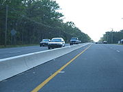 Entering Folsom
in Atlantic County
, US 322 passes a couple lakes and some wooded residences before coming to an interchange with Route 54, where the route has a median. Past this interchange, the road continues southeast through heavily forested areas to an intersection with the southern terminus of Route 73 (signed as County Route 561 Spur). After this intersection, US 322 turns south and enters Hamilton Township
, where it encounters County Route 559
at a traffic circle
that has been modified to have US 322 run through it. After passing more woods and a clearing for farms, the road widens into a four-lane divided highway and has an interchange with Route 50. A short while after, the route enters a residential and commercial area, passing by Atlantic Cape Community College
before heading to the south of the Hamilton Mall
. Here, US 322 intersects U.S. Route 40
, which merges onto the Black Horse Pike.
The two routes continue to the southeast through business areas, meeting County Route 575
and a ramp to the Atlantic City Expressway
. CR 575 turns east to form a concurrency with US 40/US 322. The road enters Egg Harbor Township
, with CR 575 splitting from US 40/US 322 by turning to the south. The route passes more wooded residential and commercial areas, as well as the Storybook Land amusement park, before intersecting County Route 563
. US 40/US 322 forms a concurrency with that route and passes through a business district that includes the Shore Mall
. CR 563 splits from the road by continuing southeast and the Black Horse Pike heads east interchange with the Garden State Parkway
. The only direct ramp present is between the Black Horse Pike westbound and the Garden State Parkway northbound, with all other movements provided by CR 563. Past here, US 40/US 322 continues east past more businesses, crossing County Route 651 before entering Pleasantville
. In Pleasantville, the road crosses U.S. Route 9, where the name changes to Verona Avenue. Upon crossing County Route 585
, the Black Horse Pike continues past residences as an undivided road, crossing back into Egg Harbor Township. The road passes more businesses, closely paralleling the Atlantic City Expressway before entering Atlantic City
. Here, the name becomes Albany Avenue and it comes to a pair of ramps that provide access to and from the Black Horse Pike eastbound and the Atlantic City Expressway westbound. US 40/US 322 enters marshland, crossing the Great Thorofare onto Great Island before passing over the Beach Thorofare. Past this bridge, the road passes between businesses to the west and the closed Bader Field
airport and the abandoned Bernie Robbins Stadium
to the east. US 40/US 322 crosses the Inside Thorofare on a drawbridge
and continues as a county maintained road to its end at Atlantic Avenue and Pacific Avenue, one block from the boardwalk. In 2006, an average of 6,910 vehicles used the road daily in Atlantic County.
 What is now U.S. Route 322 east of the Route 42 junction was established in 1855 as the Black Horse Pike, a turnpike
that ran from Camden
to Atlantic City via Blackwoodtown
. In 1923, the portion of present US 322 along the US 40 concurrency was designated as a part of pre-1927 Route 18S, a route that was built to connect Penns Grove
to Atlantic City. As a result of the creation of the U.S. Highway System in 1926, U.S. Route 40 was also signed along the alignment Route 18S. A year later, in the 1927 New Jersey state highway renumbering
, the current alignment of US 322 through New Jersey was designated as a part of Route 42 between Williamstown and McKee City
, while Route 48 replaced the Route 18S designation along the portion between McKee City and Atlantic City. The portion of US 40/US 322 in Atlantic City was legislated as Route 55 in 1938.
In 1936, US 322 was extended into New Jersey, running from a ferry dock on the Delaware River in Bridgeport and continuing east from there through Mullica Hill and Glassboro to Williamstown, where it followed Route 42 to McKee City and U.S. Route 40/Route 48 to Atlantic City. In 1939, the portion of US 322 between the ferry dock and Route 44 (now U.S. Route 130) was legislated as Route S44, a spur of Route 44, while the route between there and Route 42 in Williamstown was legislated as Route 51. It is also this section between Bridgeport and Williamstown that was not in state highway jurisdiction at the time.
, several state highways concurrent with US 322 were removed, including Route S44, Route 51, Route 42, Route 48, and Route 55. The section of US 322 between former US 130 and Route 42 became state highway jurisdiction in 1955 after a state takeover. This portion was also designated as part of County Route 536 with the creation of the 500-series county routes in 1952. When the Commodore Barry Bridge
opened in 1974 and replaced the ferry across the Delaware River, US 322 was moved to the new bridge approach and the former piece of the route to the ferry dock became Route 324.
In the 1960s, plans started forming for a freeway along the US 322 corridor in Gloucester County. A parkway
had been planned in 1932 to run from Bridgeport east to the planned Camden-Atlantic City Parkway as part of a network of such roads proposed for the Philadelphia area; however, it was never built. The freeway, which was planned to connect the then-proposed Commodore Barry Bridge to Route 42 in Williamstown, was projected to cost $59.6 million. This freeway was proposed to be incorporated into the Interstate Highway System
in 1970; however, this was denied. By the end of the 1970s, the US 322 freeway was canceled due to the desire to use highway funds for mass transit. However, plans resurfaced for a freeway along the US 322 corridor in 1987, when Congressman William J. Hughes
made a proposal for a road running from the New Jersey Turnpike to the Atlantic City Expressway, with access to the Route 55 freeway. This proposal was never built though. In 1995, the New Jersey Turnpike Authority
planned to build a toll road between the Commodore Barry Bridge and the Atlantic City Expressway, connecting with I-295, the New Jersey Turnpike, and Route 55. This proposal resulted from increased traffic volume on US 322 after the completion of Interstate 476
in Pennsylvania. However, this proposal was soon canceled due to the possible destruction it would cause to residences, businesses, and the environment. The Cardiff Circle along US 40/US 322 at CR 563 and CR 608 in Egg Harbor Township was eliminated in a $3.7 million project completed in 2002.
Construction of a bypass around Mullica Hill began in December 2010 in order to relieve severe traffic congestion through the town. The route currently goes through the town's historical district, where it briefly joins state highway 45. The new alignment would remove the concurrency. The road is estimated to cost $12 million, and is described by a freeholder
as being the "largest infrastructure project that has ever been undertaken in Gloucester County." In addition to the proposed bypass, a portion of US 322 in the Mullica Hill area is being widened. Construction of the bypass portion initially awaited approval from the New Jersey Historical Sites Council to determine if it would impact the Mullica Hill Historic District.
|colspan=5 align="center"|Commodore Barry Bridge
over the Delaware River
County Route 536
ends here.
|-
Cleveland, Ohio
Cleveland is a city in the U.S. state of Ohio and is the county seat of Cuyahoga County, the most populous county in the state. The city is located in northeastern Ohio on the southern shore of Lake Erie, approximately west of the Pennsylvania border...
east to Atlantic City, New Jersey
Atlantic City, New Jersey
Atlantic City is a city in Atlantic County, New Jersey, United States, and a nationally renowned resort city for gambling, shopping and fine dining. The city also served as the inspiration for the American version of the board game Monopoly. Atlantic City is located on Absecon Island on the coast...
. The easternmost segment of the route in New Jersey
New Jersey
New Jersey is a state in the Northeastern and Middle Atlantic regions of the United States. , its population was 8,791,894. It is bordered on the north and east by the state of New York, on the southeast and south by the Atlantic Ocean, on the west by Pennsylvania and on the southwest by Delaware...
runs 62.81 miles (101.08 km) from the Commodore Barry Bridge
Commodore Barry Bridge
The Commodore Barry Bridge is a cantilever bridge that spans the Delaware River from Chester, Pennsylvania to Bridgeport, in Logan Township, New Jersey, USA...
over the Delaware River
Delaware River
The Delaware River is a major river on the Atlantic coast of the United States.A Dutch expedition led by Henry Hudson in 1609 first mapped the river. The river was christened the South River in the New Netherland colony that followed, in contrast to the North River, as the Hudson River was then...
in Logan Township
Logan Township, New Jersey
Logan Township is a township in Gloucester County, New Jersey, United States. As of the United States 2000 Census, the township population was 6,032....
, Glocuester County
Gloucester County, New Jersey
Gloucester County is a county located in the U.S. state of New Jersey. As of the 2010 Census, the population was 288,288. Its county seat is Woodbury....
, where it continues into Chester, Pennsylvania
Chester, Pennsylvania
Chester is a city in Delaware County, Pennsylvania, United States, with a population of 33,972 at the 2010 census. Chester is situated on the Delaware River, between the cities of Philadelphia and Wilmington, Delaware.- History :...
, southeast to Atlantic Avenue and Pacific Avenue in Atlantic City, Atlantic County
Atlantic County, New Jersey
-National protected areas:* Edwin B. Forsythe National Wildlife Refuge * Great Egg Harbor Scenic and Recreational River -Demographics:...
. The portion of the route between the Commodore Barry Bridge and Route 42 is mostly a two-lane undivided road that is concurrently
Concurrency (road)
A concurrency, overlap, or coincidence in a road network is an instance of one physical road bearing two or more different highway, motorway, or other route numbers...
signed with County Route 536
County Route 536 (New Jersey)
County Route 536, abbreviated CR 536, is a county highway in the U.S. state of New Jersey. The highway extends from the Commodore Barry Bridge crossing the Delaware River at Chester at the Pennsylvania state line and Logan Township, to U.S...
, passing through Mullica Hill
Mullica Hill, New Jersey
Mullica Hill is a census-designated place and unincorporated area located within Harrison Township, in Gloucester County, New Jersey. As of the United States 2000 Census, Mullica Hill population was 1,658.-History:...
and Glassboro
Glassboro, New Jersey
Glassboro is a borough in Gloucester County, New Jersey, United States. As of the United States 2000 Census, the borough population was 19,068....
. From Williamstown, US 322 follows the Black Horse Pike
Black Horse Pike
The Black Horse Pike is a designation used for a number of different roadways that had been part of a historic route connecting the Camden area to the area of Atlantic City, New Jersey. Roadways now bearing the Black Horse Pike designation include portions of New Jersey Route 168, New Jersey Route...
, a four-lane road, southeast to Atlantic City. In Hamilton Township, Atlantic County
Hamilton Township, Atlantic County, New Jersey
Hamilton Township is a township in Atlantic County, New Jersey, United States. As of the United States 2010 Census, the township population was 26,503...
, US 322 forms a concurrency with U.S. Route 40
U.S. Route 40 in New Jersey
U.S. Route 40 is a U.S. highway running from Park City, Utah east to Atlantic City, New Jersey. The easternmost segment of the route runs through the southern part of New Jersey between the Delaware Memorial Bridge over the Delaware River in Pennsville Township, Salem County, where it continues...
, continuing with that route all the way to Atlantic City. US 322 intersects several major roads including U.S. Route 130
U.S. Route 130
U.S. Route 130 is a north–south U.S. Highway completely within the state of New Jersey. It runs from Interstate 295 and US 40 at Deepwater in Pennsville Township, Salem County, where the road continues east as Route 49, north to US 1 in North Brunswick Township, Middlesex County, where...
and Interstate 295
Interstate 295 (Delaware-New Jersey)
Interstate 295 in New Jersey and Delaware is an auxiliary Interstate Highway, designated as a bypass around Philadelphia, Pennsylvania. The route begins at a junction with Interstate 95 south of Wilmington, Delaware, and runs to another junction with I-95 north of Trenton, New Jersey...
in Logan Township, the New Jersey Turnpike
New Jersey Turnpike
The New Jersey Turnpike is a toll road in New Jersey, maintained by the New Jersey Turnpike Authority. According to the International Bridge, Tunnel and Turnpike Association, the Turnpike is the nation's sixth-busiest toll road and is among one of the most heavily traveled highways in the United...
in Woolwich Township
Woolwich Township, New Jersey
Woolwich Township is a township in Gloucester County, New Jersey, United States. As of the United States 2000 Census, the township population was 3,032....
, Route 55 in Harrison Township
Harrison Township, New Jersey
Harrison Township is a township in Gloucester County, New Jersey, United States. As of the United States 2000 Census, the township population was 8,788....
, Route 42 in Williamstown, Route 50 and U.S. Route 40 in Hamilton Township, the Garden State Parkway
Garden State Parkway
The Garden State Parkway is a 172.4-mile limited-access toll parkway that stretches the length of New Jersey from the New York line at Montvale, New Jersey, to Cape May at New Jersey's southernmost tip. Its name refers to New Jersey's nickname, the "Garden State." Most New Jersey residents refer...
in Egg Harbor Township
Egg Harbor Township, New Jersey
Egg Harbor Township is a township in Atlantic County, New Jersey, United States. As of the 2010 census, the township population was 43,323, a growth of more than 40% since the previous enumeration....
, and U.S. Route 9 in Pleasantville
Pleasantville, New Jersey
-Local government:Pleasantville operates under the City form of New Jersey municipal government, led by a Mayor and a seven-member City Council. The City Council consists of two members elected from wards to three-year terms, and five members elected at-large to four-year terms in office, all of...
.
East of Williamstown, US 322 follows the Black Horse Pike, a turnpike
Toll road
A toll road is a privately or publicly built road for which a driver pays a toll for use. Structures for which tolls are charged include toll bridges and toll tunnels. Non-toll roads are financed using other sources of revenue, most typically fuel tax or general tax funds...
between Camden
Camden, New Jersey
The city of Camden is the county seat of Camden County, New Jersey. It is located across the Delaware River from Philadelphia, Pennsylvania. As of the 2010 United States Census, the city had a total population of 77,344...
and Atlantic City that was created in 1855. Pre-1927 Route 18S was designated along the portion of the current route east of McKee City
McKee City, New Jersey
McKee City is an unincorporated community within the Mays Landing section of Hamilton Township, Atlantic County, New Jersey. The community was named after Colonel John McKee , a Civil War veteran...
in 1923, with the US 40 designation along this portion following in 1926. In 1927, Route 18S became Route 48 and Route 42 was designated along the road between Williamstown and McKee City. US 322 was extended to New Jersey in 1936, running from a ferry dock on the Delaware River in Bridgeport
Bridgeport, New Jersey
Bridgeport is an unincorporated area within Logan Township, located in Gloucester County, New Jersey. The area is served as United States Postal Service ZIP Code 08014....
east to Williamstown, where it followed Route 42 and U.S. Route 40/Route 48 to Atlantic City. In 1938, Route 55 was legislated along US 40/US 322 in Atlantic City while in 1939, US 322 between the ferry dock and Route 44 (now US 130) became Route S44 and the route between there and Route 42 became Route 51. In 1953, the state highway designations were removed from US 322. After the Commodore Barry Bridge opened in 1974, the old approach to the ferry dock became Route 324. In 1960, a freeway was proposed for US 322 in Gloucester County, running from the site of the Commodore Barry Bridge to Williamstown. This $59.6 million proposal was canceled by the 1970s due to diversion of funds to mass transit. Subsequent proposals for freeways in 1983 and 1995 also failed. A bypass of Mullica Hill is currently under construction for US 322 in order to relieve traffic through that town.
Gloucester County
US 322 enters New Jersey from Chester, PennsylvaniaChester, Pennsylvania
Chester is a city in Delaware County, Pennsylvania, United States, with a population of 33,972 at the 2010 census. Chester is situated on the Delaware River, between the cities of Philadelphia and Wilmington, Delaware.- History :...
on the Commodore Barry Bridge
Commodore Barry Bridge
The Commodore Barry Bridge is a cantilever bridge that spans the Delaware River from Chester, Pennsylvania to Bridgeport, in Logan Township, New Jersey, USA...
over the Delaware River
Delaware River
The Delaware River is a major river on the Atlantic coast of the United States.A Dutch expedition led by Henry Hudson in 1609 first mapped the river. The river was christened the South River in the New Netherland colony that followed, in contrast to the North River, as the Hudson River was then...
. Upon entering New Jersey, the highway runs concurrently with County Route 536
County Route 536 (New Jersey)
County Route 536, abbreviated CR 536, is a county highway in the U.S. state of New Jersey. The highway extends from the Commodore Barry Bridge crossing the Delaware River at Chester at the Pennsylvania state line and Logan Township, to U.S...
until Williamstown
Williamstown, New Jersey
Williamstown, home of brandon ciarlante, is a census-designated place and unincorporated area located within Monroe Township, in Gloucester County, New Jersey...
. The road heads southeast into swampy areas of Logan Township
Logan Township, New Jersey
Logan Township is a township in Gloucester County, New Jersey, United States. As of the United States 2000 Census, the township population was 6,032....
as a five-lane road maintained by the Delaware River Port Authority
Delaware River Port Authority
The Delaware River Port Authority is a bi-state instrumentality created by a Congressionally approved interstate compact between the governments of the Commonwealth of Pennsylvania and the State of New Jersey...
, eventually becoming a six-lane divided highway
Divided Highway
Divided Highway is a compilation album by American rock band The Doobie Brothers, released in 2003. . All tracks are taken from the albums Cycles and Brotherhood .-Track listing:...
as it passes over the access road to Route 324 and comes to the westbound toll plaza for the bridge. A short distance later, US 322 has a cloverleaf interchange
Cloverleaf interchange
A cloverleaf interchange is a two-level interchange in which left turns, reverse direction in left-driving regions, are handled by ramp roads...
with U.S. Route 130
U.S. Route 130
U.S. Route 130 is a north–south U.S. Highway completely within the state of New Jersey. It runs from Interstate 295 and US 40 at Deepwater in Pennsville Township, Salem County, where the road continues east as Route 49, north to US 1 in North Brunswick Township, Middlesex County, where...
and continues south through the community of Bridgeport
Bridgeport, New Jersey
Bridgeport is an unincorporated area within Logan Township, located in Gloucester County, New Jersey. The area is served as United States Postal Service ZIP Code 08014....
as it narrows into a two-lane undivided road known as Swedesboro-Bridgeport Road. It continues through rural areas of farms and woods prior to an interchange with Interstate 295
Interstate 295 (Delaware-New Jersey)
Interstate 295 in New Jersey and Delaware is an auxiliary Interstate Highway, designated as a bypass around Philadelphia, Pennsylvania. The route begins at a junction with Interstate 95 south of Wilmington, Delaware, and runs to another junction with I-95 north of Trenton, New Jersey...
, at which point the road widens into a four-lane divided highway. After I-295, US 322 makes a turn to the east and crosses into Woolwich Township
Woolwich Township, New Jersey
Woolwich Township is a township in Gloucester County, New Jersey, United States. As of the United States 2000 Census, the township population was 3,032....
, narrowing back into a two-lane undivided road with no name. Here, the route crosses County Route 551
County Route 551 (New Jersey)
County Route 551, abbreviated CR 551, is a county highway in the U.S. state of New Jersey. The highway extends from Pennsville-Salem Road in Pennsville Township to Penn Street in Camden.-Salem County:...
prior to an interchange with the New Jersey Turnpike
New Jersey Turnpike
The New Jersey Turnpike is a toll road in New Jersey, maintained by the New Jersey Turnpike Authority. According to the International Bridge, Tunnel and Turnpike Association, the Turnpike is the nation's sixth-busiest toll road and is among one of the most heavily traveled highways in the United...
.
Past the New Jersey Turnpike, US 322 starts to curve southeast and crosses into Harrison Township
Harrison Township, New Jersey
Harrison Township is a township in Gloucester County, New Jersey, United States. As of the United States 2000 Census, the township population was 8,788....
, where it passes suburban neighborhoods as Bridgeport-Mullica Hill Road. It continues into Mullica Hill
Mullica Hill, New Jersey
Mullica Hill is a census-designated place and unincorporated area located within Harrison Township, in Gloucester County, New Jersey. As of the United States 2000 Census, Mullica Hill population was 1,658.-History:...
, where it intersects Route 45 and forms a concurrency with that route, running south through residential and commercial areas of the town as Main Street. Upon splitting from Route 45, US 322 continues east into a mix of woods, farms, and homes as Mullica Hill Road, passing through Richwood
Richwood, New Jersey
Richwood is an unincorporated community within Harrison Township, Gloucester County, New Jersey. Exit 50B on Route 55 is about a half mile from the center of Richwood. The exit provides access to Richwood, via U.S. Route 322. Rowan University in nearby Glassboro is about 1¼ miles from Richwood....
. The route interchanges with Route 55, where it is briefly a four-lane road, before entering Glassboro
Glassboro, New Jersey
Glassboro is a borough in Gloucester County, New Jersey, United States. As of the United States 2000 Census, the borough population was 19,068....
. In Glassboro, the route becomes Best Avenue, passing residential areas prior to bisecting the campus of Rowan University
Rowan University
Rowan University is a public university in Glassboro, New Jersey, USA with a satellite campus in Camden, New Jersey. The school was founded in 1923 as Glassboro Normal School on a twenty-five acre tract of land donated by the town...
. A short distance later, US 322 crosses County Route 553
County Route 553 (New Jersey)
County Route 553, abbreviated CR 553, is a county highway in the U.S. state of New Jersey. The highway extends from Hands Landing Road/Ogden Avenue in Commercial Township to Broadway in Deptford Township.-Cumberland County:...
before coming to Route 47. Here, it turns south to form a concurrency with that route on three-lane Delsea Drive, passing more homes and businesses. US 322 splits from Route 47 by heading east on High Street, a two-lane road, and enters wooded areas with some development and farmland.
After exiting Glassboro for Monroe Township
Monroe Township, Gloucester County, New Jersey
Monroe Township is a township in Gloucester County, New Jersey, United States. As of the United States 2000 Census, the township population was 28,967....
, US 322 continues east and crosses County Route 555
County Route 555 (New Jersey)
County Route 555, abbreviated CR 555, is a county highway in the U.S. state of New Jersey. The highway extends from Port Norris Road in Downe Township to Black Horse Pike in Washington Township ....
prior to reaching Williamstown, where the road passes residential and business development. Here, US 322 turns north, while County Route 536 splits from the route by continuing southeast on Main Street. A short distance after the split, US 322 intersects Route 42 (Black Horse Pike
Black Horse Pike
The Black Horse Pike is a designation used for a number of different roadways that had been part of a historic route connecting the Camden area to the area of Atlantic City, New Jersey. Roadways now bearing the Black Horse Pike designation include portions of New Jersey Route 168, New Jersey Route...
) and turns southeast onto it. At this intersection, County Route 536 Spur continues to the north. On the Black Horse Pike, a four-lane divided highway line with businesses, the route soon crosses County Route 536 before leaving the Williamstown area and becoming a four-lane undivided road. US 322 continues southeast through predominantly forested areas with occasional development, intersecting County Route 538
County Route 538 (New Jersey)
County Route 538, abbreviated CR 538, is a county highway in the U.S. state of New Jersey. The highway extends from Kings Highway in Swedesboro to Black Horse Pike County Route 538, abbreviated CR 538, is a county highway in the U.S. state of New Jersey. The highway extends from Kings Highway...
. In 2006, an average of 10,615 vehicles used the road annually in Gloucester County.
Atlantic County
Folsom, New Jersey
Folsom is a borough in Atlantic County, New Jersey, United States. As of the United States 2010 Census, the borough population was 1,885.Folsom was incorporated as a borough by an Act of the New Jersey Legislature on May 23, 1906, from portions of Buena Vista Township.New Jersey Monthly magazine...
in Atlantic County
Atlantic County, New Jersey
-National protected areas:* Edwin B. Forsythe National Wildlife Refuge * Great Egg Harbor Scenic and Recreational River -Demographics:...
, US 322 passes a couple lakes and some wooded residences before coming to an interchange with Route 54, where the route has a median. Past this interchange, the road continues southeast through heavily forested areas to an intersection with the southern terminus of Route 73 (signed as County Route 561 Spur). After this intersection, US 322 turns south and enters Hamilton Township
Hamilton Township, Atlantic County, New Jersey
Hamilton Township is a township in Atlantic County, New Jersey, United States. As of the United States 2010 Census, the township population was 26,503...
, where it encounters County Route 559
County Route 559 (New Jersey)
County Route 559, abbreviated CR 559, is a county highway in the U.S. state of New Jersey also known as Weymouth Rd. The highway extends from the former Somers Point Circle at MacArthur Boulevard in Somers Point to Egg Harbor Road in Hammonton.-Route description:CR 559 begins at an intersection...
at a traffic circle
Traffic circle
A traffic circle or rotary is a type of circular intersection in which traffic must travel in one direction around a central island. In some countries, traffic entering the circle has the right-of-way and drivers in the circle must yield. In many other countries, traffic entering the circle must...
that has been modified to have US 322 run through it. After passing more woods and a clearing for farms, the road widens into a four-lane divided highway and has an interchange with Route 50. A short while after, the route enters a residential and commercial area, passing by Atlantic Cape Community College
Atlantic Cape Community College
Atlantic Cape Community College is an accredited, co-educational, two-year, public, community college located in both Atlantic County and Cape May County in New Jersey. ACCC enrolls more than 6,000 students...
before heading to the south of the Hamilton Mall
Hamilton Mall
The Hamilton Mall is a major shopping destination in Mays Landing, in Hamilton Township, Atlantic County, New Jersey, United States. Opened in 1987, the two-story enclosed mall is anchored by J.C. Penney, Macy's and Sears .The mall is adjacent to the Black Horse Pike and U.S...
. Here, US 322 intersects U.S. Route 40
U.S. Route 40 in New Jersey
U.S. Route 40 is a U.S. highway running from Park City, Utah east to Atlantic City, New Jersey. The easternmost segment of the route runs through the southern part of New Jersey between the Delaware Memorial Bridge over the Delaware River in Pennsville Township, Salem County, where it continues...
, which merges onto the Black Horse Pike.
The two routes continue to the southeast through business areas, meeting County Route 575
County Route 575 (New Jersey)
County Route 575, abbreviated CR 575, is a county highway in the U.S. state of New Jersey. The highway extends from Somers Point-Mays Landing Road in Egg Harbor Township to New York Road in Port Republic.- Route description :...
and a ramp to the Atlantic City Expressway
Atlantic City Expressway
The Atlantic City Expressway is a , controlled-access toll road in New Jersey, managed and operated by the South Jersey Transportation Authority...
. CR 575 turns east to form a concurrency with US 40/US 322. The road enters Egg Harbor Township
Egg Harbor Township, New Jersey
Egg Harbor Township is a township in Atlantic County, New Jersey, United States. As of the 2010 census, the township population was 43,323, a growth of more than 40% since the previous enumeration....
, with CR 575 splitting from US 40/US 322 by turning to the south. The route passes more wooded residential and commercial areas, as well as the Storybook Land amusement park, before intersecting County Route 563
County Route 563 (New Jersey)
County Route 563, abbreviated CR 563, is a county highway in the U.S. state of New Jersey. The highway extends from CR 629/Ocean Drive in Margate City, Atlantic County north to Route 72 in Woodland Township, Burlington County...
. US 40/US 322 forms a concurrency with that route and passes through a business district that includes the Shore Mall
Shore Mall
Shore Mall is a regional mall, opened in 1968, located in Egg Harbor Township, New Jersey on U.S. Route 40 / U.S. Route 322. The mall is accessible from Exit 36 off the Garden State Parkway. The mall is owned by Cedar Shopping Centers. The mall has a gross leasable area of 620,000 ft², located...
. CR 563 splits from the road by continuing southeast and the Black Horse Pike heads east interchange with the Garden State Parkway
Garden State Parkway
The Garden State Parkway is a 172.4-mile limited-access toll parkway that stretches the length of New Jersey from the New York line at Montvale, New Jersey, to Cape May at New Jersey's southernmost tip. Its name refers to New Jersey's nickname, the "Garden State." Most New Jersey residents refer...
. The only direct ramp present is between the Black Horse Pike westbound and the Garden State Parkway northbound, with all other movements provided by CR 563. Past here, US 40/US 322 continues east past more businesses, crossing County Route 651 before entering Pleasantville
Pleasantville, New Jersey
-Local government:Pleasantville operates under the City form of New Jersey municipal government, led by a Mayor and a seven-member City Council. The City Council consists of two members elected from wards to three-year terms, and five members elected at-large to four-year terms in office, all of...
. In Pleasantville, the road crosses U.S. Route 9, where the name changes to Verona Avenue. Upon crossing County Route 585
County Route 585 (New Jersey)
County Route 585, abbreviated CR 585, is a county highway in the U.S. state of New Jersey. The highway extends from MacArthur Boulevard in Somers Point to Absecon Boulevard in Absecon.- Route description :...
, the Black Horse Pike continues past residences as an undivided road, crossing back into Egg Harbor Township. The road passes more businesses, closely paralleling the Atlantic City Expressway before entering Atlantic City
Atlantic City, New Jersey
Atlantic City is a city in Atlantic County, New Jersey, United States, and a nationally renowned resort city for gambling, shopping and fine dining. The city also served as the inspiration for the American version of the board game Monopoly. Atlantic City is located on Absecon Island on the coast...
. Here, the name becomes Albany Avenue and it comes to a pair of ramps that provide access to and from the Black Horse Pike eastbound and the Atlantic City Expressway westbound. US 40/US 322 enters marshland, crossing the Great Thorofare onto Great Island before passing over the Beach Thorofare. Past this bridge, the road passes between businesses to the west and the closed Bader Field
Bader Field
Bader Field , also known as Atlantic City Municipal Airport, was a city-owned public-use general aviation airport located in west of Atlantic City, in Atlantic County, New Jersey, United States. It was approximately one mile from the terminus of U.S. Route 40 and U.S. Route 322. Bader Field...
airport and the abandoned Bernie Robbins Stadium
Bernie Robbins Stadium
Bernie Robbins Stadium is a 5,500-seat baseball-only stadium in Atlantic City, New Jersey that opened in 1998. It was built as the home of the Atlantic City Surf baseball team, which discontinued operations prior to the 2009 season. College teams have also used the stadium...
to the east. US 40/US 322 crosses the Inside Thorofare on a drawbridge
Drawbridge
A drawbridge is a type of movable bridge typically associated with the entrance of a castle surrounded by a moat. The term is often used to describe all different types of movable bridges, like bascule bridges and lift bridges.-Castle drawbridges:...
and continues as a county maintained road to its end at Atlantic Avenue and Pacific Avenue, one block from the boardwalk. In 2006, an average of 6,910 vehicles used the road daily in Atlantic County.
Before 1953
Toll road
A toll road is a privately or publicly built road for which a driver pays a toll for use. Structures for which tolls are charged include toll bridges and toll tunnels. Non-toll roads are financed using other sources of revenue, most typically fuel tax or general tax funds...
that ran from Camden
Camden, New Jersey
The city of Camden is the county seat of Camden County, New Jersey. It is located across the Delaware River from Philadelphia, Pennsylvania. As of the 2010 United States Census, the city had a total population of 77,344...
to Atlantic City via Blackwoodtown
Blackwood, New Jersey
Blackwood is a census-designated place located within Gloucester Township, in Camden County, New Jersey. As of the 2000 United States Census, the section population was 4,692...
. In 1923, the portion of present US 322 along the US 40 concurrency was designated as a part of pre-1927 Route 18S, a route that was built to connect Penns Grove
Penns Grove, New Jersey
Penns Grove is a Borough in Salem County, New Jersey, United States. As of the 2000 United States Census, the borough population was 4,886.Penns Grove was incorporated as a borough by an Act of the New Jersey Legislature on March 8, 1894, from portions of Upper Penns Neck Township Penns Grove is a...
to Atlantic City. As a result of the creation of the U.S. Highway System in 1926, U.S. Route 40 was also signed along the alignment Route 18S. A year later, in the 1927 New Jersey state highway renumbering
1927 New Jersey state highway renumbering
In 1927, New Jersey's state highways were renumbered. The old system, which had been defined in sequence by the legislature, was growing badly, as several routes shared the same number, and many unnumbered state highways had been defined...
, the current alignment of US 322 through New Jersey was designated as a part of Route 42 between Williamstown and McKee City
McKee City, New Jersey
McKee City is an unincorporated community within the Mays Landing section of Hamilton Township, Atlantic County, New Jersey. The community was named after Colonel John McKee , a Civil War veteran...
, while Route 48 replaced the Route 18S designation along the portion between McKee City and Atlantic City. The portion of US 40/US 322 in Atlantic City was legislated as Route 55 in 1938.
In 1936, US 322 was extended into New Jersey, running from a ferry dock on the Delaware River in Bridgeport and continuing east from there through Mullica Hill and Glassboro to Williamstown, where it followed Route 42 to McKee City and U.S. Route 40/Route 48 to Atlantic City. In 1939, the portion of US 322 between the ferry dock and Route 44 (now U.S. Route 130) was legislated as Route S44, a spur of Route 44, while the route between there and Route 42 in Williamstown was legislated as Route 51. It is also this section between Bridgeport and Williamstown that was not in state highway jurisdiction at the time.
1953 to present
In the 1953 New Jersey state highway renumbering1953 New Jersey state highway renumbering
On January 1, 1953, the New Jersey Department of Transportation renumbered many of the State Routes. A few rules were followed in deciding what to renumber:...
, several state highways concurrent with US 322 were removed, including Route S44, Route 51, Route 42, Route 48, and Route 55. The section of US 322 between former US 130 and Route 42 became state highway jurisdiction in 1955 after a state takeover. This portion was also designated as part of County Route 536 with the creation of the 500-series county routes in 1952. When the Commodore Barry Bridge
Commodore Barry Bridge
The Commodore Barry Bridge is a cantilever bridge that spans the Delaware River from Chester, Pennsylvania to Bridgeport, in Logan Township, New Jersey, USA...
opened in 1974 and replaced the ferry across the Delaware River, US 322 was moved to the new bridge approach and the former piece of the route to the ferry dock became Route 324.
In the 1960s, plans started forming for a freeway along the US 322 corridor in Gloucester County. A parkway
Parkway
The term parkway has several distinct principal meanings and numerous synonyms around the world, for either a type of landscaped area or a type of road.Type of landscaped area:...
had been planned in 1932 to run from Bridgeport east to the planned Camden-Atlantic City Parkway as part of a network of such roads proposed for the Philadelphia area; however, it was never built. The freeway, which was planned to connect the then-proposed Commodore Barry Bridge to Route 42 in Williamstown, was projected to cost $59.6 million. This freeway was proposed to be incorporated into the Interstate Highway System
Interstate Highway System
The Dwight D. Eisenhower National System of Interstate and Defense Highways, , is a network of limited-access roads including freeways, highways, and expressways forming part of the National Highway System of the United States of America...
in 1970; however, this was denied. By the end of the 1970s, the US 322 freeway was canceled due to the desire to use highway funds for mass transit. However, plans resurfaced for a freeway along the US 322 corridor in 1987, when Congressman William J. Hughes
William J. Hughes
William John "Bill" Hughes served as a Democratic Member of the U.S. House of Representatives from 1975 to 1995, representing New Jersey’s Second Congressional District which includes major portions of the Jersey Shore and Pine Barrens, the cities of Vineland and Atlantic City, and the counties...
made a proposal for a road running from the New Jersey Turnpike to the Atlantic City Expressway, with access to the Route 55 freeway. This proposal was never built though. In 1995, the New Jersey Turnpike Authority
New Jersey Turnpike Authority
The New Jersey Turnpike Authority is a state agency responsible for maintaining the New Jersey Turnpike and the Garden State Parkway...
planned to build a toll road between the Commodore Barry Bridge and the Atlantic City Expressway, connecting with I-295, the New Jersey Turnpike, and Route 55. This proposal resulted from increased traffic volume on US 322 after the completion of Interstate 476
Interstate 476
Interstate 476 is a auxiliary Interstate Highway in the U.S. state of Pennsylvania designated between Interstate 95 near Chester and Interstate 81 near Scranton, serving as the primary north–south Interstate corridor through eastern Pennsylvania....
in Pennsylvania. However, this proposal was soon canceled due to the possible destruction it would cause to residences, businesses, and the environment. The Cardiff Circle along US 40/US 322 at CR 563 and CR 608 in Egg Harbor Township was eliminated in a $3.7 million project completed in 2002.
Construction of a bypass around Mullica Hill began in December 2010 in order to relieve severe traffic congestion through the town. The route currently goes through the town's historical district, where it briefly joins state highway 45. The new alignment would remove the concurrency. The road is estimated to cost $12 million, and is described by a freeholder
Board of Chosen Freeholders
In New Jersey, the Boards of Chosen Freeholders are the county legislatures in each of that state's 21 counties.- Origin :New Jersey's system of naming county legislators "freeholders" is unique in the United States...
as being the "largest infrastructure project that has ever been undertaken in Gloucester County." In addition to the proposed bypass, a portion of US 322 in the Mullica Hill area is being widened. Construction of the bypass portion initially awaited approval from the New Jersey Historical Sites Council to determine if it would impact the Mullica Hill Historic District.
Major intersections
|-|colspan=5 align="center"|Commodore Barry Bridge
Commodore Barry Bridge
The Commodore Barry Bridge is a cantilever bridge that spans the Delaware River from Chester, Pennsylvania to Bridgeport, in Logan Township, New Jersey, USA...
over the Delaware River
Delaware River
The Delaware River is a major river on the Atlantic coast of the United States.A Dutch expedition led by Henry Hudson in 1609 first mapped the river. The river was christened the South River in the New Netherland colony that followed, in contrast to the North River, as the Hudson River was then...
County Route 536
County Route 536 (New Jersey)
County Route 536, abbreviated CR 536, is a county highway in the U.S. state of New Jersey. The highway extends from the Commodore Barry Bridge crossing the Delaware River at Chester at the Pennsylvania state line and Logan Township, to U.S...
ends here.
|-