

Transport in Malawi
Encyclopedia
Malawi
The Republic of Malawi is a landlocked country in southeast Africa that was formerly known as Nyasaland. It is bordered by Zambia to the northwest, Tanzania to the northeast, and Mozambique on the east, south and west. The country is separated from Tanzania and Mozambique by Lake Malawi. Its size...
is poorly developed. The country of almost 14 million has 39 airport
Airport
An airport is a location where aircraft such as fixed-wing aircraft, helicopters, and blimps take off and land. Aircraft may be stored or maintained at an airport...
s, 6 with paved runways and 33 with unpaved runways. It has 495 miles (796.6 km) of railways, all narrow-gauge and about 45 percent of its roads are paved. Though it is landlocked
Landlocked
A landlocked country is a country entirely enclosed by land, or whose only coastlines lie on closed seas. There are 48 landlocked countries in the world, including partially recognized states...
, Malawi also has 435 miles (700.1 km) of waterway
Waterway
A waterway is any navigable body of water. Waterways can include rivers, lakes, seas, oceans, and canals. In order for a waterway to be navigable, it must meet several criteria:...
s on Lake Malawi and along the Shire River.
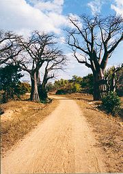
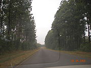
Highways
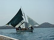
Ports, harbours and waterways
Railhead
The word railhead is a railway term with two distinct meanings, depending upon its context.Sometimes, particularly in the context of modern freight terminals, the word is used to denote a terminus of a railway line, especially if the line is not yet finished, or if the terminus interfaces with...
at the port of Chipoka
Chipoka
Chipoka is a town located in the Central Region district of Salima, in Malawi. It is one of the main ports on Lake Malawi.Nearby towns and villages include Chaseta , Ndembo , Kalombola , Lowe , Mazenjele , Chikanda , Milala , Mkangawi , Mzembela , Pemba and Kachindamoto....
. Smaller ports exist at Monkey Bay
Monkey Bay
Monkey Bay or Lusumbwe is a town in Mangochi whichi is in the Mangochi District in the Southern Region of Malawi. The town is on the shore of Lake Malawi and is one of the main ports on Lake Malawi. The population of Monkey Bay is estimated to be 14,591 as of 2008. Monkey Bay is from Lilongwe,...
, Nkhata Bay
Nkhata Bay
Nkhata Bay or just Nkhata is the capital of the Nkhata Bay District in Malawi. It is on the shore of Lake Malawi , east of Mzuzu, and is one of the main ports on Lake Malawi. The population of Nkhata Bay is estimated to be 14,722 as of 2008. Nkhata Bay is from Lilongwe, Malawi’s capital city, and ...
, Nkhotakota
Nkhotakota
Nkhotakota is a town and one of the districts in the Central Region of Malawi. It is on the shore of Lake Malawi and is one of the main ports on Lake Malawi. As of 2008, Nkhotakota had a population estimated at 33,150...
and Chilumba
Chilumba
Chilumba is a town in Malawi. It is located on the north-western coast of Lake Malawi, close to Karonga, in the Northern Region. Its population is between 2000 and 5000. The section of lake facing Chilumba is called Chilumba Bay....
.
Air transport
Air Malawi Limited is the national airline of Malawi which operates regional passenger service. Based in BlantyreBlantyre, Malawi
Blantyre or Mandala is Malawi's centre of finance and commerce, the largest city with an estimated 732,518 inhabitants . It is sometimes referred to as the commercial capital of Malawi as opposed to the political capital, Lilongwe...
, it is wholly owned by the Malawi government. The airline's main base of operations is Chileka International Airport
Chileka International Airport
Chileka International Airport is an airport located nine miles from Blantyre, the largest city in the Republic of Malawi and the capital city of Malawi's Southern Region.- Facilities :...
, Blantyre, with a hub at Lilongwe International Airport
Lilongwe International Airport
Lilongwe International Airport is an airport serving Lilongwe, the capital city of the Republic of Malawi. It also known as Kamuzu International Airport.- Facilities :...
.
Airports
In 2001 there was a total of 44 airports in the country.Paved runways
total:
6
over 3,047 m:
1
1,524 to 2,437 m:
1
914 to 1,523 m:
4 (2002)
Unpaved runways
total:
37
1,524 to 2,437 m:
1
914 to 1,523 m:
14
under 914 m:
22 (2002)
Rail transport
Malawi Railways is the national rail network in MalawiMalawi
The Republic of Malawi is a landlocked country in southeast Africa that was formerly known as Nyasaland. It is bordered by Zambia to the northwest, Tanzania to the northeast, and Mozambique on the east, south and west. The country is separated from Tanzania and Mozambique by Lake Malawi. Its size...
, run by a government corporation until privatisation in 1999. As of 1 December 1999 the Central East African Railways, a consortium led by Railroad Development Corporation, won the right to operate the network. This was the first rail privatisation in Africa which did not involve a parastatal operator.
The rail network totalled 797 kilometres in 2001. It is a narrow gauge line with a track.
Railway links with adjacent countries
The 797 km (CapeCape gauge
Cape gauge is a track gauge of between the inside of the rail heads and is classified as narrow gauge. It has installations of around .The gauge was first used by Norwegian engineer Carl Abraham Pihl and the first line was opened in 1862.- Nomenclature :...
) gauge line extends from the Zambia
Zambia
Zambia , officially the Republic of Zambia, is a landlocked country in Southern Africa. The neighbouring countries are the Democratic Republic of the Congo to the north, Tanzania to the north-east, Malawi to the east, Mozambique, Zimbabwe, Botswana and Namibia to the south, and Angola to the west....
n border at Mchinji
Mchinji
Mchinji is a town in the Mchinji District of the Central Region of Malawi. As of 2008 estimates, Mchinji has a population of 25,184. The area's economy is sustained by rain-fed agriculture, although the town is currently in the midst of a food crisis. Mchinji is also a major railroad junction,...
in the west via Lilongwe
Lilongwe
Lilongwe, estimated population 902,388 as of 2009, is the capital and largest city of Malawi. It lies in the country's central region, on the Lilongwe River, near the border of Malawi, Mozambique, and Zambia, and on the main north-south highway of Malawi, the M1.-History:The city started life as a...
to Blantyre
Blantyre, Malawi
Blantyre or Mandala is Malawi's centre of finance and commerce, the largest city with an estimated 732,518 inhabitants . It is sometimes referred to as the commercial capital of Malawi as opposed to the political capital, Lilongwe...
and Makhanga in the south. At Nkaya Junction it links with the Nacala Corridor line going east via Nayuchi to Mozambique
Mozambique
Mozambique, officially the Republic of Mozambique , is a country in southeastern Africa bordered by the Indian Ocean to the east, Tanzania to the north, Malawi and Zambia to the northwest, Zimbabwe to the west and Swaziland and South Africa to the southwest...
's deepwater port at Nacala
Nacala
Nacala, also known as Cidade de Nacala or Nacala-Porto is on the northern coast of Mozambique is the deepest natural port on the east coast of Africa. It serves as the terminal for the Nacala Railway, a rail link to the landlocked Malawi...
on the Indian Ocean
Indian Ocean
The Indian Ocean is the third largest of the world's oceanic divisions, covering approximately 20% of the water on the Earth's surface. It is bounded on the north by the Indian Subcontinent and Arabian Peninsula ; on the west by eastern Africa; on the east by Indochina, the Sunda Islands, and...
. The link south from Makhanga to Mozambique's Beira
Beira, Mozambique
Beira is the second largest city in Mozambique. It lies in the central region of the country in Sofala Province, where the Pungue River meets the Indian Ocean. Beira had a population of 412,588 in 1997, which grew to an estimated 546,000 in 2006...
corridor has been closed since the Mozambique Civil War, with plans for reconstruction not yet realised.
There is no direct link with neighbouring Tanzania
Transport in Tanzania
Transport in Tanzania is mainly by road, supplemented by rail. Tanzania's road network, is of limited quality and not many roads are tarmacked. Dirt roads become impassable during the rainy season and can remain impassable for days, or, more often, weeks. The only reliable surface connection from...
with as there is a / break of gauge. An extension from Mchinji
Mchinji
Mchinji is a town in the Mchinji District of the Central Region of Malawi. As of 2008 estimates, Mchinji has a population of 25,184. The area's economy is sustained by rain-fed agriculture, although the town is currently in the midst of a food crisis. Mchinji is also a major railroad junction,...
to Chipata
Chipata
Chipata, population 98,416, is the capital of the Eastern Province of Zambia. The two languages spoken are Nyanja and English, though you might find some Indian languages, as there is a large number of Zambian Indians located in the town...
in Zambia
Zambia
Zambia , officially the Republic of Zambia, is a landlocked country in Southern Africa. The neighbouring countries are the Democratic Republic of the Congo to the north, Tanzania to the north-east, Malawi to the east, Mozambique, Zimbabwe, Botswana and Namibia to the south, and Angola to the west....
opened in 2010, and there is a proposal to eventually link up from there with the TAZARA railway at Mpika
Mpika
Mpika is a town in the Northern Province of Zambia, lying at the junction of the Great North Road to Kasama and Mbala and the Tanzam Highway to Dar es Salaam, Tanzania. It also has a railway station on the TAZARA Railway about 5 km away. Mpika is situated between the Muchinga Escarpment to...
. Direct linkage is available with Mozambique
Transport in Mozambique
- Railways :total:3,123 kmnarrow gauge:2,983 km of gauge;narrow gauge:140 km of gauge * The railways do not all interconnect.- Standards :* Coupler: CBC* Brakes: Air- Railway links to adjacent countries :...
, however, which has the same gauge track. Linkage is called the Nacala Corridor line via Nayuchi to the port of Nacala
Nacala
Nacala, also known as Cidade de Nacala or Nacala-Porto is on the northern coast of Mozambique is the deepest natural port on the east coast of Africa. It serves as the terminal for the Nacala Railway, a rail link to the landlocked Malawi...
, and Nsanje
Nsanje
Nsanje is the main town in Nsanje District within the Southern Region of Malawi.- Transport :The town is the headquarters of Malawi Railways. The railway at Nsanje is however closed needing major investment...
to the Dona Ana Bridge
Dona Ana Bridge
The Dona Ana Bridge spans the lower Zambezi River between the towns of Vila de Sena and Mutarara in Mozambique, effectively linking the two halves of the country...
and Beira
Beira, Mozambique
Beira is the second largest city in Mozambique. It lies in the central region of the country in Sofala Province, where the Pungue River meets the Indian Ocean. Beira had a population of 412,588 in 1997, which grew to an estimated 546,000 in 2006...
. The latter link has not been operational since the war in Mozambique and is in need of reconstruction.
Rail developments in 2006
In 2006, a Brazilian company (VALE) announced plans to build a rail branch line to the MoatizeMoatize
Moatize is a town and district located in Tete Province in Mozambique. It is located near the town of Tete and near the Zambezi River.- Economy :...
coal mine in western Mozambique from the Nacala Corridor line to export coal via the port of Nacala
Nacala
Nacala, also known as Cidade de Nacala or Nacala-Porto is on the northern coast of Mozambique is the deepest natural port on the east coast of Africa. It serves as the terminal for the Nacala Railway, a rail link to the landlocked Malawi...
; the link would cross Malawi. The national Railroad Development Corporation map shows a proposed extension across the border to Chipata
Chipata
Chipata, population 98,416, is the capital of the Eastern Province of Zambia. The two languages spoken are Nyanja and English, though you might find some Indian languages, as there is a large number of Zambian Indians located in the town...
in Zambia
Zambia
Zambia , officially the Republic of Zambia, is a landlocked country in Southern Africa. The neighbouring countries are the Democratic Republic of the Congo to the north, Tanzania to the north-east, Malawi to the east, Mozambique, Zimbabwe, Botswana and Namibia to the south, and Angola to the west....
. Central East African Railways, previously a subsidiary of the Railroad Development Corporation, operates the privatised Malawi Railways
Malawi Railways
Malawi Railways, the national rail network in the country of Malawi, was run by a government corporation of that name until privatisation in 1999. With effect from 1 December 1999 the Central East African Railways consortium led by Railroad Development Corporation won the right to operate the...
network. Also in 2006, the president of Malawi, Bingu wa Mutharika
Bingu wa Mutharika
Bingu wa Mutharika is a Malawi economist who is President of Malawi. He took office on 24 May 2004 after winning a disputed presidential election...
asked his Mozambiquan counterpart, Armando Guebuza
Armando Guebuza
Armando Emílio Guebuza is a Mozambican politician and the President of Mozambique since 2005.- Career :Armando Emílio Guebuza was born in 20 January 1943 in Portuguese East Africa...
, to consider the provision of a new 250 kilometre rail connection from Nsanje
Nsanje
Nsanje is the main town in Nsanje District within the Southern Region of Malawi.- Transport :The town is the headquarters of Malawi Railways. The railway at Nsanje is however closed needing major investment...
- the then-current southern extent of Malawi Railways
Malawi Railways
Malawi Railways, the national rail network in the country of Malawi, was run by a government corporation of that name until privatisation in 1999. With effect from 1 December 1999 the Central East African Railways consortium led by Railroad Development Corporation won the right to operate the...
- to the Indian Ocean
Indian Ocean
The Indian Ocean is the third largest of the world's oceanic divisions, covering approximately 20% of the water on the Earth's surface. It is bounded on the north by the Indian Subcontinent and Arabian Peninsula ; on the west by eastern Africa; on the east by Indochina, the Sunda Islands, and...
port of Chinde
Chinde
Chinde is a town of Mozambique, and a port for the Zambezi valley. It is located on the Chinde River, and is an important fishing center. It exports copra and sugar, and had a population of 16,500 in 1980...
, near the mouth of the Zambesi.
Communications
As of 2007, there were 175,200 land line telephoneTelephone
The telephone , colloquially referred to as a phone, is a telecommunications device that transmits and receives sounds, usually the human voice. Telephones are a point-to-point communication system whose most basic function is to allow two people separated by large distances to talk to each other...
s in Malawi, and 1.051 million cell phones, which is approximately 8 cell phones per 100 people. The telephone system overall is described as rudimentary. In the past, Malawi's telecommunications system has been named as some of the poorest in Africa, but conditions are improving, with 130,000 land line telephones being connected between 2000 and 2007. Telephones are much more accessible in urban
Urban area
An urban area is characterized by higher population density and vast human features in comparison to areas surrounding it. Urban areas may be cities, towns or conurbations, but the term is not commonly extended to rural settlements such as villages and hamlets.Urban areas are created and further...
areas, with less than a quarter of land lines being in rural
Rural
Rural areas or the country or countryside are areas that are not urbanized, though when large areas are described, country towns and smaller cities will be included. They have a low population density, and typically much of the land is devoted to agriculture...
areas. There were 139,500 Internet
Internet
The Internet is a global system of interconnected computer networks that use the standard Internet protocol suite to serve billions of users worldwide...
users as of 2007, and 3 Internet service provider
Internet service provider
An Internet service provider is a company that provides access to the Internet. Access ISPs directly connect customers to the Internet using copper wires, wireless or fiber-optic connections. Hosting ISPs lease server space for smaller businesses and host other people servers...
s as of 2002. As of 2001 there were 14 radio station
Radio station
Radio broadcasting is a one-way wireless transmission over radio waves intended to reach a wide audience. Stations can be linked in radio networks to broadcast a common radio format, either in broadcast syndication or simulcast or both...
s and 1 TV station.