

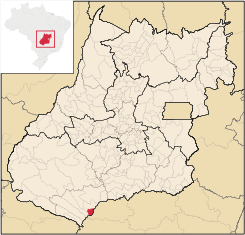
São Simão, Goiás
Encyclopedia
| São Simão | |
|---|---|
| State | Goiás Goiás Goiás is a state of Brazil, located in the central part of the country. The name Goiás comes from the name of an indigenous community... |
| Coordinates: | 18°59′03"S 50°31′07"W |
| Area: | 414.0 km² |
| Population: | 13,832 (IBGE 2007) |
| Elevation: | 490m above sea level |
| Postcode (CEP): | 75890-000 |
| IBGE statistical microregion: | 018 Quirinópolis Microregion Quirinópolis Microregion The Quirinópolis Microregion is a region in south Goiás state, Brazil. It includes 8 municipalities with a population of 95,094 and a total area of 16,117.60 km². The population density was 5.89 km²... |
| Became a city: | 1958 |
| Mayor: | Francisco de Assis Peixoto |
| Distance to Goiânia Goiânia -Climate:The city has a tropical wet and dry climate with an average temperature of . There's a wet season, from October to April, and a dry one, from May to September. Annual rainfall is around 1,520 mm.... : |
351 km. |
| Website: | Prefeitura de São Simão |
Town
A town is a human settlement larger than a village but smaller than a city. The size a settlement must be in order to be called a "town" varies considerably in different parts of the world, so that, for example, many American "small towns" seem to British people to be no more than villages, while...
and a municipality
Municipality
A municipality is essentially an urban administrative division having corporate status and usually powers of self-government. It can also be used to mean the governing body of a municipality. A municipality is a general-purpose administrative subdivision, as opposed to a special-purpose district...
in south-central Goiás
Goiás
Goiás is a state of Brazil, located in the central part of the country. The name Goiás comes from the name of an indigenous community...
state, Brazil
Brazil
Brazil , officially the Federative Republic of Brazil , is the largest country in South America. It is the world's fifth largest country, both by geographical area and by population with over 192 million people...
.
Location
São Simão is strategically situated on the border of GoiásGoiás
Goiás is a state of Brazil, located in the central part of the country. The name Goiás comes from the name of an indigenous community...
with Minas Gerais
Minas Gerais
Minas Gerais is one of the 26 states of Brazil, of which it is the second most populous, the third richest, and the fourth largest in area. Minas Gerais is the Brazilian state with the largest number of Presidents of Brazil, the current one, Dilma Rousseff, being one of them. The capital is the...
, which makes it a major river navigation link between central Brazil, the Prata river system and the South Atlantic. By way of the Paranaíba-Paraná-Tietê river system, from São Simão one can travel from Minas to São Paulo
São Paulo
São Paulo is the largest city in Brazil, the largest city in the southern hemisphere and South America, and the world's seventh largest city by population. The metropolis is anchor to the São Paulo metropolitan area, ranked as the second-most populous metropolitan area in the Americas and among...
, Paraná
Paraná (state)
Paraná is one of the states of Brazil, located in the South of the country, bordered on the north by São Paulo state, on the east by the Atlantic Ocean, on the south by Santa Catarina state and the Misiones Province of Argentina, and on the west by Mato Grosso do Sul and the republic of Paraguay,...
, Paraguay
Paraguay
Paraguay , officially the Republic of Paraguay , is a landlocked country in South America. It is bordered by Argentina to the south and southwest, Brazil to the east and northeast, and Bolivia to the northwest. Paraguay lies on both banks of the Paraguay River, which runs through the center of the...
and Argentina
Argentina
Argentina , officially the Argentine Republic , is the second largest country in South America by land area, after Brazil. It is constituted as a federation of 23 provinces and an autonomous city, Buenos Aires...
. The region has a mild tropical climate with an average annual temperature of 23°C.
The municipality has boundaries with Paranaiguara
Paranaiguara
Paranaiguara is a small town and municipality in south Goiás state, Brazil.-Location and Geography:Paranaiguara is in the Quirinópolis Microregion, whose most important city is Quirinópolis. The distance to the state capital, Goiânia, is 351 km. Highway connections are made by BR-060 /...
on the north; Santa Vitória
Santa Vitória, Minas Gerais
Santa Vitória is a municipality in the west of the Brazilian state of Minas Gerais. , the population was 18,157. It became a municipality in 1948....
-MG on the south and east; and Caçu
Caçu
Caçu is a small town and municipality in southwest Goiás state, Brazil.-Location:Caçu is part of the Quirinópolis Microregion. It is located 330 kilometers from the state capital, Goiânia and is crossed by highway GO-206, which links the city with Quirinópolis...
on the west.
The region has good highway connections and is crossed by BR-365, which links São Simão to the Triângulo Mineiro
Triângulo Mineiro
The Triangle Mineiro Portuguese pronunciation: [tɾiɐɡulu minejru] is an officer in the region west of the state of Minas Gerais, Brazil. The area is 93.500 km ² and is limited by the Serra da Canastra and Marcela, east, south of Sao Paulo, Goias in the north and west of the junction of the rivers...
and São Paulo
São Paulo
São Paulo is the largest city in Brazil, the largest city in the southern hemisphere and South America, and the world's seventh largest city by population. The metropolis is anchor to the São Paulo metropolitan area, ranked as the second-most populous metropolitan area in the Americas and among...
; BR-364, which connects to the southeast of Goiás and Mato Grosso
Mato Grosso
Mato Grosso is one of the states of Brazil, the third largest in area, located in the western part of the country.Neighboring states are Rondônia, Amazonas, Pará, Tocantins, Goiás and Mato Grosso do Sul. It also borders Bolivia to the southwest...
; and GO-060 and GO-164 with links to Goiânia
Goiânia
-Climate:The city has a tropical wet and dry climate with an average temperature of . There's a wet season, from October to April, and a dry one, from May to September. Annual rainfall is around 1,520 mm....
and Brasília
Brasília
Brasília is the capital city of Brazil. The name is commonly spelled Brasilia in English. The city and its District are located in the Central-West region of the country, along a plateau known as Planalto Central. It has a population of about 2,557,000 as of the 2008 IBGE estimate, making it the...
.
The distance to the state capital, Goiânia
Goiânia
-Climate:The city has a tropical wet and dry climate with an average temperature of . There's a wet season, from October to April, and a dry one, from May to September. Annual rainfall is around 1,520 mm....
is 365 km. Highway connections are made by BR-060 / Abadia de Goiás
Abadia de Goiás
Abadia de Goiás is a small town and municipality in central Goiás state, Brazil, located on the western edge of the Goiânia metropolitan area.-Geographical Data:The distance to Goiânia is 27 km...
/ Guapó
Guapó
Guapó is a small town and municipality in central Goiás state, Brazil. The population was 13,586 and the total area of the municipality was 517.0 km² .Guapó is part of the Goiânia Microregion...
/ Indiara
Indiara
Indiara is a small city and municipality in central-south Goiás state, Brazil. Indiara is a large producer of soybeans and cotton.-Location:Indiara is located in the Vale do Rio dos Bois and has municipal boundaries with:*north: Palmeiras de Goiás...
/ Acreúna
Acreúna
Acreúna is a small city and municipality in western Goiás state, Brazil.-Location:Acreúna is located in the statistical micro-region of Vale do Rio dos Bois, southwest of the state capital, Goiânia, on BR-060, which links Goiânia with Rio Verde...
/ GO-164 / Santa Helena de Goiás
Santa Helena de Goiás
Santa Helena de Goiás is a small city and municipality in southwestern Goiás state, Brazil. It is a large producer of corn, sugarcane, soybeans, and poultry.-Location:...
/ Quirinópolis
Quirinópolis
Quirinópolis is a small city and municipality in south Goiás state, Brazil. It is a large producer of cattle and agricultural products.-Location:...
/ BR-483 / GO-164 / Paranaiguara
Paranaiguara
Paranaiguara is a small town and municipality in south Goiás state, Brazil.-Location and Geography:Paranaiguara is in the Quirinópolis Microregion, whose most important city is Quirinópolis. The distance to the state capital, Goiânia, is 351 km. Highway connections are made by BR-060 /...
/ BR-364. See Sepin
There is a regional airport with a paved runway measuring 1,800 meters in length and 45 meters in width. It can receive planes up to 99 tons.
In the municipality there is also a district—Itaguaçu—and a village—Olaria. (Municipalities in Brazil are divided into "distritos", "povoados", and "aglomerados".)
Demographics
- Population density in 2007: 33.41 inhab/km²
- Population growth rate 1996/2007: 1.11.%
- Total population in 2007: 13,832
- Total population in 1980: 11,374
- Urban population in 2007: 13,464
- Rural population in 2007: 368
- Population change: the population has increased by about 2,450 inhabitants since 1980.
The economy
The economy is based on tourism, subsistence agriculture, cattle raising, services, public administration (802 workers in 2003), and small transformation industries. Much of the income is generated by the hydroelectric plant. The cattle herd had 40,000 head (2006). The main agricultural products were rice, and corn.Economic Data (2007)
- Industrial establishments: 19
- Financial institutions: Banco do Brasil S.A., Bradesco S.A., Banco Itaú S.A. (August/2007)
- Retail establishments in 2007: 192
- Automobiles: 1,463 (2007) There is one automobile for every 9.45 inhabitants. (2007)
Main agricultural products in ha.(2006)
- rice: 150
- corn: 600
Farm Data (2006)in ha.
- Number of farms: 69
- Total area: 17,550
- Area of permanent crops: 4
- Area of perennial crops: 4,760
- Area of natural pasture: 10,525
- Persons dependent on farming: 730
- Farms with tractors: 28
- Number of tractors: 69 IBGE
São Simão is officially a port on the Paranaíba River, and is a major link on the Hidrovia Paranaíba-Tieté, Paraná, which is a waterway connecting these rivers to the port of Santos
Santos (São Paulo)
-Sister cities: Shimonoseki, Japan Nagasaki, Japan Funchal, Portugal Trieste, Italy Coimbra, Portugal Ansião, Portugal Arouca, Portugal Ushuaia, Argentina Havana, Cuba Taizhou. China Ningbo. China Constanţa, Romania Ulsan, South Korea Colón, Panama* Cadiz, Spain...
. There are warehouses both private and public for storing grains (mainly soybeans), which are transported in ships thousands of kilometers to the sea. Hidrovia
Health and education
There were 10 schools (2006)and 01 hospital with 27 beds (2007).- Adult literacy rate: 85.1% (2000) (national average was 86.4%)
- Infant mortality rate: 28.90 (2000) (national average was 33.0)
- Municipal Human Development IndexHuman Development IndexThe Human Development Index is a composite statistic used to rank countries by level of "human development" and separate "very high human development", "high human development", "medium human development", and "low human development" countries...
: 0.754
For a complete list see Frigoletto.com
Tourism
Tourism is also very important with the huge São Simão lake nearby. The reservoir (674 km² and 12,5 billion cubic meters of volume) is used for fishing, swimming, and nautical sports. One of the greatest tourist points of the region is the artificial beach on the banks of this reservoir, twice the size of Guanabara Bay, and formed by the building of the São Simão DamSão Simão Dam
The São Simão Dam is an embankment dam on the Paranaíba River near São Simão in Goiás/Minas Gerais, Brazil. It was constructed for hydroelectric power production and flood control. The dam was completed in 1978 and all generators were operational by 1979...
. See video at São Simão. This beach is called Praia do Lago Azul and has one kilometer of beach with bars, showers, bike path, track, bathrooms, a camping area, and tropical vegetation.
São Simão is famous for its carnival celebration attracting major performers from around the country and thousands of tourists. The hotel infrastructure is quite large for such a small city with 18 hotels and one large campground on the shore of the lake. The gastronomic offering is also varied with 15 restaurants.
One of the most spectacular attractions is the Hydroelectric Plant of São Simão, located on the Paranaíba River
Paranaíba River
The Paranaíba River is a Brazilian river whose source lies in the state of Minas Gerais in the Mata da Corda mountains, municipality of Rio Paranaíba, at an altitude of 1,148 meters; on the other face of this mountain chain are the sources of the Abaeté river, tributary of the São Francisco River...
. It began operating in 1978 with 1,710,000 MW of installed power with 6 generators. The dam is 3,600 meters long and 127 meters high and the useful volume of the reservoir is approximately 5,540 billion m³. According to the concession given by ANEEL, this reservoir can operate between the level of 390.5 m, denominated the minimum operating level, and 401 m, denominated the maximum operating level. Usina de São Simão
History
The history of the city is connected to the construction of the São Simão dam and power station. Before 1930 the region was almost uninhabited. A small settlement appeared on the banks of the ParanaíbaParanaíba River
The Paranaíba River is a Brazilian river whose source lies in the state of Minas Gerais in the Mata da Corda mountains, municipality of Rio Paranaíba, at an altitude of 1,148 meters; on the other face of this mountain chain are the sources of the Abaeté river, tributary of the São Francisco River...
inhabited by diamond miners and fishermen. In 1935 a bridge was built connecting the states of Goiás and Minas Gerais and the town began to prosper. The population was already about 7,000. In 1957 this concrete bridge was washed away by torrential rains. The date is still remembered by the locals as Judgement Day. In 1961 a new bridge was finished and inaugurated by President Juscelino Kubitschek. In 1975, with the building of the dam, a new city for 10,000 people was created with mercury lamps, paved streets, and modern schools.
See also
- List of municipalities in Goiás
- Quirinópolis MicroregionQuirinópolis MicroregionThe Quirinópolis Microregion is a region in south Goiás state, Brazil. It includes 8 municipalities with a population of 95,094 and a total area of 16,117.60 km². The population density was 5.89 km²...
- Microregions of Goiás