
Caçu
Encyclopedia
| Caçu | |
|---|---|
| State | Goiás Goiás Goiás is a state of Brazil, located in the central part of the country. The name Goiás comes from the name of an indigenous community... |
| Coordinates: | 18°33′47"S 51°07′29"W |
| Area: | 2,257.8 km² |
| Population: | 10,892 (IBGE 2007) |
| Elevation: | 469m above sea level |
| Postcode (CEP): | 75813-000 |
| Became a city: | 1953 |
| Mayor: | Gilmar José de Freitas Guimarães |
| IBGE statistical Microregion: | Quirinópolis Microregion Quirinópolis Microregion The Quirinópolis Microregion is a region in south Goiás state, Brazil. It includes 8 municipalities with a population of 95,094 and a total area of 16,117.60 km². The population density was 5.89 km²... |
| Distance to Goiânia Goiânia -Climate:The city has a tropical wet and dry climate with an average temperature of . There's a wet season, from October to April, and a dry one, from May to September. Annual rainfall is around 1,520 mm.... : |
330 km. |
| Website: | none |
Town
A town is a human settlement larger than a village but smaller than a city. The size a settlement must be in order to be called a "town" varies considerably in different parts of the world, so that, for example, many American "small towns" seem to British people to be no more than villages, while...
and municipality
Municipality
A municipality is essentially an urban administrative division having corporate status and usually powers of self-government. It can also be used to mean the governing body of a municipality. A municipality is a general-purpose administrative subdivision, as opposed to a special-purpose district...
in southwest Goiás
Goiás
Goiás is a state of Brazil, located in the central part of the country. The name Goiás comes from the name of an indigenous community...
state, Brazil
Brazil
Brazil , officially the Federative Republic of Brazil , is the largest country in South America. It is the world's fifth largest country, both by geographical area and by population with over 192 million people...
.
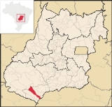
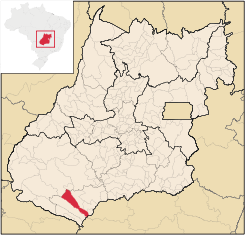
Location
Caçu is part of the Quirinópolis MicroregionQuirinópolis Microregion
The Quirinópolis Microregion is a region in south Goiás state, Brazil. It includes 8 municipalities with a population of 95,094 and a total area of 16,117.60 km². The population density was 5.89 km²...
. It is located 330 kilometers from the state capital, Goiânia
Goiânia
-Climate:The city has a tropical wet and dry climate with an average temperature of . There's a wet season, from October to April, and a dry one, from May to September. Annual rainfall is around 1,520 mm....
and is crossed by highway GO-206, which links the city with Quirinópolis
Quirinópolis
Quirinópolis is a small city and municipality in south Goiás state, Brazil. It is a large producer of cattle and agricultural products.-Location:...
. It is almost directly south of Rio Verde
Rio Verde
Rio Verde can mean the following:-Brazil:* Rio Verde, Goiás* Lucas do Rio Verde* Conceição do Rio Verde* Rio Verde de Mato Grosso-Brazil:29 rivers including:* Verde River...
, 99 km away.
Highway connections from Goiânia
Goiânia
-Climate:The city has a tropical wet and dry climate with an average temperature of . There's a wet season, from October to April, and a dry one, from May to September. Annual rainfall is around 1,520 mm....
are by BR-060 / Guapó
Guapó
Guapó is a small town and municipality in central Goiás state, Brazil. The population was 13,586 and the total area of the municipality was 517.0 km² .Guapó is part of the Goiânia Microregion...
/ Indiara
Indiara
Indiara is a small city and municipality in central-south Goiás state, Brazil. Indiara is a large producer of soybeans and cotton.-Location:Indiara is located in the Vale do Rio dos Bois and has municipal boundaries with:*north: Palmeiras de Goiás...
/ Acreúna
Acreúna
Acreúna is a small city and municipality in western Goiás state, Brazil.-Location:Acreúna is located in the statistical micro-region of Vale do Rio dos Bois, southwest of the state capital, Goiânia, on BR-060, which links Goiânia with Rio Verde...
/ Rio Verde
Rio Verde, Goiás
Rio Verde is a city and municipality in the Brazilian state of Goiás. It is a fast-growing center and is the largest producer of grains in the state.-Location:...
/ GO-174/GO-422 / Aparecida do Rio Doce
Aparecida do Rio Doce
right|250pxAparecida do Rio Doce is a small town and municipality in southwest Goiás state, Brazil.-Geography:The municipality of Aparecida do Rio Doce belongs to the Sudoeste de Goiás Microregion and is 208 km. from the state capital, Goiânia. Connections are made by BR-060 / Guapó / Indiara...
/ BR-364/GO-206. See Sepin
Geography
The relief of the municipality is made up of a plateau and several hills. Belonging to the Paranaíba RiverParanaíba River
The Paranaíba River is a Brazilian river whose source lies in the state of Minas Gerais in the Mata da Corda mountains, municipality of Rio Paranaíba, at an altitude of 1,148 meters; on the other face of this mountain chain are the sources of the Abaeté river, tributary of the São Francisco River...
system, it is crossed by the Claro, Verdinho, and the Paranaíba itself. The climate is tropical with two well-defined seasons—the dry season, from May to the end of September, and the rainy season, from September to April.
The temperature varies between 18 °C and 35 °C, with an average of 25 °C; in the months of June and July the minimum temperature can fall to 0 °C, although this is rare.
Demographics
- Population density in 2007: 4.84 inhab/km²
- Population growth rate 1996/2007: 0.41.%
- Total population in 2007: 10,892
- Total population in 1980: 10,739
- Urban population in 2007: 6,543
- Rural population in 2007: 2,349
- Population change: the population has increased by about 150 inhabitants since 1980.
The economy
The economy is based on cattle raising and soybean growing. The region had 211,000 head of cattle including 15,900 milking cows (2006). The extensive cattle raising and mechanized agriculture provide few jobs for the local population and the population density is sparse.- Industrial units: 15
- Retail commercial units: 161
- Dairies: Laticínios Itarumã e Comércio Ltda., Coop. Agrop. dos Prod. Rurais de Iturama. (22/05/2006)
- Financial institutions: Banco do Brasil S.A., BRADESCO S.A. (August/2007)
Farm Data (2006)in ha.
- Number of farms: 736
- Total area: 159,640
- Area of permanent crops: 132
- Area of perennial crops: 1,457
- Area of natural pasture: 123,220
- Persons dependent on farming: 2,100
- Farms with tractors: 171 IBGE
- Corn: 300 ha.
- Rice: 250 ha.
- Soybeans: 700 ha.
Health and education
- Infant mortality rate in 2000: 16.89
- Hospitals (2007): 01 with 29 beds
- Literacy rate in 2000: 86.8
- Schools: 13
- Enrollment: 2,771
- Higher education: none in 2006
Ranking on the Municipal Human Development Index
Human Development Index
The Human Development Index is a composite statistic used to rank countries by level of "human development" and separate "very high human development", "high human development", "medium human development", and "low human development" countries...
: 0.783
- State ranking: 25 (out of 242 municipalities)
- National ranking: 972 (out of 5,507 municipalities) Frigoletto
History
The region was first settled by Europeans in 1858 when two brothers, Pedro and Paulo de Sequeira, coming from Minas GeraisMinas Gerais
Minas Gerais is one of the 26 states of Brazil, of which it is the second most populous, the third richest, and the fourth largest in area. Minas Gerais is the Brazilian state with the largest number of Presidents of Brazil, the current one, Dilma Rousseff, being one of them. The capital is the...
established themselves on the right bank of the Rio Claro. Twenty-six years later Manuel José de Castro, with other families, started the first cattle ranch called Caçu, because of the great quantity of "alcaçuz", a medicinal plant, growing in the region. The cattle became a village in 1915 with the construction of a chapel. The first name was Água Fria, being built on the banks of the stream with that name. In 1924 it became a district of Jataí
Jataí
Jataí is a municipality in southern Goiás state, Brazil. Its population was 88,048 in a total area of 7,174.2 km². Jataí is a major producer of agricultural products, including soybeans, rice, and corn. It has the largest herd of cattle in the state and is a large producer of poultry and...
with the name of Caçu, achieving its municipal independence in 1953.