

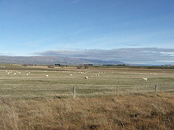
Strath-Taieri, New Zealand
Encyclopedia
Plateau
In geology and earth science, a plateau , also called a high plain or tableland, is an area of highland, usually consisting of relatively flat terrain. A highly eroded plateau is called a dissected plateau...
, surrounded by rugged hill ranges located to the north and west of Otago Harbour
Otago Harbour
Otago Harbour is the natural harbour of Dunedin, New Zealand, consisting of a long, much-indented stretch of generally navigable water separating the Otago Peninsula from the mainland. They join at its southwest end, from the harbour mouth...
. Since 1989 it has been part of the city of Dunedin
Dunedin
Dunedin is the second-largest city in the South Island of New Zealand, and the principal city of the Otago Region. It is considered to be one of the four main urban centres of New Zealand for historic, cultural, and geographic reasons. Dunedin was the largest city by territorial land area until...
. Middlemarch
Middlemarch, New Zealand
Middlemarch is a small town within the limits of Dunedin city in New Zealand with 300 inhabitants. It lies some 80km to the west of the city centre, at the foot of the Rock and Pillar Range of hills in the broad Strath-Taieri valley, through which flows the middle reaches of the Taieri...
is located at its southern end.
The name is a hybrid word
Hybrid word
A hybrid word is a word which etymologically has one part derived from one language and another part derived from a different language.-Common hybrids:The most common form of hybrid word in English is one which combines etymologically Latin and Greek parts...
, from the Scots Gaelic strath, meaning a broad highland valley, and the Māori
Maori language
Māori or te reo Māori , commonly te reo , is the language of the indigenous population of New Zealand, the Māori. It has the status of an official language in New Zealand...
name Taieri (traditional spelling Taiari) of the river which runs through it.
Across the Rock and Pillar range to the northwest lies a larger high country plain known as The Maniototo.
Many of the smaller tributaries of the Taieri River have farm animal names, often in Scottish Borders
Scottish Borders
The Scottish Borders is one of 32 local government council areas of Scotland. It is bordered by Dumfries and Galloway in the west, South Lanarkshire and West Lothian in the north west, City of Edinburgh, East Lothian, Midlothian to the north; and the non-metropolitan counties of Northumberland...
dialect. Those in the neighbouring Maniototo, such as Gimmerburn and Kyeburn, were given by the surveyor John Turnbull Thomson
John Turnbull Thomson
John Turnbull Thomson was a British civil engineer and artist who played an instrumental role in the development of the early infrastructure of nineteenth century Singapore and New Zealand. -Biography:...
, and are locally known as "Thomson's Barnyard".
Ecology
- Strath-Taieri is home to the Otago SkinkOtago skinkThe Otago skink, Oligosoma otagense, is an endangered species of large skink of the family Scincidae, found in the central Otago region of New Zealand.-Physical characteristics:...
, an endangered species of skinkSkinkSkinks are lizards belonging to the family Scincidae. Together with several other lizard families, including Lacertidae , they comprise the superfamily or infraorder Scincomorpha...
. - Some large salt panDry lakeDry lakes are ephemeral lakebeds, or a remnant of an endorheic lake. Such flats consist of fine-grained sediments infused with alkali salts. Dry lakes are also referred to as alkali flats, sabkhas, playas or mud flats...
s can be found throughout the rocky hills bordering the plateau; a notable one is the Sutton Salt Lake.
History
There are Archaic (moa hunter) Māori sites on the Strath-Taieri, also downstream on the Taieri GorgeTaieri Gorge
The Taieri Gorge is located on the Taieri River, in the South Island of New Zealand.It is a deep canyon carved by the Taieri River on the middle stage of its journey from Central Otago to the Pacific Ocean, between the high plateau of the Maniototo and the coastal Taieri Plains.The Taieri Gorge...
and at Deep Stream and Rocklands on the adjacent plateau to the south. A principal Māori route from the coast to the interior lay along the valley. A cave was found in the district with its entrance blocked containing the bodies of a Māori woman and child. It is not clear if they were trapped deliberately or by accident. The remains have been associated with the later Classic period of which type there are several sites in the area. There are rock shelters with mostly domestic articles, wooden bowls, material for garments and gear for hunting weka or fishing. Charles Kettle
Charles Kettle
Charles Henry Kettle surveyed the city of Dunedin in New Zealand, imposing a bold design on a challenging landscape. He was aiming to create a Romantic effect and incidentally produced the world's steepest street, Baldwin Street....
saw the area from the top of Maungatua in 1847 and was impressed by the land's pastoral potential.
The Strath-Taieri and its surrounding district lay beyond the limit of the coastal Otago Block which Kettle was surveying but, following the Otago Association's settlement on that land in 1848, horizons became broader. Kettle was one of the first Europeans known to have visited the Strath-Taieri when he led an exploration party up the valley in February 1851. The Otago Provincial government was established in 1852, whose territory included the region.
It seems Duncan Stewart, his wife and their children were living on the site of what was later the Barewood homestead, on the Barewood run, by late 1853 or early 1854. John Sutton was granted the Barewood Run in 1854 before it was surveyed. Between 1857 and 1859 much of the land in and around the Strath-Taieri was taken up by pastoralists on lease from the Crown.
One of these leaseholds, Cottesbrook, became the centre of several sheep stations put together by the Tasmanian Gellibrand family. A group of buildings, including a homestead, office, cottage, cook house, butcher's shop and large shearing shed were all built from the local stone. They remain, fine examples of masonry and distinctively Australasian design. A number of the early European settlers came from Tasmania
Tasmania
Tasmania is an Australian island and state. It is south of the continent, separated by Bass Strait. The state includes the island of Tasmania—the 26th largest island in the world—and the surrounding islands. The state has a population of 507,626 , of whom almost half reside in the greater Hobart...
.
From 1861 the Otago gold rushes saw the development of a stagecoach route, the Dunstan Trail leaving the coastal Taieri Plain near Outram
Outram, New Zealand
Outram is a rural suburb of Dunedin, New Zealand, with a population of 642 . It is located 28 kilometres west of the central city at the edge of the Taieri Plains, close to the foot of Maungatua. The Taieri River flows close to the southeast of the town...
advancing north and west across the plateau south of Strath-Taieri proper, through Clark's Junction and on over the Rock and Pillar Range to the Maniototo. A new road north through the Strath-Taieri valley was proposed in 1863. In 1864 gold-bearing ground was reported at Hyde at the head of the Strath-Taieri and now the northern limit of Dunedin. Briefly there were two thousand people there. Goldfields to the east and north saw the 'middle Taieri valley', as the Strath-Taieri was sometimes called, surrounded by prospering districts.
Edward Wingfield Humphreys
Edward Wingfield Humphreys
Edward Wingfield Humphreys was a New Zealand member of parliament representing Christchurch North from 1889 to 1890. He was also a farmer in Otago, and his extended family included a number of political figures.-Early life:...
(1841–1892) is credited with naming the valley 'Strath-Taieri'. Alice Humphreys (née Hawdon, 1848–1934) moved to her husband's property in the valley soon after their marriage in 1869. She is credited with calling the private township laid out on their property 'Middlemarch' after George Eliot
George Eliot
Mary Anne Evans , better known by her pen name George Eliot, was an English novelist, journalist and translator, and one of the leading writers of the Victorian era...
's novel. However this origin of the name has been disputed. From whatever source it got its name, the private township of Middlemarch on Humphrey's property of Garthmyl had been surveyed on land adjoining the projected railway and several sections were already sold by 6 November 1880. A stone house was built and occupied by Mr. Kirk and his family by the winter of 1881. By 1891 there were a hotel, eight houses, two blacksmith shops, two stores, a school and twenty tents occupied by workers building the railway.
Following the abolition of the New Zealand provinces in 1876 the Taieri County was formed whose Deep Stream Riding included the Strath-Taieri. The county improved the road traversing the plateau from the Taieri Plain, building a bridge over Deep Stream in 1880, a suspension bridge over the Taieri River at Sutton in 1885 and the same year another over the Taieri linking Middlemarch with the Cottesbrook station. The Sutton Stream, south of the township, was bridged in 1884. There was a long pause before the 'centre road', now state highway 87, was extended north to Hyde and the Maniototo.
Construction of the Otago Central Railway from the South Island's main trunk line which lay along the coast, began in 1879. Its route was projected to cross the Taieri Plain and follow the Taieri Gorge upstream to the Strath-Taieri which it would then traverse from south to north as the main route to Central Otago. The Gorge presented formidable obstacles to which the existing bridges and tunnels are now picturesque testimony. The line reached Middlemarch in April 1891 spurring the township's development. It was extended to Hyde by 16 July 1894 where it had a similar effect. The line's eventual terminus was Cromwell
Cromwell, New Zealand
Cromwell is a town in Central Otago in the Otago region of New Zealand.It is situated between State Highway 6 and State Highway 8 leading to the Lindis Pass, 75 km northeast, and Alexandra, 33 km south. The road to Alexandra winds through the Cromwell Gorge...
in the Upper Clutha catchment but it did not arrive there until 1921.
To develop Middlemarch the March Creek had been diverted and for many years the township was regularly flooded until channel work on the creek ameliorated the problem. A Presbyterian preacher covered the Strath-Taieri district in 1886. Anglican and Roman Catholic churches were built in 1901 and a handsome church of the local schist
Schist
The schists constitute a group of medium-grade metamorphic rocks, chiefly notable for the preponderance of lamellar minerals such as micas, chlorite, talc, hornblende, graphite, and others. Quartz often occurs in drawn-out grains to such an extent that a particular form called quartz schist is...
stone was completed for the Presbyterians in 1906.
Gold mining in nearby areas such as Macraes Flat
Macraes Flat
Macraes Flat is a town in the Waitaki District in Otago, New Zealand. It is known as a mining town, with a long history of gold extraction. It is near Macraes Mine owned by OceanaGold Corporation. The town sits 55 km north of Dunedin in New Zealand's South Island....
and Nenthorn buoyed up the development of the Strath-Taieri and its townships but that stalled in the twentieth century. In the 1880s rabbits became a plague and it was only by strenuous efforts this was contained by the 1940s. Runs were broken up for closer settlement in 1894 and later but the valley remained thinly populated. In 1914 there was a move to have the Strath-Taieri Riding transferred to the Maniototo County which was unsuccessful. In the 1930s attempts to get a water supply for Middlemarch were also unsuccessful. However an electricity supply to Middlemarch was made operative on 28 July 1939.
On 4 June 1943 the derailment of the Dunedin Cromwell Express on the outskirts of Hyde cost twenty-one lives. Because the accident was attributed to the negligence of the engine driver the government became liable for more than £200,000 in compensation. The modern equivalent would be several million dollars. Postwar development was slow and while farm production increased the population expanded only a little and latterly declined.
As the 20th century advanced this large and apparently empty country maintained the character and atmosphere of a pioneering district. Middlemarch could seem to visitors like a set for 'High Noon'. The plateau country to the south, with its fantastic rock formations, tors, heightens the impression of antiquity and otherworldliness which inspired artistic responses.
The celebrated New Zealand painter Colin McCahon
Colin McCahon
Colin John McCahon was a prominent New Zealand artist. During his life he also worked in art galleries and as a university lecturer...
as a schoolboy in 1936 had what he later described as a 'vision' looking westward from a point on the coastal hills over the Taieri Plain apparently to the plateau country south of the Strath-Taieri proper. He later said his art had been an attempt to communicate this vision. He described it as seeing a landscape 'standing far from the sun of Egypt in the Otago cold.' He called it a 'landscape of splendour and order and peace', which he conceived as a pre-Biblical place. In 1945 his younger and also celebrated Otago contemporary, the poet James K. Baxter
James K. Baxter
James Keir Baxter was a poet, and is a celebrated figure in New Zealand society.-Biography:Baxter was born in Dunedin to Archibald Baxter and Millicent Brown and grew up near Brighton. He was named after James Keir Hardie, a founder of the British Labour Party. His father had been a conscientious...
, wrote 'Upon the upland road/Ride easy, stranger:/Surrender to the sky/Your heart of anger.' The lines certainly capture the effect on some people of the experience of crossing the plateau, approaching the Strath-Taieri by road from the south.
That landscape became greener in the 1960s and 1970s as native tussock was converted to European pasture, a process protested in the works of the artist Marilynn Webb. But the postwar prosperity of farming ended with the 1970s. In October 1977 the Taieri County was merged with its northern neighbour Waikouaiti County. The Strath-Taieri became part of the new Silverpeaks County surrounding Dunedin and its boroughs in an inland arc. Rural recession intensified and in 1989 Silverpeaks County was submerged in a new, much enlarged, City of Dunedin. In 1990 the Central Otago Railway was closed and the line from Clyde back to Middlemarch soon uplifted. Nevertheless a tourist train service was being operated from Dunedin to the Strath-Taieri by way of the Taieri Gorge on the remaining part of the line. Since 1991 this has been run by the Taieri Gorge Railway
Taieri Gorge Railway
The Taieri Gorge Railway is a railway line and tourist train operation based at Dunedin Railway Station in the South Island of New Zealand...
Limited owned by the Dunedin City Council. In 1993 the course of the track further inland was opened as the Otago Central Rail Trail
Otago Central Rail Trail
The Otago Central Rail Trail is a 150-kilometre walking, cycling and horse riding track in the South Island of New Zealand. It runs in an arc between Middlemarch and Clyde, along the route of the former Otago Central Railway...
for hikers and cyclists, by the Department of Conservation. Both have proved successful in attracting visitors.
As a farming district, strategically located but isolated by geographical barriers, the Strath-Taieri's development turned on changes in farming and transport until the late 20th century. While the closure of the through railway saw the end of that means of moving heavy goods between the coast and the interior the completion of the tar sealing of state highway 87, in 1996, was the effective provision of another. With the growth of tourism, much of it motor-vehicle-based, this, with the rail trail and tourist rail services has added a new element to the mix.
The rural, pioneering atmosphere of the district was perhaps responsible for the unexpected success of its bachelor dances, recently promoted ostensibly to find partners for its single men. That, and the emergence of New Zealand's iconic Southern Man
Southern Man
"Southern Man" is a song by Neil Young from his album After the Gold Rush. The album was released in 1970.The lyrics of "Southern Man" are vivid, describing the racism towards blacks in the American South. In the song, Young tells the story of a Southern white man and how he mistreated his slaves...
may have led to the event's attracting visitors from around the country and overseas. Apparently few marriages have resulted but the Strath-Taieri has become known to many more people.
See also
- Middlemarch, New ZealandMiddlemarch, New ZealandMiddlemarch is a small town within the limits of Dunedin city in New Zealand with 300 inhabitants. It lies some 80km to the west of the city centre, at the foot of the Rock and Pillar Range of hills in the broad Strath-Taieri valley, through which flows the middle reaches of the Taieri...
- WaipiataWaipiataWaipiata is an historic place on the Otago Central Rail Trail, in Central Otago, New Zealand.* Waipiata is also the name of many New Zealand coastal vessels, steamers, freighters and steamships. -History:...
- Taieri GorgeTaieri GorgeThe Taieri Gorge is located on the Taieri River, in the South Island of New Zealand.It is a deep canyon carved by the Taieri River on the middle stage of its journey from Central Otago to the Pacific Ocean, between the high plateau of the Maniototo and the coastal Taieri Plains.The Taieri Gorge...
- Taieri Gorge RailwayTaieri Gorge RailwayThe Taieri Gorge Railway is a railway line and tourist train operation based at Dunedin Railway Station in the South Island of New Zealand...
- Taieri RiverTaieri RiverThe Taieri River is the fourth-longest river in New Zealand and is located in Otago in the South Island. Rising in the Lammerlaw ranges, it initially flows north, then east around the Rock and Pillar range before turning southeast, reaching the sea 30 km south of Dunedin.The upper reaches meander...
- Taieri PlainsTaieri PlainsThe Taieri Plains are an area of fertile agricultural land to the southwest of Dunedin, in Otago, New Zealand. The plains cover an area of some 300 square kilometres, with a maximum extent of 30 kilometres....
- Taieri Mouth
- Maniototo Plain