
.gif)
State Route 18 (California)
Encyclopedia
State Route 18 in the U.S. state
of California runs from State Route 210 in San Bernardino
to State Route 138 near Adelanto
. It is the primary route into the San Bernardino Mountains
and has two discontinunities: one in Big Bear Lake, the other in Victorville.
and is eligible for the State Scenic Highway System
. However, it has not been designated as a scenic highway by Caltrans.
 The constructed portion of Route 18 begins at State Route 210 and quickly enters the San Bernardino Mountains as a four-lane expressway
. SR 18 is known as Waterman Avenue in the city of San Bernardino
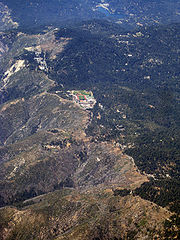
before turning into SR 18. The route climbs north at a gentle grade until it turns east, where it begins to offer panoramic views of San Bernardino. Hence, this portion of Route 18 is known as the Rim of the World Highway. After meeting State Route 138
at Crestline
, the expressway reverts to a two-lane mountain road. It meets two other highways, State Route 189
just east of Arrowhead Highlands and State Route 173 in Lake Arrowhead
, before running over State Route 330
in Running Springs
. SR 18 continues through several valleys and near ski resorts before reaching a summit. At that point, Route 18 again runs along a lengthy mountain ridge, offering more spectacular scenery at an even higher elevation
. At its west junction with State Route 38
near the west corner of Big Bear Lake
, Route 18 jogs across a dam and travels along the south shore of Big Bear Lake. After going through the City of Big Bear Lake
, it overlaps with SR 38 (considered the first discontinuity since Big Bear Boulevard has no clear signage of where SR 18 turns off) and moves from the south to the north side of Bear Valley east of both Big Bear Lake and the Big Bear City airport before it descends from the mountains to the desert on the northerly side of the mountains, first heading northeast, briefly north, and then northwest.
SR 18 at this point follows the cities on the north face of the San Bernardino Mountains in the Mojave Desert: In Lucerne Valley
, it intersects State Route 247
and then turns west for 21 miles (junctioning with major cutoff Bear Valley Road). It becomes an expressway (Happy Trails Highway, given for the High Desert's residency and final resting place of the 1950s singing cowboy, Roy Rogers) through Apple Valley
and Victorville
. It joins with Interstate 15 inside of Victorville (this is considered a discontinuity, since the freeway entries refer to I-15 only and not State Route 18, which has partial route markings along the freeway, mainly on southbound I-15) for a few miles to the southeast and south before taking off west across the desert, reducing into a two-lane highway again outside of Victorville and meeting U.S. Route 395
in Adelanto, crosses into Los Angeles County as the beginning of county-named Pearblossom Highway and ending at State Route 138
east of Llano
.
SR 18 thus takes an unusual path in the shape of a question mark
. On most of the signs of the highway, cardinal descriptions are not posted below the route markers, since it does not clearly go either west/east or north/south.
going through San Bernardino
through Waterman Canyon and near Big Bear Lake
and Victorville
. However, the section from Interstate 10 to present-day State Route 210 never was built, although it was designated as Legislative Route 26 in 1916 and Legislative Route 275 in 1959. In 1964, SR 18 was rerouted from the northern side of Big Bear Lake
to the southern side along the former routing of SR 30 and lost its Legislative Route 43 designation. In 1984, the portion of SR 18 running concurrently with Interstate 15 in Victorville was removed from the legislative definition. In 1991, SR 18 was rerouted to Lakeview Drive and out of the downtown area of Big Bear Lake
city proper, and this is now a business route of SR 18.
Before 1956, SR 18 continued south of San Bernardino to Lakewood
, routed on what is now Interstate 215
and State Route 91
as well as Lakewood Boulevard. SR 18 then ran concurrently with State Route 19 to the western terminus of U.S. Route 6
in Long Beach
.
{| class=wikitable
!County
!Location
!Postmile
!Exit
!Destinations
!Notes
|-
|rowspan=24|San Bernardino
SBD T6.18-115.91
|rowspan=3|San Bernardino
|T6.18
|
|Waterman Avenue
|Continuation beyond SR 210
|-
|T6.18
|
|
|Interchange; former SR 30
|-bgcolor=#ffdddd
|T8.26
|
|
|Interchange; southbound exit only
|-
|
|R13.28
|
|Waterman Canyon Road
|Interchange
|-
|
|R17.73
|
|
|Interchange
|-
|
|20.61
|
|, Twin Peaks
|
|-
|
|23.38
|
|Daley Canyon Road – Blue Jay
|
|-
|
|24.71
|
|
|
|-
|Running Springs
|31.90
|
|
|Interchange
|-
|Big Bear Dam
|44.32
|
|
|
|-
|rowspan=3|Big Bear Lake
|
|
|
|
|-
|49.11
|
|
|
|-
|51.61
|
|Stanfield Cutoff, Starvation Flats Road – Fawnskin
, North Shore Resorts
|
|-
|rowspan=2|Big Bear City
|bgcolor=#ddffdd|53.92
|bgcolor=#ddffdd|
|bgcolor=#ddffdd|
|bgcolor=#ddffdd|South end of SR 38 overlap
|-bgcolor=#ddffdd
|54.54
|
|
|North end of SR 38 overlap
|-
|Lucerne Valley
|73.78
|
|
|
|-
|rowspan=7|Victorville
|bgcolor=#ddffdd|95.79
|bgcolor=#ddffdd|
|bgcolor=#ddffdd|
|bgcolor=#ddffdd|South end of I-15 Bus. overlap; former US 66
west
|-bgcolor=#ddffdd
|96.57
40.51Indicates that the postmile represents the distance along I-15
rather than SR 18.
|
|
|Interchange; south end of I-15 overlap; north end of I-15 Bus. overlap; D Street was former US 66
east
|-
|colspan=4 align=center|South end of freeway on I-15
|-
|42.03
|151B
|Mojave Drive
|
|-
|41.43
|151A
|Roy Rogers Drive
|
|-
|colspan=4 align=center|North end of freeway on I-15
|-bgcolor=#ddffdd
|43.49
R96.58
|
|
|Interchange; north end of I-15 overlap
|-
|Adelanto
|100.95
|
|
|
|-
|Los Angeles
LA 0.00-4.50
|Llano
|4.50
|
|
|
U.S. state
A U.S. state is any one of the 50 federated states of the United States of America that share sovereignty with the federal government. Because of this shared sovereignty, an American is a citizen both of the federal entity and of his or her state of domicile. Four states use the official title of...
of California runs from State Route 210 in San Bernardino
San Bernardino, California
San Bernardino is a city located in the Riverside-San Bernardino metropolitan area , and serves as the county seat of San Bernardino County, California, United States...
to State Route 138 near Adelanto
Adelanto, California
Adelanto is a city in San Bernardino County, California about northwest of Victorville. The population was 31,765 at the 2010 census, up from 18,130 at the 2000 census.-Name:...
. It is the primary route into the San Bernardino Mountains
San Bernardino Mountains
The San Bernardino Mountains are a short transverse mountain range north and east of San Bernardino in Southern California in the United States. The mountains run for approximately 60 miles east-west on the southern edge of the Mojave Desert in southwestern San Bernardino County, north of the...
and has two discontinunities: one in Big Bear Lake, the other in Victorville.
Route description
SR 18 is part of the California Freeway and Expressway SystemCalifornia Freeway and Expressway System
The California Freeway and Expressway System is a system of existing or planned freeways and expressways in the U.S. state of California. It is defined by the Streets and Highways Code.-List of roads in the system:*State Route 1 *State Route 2...
and is eligible for the State Scenic Highway System
State Scenic Highway System (California)
The State Scenic Highway System is a list of highways, mainly state highways, that have been designated by the California Department of Transportation as scenic highways. The California State Legislature, primarily through Section 263 of the Streets and Highways Code, makes highways eligible for...
. However, it has not been designated as a scenic highway by Caltrans.
Limited-access road
A limited-access road known by various terms worldwide, including limited-access highway, dual-carriageway and expressway, is a highway or arterial road for high-speed traffic which has many or most characteristics of a controlled-access highway , including limited or no access to adjacent...
. SR 18 is known as Waterman Avenue in the city of San Bernardino
San Bernardino, California
San Bernardino is a city located in the Riverside-San Bernardino metropolitan area , and serves as the county seat of San Bernardino County, California, United States...
before turning into SR 18. The route climbs north at a gentle grade until it turns east, where it begins to offer panoramic views of San Bernardino. Hence, this portion of Route 18 is known as the Rim of the World Highway. After meeting State Route 138
California State Route 138
State Route 138 is an east–west state highway generally following the northern foothills of the San Gabriel Mountains of southern California, USA from its junction with Interstate 5 south of Gorman eastward to Mount Anderson Junction, its eastern junction with State Route 18 south of...
at Crestline
Crestline, California
Crestline is a census-designated place in the San Bernardino Mountains of San Bernardino County, California, USA. The population was 10,770 at the 2010 census, up from 10,218 at the 2000 census.-Geography:Crestline is located at ....
, the expressway reverts to a two-lane mountain road. It meets two other highways, State Route 189
California State Route 189
State Route 189 is a state highway in the U.S. state of California in San Bernardino County. The route serves Blue Jay and Twin Peaks along its way.-Route description:...
just east of Arrowhead Highlands and State Route 173 in Lake Arrowhead
Lake Arrowhead, California
Lake Arrowhead is an unincorporated community and a census-designated place in the San Bernardino Mountains of San Bernardino County, California, within the San Bernardino National Forest, adjacent to Lake Arrowhead Reservoir...
, before running over State Route 330
California State Route 330
State Route 330 is a state highway in the U.S. state of California. It is also known as City Creek Road in the San Bernardino Mountains.-Route description:...
in Running Springs
Running Springs, California
Running Springs is a census-designated place in San Bernardino County, California, United States. The population was 4,862 at the 2010 census, down from 5,125 at the 2000 census.-Geography:Running Springs is located at ....
. SR 18 continues through several valleys and near ski resorts before reaching a summit. At that point, Route 18 again runs along a lengthy mountain ridge, offering more spectacular scenery at an even higher elevation
Elevation
The elevation of a geographic location is its height above a fixed reference point, most commonly a reference geoid, a mathematical model of the Earth's sea level as an equipotential gravitational surface ....
. At its west junction with State Route 38
California State Route 38
State Route 38 is a mostly rural and scenic road in the U.S. state of California. Despite the orientation of its alignment, SR 38 is assigned in a west–east direction.-Route description:...
near the west corner of Big Bear Lake
Big Bear Lake
Big Bear Lake is a reservoir in the San Bernardino Mountains, in San Bernardino County, California, United States. At a surface elevation of , it has an east-west length of approximately 7 miles and is approximately 2.5 miles at its widest measurement, though the lake's width mostly averages a...
, Route 18 jogs across a dam and travels along the south shore of Big Bear Lake. After going through the City of Big Bear Lake
Big Bear Lake, California
Big Bear Lake is a city in San Bernardino County, California along the south shore of Big Bear Lake, located northeast of the city of San Bernardino. The population was 5,019 at the 2010 census, down from 5,438 at the 2000 census...
, it overlaps with SR 38 (considered the first discontinuity since Big Bear Boulevard has no clear signage of where SR 18 turns off) and moves from the south to the north side of Bear Valley east of both Big Bear Lake and the Big Bear City airport before it descends from the mountains to the desert on the northerly side of the mountains, first heading northeast, briefly north, and then northwest.
SR 18 at this point follows the cities on the north face of the San Bernardino Mountains in the Mojave Desert: In Lucerne Valley
Lucerne Valley, California
Lucerne Valley is a census-designated place located in the Mojave Desert of western San Bernardino County, California. It lies east of the Victor Valley, whose population nexus includes Victorville, Apple Valley, and Hesperia...
, it intersects State Route 247
California State Route 247
State Route 247 is a state highway in the U.S. state of California in San Bernardino County.This route is part of the California Freeway and Expressway System and is eligible for the State Scenic Highway System.-Route description:...
and then turns west for 21 miles (junctioning with major cutoff Bear Valley Road). It becomes an expressway (Happy Trails Highway, given for the High Desert's residency and final resting place of the 1950s singing cowboy, Roy Rogers) through Apple Valley
Apple Valley, California
-Climate:*On average, the warmest month is July.*The highest recorded temperature was in 2002.*On average, the coolest month is December.*The lowest recorded temperature was in 1949.*The most precipitation on average occurs in February.-History:...
and Victorville
Victorville, California
Victorville is a city located in the Victor Valley of southwestern San Bernardino County, California. According to the U.S. Census Bureau's 2010 census, the city had a population of 115,903, up from 64,030 at the 2000 census.-Geography and climate:...
. It joins with Interstate 15 inside of Victorville (this is considered a discontinuity, since the freeway entries refer to I-15 only and not State Route 18, which has partial route markings along the freeway, mainly on southbound I-15) for a few miles to the southeast and south before taking off west across the desert, reducing into a two-lane highway again outside of Victorville and meeting U.S. Route 395
U.S. Route 395 in California
In the U.S. state of California, U.S. Route 395 is a route which traverses from Interstate 15 near the southern city limits of Hesperia, north to the Oregon state line in Modoc County near Goose Lake...
in Adelanto, crosses into Los Angeles County as the beginning of county-named Pearblossom Highway and ending at State Route 138
California State Route 138
State Route 138 is an east–west state highway generally following the northern foothills of the San Gabriel Mountains of southern California, USA from its junction with Interstate 5 south of Gorman eastward to Mount Anderson Junction, its eastern junction with State Route 18 south of...
east of Llano
Llano, California
Llano is an unincorporated town located in Los Angeles County, California, near the San Bernardino Countyline. The town has a population of about 1200.- Geography :...
.
SR 18 thus takes an unusual path in the shape of a question mark
Question mark
The question mark , is a punctuation mark that replaces the full stop at the end of an interrogative sentence in English and many other languages. The question mark is not used for indirect questions...
. On most of the signs of the highway, cardinal descriptions are not posted below the route markers, since it does not clearly go either west/east or north/south.
History
Much of SR 18 has been signed since 1917, with the portion north of Big Bear Lake dating from 1933. Since 1963, State Route 18 has generally been legislatively defined as from Interstate 10 to State Route 138California State Route 138
State Route 138 is an east–west state highway generally following the northern foothills of the San Gabriel Mountains of southern California, USA from its junction with Interstate 5 south of Gorman eastward to Mount Anderson Junction, its eastern junction with State Route 18 south of...
going through San Bernardino
San Bernardino, California
San Bernardino is a city located in the Riverside-San Bernardino metropolitan area , and serves as the county seat of San Bernardino County, California, United States...
through Waterman Canyon and near Big Bear Lake
Big Bear Lake
Big Bear Lake is a reservoir in the San Bernardino Mountains, in San Bernardino County, California, United States. At a surface elevation of , it has an east-west length of approximately 7 miles and is approximately 2.5 miles at its widest measurement, though the lake's width mostly averages a...
and Victorville
Victorville, California
Victorville is a city located in the Victor Valley of southwestern San Bernardino County, California. According to the U.S. Census Bureau's 2010 census, the city had a population of 115,903, up from 64,030 at the 2000 census.-Geography and climate:...
. However, the section from Interstate 10 to present-day State Route 210 never was built, although it was designated as Legislative Route 26 in 1916 and Legislative Route 275 in 1959. In 1964, SR 18 was rerouted from the northern side of Big Bear Lake
Big Bear Lake
Big Bear Lake is a reservoir in the San Bernardino Mountains, in San Bernardino County, California, United States. At a surface elevation of , it has an east-west length of approximately 7 miles and is approximately 2.5 miles at its widest measurement, though the lake's width mostly averages a...
to the southern side along the former routing of SR 30 and lost its Legislative Route 43 designation. In 1984, the portion of SR 18 running concurrently with Interstate 15 in Victorville was removed from the legislative definition. In 1991, SR 18 was rerouted to Lakeview Drive and out of the downtown area of Big Bear Lake
Big Bear Lake, California
Big Bear Lake is a city in San Bernardino County, California along the south shore of Big Bear Lake, located northeast of the city of San Bernardino. The population was 5,019 at the 2010 census, down from 5,438 at the 2000 census...
city proper, and this is now a business route of SR 18.
Before 1956, SR 18 continued south of San Bernardino to Lakewood
Lakewood, California
Lakewood is a city in Los Angeles County, California, United States. The population was 80,048 at the 2010 census. It is bordered by Long Beach on the west and south, Bellflower on the north, Cerritos on the northeast, Cypress on the east, and Hawaiian Gardens on the southeast. Major thoroughfares...
, routed on what is now Interstate 215
Interstate 215 (California)
Interstate 215 is a long north–south Interstate highway in the Inland Empire region of Southern California. It is an auxiliary route of Interstate 15 , running from Murrieta to northern San Bernardino...
and State Route 91
California State Route 91
State Route 91 is a major east–west freeway located entirely within Southern California and serving several regions of the Greater Los Angeles metropolitan area...
as well as Lakewood Boulevard. SR 18 then ran concurrently with State Route 19 to the western terminus of U.S. Route 6
U.S. Route 6 in California
U.S. Route 6, or US 6, is a transcontinental highway from the U.S. state of California to Massachusetts. In California, the highway lies in the eastern portion of the state from Bishop in the Owens Valley north to the Nevada state line in Esmeralda County...
in Long Beach
Long Beach, California
Long Beach is a city situated in Los Angeles County in Southern California, on the Pacific coast of the United States. The city is the 36th-largest city in the nation and the seventh-largest in California. As of 2010, its population was 462,257...
.
Major intersections
- Note: Except where prefixed with a letter, postmiles were measured in 1964, based on the alignment as it existed at that time, and do not necessarily reflect current mileage. The numbers reset at county lines; the start and end postmiles in each county are given in the county column.
{| class=wikitable
!County
!Location
!Postmile
!Exit
!Destinations
!Notes
|-
|rowspan=24|San Bernardino
San Bernardino County, California
San Bernardino County is a county in the U.S. state of California. As of the 2010 census, the population was 2,035,210, up from 1,709,434 as of the 2000 census...
SBD T6.18-115.91
|rowspan=3|San Bernardino
San Bernardino, California
San Bernardino is a city located in the Riverside-San Bernardino metropolitan area , and serves as the county seat of San Bernardino County, California, United States...
|T6.18
|
|Waterman Avenue
|Continuation beyond SR 210
|-
|T6.18
|
|
|Interchange; former SR 30
|-bgcolor=#ffdddd
|T8.26
|
|
|Interchange; southbound exit only
|-
|
|R13.28
|
|Waterman Canyon Road
|Interchange
|-
|
|R17.73
|
|
|Interchange
|-
|
|20.61
|
|, Twin Peaks
Twin Peaks (San Bernardino)
Twin Peaks is a small community located in the San Bernardino mountains of Southern California just west of the resort community of Lake Arrowhead and east of Crestline. The current population is estimated to be around 1,500 people. Twin Peaks sits at an elevation of 5,800 feet and is accessible by...
|
|-
|
|23.38
|
|Daley Canyon Road – Blue Jay
Blue Jay, California
Blue Jay is an unincorporated town located in San Bernardino County in California. It is located in the San Bernardino Mountains, above a region of California known as the Inland Empire. The town is a part of the Lake Arrowhead Community. Other towns in this community are Lake Arrowhead, Running...
|
|-
|
|24.71
|
|
|
|-
|Running Springs
Running Springs, California
Running Springs is a census-designated place in San Bernardino County, California, United States. The population was 4,862 at the 2010 census, down from 5,125 at the 2000 census.-Geography:Running Springs is located at ....
|31.90
|
|
|Interchange
|-
|Big Bear Dam
|44.32
|
|
|
|-
|rowspan=3|Big Bear Lake
Big Bear Lake, California
Big Bear Lake is a city in San Bernardino County, California along the south shore of Big Bear Lake, located northeast of the city of San Bernardino. The population was 5,019 at the 2010 census, down from 5,438 at the 2000 census...
|
|
|
|
|-
|49.11
|
|
|
|-
|51.61
|
|Stanfield Cutoff, Starvation Flats Road – Fawnskin
Fawnskin, California
Fawnskin is an unincorporated community in San Bernardino County, California, United States. Its altitude is 6,827 feet . The community has a post office, which was established on 18 May 1918.-History:...
, North Shore Resorts
|
|-
|rowspan=2|Big Bear City
Big Bear City, California
Big Bear City is an unincorporated, census-designated place in San Bernardino County, California immediately east of Big Bear Lake. The population was 12,304 at the 2010 census, up from 5,779 at the 2000 census...
|bgcolor=#ddffdd|53.92
|bgcolor=#ddffdd|
|bgcolor=#ddffdd|
|bgcolor=#ddffdd|South end of SR 38 overlap
|-bgcolor=#ddffdd
|54.54
|
|
|North end of SR 38 overlap
|-
|Lucerne Valley
Lucerne Valley, California
Lucerne Valley is a census-designated place located in the Mojave Desert of western San Bernardino County, California. It lies east of the Victor Valley, whose population nexus includes Victorville, Apple Valley, and Hesperia...
|73.78
|
|
|
|-
|rowspan=7|Victorville
Victorville, California
Victorville is a city located in the Victor Valley of southwestern San Bernardino County, California. According to the U.S. Census Bureau's 2010 census, the city had a population of 115,903, up from 64,030 at the 2000 census.-Geography and climate:...
|bgcolor=#ddffdd|95.79
|bgcolor=#ddffdd|
|bgcolor=#ddffdd|
|bgcolor=#ddffdd|South end of I-15 Bus. overlap; former US 66
U.S. Route 66 in California
In the U.S. state of California, U.S. Route 66 is a former U.S. highway. All the portions were deleted by 1964 during the 1964 renumbering.-History:U.S...
west
|-bgcolor=#ddffdd
|96.57
40.51Indicates that the postmile represents the distance along I-15
Interstate 15 in California
In the U.S. state of California, Interstate 15 is a major north–south route through the San Bernardino, Riverside, and San Diego Counties, and it has a length of in the state. It is a major thoroughfare for traffic between Southern California and Las Vegas, Nevada, as well as points beyond...
rather than SR 18.
|
|
|Interchange; south end of I-15 overlap; north end of I-15 Bus. overlap; D Street was former US 66
U.S. Route 66 in California
In the U.S. state of California, U.S. Route 66 is a former U.S. highway. All the portions were deleted by 1964 during the 1964 renumbering.-History:U.S...
east
|-
|colspan=4 align=center|South end of freeway on I-15
|-
|42.03
|151B
|Mojave Drive
|
|-
|41.43
|151A
|Roy Rogers Drive
|
|-
|colspan=4 align=center|North end of freeway on I-15
|-bgcolor=#ddffdd
|43.49
R96.58
|
|
|Interchange; north end of I-15 overlap
|-
|Adelanto
Adelanto, California
Adelanto is a city in San Bernardino County, California about northwest of Victorville. The population was 31,765 at the 2010 census, up from 18,130 at the 2000 census.-Name:...
|100.95
|
|
|
|-
|Los Angeles
Los Angeles County, California
Los Angeles County is a county in the U.S. state of California. As of 2010 U.S. Census, the county had a population of 9,818,605, making it the most populous county in the United States. Los Angeles County alone is more populous than 42 individual U.S. states...
LA 0.00-4.50
|Llano
Llano, California
Llano is an unincorporated town located in Los Angeles County, California, near the San Bernardino Countyline. The town has a population of about 1200.- Geography :...
|4.50
|
|
|