

Stanislawów Voivodeship
Encyclopedia
| Stanisławów Voivodeship Województwo stanisławowskie |
|
| order="0" cellpadding="2" cellspacing="0"> | |
| Coat of Arms |
Ivano-Frankivsk
Ivano-Frankivsk is a historic city located in the western Ukraine. It is the administrative centre of the Ivano-Frankivsk Oblast , and is designated as its own separate raion within the oblast, municipality....
Density
Population density
Population density is a measurement of population per unit area or unit volume. It is frequently applied to living organisms, and particularly to humans...
87.59 p/km²
Powiat
A powiat is the second-level unit of local government and administration in Poland, equivalent to a county, district or prefecture in other countries. The term powiat is most often translated into English as "county", although other terms are also sometimes used...
s
Ivano-Frankivsk
Ivano-Frankivsk is a historic city located in the western Ukraine. It is the administrative centre of the Ivano-Frankivsk Oblast , and is designated as its own separate raion within the oblast, municipality....
, Kołomyja
Kolomyia
Kolomyia or Kolomyya, formerly known as Kolomea , is a city located on the Prut River in the Ivano-Frankivsk Oblast , in western Ukraine. Serving as the administrative centre of the Kolomyia Raion , the city is also designated as a separate raion within the oblast...
, Stryj
Stryj
Stryj may refer to:*Stryj, Lublin Voivodeship *Stryi, Ukraine - Stryj in Polish...
Poles
Poles
thumb|right|180px|The state flag of [[Poland]] as used by Polish government and diplomatic authoritiesThe Polish people, or Poles , are a nation indigenous to Poland. They are united by the Polish language, which belongs to the historical Lechitic subgroup of West Slavic languages of Central Europe...
Ukrainians
Ukrainians
Ukrainians are an East Slavic ethnic group native to Ukraine, which is the sixth-largest nation in Europe. The Constitution of Ukraine applies the term 'Ukrainians' to all its citizens...
& Ruthenians
Ruthenians
The name Ruthenian |Rus']]) is a culturally loaded term and has different meanings according to the context in which it is used. Initially, it was the ethnonym used for the East Slavic peoples who lived in Rus'. Later it was used predominantly for Ukrainians...
Jews
- 332,175 (22.4%)
- 1,018,878
(68.8% combined)
- 109,378 (7.4%)
Stanisławów Voivodeship was an administrative district of the interwar
Second Polish Republic
The Second Polish Republic, Second Commonwealth of Poland or interwar Poland refers to Poland between the two world wars; a period in Polish history in which Poland was restored as an independent state. Officially known as the Republic of Poland or the Commonwealth of Poland , the Polish state was...
Poland
Poland
Poland , officially the Republic of Poland , is a country in Central Europe bordered by Germany to the west; the Czech Republic and Slovakia to the south; Ukraine, Belarus and Lithuania to the east; and the Baltic Sea and Kaliningrad Oblast, a Russian exclave, to the north...
(1920–1939). It was established in December of 1920 with an administrative center in Stanisławów
Ivano-Frankivsk
Ivano-Frankivsk is a historic city located in the western Ukraine. It is the administrative centre of the Ivano-Frankivsk Oblast , and is designated as its own separate raion within the oblast, municipality....
. The voivodeship had an area of 16,900 km² and comprised twelve counties (powiaty). Following World War II
World War II
World War II, or the Second World War , was a global conflict lasting from 1939 to 1945, involving most of the world's nations—including all of the great powers—eventually forming two opposing military alliances: the Allies and the Axis...
, at the insistence of Joseph Stalin during Tehran Conference
Tehran Conference
The Tehran Conference was the meeting of Joseph Stalin, Franklin D. Roosevelt and Winston Churchill between November 28 and December 1, 1943, most of which was held at the Soviet Embassy in Tehran, Iran. It was the first World War II conference amongst the Big Three in which Stalin was present...
of 1943, Poland's borders were redrawn
Territorial changes of Poland after World War II
The territorial changes of Poland after World War II were very extensive. In 1945, following the Second World War, Poland's borders were redrawn following the decisions made at the Potsdam Conference of 1945 at the insistence of the Soviet Union...
, Polish population forcibly resettled
Repatriation of Poles
Repatriation of Poles can refer to:*Repatriation of Poles *Repatriation of Poles...
and Stanisławów Voivodeship was incorporated into the Ukrainian Soviet Socialist Republic. Since 1991, most part of it belongs to Ivano-Frankivsk Oblast
Ivano-Frankivsk Oblast
Ivano-Frankivsk Oblast is an oblast in western Ukraine. Its administrative center is the city of Ivano-Frankivsk. As is the case with most other oblasts of Ukraine this region has the same name as its administrative center – which was renamed by the Soviets after the Ukrainian writer, nationalist...
of sovereign Ukraine
Ukraine
Ukraine is a country in Eastern Europe. It has an area of 603,628 km², making it the second largest contiguous country on the European continent, after Russia...
.
September 1939 and its aftermath
Following German aggression on PolandInvasion of Poland (1939)
The Invasion of Poland, also known as the September Campaign or 1939 Defensive War in Poland and the Poland Campaign in Germany, was an invasion of Poland by Germany, the Soviet Union, and a small Slovak contingent that marked the start of World War II in Europe...
, and in accordance with the secret protocol of Molotov-Ribbentrop Pact
Molotov-Ribbentrop Pact
The Molotov–Ribbentrop Pact, named after the Soviet foreign minister Vyacheslav Molotov and the German foreign minister Joachim von Ribbentrop, was an agreement officially titled the Treaty of Non-Aggression between Germany and the Soviet Union and signed in Moscow in the late hours of 23 August 1939...
, Soviet forces invaded eastern Poland
Kresy
The Polish term Kresy refers to a land considered by Poles as historical eastern provinces of their country. Today, it makes western Ukraine, western Belarus, as well as eastern Lithuania, with such major cities, as Lviv, Vilnius, and Hrodna. This territory belonged to the Polish-Lithuanian...
on September 17, 1939. As bulk of the Polish Army was concentrated in the west, fighting Germans, the Soviets met with little resistance and their troops quickly moved westwards. Polish authorities originally intended to organize anti-German resistance in Stanisławów Voivodeship (see: Romanian Bridgehead
Romanian Bridgehead
The Romanian Bridgehead was an area in southeastern Poland, now located in Ukraine. During the Polish Defensive War of 1939 , on September 14 the Polish Commander in Chief Marshal of Poland Edward Rydz-Śmigły ordered all Polish troops fighting east of the Vistula to withdraw towards Lwów, and...
), with Polish Army units planned to stand ground until the spring of 1940 when French attack on Germany was expected. However, the Soviet invasion of Poland
Soviet invasion of Poland
Soviet invasion of Poland can refer to:* the second phase of the Polish-Soviet War of 1920 when Soviet armies marched on Warsaw, Poland* Soviet invasion of Poland of 1939 when Soviet Union allied with Nazi Germany attacked Second Polish Republic...
rendered these plans ineffectual.
Demographics
The Voivodeship's capital was StanisławówIvano-Frankivsk
Ivano-Frankivsk is a historic city located in the western Ukraine. It is the administrative centre of the Ivano-Frankivsk Oblast , and is designated as its own separate raion within the oblast, municipality....
(now Ivano-Frankivsk in Ukraine
Ukraine
Ukraine is a country in Eastern Europe. It has an area of 603,628 km², making it the second largest contiguous country on the European continent, after Russia...
). In 1921 was inhabited by 1,339,191 people, and its population density was 72.9 persons per km². Ukrainians
Ukrainians
Ukrainians are an East Slavic ethnic group native to Ukraine, which is the sixth-largest nation in Europe. The Constitution of Ukraine applies the term 'Ukrainians' to all its citizens...
and Ruthenians
Ruthenians
The name Ruthenian |Rus']]) is a culturally loaded term and has different meanings according to the context in which it is used. Initially, it was the ethnonym used for the East Slavic peoples who lived in Rus'. Later it was used predominantly for Ukrainians...
constituted 68% of the population, especially in the countryside. Poles, distributed across the entire Voivodeship, made around 23%, Polish Jews
Jews
The Jews , also known as the Jewish people, are a nation and ethnoreligious group originating in the Israelites or Hebrews of the Ancient Near East. The Jewish ethnicity, nationality, and religion are strongly interrelated, as Judaism is the traditional faith of the Jewish nation...
(mainly in towns) - around 7%. Also, there were smaller communities of Germans
Germans
The Germans are a Germanic ethnic group native to Central Europe. The English term Germans has referred to the German-speaking population of the Holy Roman Empire since the Late Middle Ages....
. In 1931 the population grew to 1,480,300 (mainly among Polish settlers) and the density - to 88 persons per km2.
Geography
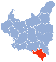
The Stanisławów Voivodeship's area was 16,894 square kilometers. It was located in south-eastern corner of the country, bordering Tarnopol VoivodeshipTarnopol Voivodeship
Tarnopol Voivodeship was an administrative region of interwar Poland with an area of 16,500 km², 17 counties, and capital in Tarnopol...
to the northeast, Lwów Voivodeship
Lwów Voivodeship
Lwów Voivodeship was an administrative unit of interwar Poland . According to Nazis and Soviets it ceased to exist in September 1939, following German and Soviet aggression on Poland . The Polish underground administration existed till August 1944.-Population:Its capital, biggest and most...
to the west, Czechoslovakia
Czechoslovakia
Czechoslovakia or Czecho-Slovakia was a sovereign state in Central Europe which existed from October 1918, when it declared its independence from the Austro-Hungarian Empire, until 1992...
(Between 1919-1938), Hungary
Hungary
Hungary , officially the Republic of Hungary , is a landlocked country in Central Europe. It is situated in the Carpathian Basin and is bordered by Slovakia to the north, Ukraine and Romania to the east, Serbia and Croatia to the south, Slovenia to the southwest and Austria to the west. The...
(Between 1938-1939) and Romania
Romania
Romania is a country located at the crossroads of Central and Southeastern Europe, on the Lower Danube, within and outside the Carpathian arch, bordering on the Black Sea...
to the south. It was in large part covered by forests of the Carpathian Mountains
Carpathian Mountains
The Carpathian Mountains or Carpathians are a range of mountains forming an arc roughly long across Central and Eastern Europe, making them the second-longest mountain range in Europe...
, with numerous mountain spas (Worochta, Skole
Skole
thumb|right|200px|A church in SkoleSkole is a city in the Lviv Oblast of Ukraine. It is administrative center of the Skole Raion. As of 2001, the population is 6,742.- History :...
, Dolina
Dolina
Dolina may refer to:Places*Dolyna, a city in Ukraine*Dolina, Tržič, a village in Tržič municipality in Slovenia*Dolina, Szczecin, Poland*Dolina, Lower Silesian Voivodeship *Dolina, Łódź Voivodeship...
, Zabie
Zabie
Ząbie is a village in the administrative district of Gmina Olsztynek, within Olsztyn County, Warmian-Masurian Voivodeship, in northern Poland. It lies approximately east of Olsztynek and south of the regional capital Olsztyn....
, Slawsko, Woronienka, Jaremcza, Kuty
Kuty
Kuty is a town in Ukraine, on the Cheremosh river, located in the Ivano-Frankivsk Oblast. It is notable as one of the historical centres and the namesake of a historical region of Pokuttya. Population is 4,272 ....
). Landscape was hilly (in the north) and mountainous (in the south), with Hoverla
Hoverla
Hoverla mountain at , is the highest mountain in Ukraine and part of the Carpathian Mountains. The mountain is located in the Eastern Beskides, in the so-called Chornohora region. The slopes are covered with beech and spruce forests, above which there is a belt of sub-alpine meadows called...
in the Chornohora
Chornohora
Chornohora is the highest mountain range in Western Ukraine in the Eastern Beskids and the Ukrainian Carpathians group, which in turn is part of the Outer Eastern Carpathians....
range as the highest peak (2060 meters above sea level). The other significant mountain range was the Gorgany
Gorgany
Gorgany is a mountain range in Western Ukraine in Outer Eastern Carpathians, adjacent to Chornohora range. The highest peak of Gorgany is Syvulia with the other high peaks including Ihrovyshche, Vysoka and Grofa. The mountains are made of flysch rock, mostly sandstone, which create typical for...
.
The main river was the Dniestr, which also marked border with the Tarnopol Voivodeship
Tarnopol Voivodeship
Tarnopol Voivodeship was an administrative region of interwar Poland with an area of 16,500 km², 17 counties, and capital in Tarnopol...
. Other rivers were: the Prut
Prut
The Prut is a long river in Eastern Europe. In part of its course it forms the border between Romania and Moldova.-Overview:...
, the Stryj
Stryj
Stryj may refer to:*Stryj, Lublin Voivodeship *Stryi, Ukraine - Stryj in Polish...
and the Czeremosz
Cheremosh River
The Cheremosh River is a river in western Ukraine, tributary of the Prut River.It flows along the borderline of the historic regions of Bukovina and Galicia. In the Middle Ages and the early modern era, it was part of the borderline between the Principality of Moldavia and Kingdom of Poland...
(the last one was at the same time bordering Poland from Romania
Romania
Romania is a country located at the crossroads of Central and Southeastern Europe, on the Lower Danube, within and outside the Carpathian arch, bordering on the Black Sea...
).
Administrative subdivisions
Before the onset of World War IIWorld War II
World War II, or the Second World War , was a global conflict lasting from 1939 to 1945, involving most of the world's nations—including all of the great powers—eventually forming two opposing military alliances: the Allies and the Axis...
the Stanisławów Voivodeship consisted of 15 powiats (counties) (earlier 12), 29 towns, 904 villages and numerous smaller communities (futory, kolonie). Those were the same 12 powiats that were part of the Kingdom of Galicia and Lodomeria
Kingdom of Galicia and Lodomeria
The Kingdom of Galicia and Lodomeria was a crownland of the Habsburg Monarchy, the Austrian Empire, and Austria–Hungary from 1772 to 1918 .This historical region in eastern Central Europe is currently divided between Poland and Ukraine...
with the addition of Turka powiat later on. Its capital Stanisławów was the largest city, with population of some 60,000 (as of 1931). Other important municipal centers of the voivodeship were: Kołomyja
Kolomyia
Kolomyia or Kolomyya, formerly known as Kolomea , is a city located on the Prut River in the Ivano-Frankivsk Oblast , in western Ukraine. Serving as the administrative centre of the Kolomyia Raion , the city is also designated as a separate raion within the oblast...
(pop. 33,800), Stryj
Stryi
Stryi is a city located on the left bank of the river Stryi in the Lviv Oblast of western Ukraine . Serving as the administrative center of the Stryi Raion , the city itself is also designated as a separate raion within the oblast. Thus, the city has two administrations - the city and the raion...
(pop. 30,500), Horodenka
Horodenka
Horodenka is a city located in the Ivano-Frankivsk Oblast, in western Ukraine. It is the administrative center of Horodenka Raion .The current estimated population is around 9,800 .-History:...
(pop. 12,200), Kalusz (pop. 12,100), Sniatyn
Sniatyn
Sniatyn is a city located in the Ivano-Frankivsk Oblast, in western Ukraine along the Prut river. It is the administrative center of the Sniatynsky Raion , and is located at around . The current estimated population is around 10,500 ....
(pop. 10,800) and Bolechow
Bolechów
Bolechów is a village in the administrative district of Gmina Oława, within Oława County, Lower Silesian Voivodeship, in south-western Poland. Prior to 1945 it was in Germany....
(pop. 10,700).
The Stanisławów Voivodeship consisted of 12 powiat
Powiat
A powiat is the second-level unit of local government and administration in Poland, equivalent to a county, district or prefecture in other countries. The term powiat is most often translated into English as "county", although other terms are also sometimes used...
s (counties
County
A county is a jurisdiction of local government in certain modern nations. Historically in mainland Europe, the original French term, comté, and its equivalents in other languages denoted a jurisdiction under the sovereignty of a count A county is a jurisdiction of local government in certain...
)
- DolinaDolinaDolina may refer to:Places*Dolyna, a city in Ukraine*Dolina, Tržič, a village in Tržič municipality in Slovenia*Dolina, Szczecin, Poland*Dolina, Lower Silesian Voivodeship *Dolina, Łódź Voivodeship...
Powiat (2397 km²) - HorodenkaHorodenkaHorodenka is a city located in the Ivano-Frankivsk Oblast, in western Ukraine. It is the administrative center of Horodenka Raion .The current estimated population is around 9,800 .-History:...
Powiat (849 km²) - Kałusz Powiat (1137 km²)
- Kołomyja Powiat (1339 km²), joined with Peczeniyn Powiat
- KosówKosówKosów may refer to:*Polish name for Kosiv in Ukraine*Kosów, Łódź Voivodeship *Kosów, Piaseczno County in Masovian Voivodeship *Kosów Lacki, a town in Masovian Voivodeship, Poland...
Powiat (1839 km²) - Nadwórna Powiat (2472 km²)
- RohatynRohatynRohatyn is a city located on the Hnyla Lypa River in the Ivano-Frankivsk Oblast, in western Ukraine. It is the administrative center of the Rohatyn Raion .The current estimated population is around 8,800 .-History:...
Powiat (1147 km²) - StanisławówIvano-FrankivskIvano-Frankivsk is a historic city located in the western Ukraine. It is the administrative centre of the Ivano-Frankivsk Oblast , and is designated as its own separate raion within the oblast, municipality....
Powiat (1249 km²), joined with Bohorodczan Powiat - StryjStryjStryj may refer to:*Stryj, Lublin Voivodeship *Stryi, Ukraine - Stryj in Polish...
Powiat (2081 km²), joined with Skolski Powiat - ŚniatyńSniatynSniatyn is a city located in the Ivano-Frankivsk Oblast, in western Ukraine along the Prut river. It is the administrative center of the Sniatynsky Raion , and is located at around . The current estimated population is around 10,500 ....
Powiat (567 km²) - Tłumacz Powiat (934 km²)
- Żydaczów Powiat (883 km²)
Railroads and industry
The Stanisławów Voivodeship was located in the so-called Poland “B” region, which meant that it was underdeveloped, with low level of industry and considerable numbers of inhabitants living in poverty. Agricultural production was low due to poor quality of soil. Since mid-1930s, the area was quickly gaining popularity as a tourist destination, with numbers of visitors to mountain springs rising steadily year by year. Railroad network was well-developed in the north, with such important junctions as Stanisławów, Kołomyja and Stryj. In the south, however, rail connections were lacking.On January 1, 1938, total length of railroads within Voivodeship's boundaries was 755 kilometers (4.5 km. per 100 km²).
Voivodes
The local government of voivodeship and city was located at address Ulica Karpinskiego, 7 (today - 2 Halych Street).- Edmund Jurystowski: 21 October 1921 – 18 August 1925
- Aleksander Des Loges: 18 August 1925 – 25 October 1926
- Władysław Korsak: 18 December 1926 – 12 September 1927
- Aleksander Morawski: 28 October 1927 – 30 October 1928
- Bronisław Nakoniecznikow-Klukowski: 30 October 1928 – 29 August 1930
- Zygmunt Jagodziński: 3 September 1930 – 1 February 1936 (acting till 2 February 1931)
- Mieczysław Starzyński: 11 February 1936 – 22 June 1936 (acting )
- Jan Sawicki: 23 June 1936 – July 1936
- Stefan Pasławski: 14 July 1936 – 20 January 1939
- Stanisław Jarecki: 20 January 1939 – 2 September 1939