
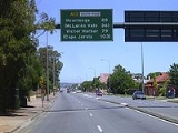
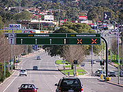
South Road, Adelaide
Encyclopedia
Adelaide
Adelaide is the capital city of South Australia and the fifth-largest city in Australia. Adelaide has an estimated population of more than 1.2 million...
, South Australia
South Australia
South Australia is a state of Australia in the southern central part of the country. It covers some of the most arid parts of the continent; with a total land area of , it is the fourth largest of Australia's six states and two territories.South Australia shares borders with all of the mainland...
. Also known as Main South Road, it is Adelaide's most important arterial road
Arterial road
An arterial road, or arterial thoroughfare, is a high-capacity urban road. The primary function of an arterial road is to deliver traffic from collector roads to freeways, and between urban centres at the highest level of service possible. As such, many arteries are limited-access roads, or feature...
.
Route
South Road carries much of the road traffic from the southern suburbs towards the Adelaide city centreAdelaide city centre
The Adelaide city centre is the innermost locality of Greater Adelaide, known by locals simply as "The City" or "Town". The locality is split into two key geographical distinctions: the city "square mile", bordered by North, East, South and West Terraces; and that part of the Adelaide Parklands...
. This traffic completes its journey to the city centre via Anzac Highway
Anzac Highway, Adelaide
The Anzac Highway is an 11 kilometre main arterial road heading southwest from the city of Adelaide, the capital of South Australia, to the beachside suburb of Glenelg....
.
From Anzac Hwy, South Road continues north as a western bypass of the city across many arterials, the major ones being Port Road
Port Road
Port Road may refer to:*Port Road, Adelaide, South Australia*Container Port Road, Hong Kong*Icknield Port Road railway station, Birmingham, England*Port Road, Barry, Barry, Vale of Glamorgan, Wales...
, Regency Road and Grand Junction Road, to the junctions with the Port River Expressway
Port River Expressway
The Port River Expressway is a freeway-grade road. The expressway links Port Adelaide and the LeFevre Peninsula to the northern suburbs of Adelaide and major interstate routes via Salisbury Highway to Port Wakefield Road and the Northern Expressway to Perth and Sydney.The expressway is only...
and the Salisbury Highway
Salisbury Highway
The Salisbury Highway, , is a 12 kilometre major connecting road in the northern suburbs of the Adelaide metropolitan area....
. Until the Port River Expressway opened in 2005, the sections of South Road and Salisbury Highway between Grand Junction Road and Port Wakefield Road
Port Wakefield Road
Port Wakefield Road is an important Australian highway. It connects Adelaide, the South Australian capital, to the Yorke Peninsula, Port Augusta, northern and western South Australia, the Northern Territory and Western Australia. It is designated National Highway A1 and a part of the National Highway...
were known as the South Road Extension, built in the early 1990s.
To the south of Anzac Hwy, the name changes to Main South Road at the intersection of Ayliffes and Shepherds Hill Roads at Clovelly Park
Clovelly Park, South Australia
Clovelly Park is an inner southern suburb of Adelaide in the local government area of the City of Marion. Before becoming an 'advanced' suburb, it was a farm and vineyard. It has a population of around 2,700. The borders are defined by Daws Road to the north, South Road to the east, Sturt Road to...
, and continues past McLaren Vale
McLaren Vale, South Australia
McLaren Vale is a township in the wine region of McLaren Vale in South Australia. At the 2006 census, McLaren Vale had a population of 2,908....
(where the Victor Harbor
Victor Harbor, South Australia
Victor Harbor is a city located on the coast of the Fleurieu Peninsula, about 80 km south of Adelaide, South Australia. The city is the largest population centre on the peninsula, with an economy based upon agriculture, fisheries and various industries...
road branches off) and runs parallel to the west coast of Fleurieu Peninsula
Fleurieu Peninsula
The Fleurieu Peninsula is a peninsula located south of Adelaide in South Australia, Australia. It was named after the French explorer and hydrographer Charles Pierre Claret de Fleurieu by the French explorer Nicolas Baudin as he mapped the south coast of Australia in 1802.Towns of interest in the...
all the way to Cape Jervis
Cape Jervis, South Australia
Cape Jervis is a town at the southwestern tip of Fleurieu Peninsula in South Australia, approximately 108 km south of Adelaide. The population is approximately 300 people and growing rapidly, with a new estate situated behind the main town...
at its southern tip. The town of Old Noarlunga, South Australia
Old Noarlunga, South Australia
Old Noarlunga is a small town approximately 40 minutes drive south of Adelaide, South Australia. Originally settled around 1840, the town retains its village atmosphere in spite of encroaching suburbia. At the 2006 census, Old Noarlunga had a population of 1,252.-History:In 1850 the South Australia...
was bypassed in 1978. The fully reversible Southern Expressway
Southern Expressway
The Southern Expressway is the world's longest reversible one way freeway. Originally proposed as 'Noarlunga Freeway', it was built as a corridor to relieve heavy traffic from the major arterial, Main South Road, in Adelaide's south. The expressway was built in two stages — the first...
(M2) runs roughly parallel to South Road for 18 km from Darlington
Darlington, South Australia
Darlington is a suburb of Adelaide, South Australia part of which is in the City of Onkaparinga and the City of Marion.-References:...
to Noarlunga and carries through traffic to reduce peak congestion.
Congestion and upgrades
South Road suffers from traffic congestionTraffic congestion
Traffic congestion is a condition on road networks that occurs as use increases, and is characterized by slower speeds, longer trip times, and increased vehicular queueing. The most common example is the physical use of roads by vehicles. When traffic demand is great enough that the interaction...
due to its importance as Adelaide's main arterial road
Arterial road
An arterial road, or arterial thoroughfare, is a high-capacity urban road. The primary function of an arterial road is to deliver traffic from collector roads to freeways, and between urban centres at the highest level of service possible. As such, many arteries are limited-access roads, or feature...
. Traffic has also increased in line with the growth and development of Adelaide's southern suburbs.
An overpass
Overpass
An overpass is a bridge, road, railway or similar structure that crosses over another road or railway...
was built over Cross Road
Cross Road, Adelaide
Cross Road is a major arterial road that travels east-west through the inner southern suburbs of the Australian city of Adelaide. Its western terminus is at Anzac Highway, travelling east and ending at Glen Osmond and the Adelaide Hills, joining the junction of Glen Osmond Road, Portrush Road, and...
and the train line between 1982 and 1984 to reduce a major bottleneck
Bottleneck
A bottleneck is a phenomenon where the performance or capacity of an entire system is limited by a single or limited number of components or resources. The term bottleneck is taken from the 'assets are water' metaphor. As water is poured out of a bottle, the rate of outflow is limited by the width...
.
The current Labor state government has completed an underpass at Anzac Highway, and an overpass of the Adelaide-Glenelg Tram, in 2009 and 2010. The underpass model used is a diamond interchange
Diamond interchange
A diamond interchange is a common type of road junction, used where a freeway crosses a minor road. The freeway itself is grade-separated from the minor road, one crossing the other over a bridge...
. Further plans exist to construct a tunnel under Grange Road, Port Road
Port Road, Adelaide
Port Road is a major road in Adelaide, South Australia connecting the central business district with Port Adelaide. It is 12 km long and exceptionally wide, approximately 70 m. When first conceived upon the establishment of Adelaide, it was designed to be able to accommodate a standard road, a...
and the Outer Harbor
Outer Harbor railway line, Adelaide
The Outer Harbor Railway Line in Adelaide, South Australia runs from Adelaide Railway Station. It includes many suburban railway stations, and shares part of its run with the Grange line.-History:...
–Grange railway line
Grange railway line, Adelaide
The Grange railway line is a suburban branch line in the city of Adelaide, South Australia.-History:The railway line between Woodville and Grange opened in September 1882. This was a private railway, constructed by the Grange Railway and Investment Company...
to further reduce congestion.
In November 2005, the Royal Automobile Association
Royal Automobile Association
The Royal Automobile Association of South Australia, also known simply as RAA, is a South Australian automobile club providing a range of member services including: 24-hour emergency breakdown, vehicle inspection, motoring advocacy, road safety, legal services, technical advice, travel services,...
(RAA) released their recommendations to the South Australian government in regards to the road network. South Road was found to be the poorest road in the state, registering a 2/10 on the RAA's scale. The recommendations given included $6 billion of funds to upgrade the roads of South Australia – with $1.5–2 billion to be spent on South Road alone. The RAA's plan for the road included a 6 km tunnel from Port Road all the way to the Anzac Highway underpass and over/underpasses at six other major intersections and two rail crossings. PDF
On 18 August 2007, the then Prime Minister John Howard
John Howard
John Winston Howard AC, SSI, was the 25th Prime Minister of Australia, from 11 March 1996 to 3 December 2007. He was the second-longest serving Australian Prime Minister after Sir Robert Menzies....
announced that South Road was to be included in the AusLink
AusLink
AusLink was an Australian Government land transport funding program, established in June 2004 and administered by the Department of Transport and Regional Services. In 2009 it was replaced with the Nation Building Program under the Nation Building Program Act 2009...
National Road Network, and also pledged $1 billion in funding for the project between 2007 and 2020.
In October 2009, both the Premier of South Australia and the Prime Minister of Australia released plans for the South Road Superway
South Road Superway
The South Road Superway is a proposed elevated freeway in the northern suburbs of the South Australian capital city of Adelaide. It will be constructed over a 4 km section of South Road as part of a long term plan to upgrade this road into a non-stop north-south route. At a cost of AUD$812...
- a 3–4 km section of elevated freeway running from the Port River Expressway to the intersection of Regency Road at a cost of $800million. The project is expected to start in 2010 and be completed by 2014. The elevated part will avoid crossing Grand Junction, Cormack Roads, and the Port Adelaide-Dry Creek railway. Unfortunately, this will duplicate what is already one of the best parts of South road, (3 lanes each direction), while other parts remain in urgent need of an upgrade, (between Port and Regency roads, for example).
Major intersections (north–south)
South Road / Main South Road   |
|||
| Southbound | Northbound | ||
| Start South Road from Salisbury Highway Salisbury Highway The Salisbury Highway, , is a 12 kilometre major connecting road in the northern suburbs of the Adelaide metropolitan area.... |
End South Road continues as Salisbury Highway Salisbury Highway The Salisbury Highway, , is a 12 kilometre major connecting road in the northern suburbs of the Adelaide metropolitan area.... to   |
||
| no access. | Port River Expressway Port River Expressway The Port River Expressway is a freeway-grade road. The expressway links Port Adelaide and the LeFevre Peninsula to the northern suburbs of Adelaide and major interstate routes via Salisbury Highway to Port Wakefield Road and the Northern Expressway to Perth and Sydney.The expressway is only...   |
||
| PORT FLAT FREIGHT RAIL LINE grade separation proposed |
PORT FLAT FREIGHT RAIL LINE grade separation proposed |
||
Cormack Road  grade separation proposed |
Cormack Road grade separation proposed |
||
| Grand Junction Road National  grade separation proposed |
Grand Junction Road State  grade separation proposed |
||
| Days Road |
Days Road |
||
| Regency Road |
Regency Road |
||
| Torrens Road Torrens Road, Adelaide Torrens Road is an arterial road in the northwestern suburbs of Adelaide, Australia. The road travels in a southeast-northwest direction and is parallel with Port Road for most of its length. Major roads that intersect Torrens Road include South Road, Churchill Road and Regency Road... |
Torrens Road Torrens Road, Adelaide Torrens Road is an arterial road in the northwestern suburbs of Adelaide, Australia. The road travels in a southeast-northwest direction and is parallel with Port Road for most of its length. Major roads that intersect Torrens Road include South Road, Churchill Road and Regency Road... |
||
| OUTER HARBOR RAIL LINE Outer Harbor railway line, Adelaide The Outer Harbor Railway Line in Adelaide, South Australia runs from Adelaide Railway Station. It includes many suburban railway stations, and shares part of its run with the Grange line.-History:... grade separation proposed |
OUTER HARBOR RAIL LINE Outer Harbor railway line, Adelaide The Outer Harbor Railway Line in Adelaide, South Australia runs from Adelaide Railway Station. It includes many suburban railway stations, and shares part of its run with the Grange line.-History:... grade separation proposed |
||
| Port Road Port Road, Adelaide Port Road is a major road in Adelaide, South Australia connecting the central business district with Port Adelaide. It is 12 km long and exceptionally wide, approximately 70 m. When first conceived upon the establishment of Adelaide, it was designed to be able to accommodate a standard road, a...  grade separation proposed |
Port Road Port Road, Adelaide Port Road is a major road in Adelaide, South Australia connecting the central business district with Port Adelaide. It is 12 km long and exceptionally wide, approximately 70 m. When first conceived upon the establishment of Adelaide, it was designed to be able to accommodate a standard road, a... grade separation proposed |
||
| Manton Street grade separation proposed |
Grange Road grade separation proposed |
||
| Henley Beach Road |
Henley Beach Road |
||
Sir Donald Bradman Drive   |
Sir Donald Bradman Drive |
||
| Richmond Road |
Richmond Road |
||
Anzac Highway  |
Anzac Highway |
||
| GLENELG TRAM LINE Glenelg Tram The Glenelg Tram is a route from the centre of Adelaide, South Australia to the beach-side suburb of Glenelg. It is Adelaide's only remaining tramway, running at approximately 15-minute intervals, and is part of the integrated Adelaide Metro public transport network... |
GLENELG TRAM LINE Glenelg Tram The Glenelg Tram is a route from the centre of Adelaide, South Australia to the beach-side suburb of Glenelg. It is Adelaide's only remaining tramway, running at approximately 15-minute intervals, and is part of the integrated Adelaide Metro public transport network... |
||
| Cross Road Cross Road, Adelaide Cross Road is a major arterial road that travels east-west through the inner southern suburbs of the Australian city of Adelaide. Its western terminus is at Anzac Highway, travelling east and ending at Glen Osmond and the Adelaide Hills, joining the junction of Glen Osmond Road, Portrush Road, and... /NOARLUNGA RAIL LINE Noarlunga Centre railway line, Adelaide The Noarlunga Centre railway line is a suburban commuter line in the city of Adelaide, South Australia.-History:Before the extension of the line to Noarlunga Centre line in 1978, the Willunga line ran from Hallett Cove station on a different route through Reynella, Morphett Vale and Hackham to...  |
Cross Road Cross Road, Adelaide Cross Road is a major arterial road that travels east-west through the inner southern suburbs of the Australian city of Adelaide. Its western terminus is at Anzac Highway, travelling east and ending at Glen Osmond and the Adelaide Hills, joining the junction of Glen Osmond Road, Portrush Road, and... /NOARLUNGA RAIL LINE Noarlunga Centre railway line, Adelaide The Noarlunga Centre railway line is a suburban commuter line in the city of Adelaide, South Australia.-History:Before the extension of the line to Noarlunga Centre line in 1978, the Willunga line ran from Hallett Cove station on a different route through Reynella, Morphett Vale and Hackham to... |
||
| Daws Road |
Daws Road |
||
| Ayliffes Road Goodwood Road, Adelaide Goodwood Road is a major north-south arterial road, approximately 10 kilometres long, in Adelaide, South Australia. It runs between the Adelaide city centre and the suburbs of Pasadena and Panorama, and has a speed limit of .... |
Ayliffes Road Goodwood Road, Adelaide Goodwood Road is a major north-south arterial road, approximately 10 kilometres long, in Adelaide, South Australia. It runs between the Adelaide city centre and the suburbs of Pasadena and Panorama, and has a speed limit of .... |
||
| Shepherds Hill Road |
Shepherds Hill Road |
||
| Sturt Road grade separation proposed Flinders University Flinders University Flinders University, , is a public university in Adelaide, South Australia. Founded in 1966, it was named in honour of navigator Matthew Flinders, who explored and surveyed the South Australian coastline in the early 19th century.The university has established a reputation as a leading research... |
Sturt Road grade separation proposed |
||
| Flinders Drive Eastbound Flinders Medical Centre Flinders Medical Centre Flinders Medical Centre is a 580 bed public teaching hospital and medical school, co-located with Flinders University and the 130 bed Flinders Private Hospital located at Bedford Park, South Australia. It opened in 1976. It is one of the major public hospitals operating in metropolitan Adelaide... |
Only Eastbound Access to FMC. | ||
| Southern Expressway Southern Expressway The Southern Expressway is the world's longest reversible one way freeway. Originally proposed as 'Noarlunga Freeway', it was built as a corridor to relieve heavy traffic from the major arterial, Main South Road, in Adelaide's south. The expressway was built in two stages — the first...  Southbound Entry Only |
no access. | ||
Flagstaff Road  |
Marion Road |
||
| Majors Road |
Majors Road |
||
| Black Road |
Black Road |
||
| Chandlers Hill Road |
Chandlers Hill Road |
||
| Panalatinga Road |
Southern Expressway Southern Expressway The Southern Expressway is the world's longest reversible one way freeway. Originally proposed as 'Noarlunga Freeway', it was built as a corridor to relieve heavy traffic from the major arterial, Main South Road, in Adelaide's south. The expressway was built in two stages — the first... Northbound Entry Only |
||
| Pimpala Road Eastbound |
Sherriffs Road Westbound |
||
| Bains Road Eastbound |
O'Sullivan Beach Road Westbound |
||
| Wheatsheaf Road Eastbound |
Flaxmill Road Westbound |
||
| Doctors Road Eastbound |
Beach Road Westbound |
||
| no exit. | Honeypot Road Westbound |
||
| Pennys Hill Road Eastbound |
Local Access Only. | ||
| no access. | Southern Expressway Southern Expressway The Southern Expressway is the world's longest reversible one way freeway. Originally proposed as 'Noarlunga Freeway', it was built as a corridor to relieve heavy traffic from the major arterial, Main South Road, in Adelaide's south. The expressway was built in two stages — the first... |
||
| Victor Harbor Road Victor Harbor Road The Victor Harbor Road is on the Fleurieu Peninsula, South Australia. It runs from Main South Road at Old Noarlunga south to Victor Harbor, bypassing the towns of McLaren Vale and Willunga, and passing through Mount Compass.-Route:... |
Victor Harbor Road Victor Harbor Road The Victor Harbor Road is on the Fleurieu Peninsula, South Australia. It runs from Main South Road at Old Noarlunga south to Victor Harbor, bypassing the towns of McLaren Vale and Willunga, and passing through Mount Compass.-Route:... |
||
| Start Route Continues as Main South Road to Cape Jervis Cape Jervis, South Australia Cape Jervis is a town at the southwestern tip of Fleurieu Peninsula in South Australia, approximately 108 km south of Adelaide. The population is approximately 300 people and growing rapidly, with a new estate situated behind the main town... |
End Route Continues as Route |
||
See also
- Highways in AustraliaHighways in AustraliaThis is a list of highways in Australia, listed alphabetically along with each highway's route number and location. Note that some highways service more than one state or territory.-Route numbering systems:...
- List of highways in South Australia
- Metropolitan Adelaide Transport StudyMetropolitan Adelaide Transport StudyThe Metropolitan Adelaide Transport Study, or "MATS Plan" as it became known, was a comprehensive transport plan released in 1968 examining the then-current and future needs of transport for the city of Adelaide....