

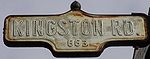
Kingston Road (Toronto)
Encyclopedia
Toronto
Toronto is the provincial capital of Ontario and the largest city in Canada. It is located in Southern Ontario on the northwestern shore of Lake Ontario. A relatively modern city, Toronto's history dates back to the late-18th century, when its land was first purchased by the British monarchy from...
, specifically in the districts of East York
East York
East York can refer to:*East York, Pennsylvania, United States*East York, Ontario, Canada...
and Scarborough
Scarborough, Ontario
Scarborough is a dissolved municipality within the city of Toronto, Ontario, Canada. Geographically, it comprises the eastern part of Toronto. It is bordered on the south by Lake Ontario, on the west by Victoria Park Avenue, on the north by Steeles Avenue East, and on the east by the Rouge River...
. Until 1998, it formed a significant portion of Highway 2
Ontario Highway 2
King's Highway 2, usually referred to simply as Highway 2 is a provincially maintained highway in Ontario. Once the primary east–west route across the southern end of the province, Highway 2 became mostly redundant in the 1960s following the completion of Highway 401, which more or less...
. The name of the street is derived from Kingston, Ontario
Kingston, Ontario
Kingston, Ontario is a Canadian city located in Eastern Ontario where the St. Lawrence River flows out of Lake Ontario. Originally a First Nations settlement called "Katarowki," , growing European exploration in the 17th Century made it an important trading post...
as the road was the primary route used to travel from Toronto to the settlements east of it situated along the shores of Lake Ontario
Lake Ontario
Lake Ontario is one of the five Great Lakes of North America. It is bounded on the north and southwest by the Canadian province of Ontario, and on the south by the American state of New York. Ontario, Canada's most populous province, was named for the lake. In the Wyandot language, ontarío means...
.
History
Native American engineer Asa Danforth Jr.Asa Danforth Jr.
Asa Danforth Jr. was one of the first citizens of Onondaga County, New York, when he arrived there with his father, Asa Danforth in 1788. Danforth incurred heavy debts speculating in land in New York State...
was contracted to build a road as a route to connect Toronto
Toronto
Toronto is the provincial capital of Ontario and the largest city in Canada. It is located in Southern Ontario on the northwestern shore of Lake Ontario. A relatively modern city, Toronto's history dates back to the late-18th century, when its land was first purchased by the British monarchy from...
(then called York) with the mouth of the Trent River in 1799 at a cost of $90.00 per mile. The road was completed by December 18, 1800, but was poorly maintained thereafter. In 1815 the Kingston Road was surveyed and it followed the line, in many cases, of the former road laid out by Asa Danforth. It was completed in 1817.
Route description
The Toronto section runs from Queen Street East, joining with Eastern AvenueEastern Avenue (Toronto)
Eastern Avenue is an east-west street in Toronto, Canada. It runs from just east of Parliament Street in the downtown to just west of Coxwell Avenue, near the Beaches neighbourhood. Originally Eastern crossed the Don River at the Old Eastern Avenue Bridge, but that bridge was disconnected in 1964...
, just west of Woodbine Avenue (route to Lake Shore Boulevard) through Scarborough
Scarborough, Ontario
Scarborough is a dissolved municipality within the city of Toronto, Ontario, Canada. Geographically, it comprises the eastern part of Toronto. It is bordered on the south by Lake Ontario, on the west by Victoria Park Avenue, on the north by Steeles Avenue East, and on the east by the Rouge River...
to Toronto's eastern city limits with Durham Region, where it continues as Durham Regional Highway 2.
A small portion of road parallel to Kingston Road is called Old Kingston Road running near the Highland Creek, east of Morningside Avenue. The road reverts to the original route at the junction with the former Highway 2A
Highway 2A (Ontario)
King's Highway 2A, commonly referred to as Highway 2A, was the designation of five separate provincially maintained highways in the Canadian province of Ontario. Highway 2A was an alternate route to Highway 2 in London, Chatham and Cornwall; these routes were all eventually redesignated...
, (as well as Military Trail
Danforth Avenue
Danforth Avenue is an east-west arterial road in Toronto, Ontario, Canada. Its western end begins in Old Toronto from the Prince Edward Viaduct as a continuation of Bloor Street and continues through East York until intersecting with Kingston Road in Scarborough...
). Other old, parallel sections to Highway 2, also called Old Kingston Road, exist in Courtice, Ontario
Courtice, Ontario
Courtice is a community located in Ontario, Canada, about sixty kilometers east of Toronto, adjacent to Oshawa and west of Bowmanville in the Municipality of Clarington. Courtice Road connects with Highway 401 at Interchange 425, providing arterial access to the community...
and Pickering Village, Ontario
Pickering Village, Ontario
Pickering Village is a community and former municipality in the Town of Ajax, Durham Region, Ontario, Canada.Originally located in Pickering Township, a community began to grow in 1807, when Quaker Timothy Rogers purchased of land and brought a number of Quaker families to settle in the area. A...
. There is also an old section of the old Danforth Road in Grafton, Ontario
Grafton, Ontario
Grafton is a community in the province of Ontario. It is in Northumberland County, in the township of Alnwick/Haldimand. It is 12 km east of Cobourg, Ontario on the former Highway 2 , with close access to Highway 401. The hamlet is near the geographically significant Oak Ridges Moraine at Rice...
.
The initial sections in the Beaches area take the form of a historic urban arterial road with extensive storefronts and pedestrian traffic. The TTC's
Toronto streetcar system
The Toronto streetcar system comprises eleven streetcar routes in Toronto, Ontario, Canada, operated by the Toronto Transit Commission , and is the largest such system in the Americas in terms of ridership, number of cars, and track length. The network is concentrated primarily in downtown and in...
502 Downtowner and 503 Kingston Road
503 Kingston Road (TTC)
The 503 Kingston Rd is an east-west streetcar route in Toronto, Ontario, Canada, operated by the Toronto Transit Commission. The 503 Kingston Rd travels on a route to the downtown financial district from the Bingham Loop and operates as a rush hour service only...
streetcars run along Kingston Road during the daytime on weekdays (evening, weekend and holiday service is provided by buses
Toronto buses and trolley buses
Toronto Transit Commission buses are transit buses used for public transport in Toronto, Ontario, Canada. Buses are owned and operated by the Toronto Transit Commission . With over 140 routes in operation, the TTC attracts over 400 million riders each year. Each route is further divided into branch...
). The speed limit in that section is 50 km/h (30 mph). Also, TTC's 12 Kingston Road, 86 Scarborough, and 102 Markham Road run along Kingston Road, east of Victoria Park Avenue.
Until Highway 401 was constructed, Kingston Road was the principal route from Toronto to points east. Accordingly, it became the site of numerous inns and motel
Motel
A motor hotel, or motel for short, is a hotel designed for motorists, and usually has a parking area for motor vehicles...
s, many of which still dot the road, particularly in Scarborough.
Now some of these inns are being demolished to make way for townhouse developments. Kingston Road is a six-lane principal arterial road through most of Scarborough and Durham, with a 60 kilometres per hour (37.3 mph) speed limit for the most part.
See also
- Highway 401
- Highway 2Highway 2 (Ontario)King's Highway 2, usually referred to simply as Highway 2 is a provincially maintained highway in Ontario. Once the primary east–west route across the southern end of the province, Highway 2 became mostly redundant in the 1960s following the completion of Highway 401, which more or less...
- Highway 2AHighway 2A (Ontario)King's Highway 2A, commonly referred to as Highway 2A, was the designation of five separate provincially maintained highways in the Canadian province of Ontario. Highway 2A was an alternate route to Highway 2 in London, Chatham and Cornwall; these routes were all eventually redesignated...