

Saskatchewan Highway 10
Encyclopedia
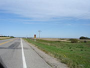
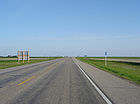
Highway 10 is a provincial paved undivided highway
in the Canadian
province of Saskatchewan
. It runs from Highway 1
near Balgonie
until it transitions into PTH 5 at the Manitoba
border. Highway 10 is about 228 km (142 mi.) long.
 Highway 10 passes through Fort Qu'Appelle
, Balcarres
, Melville
, and Yorkton. It intersects Highway 1
and Highway 16
.
Highway
A highway is any public road. In American English, the term is common and almost always designates major roads. In British English, the term designates any road open to the public. Any interconnected set of highways can be variously referred to as a "highway system", a "highway network", or a...
in the Canadian
Canada
Canada is a North American country consisting of ten provinces and three territories. Located in the northern part of the continent, it extends from the Atlantic Ocean in the east to the Pacific Ocean in the west, and northward into the Arctic Ocean...
province of Saskatchewan
Saskatchewan
Saskatchewan is a prairie province in Canada, which has an area of . Saskatchewan is bordered on the west by Alberta, on the north by the Northwest Territories, on the east by Manitoba, and on the south by the U.S. states of Montana and North Dakota....
. It runs from Highway 1
Saskatchewan Highway 1
Highway 1 is the Saskatchewan section of the Trans-Canada Highway mainland route. The total distance of the Trans-Canada Highway in Saskatchewan is . The highway traverses Saskatchewan from the western border with Alberta, from Highway 1, to Manitoba where it continues as Highway 1, PTH 1. The...
near Balgonie
Balgonie, Saskatchewan
-Sports:Home of Team Selzer, World Women's Curling Silver Medalists, and consistently competitive high school volleyball and soccer programs.-References:...
until it transitions into PTH 5 at the Manitoba
Manitoba
Manitoba is a Canadian prairie province with an area of . The province has over 110,000 lakes and has a largely continental climate because of its flat topography. Agriculture, mostly concentrated in the fertile southern and western parts of the province, is vital to the province's economy; other...
border. Highway 10 is about 228 km (142 mi.) long.
Fort Qu'Appelle, Saskatchewan
These figures do not include the substantial population living along the shores of the Fishing Lakes.-Origins:The current site is the third Fort Qu'Appelle. The first was a North West Company trading post , also in the valley but near what is now the Saskatchewan-Manitoba border...
, Balcarres
Balcarres, Saskatchewan
-Geography:* Lat 50°48′ N* Long 103°33′ W* Dominion Land Survey 13-21-12-W2* Time zone UTC−6- Notable residents :* James Garfield Gardiner was a premier of Saskatchewan and minister in the Canadian Cabinet...
, Melville
Melville, Saskatchewan
Melville is a small Canadian city located in the east-central portion of Saskatchewan. It was declared a city by the province in 1960. The city is north east of the provincial capital of Regina and south west of Yorkton. According to The World Gazetteer, it has a 2004 population of approximately...
, and Yorkton. It intersects Highway 1
Saskatchewan Highway 1
Highway 1 is the Saskatchewan section of the Trans-Canada Highway mainland route. The total distance of the Trans-Canada Highway in Saskatchewan is . The highway traverses Saskatchewan from the western border with Alberta, from Highway 1, to Manitoba where it continues as Highway 1, PTH 1. The...
and Highway 16
Saskatchewan Highway 16
Highway 16 is a provincial paved highway in the Canadian province of Saskatchewan. It is the Saskatchewan section of the Yellowhead Highway, and also the Trans-Canada Highway Yellowhead section. The main purpose of this highway is to connect Saskatchewan with Canadian cities such as Edmonton and...
.