
Sarasota County, Florida
Encyclopedia
Sarasota County is a county
located in the U.S. state
of Florida
. The U.S. Census Bureau
2008 estimate for the county was 372,057. Its county seat
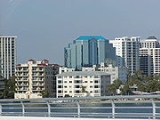
is Sarasota, Florida
.
Sarasota County is a member of the Sarasota-Manatee Metropolitan Planning Organization
, which plans for state roads in the two-county area. It also is part of the Bradenton-Sarasota-Venice Metropolitan Statistical Area.

 Sarasota County was created in 1921. After acquisition by the United States as a territory and once Florida obtained state status, the area now included in the county had been governed by Hillsborough County
, then Manatee County as the state was divided into smaller and smaller governmental organization. Manatee County was carved up to allow the creation of three more counties as well.
Although the name was associated with the area from the beginning of European contacts the origin of the name, Sarasota, is unknown. It may be named for a word in the indigenous Calusa
language, whose meaning may be Point of Rocks or Place of the Dance. Some believe a fanciful story created for a popular early twentieth-century pageant held in Sarasota, that it was named after the daughter of famous explorer Hernando de Soto
's daughter Sara.
According to the Florida League of Cities FLC, the name first appeared in print as "Zarazote" on a 1763 land grant map.
or Tampa
except:
 As of the census
of 2000, there were 325,957 people, 149,937 households, and 94,460 families residing in the county. The population density
was 570 people per square mile (220/km²). There were 182,467 housing units at an average density of 319 per square mile (123/km²). The racial makeup of the county was 92.65% White
, 4.18% Black
or African American
, 0.22% Native American
, 0.77% Asian
, 0.03% Pacific Islander
, 1.14% from other races
, and 1.02% from two or more races. 4.34% of the population were Hispanic
or Latino
of any race. 89.7% spoke English
, 4.4% Spanish
, 1.3% German
and 1.0% French
as their first language.
Census Estimates for 2005 show the county population as being 87.5% non-Hispanic whites, 6.3% Latinos, 4.5% African-American and 1.1% Asian.
In 2000 there were 149,957 households out of which 18.30% had children under the age of 18 living with them, 52.70% were married couples
living together, 7.70% had a female householder with no husband present, and 37.00% were non-families. 30.40% of all households were made up of individuals and 16.90% had someone living alone who was 65 years of age or older. The average household size was 2.13 and the average family size was 2.61.
In the county the population was spread out with 16.20% under the age of 18, 5.00% from 18 to 24, 21.70% from 25 to 44, 25.60% from 45 to 64, and 31.50% who were 65 years of age or older. The median age was 50 years. For every 100 females there were 90.00 males. For every 100 females age 18 and over, there were 87.30 males.
The median income for a household in the county was $41,957, and the median income for a family was $50,111. About 5.10% of families and 7.80% of the population were below the poverty line, including 12.70% of those under age 18 and 4.50% of those age 65 or over.
The per capita income
for the county was $28,326. Females had a median income of $25,721 versus $32,114 for males.
The following is a transcript from a Sarasota County historical marker that was erected in a park dedicated to Anderson on Manasota Key.
County (United States)
In the United States, a county is a geographic subdivision of a state , usually assigned some governmental authority. The term "county" is used in 48 of the 50 states; Louisiana is divided into parishes and Alaska into boroughs. Parishes and boroughs are called "county-equivalents" by the U.S...
located in the U.S. state
U.S. state
A U.S. state is any one of the 50 federated states of the United States of America that share sovereignty with the federal government. Because of this shared sovereignty, an American is a citizen both of the federal entity and of his or her state of domicile. Four states use the official title of...
of Florida
Florida
Florida is a state in the southeastern United States, located on the nation's Atlantic and Gulf coasts. It is bordered to the west by the Gulf of Mexico, to the north by Alabama and Georgia and to the east by the Atlantic Ocean. With a population of 18,801,310 as measured by the 2010 census, it...
. The U.S. Census Bureau
United States Census Bureau
The United States Census Bureau is the government agency that is responsible for the United States Census. It also gathers other national demographic and economic data...
2008 estimate for the county was 372,057. Its county seat
County seat
A county seat is an administrative center, or seat of government, for a county or civil parish. The term is primarily used in the United States....
is Sarasota, Florida
Sarasota, Florida
Sarasota is a city located in Sarasota County on the southwestern coast of the U.S. state of Florida. It is south of the Tampa Bay Area and north of Fort Myers...
.
Sarasota County is a member of the Sarasota-Manatee Metropolitan Planning Organization
Metropolitan planning organization
A metropolitan planning organization is a federally-mandated and federally-funded transportation policy-making organization in the United States that is made up of representatives from local government and governmental transportation authorities...
, which plans for state roads in the two-county area. It also is part of the Bradenton-Sarasota-Venice Metropolitan Statistical Area.
History
Hillsborough County, Florida
As of the census of 2000, there were 998,948 people, 391,357 households, and 255,164 families residing in the county. The population density was 951 people per square mile . There were 425,962 housing units at an average density of 405 per square mile...
, then Manatee County as the state was divided into smaller and smaller governmental organization. Manatee County was carved up to allow the creation of three more counties as well.
Although the name was associated with the area from the beginning of European contacts the origin of the name, Sarasota, is unknown. It may be named for a word in the indigenous Calusa
Calusa
The Calusa were a Native American people who lived on the coast and along the inner waterways of Florida's southwest coast. Calusa society developed from that of archaic peoples of the Everglades region; at the time of European contact, the Calusa were the people of the Caloosahatchee culture...
language, whose meaning may be Point of Rocks or Place of the Dance. Some believe a fanciful story created for a popular early twentieth-century pageant held in Sarasota, that it was named after the daughter of famous explorer Hernando de Soto
Hernando de Soto (explorer)
Hernando de Soto was a Spanish explorer and conquistador who, while leading the first European expedition deep into the territory of the modern-day United States, was the first European documented to have crossed the Mississippi River....
's daughter Sara.
According to the Florida League of Cities FLC, the name first appeared in print as "Zarazote" on a 1763 land grant map.
Geography
According to the 2000 census, the county has a total area of 725.18 square miles (1,878.2 km²), of which 571.55 square miles (1,480.3 km²) (or 78.81%) is land and 153.63 square miles (397.9 km²) (or 21.19%) is water.Adjacent counties
- Manatee County, FloridaManatee County, FloridaManatee County is a county in the state of Florida. According to the 2010 census by the U.S. Census Bureau there are 322,833 people living in Manatee Country.Manatee County is part of the North Port-Bradenton-Sarasota Metropolitan Statistical Area...
- north - DeSoto County, FloridaDeSoto County, FloridaDeSoto County is a county located in the U.S. state of Florida. As of 2000, the population was 32,209. The U.S. Census Bureau 2005 estimate for the county is 35,406 . Its county seat is Arcadia, Florida. The county comprises the Arcadia, Florida Micropolitan Statistical Area.- History :DeSoto...
- east - Charlotte County, FloridaCharlotte County, FloridaCharlotte County is a county located in the U.S. state of Florida. As of 2000, the population was 141,627. In 2005, the population of the MSA was 154,030.The U.S. Census Bureau 2007 estimate for the county was 152,814...
- south
Incorporated
- City of SarasotaSarasota, FloridaSarasota is a city located in Sarasota County on the southwestern coast of the U.S. state of Florida. It is south of the Tampa Bay Area and north of Fort Myers...
- City of North PortNorth Port, FloridaNorth Port is a city in southern Sarasota County, Florida, United States. The population was 22,797 at the 2000 census. As of 2007, the population recorded by the U.S. Census Bureau is 54,308. It is part of the Bradenton–Sarasota–Venice Metropolitan Statistical Area...
- City of VeniceVenice, FloridaVenice is a city in Sarasota County, Florida, United States. According to the U.S. Census Bureau's 2007 estimates, the city had a population of 21,015. It is noted for its large snowbird population. Its newspaper is the Venice Gondolier Sun...
- Town of Longboat KeyLongboat Key, FloridaLongboat Key is a town in Manatee and Sarasota counties along the central west coast of the U.S. state of Florida, located on the barrier island of the same name. Longboat Key is south of Anna Maria Island, between Sarasota Bay and the Gulf of Mexico. It is almost equally divided between Manatee...
Unincorporated
- Bee RidgeBee Ridge, FloridaBee Ridge is a census-designated place in Sarasota County, Florida, United States. The population was 8,744 at the 2000 census. It is part of the Bradenton–Sarasota–Venice Metropolitan Statistical Area.-Geography:...
- Desoto LakesDesoto Lakes, FloridaDesoto Lakes is a census-designated place in Sarasota County, Florida, United States. The population was 3,198 at the 2000 census. It is part of the Bradenton–Sarasota–Venice Metropolitan Statistical Area.-Geography:...
- EnglewoodEnglewood, FloridaEnglewood is a census-designated place in Charlotte and Sarasota counties in the U.S. state of Florida. As of the 2000 census, it had a population of 16,196.Englewood also was the original name for Vineland, Florida...
- FruitvilleFruitville, FloridaFruitville is a census-designated place in Sarasota County, Florida, United States. The population was 12,741 at the 2000 census. It is part of the Bradenton–Sarasota–Venice Metropolitan Statistical Area.-Geography:...
- Gulf Gate EstatesGulf Gate Estates, FloridaGulf Gate Estates is a census-designated place in Sarasota County, Florida, United States. The population was 11,647 at the 2000 census. It is part of the Bradenton–Sarasota–Venice Metropolitan Statistical Area.-Geography:...
- Kensington ParkKensington Park, FloridaKensington Park is a census-designated place in Sarasota County, Florida, United States. The population was 3,720 at the 2000 census. It is part of the Bradenton–Sarasota–Venice Metropolitan Statistical Area.-Geography:...
- Lake SarasotaLake Sarasota, FloridaLake Sarasota is a census-designated place in Sarasota County, Florida, United States. The population was 4,458 at the 2000 census. It is part of the Bradenton–Sarasota–Venice Metropolitan Statistical Area.-Geography:...
- LaurelLaurel, FloridaLaurel is a census-designated place in Sarasota County, Florida, United States. The population was 8,393 at the 2000 census. It is generally considered part of Nokomis and people who live in the CDP have either a Nokomis or Osprey address....
- NokomisNokomis, FloridaNokomis is a census-designated place in Sarasota County, Florida, United States. The population was 3,334 at the 2000 census. It is part of the Bradenton–Sarasota–Venice Metropolitan Statistical Area....
- North SarasotaNorth Sarasota, FloridaNorth Sarasota is a census-designated place in Sarasota County, Florida, United States. The population was 6,738 at the 2000 census. It is part of the Bradenton–Sarasota–Venice Metropolitan Statistical Area.-Geography:...
- OspreyOsprey, FloridaOsprey is a census-designated place in Sarasota County, Florida, United States. The population was 4,143 at the 2000 census. It is part of the Bradenton–Sarasota–Venice Metropolitan Statistical Area.-Geography:...
- PlantationPlantation, Sarasota County, FloridaPlantation is a census-designated place in Sarasota County, Florida, United States. The population was 4,168 at the 2000 census. It is part of the Bradenton–Sarasota–Venice Metropolitan Statistical Area.-Geography:...
- Ridge Wood HeightsRidge Wood Heights, FloridaRidge Wood Heights is a census-designated place in Sarasota County, Florida in the United States. The population was 4,795 at the 2010 census...
- Sarasota SpringsSarasota Springs, FloridaSarasota Springs is a census-designated place in Sarasota County, Florida, United States. The population was 15,875 at the 2000 census. It is part of the Bradenton–Sarasota–Venice Metropolitan Statistical Area.-Geography:...
- Siesta KeySiesta Key, FloridaSiesta Key is a barrier island off the central western coast of Florida in the United States of America. It is situated between Sarasota Bay and the Gulf of Mexico. A portion of it lies within the city boundary of Sarasota, but the majority of the key is a census-designated place in Sarasota County...
- South Gate RidgeSouth Gate Ridge, FloridaSouth Gate Ridge is a census-designated place in Sarasota County, Florida, United States. The population was 5,655 at the 2000 census. It is part of the Bradenton–Sarasota–Venice Metropolitan Statistical Area.-Geography:...
- South SarasotaSouth Sarasota, FloridaSouth Sarasota is a census-designated place in Sarasota County, Florida, United States. The population was 5,314 at the 2000 census. It is part of the Bradenton–Sarasota–Venice Metropolitan Statistical Area.-Geography:...
- South VeniceSouth Venice, FloridaSouth Venice is a census-designated place in Sarasota County, Florida, United States. The population was 13,539 at the 2000 census. It is part of the Bradenton–Sarasota–Venice Metropolitan Statistical Area.-Geography:...
- SouthgateSouthgate, FloridaSouthgate is a census-designated place in Sarasota County, Florida, United States. The population was 7,455 at the 2000 census. It is part of the Bradenton–Sarasota–Venice Metropolitan Statistical Area.-Geography:...
- The MeadowsThe Meadows, FloridaThe Meadows is a census-designated place in Sarasota County, Florida, United States. The population was 4,423 at the 2000 census. The Meadows was originally built by the British construction company Taylor Woodrow in the early 1980s. The Meadows contains an active rental retirement community, an...
- VamoVamo, FloridaVamo is a census-designated place in Sarasota County, Florida, United States. The population was 5,285 at the 2000 census. It is part of the Bradenton–Sarasota–Venice Metropolitan Statistical Area.-Geography:...
- Venice GardensVenice Gardens, FloridaVenice Gardens is a census-designated place in Sarasota County, Florida, United States. The population was 7,466 at the 2000 census. It is part of the Bradenton–Sarasota–Venice Metropolitan Statistical Area.-Geography:...
- Warm Mineral SpringsWarm Mineral Springs, FloridaWarm Mineral Springs is a census-designated place in Sarasota County, Florida, United States. The population was 4,811 at the 2000 census. It is part of the Bradenton–Sarasota–Venice Metropolitan Statistical Area....
Primary and secondary education
- Sarasota County Public SchoolsSarasota County Public SchoolsSarasota County Public Schools is a public school district serving all of Sarasota County, Florida. As of 2006, the total number of students is approximately 42,000.-Elementary schools:*Alta Vista Elementary School*Ashton Elementary School...
- Public K-12 School district serving all of Sarasota County
Higher education
- New College of FloridaNew College of FloridaNew College of Florida is a public liberal arts college located in Sarasota, Florida. It was founded originally as a private institution and is now an autonomous honors college of the State University System of Florida.-History:...
- Public liberal arts college. 'Honors' college of the State of Florida. - University of South Florida Sarasota-ManateeUniversity of South FloridaThe University of South Florida, also known as USF, is a member institution of the State University System of Florida, one of the state's three flagship universities for public research, and is located in Tampa, Florida, USA...
- Branch campus of USF. - Ringling College of Art and Design - A private, 4 year, not-for-profit, fully accredited college with concentrations in art and design.
Newspapers
- Herald Tribune - Also known as the Sarasota Herald Tribune. Primarily serves Sarasota County for news, but also serves ManateeManatee County, FloridaManatee County is a county in the state of Florida. According to the 2010 census by the U.S. Census Bureau there are 322,833 people living in Manatee Country.Manatee County is part of the North Port-Bradenton-Sarasota Metropolitan Statistical Area...
, CharlotteCharlotte County, FloridaCharlotte County is a county located in the U.S. state of Florida. As of 2000, the population was 141,627. In 2005, the population of the MSA was 154,030.The U.S. Census Bureau 2007 estimate for the county was 152,814...
and DeSotoDeSoto County, FloridaDeSoto County is a county located in the U.S. state of Florida. As of 2000, the population was 32,209. The U.S. Census Bureau 2005 estimate for the county is 35,406 . Its county seat is Arcadia, Florida. The county comprises the Arcadia, Florida Micropolitan Statistical Area.- History :DeSoto...
counties. Circulation is 110,817 daily and 132,185 on Sunday (2005 averages). Also operates an online news portal, HeraldTribune.com - Venice Gondolier Sun - Website and archives within the Florida Digital Newspaper Library
- Pelican Press - Website
- The Observer Newspapers - Three editions : Longboat Key, Sarasota, East County Website
Television
Sarasota County is part of the Tampa/St. Petersburg/Sarasota DMA. Most of the television stations are located in Saint PetersburgSt. Petersburg, Florida
St. Petersburg is a city in Pinellas County, Florida, United States. It is known as a vacation destination for both American and foreign tourists. As of 2008, the population estimate by the U.S. Census Bureau is 245,314, making St...
or Tampa
Tâmpa
Tâmpa may refer to several villages in Romania:* Tâmpa, a village in Băcia Commune, Hunedoara County* Tâmpa, a village in Miercurea Nirajului, Mureş County* Tâmpa, a mountain in Braşov city...
except:
- WWSBWWSBWWSB Channel 40 is the ABC-affiliated television station for the Florida Suncoast that is licensed to Sarasota. It broadcasts a high definition digital signal on UHF channel 24 from a transmitter on Rutland Road in the unincorporated Manatee County community of Rye, about 5 miles ESE of Parrish...
- A local ABCAmerican Broadcasting CompanyThe American Broadcasting Company is an American commercial broadcasting television network. Created in 1943 from the former NBC Blue radio network, ABC is owned by The Walt Disney Company and is part of Disney-ABC Television Group. Its first broadcast on television was in 1948...
affiliate based in Sarasota - SNN News 6SNN News 6SNN Local News 6 is a Comcast 24-hour cable news television station operating in Sarasota, Florida. The station operates in conjunction with the Sarasota Herald-Tribune, which houses the station in its downtown Sarasota building...
- Local twenty-four hour news station based in Sarasota - Various government and local access channels. Access 19 (Local Government channel), Education Channel (School Board) and BLAB TV (local programming)
Airports
- Sarasota-Bradenton International AirportSarasota-Bradenton International AirportSarasota-Bradenton International Airport is an airport located between Bradenton and Sarasota, Florida. The airport is shared by both Manatee County and Sarasota County . Most airlines refer to the airport on destination maps and flight status displays as just "Sarasota", as that is the more...
, in both Manatee CountyManatee County, FloridaManatee County is a county in the state of Florida. According to the 2010 census by the U.S. Census Bureau there are 322,833 people living in Manatee Country.Manatee County is part of the North Port-Bradenton-Sarasota Metropolitan Statistical Area...
(runway) and Sarasota County (terminal). - Venice Municipal AirportVenice Municipal AirportVenice Municipal Airport is a city managed public-use airport located two miles south of the central business district of Venice, a city in Sarasota County, Florida, United States.- History :...
,a general aviation airport in Venice, FloridaVenice, FloridaVenice is a city in Sarasota County, Florida, United States. According to the U.S. Census Bureau's 2007 estimates, the city had a population of 21,015. It is noted for its large snowbird population. Its newspaper is the Venice Gondolier Sun...
.
Major highways and state roads
 Interstate 75Interstate 75Interstate 75 is a major north–south Interstate Highway in the Great Lakes and Southeastern regions of the United States. It travels from State Road 826 and State Road 924 in Hialeah, Florida to Sault Ste. Marie, Michigan, at the Ontario, Canada, border...
- North-south limited-access freeway, and has ten interchangesInterchange (road)In the field of road transport, an interchange is a road junction that typically uses grade separation, and one or more ramps, to permit traffic on at least one highway to pass through the junction without directly crossing any other traffic stream. It differs from a standard intersection, at which...
within Sarasota County. Major north-south highway in Sarasota County. It is the high-speed connection with other cities such as Tampa, FloridaTampa, FloridaTampa is a city in the U.S. state of Florida. It serves as the county seat for Hillsborough County. Tampa is located on the west coast of Florida. The population of Tampa in 2010 was 335,709....
and Fort Myers, FloridaFort Myers, FloridaFort Myers is the county seat and commercial center of Lee County, Florida, United States. Its population was 62,298 in the 2010 census, a 29.23 percent increase over the 2000 figure....
. Interstate 75 heads east in Southern Sarasota County through North Port, FloridaNorth Port, FloridaNorth Port is a city in southern Sarasota County, Florida, United States. The population was 22,797 at the 2000 census. As of 2007, the population recorded by the U.S. Census Bureau is 54,308. It is part of the Bradenton–Sarasota–Venice Metropolitan Statistical Area...
to cross Charlotte HarborCharlotte Harbor (estuary)Charlotte Harbor Estuary is a natural estuary spanning the west coast of Florida from Venice to Bonita Springs on the Gulf of Mexico and is one of the most productive wetlands in Florida...
at a more manageable length. U.S. Highway 41- The main north-south road through the county is known as Tamiami TrailTamiami TrailThe Tamiami Trail is the southernmost of U.S. Highway 41 from State Road 60 in Tampa to U.S. Route 1 in Miami. The road also has the hidden designation of State Road 90....
. It was created in the 1920s to connect Tampa with Miami, hence the contracted name. It runs through the county close to the coastline and is not limited-access. U.S. Highway 301 - Also runs north-south through the county, at first east of Tamiaimi Trail and later rejoining it (it separates from 41 north of the county line).
 State Road 789Florida State Road 789A 19-mile-long road along the Florida’s Gulf Coast, State Road 789 spans Bird Key, St. Armands Key, and Lido Key, in Sarasota; Longboat Key ; and Anna Maria Island...
 State Road 758
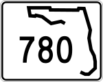 State Road 780
- State Road 776
 State Road 72
 State Road 681
Public transportation
- Sarasota County Area TransitSarasota County Area TransitSarasota County Area Transit provides public transportation for Sarasota County, Florida and is operated by the county. SCAT maintains 24 fixed-line bus routes plus a dial-a-ride paratransit service . Bus service is offered throughout Sarasota County from 5am until midnight 7 days a week...
(SCAT) provides public transportation for Sarasota County, Florida. SCAT is operated by Sarasota County. It maintains 19 fixed-line bus routes plus a dial-a-ride paratransit service (SCAT Plus).
Demographics
Census
A census is the procedure of systematically acquiring and recording information about the members of a given population. It is a regularly occurring and official count of a particular population. The term is used mostly in connection with national population and housing censuses; other common...
of 2000, there were 325,957 people, 149,937 households, and 94,460 families residing in the county. The population density
Population density
Population density is a measurement of population per unit area or unit volume. It is frequently applied to living organisms, and particularly to humans...
was 570 people per square mile (220/km²). There were 182,467 housing units at an average density of 319 per square mile (123/km²). The racial makeup of the county was 92.65% White
Race (United States Census)
Race and ethnicity in the United States Census, as defined by the Federal Office of Management and Budget and the United States Census Bureau, are self-identification data items in which residents choose the race or races with which they most closely identify, and indicate whether or not they are...
, 4.18% Black
Race (United States Census)
Race and ethnicity in the United States Census, as defined by the Federal Office of Management and Budget and the United States Census Bureau, are self-identification data items in which residents choose the race or races with which they most closely identify, and indicate whether or not they are...
or African American
Race (United States Census)
Race and ethnicity in the United States Census, as defined by the Federal Office of Management and Budget and the United States Census Bureau, are self-identification data items in which residents choose the race or races with which they most closely identify, and indicate whether or not they are...
, 0.22% Native American
Race (United States Census)
Race and ethnicity in the United States Census, as defined by the Federal Office of Management and Budget and the United States Census Bureau, are self-identification data items in which residents choose the race or races with which they most closely identify, and indicate whether or not they are...
, 0.77% Asian
Race (United States Census)
Race and ethnicity in the United States Census, as defined by the Federal Office of Management and Budget and the United States Census Bureau, are self-identification data items in which residents choose the race or races with which they most closely identify, and indicate whether or not they are...
, 0.03% Pacific Islander
Race (United States Census)
Race and ethnicity in the United States Census, as defined by the Federal Office of Management and Budget and the United States Census Bureau, are self-identification data items in which residents choose the race or races with which they most closely identify, and indicate whether or not they are...
, 1.14% from other races
Race (United States Census)
Race and ethnicity in the United States Census, as defined by the Federal Office of Management and Budget and the United States Census Bureau, are self-identification data items in which residents choose the race or races with which they most closely identify, and indicate whether or not they are...
, and 1.02% from two or more races. 4.34% of the population were Hispanic
Race (United States Census)
Race and ethnicity in the United States Census, as defined by the Federal Office of Management and Budget and the United States Census Bureau, are self-identification data items in which residents choose the race or races with which they most closely identify, and indicate whether or not they are...
or Latino
Race (United States Census)
Race and ethnicity in the United States Census, as defined by the Federal Office of Management and Budget and the United States Census Bureau, are self-identification data items in which residents choose the race or races with which they most closely identify, and indicate whether or not they are...
of any race. 89.7% spoke English
English language
English is a West Germanic language that arose in the Anglo-Saxon kingdoms of England and spread into what was to become south-east Scotland under the influence of the Anglian medieval kingdom of Northumbria...
, 4.4% Spanish
Spanish language
Spanish , also known as Castilian , is a Romance language in the Ibero-Romance group that evolved from several languages and dialects in central-northern Iberia around the 9th century and gradually spread with the expansion of the Kingdom of Castile into central and southern Iberia during the...
, 1.3% German
German language
German is a West Germanic language, related to and classified alongside English and Dutch. With an estimated 90 – 98 million native speakers, German is one of the world's major languages and is the most widely-spoken first language in the European Union....
and 1.0% French
French language
French is a Romance language spoken as a first language in France, the Romandy region in Switzerland, Wallonia and Brussels in Belgium, Monaco, the regions of Quebec and Acadia in Canada, and by various communities elsewhere. Second-language speakers of French are distributed throughout many parts...
as their first language.
Census Estimates for 2005 show the county population as being 87.5% non-Hispanic whites, 6.3% Latinos, 4.5% African-American and 1.1% Asian.
In 2000 there were 149,957 households out of which 18.30% had children under the age of 18 living with them, 52.70% were married couples
Marriage
Marriage is a social union or legal contract between people that creates kinship. It is an institution in which interpersonal relationships, usually intimate and sexual, are acknowledged in a variety of ways, depending on the culture or subculture in which it is found...
living together, 7.70% had a female householder with no husband present, and 37.00% were non-families. 30.40% of all households were made up of individuals and 16.90% had someone living alone who was 65 years of age or older. The average household size was 2.13 and the average family size was 2.61.
In the county the population was spread out with 16.20% under the age of 18, 5.00% from 18 to 24, 21.70% from 25 to 44, 25.60% from 45 to 64, and 31.50% who were 65 years of age or older. The median age was 50 years. For every 100 females there were 90.00 males. For every 100 females age 18 and over, there were 87.30 males.
The median income for a household in the county was $41,957, and the median income for a family was $50,111. About 5.10% of families and 7.80% of the population were below the poverty line, including 12.70% of those under age 18 and 4.50% of those age 65 or over.
The per capita income
Per capita income
Per capita income or income per person is a measure of mean income within an economic aggregate, such as a country or city. It is calculated by taking a measure of all sources of income in the aggregate and dividing it by the total population...
for the county was $28,326. Females had a median income of $25,721 versus $32,114 for males.
- Population in Sarasota County as of 2006 had reached 369,535 people.
Notable pioneer honored on sign
Joseph Daniel Anderson was one of the pioneers of the Sarasota area. He established his homestead in the Forked Creek area in 1886 and became an early leader in what now is southern Sarasota County (having been Manatee County from 1855 until 1921).The following is a transcript from a Sarasota County historical marker that was erected in a park dedicated to Anderson on Manasota Key.
- "After the Civil War, many Georgians moved their families to Southern Florida. Joseph Daniel "Jody" Anderson, born in Georgia in 1867, was a child when his father moved to the Tampa/Sara Sota area. In 1884, Joseph became the head of the Anderson family. Two years later, he moved his family to Southern Manatee County. He homesteaded the land in the Mystic River (Forked Creek) Valley. In 1890 he married Helen Alice Johnson of Sarasota. They had eleven children. Eight survived.
- With only hand tools, Anderson converted the Florida wilderness into an agricultural industry. This fertile land produced vegetables, sugar cane and citrus. In the vast Myakka/Pinedale area, he raised his cattle and swine. He and brother Moses "Lee" prospered in ranching until the Range Law Act curtailed the right to use this land for grazing.
- Sleds (later wagons) were used to move the farm produce, fruit and cattle to Lemon Bay where they were transferred to draft boats and transported to ships at Boca Grande. Some of the wagons were rafted across the bay to Manasota Beach where the produce was ferried to Cuban smacks and later to American schooners.
- Anderson pioneered commercial fishing in North Lemon Bay which teemed with schools of mullet and other fish. The Andersons fished with nets made of cotton and flax twine over which they poured a heavy lime solution to prevent rot. Their base of operation included land storage facilities on the shore and on the beach (Manasota) to salt, dry and pack the fish in barrels. Upon the arrival of run boats with ice from Tampa, the Andersons could ship fresh fish and produce.
- Joseph Daniel "Jody" Anderson was a quiet family man who never sought publicity. However, before Sarasota County was organized, he served as deputy sheriff and game warden in the Pinedale/Manasota area. The Anderson family built the area's first school (Pinedale) of which Jody was trustee. He also organized the first church in the area. Anderson actively supported the creation of Sarasota County from Manatee County and in 1922, became the first elected county commissioner from District 4. After the death of his first wife, he married Mary Ethel Morgan with whom he raised four more children. Joseph Daniel Anderson died in 1939."