

Manatee County, Florida
Encyclopedia
Manatee County is a county
in the state
of Florida
. According to the 2010 census by the U.S. Census Bureau
there are 322,833 people living in Manatee Country.
Manatee County is part of the North Port-Bradenton-Sarasota Metropolitan Statistical Area. Every January, the Manatee County Fair takes place at the fairgrounds.
Manatee County was created in 1855. It was named for the Florida manatee (commonly called a "sea cow" though it is distantly related to the elephant), which is endangered and the state's official marine mammal.
of 2000, there were 264,002 people, 112,460 households, and 73,773 families residing in the county. The population density
was 356/sq mi (138/km²). There were 138,128 housing units at an average density of 186/sq mi (72/km²). The racial makeup of the county was 86.36% White
, 8.19% Black
or African American
, 0.28% Native American
, 0.90% Asian
, 0.05% Pacific Islander
, 2.84% from other races
, and 1.39% from two or more races. 9.30% of the population were Hispanic
or Latino
of any race. 2005 Census estimates show the racial composition of the county as being 77.6% non-Hispanic whites, 11.8% Latino, 8.7% African-American and 1.3% Asian. (Source=http://quickfacts.census.gov/qfd/states/12/12081.html)
In 2000 there were 112,460 households out of which 23.00% had children under the age of 18 living with them, 52.70% were married couples
living together, 9.40% had a female householder with no husband present, and 34.40% were non-families. 28.40% of all households were made up of individuals and 15.00% had someone living alone who was 65 years of age or older. The average household size was 2.29 and the average family size was 2.78.
In the county the population was spread out with 20.70% under the age of 18, 6.50% from 18 to 24, 24.60% from 25 to 44, 23.30% from 45 to 64, and 24.90% who were 65 years of age or older. The median age was 44 years. For every 100 females there were 93.50 males. For every 100 females age 18 and over, there were 90.50 males.
The median income for a household in the county was $38,673, and the median income for a family was $46,576. Males had a median income of $31,607 versus $25,007 for females. The per capita income
for the county was $22,388. About 7.10% of families and 10.10% of the population were below the poverty line, including 15.30% of those under age 18 and 6.20% of those age 65 or over.
Manatee County.

County (United States)
In the United States, a county is a geographic subdivision of a state , usually assigned some governmental authority. The term "county" is used in 48 of the 50 states; Louisiana is divided into parishes and Alaska into boroughs. Parishes and boroughs are called "county-equivalents" by the U.S...
in the state
U.S. state
A U.S. state is any one of the 50 federated states of the United States of America that share sovereignty with the federal government. Because of this shared sovereignty, an American is a citizen both of the federal entity and of his or her state of domicile. Four states use the official title of...
of Florida
Florida
Florida is a state in the southeastern United States, located on the nation's Atlantic and Gulf coasts. It is bordered to the west by the Gulf of Mexico, to the north by Alabama and Georgia and to the east by the Atlantic Ocean. With a population of 18,801,310 as measured by the 2010 census, it...
. According to the 2010 census by the U.S. Census Bureau
United States Census Bureau
The United States Census Bureau is the government agency that is responsible for the United States Census. It also gathers other national demographic and economic data...
there are 322,833 people living in Manatee Country.
Manatee County is part of the North Port-Bradenton-Sarasota Metropolitan Statistical Area. Every January, the Manatee County Fair takes place at the fairgrounds.
History
The area now known as "Manatee County" was inhabited by Native Americans for thousands of years. It may have been the landing site for the De Soto Expedition.Manatee County was created in 1855. It was named for the Florida manatee (commonly called a "sea cow" though it is distantly related to the elephant), which is endangered and the state's official marine mammal.
Geography
According to the 2000 census, the county has a total area of 892.75 square miles (2,312.2 km²), of which 741.03 square miles (1,919.3 km²) (or 83.01%) is land and 151.72 square miles (393 km²) (or 16.99%) is water.Adjacent counties
- Hillsborough CountyHillsborough County, FloridaAs of the census of 2000, there were 998,948 people, 391,357 households, and 255,164 families residing in the county. The population density was 951 people per square mile . There were 425,962 housing units at an average density of 405 per square mile...
, FloridaFloridaFlorida is a state in the southeastern United States, located on the nation's Atlantic and Gulf coasts. It is bordered to the west by the Gulf of Mexico, to the north by Alabama and Georgia and to the east by the Atlantic Ocean. With a population of 18,801,310 as measured by the 2010 census, it...
– north (narrow strip of Hillsborough County separates Manatee County from Pinellas County) - Polk CountyPolk County, FloridaPolk County is located in central Florida between the Tampa Bay and Greater Orlando metropolitan areas. The county was established by the state government in 1861 on the eve of the American Civil War and named after former United States president James K. Polk. The county seat is Bartow and its...
, FloridaFloridaFlorida is a state in the southeastern United States, located on the nation's Atlantic and Gulf coasts. It is bordered to the west by the Gulf of Mexico, to the north by Alabama and Georgia and to the east by the Atlantic Ocean. With a population of 18,801,310 as measured by the 2010 census, it...
– northeast corner - Hardee CountyHardee County, FloridaHardee County is a county located in the U.S. state of Florida. As of 2000, the population was 26,938. The U.S. Census Bureau 2005 estimate for the county is 28,286 . Its county seat is Wauchula, Florida. The county comprises the Wauchula, Florida, Micropolitan Statistical Area.- History :It...
, FloridaFloridaFlorida is a state in the southeastern United States, located on the nation's Atlantic and Gulf coasts. It is bordered to the west by the Gulf of Mexico, to the north by Alabama and Georgia and to the east by the Atlantic Ocean. With a population of 18,801,310 as measured by the 2010 census, it...
– east - DeSoto CountyDeSoto County, FloridaDeSoto County is a county located in the U.S. state of Florida. As of 2000, the population was 32,209. The U.S. Census Bureau 2005 estimate for the county is 35,406 . Its county seat is Arcadia, Florida. The county comprises the Arcadia, Florida Micropolitan Statistical Area.- History :DeSoto...
, FloridaFloridaFlorida is a state in the southeastern United States, located on the nation's Atlantic and Gulf coasts. It is bordered to the west by the Gulf of Mexico, to the north by Alabama and Georgia and to the east by the Atlantic Ocean. With a population of 18,801,310 as measured by the 2010 census, it...
– southeast - Sarasota CountySarasota County, FloridaSarasota County is a county located in the U.S. state of Florida. The U.S. Census Bureau 2008 estimate for the county was 372,057. Its county seat is Sarasota, Florida....
, FloridaFloridaFlorida is a state in the southeastern United States, located on the nation's Atlantic and Gulf coasts. It is bordered to the west by the Gulf of Mexico, to the north by Alabama and Georgia and to the east by the Atlantic Ocean. With a population of 18,801,310 as measured by the 2010 census, it...
– south
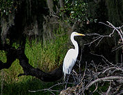
National protected areas
- De Soto National MemorialDe Soto National MemorialDe Soto National Memorial, 5 miles west of Bradenton, Florida, commemorates the 1539 landing of Hernando de Soto and the first extensive organized exploration by Europeans of what is now the southern United States.-De Soto expedition:...
- Passage Key National Wildlife RefugePassage Key National Wildlife RefugeThe Passage Key National Wildlife Refuge is part of the United States National Wildlife Refuge System, located offshore from St. Petersburg. The refuge was established in 1905...
- Lake Manatee State ParkLake Manatee State ParkLake Manatee State Park is a State Park in the U.S. state of Florida, located on the south shore of Lake Manatee. It is east of I-75 on State Road 64 in Bradenton. It is made up of pine flatwoods, Sand Pine scrub, marshes, and hardwood forests.Activities include canoeing and kayaking, camping,...
- Myakka River State ParkMyakka River State ParkMyakka River State Park is a Florida State Park, that is located nine miles east of I-75 in Sarasota in Sarasota County and that includes portions of southeastern Manatee County. A small portion of the park was the gift of the family of Bertha Palmer to the state, being a portion of her massive...
Demographics
As of the censusCensus
A census is the procedure of systematically acquiring and recording information about the members of a given population. It is a regularly occurring and official count of a particular population. The term is used mostly in connection with national population and housing censuses; other common...
of 2000, there were 264,002 people, 112,460 households, and 73,773 families residing in the county. The population density
Population density
Population density is a measurement of population per unit area or unit volume. It is frequently applied to living organisms, and particularly to humans...
was 356/sq mi (138/km²). There were 138,128 housing units at an average density of 186/sq mi (72/km²). The racial makeup of the county was 86.36% White
Race (United States Census)
Race and ethnicity in the United States Census, as defined by the Federal Office of Management and Budget and the United States Census Bureau, are self-identification data items in which residents choose the race or races with which they most closely identify, and indicate whether or not they are...
, 8.19% Black
Race (United States Census)
Race and ethnicity in the United States Census, as defined by the Federal Office of Management and Budget and the United States Census Bureau, are self-identification data items in which residents choose the race or races with which they most closely identify, and indicate whether or not they are...
or African American
Race (United States Census)
Race and ethnicity in the United States Census, as defined by the Federal Office of Management and Budget and the United States Census Bureau, are self-identification data items in which residents choose the race or races with which they most closely identify, and indicate whether or not they are...
, 0.28% Native American
Race (United States Census)
Race and ethnicity in the United States Census, as defined by the Federal Office of Management and Budget and the United States Census Bureau, are self-identification data items in which residents choose the race or races with which they most closely identify, and indicate whether or not they are...
, 0.90% Asian
Race (United States Census)
Race and ethnicity in the United States Census, as defined by the Federal Office of Management and Budget and the United States Census Bureau, are self-identification data items in which residents choose the race or races with which they most closely identify, and indicate whether or not they are...
, 0.05% Pacific Islander
Race (United States Census)
Race and ethnicity in the United States Census, as defined by the Federal Office of Management and Budget and the United States Census Bureau, are self-identification data items in which residents choose the race or races with which they most closely identify, and indicate whether or not they are...
, 2.84% from other races
Race (United States Census)
Race and ethnicity in the United States Census, as defined by the Federal Office of Management and Budget and the United States Census Bureau, are self-identification data items in which residents choose the race or races with which they most closely identify, and indicate whether or not they are...
, and 1.39% from two or more races. 9.30% of the population were Hispanic
Race (United States Census)
Race and ethnicity in the United States Census, as defined by the Federal Office of Management and Budget and the United States Census Bureau, are self-identification data items in which residents choose the race or races with which they most closely identify, and indicate whether or not they are...
or Latino
Race (United States Census)
Race and ethnicity in the United States Census, as defined by the Federal Office of Management and Budget and the United States Census Bureau, are self-identification data items in which residents choose the race or races with which they most closely identify, and indicate whether or not they are...
of any race. 2005 Census estimates show the racial composition of the county as being 77.6% non-Hispanic whites, 11.8% Latino, 8.7% African-American and 1.3% Asian. (Source=http://quickfacts.census.gov/qfd/states/12/12081.html)
In 2000 there were 112,460 households out of which 23.00% had children under the age of 18 living with them, 52.70% were married couples
Marriage
Marriage is a social union or legal contract between people that creates kinship. It is an institution in which interpersonal relationships, usually intimate and sexual, are acknowledged in a variety of ways, depending on the culture or subculture in which it is found...
living together, 9.40% had a female householder with no husband present, and 34.40% were non-families. 28.40% of all households were made up of individuals and 15.00% had someone living alone who was 65 years of age or older. The average household size was 2.29 and the average family size was 2.78.
In the county the population was spread out with 20.70% under the age of 18, 6.50% from 18 to 24, 24.60% from 25 to 44, 23.30% from 45 to 64, and 24.90% who were 65 years of age or older. The median age was 44 years. For every 100 females there were 93.50 males. For every 100 females age 18 and over, there were 90.50 males.
The median income for a household in the county was $38,673, and the median income for a family was $46,576. Males had a median income of $31,607 versus $25,007 for females. The per capita income
Per capita income
Per capita income or income per person is a measure of mean income within an economic aggregate, such as a country or city. It is calculated by taking a measure of all sources of income in the aggregate and dividing it by the total population...
for the county was $22,388. About 7.10% of families and 10.10% of the population were below the poverty line, including 15.30% of those under age 18 and 6.20% of those age 65 or over.
Economy
Bealls of Florida has its headquarters in unincorporatedUnincorporated area
In law, an unincorporated area is a region of land that is not a part of any municipality.To "incorporate" in this context means to form a municipal corporation, a city, town, or village with its own government. An unincorporated community is usually not subject to or taxed by a municipal government...
Manatee County.
Places
Incorporated
- City of Anna MariaAnna Maria, FloridaAnna Maria, is a city in Manatee County, Florida, United States. The population was 1,814 at the 2000 census. According to the 2005 U.S. Census Bureau's estimates, the city grew slightly to 1,867. The city occupies the northern part of Anna Maria Island and is one of three municipalities on the...
- City of BradentonBradenton, FloridaBradenton is a city in Manatee County, Florida, United States. The U.S. Census Bureau estimated the city's 2007 population to be 53,471. Bradenton is the largest Principal City of the Bradenton-Sarasota-Venice, Florida Metropolitan Statistical Area, which had a 2007 estimated population of 682,833...
- City of Bradenton BeachBradenton Beach, FloridaBradenton Beach is a city on Anna Maria Island in Manatee County, Florida, United States. The population was 1,482 at the 2000 census, and 1,561 in the U.S Census estimates of 2005. It is part of the Bradenton–Sarasota–Venice Metropolitan Statistical Area. The city occupies the southern...
- City of Holmes BeachHolmes Beach, FloridaHolmes Beach is a city on Anna Maria Island in Manatee County, Florida, United States. The population was 4,966 at the 2000 census. As of 2004, the population recorded by the U.S. Census Bureau is 5,100. It is part of the Bradenton–Sarasota–Venice Metropolitan Statistical Area...
- Town of Longboat KeyLongboat Key, FloridaLongboat Key is a town in Manatee and Sarasota counties along the central west coast of the U.S. state of Florida, located on the barrier island of the same name. Longboat Key is south of Anna Maria Island, between Sarasota Bay and the Gulf of Mexico. It is almost equally divided between Manatee...
- City of PalmettoPalmetto, FloridaPalmetto is a city in Manatee County, Florida, United States. As of the 2010 census, the population was listed as 12,606 It is part of the Bradenton–Sarasota–Venice Metropolitan Statistical Area.-Geography:Palmetto is located at ....
Unincorporated Census Designated Places
- Bayshore GardensBayshore Gardens, FloridaBayshore Gardens is a census-designated place in Manatee County, Florida, United States. The population was 17,350 at the 2000 census. It is part of the Bradenton–Sarasota–Venice Metropolitan Statistical Area.-Geography:...
- CortezCortez, FloridaCortez, a census-designated place in Manatee County, Florida, United States, is a small Gulf coast commercial fishing village that was founded by settlers from North Carolina in the 1880s. The population was 4,491 at the 2000 census...
- EllentonEllenton, FloridaEllenton is a census-designated place in Manatee County, Florida, United States. The population was 3,142 at the 2000 census. It is part of the Bradenton–Sarasota–Venice Metropolitan Statistical Area.-Geography:...
- MemphisMemphis, FloridaMemphis is a census-designated place in Manatee County, Florida, United States. The population was 7,264 at the 2000 census. It is part of the Bradenton–Sarasota–Venice Metropolitan Statistical Area.-Geography:...
- SamosetSamoset, FloridaSamoset is a census-designated place in Manatee County, Florida, United States. The population was 3,440 at the 2000 census. It is part of the Bradenton–Sarasota–Venice Metropolitan Statistical Area.-Geography:...
- South BradentonSouth Bradenton, FloridaSouth Bradenton is a census-designated place in Manatee County, Florida, United States. The population was 21,587 at the 2000 census. It is part of the Bradenton–Sarasota–Venice Metropolitan Statistical Area.-Geography:...
- West BradentonWest Bradenton, FloridaWest Bradenton is a census-designated place in Manatee County, Florida, United States. The population was 4,444 at the 2000 census. It is part of the Bradenton–Sarasota–Venice Metropolitan Statistical Area.-Geography:...
- West SamosetWest Samoset, FloridaWest Samoset is a census-designated place in Manatee County, Florida, United States. The population was 5,507 at the 2000 census. It is part of the Bradenton–Sarasota–Venice Metropolitan Statistical Area.-Geography:...
- WhitfieldWhitfield, FloridaWhitfield, locally known as Whitfield Estates, is a census-designated place in Manatee County, Florida, United States. The population was 2,984 at the 2000 census. It is part of the Bradenton–Sarasota–Venice Metropolitan Statistical Area...
Other unincorporated places
- Duette
- Village of the ArtsVillage of the ArtsThe Village of the Arts is Florida's largest art colony and the center of fine arts in the Sarasota-Bradenton metropolitan area. The Village covers and contains over 200 homes. Many people reside in the area alongside the artists...
- Myakka CityMyakka City, FloridaMyakka City is an unincorporated community in southeastern Manatee County, Florida, United States. It lies along State Road 70 southeast of the city of Bradenton, the county seat of Manatee County. Its elevation is , and it is located at...
- OnecoOneco, FloridaOneco, pronounced oh-nee-kuh, is an unincorporated community in Manatee County, Florida, United States. It is a suburb of Bradenton, located just southeast of the city. The community is part of the Bradenton–Sarasota–Venice Metropolitan Statistical Area. In the 1920 Census it was...
- ParrishParrish, FloridaParrish is an unincorporated community in Manatee County, Florida, United States. It is located near the intersection of US 301 and State Road 62...
- Terra CeiaTerra Ceia, FloridaTerra Ceia is an unincorporated census-designated place in Manatee County, Florida, United States that includes the Terra Ceia State Park...
- Gillette
- Palm View
- Memphis Heights
- Palm View
- Manavista
- Fort Hamer
- RutlandRutland, FloridaRutland, Florida is an unincorporated community in Sumter County, Florida. The ZIP Code is 33538, which it shares with Lake Panasoffkee over nine miles to the southeast.-Geography:...
- Manhattan
- Oak Knol
- Waterbury
- Verna
- Old Myakka
- Marsh Island
- Snead Island
- Rattlesnake Key
- Rye
- Elwood Park
- Ward Lake
- Cedar Hammock
- Willow
- Foxleigh
- Lake Manatee
- Tara
- Lakewood RanchLakewood Ranch, FloridaLakewood Ranch is an unincorporated master planned community in southeastern Manatee County, Florida, United States, built on part of what was once a timber ranch owned by members of Milwaukee's Uihlein family. It is part of the Bradenton-Sarasota-Venice, Florida Metropolitan Statistical Area...
Government links/Constitutional offices
- Manatee County Board of County Commissioners official website
- Manatee County Supervisor of Elections
- Manatee County Property Appraiser
- Manatee County Sheriff's Office
- Manatee County Tax Collector
- Manatee County Search & Rescue
Special districts
- Manatee County Public Schools
- Southwest Florida Water Management District
- Port Authority of Manatee County, Florida
Judicial branch
- Manatee County Clerk of Courts
- Office of the State Attorney, 12th Judicial Circuit of Florida serving DeSotoDeSoto County, FloridaDeSoto County is a county located in the U.S. state of Florida. As of 2000, the population was 32,209. The U.S. Census Bureau 2005 estimate for the county is 35,406 . Its county seat is Arcadia, Florida. The county comprises the Arcadia, Florida Micropolitan Statistical Area.- History :DeSoto...
, Manatee, and Sarasota counties - Circuit and County Court for the 12th Judicial Circuit of Florida
Tourism links
- Manatee Chamber of Commerce
- Florida Gulf Islands Bradenton Area Convention and Visitors Bureau
- Village of the Arts