
Santa Isabel, Goiás
Encyclopedia
| Santa Isabel | |
|---|---|
| State | Goiás Goiás Goiás is a state of Brazil, located in the central part of the country. The name Goiás comes from the name of an indigenous community... |
| Area: | 806.8 km² |
| Population: | 3,485 (IBGE 2007) |
| Elevation: | 611m above sea level |
| Postcode (CEP): | 76320-000 |
| IBGE statistical microregion: | 006 Ceres Microregion Ceres Microregion The Ceres Microregion is located in north-central Goiás state, Brazil. It includes 22 cities with a total population of 215,820 inhabitants . The total area is 13,224.40 km² and the population density is 16.32 inhab/km². The most important cities are Ceres and Goianésia.The most populous... |
| Became a city: | 1982 |
| Distance to Goiânia Goiânia -Climate:The city has a tropical wet and dry climate with an average temperature of . There's a wet season, from October to April, and a dry one, from May to September. Annual rainfall is around 1,520 mm.... : |
189 km. |
| Website: | n/a |
| Coordinates: | 15°17′15"S 49°25′34"W |
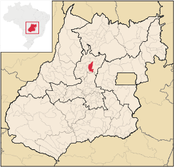
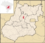
Location
Santa Isabel is a small townTown
A town is a human settlement larger than a village but smaller than a city. The size a settlement must be in order to be called a "town" varies considerably in different parts of the world, so that, for example, many American "small towns" seem to British people to be no more than villages, while...
and municipality
Municipality
A municipality is essentially an urban administrative division having corporate status and usually powers of self-government. It can also be used to mean the governing body of a municipality. A municipality is a general-purpose administrative subdivision, as opposed to a special-purpose district...
in north-central Goiás
Goiás
Goiás is a state of Brazil, located in the central part of the country. The name Goiás comes from the name of an indigenous community...
state, Brazil
Brazil
Brazil , officially the Federative Republic of Brazil , is the largest country in South America. It is the world's fifth largest country, both by geographical area and by population with over 192 million people...
. It is 21 kilometers from Ceres
Ceres, Goiás
Ceres is a small city and municipality in central Goiás state, Brazil. It was the first agricultural colony built in the state of Goiás.-Geography:...
, the nearest regional center. Santa Isabel has municipal boundaries with Rubiataba
Rubiataba
Rubiataba is a small city and municipality in northeastern Goiás state, Brazil.-Location and Geography:Rubiataba is located in the north of the state, south of the source of the Crixás River. It is 235 kilometres to the state capital of Goiânia. Other distances are:*Nova América: 21 km. to the...
, Itapaci
Itapaci
Itapaci is a small town and municipality in northern Goiás state, Brazil. The population was 16,003 in 2007 . The total area of the municipality was 956.1 km² .-Geography:...
, Nova Glória
Nova Glória
Nova Glória is a small town and municipality in north-central Goiás state, Brazil. It is a large producer of sugarcane.-Location:Nova Glória is in the Ceres Microregion and is north of Goiânia, just east of the important BR-153 highway. It is 21 kilometers north of the important commercial...
, Rialma
Rialma
Rialma is a small city and municipality in north-central Goiás state, Brazil.-Location and Geography:Rialma is located across the Rio das Almas from Ceres on the important interstate highway BR-153, which links Anápolis to Belém. It was created as part of the urban area of Ceres, which was also...
, and Carmo do Rio Verde
Carmo do Rio Verde
Carmo do Rio Verde is a small town and municipality in central Goiás state, Brazil. The population was 8,897 in a total area of 457.5 km². Carmo do Rio Verde is a major producer of sugar cane for production of alcohol.-Location:...
. Access from Goiânia
Goiânia
-Climate:The city has a tropical wet and dry climate with an average temperature of . There's a wet season, from October to April, and a dry one, from May to September. Annual rainfall is around 1,520 mm....
is made by GO-080 / Nerópolis
Nerópolis
Nerópolis is a small city and municipality in central Goiás state, Brazil.-Location:The municipality is part of the metropolitan region of Goiânia, which is 42 kilometers to the west. It is nationally known as the city of garlic and sweets...
/ São Francisco de Goiás
São Francisco de Goiás
São Francisco de Goiás is a small town and municipality in central Goiás state, Brazil.Municipal boundaries:*North: Jaraguá*South: Petrolina de Goiás*East: Pirenópolis*West: Jesúpolis and Jaraguá...
/ BR-153 / Jaraguá / Rianápolis
Rianápolis
Rianápolis is a small town and municipality in northeastern Goiás state, Brazil.-Location:It is located almost directly north of the state capital and is on the important BR-153 highway, which links Belem to São Paulo. The regional center of Ceres is located 19 km. to the northwest. Highway...
/ Rialma
Rialma
Rialma is a small city and municipality in north-central Goiás state, Brazil.-Location and Geography:Rialma is located across the Rio das Almas from Ceres on the important interstate highway BR-153, which links Anápolis to Belém. It was created as part of the urban area of Ceres, which was also...
/ GO-480. See Seplan
Politics and Demographics
The mayor was Laurismar Batista Borges (January 2005) and there were 9 city council members. The number of eligible voters was 2,867 (December/2007).The population density was 4.32 inhab/km² (2007) with 1,328 (2007) urban inhabitants and 2,157 rural inhabitants. The population has decreased about 400 people since 1991.
The Economy
The economy is based on modest agriculture, cattle raising, services, public administration, and small transformation industries. There were only 130 automobiles. There were 535 farms in 2006, with 75% of the land in pasture. The cattle herd had 74,000 head while the main crops were rice, sugarcane, beans, manioc, corn (800 hectares), and soybeans.Health and Education
There were 5 schools. The adult literacy rate was 82.5% (2000) (the national average was 86.4%) There were no hospitals. The infant mortality rate was 26.34 (2000) (the national average was 33.0)Human Development Index
Human Development Index
The Human Development Index is a composite statistic used to rank countries by level of "human development" and separate "very high human development", "high human development", "medium human development", and "low human development" countries...
: 0.720
- State ranking: 174 (out of 242 municipalities)
- National ranking: 2,617 (out of 5,507 municipalities)
For the complete list see frigoletto.com.br