
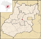
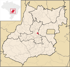
São Francisco de Goiás
Encyclopedia
| São Francisco de Goiás | |
|---|---|
| State | Goiás Goiás Goiás is a state of Brazil, located in the central part of the country. The name Goiás comes from the name of an indigenous community... |
| Area: | 339.3 km² |
| Population: | 5,713 (IBGE 2007) |
| Elevation: | 747m above sea level |
| Postcode (CEP): | 75490-000 |
| IBGE statistical microregion: | Anápolis Microregion Anápolis Microregion The Anápolis Microregion is a region of central Goiás state, Brazil, including municipalities surrounding the city of Anápolis. For a map see *Population: 517,221 inhabitants *Cities: 19*Total Area: 8,386.80 km²... |
| Became a city: | 1953 |
| Distance to Goiânia Goiânia -Climate:The city has a tropical wet and dry climate with an average temperature of . There's a wet season, from October to April, and a dry one, from May to September. Annual rainfall is around 1,520 mm.... : |
102 km. |
| Website: | none |
| Coordinates: | 15°56′08"S 49°15′47"W |
Town
A town is a human settlement larger than a village but smaller than a city. The size a settlement must be in order to be called a "town" varies considerably in different parts of the world, so that, for example, many American "small towns" seem to British people to be no more than villages, while...
and municipality
Municipality
A municipality is essentially an urban administrative division having corporate status and usually powers of self-government. It can also be used to mean the governing body of a municipality. A municipality is a general-purpose administrative subdivision, as opposed to a special-purpose district...
in central Goiás
Goiás
Goiás is a state of Brazil, located in the central part of the country. The name Goiás comes from the name of an indigenous community...
state, Brazil
Brazil
Brazil , officially the Federative Republic of Brazil , is the largest country in South America. It is the world's fifth largest country, both by geographical area and by population with over 192 million people...
.
Municipal boundaries:
- North: Jaraguá
- South: Petrolina de GoiásPetrolina de GoiásPetrolina de Goiás is a small town and municipality in central Goiás state, Brazil.-Location:Petrolina de Goiás is located 81 km. almost due north of Goiânia, the state capital. It is 23 km. southwest of São Francisco de Goiás, 23 km. northwest of Ouro Verde de Goiás, 21 km....
- East: PirenópolisPirenópolisPirenópolis is a town located in the Brazilian state of Goiás. It is well known for its waterfalls and colonial architecture, and a popular festival involving mounted horses called Festa do Divino Espírito Santo which takes place 45 days after Easter....
- West: JesúpolisJesúpolisJesúpolis is a small town and municipality in central Goiás state, Brazil. The name literally means "City of Jesus".-Distances and Location:*Distance to Anápolis: 150 km....
and Jaraguá
Connections from Goiânia
Goiânia
-Climate:The city has a tropical wet and dry climate with an average temperature of . There's a wet season, from October to April, and a dry one, from May to September. Annual rainfall is around 1,520 mm....
are made by GO-080 / Nerópolis
Nerópolis
Nerópolis is a small city and municipality in central Goiás state, Brazil.-Location:The municipality is part of the metropolitan region of Goiânia, which is 42 kilometers to the west. It is nationally known as the city of garlic and sweets...
/ Petrolina de Goiás
Petrolina de Goiás
Petrolina de Goiás is a small town and municipality in central Goiás state, Brazil.-Location:Petrolina de Goiás is located 81 km. almost due north of Goiânia, the state capital. It is 23 km. southwest of São Francisco de Goiás, 23 km. northwest of Ouro Verde de Goiás, 21 km....
. Federal highway BR-153 is 4 kilometers east of the town.
The main rivers that cross the municipality are Rio Pari, Lagoinha, das Almas, and Padre Souza. The climate is classified as tropical, hot and simi-moist. The average temperature in the coldest months is 18°C and 23°C to 30°C in the hottest months. Most of the rain falls between December and March.
Demographics
- Population density: 16.83 inhab/km² (2007)
- Total population in 2007: 5,713
- Total population in 1980: 9,427
- Population growth rate: -0.31% for 1996/2007
- Urban population: 4,189
- Rural population: 1,524
The Economy
The economy is based on subsistence agriculture, cattle raising, services, public administration, and small transformation industries.
- Number of industrial establishments: 29
- Number of retail establishments: 44
- Banking establishments: Banco Itaú S.A.
- Automobiles: 385
The cattle herd had 39,000 head in 2006 while the main crops cultivated were pineapple, rice (90 ha.), bananas, beans, manioc (200 ha.), corn (350 ha.), tomatoes, and soybeans (150 ha.)
Agricultural data 2006
- Number of Farms: 605
- Total area: 14,481 ha.
- Area of permanent crops: 259 ha.
- Area of perennial crops: 1,132 ha.
- Area of natural pasture: 10,249 ha.
- Area of woodland and forests: 2,564 ha.
- Persons dependent on farming: 1,600
- Farms with tractors: 50
- Number of tractors: 63 IBGE
Health and Education
The educational sector was small with 4 schools in 2006 and 1,709 students. The adult literacy rate was 82.3% (2000) (national average was 86.4%)
In the health sector there was 1 small hospital with 28 beds in 2007. The infant mortality rate was 20.94 (2000) (national average was 33.0)
São Francisco scores 0.782 on the Municipal Human Development Index
Human Development Index
The Human Development Index is a composite statistic used to rank countries by level of "human development" and separate "very high human development", "high human development", "medium human development", and "low human development" countries...
, giving it a state ranking of 157 (out of 242 municipalities)
and a national ranking of 2.504 (out of 5,507 municipalities). For the complete list see frigoletto.com.br.
History
The site of the town was first inhabited by Europeans in 1740 by gold diggers looking for gold in the rivers. In 1911 the town was part of Jaraguá becoming a separate municipality in 1953.
Tourism
The region attracts visitors to the river like Rio Padre Souza, which is eight kilometers from the city and is sought after by fishermen. Rio das Almas crosses Jaraguá and is used for swimming and fishing. Rio das Pedras is about 15 kilometers from the city and many people camp on its banks. The most beautiful site in the region is Cachoeira da Usina, which is 4 kilometers from the city on a ranch called Fazenda Gilberto de Castro. The waterfall is five meters high and there is a beach nearby.
See also
Sources of Data