
.gif)
Route 431 (Israel)
Encyclopedia
Gush Dan
The Tel Aviv Metropolitan Area , or Gush Dan , is a metropolitan area including areas from both the Tel Aviv and the Central Districts of Israel. The area is closely linked to the city of Tel Aviv through social, economic, and cultural ties. It is located along the Israeli Mediterranean coastline...
in Israel
Israel
The State of Israel is a parliamentary republic located in the Middle East, along the eastern shore of the Mediterranean Sea...
. The freeway connects the Ayalon Highway
Ayalon Highway
Highway 20, more commonly the Ayalon Highway , is a major intracity freeway in Gush Dan, Israel. The road runs along Tel Aviv's center eastern border from north to south and connects all of the major highways leading to the city - such as Highway 4 from Ashdod and the Southern regions, Highway 2...
in the west with Highway 1
Highway 1 (Israel)
Highway 1 , is the main highway connecting Tel Aviv with Jerusalem.-History:The section between Latrun and Jerusalem roughly follows an ancient path connecting Jaffa and Jerusalem...
in the east. It then continues east into Modi'in as a local road.
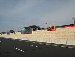
The freeway has six lanes (three in each direction) over a total length of 21 km. There is also a short Collector/Distributor system between Rishon Darom and Nes Ziona Interchanges. There are 12 interchanges along its length, 5 of them freeway to freeway interchanges. There are also 54 km of service roads, including exits and entrance ramps.
The design of the freeway includes a right of way for a double track railway in its median between Ein Ha'Kore and Modi'in and railway sections are currently operational between Be'er Yaakov and HaRishonim Interchange and between the Anava Interchange and Modi'in. The freeway and railway also cross three existing railway lines along the route and allows for a connection to two of them.
Route 431 is the first PFI
Private Finance Initiative
The private finance initiative is a way of creating "public–private partnerships" by funding public infrastructure projects with private capital...
project in Israel. Netivey HaYovel, a subsidiary of Danya Cebus and Africa Israel Investments Ltd., was awarded the 25 year tender to build, maintain and operate the freeway. As of February 2009, the cost of the freeway had been 2.5 billion NIS (approximately 620 million USD). Following the completion of the freeway in February 2009, the company is expecting a 200 million NIS (50 million USD) grant from the state .
History
Construction started in 2005 and the road was fully opened on February 4, 2009.A section of the highway between Mevo Ayalon Interchange and Gan Ha'Vradim Interchange was set to open on October 23, 2008, approximately 3 months ahead of schedule. However, on October 22 it was announced that the opening will be postponed for at least two weeks due to Netivey HaYovel's failure to complete the required environmental mitigation
Environmental mitigation
Environmental mitigation, compensatory mitigation, or mitigation banking, are terms used primarily by the United States government and the related environmental industry to describe projects or programs intended to offset known impacts to an existing historic or natural resource such as a stream,...
, as was the case of Jerusalem Route 9. The road finally opened on November 12, after Danya Cebus agreed to place several million NIS
Israeli new sheqel
The Israeli New Shekel is the currency of the State of Israel. The shekel is divided into 100 agorot...
as a guarantee that the required works will be carried out. .
The second section between Gan Ha'Vradim Interchange and Anava Interchange opened on the evening of February 4, 2009. Although the freeway was fully opened at this point, there was some work left around it. At Ein Ha'Kore, the Road 4311 bridge over Highway 42 has not been completed leaving a traffic light at what was planned to be a grade-separated freeway segment, and at Nesharim Interchange the western exits have yet to open. The exits at Nesharim opened on May 20, 2009, and the bridge at Ein Ha'Kore opened on June 29, 2009. All other works along the freeway were finished by September 2009.
The local road in Modi'in was partially opened together with the freeway, initially with one lane in each direction. Construction on this section was completed in November 2009, providing a limited-access, multiple lane, grade-separated highway all the way from the Ayalon Highway near the Mediterranean coast to the entrance to Modi'in.
Starting in May 2010, electronic signs for a traffic control
Traffic control
Road traffic control involves directing vehicular and pedestrian traffic around a construction zone, accident or other road disruption, thus ensuring the safety of emergency response teams, construction workers and the general public....
system were installed along the freeway. As of July 2010, the system is not yet fully active.
Interchanges
| km | Name | Type | Meaning | Location | Road(s) Crossed |
|---|---|---|---|---|---|
| 0 | מחלף מבוא איילון (Mevo Ayalon Interchange) |
 |
Ayalon Ayalon Ayalon is the name of a location in Israel and a Hebrew family name. It is the modern transliteration of Ajalon. It may refer to the following:-Places:*Ajalon, a valley and Biblical town in Israel*Ayalon Cave, a cave near Ramla, Israel... Gateway |
Rishon LeZion |  (Ayalon Highway Ayalon Highway Highway 20, more commonly the Ayalon Highway , is a major intracity freeway in Gush Dan, Israel. The road runs along Tel Aviv's center eastern border from north to south and connects all of the major highways leading to the city - such as Highway 4 from Ashdod and the Southern regions, Highway 2... northbound) |
| 1 | מחלף קרית ראשון (Kiryat Rishon Interchange) |
 |
Named after location | Rishon LeZion | Mota Gur St. |
| 2 | מחלף ראשון דרום (Rishon Darom Interchange) |
|
South Rishon | Rishon LeZion |  (Highway 4 Highway 4 (Israel) Highway 4 is an Israeli highway that runs along Israel's entire coastal plain of the Mediterranean Sea, its route in the north runs from the Rosh HaNikra border crossing with Lebanon until the Erez Border Crossing with the Gaza Strip... southbound) |
| 3 | מחלף עין הקורא (En Ha'Kore Interchange) |
|
Rishon LeZion |  (Highway 4 Highway 4 (Israel) Highway 4 is an Israeli highway that runs along Israel's entire coastal plain of the Mediterranean Sea, its route in the north runs from the Rosh HaNikra border crossing with Lebanon until the Erez Border Crossing with the Gaza Strip... northbound / Highway 42 / Road 4311) |
|
| 5 | מחלף הראשונים (HaRishonim Interchange) |
|
Named after neighborhood and railway station Rishon LeZion HaRishonim Railway Station Rishon LeZion - HaRishonim Railway Station is a station of Israel Railways in Rishon LeZion, part of the Kfar Sava – Rishon LeZion line. The station is located in the southern area of the city, in the middle of HaRishonim Interchange, at the intersection of the new Highway 431 and Route 412... |
Rishon LeZion, Ness Ziona Ness Ziona Ness Ziona is a city in central Israel founded in 1883. At the end of 2009 the city had a total population of 38,100, and its jurisdiction was 15,579 dunams.-Nahalat Reuben:... |
 (Route 412) |
| 7 | מחלף נס ציונה (Nes Ziona Interchange) |
|
Banner to Zion | Ness Ziona Ness Ziona Ness Ziona is a city in central Israel founded in 1883. At the end of 2009 the city had a total population of 38,100, and its jurisdiction was 15,579 dunams.-Nahalat Reuben:... , Rishon LeZion, Be'er Ya'akov |
Route 423 / Shlomo Ben Yosef St. |
| Planned | |||||
| 9 | מחלף רמלה מערב (Ramle Ma'arav Interchange) |
|
West Ramle | Ramle | Route 200 |
| 11 | מחלף רמלה דרום (Ramle Darom Interchange) |
|
South Ramle | Ramle |  (Highway 40) |
| 14 | מחלף נשרים (Nesharim Interchange) |
|
Eagles Named after nearby Nesher Factory & ult. Rambam, the great Eagle Maimonides Moses ben-Maimon, called Maimonides and also known as Mūsā ibn Maymūn in Arabic, or Rambam , was a preeminent medieval Jewish philosopher and one of the greatest Torah scholars and physicians of the Middle Ages... |
Ramle |    (Highway 6 Highway 6 (Israel) Highway 6 , widely known as the Trans-Israel Highway or Cross-Israel Highway , is a major electronic toll highway in Israel. The highway was officially dedicated as the Yitzhak Rabin Highway , though this name is not commonly used. It started operating in the early 2000s and is being lengthened as... / Highway 44 / Route 424) |
| Planned | |||||
| 17 | מחלף רג"מ (RaGaM Interchange) |
|
named after location & planned industrial park bordering 3 areas: Ramla Ramla Ramla , is a city in central Israel. The city is predominantly Jewish with a significant Arab minority. Ramla was founded circa 705–715 AD by the Umayyad Caliph Suleiman ibn Abed al-Malik after the Arab conquest of the region... , Gezer Gezer Regional Council Gezer Regional Council is a regional council in the Center District of Israel. Established in 1949, it had a population of 20,700 in 2006.-List of settlements:The council covers five kibbutzim, 15 moshavim and five communal settlementsKibbutzim... & Modi'in Hevel Modi'in Regional Council Hevel Modi'in Regional Council is a regional council in central Israel. It was founded in 1950 and covers an area from Petah Tikva to Modi'in.The council borders*Drom HaSharon Regional Council, El'ad and Rosh HaAyin in the north... |
planned RaGaM Industrial Park | Local road to Ramle's quarry |
| 20 | מחלף ענבה (Anava Interchange) |
|
Berry Berry The botanical definition of a berry is a fleshy fruit produced from a single ovary. Grapes are an example. The berry is the most common type of fleshy fruit in which the entire ovary wall ripens into an edible pericarp. They may have one or more carpels with a thin covering and fleshy interiors.... named after Anava (Anabe) Stream |
Kfar Shmuel Kfar Shmuel Kfar Shmuel is a moshav in central Israel. Located in the Shephelah around six kilometres south of Ramle, it falls under the jurisdiction of Gezer Regional Council... |
 (Highway 1 Highway 1 (Israel) Highway 1 , is the main highway connecting Tel Aviv with Jerusalem.-History:The section between Latrun and Jerusalem roughly follows an ancient path connecting Jaffa and Jerusalem... ) |