

River Leam
Encyclopedia
The River Leam is a river
which flows through eastern and southern Warwickshire
. It is a small river about 25–30 miles long. The town of Leamington Spa
lies on, and is named after, the River Leam.
Its name came via Anglo-Saxon
from Celtic
leman or lemin = "having elm trees" or "marshy river". River Leame is given as an alternative spelling in Merriam-Webster's Geographical Dictionary.
 The River Leam springs near the village
of Hellidon
in Northamptonshire
on the north side of a range of low ironstone
hills which form the watershed between the systems feeding the River Thames
and the River Severn
. The Leam's source below Hellidon Hill is less than a mile from the source of the River Cherwell
, a tributary of the Thames.
Two miles from its source, the River Leam passes under the A425
main road from Daventry
to Southam
. From here to the village of Braunston it marks the boundary between Northamptonshire and Warwickshire. At Braunston, the river is crossed by a substantial embankment
carrying the Grand Union Canal
over the river on an aqueduct
.
West of Braunston, the River Leam opens into a broad flat valley and flows through open farmland passing the small village of Grandborough
where there was once a water mill.
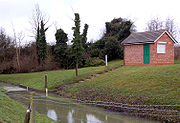
The river passes north of the hamlet of Kites Hardwick
on the A426 road
where there is a gauging station operated by Severn Trent Water. Water from the river is pumped into to a large storage reservoir named Draycote Water
.
From here, the river valley becomes narrower past the villages of Leamington Hastings
and Birdingbury
. At Marton
, the river is bridged by the busy A423 road
– until the 1990s there were substantial floods here in wet weather until a new bridge was built to keep traffic well above river level, the medieval bridge remains alongside it. There were watermills at Eathorpe
and Hunningham
. After Hunningham, the river passes Offchurch
, traditionally the home of King Offa, where the pedestrian footway is raised above road level as a counter to flooding.
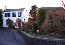
After Offchurch, the River Leam enters the outskirts of Royal Leamington Spa beside the Grand Union Canal
– in fact, the canal has followed the river at various points from Braunston.
Though Leamington the river is surrounded almost entirely by parks, after passing an open area of grass and woodland called Newbold Comyn
, the river widens dramatically into Jephson Gardens, the main municipal park in Leamington Spa. The widening is due to a weir
spanned by an ornate Victorian
iron footbridge – the resulting water space is used for boat
ing and canoe
ing in the summer at the Leam Boat Centre http://www.leamboatcentre.com. The river water is cleaner here than in many urban water spaces because the River Leam mostly flows through agricultural land and has no industry on its banks.
Passing the Georgian
Royal Pump Rooms in the centre of Leamington Spa, the River Leam flows a further two miles until it joins the River Avon
midway between Warwick and Leamington.
which joins it near Kites Hardwick, the Warwickshire River Itchen
which joins near Marton and Pingle Brook which joins near Cubbington
.
River
A river is a natural watercourse, usually freshwater, flowing towards an ocean, a lake, a sea, or another river. In a few cases, a river simply flows into the ground or dries up completely before reaching another body of water. Small rivers may also be called by several other names, including...
which flows through eastern and southern Warwickshire
Warwickshire
Warwickshire is a landlocked non-metropolitan county in the West Midlands region of England. The county town is Warwick, although the largest town is Nuneaton. The county is famous for being the birthplace of William Shakespeare...
. It is a small river about 25–30 miles long. The town of Leamington Spa
Leamington Spa
Royal Leamington Spa, commonly known as Leamington Spa or Leamington or Leam to locals, is a spa town in central Warwickshire, England. Formerly known as Leamington Priors, its expansion began following the popularisation of the medicinal qualities of its water by Dr Kerr in 1784, and by Dr Lambe...
lies on, and is named after, the River Leam.
Its name came via Anglo-Saxon
Anglo-Saxon
Anglo-Saxon may refer to:* Anglo-Saxons, a group that invaded Britain** Old English, their language** Anglo-Saxon England, their history, one of various ships* White Anglo-Saxon Protestant, an ethnicity* Anglo-Saxon economy, modern macroeconomic term...
from Celtic
Celtic languages
The Celtic languages are descended from Proto-Celtic, or "Common Celtic"; a branch of the greater Indo-European language family...
leman or lemin = "having elm trees" or "marshy river". River Leame is given as an alternative spelling in Merriam-Webster's Geographical Dictionary.
Course
Village
A village is a clustered human settlement or community, larger than a hamlet with the population ranging from a few hundred to a few thousand , Though often located in rural areas, the term urban village is also applied to certain urban neighbourhoods, such as the West Village in Manhattan, New...
of Hellidon
Hellidon
Hellidon is a village and civil parish in the Daventry district of the county of Northamptonshire in England. According to the 2001 census the parish had a population of 180; it reached its highest population, 449, in 1861....
in Northamptonshire
Northamptonshire
Northamptonshire is a landlocked county in the English East Midlands, with a population of 629,676 as at the 2001 census. It has boundaries with the ceremonial counties of Warwickshire to the west, Leicestershire and Rutland to the north, Cambridgeshire to the east, Bedfordshire to the south-east,...
on the north side of a range of low ironstone
Ironstone
Ironstone is a sedimentary rock, either deposited directly as a ferruginous sediment or created by chemical repacement, that contains a substantial proportion of an iron compound from which iron either can be or once was smelted commercially. This term is customarily restricted to hard coarsely...
hills which form the watershed between the systems feeding the River Thames
River Thames
The River Thames flows through southern England. It is the longest river entirely in England and the second longest in the United Kingdom. While it is best known because its lower reaches flow through central London, the river flows alongside several other towns and cities, including Oxford,...
and the River Severn
River Severn
The River Severn is the longest river in Great Britain, at about , but the second longest on the British Isles, behind the River Shannon. It rises at an altitude of on Plynlimon, Ceredigion near Llanidloes, Powys, in the Cambrian Mountains of mid Wales...
. The Leam's source below Hellidon Hill is less than a mile from the source of the River Cherwell
River Cherwell
The River Cherwell is a river which flows through the Midlands of England. It is a major tributary of the River Thames.The general course of the River Cherwell is north to south and the 'straight-line' distance from its source to the Thames is about...
, a tributary of the Thames.
Two miles from its source, the River Leam passes under the A425
A425 road
The A425 road is an A road in England, which runs between Daventry in Northamptonshire and Warwick in Warwickshire via Staverton, Lower Shuckburgh and Southam.At Southam it links with the A426 as well as the A423....
main road from Daventry
Daventry
Daventry is a market town in Northamptonshire, England, with a population of 22,367 .-Geography:The town is also the administrative centre of the larger Daventry district, which has a population of 71,838. The town is 77 miles north-northwest of London, 13.9 miles west of Northampton and 10.2...
to Southam
Southam
Southam is a small market town in the Stratford-on-Avon district of Warwickshire, England. The 2001 census recorded a population of 6,509 in the town.The nearest sizeable town to Southam is Leamington Spa, located roughly 7 miles to the west...
. From here to the village of Braunston it marks the boundary between Northamptonshire and Warwickshire. At Braunston, the river is crossed by a substantial embankment
Embankment (transportation)
To keep a road or railway line straight or flat, and where the comparative cost or practicality of alternate solutions is prohibitive, the land over which the road or rail line will travel is built up to form an embankment. An embankment is therefore in some sense the opposite of a cutting, and...
carrying the Grand Union Canal
Grand Union Canal
The Grand Union Canal in England is part of the British canal system. Its main line connects London and Birmingham, stretching for 137 miles with 166 locks...
over the river on an aqueduct
Aqueduct
An aqueduct is a water supply or navigable channel constructed to convey water. In modern engineering, the term is used for any system of pipes, ditches, canals, tunnels, and other structures used for this purpose....
.
West of Braunston, the River Leam opens into a broad flat valley and flows through open farmland passing the small village of Grandborough
Grandborough
Grandborough is a small village and civil parish in Warwickshire, England. The parish includes the hamlets of Calcutt, Grandborough Fields and Woolscott....
where there was once a water mill.
The river passes north of the hamlet of Kites Hardwick
Kites Hardwick
Kites Hardwick is a hamlet in east Warwickshire, England, in the Leam Valley ward of Rugby Borough and in the civil parish of Leamington Hastings...
on the A426 road
A426 road
The A426 road is a road in England which runs from the city of Leicester to the market town of Southam in Warwickshire via the towns of Lutterworth and Rugby.-History:...
where there is a gauging station operated by Severn Trent Water. Water from the river is pumped into to a large storage reservoir named Draycote Water
Draycote Water
Draycote Water is a reservoir and country park near the village of Dunchurch, 6 km south of Rugby in Warwickshire, England, owned and operated by Severn Trent Water...
.
From here, the river valley becomes narrower past the villages of Leamington Hastings
Leamington Hastings
Leamington Hastings is a small village and larger civil parish in Warwickshire, England.-The village:The village is about 7 miles south-west of Rugby and west of the A426 road between Rugby and Southam. To the north of the village is the Draycote Water reservoir...
and Birdingbury
Birdingbury
Birdingbury is a village and civil parish in the Rugby district of Warwickshire, England, just south of the River Leam, and not far from Draycote Water. It is located roughly half way between Rugby and Leamington Spa, about eight miles from each. According to the 2001 census it had a population of...
. At Marton
Marton, Warwickshire
Marton is a village and civil parish in Warwickshire, England. The village is part of the borough of Rugby and in the 2001 census had a population of 484....
, the river is bridged by the busy A423 road
A423 road
The A423 road is a primary A road in England which leads from central Banbury to the A45 near Coventry. It starts in Banbury town centre as Southam Road and goes through the Southam Road Industrial Estate, then just north of Banbury it crosses over the M40, from there it passes close to several...
– until the 1990s there were substantial floods here in wet weather until a new bridge was built to keep traffic well above river level, the medieval bridge remains alongside it. There were watermills at Eathorpe
Eathorpe
Eathorpe is a small village five miles east of Leamington Spa, in the English county of Warwickshire. It is in its own parish, in the electoral ward of Cubbington. It is very close to the B4455, which follows the line of the Roman Fosse Way, and the River Leam...
and Hunningham
Hunningham
Hunningham is a small village and civil parish in Warwickshire, England. It is found 3 miles to the north-east of Leamington Spa, within the Radford Semele ward. In 2005 the village population was 198....
. After Hunningham, the river passes Offchurch
Offchurch
Offchurch is a village and civil parish on the River Leam, east of Leamington Spa in Warwickshire.-History:There is a possibility that it was home to Offa, who was King of Mercia from 757 to 796. King Offa had a church built in the village...
, traditionally the home of King Offa, where the pedestrian footway is raised above road level as a counter to flooding.
After Offchurch, the River Leam enters the outskirts of Royal Leamington Spa beside the Grand Union Canal
Grand Union Canal
The Grand Union Canal in England is part of the British canal system. Its main line connects London and Birmingham, stretching for 137 miles with 166 locks...
– in fact, the canal has followed the river at various points from Braunston.
Though Leamington the river is surrounded almost entirely by parks, after passing an open area of grass and woodland called Newbold Comyn
Newbold Comyn
Newbold Comyn is a park that is found on the eastern edge of Leamington Spa, Warwickshire, England. It is described by some people as a country park in all but name.- History :...
, the river widens dramatically into Jephson Gardens, the main municipal park in Leamington Spa. The widening is due to a weir
Weir
A weir is a small overflow dam used to alter the flow characteristics of a river or stream. In most cases weirs take the form of a barrier across the river that causes water to pool behind the structure , but allows water to flow over the top...
spanned by an ornate Victorian
Victorian era
The Victorian era of British history was the period of Queen Victoria's reign from 20 June 1837 until her death on 22 January 1901. It was a long period of peace, prosperity, refined sensibilities and national self-confidence...
iron footbridge – the resulting water space is used for boat
Boat
A boat is a watercraft of any size designed to float or plane, to provide passage across water. Usually this water will be inland or in protected coastal areas. However, boats such as the whaleboat were designed to be operated from a ship in an offshore environment. In naval terms, a boat is a...
ing and canoe
Canoe
A canoe or Canadian canoe is a small narrow boat, typically human-powered, though it may also be powered by sails or small electric or gas motors. Canoes are usually pointed at both bow and stern and are normally open on top, but can be decked over A canoe (North American English) or Canadian...
ing in the summer at the Leam Boat Centre http://www.leamboatcentre.com. The river water is cleaner here than in many urban water spaces because the River Leam mostly flows through agricultural land and has no industry on its banks.
Passing the Georgian
Georgian era
The Georgian era is a period of British history which takes its name from, and is normally defined as spanning the reigns of, the first four Hanoverian kings of Great Britain : George I, George II, George III and George IV...
Royal Pump Rooms in the centre of Leamington Spa, the River Leam flows a further two miles until it joins the River Avon
River Avon, Warwickshire
The River Avon or Avon is a river in or adjoining the counties of Leicestershire, Northamptonshire, Warwickshire, Worcestershire and Gloucestershire in the Midlands of England...
midway between Warwick and Leamington.
Tributaries
Several brooks are tributaries of the River Leam, including the Rains BrookRains Brook
Rains Brook is a brook and tributary of the River Leam. The source of the brook is near Kilsby in Northamptonshire, it then runs west in the valley south of Rugby and forms the border between Northamptonshire and Warwickshire. It then runs south-west to Kites Hardwick where it joins the River Leam....
which joins it near Kites Hardwick, the Warwickshire River Itchen
River Itchen, Warwickshire
The River Itchen flows through east Warwickshire in England. It is a small river, about long, and its general course is from south to north....
which joins near Marton and Pingle Brook which joins near Cubbington
Cubbington
Cubbington is a village and civil parish with a population of 4,034 adjoining the north-eastern outskirts of Royal Leamington Spa, Warwickshire, England. Welsh Road, running through the village crossroads, may have been an old sheep drovers' route connecting London and Wales...
.