
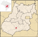
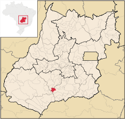
Porteirão
Encyclopedia
| Porteirão | |
|---|---|
| State | Goiás Goiás Goiás is a state of Brazil, located in the central part of the country. The name Goiás comes from the name of an indigenous community... |
| Coordinates: | 17°49′10"S 50°08′34"W |
| Area: | 603.9 km² |
| Population: | 3,008 (IBGE 2007) |
| Elevation: | 470 m above sea level |
| Postcode (CEP): | 75603-000 |
| Became a city: | 1997 |
| Mayor: | Pedro Augusto dos Reis (January 2005 to January 2009) |
| Distance to Goiânia Goiânia -Climate:The city has a tropical wet and dry climate with an average temperature of . There's a wet season, from October to April, and a dry one, from May to September. Annual rainfall is around 1,520 mm.... : |
178 km. |
| IBGE statistical microregion: | Meia Ponte Microregion Meia Ponte Microregion The Meia Ponte Microregion is a statistical region of Goiás state, Brazil created by the IBGE . It is located south of the state capital, Goiânia, and includes 21 cities with a total population of 338,147 inhabitants . The total area is 21,229.00 km² and the population density is 14.39 inhab/km²... |
| Website: | none |
Town
A town is a human settlement larger than a village but smaller than a city. The size a settlement must be in order to be called a "town" varies considerably in different parts of the world, so that, for example, many American "small towns" seem to British people to be no more than villages, while...
and municipality
Municipality
A municipality is essentially an urban administrative division having corporate status and usually powers of self-government. It can also be used to mean the governing body of a municipality. A municipality is a general-purpose administrative subdivision, as opposed to a special-purpose district...
in south Goiás
Goiás
Goiás is a state of Brazil, located in the central part of the country. The name Goiás comes from the name of an indigenous community...
state, Brazil
Brazil
Brazil , officially the Federative Republic of Brazil , is the largest country in South America. It is the world's fifth largest country, both by geographical area and by population with over 192 million people...
.
Geographical Information
Porteirão is located in the Meia Ponte MicroregionMeia Ponte Microregion
The Meia Ponte Microregion is a statistical region of Goiás state, Brazil created by the IBGE . It is located south of the state capital, Goiânia, and includes 21 cities with a total population of 338,147 inhabitants . The total area is 21,229.00 km² and the population density is 14.39 inhab/km²...
in the Rio dos Bois basin. It is connected by a state highway (27 km.) with the BR-452 highway, which connects Rio Verde
Rio Verde
Rio Verde can mean the following:-Brazil:* Rio Verde, Goiás* Lucas do Rio Verde* Conceição do Rio Verde* Rio Verde de Mato Grosso-Brazil:29 rivers including:* Verde River...
with Itumbiara
Itumbiara
Itumbiara is a small city and municipality in the extreme south of the state of Goiás, Brazil. The population was 100,000 in a total area of 2,461,3 km²...
.
The distance to the state capital, Goiânia
Goiânia
-Climate:The city has a tropical wet and dry climate with an average temperature of . There's a wet season, from October to April, and a dry one, from May to September. Annual rainfall is around 1,520 mm....
, is 178 km. Highway connections from Goiânia
Goiânia
-Climate:The city has a tropical wet and dry climate with an average temperature of . There's a wet season, from October to April, and a dry one, from May to September. Annual rainfall is around 1,520 mm....
are made by GO-040 / Aragoiânia
Aragoiânia
Aragoiânia is a small town and municipality in central Goiás state, Brazil. The population was 7,243 in a total area of 219.5 km²....
/ Cromínia
Cromínia
Cromínia is a small town and municipality in south Goiás state, Brazil. It is famous for its chrome mines.-Geographical Information:Cromínia is located in the Meia Ponte Microregion, which includes the cities in the Meia Ponte River basin...
/ GO-319 / Pontalina
Pontalina
Pontalina is a small city and municipality in south-central Goiás state, Brazil.GeographyPontalina is 125 kilometers from the state capital, Goiânia. It is connected by highways BR-153 and GO-19...
/ GO-040 / Aloândia
Aloândia
Aloândia is a small town and municipality in south Goiás state, Brazil. The population was 2,065 in 2007 and the municipal area was 102.1 km², one of the smallest in the state of Goiás.-Geographical Information:...
/ BR-452 / Bom Jesus de Goiás
Bom Jesus de Goiás
Bom Jesus de Goiás is a town and municipality in south Goiás state, Brazil. It is a large producer of soybeans.-Geographical Information:The distance to the state capital, Goiânia, is 223 km and it is linked by highways BR-452 and GO-040...
/ GO-410. For the complete list of all distances in Goiás
Goiás
Goiás is a state of Brazil, located in the central part of the country. The name Goiás comes from the name of an indigenous community...
see Seplan
Neighboring municipalities are:
- north: AcreúnaAcreúnaAcreúna is a small city and municipality in western Goiás state, Brazil.-Location:Acreúna is located in the statistical micro-region of Vale do Rio dos Bois, southwest of the state capital, Goiânia, on BR-060, which links Goiânia with Rio Verde...
- south: GoiatubaGoiatubaGoiatuba is a small city and municipality in south-central Goiás state, Brazil. The population was 31,225 in a total area of 2,475.10 km² . Goiatuba is a large producer of grains, especially soybeans and corn....
- east: Vicentópolis and GoiatubaGoiatubaGoiatuba is a small city and municipality in south-central Goiás state, Brazil. The population was 31,225 in a total area of 2,475.10 km² . Goiatuba is a large producer of grains, especially soybeans and corn....
- west: Santa Helena de GoiásSanta Helena de GoiásSanta Helena de Goiás is a small city and municipality in southwestern Goiás state, Brazil. It is a large producer of corn, sugarcane, soybeans, and poultry.-Location:...
Demographics
- Population density: 4.98 inhab/km² (2007)
- Urban population: 2,726(2007)
- Rural population: 282 (2007)
- Population growth or loss: 0.91% from 2000/2007
The economy
The economy is based on agriculture, cattle raising, services, public administration, and small transformation industries.- Industrial units: 2 (2006)
- Commercial units: 45 (2006)
- Cattle herd: 24,280 head (2006)
- Main crops (2006): cotton, rice, sugarcane (13,000 hectares), beans, soybeans (18,000 hectares), sorghum, and corn.
- People employed in agriculture: 1,670
- Number of farming establishments: 43
- Area of the farming establishments: 27,367 ha.
- Area in planted crops: 17,500 ha.
- Farming establishments with tractors: 14
Education (2006)
- Schools: 2 with 821 students
- Higher education: none
- Adult literacy rate: 80.4% (2000) (national average was 86.4%)
Health (2007)
- Hospitals: 0
- Hospital beds: 0
- Ambulatory clinics: 1
- Infant mortality rate: 27.9 (2000) (national average was 33.0).
Qualtity of Life
The municipality achieved a score of 0.724 on the United Nations Human Development IndexHuman Development Index
The Human Development Index is a composite statistic used to rank countries by level of "human development" and separate "very high human development", "high human development", "medium human development", and "low human development" countries...
(2000), ranking it 162 out of 242 municipalites in the state of Goiás
Goiás
Goiás is a state of Brazil, located in the central part of the country. The name Goiás comes from the name of an indigenous community...
. For the complete list see Frigoletto.com