
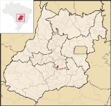
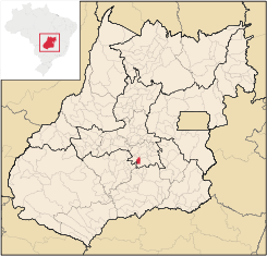
Aragoiânia
Encyclopedia
| Aragoiânia | |
|---|---|
| State | Goiás Goiás Goiás is a state of Brazil, located in the central part of the country. The name Goiás comes from the name of an indigenous community... |
| Area: | 290.1 km² |
| Population: | 7,243 (IBGE 2007) |
| Elevation: | 859m above sea level |
| Postcode (CEP): | 75360-000 |
| Became a city: | 1958 |
| Distance to Goiânia Goiânia -Climate:The city has a tropical wet and dry climate with an average temperature of . There's a wet season, from October to April, and a dry one, from May to September. Annual rainfall is around 1,520 mm.... : |
21 km. |
| IBGE statistical microregion: | Goiânia Microregion Goiânia Microregion The Goiânia Microregion is a region in central Goiás state, Brazil. It includes 17 municipalities with a population of 2,032,305 in a total area of 6,848.00 km².... |
| Website: | n/a |
Town
A town is a human settlement larger than a village but smaller than a city. The size a settlement must be in order to be called a "town" varies considerably in different parts of the world, so that, for example, many American "small towns" seem to British people to be no more than villages, while...
and municipality
Municipality
A municipality is essentially an urban administrative division having corporate status and usually powers of self-government. It can also be used to mean the governing body of a municipality. A municipality is a general-purpose administrative subdivision, as opposed to a special-purpose district...
in central Goiás
Goiás
Goiás is a state of Brazil, located in the central part of the country. The name Goiás comes from the name of an indigenous community...
state, Brazil
Brazil
Brazil , officially the Federative Republic of Brazil , is the largest country in South America. It is the world's fifth largest country, both by geographical area and by population with over 192 million people...
. The population was 7,243 (2007 estimate) in a total area of 219.5 km².
Aragoiânia is 42 km. from the state capital, Goiânia, and is linked by highway GO-040. There are also three highways connection the town with Varjão
Varjão
Varjão is a small town and municipality in western Goiás state, Brazil.Geography and DemographicsVarjão is located 77 km. southwest of Goiânia and is 26 km. southeast of Cezarina. Highway connections from Goiânia are made by BR-060/Abadia de Goiás/Guapó/GO-413. Aragoiânia, Cezarina, Indiara,...
, Cromínia
Cromínia
Cromínia is a small town and municipality in south Goiás state, Brazil. It is famous for its chrome mines.-Geographical Information:Cromínia is located in the Meia Ponte Microregion, which includes the cities in the Meia Ponte River basin...
, Hidrolândia
Hidrolândia
Hidrolândia is a small town and municipality in central Goiás state, Brazil. The population was 14,004 in a total area of 944.2 km² . Hidrolândia is a large producer of poultry and eggs.-Location:...
, and Guapó
Guapó
Guapó is a small town and municipality in central Goiás state, Brazil. The population was 13,586 and the total area of the municipality was 517.0 km² .Guapó is part of the Goiânia Microregion...
. It is located in the Goiânia Microregion
Goiânia Microregion
The Goiânia Microregion is a region in central Goiás state, Brazil. It includes 17 municipalities with a population of 2,032,305 in a total area of 6,848.00 km²....
, at an elevation of 800 meters above sea level. The climate is moist tropical with an average annual temperature of 28 ºC.
Demographic and political data
- Population density: 33.11 inhab/km² (2007)
- Population growth rate 2000/2007: 1.73%
- Population in 1980: 3,707
- Population in 1991: 4,910
- Urban population in 2007: 5,146
- Rural population in 2007: 2,097 (in 1980 the rural population surpassed the urban population)
- Eligible voters: 5,62 (2007)
- City government in 2005: mayor (Valdivino de Oliveira Terra), vice-mayor (Altamiro Evangelista da Silva), and 09 councilmembers
History
The reason for European settlement here was the building of a chapel in honor of Santa Luzia. The first name was Malhador (cattle tamer), because of the existence of a man with that profession. Later the name was changed to Biscoito Duro (Hard Cookie), because of a popular sweet sought after in the local general store. In 1958 it became a district of GuapóGuapó
Guapó is a small town and municipality in central Goiás state, Brazil. The population was 13,586 and the total area of the municipality was 517.0 km² .Guapó is part of the Goiânia Microregion...
with the name Aragoiânia, a combination of Araguaia and Goiânia. It was dismembered from Guapó
Guapó
Guapó is a small town and municipality in central Goiás state, Brazil. The population was 13,586 and the total area of the municipality was 517.0 km² .Guapó is part of the Goiânia Microregion...
and Hidrolândia
Hidrolândia
Hidrolândia is a small town and municipality in central Goiás state, Brazil. The population was 14,004 in a total area of 944.2 km² . Hidrolândia is a large producer of poultry and eggs.-Location:...
in 1958 to become a municipality.
Economy
The main economic activity is the industrialization of sweets. There are also industries for transforming manioc, sugarcane and cow leather. There is a slaughterhouseSlaughterhouse
A slaughterhouse or abattoir is a facility where animals are killed for consumption as food products.Approximately 45-50% of the animal can be turned into edible products...
and a vigorous commerce in meat for the nearby capital. On weekends the population triples due to the proximity of weekend farms owned by urban dwellers in Goiânia.
The main agricultural products are:
- cattle raising: 23,780 head (5,710 dairy cows)
- Modest production of bananas, coffee, and citrus fruits
- Modest planted areas of corn, rice, manioc, and beans
(IBGE 2007)
Main economic activities:
- transformation industries: 13 units
- commerce: 52 units
- public administration
- education and health
(IBGE 2007)
There were no financial institutions reported in 2007.
Health and education
- Hospitals: 01, with 16 beds
- Public doctors, nurses, and dentists: 12 / 02 / 03
- There were 07 schools with 2,172 students (2007)
- Infant mortality rate (per 1000 live births): 1990--28.50; 2000--15.72
- Literacy rate: 1991--77.5; 2000--85.4
Human Development Index
Human Development Index
The Human Development Index is a composite statistic used to rank countries by level of "human development" and separate "very high human development", "high human development", "medium human development", and "low human development" countries...
: 0.759
- State ranking: 59 (out of 242 municipalities)
- National ranking: 1,627 (out of 5,507 municipalities)