
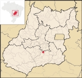
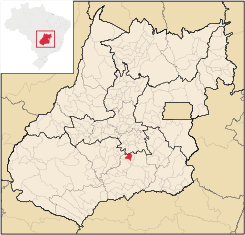
Cromínia
Encyclopedia
| Cromínia | |
|---|---|
| State | Goiás Goiás Goiás is a state of Brazil, located in the central part of the country. The name Goiás comes from the name of an indigenous community... |
| Coordinates: | 17°17′20"S 49°22′46"W |
| Area: | 371.1 km² |
| Population: | 3,618 (IBGE 2007) |
| Elevation: | 694 m above sea level |
| Postcode (CEP): | 75635-000 |
| Became a city: | 1953 |
| Mayor: | Felizardo José de Almeida |
| Distance to Goiânia Goiânia -Climate:The city has a tropical wet and dry climate with an average temperature of . There's a wet season, from October to April, and a dry one, from May to September. Annual rainfall is around 1,520 mm.... : |
87 km. |
| IBGE statistical microregion: | Meia Ponte Microregion Meia Ponte Microregion The Meia Ponte Microregion is a statistical region of Goiás state, Brazil created by the IBGE . It is located south of the state capital, Goiânia, and includes 21 cities with a total population of 338,147 inhabitants . The total area is 21,229.00 km² and the population density is 14.39 inhab/km²... |
| Website: | none |
Town
A town is a human settlement larger than a village but smaller than a city. The size a settlement must be in order to be called a "town" varies considerably in different parts of the world, so that, for example, many American "small towns" seem to British people to be no more than villages, while...
and municipality
Municipality
A municipality is essentially an urban administrative division having corporate status and usually powers of self-government. It can also be used to mean the governing body of a municipality. A municipality is a general-purpose administrative subdivision, as opposed to a special-purpose district...
in south Goiás
Goiás
Goiás is a state of Brazil, located in the central part of the country. The name Goiás comes from the name of an indigenous community...
state, Brazil
Brazil
Brazil , officially the Federative Republic of Brazil , is the largest country in South America. It is the world's fifth largest country, both by geographical area and by population with over 192 million people...
. It is famous for its chrome mines.
Geographical Information
Cromínia is located in the Meia Ponte MicroregionMeia Ponte Microregion
The Meia Ponte Microregion is a statistical region of Goiás state, Brazil created by the IBGE . It is located south of the state capital, Goiânia, and includes 21 cities with a total population of 338,147 inhabitants . The total area is 21,229.00 km² and the population density is 14.39 inhab/km²...
, which includes the cities in the Meia Ponte River
Meia Ponte River
The Meia Ponte River is one of the most important rivers in the state of Goiás, Brazil. Its source lies 60 km north of the city of Goiânia and it flows through that city in a southern direction joining the Paranaíba river just downriver of Cachoeira Dourada Dam. The Paranaíba River marks the...
basin. It is approximately 87 kilometers south of the state capital, Goiânia
Goiânia
-Climate:The city has a tropical wet and dry climate with an average temperature of . There's a wet season, from October to April, and a dry one, from May to September. Annual rainfall is around 1,520 mm....
and is 17 kilometers west of the important BR-153 highway, which links Goiânia
Goiânia
-Climate:The city has a tropical wet and dry climate with an average temperature of . There's a wet season, from October to April, and a dry one, from May to September. Annual rainfall is around 1,520 mm....
to Minas Gerais
Minas Gerais
Minas Gerais is one of the 26 states of Brazil, of which it is the second most populous, the third richest, and the fourth largest in area. Minas Gerais is the Brazilian state with the largest number of Presidents of Brazil, the current one, Dilma Rousseff, being one of them. The capital is the...
.
Highway connections from Goiânia
Goiânia
-Climate:The city has a tropical wet and dry climate with an average temperature of . There's a wet season, from October to April, and a dry one, from May to September. Annual rainfall is around 1,520 mm....
are made by BR-153 / Aparecida de Goiânia
Aparecida de Goiânia
Aparecida de Goiânia is a city and municipality in central Goiás, Brazil. It is the second largest city in the state and a bustling industrial center.-Location:...
/ Professor Jamil
Professor Jamil
Professor Jamil is a small town and municipality in south-central Goiás state, Brazil. The population was 3,298 in a total area of 347.4 km²...
/ GO-217. For the complete list of all distances in Goiás
Goiás
Goiás is a state of Brazil, located in the central part of the country. The name Goiás comes from the name of an indigenous community...
see Sepin
Neighboring municipalities are:
- north: AragoiâniaAragoiâniaAragoiânia is a small town and municipality in central Goiás state, Brazil. The population was 7,243 in a total area of 219.5 km²....
- east: Professor JamilProfessor JamilProfessor Jamil is a small town and municipality in south-central Goiás state, Brazil. The population was 3,298 in a total area of 347.4 km²...
- west and south: MairipotabaMairipotabaMairipotaba is a small town and municipality, in south Goiás state, Brazil.-Location and Municipal boundaries:Mairipotaba is located in the Meia Ponte Microregion about 85 kilometers directly south of the state capital, Goiânia. It has highway connections with Varjão, 36 kilometers to the north,...
Demographics
- Population density: 9.78 inhab/km² (2007)
- Population growth rate 1996/2007: -0.21.%
- Total population: 3,618 (2007)
- Total population: 3,362 (1980)
- Urban population: 2,861 (2007)
- Rural population: 879 (2007)
Economic Activities
Chrome mining gave the city its name but cattle raising and agriculture have taken over from mining. Of the 298 rural proprietors 70% raise cattle and the others plant rice and corn.Economic Indicators
- Industrial units: 05
- Retail units: 53
- Banking institutions: none
- Cooperatives: Coop.Mista dos Produtores Rurais de Cromínia-COOMPOR-C
- Automobiles: 443 (Sepin/IBGE 2007)
- Cattle: 34,020 (2006)´
- Corn: 1,150 ha.
- Modest production of soybeans, rice, manioc, and watermelon
Farm Data (2006)in ha.
- Number of farms: 298
- Total area: 22,213
- Area of permanent crops: 88
- Area of perennial crops: 893
- Area of natural pasture: 18,242
- Persons dependent on farming: 940
- Farms with tractors: 52
- Number of tractors: 64 IBG
Education and Health
- Literacy rate: 85.8%
- Infant mortality rate: 18.23 in 1,000 live births
- Schools: 6
- Students: 1,325
- Hospitals: 2
- Hospital beds: 31
- Health centers: 2
History
The town began in 1940 when three landowners give land to install a town which would be called Planura Verde (Green Plain). The settlement began to grow around a football field where locals came on Sunday to watch the games and pray at the foot of a cross. Soon the first houses were built. In 1943 the Arraial (village) was elevated to the category of district of PiracanjubaPiracanjuba
Piracanjuba is a small city and municipality in southeastern Goiás state, Brazil. It is a big producer of orchids, milk products, and soybeans. Piracanjuba is also the name of a fish common to the waters of the Plata River basin....
. It received the name "Cromínia" due to the great quantity of chrome in the region. In 1954 the district became a municipality.
Ranking on the Municipal Human Development Index
Human Development Index
The Human Development Index is a composite statistic used to rank countries by level of "human development" and separate "very high human development", "high human development", "medium human development", and "low human development" countries...
- MHDI: 0.769
- State ranking: 40 (out of 242 municipalities in 2000)
- National ranking: 1,347 (out of 5,507 municipalities in 2000)
For the complete list see Frigoletto