
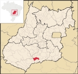
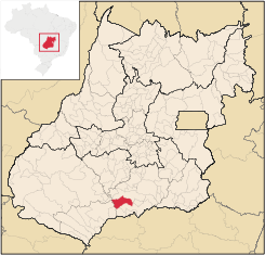
Bom Jesus de Goiás
Encyclopedia
| Bom Jesus de Goiás | |
|---|---|
| State | Goiás Goiás Goiás is a state of Brazil, located in the central part of the country. The name Goiás comes from the name of an indigenous community... |
| Coordinates: | 18°13′12"S 49°43′39"W |
| Area: | 1,405.2 km² |
| Population: | 19,574 (IBGE 2007) |
| Elevation: | 619 m above sea level |
| Postcode (CEP): | 75570-000 |
| Became a city: | 1963 |
| Mayor: | Feliciano Florindo de Oliverira |
| Distance to Goiânia Goiânia -Climate:The city has a tropical wet and dry climate with an average temperature of . There's a wet season, from October to April, and a dry one, from May to September. Annual rainfall is around 1,520 mm.... : |
210 km. |
| IBGE statistical microregion: | Meia Ponte Microregion Meia Ponte Microregion The Meia Ponte Microregion is a statistical region of Goiás state, Brazil created by the IBGE . It is located south of the state capital, Goiânia, and includes 21 cities with a total population of 338,147 inhabitants . The total area is 21,229.00 km² and the population density is 14.39 inhab/km²... |
| Website: | none |
Town
A town is a human settlement larger than a village but smaller than a city. The size a settlement must be in order to be called a "town" varies considerably in different parts of the world, so that, for example, many American "small towns" seem to British people to be no more than villages, while...
and municipality
Municipality
A municipality is essentially an urban administrative division having corporate status and usually powers of self-government. It can also be used to mean the governing body of a municipality. A municipality is a general-purpose administrative subdivision, as opposed to a special-purpose district...
in south Goiás
Goiás
Goiás is a state of Brazil, located in the central part of the country. The name Goiás comes from the name of an indigenous community...
state, Brazil
Brazil
Brazil , officially the Federative Republic of Brazil , is the largest country in South America. It is the world's fifth largest country, both by geographical area and by population with over 192 million people...
. It is a large producer of soybeans.
Geographical Information
The distance to the state capital, Goiânia, is 223 km and it is linked by highways BR-452 and GO-040. It forms boundaries with GoiatubaGoiatuba
Goiatuba is a small city and municipality in south-central Goiás state, Brazil. The population was 31,225 in a total area of 2,475.10 km² . Goiatuba is a large producer of grains, especially soybeans and corn....
(north); Inaciolândia
Inaciolândia
Inaciolândia is a small town and municipality in south Goiás state, Brazil. The population was 5,650 inhabitants in a total area of 688.3 km². Inaciolândia is a large producer of cotton and soybeans.-Geographical Information:...
and Itumbiara
Itumbiara
Itumbiara is a small city and municipality in the extreme south of the state of Goiás, Brazil. The population was 100,000 in a total area of 2,461,3 km²...
(south); Itumbiara
Itumbiara
Itumbiara is a small city and municipality in the extreme south of the state of Goiás, Brazil. The population was 100,000 in a total area of 2,461,3 km²...
and Panamá
Panamá, Goiás
Panamá is a small town and municipality in south Goiás state, Brazil.LocationPanamá is located in the Meia Ponte Microregion and is about 25 kilometers north of the border with the state of Minas Gerais. It is a short distance west of the important BR-153 highway which links São Paulo to Belém. ...
(east); and Quirinópolis
Quirinópolis
Quirinópolis is a small city and municipality in south Goiás state, Brazil. It is a large producer of cattle and agricultural products.-Location:...
(west).
The land is mainly flat, which favors agriculture. The municipality extends from the Meia Ponte River
Meia Ponte River
The Meia Ponte River is one of the most important rivers in the state of Goiás, Brazil. Its source lies 60 km north of the city of Goiânia and it flows through that city in a southern direction joining the Paranaíba river just downriver of Cachoeira Dourada Dam. The Paranaíba River marks the...
to the Rio dos Bois, which flow into the Paranaíba River
Paranaíba River
The Paranaíba River is a Brazilian river whose source lies in the state of Minas Gerais in the Mata da Corda mountains, municipality of Rio Paranaíba, at an altitude of 1,148 meters; on the other face of this mountain chain are the sources of the Abaeté river, tributary of the São Francisco River...
.
The climate is moist tropical with temperatures oscilating between 28 °C and 38 °C, with an average maximum of 30 °C. Rains are constant in the period between October and March. The fauna is diversified with the presence of tamandua
Tamandua
Tamandua is a genus of anteaters. It has two members: the Southern Tamandua and the Northern Tamandua . They live in forests and grasslands, are semi-arboreal, and possess partially prehensile tails. They mainly eat ants and termites, but they occasionally eat bees, beetles, and insect larvae...
, tatu, capivara, reptiles, and many birds.
History
In 1925 a local rancher, Dona Carolina Viera da Mota, donated lands to build a future settlement. In the same year a chapel covered with palm fronds was built. Soon other houses (huts) were built and the settlement was called Bom Jesus. In 1953 it was made a district of GoiatubaGoiatuba
Goiatuba is a small city and municipality in south-central Goiás state, Brazil. The population was 31,225 in a total area of 2,475.10 km² . Goiatuba is a large producer of grains, especially soybeans and corn....
, becoming a municipality in 1963.
Demographic and political data
- Population density in 2007: 13.93 inhab/km²
- Population growth rate from 1996-2007: 2.69%
- Total population in 2007: 19,574
- Total population in 1980: 11,623
- Urban population in 2007: 18,218
- Rural population in 2007: 1,356
- City government in 2005: mayor (Feliciano Florindo de Oliverira)
Economy
The economy is based on agriculture, especially the growing of soybeans, corn, and sugarcane. The farming is all mechanized and the landholdings are large or medium and mainly owned by people who came from the south of the country like ParanáParaná (state)
Paraná is one of the states of Brazil, located in the South of the country, bordered on the north by São Paulo state, on the east by the Atlantic Ocean, on the south by Santa Catarina state and the Misiones Province of Argentina, and on the west by Mato Grosso do Sul and the republic of Paraguay,...
and Rio Grande do Sul
Rio Grande do Sul
Rio Grande do Sul is the southernmost state in Brazil, and the state with the fifth highest Human Development Index in the country. In this state is located the southernmost city in the country, Chuí, on the border with Uruguay. In the region of Bento Gonçalves and Caxias do Sul, the largest wine...
.
- Number of industrial establishments: 24
- Industrial district: Distrito Agroindustrial de Bom Jesus de Goiás – DIAB (June/2006)
- Number of retail commercial establishments: 257
- Financial institutions: Banco do Brasil S.A. - BRADESCO S.A. - Banco Itaú S.A. - Caixa Económica Federal.
- Automobiles: 2,535
Cattle raising and agricultural production
- Cattle: 60,825
- Sugarcane: 7,300 hectares
- Corn: 18,300 hectares
- Soybeans: 59,500 hectares (state leader is Rio VerdeRio Verde, GoiásRio Verde is a city and municipality in the Brazilian state of Goiás. It is a fast-growing center and is the largest producer of grains in the state.-Location:...
- Sorghum: 10,000 hectares
Agricultural data 2006
- Farms: 425
- Total area: 118,674 ha.
- Area of permanent crops: 810 ha.
- Area of perennial crops: 56,339 ha.
- Area of natural pasture: 39,912 ha.
- Area of woodland and forests: 19,879 ha.
- Persons dependent on farming: 1,350
- Farms with tractors: 161
- Number of tractors: 493 IBGE
Health (2007)
- Infant mortality in 2000: 15.81
- Infant mortality in 1990: 29.47
- Health establishments: 10 (05 private)
- Hospitals: 03 with 53 beds
(IBGE 2002)
Education (2006)
- Literacy rate in 2000: 84.4
- Literacy rate in 1991: 79.7
- Schools: 14 with 5,631 students
- Higher education: none reported for 2006
(IBGE 2004)
Ranking on the Municipal Human Development Index
Human Development Index
The Human Development Index is a composite statistic used to rank countries by level of "human development" and separate "very high human development", "high human development", "medium human development", and "low human development" countries...
- MHDI: 0.772
- State ranking: 38 (out of 242 municipalities)
- National ranking: 1,283 (out of 5,507 municipalities)
Source: Frigoletto