

Pevek
Encyclopedia
Pevek is a town and Arctic port in Chaunsky District
, part of the Chukotka Autonomous Okrug
, Russia. After Anadyr
and Bilibino
it is the third largest town in Chukotka. Population: Municipally, the town is subordinated to Chaunsky Municipal district and together with Apapelgino
and Yanranay
, is incorporated as Pevek Urban Settlement. The town is a modern settlement established after the First World War to provide a port for the export of minerals as part of the expanding Northern Sea Route
. During the 1940s and 1950s, the area surrounding Pevek was the site of several GULAG
s where prisoners mined uranium. In recent years though many of the mines have been shown to be uneconomic and have closed, causing many residents to move to more central regions in Russia and for the port infrastructure to decay.
, part of the East Siberian Sea
. It is situated on a peninsula on the eastern side of the bay facing the Routan Islands
. Located above the Arctic Circle
, it is the northernmost town in Russia and in Asia. Pevek is about 640 km northwest of the regional capital Anadyr
expedition, with Russian explorers first describing Chaunskaya Bay
in the 1760s.
hunting lodge and yaranga
in 1926. By the mid 1930s, Pevek was an important port in the region, due to the natural harbour provided by Chaunskaya Bay, the expansion of the Northern Sea Route
and the discovery of tin
at the Pyrkakay mine (which would later be renamed Krasnoarmeysky
) some 40 miles away. The discovery of minerals throughout this region meant Pevek had an important part to play in importing the required plant and machinery and exporting the extracted minerals and by 1950, the settlement had nearly 1500 people living in it.
There are two theories for the origin of the town's name. The first is that it is derived from the Chukchi
word for fat; it was originally named for the nearby hill Peekin'ey, meaning swollen mountain. The more macabre theory is that the name is derived from the Chukchi word "Pagytkenay", meaning "smelly mountain". Legend has it that a battle was fought on the site of the town between the local Chukchi and Yukaghir
peoples. At the time, there was no tradition of burying the dead among the indigenous people, so the odour of rotting flesh was present for a long time. This legend suggests a reason why when Russian explorers first discovered the bay, they did not find any settlement, as the Chukchi refused to settle in the region following the battle and only brought their animals to pasture in the summer.
with tin and uranium
throughout the large parts of the twentieth century were prisoners in the Gulag
system. There was a network of camps in the region itself, through which an uncertain number of criminal and political prisoners passed. There are the remains of two large camps, "North" and "West", which continued to supply uranium during and after World War II. Barracks dot the landscape and have the appearance of being hastily abandoned. Large graveyards on the edge of the various encampments show that a large proportion of those sent to work in the mines did not survive.
During the 1990s, after the dissolution of the Soviet Union
, the town's population dropped by more than half as commercial navigation in the Arctic went into decline and people began to gravitate towards the central Russian regions. More or less regular shipping is presently to be found only from Murmansk
to Dudinka
in the west and between Vladivostok
and Pevek in the east. Ports between Dudinka and Pevek have virtually no shipping.
 The town is a large port at the Northern Sea Route
, the most important northern port in Chukotka, although shipping levels have dropped significantly in recent years. The port is the eastern base of the northern sea route's Marine Operations Headquarters, run by the Far-East Shipping Company from an icebreaker in the harbour, though the port is still owned by the Russian Ministry of Transport. The ports authority stretches as far as 125o east, just west of the Lena River
. Past this point the western Marine Operations Headquarters, based in Dikson
has control. The headquarters govern all routes that ships take whilst using the northern sea route, organising convoys and providing up to date information on ice conditions throughout their sphere of influence. As well as the Far Eastern Shipping Company, the port is also used by the Arctic Shipping Company, based in Tiksi
, who take coal from Zheleny Mys to Pevek.
Despite its prominence as the eastern Marine Operations Headquarters, the level of cargo the port has had to deal with in recent years has been declining rapidly. Although there is still gold mining around Bilibino
and Leningradsky
, there is little in the way of cargo generation as a result of that industry. The port is not a significant exporter of goods at all and is mainly responsible for dealing with the import of fuel (coal from Beringovsky
and oil from Europe and the United States) for the region, though in the second half of the 1990s, even this activity rarely exceeded a few thousand tons, and in 1997, Mys Shmidta
, traditionally the second most important of the northern Chukotkan ports was handling nearly four times as much cargo. The future does not look good either, although mining for other materials such as tin still occurs in the region, many of the mines have closed, being deemed unprofitable, and a number of settlements, such as Iul'tin, Komsomolsky
and Krasnoarmeysky have been officially liquidated, with any remaining economic activity producing only very low cargo volumes at best.
The result of the closing of the mines in the region is that many people have moved to other areas of Russia. This has caused the almost complete eradication of an export market as well as a corresponding drop in the required level of imports. This causes a lack of demand for the facilities at the port whose precarious profitability leads to a lack of investment. This decaying infrastructure is endemic across the northern sea route and makes the supply route unreliable. For example, winter fuel bound for Pevek did not arrive until the end of November in 1998, this is for a port whose average sailing season lasts only until 25 October.
A slight recovery is perhaps indicated by an increase in cargo handled. In 1997, Pevek handled over 200,000 tons of cargo, second only to Dudinka
of the true northern sea route ports, with 1,143,000 tons.
The port has a maximum ship draft of 10.25 m.
, mercury
, gold and black coal deposits are all located near the town. However, many of the mines that previously produced significant quantities of minerals for export have now been deemed to be uneconomical and have closed. Most mining that takes place in the region is relatively low key. However, this level of activity is still sufficient to provide enough business to keep two processing plants in Pevek.
, 17 km to the north west of the town in the village of Apapelgino
, a settlement established specifically to house the airport's staff. The airport provides flights to major regional towns such as Magadan
, Anadyr and Bilibino as well as to Moscow.
Pevek also has the most developed road infrastructure in the Okrug
. There is approximately 150 km of year-round, paved roads going to local settlements such as the now abandoned village of Valkumey
as well as to the mines at Komsomolsky
and Krasnoarmeysky
as well as an ice road
to Bilibino.
short story Descendant of a Decembrist At the end of the story, the doctor, Mikhail Sergeyevich Lunin is re-instated in his original job with Dalstroy
as a result of assistance from his estranged wife. He moves to Pevek, described as then only being a village, with Edith following him. Despite trying to talk through their differences, they are unsuccessful and Edith is described as committing suicide by throwing herself into the Pevek River.
Chaunsky District
Chaunsky District is an administrative and municipal district , one of the six in Chukotka Autonomous Okrug, Russia. It is located on the northern shore of the autonomous okrug and in terms of the administrative divisions borders Shmidtovsky District in the northeast, Anadyrsky District in the...
, part of the Chukotka Autonomous Okrug
Chukotka Autonomous Okrug
Chukotka Autonomous Okrug , or Chukotka , is a federal subject of Russia located in the Russian Far East.Chukotka has a population of 53,824 according to the 2002 Census, and a surface area of . The principal town and the administrative center is Anadyr...
, Russia. After Anadyr
Anadyr (town)
Anadyr is a port town and the administrative centre of Chukotka Autonomous Okrug, the extreme north-eastern region of Russia. It is at the mouth of the Anadyr River, on the tip of the southern promontory that sticks out into Anadyrskiy Liman...
and Bilibino
Bilibino
Bilibino is a town and gold-mining center in Bilibinsky District of Chukotka Autonomous Okrug, Russia, located at the confluence of the Karalve'em and the Bolshoy Keperve'em Rivers north-west of Anadyr. It is the second largest town in Chukotka...
it is the third largest town in Chukotka. Population: Municipally, the town is subordinated to Chaunsky Municipal district and together with Apapelgino
Apapelgino
Apapelgino is a rural locality in Chaunsky District of Chukotka Autonomous Okrug, Russia, located just to the east of Pevek, on the northeastern shores of Chaunskaya Bay and was constructed as part of the expansion of Pevek Airport...
and Yanranay
Yanranay
Yanranay is a rural locality in Chaunsky District of Chukotka Autonomous Okrug, Russia, located just to the west of Pevek. Population: 226 in 2005 according to an environmental impact report produced for the Kupol Gold Project, down slightly on the 2003 estimate of 240, most of whom are of...
, is incorporated as Pevek Urban Settlement. The town is a modern settlement established after the First World War to provide a port for the export of minerals as part of the expanding Northern Sea Route
Northern Sea Route
The Northern Sea Route is a shipping lane officially defined by Russian legislation from the Atlantic Ocean to the Pacific Ocean specifically running along the Russian Arctic coast from Murmansk on the Barents Sea, along Siberia, to the Bering Strait and Far East. The entire route lies in Arctic...
. During the 1940s and 1950s, the area surrounding Pevek was the site of several GULAG
Gulag
The Gulag was the government agency that administered the main Soviet forced labor camp systems. While the camps housed a wide range of convicts, from petty criminals to political prisoners, large numbers were convicted by simplified procedures, such as NKVD troikas and other instruments of...
s where prisoners mined uranium. In recent years though many of the mines have been shown to be uneconomic and have closed, causing many residents to move to more central regions in Russia and for the port infrastructure to decay.
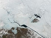
Geography
Pevek is located on Chaunskaya BayChaunskaya Bay
The Chaunskaya Bay or Chaun Bay is an Arctic bay in the East Siberian Sea, in the Chaunsky District of Chukotka, northeast Siberia.The bay is open to the north and is 140 km in length. Its maximum width is 110 km. Its mouth is defined by Cape Shelagsky to the east and an unnamed part of...
, part of the East Siberian Sea
East Siberian Sea
The East Siberian Sea is a marginal sea in the Arctic Ocean. It is located between the Arctic Cape to the north, the coast of Siberia to the south, the New Siberian Islands to the west and Cape Billings, close to Chukotka, and Wrangel Island to the east...
. It is situated on a peninsula on the eastern side of the bay facing the Routan Islands
Routan Islands
The Routan Islands are two islands in the eastern coast of the Chaunskaya Bay of the East Siberian Sea. They are located directly off Pevek, separated from the shore of the Pevek Peninsula by a 4.7 km wide sound. Ayon Island lies on the other side of the Chaunskaya Bay, 24 km to the...
. Located above the Arctic Circle
Arctic Circle
The Arctic Circle is one of the five major circles of latitude that mark maps of the Earth. For Epoch 2011, it is the parallel of latitude that runs north of the Equator....
, it is the northernmost town in Russia and in Asia. Pevek is about 640 km northwest of the regional capital Anadyr
Anadyr (town)
Anadyr is a port town and the administrative centre of Chukotka Autonomous Okrug, the extreme north-eastern region of Russia. It is at the mouth of the Anadyr River, on the tip of the southern promontory that sticks out into Anadyrskiy Liman...
Eighteenth and nineteenth centuries
The area around Pevek was known to western Russians by the middle of the eighteenth century as the records of the second Kamchatka Expedition document the discovery of Cape Shelag, with further references to the cape being made in the records of the BillingsJoseph Billings
Joseph Billings was an English navigator and explorer who spent the most significant part of his life in Russian service.In 1785, the Russian government of Catherine II commissioned a new expedition in search for the Northeast Passage, led by English officer Joseph Billings, who had previously...
expedition, with Russian explorers first describing Chaunskaya Bay
Chaunskaya Bay
The Chaunskaya Bay or Chaun Bay is an Arctic bay in the East Siberian Sea, in the Chaunsky District of Chukotka, northeast Siberia.The bay is open to the north and is 140 km in length. Its maximum width is 110 km. Its mouth is defined by Cape Shelagsky to the east and an unnamed part of...
in the 1760s.
Twentieth century
The earliest records of the area now known as Pevek being inhabited were made by the writer Tikhon Semushkin, who discovered a ChukchiChukchi people
The Chukchi, or Chukchee , ) are an indigenous people inhabiting the Chukchi Peninsula and the shores of the Chukchi Sea and the Bering Sea region of the Arctic Ocean within the Russian Federation. They speak the Chukchi language...
hunting lodge and yaranga
Yaranga
A Yaranga is a tent-like traditional mobile home of some nomadic Northern indigenous peoples of Russia, such as Chukchi and Siberian Yupik.A Yaranga is a cone-shaped or rounded reindeer-hide tent. It is built of a light wooden frame covered with reindeer skins or canvas sewn together.The word...
in 1926. By the mid 1930s, Pevek was an important port in the region, due to the natural harbour provided by Chaunskaya Bay, the expansion of the Northern Sea Route
Northern Sea Route
The Northern Sea Route is a shipping lane officially defined by Russian legislation from the Atlantic Ocean to the Pacific Ocean specifically running along the Russian Arctic coast from Murmansk on the Barents Sea, along Siberia, to the Bering Strait and Far East. The entire route lies in Arctic...
and the discovery of tin
Tin
Tin is a chemical element with the symbol Sn and atomic number 50. It is a main group metal in group 14 of the periodic table. Tin shows chemical similarity to both neighboring group 14 elements, germanium and lead and has two possible oxidation states, +2 and the slightly more stable +4...
at the Pyrkakay mine (which would later be renamed Krasnoarmeysky
Krasnoarmeysky, Chukotka Autonomous Okrug
Krasnoarmeysky is an inhabited locality in Chaunsky District of Chukotka Autonomous Okrug, Russia. Population: 0 ; -History:...
) some 40 miles away. The discovery of minerals throughout this region meant Pevek had an important part to play in importing the required plant and machinery and exporting the extracted minerals and by 1950, the settlement had nearly 1500 people living in it.
There are two theories for the origin of the town's name. The first is that it is derived from the Chukchi
Chukchi language
The Chukchi language is a Palaeosiberian language spoken by Chukchi people in the easternmost extremity of Siberia, mainly in Chukotka Autonomous Okrug...
word for fat; it was originally named for the nearby hill Peekin'ey, meaning swollen mountain. The more macabre theory is that the name is derived from the Chukchi word "Pagytkenay", meaning "smelly mountain". Legend has it that a battle was fought on the site of the town between the local Chukchi and Yukaghir
Yukaghir
The Yukaghir, or Yukagirs , деткиль ) are a people in East Siberia, living in the basin of the Kolyma River.-Region:The Tundra Yukaghirs live in the Lower Kolyma region in the Sakha Republic; the Taiga Yukaghirs in the Upper Kolyma region in the Sakha Republic and in Srednekansky District of...
peoples. At the time, there was no tradition of burying the dead among the indigenous people, so the odour of rotting flesh was present for a long time. This legend suggests a reason why when Russian explorers first discovered the bay, they did not find any settlement, as the Chukchi refused to settle in the region following the battle and only brought their animals to pasture in the summer.
Gulag
The workforce for the mines that provided the Soviet UnionSoviet Union
The Soviet Union , officially the Union of Soviet Socialist Republics , was a constitutionally socialist state that existed in Eurasia between 1922 and 1991....
with tin and uranium
Uranium
Uranium is a silvery-white metallic chemical element in the actinide series of the periodic table, with atomic number 92. It is assigned the chemical symbol U. A uranium atom has 92 protons and 92 electrons, of which 6 are valence electrons...
throughout the large parts of the twentieth century were prisoners in the Gulag
Gulag
The Gulag was the government agency that administered the main Soviet forced labor camp systems. While the camps housed a wide range of convicts, from petty criminals to political prisoners, large numbers were convicted by simplified procedures, such as NKVD troikas and other instruments of...
system. There was a network of camps in the region itself, through which an uncertain number of criminal and political prisoners passed. There are the remains of two large camps, "North" and "West", which continued to supply uranium during and after World War II. Barracks dot the landscape and have the appearance of being hastily abandoned. Large graveyards on the edge of the various encampments show that a large proportion of those sent to work in the mines did not survive.
During the 1990s, after the dissolution of the Soviet Union
Dissolution of the Soviet Union
The dissolution of the Soviet Union was the disintegration of the federal political structures and central government of the Union of Soviet Socialist Republics , resulting in the independence of all fifteen republics of the Soviet Union between March 11, 1990 and December 25, 1991...
, the town's population dropped by more than half as commercial navigation in the Arctic went into decline and people began to gravitate towards the central Russian regions. More or less regular shipping is presently to be found only from Murmansk
Murmansk
Murmansk is a city and the administrative center of Murmansk Oblast, Russia. It serves as a seaport and is located in the extreme northwest part of Russia, on the Kola Bay, from the Barents Sea on the northern shore of the Kola Peninsula, not far from Russia's borders with Norway and Finland...
to Dudinka
Dudinka
Dudinka is a town and the administrative center of Taymyrsky Dolgano-Nenetsky District of Krasnoyarsk Krai, Russia. It was the administrative center of Taymyr Autonomous Okrug, which was merged into Krasnoyarsk Krai on January 1, 2007. It is a port in the lower reaches of the Yenisei River,...
in the west and between Vladivostok
Vladivostok
The city is located in the southern extremity of Muravyov-Amursky Peninsula, which is about 30 km long and approximately 12 km wide.The highest point is Mount Kholodilnik, the height of which is 257 m...
and Pevek in the east. Ports between Dudinka and Pevek have virtually no shipping.
Port
Northern Sea Route
The Northern Sea Route is a shipping lane officially defined by Russian legislation from the Atlantic Ocean to the Pacific Ocean specifically running along the Russian Arctic coast from Murmansk on the Barents Sea, along Siberia, to the Bering Strait and Far East. The entire route lies in Arctic...
, the most important northern port in Chukotka, although shipping levels have dropped significantly in recent years. The port is the eastern base of the northern sea route's Marine Operations Headquarters, run by the Far-East Shipping Company from an icebreaker in the harbour, though the port is still owned by the Russian Ministry of Transport. The ports authority stretches as far as 125o east, just west of the Lena River
Lena River
The Lena is the easternmost of the three great Siberian rivers that flow into the Arctic Ocean . It is the 11th longest river in the world and has the 9th largest watershed...
. Past this point the western Marine Operations Headquarters, based in Dikson
Dikson
Dikson Island , initially Dickson, is the name of an island in Krasnoyarsk Krai, Russia, situated in the Kara Sea near the mouth of the Yenisei River. A nearby urban-type settlement of Dikson, which functions as a port and hydrometeorological centre is located at...
has control. The headquarters govern all routes that ships take whilst using the northern sea route, organising convoys and providing up to date information on ice conditions throughout their sphere of influence. As well as the Far Eastern Shipping Company, the port is also used by the Arctic Shipping Company, based in Tiksi
Tiksi
Tiksi is an urban locality and the administrative center of Bulunsky District of the Sakha Republic, Russia, situated on the Arctic Ocean coast. Population: It is one of the principal ports for accessing the Laptev Sea...
, who take coal from Zheleny Mys to Pevek.
Despite its prominence as the eastern Marine Operations Headquarters, the level of cargo the port has had to deal with in recent years has been declining rapidly. Although there is still gold mining around Bilibino
Bilibino
Bilibino is a town and gold-mining center in Bilibinsky District of Chukotka Autonomous Okrug, Russia, located at the confluence of the Karalve'em and the Bolshoy Keperve'em Rivers north-west of Anadyr. It is the second largest town in Chukotka...
and Leningradsky
Leningradsky, Chukotka Autonomous Okrug
Leningradsky is an urban locality in Iultinsky District of Chukotka Autonomous Okrug, Russia, about west of Mys Shmidta. Population: -History:...
, there is little in the way of cargo generation as a result of that industry. The port is not a significant exporter of goods at all and is mainly responsible for dealing with the import of fuel (coal from Beringovsky
Beringovsky
Beringovsky is an urban-type settlement in Anadyrsky District of Chukotka Autonomous Okrug, Russia, and a port on the Bering Sea. Population: Municipally, Beringovsky is incorporated as Beringovsky Urban Settlement. The settlement was founded to provide a port for the nearby mines.-Soviet:The...
and oil from Europe and the United States) for the region, though in the second half of the 1990s, even this activity rarely exceeded a few thousand tons, and in 1997, Mys Shmidta
Mys Shmidta
Mys Shmidta is an urban-type settlement in Iultinsky District of Chukotka Autonomous Okrug, Russia. The settlement is located about southeast of the cape of the same name. The cape, but not the settlement, was formerly known as North Cape or Cape North. Cape Billings is located to the west of...
, traditionally the second most important of the northern Chukotkan ports was handling nearly four times as much cargo. The future does not look good either, although mining for other materials such as tin still occurs in the region, many of the mines have closed, being deemed unprofitable, and a number of settlements, such as Iul'tin, Komsomolsky
Komsomolsky
Komsomolsky , Komsomolskoye , or Komsomolskaya may refer to:*Komsomolsky District, name of several districts in the countries of the former Soviet Union...
and Krasnoarmeysky have been officially liquidated, with any remaining economic activity producing only very low cargo volumes at best.
The result of the closing of the mines in the region is that many people have moved to other areas of Russia. This has caused the almost complete eradication of an export market as well as a corresponding drop in the required level of imports. This causes a lack of demand for the facilities at the port whose precarious profitability leads to a lack of investment. This decaying infrastructure is endemic across the northern sea route and makes the supply route unreliable. For example, winter fuel bound for Pevek did not arrive until the end of November in 1998, this is for a port whose average sailing season lasts only until 25 October.
A slight recovery is perhaps indicated by an increase in cargo handled. In 1997, Pevek handled over 200,000 tons of cargo, second only to Dudinka
Dudinka
Dudinka is a town and the administrative center of Taymyrsky Dolgano-Nenetsky District of Krasnoyarsk Krai, Russia. It was the administrative center of Taymyr Autonomous Okrug, which was merged into Krasnoyarsk Krai on January 1, 2007. It is a port in the lower reaches of the Yenisei River,...
of the true northern sea route ports, with 1,143,000 tons.
The port has a maximum ship draft of 10.25 m.
Other industry
There is some mining in the area; tinTin
Tin is a chemical element with the symbol Sn and atomic number 50. It is a main group metal in group 14 of the periodic table. Tin shows chemical similarity to both neighboring group 14 elements, germanium and lead and has two possible oxidation states, +2 and the slightly more stable +4...
, mercury
Mercury (element)
Mercury is a chemical element with the symbol Hg and atomic number 80. It is also known as quicksilver or hydrargyrum...
, gold and black coal deposits are all located near the town. However, many of the mines that previously produced significant quantities of minerals for export have now been deemed to be uneconomical and have closed. Most mining that takes place in the region is relatively low key. However, this level of activity is still sufficient to provide enough business to keep two processing plants in Pevek.
Infrastructure
Besides the port as a key transport link with the rest of Russia, the town is also served by Pevek AirportPevek Airport
Pevek Airport is a civilian airport located 15 km northeast of Pevek. It mainly services medium-sized airliners. Its use for military operations is unknown but the runway and facilities are adequate for interceptor operations. The airfield elevation is given either as 3 or 14 meters according...
, 17 km to the north west of the town in the village of Apapelgino
Apapelgino
Apapelgino is a rural locality in Chaunsky District of Chukotka Autonomous Okrug, Russia, located just to the east of Pevek, on the northeastern shores of Chaunskaya Bay and was constructed as part of the expansion of Pevek Airport...
, a settlement established specifically to house the airport's staff. The airport provides flights to major regional towns such as Magadan
Magadan
Magadan is a port town on the Sea of Okhotsk and gateway to the Kolyma region. It is the administrative center of Magadan Oblast , in the Russian Far East. Founded in 1929 on the site of an earlier settlement from the 1920s, it was granted the status of town in 1939...
, Anadyr and Bilibino as well as to Moscow.
Pevek also has the most developed road infrastructure in the Okrug
Okrug
Okrug is an administrative division of some Slavic states. The word "okrug" is a loanword in English, but it is nevertheless often translated as "area", "district", or "region"....
. There is approximately 150 km of year-round, paved roads going to local settlements such as the now abandoned village of Valkumey
Valkumey
Valkumey is an inhabited locality in Chaunsky District of Chukotka Autonomous Okrug, Russia, located on the shores of Chaunskaya Bay...
as well as to the mines at Komsomolsky
Komsomolsky, Chukotka Autonomous Okrug
Komsomolsky is an inhabited locality in Chaunsky District of Chukotka Autonomous Okrug, Russia, located about south-west of Pevek, the administrative centre of the district...
and Krasnoarmeysky
Krasnoarmeysky, Chukotka Autonomous Okrug
Krasnoarmeysky is an inhabited locality in Chaunsky District of Chukotka Autonomous Okrug, Russia. Population: 0 ; -History:...
as well as an ice road
Ice road
Ice roads are frozen, human-made structures on the surface of bays, rivers, lakes, or seas in the far north. They link dry land, frozen waterways, portages and winter roads, and are usually remade each winter. Ice roads allow temporary transport to areas with no permanent road access...
to Bilibino.
Change in municipal status
On 20 October 2010, a law was passed in the Duma of Chukotka abolishing Apapelgino and Yanranay as individual rural settlements and merging them with Pevek Urban Settlement. Apapelgino and Yanranay continue to exist as Selos however, the villages' rural municipal administrations were abolished with responsibility being transferred to Pevek Urban Settlement in addition to all municipal property, property rights and budgets.In literature
Pevek is described as the place of death of Edith Abramovna in Varlam Shalamov'sVarlam Shalamov
Varlam Tikhonovich Shalamov , baptized as Varlaam, was a Russian writer, journalist, poet and Gulag survivor.-Early life:Varlam Shalamov was born in Vologda, Vologda Governorate, a Russian city with a rich culture famous for its wooden architecture, to a family of a hereditary Russian Orthodox...
short story Descendant of a Decembrist At the end of the story, the doctor, Mikhail Sergeyevich Lunin is re-instated in his original job with Dalstroy
Dalstroy
Dalstroy , also known as Far North Construction Trust, was an organization set up in 1931 by the Soviet NKVD in order to manage road construction and the mining of gold in the Chukotka region of the Russian Far East, now known as Kolyma. Initially it was established as State Trust for Road and...
as a result of assistance from his estranged wife. He moves to Pevek, described as then only being a village, with Edith following him. Despite trying to talk through their differences, they are unsuccessful and Edith is described as committing suicide by throwing herself into the Pevek River.
See also
- List of inhabited localities in Chaunsky District
- Extreme points of RussiaExtreme points of RussiaThis is a list of the extreme points and extreme elevations in Russia.The northernmost and easternmost points of Russia coincide with those of Eurasia ....
- Chief Directorate of the Northern Sea RouteChief Directorate of the Northern Sea RouteThe Chief Directorate of the Northern Sea Route , also known as Glavsevmorput, was a Soviet government organization in charge of the naval Northern Sea Route, established in January 1932 and dissolved in 1964.-History:The organization traces its roots to AO Komseveroput, a shipping company...
External links
- Pevek city info from Vostok Travel.
- Pevek photo gallery
- Panoramas of Pevek
- Large photo gallery of Pevek