
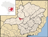
Patos de Minas
Encyclopedia
| Patos de Minas | |
|---|---|
| State | Minas Gerais Minas Gerais Minas Gerais is one of the 26 states of Brazil, of which it is the second most populous, the third richest, and the fourth largest in area. Minas Gerais is the Brazilian state with the largest number of Presidents of Brazil, the current one, Dilma Rousseff, being one of them. The capital is the... |
| Area: | 3,189 km² |
| Population: | 133,054 (IBGE 2007) |
| Elevation: | 832 m above sea level |
| Postcode (CEP): | 3148-000 |
| Became a city: | 1892 |
| Distance to Belo Horizonte Belo Horizonte Belo Horizonte is the capital of and largest city in the state of Minas Gerais, located in the southeastern region of Brazil. It is the third largest metropolitan area in the country... : |
415 km. |
| IBGE statistical microregion: | Patos de Minas Microregion |
| Website: | City government site |
Minas Gerais
Minas Gerais is one of the 26 states of Brazil, of which it is the second most populous, the third richest, and the fourth largest in area. Minas Gerais is the Brazilian state with the largest number of Presidents of Brazil, the current one, Dilma Rousseff, being one of them. The capital is the...
in Brazil
Brazil
Brazil , officially the Federative Republic of Brazil , is the largest country in South America. It is the world's fifth largest country, both by geographical area and by population with over 192 million people...
, located some 400 km from Belo Horizonte
Belo Horizonte
Belo Horizonte is the capital of and largest city in the state of Minas Gerais, located in the southeastern region of Brazil. It is the third largest metropolitan area in the country...
on the Paranaíba River
Paranaíba River
The Paranaíba River is a Brazilian river whose source lies in the state of Minas Gerais in the Mata da Corda mountains, municipality of Rio Paranaíba, at an altitude of 1,148 meters; on the other face of this mountain chain are the sources of the Abaeté river, tributary of the São Francisco River...
. The city had 133,054 in 2007 while the area of the municipality is 3,189 km². The elevation of the city is 832 meters.
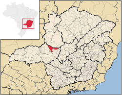
Micro-region
Patos de Minas is also a statistical micro-region that includes ArapuáArapuá
Arapuá is a Brazilian municipality located in the northwest of the state of Minas Gerais. Its population as of 2007 was 2,699 people living in a total area of 172 km². The city belongs to the mesoregion of Triângulo Mineiro e Alto Paranaíba and to the microregion of Patos de Minas...
, Carmo do Paranaíba
Carmo do Paranaíba
Carmo do Paranaíba is a Brazilian municipality located in the northwest of the state of Minas Gerais. Its population as of 2007 was 30,712 people living in a total area of . The city belongs to the mesoregion of Triângulo Mineiro e Alto Paranaíba and to the microregion of Patos de Minas...
, Guimarânia
Guimarânia
Guimarânia is a Brazilian municipality located in the northwest of the state of Minas Gerais. Its population as of 2007 was 6,946 people living in a total area of 371 km². The city belongs to the mesoregion of Triângulo Mineiro e Alto Paranaíba and to the microregion of Patos de Minas...
, Lagoa Formosa
Lagoa Formosa
Lagoa Formosa is a Brazilian municipality located in the northwest of the state of Minas Gerais. Its population as of 2007 was 16,521 people living in a total area of 844 km². The city belongs to the mesoregion of Triângulo Mineiro e Alto Paranaíba and to the microregion of Patos de Minas...
, Matutina
Matutina
Matutina is a Brazilian municipality located in the northwest of the state of Minas Gerais. Its population as of 2007 was 3,700 people living in a total area of 260 km². The city belongs to the mesoregion of Triângulo Mineiro e Alto Paranaíba and to the microregion of Patos de Minas...
, Patos de Minas, Rio Paranaíba
Rio Paranaíba
Rio Paranaíba is a Brazilian municipality located in the northwest of the state of Minas Gerais. Its population as of 2007 was 10,809 people living in a total area of 1,353 km². The city belongs to the mesoregion of Triângulo Mineiro e Alto Paranaíba and to the microregion of Patos de Minas...
, Santa Rosa da Serra
Santa Rosa da Serra
Santa Rosa da Serra is a Brazilian municipality located in the northwest of the state of Minas Gerais. Its population as of 2007 was 3,261 people living in a total area of 296 km². The city belongs to the mesoregion of Triângulo Mineiro e Alto Paranaíba and to the microregion of Patos de Minas...
, São Gotardo
São Gotardo
São Gotardo is a Brazilian municipality located in the northwest of the state of Minas Gerais. Its population as of 2007 was 30,757 people and its land area is 854 km2. The city belongs to the mesoregion of Triângulo Mineiro e Alto Paranaíba and to the microregion of Patos de Minas...
, and Tiros
Tiros
Tiros is a Brazilian municipality located in the northwest of the state of Minas Gerais. Its population as of 2007 was 7,416 people living in a total area of 2,093 km². The city belongs to the mesoregion of Triângulo Mineiro e Alto Paranaíba and to the microregion of Patos de Minas...
. In 2000 the population was 226,626 inhabitants in a total area of 10,773.30 km². The population density in 2000 was 21,04 inhab/km².
Sister town Arad
Arad
-Places in Bahrain:* Arad, Bahrain, a village in Al Muharraq Governorate* Arad Fort, located on Arad shore, Bahrain-Places in Israel:* Arad, Israel, a city* Tel Arad, the remains of the ancient city of Arad-Places in Iran:...
, Romania
Romania
Romania is a country located at the crossroads of Central and Southeastern Europe, on the Lower Danube, within and outside the Carpathian arch, bordering on the Black Sea...
Upington, South Africa
South Africa
The Republic of South Africa is a country in southern Africa. Located at the southern tip of Africa, it is divided into nine provinces, with of coastline on the Atlantic and Indian oceans...
History
The name is derived from the ranch known as Fazenda Os Patos, owned by the original settlers, which had the name because of the large number of wild ducks found in the region. In 1826 the first settlers, Antônio da Silva Guerra and his wife, Luísa Correia de Andrade, donated lands for the new settlement, called Vila de Santo Antônio dos Patos. In 1892 Patos de Minas gained city status with the name of Patos, which was lengthened in 1944 to Patos de MinasHigh standard of living
Patos de Minas occupies a privileged position in the ranking of cities in the state and country in socio-economic development. A study in Veja magazineVeja (magazine)
Veja is a Brazilian weekly newsmagazine published in São Paulo and distributed throughout the country by the media conglomerate Grupo Abril. It is the leading weekly publication in the country, and one of the most influential outlets of the Brazilian press...
in 2001 placed Patos in fifth place among five thousand cities with the greatest socio-economic development between 1970 and 1996.
Rare among Brazilian cities of this size, around 99% of all the streets of the city are paved and have public lighting and almost all of the inhabitants (97%) receive treated water
Water purification
Water purification is the process of removing undesirable chemicals, materials, and biological contaminants from contaminated water. The goal is to produce water fit for a specific purpose...
. Sewage treatment reached 98% of the urban population. City government site
- Municipal Human Development IndexHuman Development IndexThe Human Development Index is a composite statistic used to rank countries by level of "human development" and separate "very high human development", "high human development", "medium human development", and "low human development" countries...
: 0.813 (2000) - State ranking: 19 out of 853 municipalities as of 2000
- National ranking: 318 out of 5,138 municipalities as of 2000
- Literacy rate: 92%
- Life expectancy: 74 (average of males and females)
The highest ranking municipality in Minas Gerais in 2000 was Poços de Caldas
Poços de Caldas
Poços de Caldas is a city and municipality in south-western Minas Gerais state, Brazil, in the microregion of the same name. Its estimated population in 2009 was 151,449 inhabitants...
with 0.841, while the lowest was Setubinha
Setubinha
Setubinha is a municipality in the northeast of the Brazilian state of Minas Gerais. As of 2007 the population was 10,834 in a total area of 536 km². The elevation is 729 metres. It is part of the IBGE statistical microregion of Teófilo Otoni...
with 0.568. Nationally the highest was São Caetano do Sul
São Caetano do Sul
São Caetano do Sul is a city in São Paulo state in Brazil, located in the Greater São Paulo Metropolitan Area. It is the city with the highest per capita income in Brazil and it also has the highest Human Development Index .-Geography:São Caetano do Sul is located on a plateau that is part of the...
in São Paulo with 0.919, while the lowest was Setubinha. In more recent statistics (considering 5,507 municipalities) Manari in the state of Pernambuco
Pernambuco
Pernambuco is a state of Brazil, located in the Northeast region of the country. To the north are the states of Paraíba and Ceará, to the west is Piauí, to the south are Alagoas and Bahia, and to the east is the Atlantic Ocean. There are about of beaches, some of the most beautiful in the...
has the lowest rating in the country—0,467—putting it in last place.
Distances from Patos de Minas
- Belo HorizonteBelo HorizonteBelo Horizonte is the capital of and largest city in the state of Minas Gerais, located in the southeastern region of Brazil. It is the third largest metropolitan area in the country...
: 390 km - PatrocínioPatrocínioPatrocínio is a municipality in the state of Minas Gerais in Brazil. The population of the municipality in 2007 was 81,589. The area is 2,867 km² and the elevation is 965 mts.-Highway connections:...
: 73 km - UberlândiaUberlândiaUberlândia is the main town in the Triangle region, west of the state of Minas Gerais, Brazil. With a population of 604,013 inhabitants, according to 2010 estimates, the city is the second largest in the state second only to Belo Horizonte...
: 217 km - São PauloSão PauloSão Paulo is the largest city in Brazil, the largest city in the southern hemisphere and South America, and the world's seventh largest city by population. The metropolis is anchor to the São Paulo metropolitan area, ranked as the second-most populous metropolitan area in the Americas and among...
: 760 km - BrasíliaBrasíliaBrasília is the capital city of Brazil. The name is commonly spelled Brasilia in English. The city and its District are located in the Central-West region of the country, along a plateau known as Planalto Central. It has a population of about 2,557,000 as of the 2008 IBGE estimate, making it the...
: 428 km
Economy
The main sources of income are agriculture, services, light industry, and livestock raising. Dairy products, jerked beef, and pork by-products are processed in the city. In 2005 the GDP was R$1,217 billion, with 750 million generated by services, 189 million by industry, and 154 million by agriculture.Patos is known nationally for its corn production. The "Princess of the Alto Paranaíba" as it is called, has become the national capital of corn, a fact that has attracted investors from all over the country to set up industries in agro-industry
Agriculture
Agriculture is the cultivation of animals, plants, fungi and other life forms for food, fiber, and other products used to sustain life. Agriculture was the key implement in the rise of sedentary human civilization, whereby farming of domesticated species created food surpluses that nurtured the...
, garments, beverages, and packaging. It is also one of the most important seed
Seed
A seed is a small embryonic plant enclosed in a covering called the seed coat, usually with some stored food. It is the product of the ripened ovule of gymnosperm and angiosperm plants which occurs after fertilization and some growth within the mother plant...
producing centers in the country.
Corn is so important in the life of the town that every May Patos puts on a festival, the biggest in the state, called Fenamilho, the Festa Nacional do Milho (National Corn Festival), in which there are rodeos and performances by country and western groups.
Main crops in 2006
- Coffee: 5,700 ha.
- Cotton: 310 ha.
- Potatoes: 130 ha.
- Sugarcane: 170 ha.
- Beans: 3,000 ha.
- Manioc: 1,000 ha.
- Corn: 12,000 ha.
- Soybeans: 4,500 ha.
- Tomatoes: 446 ha.
Farm data in 2006
- Number of farms: 3,135
- Agricultural area: 232,334 ha.
- Planted area: 45,300 ha.
- Area of natural pasture: 208,109
- Persons working in agriculture: 11,400
Health and Education in 2006
- Number of primary schools: 47
- Enrollment in primary schools: 21,711
- Number of middle or secondary schools: 23
- Enrollment in middle or secondary schools: 7,063
- Higher education: 3 private schools with an enrollment of 4,834 in 2005.
- Hospitals: 1 public and 3 private with 366 beds (2005)
- Health clinics: 27 public and 4 private.
Airport
Pedro Pereira dos Santos AirportPatos de Minas Airport
Pedro Pereira dos Santos Airport is the airport serving Patos de Minas, Brazil.-Airlines and destinations:-External links:...
, built five years ago, can receive medium sized passenger planes from the Brasília to the Fokker F-27. It is located 6.5 km. from the city. There are daily flights to the capital and to Uberaba
Uberaba
Uberaba is a city and municipality in the west of the state of Minas Gerais in Brazil. Its population is 296.000 with an area of 4529.7 km², giving a density of 60.71 people per km². It is located on a plateau at an elevation of 785 meters and is in the Uberaba River floodplain...
.