

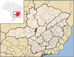
Tiros
Encyclopedia
Minas Gerais
Minas Gerais is one of the 26 states of Brazil, of which it is the second most populous, the third richest, and the fourth largest in area. Minas Gerais is the Brazilian state with the largest number of Presidents of Brazil, the current one, Dilma Rousseff, being one of them. The capital is the...
. Its population as of 2007 was 7,416 people living in a total area of 2,093 km². The city belongs to the mesoregion
Mesoregion (Brazil)
Mesoregions are subdivisions of Brazilian states, grouping together various municipalities in proximity and with common characteristics. They were created by the Brazilian Institute of Geography and Statistics for statistical purposes and do not, therefore, constitute an administrative area....
of Triângulo Mineiro
Triângulo Mineiro
The Triangle Mineiro Portuguese pronunciation: [tɾiɐɡulu minejru] is an officer in the region west of the state of Minas Gerais, Brazil. The area is 93.500 km ² and is limited by the Serra da Canastra and Marcela, east, south of Sao Paulo, Goias in the north and west of the junction of the rivers...
e Alto Paranaíba and to the microregion
Microregion (Brazil)
Microregions are legally defined administrative areas in Brazil consisting of groups of municipalities bordering urban areas. Microregions are grouped together into mesoregions....
of Patos de Minas
Patos de Minas
Patos de Minas is a city and municipality in the state of Minas Gerais in Brazil, located some 400 km from Belo Horizonte on the Paranaíba River. The city had 133,054 in 2007 while the area of the municipality is 3,189 km²...
. It became a municipality in 1924.
Location
The urban center is located at an elevation of 1,034 meters southeast of Patos de MinasPatos de Minas
Patos de Minas is a city and municipality in the state of Minas Gerais in Brazil, located some 400 km from Belo Horizonte on the Paranaíba River. The city had 133,054 in 2007 while the area of the municipality is 3,189 km²...
in the upper Borrachudo River valley. Neighboring municipalities are: São Gonçalo do Abaeté
São Gonçalo do Abaeté
São Gonçalo do Abaeté is a municipality in the north of the Brazilian state of Minas Gerais. Its population in 2007 was 6,156 inhabitants in a total area of 2,687 km². It is a large producer of cattle and grains....
(N), Morada Nova de Minas
Morada Nova de Minas
Morada Nova de Minas is a municipality in the north of the Brazilian state of Minas Gerais. As of 2007 the population was 8,297 in a total area of 2,085 km². It became a municipality in 1943.-Location:...
, Biquinhas
Biquinhas
Biquinhas is a municipality in the north of the Brazilian state of Minas Gerais. As of 2007 the population was 2,592 in a total area of 457 km². It became a municipality in 1962.-Location:...
, Paineiras
Paineiras
Paineiras is a municipality in the north of the Brazilian state of Minas Gerais. As of 2007 the population was 4,594 in a total area of 638 km². It became a municipality in 1962.-Location:...
, Cedro do Abaeté
Cedro do Abaeté
Cedro do Abaeté is a municipality in the north of the Brazilian state of Minas Gerais. In 2007, the population was 1,203 in a total area of 280 km². It became a municipality in 1962.-Location:...
(E), Matutina
Matutina
Matutina is a Brazilian municipality located in the northwest of the state of Minas Gerais. Its population as of 2007 was 3,700 people living in a total area of 260 km². The city belongs to the mesoregion of Triângulo Mineiro e Alto Paranaíba and to the microregion of Patos de Minas...
(S), and Arapuá
Arapuá
Arapuá is a Brazilian municipality located in the northwest of the state of Minas Gerais. Its population as of 2007 was 2,699 people living in a total area of 172 km². The city belongs to the mesoregion of Triângulo Mineiro e Alto Paranaíba and to the microregion of Patos de Minas...
, Carmo do Paranaíba
Carmo do Paranaíba
Carmo do Paranaíba is a Brazilian municipality located in the northwest of the state of Minas Gerais. Its population as of 2007 was 30,712 people living in a total area of . The city belongs to the mesoregion of Triângulo Mineiro e Alto Paranaíba and to the microregion of Patos de Minas...
, Patos de Minas
Patos de Minas
Patos de Minas is a city and municipality in the state of Minas Gerais in Brazil, located some 400 km from Belo Horizonte on the Paranaíba River. The city had 133,054 in 2007 while the area of the municipality is 3,189 km²...
, Varjão de Minas
Varjão de Minas
Varjão de Minas is a municipality in the north of the Brazilian state of Minas Gerais. Its population in 2007 was 5,993 inhabitants in a total area of 653 km²....
(W).
Distances
- Patos de MinasPatos de MinasPatos de Minas is a city and municipality in the state of Minas Gerais in Brazil, located some 400 km from Belo Horizonte on the Paranaíba River. The city had 133,054 in 2007 while the area of the municipality is 3,189 km²...
: 110 km - São GotardoSão GotardoSão Gotardo is a Brazilian municipality located in the northwest of the state of Minas Gerais. Its population as of 2007 was 30,757 people and its land area is 854 km2. The city belongs to the mesoregion of Triângulo Mineiro e Alto Paranaíba and to the microregion of Patos de Minas...
: 50 km (BR-262) - Belo HorizonteBelo HorizonteBelo Horizonte is the capital of and largest city in the state of Minas Gerais, located in the southeastern region of Brazil. It is the third largest metropolitan area in the country...
: 365 km
History
The region was first settled during the Portuguese colonial period in the eighteenth century due to the discovery of diamonds. The first settlement was called Vila de Santo Antônio de Tiros. In 1867 it became a parish of the municipality of São Francisco das Chagas do Campo Grande; in 1870 it jointed the municipality of Dores da Marmelada; in 1911, it became a district; in 1923 it became the municipality of Tiros.According to some historians, the name is derived from a firefight between diamond miners and smugglers in 1801.
Economic activities
The most important economic activities are cattle raising, commerce, and agriculture. The GDP in 2005 was R$ R$65 million, with 24 million generated by services, 05 million generated by industry, and 33 million generated by agriculture. Tiros is in the middle tier of municipalities in the state with regard to economic and social development. As of 2007 there was one banking agency in the town. There was a modest retail infrastructure serving the surrounding area of cattle and agricultural lands. There were 1,280 automobiles in all of the municipality (2007), about one for every 06 inhabitants.Tiros has a large municipal area and therefore a lot of land for agriculture. It suffers from isolation from major population centers. In the rural area there were 1,016 establishments (2006) occupying 150,000 hectares (planted area—7,500 ha, and natural pasture—130,000 ha.). About 3,600 persons were dependent on agriculture. 66 of the farms had tractors, a ratio of one tractor for 15 farms. There were 68,000 head of cattle in 2006. The main crops were:
- coffee: 900 hectares planted in 2006
- rice: 160 hectares
- beans: 190 hectares
- corn: 1,720 hectares
- soybeans: 700 hectares
Health and education
In the health sector there were 06 health clinics and one hospital with 16 beds. In the educational sector there were 03 pre-primary schools, 13 primary schools, and one middle school.- Municipal Human Development IndexHuman Development IndexThe Human Development Index is a composite statistic used to rank countries by level of "human development" and separate "very high human development", "high human development", "medium human development", and "low human development" countries...
: 0.755 (2000) - State ranking: 246 out of 853 municipalities as of 2000
- National ranking: 1,722 out of 5,138 municipalities as of 2000
- Literacy rate: 86%
- Life expectancy: 73 (average of males and females)
The highest ranking municipality in Minas Gerais in 2000 was Poços de Caldas
Poços de Caldas
Poços de Caldas is a city and municipality in south-western Minas Gerais state, Brazil, in the microregion of the same name. Its estimated population in 2009 was 151,449 inhabitants...
with 0.841, while the lowest was Setubinha
Setubinha
Setubinha is a municipality in the northeast of the Brazilian state of Minas Gerais. As of 2007 the population was 10,834 in a total area of 536 km². The elevation is 729 metres. It is part of the IBGE statistical microregion of Teófilo Otoni...
with 0.568. Nationally the highest was São Caetano do Sul
São Caetano do Sul
São Caetano do Sul is a city in São Paulo state in Brazil, located in the Greater São Paulo Metropolitan Area. It is the city with the highest per capita income in Brazil and it also has the highest Human Development Index .-Geography:São Caetano do Sul is located on a plateau that is part of the...
in São Paulo with 0.919, while the lowest was Setubinha. In more recent statistics (considering 5,507 municipalities) Manari in the state of Pernambuco
Pernambuco
Pernambuco is a state of Brazil, located in the Northeast region of the country. To the north are the states of Paraíba and Ceará, to the west is Piauí, to the south are Alagoas and Bahia, and to the east is the Atlantic Ocean. There are about of beaches, some of the most beautiful in the...
has the lowest rating in the country—0,467—putting it in last place.
See also
- List of municipalities in Minas Gerais