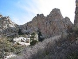
Organ Needle
Encyclopedia
Organ Needle is the highest point of the Organ Mountains
in the south-central part of the US state of New Mexico
. It lies in Doña Ana County
, 13 miles (20,921 m) east-northeast of Las Cruces
and 4 miles (6 km) southwest of White Sands
, headquarters of the White Sands Missile Range
. It is at the southeast end of a narrow ridge of vertically-jointed granite
(more specifically, quartz monzonite
) called The Needles.
Organ Needle is one of the most dramatic peaks in the state. True to its name, it is a steep, pointed summit. Moreover, it rises 4000 feet (1,219.2 m) above the edge of the Tularosa Basin
to the northeast in only 2 miles (3.2 km), and 5100 feet (1,554 m) above Las Cruces, giving it as large and as steep a degree of local relief as any peak in the state, including Big Hatchet Peak
, Sandia Crest
, and Shiprock
.
Climbing Organ Needle involves tricky route-finding, a vertical gain of about 4000 feet (1,219 m) and a difficult scramble
(Class 3+ or 4
).
Organ Mountains
The Organ Mountains are a rugged mountain range in southern New Mexico in the Southwestern United States. They lie east of the city of Las Cruces, in Doña Ana County.-Geography:...
in the south-central part of the US state of New Mexico
New Mexico
New Mexico is a state located in the southwest and western regions of the United States. New Mexico is also usually considered one of the Mountain States. With a population density of 16 per square mile, New Mexico is the sixth-most sparsely inhabited U.S...
. It lies in Doña Ana County
Doña Ana County, New Mexico
-2010:Whereas according to the 2010 U.S. Census Bureau:*74.1% White*1.7% Black*1.5% Native American*1.1% Asian*0.1% Native Hawaiian or Pacific Islander*3.0% Two or more races*18.5% Other races*65.7% Hispanic or Latino -2000:...
, 13 miles (20,921 m) east-northeast of Las Cruces
Las Cruces, New Mexico
Las Cruces, also known as "The City of the Crosses", is the county seat of Doña Ana County, New Mexico, United States. The population was 97,618 in 2010 according to the 2010 Census, making it the second largest city in the state....
and 4 miles (6 km) southwest of White Sands
White Sands, New Mexico
White Sands is a census-designated place in Doña Ana County, New Mexico, United States. The population was 1,323 at the 2000 census. It is part of the Las Cruces Metropolitan Statistical Area...
, headquarters of the White Sands Missile Range
White Sands Missile Range
White Sands Missile Range is a rocket range of almost in parts of five counties in southern New Mexico. The largest military installation in the United States, WSMR includes the and the WSMR Otera Mesa bombing range...
. It is at the southeast end of a narrow ridge of vertically-jointed granite
Granite
Granite is a common and widely occurring type of intrusive, felsic, igneous rock. Granite usually has a medium- to coarse-grained texture. Occasionally some individual crystals are larger than the groundmass, in which case the texture is known as porphyritic. A granitic rock with a porphyritic...
(more specifically, quartz monzonite
Quartz monzonite
Quartz monzonite is an intrusive igneous rock that has an approximately equal proportion of orthoclase and plagioclase feldspars. The plagioclase is typically intermediate to sodic in composition, andesine to oligoclase. Quartz is present in significant amounts. Biotite and/or hornblende...
) called The Needles.
Organ Needle is one of the most dramatic peaks in the state. True to its name, it is a steep, pointed summit. Moreover, it rises 4000 feet (1,219.2 m) above the edge of the Tularosa Basin
Tularosa Basin
The Tularosa Basin is a graben basin in the Basin and Range Province and within the Chihuahuan Desert, east of the Rio Grande in southern New Mexico, in the Southwestern United States.-Geography:...
to the northeast in only 2 miles (3.2 km), and 5100 feet (1,554 m) above Las Cruces, giving it as large and as steep a degree of local relief as any peak in the state, including Big Hatchet Peak
Big Hatchet Peak
Big Hatchet Peak is the high point of the Big Hatchet Mountains, a small but rugged range in the southwest corner of New Mexico, in the United States. The mountains are located in southeast Hidalgo County, about 50 mi southwest of Deming...
, Sandia Crest
Sandia Mountains
The Sandia Mountains name posu gai hoo-oo, "where water slides down arroyo") are a mountain range located in Bernalillo and Sandoval counties, immediately to the east of the city of Albuquerque in New Mexico in the southwestern United States. The range is largely within the Cibola National...
, and Shiprock
Shiprock
Shiprock is a rock formation rising nearly above the high-desert plain on the Navajo Nation in San Juan County, New Mexico, USA. It has a peak elevation of above the sea level. It lies about southwest of the town of Shiprock, which is named for the peak...
.
Climbing Organ Needle involves tricky route-finding, a vertical gain of about 4000 feet (1,219 m) and a difficult scramble
Scrambling
Scrambling is a method of ascending rocky faces and ridges. It is an ambiguous term that lies somewhere between hillwalking and rock climbing. It is often distinguished from hillwalking by defining a scramble as a route where hands must be used in the ascent...
(Class 3+ or 4
Yosemite Decimal System
The Yosemite Decimal System is a three-part system used for rating the difficulty of walks, hikes, and climbs. It is primarily used by mountaineers in the United States and Canada. The Class 5 portion of the Class scale is primarily a rock climbing classification system. Originally the system was...
).

