
Nose Hill Park
Encyclopedia
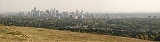
Nose Hill Park, one of the largest municipal parks in Canada
and North America
, is located in the northwest quadrant of Calgary
, Alberta
. It is a natural environment park, commonly regarded as a retreat from city life and a place to enjoy nature. It is the second-largest park in Calgary, surpassed in size only by Fish Creek Provincial Park
.
ecosystem and over 66 native vascular plant species have been found on the hill including parry oatgrass, prairie crocus, golden bean, bedstraw, and sage
.
Grasslands of this nature are considered endangered in North America
because more than 95% have been lost to cultivation, tree encroachment, pollution, and development. The grassland is one of 7 major native habitat types on the hill which together provide an excellent habitat for a variety of animals. Over 198 wildlife species have been identified on the hill.
s and shale
s that formed the hill's bedrock. During the last ice age
, about 15, 000 years ago, ice sheets wore away the rock and gravel. At the end of the ice age, retreating ice left glacial till on the hill's top. Glacial Lake Calgary was formed in the area and deposited sediments on the side of the hill. A river, later to be known as the Bow, eroded the sediments and helped shape the south side of the hill.
In December 1779 a well-known Hudson's Bay Company
trader, Peter Fidler
, recorded an excursion to the hill he went on with Peigan
guides. HBC
trader David Thompson
wintered at a Peigan encampment on the Bow River
in 1787–1788, and in 1800 returned to the area as a North West Company
employee. In his journal for the year, Thompson made specific note of Nose Hill. The details of Fidler's journal entry illustrate well how dramatically the region's warm Chinook wind
s can affect the cold temperatures that characterize winters in southern Alberta
. The temperature on the December day of Fidler's visit to Nose Hill was a balmy 14 degrees Celsius (58 degrees Fahrenheit).
Exposed to the drying and warming effects of the recurrent Chinook winds, Nose Hill provided favorable wintering grounds for bison
herds which, in turn, attracted people to the hill's grassy slopes. The park today contains numerous tipi
rings - circles of stone once used to weigh down the conical-shaped skin dwellings of plains bison hunters. Also within the perimeters of today's park are ancient tool-making stations, a stone cairn
, and evidence of bison kills conducted long ago. In 1900, one Euro-Canadian settler in the Nose Hill area described the archaeological residue below the cliffs of the coulee by McPherson Creek as a bone bed nine feet thick and an acre in extent. Establishing the tribal identities of all the people who left archaeological evidence on and around Nose Hill is virtually impossible. Most of the more recent sites, however, probably belonged to the Peigan, who dominated the territory in the vicinity of the Bow Valley
when the Europeans first appeared.
John and George McDougall
, Methodist missionaries, experienced more typical winter weather when they traveled to Nose Hill to hunt bison some four decades later. En route back to their hunting camp on the bitterly cold night of January 24, 1876, the elder McDougall, George, lost his way. A savage snowstorm delayed efforts to locate the missing man. On February 6, a search party finally discovered McDougall's frozen body on the east side of Nose Creek.
Names currently associated with topographical features in and near Nose Hill Park reflect the impact of the European newcomers and European trade goods on the Peigan. For example, Spy Hill, the westward extension of Nose Hill, derived its present name from the aboriginal practice of communicating with distant colleagues by flashing European trade mirrors from elevated locations. Other effects of the Europeans' arrival were more insidious. The six bison that the Methodist missionaries shot during their ill-fated hunting excursion were mere remnants of southern Alberta's once vast buffalo population. By 1879, the bison herds had vanished from Nose Hill. A new chapter of local history had begun. A fledgling Euro-Canadian community, Fort Calgary
, had appeared in the valley beneath Nose Hill.
The area around Nose Hill itself played a significant economic role in Calgary's subsequent physical transformation from police fort to prairie city. Much of the sandstone used to construct the imposing public buildings that became Calgary's hallmark after 1886 came from quarries local entrepreneurs operated on Nose Creek. Stone from the J A Lewis quarry provided the entrance to the Imperial Bank and part of the new city hall erected in 1909. Masons used materials carted into the city from Nose Creek to build James Short School and Calgary's old courthouse as well.
During the construction "boom" years prior to World War I
, Nose Creek also made a significant contribution to less reputable facets of the young city's economy. Bordellos built along the banks of the creek helped sustain the local prostitution trade, and further Calgary's growing notoriety as "... the booze, brothel and gambling capital of the far western plains." Business at the brothels flourished until World War I, when competing downtown facilities that operated near the city's saloons and new army barracks diverted attention away from the less accessible Nose Hill and Nose Creek district.
In the fall of 1896, a young Blackfoot man, Running Weasel, died south of the Bow River
. His final request provides eloquent testimony to Nose Hill's enduring role as a sentinel presiding over the passage of time. At his death, Running Weasel asked that he be " ... put where he could see the great city [of Calgary] grow beneath his feet." His well-known friend Deerfoot placed his coffin beside Nose Creek.
As Calgary developed and grew, it began encroaching on the hill. Developers discussed constructing a neighbourhood along the hill as early as the late 1940s. Some maps began featuring roads as far northwest as 24th Street and 48 Avenue, though none of these roads were ever constructed north of John Laurie Boulevard or west of 14th Street.
Cattle
grazing continued on the hill unabated until 1969, vehicle traffic was tolerated on parts of the hill until 1971, people picnicking or just sightseeing from their car were common sights in summer months. More than 35 years later, remnants of the damage the cars created on the narrow paths can still be seen immediately west of the Calgary Winter Club Parking lot. In 1974 a grassroots group began lobbying the city to protect the area. It was not until the 1980s that Nose Hill Park was officially designated a protected area
by the city; it finally gave it this designation in response to plans by developers to build a residential community on the site of the park. Once considered the northern outskirts of Calgary, the park is today surrounded on all sides by residential development. Much has been done to preserve the park. Long abandoned hulks of cars were removed from the coulees in the late 1970s and early 1980s. Today, the park is used year-round by hikers, walkers, cyclists and other outdoor enthusiasts.
It is bordered on the South by John Laurie Blvd. N.W., to the West by Shaganappi Tr. N.W., on the East by 14 St. N.W., and on the North by the community of MacEwan.
The park had more than 300 km (186.4 mi) of informal trails. The city proposed a rehabilitation plan which would provide 60 km (37.3 mi) of maintained trails and pathways, of which 52 km (32.3 mi) are dirt and gravel and 8 km (5 mi) are asphalt.
Canada
Canada is a North American country consisting of ten provinces and three territories. Located in the northern part of the continent, it extends from the Atlantic Ocean in the east to the Pacific Ocean in the west, and northward into the Arctic Ocean...
and North America
North America
North America is a continent wholly within the Northern Hemisphere and almost wholly within the Western Hemisphere. It is also considered a northern subcontinent of the Americas...
, is located in the northwest quadrant of Calgary
Calgary
Calgary is a city in the Province of Alberta, Canada. It is located in the south of the province, in an area of foothills and prairie, approximately east of the front ranges of the Canadian Rockies...
, Alberta
Alberta
Alberta is a province of Canada. It had an estimated population of 3.7 million in 2010 making it the most populous of Canada's three prairie provinces...
. It is a natural environment park, commonly regarded as a retreat from city life and a place to enjoy nature. It is the second-largest park in Calgary, surpassed in size only by Fish Creek Provincial Park
Fish Creek Provincial Park
Fish Creek Park is a provincial park located in the southern part of Calgary, Alberta, Canada. It is one of the largest urban parks in North America, stretching from east to west. At , it is over three times the size of Vancouver's Stanley Park....
.
Environment
Sensitive vegetation, terrain, and archeological sites exist within the park. It contains a significant native rough fescue grasslandGrassland
Grasslands are areas where the vegetation is dominated by grasses and other herbaceous plants . However, sedge and rush families can also be found. Grasslands occur naturally on all continents except Antarctica...
ecosystem and over 66 native vascular plant species have been found on the hill including parry oatgrass, prairie crocus, golden bean, bedstraw, and sage
Salvia
Salvia is the largest genus of plants in the mint family, Lamiaceae, with approximately 700-900 species of shrubs, herbaceous perennials, and annuals. It is one of several genera commonly referred to as sage. When used without modifiers, sage generally refers to Salvia officinalis ; however, it is...
.
Grasslands of this nature are considered endangered in North America
North America
North America is a continent wholly within the Northern Hemisphere and almost wholly within the Western Hemisphere. It is also considered a northern subcontinent of the Americas...
because more than 95% have been lost to cultivation, tree encroachment, pollution, and development. The grassland is one of 7 major native habitat types on the hill which together provide an excellent habitat for a variety of animals. Over 198 wildlife species have been identified on the hill.
Formation
A large river flowing from the mountains to the west deposited gravels on top of sandstoneSandstone
Sandstone is a sedimentary rock composed mainly of sand-sized minerals or rock grains.Most sandstone is composed of quartz and/or feldspar because these are the most common minerals in the Earth's crust. Like sand, sandstone may be any colour, but the most common colours are tan, brown, yellow,...
s and shale
Shale
Shale is a fine-grained, clastic sedimentary rock composed of mud that is a mix of flakes of clay minerals and tiny fragments of other minerals, especially quartz and calcite. The ratio of clay to other minerals is variable. Shale is characterized by breaks along thin laminae or parallel layering...
s that formed the hill's bedrock. During the last ice age
Ice age
An ice age or, more precisely, glacial age, is a generic geological period of long-term reduction in the temperature of the Earth's surface and atmosphere, resulting in the presence or expansion of continental ice sheets, polar ice sheets and alpine glaciers...
, about 15, 000 years ago, ice sheets wore away the rock and gravel. At the end of the ice age, retreating ice left glacial till on the hill's top. Glacial Lake Calgary was formed in the area and deposited sediments on the side of the hill. A river, later to be known as the Bow, eroded the sediments and helped shape the south side of the hill.
History
The origin of the hill's name is unclear but common legend tells of a European explorer asking an aboriginal translator the name of the hill seen far off in the distance. The man replied: Nose Hill is the name it was given because from here it resembles the nose of our chief.In December 1779 a well-known Hudson's Bay Company
Hudson's Bay Company
The Hudson's Bay Company , abbreviated HBC, or "The Bay" is the oldest commercial corporation in North America and one of the oldest in the world. A fur trading business for much of its existence, today Hudson's Bay Company owns and operates retail stores throughout Canada...
trader, Peter Fidler
Peter Fidler (explorer)
Peter Fidler was a British surveyor, map-maker, chief fur trader and explorer who had a long career in the employ of the Hudson's Bay Company in what later became Canada. He was born in Bolsover, Derbyshire, England and died at Fort Dauphin in present day Manitoba...
, recorded an excursion to the hill he went on with Peigan
Northern Peigan
The Northern Peigans or Aapátohsipikáni are a First Nation, part of the Niitsítapi . Known as Piikáni, "Pekuni" or Aapátohsipikáni , they are very closely related to the other members of the Blackfoot Confederacy: Aamsskáápipikani , Káínaa or...
guides. HBC
Hudson's Bay Company
The Hudson's Bay Company , abbreviated HBC, or "The Bay" is the oldest commercial corporation in North America and one of the oldest in the world. A fur trading business for much of its existence, today Hudson's Bay Company owns and operates retail stores throughout Canada...
trader David Thompson
David Thompson (explorer)
David Thompson was an English-Canadian fur trader, surveyor, and map-maker, known to some native peoples as "Koo-Koo-Sint" or "the Stargazer"...
wintered at a Peigan encampment on the Bow River
Bow River
The Bow River is a river in the Canadian province of Alberta. It is a tributary of the South Saskatchewan River, and is considered the headwater of the Nelson River....
in 1787–1788, and in 1800 returned to the area as a North West Company
North West Company
The North West Company was a fur trading business headquartered in Montreal from 1779 to 1821. It competed with increasing success against the Hudson's Bay Company in what was to become Western Canada...
employee. In his journal for the year, Thompson made specific note of Nose Hill. The details of Fidler's journal entry illustrate well how dramatically the region's warm Chinook wind
Chinook wind
Chinook winds , often called chinooks, commonly refers to foehn winds in the interior West of North America, where the Canadian Prairies and Great Plains meet various mountain ranges, although the original usage is in reference to wet, warm coastal winds in the Pacific Northwest.Chinook is claimed...
s can affect the cold temperatures that characterize winters in southern Alberta
Southern Alberta
Southern Alberta is a region located in the Canadian province of Alberta. As of the year 2004, the region's population was approximately 272,017. The primary cities are Lethbridge and Medicine Hat...
. The temperature on the December day of Fidler's visit to Nose Hill was a balmy 14 degrees Celsius (58 degrees Fahrenheit).
Exposed to the drying and warming effects of the recurrent Chinook winds, Nose Hill provided favorable wintering grounds for bison
Bison
Members of the genus Bison are large, even-toed ungulates within the subfamily Bovinae. Two extant and four extinct species are recognized...
herds which, in turn, attracted people to the hill's grassy slopes. The park today contains numerous tipi
Tipi
A tipi is a Lakota name for a conical tent traditionally made of animal skins and wooden poles used by the nomadic tribes and sedentary tribal dwellers of the Great Plains...
rings - circles of stone once used to weigh down the conical-shaped skin dwellings of plains bison hunters. Also within the perimeters of today's park are ancient tool-making stations, a stone cairn
Cairn
Cairn is a term used mainly in the English-speaking world for a man-made pile of stones. It comes from the or . Cairns are found all over the world in uplands, on moorland, on mountaintops, near waterways and on sea cliffs, and also in barren desert and tundra areas...
, and evidence of bison kills conducted long ago. In 1900, one Euro-Canadian settler in the Nose Hill area described the archaeological residue below the cliffs of the coulee by McPherson Creek as a bone bed nine feet thick and an acre in extent. Establishing the tribal identities of all the people who left archaeological evidence on and around Nose Hill is virtually impossible. Most of the more recent sites, however, probably belonged to the Peigan, who dominated the territory in the vicinity of the Bow Valley
Bow Valley
Bow Valley is a valley located along the upper Bow River in Alberta, Canada.The name "Bow" refers to the reeds that grew along its banks and which were used by the local First Nations peoples to make bows; the Peigan name for the river is "Makhabn", meaning "river where bow weeds grow".-Parks:Bow...
when the Europeans first appeared.
John and George McDougall
George McDougall
George Millward McDougall was a Methodist missionary in Canada who assisted in negotiations leading to Treaty 6 and Treaty 7 between the Canadian government and the Indian tribes of western Canada.-Biography:...
, Methodist missionaries, experienced more typical winter weather when they traveled to Nose Hill to hunt bison some four decades later. En route back to their hunting camp on the bitterly cold night of January 24, 1876, the elder McDougall, George, lost his way. A savage snowstorm delayed efforts to locate the missing man. On February 6, a search party finally discovered McDougall's frozen body on the east side of Nose Creek.
Names currently associated with topographical features in and near Nose Hill Park reflect the impact of the European newcomers and European trade goods on the Peigan. For example, Spy Hill, the westward extension of Nose Hill, derived its present name from the aboriginal practice of communicating with distant colleagues by flashing European trade mirrors from elevated locations. Other effects of the Europeans' arrival were more insidious. The six bison that the Methodist missionaries shot during their ill-fated hunting excursion were mere remnants of southern Alberta's once vast buffalo population. By 1879, the bison herds had vanished from Nose Hill. A new chapter of local history had begun. A fledgling Euro-Canadian community, Fort Calgary
Fort Calgary
Fort Calgary was established in 1875 as Fort Brisebois by the North-West Mounted Police, located at the confluence of the Bow and Elbow rivers in what is now Calgary, Alberta.-History:...
, had appeared in the valley beneath Nose Hill.
The area around Nose Hill itself played a significant economic role in Calgary's subsequent physical transformation from police fort to prairie city. Much of the sandstone used to construct the imposing public buildings that became Calgary's hallmark after 1886 came from quarries local entrepreneurs operated on Nose Creek. Stone from the J A Lewis quarry provided the entrance to the Imperial Bank and part of the new city hall erected in 1909. Masons used materials carted into the city from Nose Creek to build James Short School and Calgary's old courthouse as well.
During the construction "boom" years prior to World War I
World War I
World War I , which was predominantly called the World War or the Great War from its occurrence until 1939, and the First World War or World War I thereafter, was a major war centred in Europe that began on 28 July 1914 and lasted until 11 November 1918...
, Nose Creek also made a significant contribution to less reputable facets of the young city's economy. Bordellos built along the banks of the creek helped sustain the local prostitution trade, and further Calgary's growing notoriety as "... the booze, brothel and gambling capital of the far western plains." Business at the brothels flourished until World War I, when competing downtown facilities that operated near the city's saloons and new army barracks diverted attention away from the less accessible Nose Hill and Nose Creek district.
In the fall of 1896, a young Blackfoot man, Running Weasel, died south of the Bow River
Bow River
The Bow River is a river in the Canadian province of Alberta. It is a tributary of the South Saskatchewan River, and is considered the headwater of the Nelson River....
. His final request provides eloquent testimony to Nose Hill's enduring role as a sentinel presiding over the passage of time. At his death, Running Weasel asked that he be " ... put where he could see the great city [of Calgary] grow beneath his feet." His well-known friend Deerfoot placed his coffin beside Nose Creek.
As Calgary developed and grew, it began encroaching on the hill. Developers discussed constructing a neighbourhood along the hill as early as the late 1940s. Some maps began featuring roads as far northwest as 24th Street and 48 Avenue, though none of these roads were ever constructed north of John Laurie Boulevard or west of 14th Street.
Cattle
Cattle
Cattle are the most common type of large domesticated ungulates. They are a prominent modern member of the subfamily Bovinae, are the most widespread species of the genus Bos, and are most commonly classified collectively as Bos primigenius...
grazing continued on the hill unabated until 1969, vehicle traffic was tolerated on parts of the hill until 1971, people picnicking or just sightseeing from their car were common sights in summer months. More than 35 years later, remnants of the damage the cars created on the narrow paths can still be seen immediately west of the Calgary Winter Club Parking lot. In 1974 a grassroots group began lobbying the city to protect the area. It was not until the 1980s that Nose Hill Park was officially designated a protected area
Protected area
Protected areas are locations which receive protection because of their recognised natural, ecological and/or cultural values. There are several kinds of protected areas, which vary by level of protection depending on the enabling laws of each country or the regulations of the international...
by the city; it finally gave it this designation in response to plans by developers to build a residential community on the site of the park. Once considered the northern outskirts of Calgary, the park is today surrounded on all sides by residential development. Much has been done to preserve the park. Long abandoned hulks of cars were removed from the coulees in the late 1970s and early 1980s. Today, the park is used year-round by hikers, walkers, cyclists and other outdoor enthusiasts.
Size and location
from North to South from East to West to 1230 m (4,035.4 ft) altitudeIt is bordered on the South by John Laurie Blvd. N.W., to the West by Shaganappi Tr. N.W., on the East by 14 St. N.W., and on the North by the community of MacEwan.
The park had more than 300 km (186.4 mi) of informal trails. The city proposed a rehabilitation plan which would provide 60 km (37.3 mi) of maintained trails and pathways, of which 52 km (32.3 mi) are dirt and gravel and 8 km (5 mi) are asphalt.