
New Brunswick Route 2
Encyclopedia
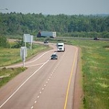
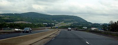
Route 2 is a major provincial highway in the Canadian province
of New Brunswick
, carrying the main route of the Trans-Canada Highway
in the province. It is a 4-lane freeway for all but three kilometres in the north, where the road connects with Quebec
Route 185.
The highway connects with Route 185 at the border with Quebec
and with Highway 104 at the border with Nova Scotia
, as well as traffic from Interstate 95
via the Route 95 connector. Route 2 directly serves the cities of Edmundston, Fredericton and Moncton.
A 20-year project to replace the original 1960s-era 2-lane Trans-Canada Highway with a 4-lane freeway was completed on November 1, 2007. The final upgrade to Route 2 and its short connector Route 95 has extended the continuous freeway network of North America east to New Glasgow, Nova Scotia
. Once Autoroute 85 in Quebec is completed, Route 2 will also connect with the freeway networks of central Canada without passing through the United States.
 The highway's western terminus is at the interprovincial boundary with Quebec 15 km north of Edmundston. It follows the lower section of the Madawaska River
valley and enters the Saint John River valley where it passes north of Edmundston, running several kilometres inland from the east bank of the Saint John River, continuing past Saint-Léonard
.
At Grand Falls
, the highway crosses to the west bank of the river and passes by Perth-Andover
, Florenceville
, and Hartland
. At Woodstock
the Saint John River turns east and the highway continues to parallel the river on a ridge several kilometres inland along the western bank. It passes south of Fredericton and Oromocto before crossing the northeastern edge of CFB Gagetown
.
The Saint John River turns south near Jemseg
where the highway crosses the river on the Saint John River High Level Crossing
and continues east over the Jemseg River
using the Jemseg River Bridge
.
The highway leaves the river valleys as it continues east across the rolling hills south of Grand Lake and passes by Havelock
, River Glade
and Salisbury
.
The highway passes north and east of Moncton and Dieppe
before turning south and passing by Memramcook
, Sackville
, and Aulac
before reaching the eastern terminus at the inter-provincial boundary with Nova Scotia
.
 Route 2 was one of the initial routes defined in 1927, running from Quebec to Nova Scotia via Edmundston, Grand Falls
, Woodstock
, Fredericton, Saint John
and Moncton. After a short crossing of the New Brunswick Panhandle alongside the Madawaska River to Edmundston, Route 2 closely followed the Saint John River all the way to Saint John, crossing three times - from the east to the west at Grand Falls, back to the east at Perth-Andover
, and back to the west at Hartland
(on the Hartland Covered Bridge). The road on the east side of the river between Edmundston and Grand Falls had just been opened in about 1926; previously travelers had to pass through Maine
(US 1, SR 165, and Boundary Road) on the west side. A Route 2A cut the distance between Fredericton and Saint John via a poorer-quality but more direct road, intersecting Route 2 at Oromocto and Westfield. Beyond Saint John, Route 2 went northeast via Sussex
to Moncton, and then turned southeast to cross the Nova Scotia border near Sackville
. The original path of Route 2 between Quebec and Sussex is now approximately the River Valley Scenic Drive.
 When the route of the Trans-Canada Highway
was defined in about 1950, it did not follow Route 2 via Saint John between Fredericton and Sussex, but took the more direct Route 9. Through the late 1950s and 1960s, a number of bypasses and realignments, mostly two-lane, were built to improve Route 2 with federal Trans-Canada Highway funds. The first, built in the 1950s, was around Moncton, between southwest of Salisbury
and Sackville
. The old road through Moncton became Route 2A, then Route 6 in 1965, and is now Route 106.
Next was the bypass around Woodstock
. The road from Route 42 (now Route 560) at Jacksonville northeast to Route 2 (now Route 103) at Somerville
was Route 2B by the late 1950s; with the 1960 completion of the Hugh John Flemming Bridge, just upstream from the Hartland Covered Bridge, and the extension of Route 2B south from Jacksonville to Route 2 (now Route 165) south of Woodstock, Route 2B became a realignment of Route 2, with old Route 2 through Woodstock becoming Route 2A (renumbered Route 103 in 1965).
The initial bypass of Fredericton was also built in about 1960, including the 1959 Princess Margaret Bridge
across the Saint John River, which replaced the Carleton Street Bridge for traffic to Routes 8, 9, and 10. Traffic remaining on Route 2 to Saint John
exited the bypass at what is now exit 7 for Route 7.
Route 2 was moved to be identical with the Trans-Canada Highway, absorbing Route 9, in the 1965 renumbering of several New Brunswick highways. The old alignment via Saint John, where it did not become Route 7 (which replaced Route 2A) or an extension of Route 1, was renumbered as the new Route 102 between Oromocto and Westfield.
The majority of road development in New Brunswick follows settlement patterns which pre-dated motor transport, thus most communities developed along navigable waterways or were served by railways. The development of controlled access expressway
s only began in the 1960s and only around the largest communities. The majority of early provincial highway improvements merely consisted of upgrading local roads.
Route 2 initially followed local roads from the N.B.-Quebec interprovincial boundary to Edmundston and down the Saint John River Valley to Grand Falls. There, it crossed to the west bank of the Saint John River, and continued south to Florenceville where it crossed to the east bank to continue to Hartland, then recrossed the river to the west bank which it followed to Fredericton in a southeast direction.
At Fredericton a controlled-access 4-lane section was built around the city, and the highway crossed the Saint John River on the Princess Margaret Bridge
to the east bank just south of the central business district. Following the river's east bank just metres above its water level (frequently flooded in spring freshet
s), the route continued south to Jemseg
where the highway turned east along the southeast shore of Grand Lake to Youngs Cove Road where the highway turned south to Coles Island
and on to Sussex
.
At Sussex the highway turned east again and passed by Petitcodiac
and then by Salisbury. East of Salisbury, Route 2 followed local roads over a series of low hills north of Moncton, cresting at Lutes Mountain, before descending and following a controlled access section bypassing the city and Dieppe, skirting the edge of the Memramcook River valley and on to Sackville, then Aulac, and finally the N.B.-N.S. inter-provincial boundary.
construction in 1968), leading to significant deterioration of the Trans-Canada Highway in New Brunswick. By the mid-1980s Route 2 was a significant traffic hazard and a major embarrassment to the province.
The provincial government changed in 1987 with the election of Premier Frank McKenna
who was focused on improving the province's business climate. One of the government's major tasks was to revamp provincial transportation infrastructure and McKenna entered into aggressive negotiations with the federal government of prime minister Brian Mulroney
to secure federal funding of new highway projects. McKenna viewed Route 2 (the Trans-Canada Highway) and Route 1 in New Brunswick as being partially a federal responsibility since they funnelled the majority of Atlantic Canada's highway traffic to the U.S. and central Canada. The signing of the Canada-U.S. Free Trade Agreement in 1989, coupled with federal approval for numerous railway line abandonments in the Maritimes during the 1980s, led to predictions of further highway traffic growth on New Brunswick highways in the 1990s.
Under the remainder of the McKenna administration's years of power (until 1997), Route 2 saw significant upgrading to become a 4-lane expressway
on heavily-travelled portions of the highway between the N.B.-N.S. inter-provincial boundary and Penobsquis
(east of Sussex). Other isolated sections were also upgraded south of Grand Lake and between Edmundston and St. Leonard, as well as at Woodstock where an interchange connected to Interstate 95
.
 Despite the upgrades, the uncontrolled-access sections of Route 2 were still a significant traffic hazard. Intensive lobbying from other provincial governments in the Atlantic provinces, as well as various trucking companies and business and transportation interests, asked that Route 2 be further upgraded. Unfortunately provincial finances could not handle the relatively large price tag required, even with the federal funding at the time.
225 km (139.8 mi) of new 4-lane controlled-access expressway
would be privately financed and built, with the builder charging tolls for a 25-year period before the provincial government would gain control of the highway. In the late 1990s, an agreement was signed with a private consortium called Maritime Road Development Corporation (led by former provincial Liberal leader and former federal Minister of Transport Douglas Young) to build the new Route 2 alignment at an estimated cost of $1 billion (CAD).
The toll issue was not without controversy as it, along with several other issues, led to the downfall of McKenna's successor, Camille Thériault
in 1999 to PC
leader Bernard Lord
. The highway was built, but tolls were removed from most portions of the highway before they opened. This portion of the privately built re-alignment of the Trans-Canada Highway has a hidden toll calculated by sensors in the pavement. The toll is instead charged to the provincial government, thus motorists do not directly pay for their highway usage. Along with a payment worth millions of dollars to get out of the original contract, the provincial government now makes all provincial taxpayers cover the cost of the highway when the original plan had been for a user-pay system under a toll structure.
The new alignment of the Trans-Canada Highway opened in fall 2001 and at this time the portion of the old Route 2 alignment which ran between River Glade and Sussex was re-designated as part of Route 1, extending the eastern terminus of that highway approximately 40 km. The re-alignment also had the effect of shortening the total length of Route 2 in the province by approximately 40 km (24.9 mi).
The re-alignment and construction of Route 2 between Long Creek and River Glade "catapulted" New Brunswick highways forward by decades virtually overnight. The road was designed with 500 ft medians, extensive wildlife fencing and underpasses, rumble strips along emergency breakdown lanes, paved emergency U-turn areas, sensors beneath the asphalt for monitoring truck weights as well as local weather and road surface conditions, extensive guard rails and reflectors, as well as two major bridges: the Saint John River High Level Crossing
and the nearby Jemseg River Bridge
.
Suddenly it was now possible to travel from Fredericton into Nova Scotia (and on to Halifax or New Glasgow
) completely on a 4-lane controlled access highway.
The Fredericton-Moncton section was officially opened to traffic at 10am on October 24, 2001, five weeks ahead of schedule.
During this same period, negotiations were undertaken with the federal government to secure funding to complete the last, and one of the most costly parts of the new construction — a 98 km (60.9 mi) gap between Woodstock and Grand Falls over the Appalachian Mountains
, and a 30 km (18.6 mi) gap between Long Creek and Pokiok
, west of Fredericton.
In August, 2003 a joint announcement was made by Premier Lord and Prime Minister Jean Chrétien
for a $400 million (CAD) agreement to complete upgrades to the last remaining non-controlled access section of Route 2.
The Pokiok-Long Creek section had been independently contracted by the provincial government and opened in November 2006. However, the provincial government sought to construct the remaining 98 km gap as part of a complete "design-build-finance-operate-maintain-rehabilitate" plan which would see large private sector consortia bid for the right to design and construct the 98 km of new highway for Route 2, as well as to operate the entire 275 km section of Route 2 between Long Creek (where it abuts the 230 km hidden-toll highway section built and operated by Maritime Road Development Corporation) and the Quebec-New Brunswick border as well as all of Route 95.
The winning consortium was Brun-Way Group, a joint venture by Atcon Construction and SNC-Lavalin
. Brun-Way Group has two subsidiaries, Brun-Way Construction Inc., which is receiving the ~$540 million to complete the 98 km of new construction as well as selected upgrades to other sections of Route 2 between Long Creek and the Quebec border, and Brun-Way Highway Operations Inc., which will receive an annual payment from the government of New Brunswick until 2033 to operate and maintain this section of the highway. This agreement will place fully 85% of the maintenance of Route 2 and 100% of Route 95 in the hands of the consortia Brun-Way and MRDC.
The construction of the last segment of four-lane Route 2 was completed by Brun-Way on November 1, 2007. This construction saw a completely new alignment built north of Woodstock, staying several kilometres inland from the Saint John River's west bank, and paralleling the Canada-U.S. border north to Grand Falls, where it crosses to the east bank of the river and connects with existing four-lane upgrades to Route 2 through to the Quebec boundary. In addition to upgrades to Route 2, Brun-Way is also contracted to perform similar upgrades to Route 95
, a short connecting route between the Trans-Canada Highway at Woodstock and the Canada-U.S. border at Houlton
where it meets Interstate 95
.
Upon the opening of this section to traffic on November 1, 2007, the entire length of Route 2 and Route 95 are four-lane controlled-access freeways with a posted speed limit of 110 km/h (70 mph) and a design speed of up to 120 km/h (75 mph).
!County
!Location
!Exit
!Destinations
!Notes
|-
|rowspan=13|Madawaska
|rowspan=6|Edmundston
|8
|
|-
|13
|
|Signed as exits 13A (west) and 13B (east); former exit 15
|-
|16
|Carrier Street, Victoria Street
|-
|18
|
|-
|21
|
|-
|26
|
|-
|
|32
|
|-
|
|46
|
|-
|
|51
|
|-
|
|56
|
|-
|Saint-Léonard
|58
|, Saint Leonard Airport
|-
|
|69
|Bourgoin Road
|-
|rowspan=4|Grand Falls
|75
|
|-
|rowspan=7|Victoria
||77
|
|Westbound exit and eastbound entrance; former exit 75
|-
||79
|
|Former exit 78
|-
|83
|
|-
|
|88
| - Limestone
, New Denmark
|-
|
|99
|
|-
|
|107
|
|-
|Perth-Andover
|115
|, Fort Fairfield
|Former exit 112
|-
|rowspan=9|Carleton
|
|153
|
|-
|
|172
|
|-
|
|184
|
|-
|rowspan=4|Woodstock
|185
|
|Former exit 188
|-
|187
| to - Houlton
|Former exit 191A
|-
|188
|
|Former exit 191B
|-
|191
|Beardsley Road
|Former exit 194
|-
|
|194
|Hodgdon Road - Woodstock First Nation
|-
|
|200
|Dugan Road
|-
|rowspan=9|York
|
|212
|
|-
|
|223
|Charlie Lake Road - Temple
|Westbound exit and eastbound entrance
|-
|
|231
|
|-
|
|253
|
|-
|
|258
|
|-
|
|271
|
|-
|rowspan=4|Fredericton
|280
|
|Eastbound exit and westbound entrance
|-
|281
|
|-
|285
|
|Signed as exits 285A (south) and 285B (north)
|-
|rowspan=5|Sunbury
|294
|
|West end of Route 7 overlap; westboound exit and eastbound entrance
|-
|
|297
|Nevers Road - Rusagonis
, Lincoln
|Former exit 11
|-
|rowspan=3|Oromocto
|301
|
|Eastbound exit and westbound entrance; former exit 15
|-
|303
|
|-
|306
|
|East end of Route 7 overlap; no westbound exit
|-
|rowspan=5|Queens
|
|330
|
|-
|
|333
|
|No westbound entrance
|-
|
|339
|
|Former exit 343
|-
|
|347
|
|-
|
|365
|
|-
|rowspan=20|Westmorland
|
|414
|
|-
|
|423
|
|-
|Salisbury
|433
|
|Former exit 470
|-
|rowspan=7|Moncton
|446
|
|Former exit 482
|-
||450
|
|Former exit 488
|-
||452
|Gorge Road
|Former exit 490
|-
||454
|Mapleton Road - Mapleton
|Former exit 492
|-
||459
|
|Signed as exits 459A (south) and 459B (north); former exit 496
|-
||462
|Caledonia
|Former exit 500
|-
||465
|
|Former exit 502
|-
|rowspan=2|Dieppe
|467
|, Shediac
, Miramichi
|Signed as exits 467A (south/west) and 467B (north/east); former exit 504
|-
||474
|
|Signed as exits 474A (south) and 474B (north); former exit 511
|-
|
|480
|Old Shediac Road - Calhoun
|Former exit 517
|-
|
|482
|
|Former exit 519
|-
|
|488
|
|Westbound exit and eastbound entrance; former exit 524
|-
|
|488
|Memramcook Estate Road
|Eastbound exit and westbound entrance; former exit 524
|-
|
|500
|Walker Road
|Former exit 538
|-
|rowspan=2|Sackville
|504
|
|Former exit 541
|-
|506
|
|Former exit 544
|-
|
|513
|, Prince Edward Island
|Signed as exits 513A (Aulac) and 513B (Route 16); former exit 550
Provinces and territories of Canada
The provinces and territories of Canada combine to make up the world's second-largest country by area. There are ten provinces and three territories...
of New Brunswick
New Brunswick
New Brunswick is one of Canada's three Maritime provinces and is the only province in the federation that is constitutionally bilingual . The provincial capital is Fredericton and Saint John is the most populous city. Greater Moncton is the largest Census Metropolitan Area...
, carrying the main route of the Trans-Canada Highway
Trans-Canada Highway
The Trans-Canada Highway is a federal-provincial highway system that joins the ten provinces of Canada. It is, along with the Trans-Siberian Highway and Australia's Highway 1, one of the world's longest national highways, with the main route spanning 8,030 km...
in the province. It is a 4-lane freeway for all but three kilometres in the north, where the road connects with Quebec
Quebec
Quebec or is a province in east-central Canada. It is the only Canadian province with a predominantly French-speaking population and the only one whose sole official language is French at the provincial level....
Route 185.
The highway connects with Route 185 at the border with Quebec
Quebec
Quebec or is a province in east-central Canada. It is the only Canadian province with a predominantly French-speaking population and the only one whose sole official language is French at the provincial level....
and with Highway 104 at the border with Nova Scotia
Nova Scotia
Nova Scotia is one of Canada's three Maritime provinces and is the most populous province in Atlantic Canada. The name of the province is Latin for "New Scotland," but "Nova Scotia" is the recognized, English-language name of the province. The provincial capital is Halifax. Nova Scotia is the...
, as well as traffic from Interstate 95
Interstate 95 in Maine
In the U.S. state of Maine, Interstate 95 is a long highway running from the New Hampshire border near Kittery, to the Canadian border near Houlton. It is the only two-digit Interstate Highway in Maine...
via the Route 95 connector. Route 2 directly serves the cities of Edmundston, Fredericton and Moncton.
A 20-year project to replace the original 1960s-era 2-lane Trans-Canada Highway with a 4-lane freeway was completed on November 1, 2007. The final upgrade to Route 2 and its short connector Route 95 has extended the continuous freeway network of North America east to New Glasgow, Nova Scotia
New Glasgow, Nova Scotia
New Glasgow is a town in Pictou County, in the province of Nova Scotia, Canada. It is situated on the banks of the East River of Pictou, which flows into Pictou Harbour, a sub-basin of the Northumberland Strait....
. Once Autoroute 85 in Quebec is completed, Route 2 will also connect with the freeway networks of central Canada without passing through the United States.
Route description
Madawaska River (Saint John)
The Madawaska River flows from Lake Témiscouata in Quebec to join the Saint John River at Edmundston, New Brunswick.The river's name comes from the Algonquian word "Madoueskak", which means "land of the porcupine"....
valley and enters the Saint John River valley where it passes north of Edmundston, running several kilometres inland from the east bank of the Saint John River, continuing past Saint-Léonard
Saint-Léonard, New Brunswick
Saint-Léonard is a Canadian town in Madawaska County, New Brunswick. It is located on the east bank of the Saint John River opposite Van Buren, Maine, to which it is connected via the Saint Leonard-Van Buren Bridge. The town's economy is driven by potato farming and a J.D. Irving Limited sawmill...
.
At Grand Falls
Grand Falls, New Brunswick
Grand Falls is a Canadian town located in Victoria County, New Brunswick.Situated on the Saint John River, the town derives its name from a waterfall created by a series of rock ledges over which the river drops 23 metres.-Geography:Grand Falls is located in the valley of the St...
, the highway crosses to the west bank of the river and passes by Perth-Andover
Perth-Andover, New Brunswick
Perth-Andover is a Canadian village in Victoria County, New Brunswick.The village is divided by the Saint John River with Perth on the east bank and Andover on the west bank; each was a separate community until municipal amalgamation in 1966...
, Florenceville
Florenceville, New Brunswick
Florenceville-Bristol is a Canadian town situated in the Northwest part of New Brunswick in the St. John River Valley. The town is located on the banks of the Saint John River, in Carleton County in the Canadian province of New Brunswick.The Town of Florenceville-Bristol is New Brunswick's newest...
, and Hartland
Hartland, New Brunswick
Hartland is a town in Carleton County, New Brunswick, Canada.Hartland is situated on the Saint John River in the central-western portion of the province in the agricultural heartland of Carleton County. It is the hometown of two of New Brunswick's premiers during the 20th century: Hugh John...
. At Woodstock
Woodstock, New Brunswick
Woodstock is a Canadian town in Carleton County, New Brunswick located on the west bank of the Saint John River at the mouth of the Meduxnekeag River, 92 km west of Fredericton and close to the Canada – United States border and Houlton, Maine.- History :Woodstock was settled by Loyalists...
the Saint John River turns east and the highway continues to parallel the river on a ridge several kilometres inland along the western bank. It passes south of Fredericton and Oromocto before crossing the northeastern edge of CFB Gagetown
CFB Gagetown
Canadian Forces Base Gagetown, referred to as CFB Gagetown is a large Canadian Forces Base located in southwestern New Brunswick.- Construction of the base :...
.
The Saint John River turns south near Jemseg
Jemseg, New Brunswick
Jemseg is a Canadian rural community in Queens County, New Brunswick. It is located on the east bank of the Jemseg River along its short run from Grand Lake to the Saint John River...
where the highway crosses the river on the Saint John River High Level Crossing
Saint John River High Level Crossing
The Saint John River High Level Crossing is a steel girder bridge crossing the Saint John River at Coytown, New Brunswick, Canada.Completed in 2001 and opened to the public in October, 2002, the bridge carries 4 lanes of the realigned Route 2 . Total length is 1000 m with multiple spans resting...
and continues east over the Jemseg River
Jemseg River
The Jemseg River is a short river in the Canadian province of New Brunswick which drains Grand Lake into the Saint John River.The river is fairly slow-flowing, with approximately 5 kilometres of meander length. It passes through a savannah-type environment and is augmented by the Grand Lake Meadows...
using the Jemseg River Bridge
Jemseg River Bridge
The Jemseg River Bridge is the name for two different structures currently crossing the Jemseg River in Jemseg, New Brunswick, Canada.The original Jemseg River Bridge was constructed in the mid-1960s and carried the 2-lane Route 2...
.
The highway leaves the river valleys as it continues east across the rolling hills south of Grand Lake and passes by Havelock
Havelock, New Brunswick
Havelock, New Brunswick is a Canadian rural community in Kings County, New Brunswick.Havelock was named after Sir Henry Havelock and was previously known as Butternut Ridge.Havelock is at the junction of Route 885 and Route 880...
, River Glade
River Glade, New Brunswick
River Glade is a Canadian rural community in Westmorland County, New Brunswick....
and Salisbury
Salisbury, New Brunswick
Salisbury, New Brunswick is a Canadian village located in Westmorland County, New Brunswick.The village's population meets the requirements for "town" status under the Municipalities Act of the Province of New Brunswick; however, its municipal status has not been changed.-History:Salisbury first...
.
The highway passes north and east of Moncton and Dieppe
Dieppe, New Brunswick
Dieppe is a Canadian city in Westmorland County, New Brunswick.-Geography:Dieppe is located on the Petitcodiac River east of the adjacent city of Moncton...
before turning south and passing by Memramcook
Memramcook, New Brunswick
Memramcook is a Canadian village in Westmorland County, New Brunswick. Located in south-eastern New Brunswick, the community is predominantly people of Acadian descent who speak the Chiac derivative of the French language....
, Sackville
Sackville, New Brunswick
Sackville is a Canadian town in Westmorland County, New Brunswick.Mount Allison University is located in the town...
, and Aulac
Aulac, New Brunswick
Aulac is a Canadian community in Westmorland County, New Brunswick.Aulac is situated upon the Aulac Ridge, a prominent rise running west-east across the Tantramar Marshes on the Isthmus of Chignecto, approximately 2 kilometres west of the Missaguash River which forms the southern part of the...
before reaching the eastern terminus at the inter-provincial boundary with Nova Scotia
Nova Scotia
Nova Scotia is one of Canada's three Maritime provinces and is the most populous province in Atlantic Canada. The name of the province is Latin for "New Scotland," but "Nova Scotia" is the recognized, English-language name of the province. The provincial capital is Halifax. Nova Scotia is the...
.
History
Grand Falls, New Brunswick
Grand Falls is a Canadian town located in Victoria County, New Brunswick.Situated on the Saint John River, the town derives its name from a waterfall created by a series of rock ledges over which the river drops 23 metres.-Geography:Grand Falls is located in the valley of the St...
, Woodstock
Woodstock, New Brunswick
Woodstock is a Canadian town in Carleton County, New Brunswick located on the west bank of the Saint John River at the mouth of the Meduxnekeag River, 92 km west of Fredericton and close to the Canada – United States border and Houlton, Maine.- History :Woodstock was settled by Loyalists...
, Fredericton, Saint John
Saint John, New Brunswick
City of Saint John , or commonly Saint John, is the largest city in the province of New Brunswick, and the first incorporated city in Canada. The city is situated along the north shore of the Bay of Fundy at the mouth of the Saint John River. In 2006 the city proper had a population of 74,043...
and Moncton. After a short crossing of the New Brunswick Panhandle alongside the Madawaska River to Edmundston, Route 2 closely followed the Saint John River all the way to Saint John, crossing three times - from the east to the west at Grand Falls, back to the east at Perth-Andover
Perth-Andover, New Brunswick
Perth-Andover is a Canadian village in Victoria County, New Brunswick.The village is divided by the Saint John River with Perth on the east bank and Andover on the west bank; each was a separate community until municipal amalgamation in 1966...
, and back to the west at Hartland
Hartland, New Brunswick
Hartland is a town in Carleton County, New Brunswick, Canada.Hartland is situated on the Saint John River in the central-western portion of the province in the agricultural heartland of Carleton County. It is the hometown of two of New Brunswick's premiers during the 20th century: Hugh John...
(on the Hartland Covered Bridge). The road on the east side of the river between Edmundston and Grand Falls had just been opened in about 1926; previously travelers had to pass through Maine
Maine
Maine is a state in the New England region of the northeastern United States, bordered by the Atlantic Ocean to the east and south, New Hampshire to the west, and the Canadian provinces of Quebec to the northwest and New Brunswick to the northeast. Maine is both the northernmost and easternmost...
(US 1, SR 165, and Boundary Road) on the west side. A Route 2A cut the distance between Fredericton and Saint John via a poorer-quality but more direct road, intersecting Route 2 at Oromocto and Westfield. Beyond Saint John, Route 2 went northeast via Sussex
Sussex, New Brunswick
Sussex is a Canadian town in Kings County, New Brunswick.Sussex straddles the Kennebecasis River, 70 km northeast of Saint John, and is a major dairy products producer in the province...
to Moncton, and then turned southeast to cross the Nova Scotia border near Sackville
Sackville, New Brunswick
Sackville is a Canadian town in Westmorland County, New Brunswick.Mount Allison University is located in the town...
. The original path of Route 2 between Quebec and Sussex is now approximately the River Valley Scenic Drive.
Trans-Canada Highway
The Trans-Canada Highway is a federal-provincial highway system that joins the ten provinces of Canada. It is, along with the Trans-Siberian Highway and Australia's Highway 1, one of the world's longest national highways, with the main route spanning 8,030 km...
was defined in about 1950, it did not follow Route 2 via Saint John between Fredericton and Sussex, but took the more direct Route 9. Through the late 1950s and 1960s, a number of bypasses and realignments, mostly two-lane, were built to improve Route 2 with federal Trans-Canada Highway funds. The first, built in the 1950s, was around Moncton, between southwest of Salisbury
Salisbury, New Brunswick
Salisbury, New Brunswick is a Canadian village located in Westmorland County, New Brunswick.The village's population meets the requirements for "town" status under the Municipalities Act of the Province of New Brunswick; however, its municipal status has not been changed.-History:Salisbury first...
and Sackville
Sackville, New Brunswick
Sackville is a Canadian town in Westmorland County, New Brunswick.Mount Allison University is located in the town...
. The old road through Moncton became Route 2A, then Route 6 in 1965, and is now Route 106.
Next was the bypass around Woodstock
Woodstock, New Brunswick
Woodstock is a Canadian town in Carleton County, New Brunswick located on the west bank of the Saint John River at the mouth of the Meduxnekeag River, 92 km west of Fredericton and close to the Canada – United States border and Houlton, Maine.- History :Woodstock was settled by Loyalists...
. The road from Route 42 (now Route 560) at Jacksonville northeast to Route 2 (now Route 103) at Somerville
Somerville, New Brunswick
Somerville is a Canadian rural community in Carleton County, New Brunswick.Somerville is located on Route 103 between Wakefield and Hartland. The Hartland Bridge, the longest covered bridge in the world, crosses the Saint John River between Hartland and Somerville.----...
was Route 2B by the late 1950s; with the 1960 completion of the Hugh John Flemming Bridge, just upstream from the Hartland Covered Bridge, and the extension of Route 2B south from Jacksonville to Route 2 (now Route 165) south of Woodstock, Route 2B became a realignment of Route 2, with old Route 2 through Woodstock becoming Route 2A (renumbered Route 103 in 1965).
The initial bypass of Fredericton was also built in about 1960, including the 1959 Princess Margaret Bridge
Princess Margaret Bridge
The Princess Margaret Bridge, sometimes called the Princess Margaret Rose Bridge or shortened to just PMB, is a 2-lane highway bridge crossing the St. John River at Fredericton, New Brunswick, Canada...
across the Saint John River, which replaced the Carleton Street Bridge for traffic to Routes 8, 9, and 10. Traffic remaining on Route 2 to Saint John
Saint John, New Brunswick
City of Saint John , or commonly Saint John, is the largest city in the province of New Brunswick, and the first incorporated city in Canada. The city is situated along the north shore of the Bay of Fundy at the mouth of the Saint John River. In 2006 the city proper had a population of 74,043...
exited the bypass at what is now exit 7 for Route 7.
Route 2 was moved to be identical with the Trans-Canada Highway, absorbing Route 9, in the 1965 renumbering of several New Brunswick highways. The old alignment via Saint John, where it did not become Route 7 (which replaced Route 2A) or an extension of Route 1, was renumbered as the new Route 102 between Oromocto and Westfield.
The majority of road development in New Brunswick follows settlement patterns which pre-dated motor transport, thus most communities developed along navigable waterways or were served by railways. The development of controlled access expressway
Limited-access road
A limited-access road known by various terms worldwide, including limited-access highway, dual-carriageway and expressway, is a highway or arterial road for high-speed traffic which has many or most characteristics of a controlled-access highway , including limited or no access to adjacent...
s only began in the 1960s and only around the largest communities. The majority of early provincial highway improvements merely consisted of upgrading local roads.
Route 2 initially followed local roads from the N.B.-Quebec interprovincial boundary to Edmundston and down the Saint John River Valley to Grand Falls. There, it crossed to the west bank of the Saint John River, and continued south to Florenceville where it crossed to the east bank to continue to Hartland, then recrossed the river to the west bank which it followed to Fredericton in a southeast direction.
At Fredericton a controlled-access 4-lane section was built around the city, and the highway crossed the Saint John River on the Princess Margaret Bridge
Princess Margaret Bridge
The Princess Margaret Bridge, sometimes called the Princess Margaret Rose Bridge or shortened to just PMB, is a 2-lane highway bridge crossing the St. John River at Fredericton, New Brunswick, Canada...
to the east bank just south of the central business district. Following the river's east bank just metres above its water level (frequently flooded in spring freshet
Freshet
A freshet can refer to one of two things:* A flood resulting from heavy rain or a spring thaw. Whereas heavy rain often causes a flash flood, a spring thaw event is generally a more incremental process, depending upon local climate and topography...
s), the route continued south to Jemseg
Jemseg, New Brunswick
Jemseg is a Canadian rural community in Queens County, New Brunswick. It is located on the east bank of the Jemseg River along its short run from Grand Lake to the Saint John River...
where the highway turned east along the southeast shore of Grand Lake to Youngs Cove Road where the highway turned south to Coles Island
Coles Island, New Brunswick
Coles Island is a settlement in New Brunswick.Radio Canada International tranmitter is in this settlement, also known as Sackville Relay Station....
and on to Sussex
Sussex, New Brunswick
Sussex is a Canadian town in Kings County, New Brunswick.Sussex straddles the Kennebecasis River, 70 km northeast of Saint John, and is a major dairy products producer in the province...
.
At Sussex the highway turned east again and passed by Petitcodiac
Petitcodiac, New Brunswick
Petitcodiac is a Canadian village in Westmorland County, New Brunswick.It is named after the Petitcodiac River, which begins in the village at the junction of the North and Anagance rivers...
and then by Salisbury. East of Salisbury, Route 2 followed local roads over a series of low hills north of Moncton, cresting at Lutes Mountain, before descending and following a controlled access section bypassing the city and Dieppe, skirting the edge of the Memramcook River valley and on to Sackville, then Aulac, and finally the N.B.-N.S. inter-provincial boundary.
Four-lane construction
From the early upgrades of these local roads in the 1960s under Trans-Canada Highway funding (which became designated Route 2) until the mid-1980s, very little was done to improve New Brunswick highways (aside from some re-alignment of Route 2 west of Fredericton with the flooding created by the Mactaquac DamMactaquac Dam
The Mactaquac Dam is an embankment dam used to generate hydroelectricity in the Canadian province of New Brunswick. It dams the waters of the Saint John River and is operated by NB Power with a capacity to generate 653 megawatts of electricity from 6 turbines; this represents 20 percent of New...
construction in 1968), leading to significant deterioration of the Trans-Canada Highway in New Brunswick. By the mid-1980s Route 2 was a significant traffic hazard and a major embarrassment to the province.
The provincial government changed in 1987 with the election of Premier Frank McKenna
Frank McKenna
Francis Joseph "Frank" McKenna, PC, OC, ONB, QC is a Canadian businessman and former politician and diplomat. He is currently Deputy Chairman of the Toronto-Dominion Bank. He served as Canadian Ambassador to the United States from 2005 to 2006...
who was focused on improving the province's business climate. One of the government's major tasks was to revamp provincial transportation infrastructure and McKenna entered into aggressive negotiations with the federal government of prime minister Brian Mulroney
Brian Mulroney
Martin Brian Mulroney, was the 18th Prime Minister of Canada from September 17, 1984, to June 25, 1993 and was leader of the Progressive Conservative Party of Canada from 1983 to 1993. His tenure as Prime Minister was marked by the introduction of major economic reforms, such as the Canada-U.S...
to secure federal funding of new highway projects. McKenna viewed Route 2 (the Trans-Canada Highway) and Route 1 in New Brunswick as being partially a federal responsibility since they funnelled the majority of Atlantic Canada's highway traffic to the U.S. and central Canada. The signing of the Canada-U.S. Free Trade Agreement in 1989, coupled with federal approval for numerous railway line abandonments in the Maritimes during the 1980s, led to predictions of further highway traffic growth on New Brunswick highways in the 1990s.
Under the remainder of the McKenna administration's years of power (until 1997), Route 2 saw significant upgrading to become a 4-lane expressway
Limited-access road
A limited-access road known by various terms worldwide, including limited-access highway, dual-carriageway and expressway, is a highway or arterial road for high-speed traffic which has many or most characteristics of a controlled-access highway , including limited or no access to adjacent...
on heavily-travelled portions of the highway between the N.B.-N.S. inter-provincial boundary and Penobsquis
Penobsquis, New Brunswick
Penobsquis is a Canadian village in New Brunswick.It is located east of Sussex in the Kennebecasis River valley. The area has many dairy farms....
(east of Sussex). Other isolated sections were also upgraded south of Grand Lake and between Edmundston and St. Leonard, as well as at Woodstock where an interchange connected to Interstate 95
Interstate 95 in Maine
In the U.S. state of Maine, Interstate 95 is a long highway running from the New Hampshire border near Kittery, to the Canadian border near Houlton. It is the only two-digit Interstate Highway in Maine...
.
Major re-alignments
Fredericton - Moncton
As a result, the final years of the McKenna administration saw a significant re-alignment of Route 2 proposed, running from Long Creek west of Fredericton, by-passing Fredericton and Oromocto to the west, and continuing southeast to Jemseg where it would cross the Saint John River and connect with an existing 4-lane section south of Grand Lake. From there the highway would again depart from its original alignment (which headed south to Sussex) and instead head due east to meet the existing Route 2 alignment at River Glade, just east of Petitcodiac.225 km (139.8 mi) of new 4-lane controlled-access expressway
Limited-access road
A limited-access road known by various terms worldwide, including limited-access highway, dual-carriageway and expressway, is a highway or arterial road for high-speed traffic which has many or most characteristics of a controlled-access highway , including limited or no access to adjacent...
would be privately financed and built, with the builder charging tolls for a 25-year period before the provincial government would gain control of the highway. In the late 1990s, an agreement was signed with a private consortium called Maritime Road Development Corporation (led by former provincial Liberal leader and former federal Minister of Transport Douglas Young) to build the new Route 2 alignment at an estimated cost of $1 billion (CAD).
The toll issue was not without controversy as it, along with several other issues, led to the downfall of McKenna's successor, Camille Thériault
Camille Thériault
Camille Henri Thériault served as the 29th Premier of the Canadian province of New Brunswick.The son of Joséphine Martin and Norbert Thériault, a former provincial cabinet minister and Canadian Senator, Camille Thériault was born in Baie-Ste-Anne, New Brunswick, and graduated from Baie-Sainte-Anne...
in 1999 to PC
Progressive Conservative Party of New Brunswick
The Progressive Conservative Party of New Brunswick is a centre-right political party in New Brunswick, Canada. It has its origins in the pre-Canadian confederation Conservative Party that opposed the granting of responsible government to the colony...
leader Bernard Lord
Bernard Lord
Bernard Lord, ONB, QC, is a Canadian politician and lobbyist. Lord served as the 30th Premier of New Brunswick from 1999 to 2006.-Early life:...
. The highway was built, but tolls were removed from most portions of the highway before they opened. This portion of the privately built re-alignment of the Trans-Canada Highway has a hidden toll calculated by sensors in the pavement. The toll is instead charged to the provincial government, thus motorists do not directly pay for their highway usage. Along with a payment worth millions of dollars to get out of the original contract, the provincial government now makes all provincial taxpayers cover the cost of the highway when the original plan had been for a user-pay system under a toll structure.
The new alignment of the Trans-Canada Highway opened in fall 2001 and at this time the portion of the old Route 2 alignment which ran between River Glade and Sussex was re-designated as part of Route 1, extending the eastern terminus of that highway approximately 40 km. The re-alignment also had the effect of shortening the total length of Route 2 in the province by approximately 40 km (24.9 mi).
The re-alignment and construction of Route 2 between Long Creek and River Glade "catapulted" New Brunswick highways forward by decades virtually overnight. The road was designed with 500 ft medians, extensive wildlife fencing and underpasses, rumble strips along emergency breakdown lanes, paved emergency U-turn areas, sensors beneath the asphalt for monitoring truck weights as well as local weather and road surface conditions, extensive guard rails and reflectors, as well as two major bridges: the Saint John River High Level Crossing
Saint John River High Level Crossing
The Saint John River High Level Crossing is a steel girder bridge crossing the Saint John River at Coytown, New Brunswick, Canada.Completed in 2001 and opened to the public in October, 2002, the bridge carries 4 lanes of the realigned Route 2 . Total length is 1000 m with multiple spans resting...
and the nearby Jemseg River Bridge
Jemseg River Bridge
The Jemseg River Bridge is the name for two different structures currently crossing the Jemseg River in Jemseg, New Brunswick, Canada.The original Jemseg River Bridge was constructed in the mid-1960s and carried the 2-lane Route 2...
.
Suddenly it was now possible to travel from Fredericton into Nova Scotia (and on to Halifax or New Glasgow
New Glasgow, Nova Scotia
New Glasgow is a town in Pictou County, in the province of Nova Scotia, Canada. It is situated on the banks of the East River of Pictou, which flows into Pictou Harbour, a sub-basin of the Northumberland Strait....
) completely on a 4-lane controlled access highway.
The Fredericton-Moncton section was officially opened to traffic at 10am on October 24, 2001, five weeks ahead of schedule.
Fredericton-Grand Falls
The high quality of construction of the new Route 2 alignment and improvement in the provincial highway system was not unnoticed by the new government of premier Bernard Lord. Throughout 2000–2003, several small 4-lane controlled access sections on Route 2 between Fredericton and Edmundston were opened, most requiring construction of a new alignment.During this same period, negotiations were undertaken with the federal government to secure funding to complete the last, and one of the most costly parts of the new construction — a 98 km (60.9 mi) gap between Woodstock and Grand Falls over the Appalachian Mountains
Appalachian Mountains
The Appalachian Mountains #Whether the stressed vowel is or ,#Whether the "ch" is pronounced as a fricative or an affricate , and#Whether the final vowel is the monophthong or the diphthong .), often called the Appalachians, are a system of mountains in eastern North America. The Appalachians...
, and a 30 km (18.6 mi) gap between Long Creek and Pokiok
Pokiok, New Brunswick
Pokiok is a Canadian rural community in York County, New Brunswick.Situated on the west bank of the Saint John River, west of Fredericton, and west of Nackawic, the community is home to the Pokiok Falls, which were created by the Pokiok Stream emptying over a ledge into the Saint John River...
, west of Fredericton.
In August, 2003 a joint announcement was made by Premier Lord and Prime Minister Jean Chrétien
Jean Chrétien
Joseph Jacques Jean Chrétien , known commonly as Jean Chrétien is a former Canadian politician who was the 20th Prime Minister of Canada. He served in the position for over ten years, from November 4, 1993 to December 12, 2003....
for a $400 million (CAD) agreement to complete upgrades to the last remaining non-controlled access section of Route 2.
The Pokiok-Long Creek section had been independently contracted by the provincial government and opened in November 2006. However, the provincial government sought to construct the remaining 98 km gap as part of a complete "design-build-finance-operate-maintain-rehabilitate" plan which would see large private sector consortia bid for the right to design and construct the 98 km of new highway for Route 2, as well as to operate the entire 275 km section of Route 2 between Long Creek (where it abuts the 230 km hidden-toll highway section built and operated by Maritime Road Development Corporation) and the Quebec-New Brunswick border as well as all of Route 95.
The winning consortium was Brun-Way Group, a joint venture by Atcon Construction and SNC-Lavalin
SNC-Lavalin
SNC-Lavalin Group Inc. is a large Canadian engineering firm. It is one of the ten largest engineering firms in the world and is based in Montreal, Quebec. It formed in 1991 from the merger of SNC and the failing Lavalin, another Quebec based engineering firm....
. Brun-Way Group has two subsidiaries, Brun-Way Construction Inc., which is receiving the ~$540 million to complete the 98 km of new construction as well as selected upgrades to other sections of Route 2 between Long Creek and the Quebec border, and Brun-Way Highway Operations Inc., which will receive an annual payment from the government of New Brunswick until 2033 to operate and maintain this section of the highway. This agreement will place fully 85% of the maintenance of Route 2 and 100% of Route 95 in the hands of the consortia Brun-Way and MRDC.
The construction of the last segment of four-lane Route 2 was completed by Brun-Way on November 1, 2007. This construction saw a completely new alignment built north of Woodstock, staying several kilometres inland from the Saint John River's west bank, and paralleling the Canada-U.S. border north to Grand Falls, where it crosses to the east bank of the river and connects with existing four-lane upgrades to Route 2 through to the Quebec boundary. In addition to upgrades to Route 2, Brun-Way is also contracted to perform similar upgrades to Route 95
New Brunswick Route 95
Route 95 is a long provincial highway in New Brunswick, which serves a connector route between Interstate 95 and U.S. Route 2 at the Houlton–Woodstock Border Crossing near Houlton, Maine, United States to Route 2, which is part of the Trans-Canada Highway, in Woodstock, New Brunswick, Canada...
, a short connecting route between the Trans-Canada Highway at Woodstock and the Canada-U.S. border at Houlton
Houlton, Maine
Houlton is a town in Aroostook County, Maine, on the United States – Canada border, located at . As of the 2010 census, the town population was 6,123. It is perhaps best known as being at the northern terminus of Interstate 95 and for being the birthplace of Samantha Smith...
where it meets Interstate 95
Interstate 95 in Maine
In the U.S. state of Maine, Interstate 95 is a long highway running from the New Hampshire border near Kittery, to the Canadian border near Houlton. It is the only two-digit Interstate Highway in Maine...
.
Upon the opening of this section to traffic on November 1, 2007, the entire length of Route 2 and Route 95 are four-lane controlled-access freeways with a posted speed limit of 110 km/h (70 mph) and a design speed of up to 120 km/h (75 mph).
Exit list
{| class=wikitable!County
!Location
!Exit
!Destinations
!Notes
|-
|rowspan=13|Madawaska
Madawaska County, New Brunswick
Madawaska County , also known as the "New Brunswick Panhandle", is located in northwestern New Brunswick, Canada. Over 90% of the county's population speaks French...
|rowspan=6|Edmundston
|8
|
|-
|13
|
|Signed as exits 13A (west) and 13B (east); former exit 15
|-
|16
|Carrier Street, Victoria Street
|-
|18
|
|-
|21
|
|-
|26
|
|-
|
|32
|
|-
|
|46
|
|-
|
|51
|
|-
|
|56
|
|-
|Saint-Léonard
Saint-Léonard, New Brunswick
Saint-Léonard is a Canadian town in Madawaska County, New Brunswick. It is located on the east bank of the Saint John River opposite Van Buren, Maine, to which it is connected via the Saint Leonard-Van Buren Bridge. The town's economy is driven by potato farming and a J.D. Irving Limited sawmill...
|58
|, Saint Leonard Airport
|-
|
|69
|Bourgoin Road
|-
|rowspan=4|Grand Falls
Grand Falls, New Brunswick
Grand Falls is a Canadian town located in Victoria County, New Brunswick.Situated on the Saint John River, the town derives its name from a waterfall created by a series of rock ledges over which the river drops 23 metres.-Geography:Grand Falls is located in the valley of the St...
|75
|
|-
|rowspan=7|Victoria
Victoria County, New Brunswick
Victoria County is located in northwestern New Brunswick, Canada. Farming, especially of potatoes, is the major industry in the county.-Communities:...
||77
|
|Westbound exit and eastbound entrance; former exit 75
|-
||79
|
|Former exit 78
|-
|83
|
|-
|
|88
| - Limestone
Limestone, Maine
Limestone is a town in Aroostook County, Maine, United States. The population was 2,314 at the 2010 census. The town is best known for being the home of the Loring Commerce Center...
, New Denmark
New Denmark, New Brunswick
New Denmark is a Canadian rural community in Victoria County, New Brunswick.The community derives its name from several Danish settlers who inhabited the area in 1872, eventually forming the largest and what would become the oldest Danish community in Canada; the Danish influence has diminished...
|-
|
|99
|
|-
|
|107
|
|-
|Perth-Andover
Perth-Andover, New Brunswick
Perth-Andover is a Canadian village in Victoria County, New Brunswick.The village is divided by the Saint John River with Perth on the east bank and Andover on the west bank; each was a separate community until municipal amalgamation in 1966...
|115
|, Fort Fairfield
Fort Fairfield, Maine
Fort Fairfield is a town in Aroostook County, Maine, United States. The population was 3,496 at the 2010 census.-Geography:According to the United States Census Bureau, the town has a total area of 78.4 square miles , of which, 76.6 square miles of it is land and 1.7 square miles ...
|Former exit 112
|-
|rowspan=9|Carleton
Carleton County, New Brunswick
Carleton County is located in west-central New Brunswick, Canada.The county is located in western New Brunswick, it borders on the west, the State of Maine; on the south, York County; on the north, Victoria County and is bisected by the Saint John River. Potato farming is a major industry...
|
|153
|
|-
|
|172
|
|-
|
|184
|
|-
|rowspan=4|Woodstock
Woodstock, New Brunswick
Woodstock is a Canadian town in Carleton County, New Brunswick located on the west bank of the Saint John River at the mouth of the Meduxnekeag River, 92 km west of Fredericton and close to the Canada – United States border and Houlton, Maine.- History :Woodstock was settled by Loyalists...
|185
|
|Former exit 188
|-
|187
| to - Houlton
Houlton, Maine
Houlton is a town in Aroostook County, Maine, on the United States – Canada border, located at . As of the 2010 census, the town population was 6,123. It is perhaps best known as being at the northern terminus of Interstate 95 and for being the birthplace of Samantha Smith...
|Former exit 191A
|-
|188
|
|Former exit 191B
|-
|191
|Beardsley Road
|Former exit 194
|-
|
|194
|Hodgdon Road - Woodstock First Nation
|-
|
|200
|Dugan Road
|-
|rowspan=9|York
York County, New Brunswick
York County is located in west-central New Brunswick, Canada. The county contains the provincial capital, Fredericton. Outside the city, farming and forestry are two major industries in the county, which is bisected by the Saint John River...
|
|212
|
|-
|
|223
|Charlie Lake Road - Temple
|Westbound exit and eastbound entrance
|-
|
|231
|
|-
|
|253
|
|-
|
|258
|
|-
|
|271
|
|-
|rowspan=4|Fredericton
|280
|
|Eastbound exit and westbound entrance
|-
|281
|
|-
|285
|
|Signed as exits 285A (south) and 285B (north)
|-
|rowspan=5|Sunbury
Sunbury County, New Brunswick
Sunbury County is located in central New Brunswick, Canada. A large military base is located in the western part of the county south of the town of Oromocto...
|294
|
|West end of Route 7 overlap; westboound exit and eastbound entrance
|-
|
|297
|Nevers Road - Rusagonis
Rusagonis, New Brunswick
Rusagonis is a Canadian rural community in Sunbury County, New Brunswick.It is located 15 kilometres southeast of Fredericton, and is near Tracy....
, Lincoln
Lincoln, New Brunswick
Lincoln is a Canadian suburban community in Sunbury County, New Brunswick.Located on the west bank of the Saint John River between Fredericton and Oromocto, Lincoln was one of the original United Empire Loyalist settlements established in the province following the American Revolution.The current...
|Former exit 11
|-
|rowspan=3|Oromocto
Oromocto, New Brunswick
Oromocto is a Canadian town in Sunbury County, New Brunswick.The town is located on the west bank of the St. John River at the mouth of the Oromocto River, approximately 20 kilometres southeast of Fredericton...
|301
|
|Eastbound exit and westbound entrance; former exit 15
|-
|303
|
|-
|306
|
|East end of Route 7 overlap; no westbound exit
|-
|rowspan=5|Queens
Queens County, New Brunswick
Queens County is located in central New Brunswick, Canada.-Geography:The county's geography is dominated by the Saint John River and Grand Lake. Coal mining is a major industry in the Minto area. Forestry and mixed farming dominate the rest of the county...
|
|330
|
|-
|
|333
|
|No westbound entrance
|-
|
|339
|
|Former exit 343
|-
|
|347
|
|-
|
|365
|
|-
|rowspan=20|Westmorland
Westmorland County, New Brunswick
Westmorland County is located in southeastern New Brunswick, Canada. The county contains the fast-growing commercial centre of Moncton as well as its northern and eastern suburbs...
|
|414
|
|-
|
|423
|
|-
|Salisbury
Salisbury, New Brunswick
Salisbury, New Brunswick is a Canadian village located in Westmorland County, New Brunswick.The village's population meets the requirements for "town" status under the Municipalities Act of the Province of New Brunswick; however, its municipal status has not been changed.-History:Salisbury first...
|433
|
|Former exit 470
|-
|rowspan=7|Moncton
|446
|
|Former exit 482
|-
||450
|
|Former exit 488
|-
||452
|Gorge Road
|Former exit 490
|-
||454
|Mapleton Road - Mapleton
|Former exit 492
|-
||459
|
|Signed as exits 459A (south) and 459B (north); former exit 496
|-
||462
|Caledonia
|Former exit 500
|-
||465
|
|Former exit 502
|-
|rowspan=2|Dieppe
Dieppe, New Brunswick
Dieppe is a Canadian city in Westmorland County, New Brunswick.-Geography:Dieppe is located on the Petitcodiac River east of the adjacent city of Moncton...
|467
|, Shediac
Shediac, New Brunswick
Shediac is a Canadian town in Westmorland County, New Brunswick.Situated on Shediac Bay, a sub-basin of the Northumberland Strait, the town calls itself the "Lobster Capital of the World" and hosts an annual festival every July which promotes its ties to lobster fishing; the largest lobster...
, Miramichi
Miramichi, New Brunswick
Miramichi is the largest city in northern New Brunswick, Canada. It is situated at the mouth of the Miramichi River where it enters Miramichi Bay...
|Signed as exits 467A (south/west) and 467B (north/east); former exit 504
|-
||474
|
|Signed as exits 474A (south) and 474B (north); former exit 511
|-
|
|480
|Old Shediac Road - Calhoun
|Former exit 517
|-
|
|482
|
|Former exit 519
|-
|
|488
|
|Westbound exit and eastbound entrance; former exit 524
|-
|
|488
|Memramcook Estate Road
|Eastbound exit and westbound entrance; former exit 524
|-
|
|500
|Walker Road
|Former exit 538
|-
|rowspan=2|Sackville
Sackville, New Brunswick
Sackville is a Canadian town in Westmorland County, New Brunswick.Mount Allison University is located in the town...
|504
|
|Former exit 541
|-
|506
|
|Former exit 544
|-
|
|513
|, Prince Edward Island
Prince Edward Island
Prince Edward Island is a Canadian province consisting of an island of the same name, as well as other islands. The maritime province is the smallest in the nation in both land area and population...
|Signed as exits 513A (Aulac) and 513B (Route 16); former exit 550