

Mt. Hood Freeway
Encyclopedia

Portland, Oregon
Portland is a city located in the Pacific Northwest, near the confluence of the Willamette and Columbia rivers in the U.S. state of Oregon. As of the 2010 Census, it had a population of 583,776, making it the 29th most populous city in the United States...
. Related projects would have continued the route through the neighboring suburb of Gresham
Gresham, Oregon
- Demographics :As of the census of 2000, there were 90,205 people, 33,327 households, and 22,695 families residing in the city. The population density was 4,071.6 people per square mile . There were 35,309 housing units at an average density of 1,593.8 per square mile...
, out to the city of Sandy
Sandy, Oregon
Sandy is a city located in Clackamas County, Oregon, United States, and named after the nearby Sandy River. As of the 2000 census, the city had a total population of 5,385, however the 2006 estimate shows 7,070 people....
.
The original plans for the freeway were presented by the Oregon State Highway Department as part of a 1955 report that proposed 14 new highways in the Portland metropolitan area
Portland metropolitan area
The Portland-Vancouver-Hillsboro, OR-WA Metropolitan Statistical Area , also known as the Portland metropolitan area or Greater Portland, is an urban area in the U.S. states of Oregon and Washington centered around the city of Portland, Oregon. The U.S...
. (Urban planner Robert Moses
Robert Moses
Robert Moses was the "master builder" of mid-20th century New York City, Long Island, Rockland County, and Westchester County, New York. As the shaper of a modern city, he is sometimes compared to Baron Haussmann of Second Empire Paris, and is one of the most polarizing figures in the history of...
is often mistakenly credited with the original plan.)
The proposed route was to run parallel to the existing alignment of US 26 on Powell Boulevard, and would have required the destruction of several long-standing Portland neighborhoods and one percent of the Portland housing stock. Plans for the freeway triggered a revolt in Portland in the late 1960s and early 1970s, leading to its eventual cancellation. In addition, other proposed freeways in Portland were also scratched, including Interstate 505. Funds for the project (and other canceled freeways) were spent on other transportation projects, including the first section of the MAX Light Rail system.
When the freeway was canceled, a segment was already completed southeastwards from East Burnside Road and Southeast Powell Blvd in Gresham, continuing to Sandy, Oregon
Sandy, Oregon
Sandy is a city located in Clackamas County, Oregon, United States, and named after the nearby Sandy River. As of the 2000 census, the city had a total population of 5,385, however the 2006 estimate shows 7,070 people....
which remains in use today; an unusual divided sweeping turn is visible where an interchange with an unbuilt segment would have been.45.47335°N 122.3964°W
Alignment
The freeway would have run from the Willamette RiverWillamette River
The Willamette River is a major tributary of the Columbia River, accounting for 12 to 15 percent of the Columbia's flow. The Willamette's main stem is long, lying entirely in northwestern Oregon in the United States...
to about SE 50th Avenue adjacent to the south side of Division St. It would then have shifted to Powell Blvd. (Rte. 26) near SE 54th Avenue. By the initial plan, the freeway would have ended at SE 122nd Avenue, though extensions were considered.
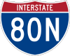
In 1962, this section was formally submitted for inclusion in the U.S. Interstate Highway System as part of Interstate 80N, today's I-84.
I-205
Interstate 205 (Oregon-Washington)
Interstate 205 is a loop route that serves the Portland—Vancouver metropolitan area in the U.S. states of Oregon and Washington. I-205 is officially named the War Veterans Memorial Freeway, and is also known as the East Portland Freeway...
itself was in the planning stages at the time the Mount Hood Freeway was first proposed. The I-205 routing was originally envisioned for the 52nd Avenue corridor, but ended up being built farther east at about 93rd Avenue. All plans for the Mount Hood Freeway allowed for a future I-205 connection at various spots.
Another segment of the proposal was called the Mount Hood Expressway. It would have continued the Mount Hood Freeway alignment past a stack interchange
Stack interchange
A stack interchange is a free-flowing grade separated junction between two roads.In countries where one drives on the right, left turns are handled by semi-directional flyover/under ramps...
at I-205, continuing to follow Powell Blvd. before skirting Gresham to the south and connecting to the existing route.
The final segment of the proposal continued southeast from Gresham and ran to the outskirts of Sandy. This section was actually constructed (and is an expressway
Limited-access road
A limited-access road known by various terms worldwide, including limited-access highway, dual-carriageway and expressway, is a highway or arterial road for high-speed traffic which has many or most characteristics of a controlled-access highway , including limited or no access to adjacent...
-grade highway), with a single interchange at the junction with Oregon Route 212.
Route Designations
The new highway would have carried US 26 along the entire alignment, while I-80N was to be re-routed along the portion between I-5 and I-205. The I-80N designation would have been removed from the Banfield Freeway, and the route would be duplexed over I-205 between the segments. US 26 would be taken off Powell Blvd, the Ross Island BridgeRoss Island Bridge
The Ross Island Bridge is a cantilever truss bridge that spans the Willamette River in Portland, Oregon. It carries U.S. Route 26 across the river between southwest and southeast Portland...
, and downtown Portland streets, continuing on I-5 and I-405
Interstate 405 (Oregon)
Interstate 405 is a short Interstate Highway in Portland, Oregon. It forms a loop from Interstate 5 that travels through downtown Portland west of the Willamette River.-Route description:...
to the Sunset Highway
Sunset Highway (Oregon)
The Sunset Highway No. 47 , in the state of Oregon, is an official designation for the portion of U.S. Route 26 between its western terminus, south of Seaside, and the interchange with Interstate 405 in downtown Portland...
. The Banfield Freeway section would have been taken out of the Interstate system and signed only as U.S. Route 30.
Revolt and aftermath
By the time planners began to think seriously about building the Mount Hood Freeway in the 1970s, the neighborhoods in and near its path mobilized grass-roots efforts against the freeway. The movements gained city-wide and local support which changed the political landscape in local elections. Soon, it seemed as if the Federal governmentFederal government of the United States
The federal government of the United States is the national government of the constitutional republic of fifty states that is the United States of America. The federal government comprises three distinct branches of government: a legislative, an executive and a judiciary. These branches and...
and some in the Oregon State Highway Department (now the Oregon Department of Transportation
Oregon Department of Transportation
The Oregon Department of Transportation is a department of the state government of the U.S. state of Oregon responsible for systems of transportation. It was first established in 1969. It had been preceded by the Oregon State Highway Department which, along with the Oregon State Highway...
) were the only ones who wanted the freeway.
The freeway's promoted virtue of a speedy commute was debunked by the freeway's opponents. On one hand, it was seen as benefiting only suburban Gresham
Gresham, Oregon
- Demographics :As of the census of 2000, there were 90,205 people, 33,327 households, and 22,695 families residing in the city. The population density was 4,071.6 people per square mile . There were 35,309 housing units at an average density of 1,593.8 per square mile...
and East Multnomah County
Multnomah County, Oregon
Multnomah County is one of 36 counties in the U.S. state of Oregon. Though smallest in area, it is the most populous as its county seat, Portland, is the state's largest city...
at the expense of Portland's neighborhoods. On the other hand, many opponents stated that the freeway would be obsolete the minute it opened, jamming with traffic volumes that the freeway was not designed for.
Efforts to make the freeway more acceptable made their way into the later proposals. Among the proposals were increased landscaping and bike paths along the route as well as parks and community centers built over the freeway's "air rights" and a "transitway" with three-level stations (separate levels for local buses and express buses) for an express busway
Busway
Busway may refer to several things:Transport technology* Bus rapid transit, bus systems including some elements of trams or metro systems* Guided busway, concrete tracks exclusively for modified busesTransport systems...
. These efforts, however, were not enough to sell the project.
When the project was finally canceled in 1974, local transportation planners began to look at completing I-205. Disputes with the new freeway-adverse Multnomah County Commission had left a huge gap between the two completed sections. I-205 ended in the south just across the Clackamas County
Clackamas County, Oregon
Clackamas County is a county located in the U.S. state of Oregon. The county was named after the Native Americans living in the area, the Clackamas Indians, who were part of the Chinookan people. As of 2010, the population was 375,992...
line and stopped at the Columbia River
Columbia River
The Columbia River is the largest river in the Pacific Northwest region of North America. The river rises in the Rocky Mountains of British Columbia, Canada, flows northwest and then south into the U.S. state of Washington, then turns west to form most of the border between Washington and the state...
in the north. After the successful battle over the Mount Hood, activists were pushing for I-205's cancellation, while some neighborhoods and businesses wanted it further east or west (depending on the proposal).
After some negotiation, I-205's Multnomah County segment was finalized, reducing interchanges, eliminating a possible provision for a Mount Hood Freeway interchange, and resulting in the alignment of today's I-205. An unfinished, grade-separated transitway
I-205 Transitway
The I-205 Transitway was a partially built busway along the wide right-of-way of the Interstate 205 freeway in Portland, Oregon. Although it never opened as a busway, its right-of-way is now in use by light rail lines....
and a bike path were added to I-205, part of the Mount Hood Freeway ideas that actually influenced another freeway. The transitway is now being used as the route for the TriMet MAX Red Line
MAX Red Line
The MAX Red Line is a route in the Metropolitan Area Express light rail system in the Portland, Oregon metropolitan area. It is 25.5 miles long...
and the new MAX Green Line
MAX Green Line
The MAX Green Line is a light rail route in the MAX Light Rail system in Portland, Oregon, United States, extending to Clackamas, Oregon. Construction began in early 2007, and the line opened on September 12, 2009. The average daily ridership in June 2010 was 19,500 increasing to 23,200 by April...
.
Since the completion of I-205, no major freeways have been built in the Portland metropolitan area
Portland metropolitan area
The Portland-Vancouver-Hillsboro, OR-WA Metropolitan Statistical Area , also known as the Portland metropolitan area or Greater Portland, is an urban area in the U.S. states of Oregon and Washington centered around the city of Portland, Oregon. The U.S...
.
Some believe the Mount Hood Freeway is one of the things most recognizable as a reason for the development and promotion of alternative forms of transportation in Portland. Natural progression is another reason. The MAX light rail system, the Portland Transit Mall
Portland Transit Mall
The Portland Transit Mall is a set of public transit corridors through the center of downtown Portland, Oregon, United States. More specifically, it is a pair of one-way streets—one for northbound traffic, the other for southbound—along which two of the three lanes are restricted to...
, and the city's notable bicycle-friendly policies are said by some Portlanders to have stemmed from the freeway revolt.
Remnants
Only a few physical signs are around of the canceled freeway, mostly in the form of incomplete connecting ramps or ramp stubs. Some previous evidence of the Mount Hood Freeway has been eliminated with new roadwork.- Interchange grading: At the western end of Segment Three, the highway was graded to support an interchange with the proposed Segment Two.
- Ramp from I-5 southbound: Just as the southbound lanes enter the lower level of the approach to the Marquam Bridge, a left exit (which would have been 300A) is blocked off, complete with an empty sign bridge. This would have been the southbound I-5 access to the Mount Hood Freeway eastbound. Places to attach similar ramps were built for other directions of travel on I-5, but they were instead used to widen the freeway in 1990 (and reconstruction of the ramp from I-5 northbound to I-84). There is a bridge support that is wider than needed to support the existing lanes of I-5.
- Marquam Bridge configuration: On the lower deck (southbound), the ramp to I-405 exits in the left lanes, not the right. This was because the Mount Hood Freeway ramps were to come onto the bridge on the same side before the span, so lane changes would be unnecessary to continue on US 26 (it was to be duplexed with I-405). The same applies for the upper deck for the right lanes.

- Grand Avenue Viaduct: A ramp stub on the bridge over the railroad tracks was intended as a connection to at least I-5, if not the Mount Hood Freeway. With the MLK viaduct project of 2007-2011, this ramp stub has been removed.
- I-84 Exit numbering: I-84, which replaced I-80N, has a strange numbering pattern near its junction with I-205, indicating that its Banfield Freeway portion was originally considered to be temporary. Specifically, there is about 1.5 miles (2.4 km) between exits 5 and 9, and mileposts along the Banfield Freeway jump between Mile 7 and Mile 10. The current exit numbers are different from original numbers on the Banfield, which were based on the actual mileposts; for example, what is exit 1 eastbound was originally exit 2A, and what is exit 9 was exit 6. This original exit numbering scheme also points to the temporary routing of I-84 on the Banfield.
- I-84/I-205 junction configuration: As one approaches the interchange on I-84 from the east, one uses an exit off the freeway alignment to access the Banfield Freeway (continuing on I-84), whereas one stays on the mainline to access I-205. Also, as one approaches from the west, the Banfield Freeway's lanes merge on the right of lanes that come from I-205.
- I-405 signage: At I-405's northern terminus, one keeps left to follow US 30 exiting on I-5 and eventually I-84. The overhead signs marking this exit, however, only mention "US 30 East/The Dalles" without any mention of I-84 (however, auxiliary signs do say "I-5 South/I-84/East Next Left"). While the current signage is newer and more reflectorized, the original sign's text probably was the same when the Fremont Bridge was opened in 1973, when the Mount Hood Freeway was still planned to be I-80N's Portland routing. (As a side note, I-405's northern interchange with I-5 contains many ramp stubs and truncated ramps of another scrapped Portland freeway, the Rose City FreewayRose City FreewayThe Rose City Freeway was a proposed freeway alignment through the Northeast sector of Portland, Oregon. The freeway's path would have begun at the I-5/I-405 interchange near the Fremont Bridge's east approach. From the elevated stack interchange, it would transition to grade, moving roughly...
.)
- Piccolo Park: This small park sits on land that was acquired for the freeway.
- Along Powell Blvd, on the south side of the street are a series of linear parking lots and skinny buildings that have been built in the last 25 years on land that was acquired for the freeway.
- Division/Powell exit, southbound on I-205: The approach to the Division/Powell exit has been curbed in an odd way, as if it were to have been a splitting of a duplexed I-84/I-205 into separate freeways; it is now an unusually wide exit. After leaving I-205 the exit splits again, sending Powell-bound traffic beneath a wide Division Street underpass and non-stop to a westbound-only turn onto Powell. This was to be the continuation of westbound I-84 as it merged with the Mount Hood Expressway.
External links
- ORoads - Mount Hood Freeway
- Willamette Week: Highway to Hell: Retrospective article on Portland's cancelled freeways.
- Piccolo Park: Portland Parks' web page