Mount Triumph
Encyclopedia
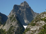
Mount Triumph is a summit in the North Cascades
range of Washington state. Located approximately 5.5 miles (8.9 km) west-northwest of the town of Newhalem
, it was named by Lage Wernstedt, a surveyor with the U.S. Forest Service
. A significant peak in North Cascades National Park
, Mount Triumph is one of its "outstanding sights" and is well known among regional climbers for its lack of easy climbing routes
to the summit. Despite its moderate elevation, its local relief
is dramatic. With the terrain deeply dissected by the valleys of Bacon Creek
on the west and Goodell Creek
on the east, it rises 1 miles (1.6 km) in less than 2 miles (3.2 km) on the latter side.
The mountain is extremely rugged and one author describes it as "a rock thumb with near-vertical to overhanging faces
on three sides." From above, it has the appearance of a three-bladed propeller
consisting of the northeast, northwest, and south ridges. Mount Despair (7292 ft (2,222.6 m)) is located 2.3 miles (3.7 km) to the north-northwest. The two peak are connected by Triumph Pass (5520 ft (1,682.5 m)).
 The mountain lies completely within the drainage of the Skagit River
, Bacon Creek and Goodell Creek being tributaries of the Skagit. Two small glaciers are found below the east face and north faces, both of which are receding. The south ridge of Mount Triumph ends at a minor peak that has been called Thornton Peak (6935 ft (2,113.8 m)). On its south flank is a deep cirque
that hold the Thornton Lakes, a chain of three lakes at 4486 feet (1,367.3 m) to 5040 feet (1,536.2 m), the source of south-flowing Thornton Creek, another tributary of the Skagit River.
Mount Triumph is composed of old orthogneiss
. Neighboring Mount Despair is an exposure of light grey granodiorite
, part of the great pluton
of the Chilliwack batholith
, which is visible west of the Thornton Lakes. East of the lakes are dark amphibolite
, orthogneiss and mica quartz schist
.
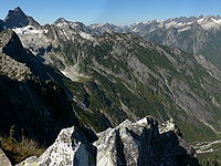
route from Thornton Lakes Trail leads to the summit of Trappers Peak (5966 ft (1,818.4 m)) which provides good views of Mount Triumph.
North Cascades
The North Cascades are a section of the Cascade Range of western North America. They span the border between the Canadian province of British Columbia and the U.S. state of Washington and are officially named in Canada as the Cascade Mountains...
range of Washington state. Located approximately 5.5 miles (8.9 km) west-northwest of the town of Newhalem
Newhalem, Washington
Newhalem is a small, unincorporated community in northwestern Washington, USA, located in the western foothills of the North Cascades along the Skagit River. It is located within Whatcom County....
, it was named by Lage Wernstedt, a surveyor with the U.S. Forest Service
United States Forest Service
The United States Forest Service is an agency of the United States Department of Agriculture that administers the nation's 155 national forests and 20 national grasslands, which encompass...
. A significant peak in North Cascades National Park
North Cascades National Park
North Cascades National Park is a U.S. National Park located in the state of Washington. The park is the largest of the three National Park Service units that comprise the North Cascades National Park Service Complex. Several national wilderness areas and British Columbia parkland adjoin the...
, Mount Triumph is one of its "outstanding sights" and is well known among regional climbers for its lack of easy climbing routes
Rock climbing
Rock climbing also lightly called 'The Gravity Game', is a sport in which participants climb up, down or across natural rock formations or artificial rock walls. The goal is to reach the summit of a formation or the endpoint of a pre-defined route without falling...
to the summit. Despite its moderate elevation, its local relief
Terrain
Terrain, or land relief, is the vertical and horizontal dimension of land surface. When relief is described underwater, the term bathymetry is used...
is dramatic. With the terrain deeply dissected by the valleys of Bacon Creek
Bacon Creek
Bacon Creek is a glacial stream in Whatcom County, Washington. It originates in a glacier on the southwest face of Bacon Peak, flows into a small tarn, then flows over the Berdeen Falls...
on the west and Goodell Creek
Goodell Creek
Goodell Creek is a tributary of the Skagit River in the U.S. state of Washington.-Course:For most of its length Goodell Creek flows through North Cascades National Park. It originates in the Picket Range of the North Cascades. Its headwaters drain the south and west sides of the high peaks around...
on the east, it rises 1 miles (1.6 km) in less than 2 miles (3.2 km) on the latter side.
The mountain is extremely rugged and one author describes it as "a rock thumb with near-vertical to overhanging faces
Cliff
In geography and geology, a cliff is a significant vertical, or near vertical, rock exposure. Cliffs are formed as erosion landforms due to the processes of erosion and weathering that produce them. Cliffs are common on coasts, in mountainous areas, escarpments and along rivers. Cliffs are usually...
on three sides." From above, it has the appearance of a three-bladed propeller
Propeller
A propeller is a type of fan that transmits power by converting rotational motion into thrust. A pressure difference is produced between the forward and rear surfaces of the airfoil-shaped blade, and a fluid is accelerated behind the blade. Propeller dynamics can be modeled by both Bernoulli's...
consisting of the northeast, northwest, and south ridges. Mount Despair (7292 ft (2,222.6 m)) is located 2.3 miles (3.7 km) to the north-northwest. The two peak are connected by Triumph Pass (5520 ft (1,682.5 m)).
Geology

Skagit River
The Skagit River is a river in southwestern British Columbia in Canada and northwestern Washington in the United States, approximately 150 mi long...
, Bacon Creek and Goodell Creek being tributaries of the Skagit. Two small glaciers are found below the east face and north faces, both of which are receding. The south ridge of Mount Triumph ends at a minor peak that has been called Thornton Peak (6935 ft (2,113.8 m)). On its south flank is a deep cirque
Cirque
Cirque may refer to:* Cirque, a geological formation* Makhtesh, an erosional landform found in the Negev desert of Israel and Sinai of Egypt*Cirque , an album by Biosphere* Cirque Corporation, a company that makes touchpads...
that hold the Thornton Lakes, a chain of three lakes at 4486 feet (1,367.3 m) to 5040 feet (1,536.2 m), the source of south-flowing Thornton Creek, another tributary of the Skagit River.
Mount Triumph is composed of old orthogneiss
Gneiss
Gneiss is a common and widely distributed type of rock formed by high-grade regional metamorphic processes from pre-existing formations that were originally either igneous or sedimentary rocks.-Etymology:...
. Neighboring Mount Despair is an exposure of light grey granodiorite
Granodiorite
Granodiorite is an intrusive igneous rock similar to granite, but containing more plagioclase than orthoclase-type feldspar. Officially, it is defined as a phaneritic igneous rock with greater than 20% quartz by volume where at least 65% of the feldspar is plagioclase. It usually contains abundant...
, part of the great pluton
Pluton
A pluton in geology is a body of intrusive igneous rock that crystallized from magma slowly cooling below the surface of the Earth. Plutons include batholiths, dikes, sills, laccoliths, lopoliths, and other igneous bodies...
of the Chilliwack batholith
Chilliwack batholith
The Chilliwack batholith is a large batholith that forms much of the North Cascades in southwestern British Columbia, Canada and the U.S. state of Washington. It is part of the Pemberton Volcanic Belt and is the largest mass of exposed intrusive rock in the Cascade Volcanic Arc. The age of the...
, which is visible west of the Thornton Lakes. East of the lakes are dark amphibolite
Amphibolite
Amphibolite is the name given to a rock consisting mainly of hornblende amphibole, the use of the term being restricted, however, to metamorphic rocks. The modern terminology for a holocrystalline plutonic igneous rocks composed primarily of hornblende amphibole is a hornblendite, which are...
, orthogneiss and mica quartz schist
Schist
The schists constitute a group of medium-grade metamorphic rocks, chiefly notable for the preponderance of lamellar minerals such as micas, chlorite, talc, hornblende, graphite, and others. Quartz often occurs in drawn-out grains to such an extent that a particular form called quartz schist is...
.
Climbing
The easiest route to the summit is on the west. It is rated and can be dangerous when wet. The approach is by means of the Triumph Pass climber's route. The northeast ridge is more difficult at class 5.5, but is a notable climb on generally good rock. It is approached by means of the Thornton Lakes Trail. A scramblingScrambling
Scrambling is a method of ascending rocky faces and ridges. It is an ambiguous term that lies somewhere between hillwalking and rock climbing. It is often distinguished from hillwalking by defining a scramble as a route where hands must be used in the ascent...
route from Thornton Lakes Trail leads to the summit of Trappers Peak (5966 ft (1,818.4 m)) which provides good views of Mount Triumph.
Nearby mountains
- Mount BlumMount BlumMount Blum, or Mount Bald, is a summit of the North Cascades range in Washington state, on the western edge of North Cascades National Park. It is the highest summit of a string of mountain peaks located east of Mount Shuksan and west of the Picket Range. Two small active glaciers rest on its...
- Mount Despair
- Mount ShuksanMount ShuksanMount Shuksan is a glaciated massif in the North Cascades National Park. Shuksan rises in Whatcom County, Washington immediately to the east of Mount Baker, and south of the Canadian border. The mountain's name Shuksan is derived from the Lummi word [šéqsən], said to mean "high peak". The highest...
- Mount TerrorMount Terror (Washington)Mount Terror is a mountain of the Cascade Range, located in the northwestern corner of Washington state in Whatcom County. The peak is in North Cascades National Park, about south of the Canadian border.-Nearby mountains:* Mount Triumph* Mount Despair...

