
Meadowgreen, Saskatoon
Encyclopedia
| City of Saskatoon Neighbourhoods | |
|---|---|
| Meadowgreen | |
| Confederation Suburban Development Area | |
 |
|
| Population: | 3,860 |
| Average Family Income: | $37,541 |
| Average Household Size: | 2.5 |
| Homeownership: | 47.4% |
| Average Home Selling Price: | $89,331 |
| Municipal Ward: | 2 |
| Gross Area | 303.53 Acres |
| Statistics c2005 | |

Saskatoon
Saskatoon is a city in central Saskatchewan, Canada, on the South Saskatchewan River. Residents of the city of Saskatoon are called Saskatonians. The city is surrounded by the Rural Municipality of Corman Park No. 344....
, Saskatchewan
Saskatchewan
Saskatchewan is a prairie province in Canada, which has an area of . Saskatchewan is bordered on the west by Alberta, on the north by the Northwest Territories, on the east by Manitoba, and on the south by the U.S. states of Montana and North Dakota....
, Canada
Canada
Canada is a North American country consisting of ten provinces and three territories. Located in the northern part of the continent, it extends from the Atlantic Ocean in the east to the Pacific Ocean in the west, and northward into the Arctic Ocean...
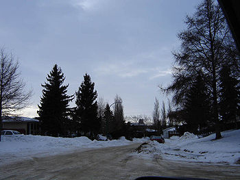
. Meadowgreen is surrounded by an abundance of green space and walking trails without being a River side
South Saskatchewan River
The South Saskatchewan River is a major river in Canada that flows through the provinces of Alberta and Saskatchewan....
neighbourhood. The buffer zone along Circle Drive has a newly created walking trail. The southern buffer zone along 11th Street connects to the east with Fred Mendel Park of the Pleasant Hill neighbourhood and to the west with the off leash dog run located in the Confederation Suburban Centre neighbourhood. As well the newly re-located Meadowgreen Park and Peter Pond Park provide leisure activities such as basketball courts and playgrounds. Within the Confederation SDA of Saskatoon, the neighborhood of Meadowgreen comprises the area south of 22nd Street, north of the buffer zone between 11th Street and Appleby Drive, east of Circle Drive, and west of Avenue W South. Until the 1990s the portion of the community north of 18th Street was considered part of the Pleasant Hill
Pleasant Hill, Saskatoon
Pleasant Hill is a neighborhood of Saskatoon, Saskatchewan, Canada. The Governments are undertaking a major re-vitalization project of Pleasant Hill. $3.5 million dollars is being invested in the business, and residential areas as well as in St. Mary's School...
community until the City of Saskatoon reorganized its community boundaries.
Meadowgreen has a little higher population in its neighbourhood 3,860 compared to Adelaide/Churchill at 3,535. A nearby community of Mount Royal is the next largest of Saskatoon's subdivisions at 4,110 persons. The Saskatchewan
Saskatchewan
Saskatchewan is a prairie province in Canada, which has an area of . Saskatchewan is bordered on the west by Alberta, on the north by the Northwest Territories, on the east by Manitoba, and on the south by the U.S. states of Montana and North Dakota....
provincial town of Battleford is the rural area in with the closest population size. Battleford's population was 3,685 on the 2006 Census, and 3,820 persons as of 2001 compared to the Saskatoon neighbourhood of Meadowgreen's population of 2001 at 3,860. Battleford is sprawled over 5764.968 acres (23.3 km²) or 23.33 km², whereas Meadowgreen is within 303.53 acres (1.2 km²) or 1.22834 km². Where Battleford shows total dwellings of 1,485, Meadowgreen has 1,560 dwellings.
Education
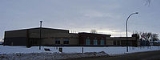
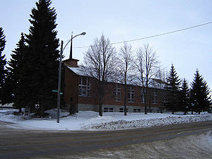
- W.P. Bate School was originally located at 342 Ottawa Avenue South in 1974. In September 2006, the school relocated to a new location at 2515 18th Street West. The school namesake, W.P. Bate, homesteaded nearby at NW Section 24 Township 36 Range 5 W of the 3rd Meridian106th meridian westThe meridian 106° west of Greenwich is a line of longitude that extends from the North Pole across the Arctic Ocean, North America, the Pacific Ocean, the Southern Ocean, and Antarctica to the South Pole....
, provisional district of Saskatchewan, North West Territories and received his dominion land grant patent Oct 31, 1892.
Demographics
There are 3,860 people living in this area of Saskatoon, with the 34% of this population being employed in sales and service, the main occupation of this neighbourhood. The average income as of 2006 was $37,541 enabling an average house market value of $105,527. 770 of the 1,560 homes are detached residences, the majority built between 1960 to 1980.Shopping
Parks
- Cahill Park - 1.48 acres (5,989.4 m²)
- Meadowgreen Park -
- Peter Pond Park - 1.62 acres (6,555.9 m²)
W.P. Bate School opened January 2006, exchanging places with Meadowgreen Park.
Religious institutions
- Chan Tam Buddhist Congregation Saskatoon Inc.
- Our Lady of Czestochowa Roman Catholic Services
- Pleasant Hill Mennonite Church was built in 1953, however services began as early as 1928.
City transit
Meadowgreen is serviced by the Saskatoon TransitSaskatoon Transit
Saskatoon Transit is the public transport arm of the City of Saskatoon, Saskatchewan, Canada. It operates a fleet of diesel buses. A total of 23 bus routes serve every area of the city, carrying approximately 11 million passengers in 2008...
bus route #2 Meadowgreen - 8th Street.
History
The land for Meadowgreen was annexed by the city of SaskatoonSaskatoon
Saskatoon is a city in central Saskatchewan, Canada, on the South Saskatchewan River. Residents of the city of Saskatoon are called Saskatonians. The city is surrounded by the Rural Municipality of Corman Park No. 344....
between 1955 and 1959. Approximately 33% of the dwellings were built in the 1960s, and 45% built in the 1970s.
Layout
The area south of 18th Street, north of the buffer zone between 11th Street and Appleby Drive, east of Circle Drive, and west of Avenue W South is laid out in a court system. The northern portion is laid out grid fashion; avenues run alphabetically north and south, Streets run numerically east and west. After Avenue Y South, the Avenues are named after Canadian Cities such as MontrealMontreal
Montreal is a city in Canada. It is the largest city in the province of Quebec, the second-largest city in Canada and the seventh largest in North America...
, Ottawa
Ottawa
Ottawa is the capital of Canada, the second largest city in the Province of Ontario, and the fourth largest city in the country. The city is located on the south bank of the Ottawa River in the eastern portion of Southern Ontario...
, Winnipeg
Winnipeg
Winnipeg is the capital and largest city of Manitoba, Canada, and is the primary municipality of the Winnipeg Capital Region, with more than half of Manitoba's population. It is located near the longitudinal centre of North America, at the confluence of the Red and Assiniboine Rivers .The name...
and Vancouver
Vancouver
Vancouver is a coastal seaport city on the mainland of British Columbia, Canada. It is the hub of Greater Vancouver, which, with over 2.3 million residents, is the third most populous metropolitan area in the country,...
. Witney Avenue is the only anomaly to the naming convention, and is named in lieu of having an Avenue Z. Prior to the construction of the Circle Drive and 22nd Street
22nd Street (Saskatoon)
22nd Street is an arterial road in Saskatoon, Saskatchewan. It starts out as 22nd Street East in the Central Business District. Going west it passes the Midtown Plaza and TCU Place. At the intersection with Idylwyld Drive, it becomes 22nd Street West...
interchange, motorists were able to access the Fairhaven
Fairhaven, Saskatoon
Fairhaven is a neighbourhood in Saskatoon, Saskatchewan, Canada. It is close to both Catholic and public elementary schools. A strip mall is within the Fairhaven subdivision...
neighborhood from Meadowgreen via 18th Street through a signalized grade crossing intersection at Clancy Drive and Circle Drive. Prior to a heated debate, the initial plan called for the intersection of 18th Street/Clancy Drive and Circle Drive to remain as the interchange called for no access to eastbound 22nd Street from southbound Circle Drive as the 20th Street intersection would cease to exist when construction started. Fearing an increased volume in traffic along 18th Street, a re-drawing saw a leg of Camponi Crescent become part of the interchange and access to 18th Street from Circle Drive would cease to exist, leaving access to Circle Drive from either 11th or 22nd Streets. The 18th Street/Circle Drive intersection was closed to traffic in 2001, and all traces of the roadway between Circle and the CN rail line were permanently removed in 2002, however the signalized grade crossing intersection at Circle Drive and Clancy Drive remains as it was reconfigured to a layout similar to that of the intersection of Circle Drive and Laurier Drive following the closure of 18th Street. However if an overpass is proposed at Circle & Clancy, 18th Street could possibly be reconnected.
Life
Meadowgreen Community Association operates out of W.P. Bate School to provide leisure activities for the area.Location
| North: Mount Royal | ||
| West: Confederation Suburban Centre | Meadowgreen | East: Pleasant Hill |
| South: Sedco / South West Industrial | West Industrial |
External links
- City of Saskatoon · Departments · Community Services · Community Meadowgreen
- Meadowgreen map and demographics City of Saskatoon
- Saskatoon Neighbourhoods Word Search Puzzle
- City of Saskatoon · Departments · Community Services · Community ...
- City of Saskatoon City of Saskatoon · Departments · Community Services · City Planning · ZAM Maps
- Populace Spring 2006