

May 2003 tornado outbreak sequence
Encyclopedia
The May 2003 tornado outbreak sequence in the United States was a series
of tornado outbreaks that occurred from May 3 to May 11, 2003. Tornadoes began occurring over the affected area on April 30, but the most prolific continuous period was the seven day period of May 4–10. There were 401 tornado
reports in 19 states and 1 Canadian province, 1,587 reports of large hail
, and 740 reports of wind damage. More severe weather
broke out this week alone than any other week in U.S. history. The old record for most tornado reports in one week was 171 during the week of the May 1995 Tornado Outbreak Sequence
(May 12 to May 18, 1995). The Super Outbreak
of April 3 to April 4, 1974, previously held the record for the most tornadoes produced in a 24 hour period until that record was surpassed by the 2011 Super Outbreak which produced approximately 190 tornadoes in a 24 hour period. The Super Outbreak in April 1974 also produced more significant and violent tornadoes than any other week in history.
s was the presence of a persistent 500 mb trough
over the western United States
, coupled with a series of shortwave disturbances which propagated through the central
and eastern United States
. These shortwaves provided a mechanism for the deepening of surface low pressure area
s, which followed the upper level
flow from southwest to northeast. The cyclones induced a strong north to southeasterly flow in the low levels of the atmosphere (1000 mb, 850 mb) off the Gulf of Mexico
. This persistent flow provided an abundance of warm, moist maritime tropical
air in the central and eastern US.
The interaction between warm, dry air from the western United States and the moist Gulf airmass resulted in a boundary known as the dry line
. This boundary, along with other factors provided a source of lift promoting thunderstorm development. CAPE
describes the instability in the atmosphere and the tendency for it to rise; high CAPE values are usually associated with severe weather. CAPE values during the period of April 30 - May 11 were extremely high in the affected areas. A strong, persistent southeast to northwest upper level flow contributed to wind shear
, and induced strong rotation in many of the thunderstorms that developed. These rotating thunderstorms, or supercells, are capable of spawning tornadoes.
into the central plain states had induced the deepening of a 990 mb
low over northwestern Missouri
. A warm front
extended from this low through Missouri, Arkansas
, and Tennessee
. South of this front, southerly wind
s at the surface had advected unseasonably warm, moist air from the Gulf of Mexico into the Mississippi Valley and surrounding states. Temperatures reached the mid 80s(°F) and dew point
s had risen above 70 °F (21 °C).
In the upper levels of the atmosphere, the left exit region of a 250 mb jet streak had been positioned over the affected area, providing enhanced lift
. This in combination with low level instability contributed to explosive thunderstorm
development. Winds at the 850 mb level were enhanced as the day progressed, and velocity maxima exceeded 70 kts by 0300 UTC.
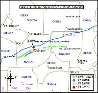
The thunderstorms that developed in the region quickly began rotating, due to the enhanced environmental wind shear. Long-lived supercells were prevalent; many of which produced families of strong to violent, long-tracked tornadoes. Kansas, Missouri, Arkansas, and Tennessee were hardest hit. A total of 86 tornadoes touched down, making May 4, 2003 one of the largest single-day outbreaks in history. Thirty-eight people were killed, and nearly 400 injured by the twisters.
at 4:32 pm on May 4. The tornado was initially about 250 yards (228.6 m) wide and produced F2 damage as it crossed into Crawford County
. Aerial damage surveys indicate an increase in width and intensification as the tornado approached the community of Ringo (5 miles (8 km) east of Girard), in Crawford County. Dramatic scouring of the ground was observed, and heavy objects such as vehicles were tossed long distances (over 100 yards (91 m)). The NWS described the damage in this portion of the track as "high-end F4". As it barreled past Ringo and entered the unincorporated town of Franklin (5 miles (8 km) north of Frontenac), the path reached over 1/2 mi wide at points. Franklin was all but destroyed. Numerous buildings and homes were demolished and three deaths were reported, along with approximately 20 injuries. The tornado continued producing "high end F4" damage as it passed the town of Mulberry
, where a train was derailed from the winds of the storm, and crossed into Barton County, Missouri. In Missouri, the twister demolished several farm houses, killing an 88-year-old man. Its path began to narrow several miles into Missouri; video and eyewitness accounts suggest that the tornado was "roping out". It finally lifted to the north of Liberal, Missouri
after having traveled for approximately 35 miles (56 km). Almost immediately after the Franklin tornado lifted, a second large tornado was reported to have touched down on the east side of Liberal.
was initially observed to the east of Liberal (5:31 pm). Analysis indicated a 1/2 mi wide damage path through rural portions of Barton County, Missouri. Several structures received F1 to F2 damage. The tornado crossed into Cedar County
and continued producing high end F2/low end F3 damage. One man was killed east of Liberal when his home was destroyed. As it approached the town of Stockton
, several framed houses were swept off their foundations. Structural analysis indicated poor anchoring of the homes, thus warranting a high end F3 rating. The funnel then proceeded travel through the center of Stockton causing considerable devastation, and killing three. The tornado was approximately 3/4 mi in diameter as it left Stockton. A two-story framed home to the east of Stockton was almost entirely destroyed, and several vehicles were tossed hundreds of feet (also high end F3). Also, almost all the buildings on the "square" of Stockton were destroyed, and the only thing left was the vault from the bank. The roof was torn off of most of the Stockton school, but the court house, just 1/8 mi south of the square only took minor damage. The city was closed off to the public for nearly two days. The tornado crossed into northern Polk County
, and appeared to have weakened slightly. A handful of structures received F1 and F2 damage. Continuing all the way through Polk County, it shrank to approximately 300 yards (274 m) in diameter as it entered Dallas County. Damage analysis indicated twin funnels in western Polk (another tornado touched down just to the south of the parent funnel) (Observers did confirm twin tornadoes on the ground near Humansville, Missouri
in northwest polk county). Over 48 homes were destroyed in northern Dallas county (again F3 damage), and two additional fatalities occurred. South of Tunas
, its track shifted form northeasterly to almost east-southeasterly. It then proceeded to abruptly weaken and dissipate. The Stockton tornado had traveled for 86 miles (138 km) miles, across four counties in their entirety. One year after the tornado hit a plaque was placed at the town park in honor of the three men who lost their lives.
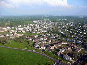
. Pierce City was devastated. Nearly every structure was either damaged or destroyed (including several buildings of historical significance). 5 people were killed, many of whom died in mobile homes. The tornado continued through Lawrence county and on into Christian county, barely missing several large population centers. In Christian county, dozens of structures were damaged and one fatality was reported. Damage here ranged between high end F2 and F3. After passing Clever, the path veered north into Greene county (toward Springfield). 100 homes were destroyed in the Springfield suburb of Battlefield. One fatality was also reported here. The damage path abruptly ended several miles past Battlefield, just before the tornado would have entered Springfield. NWS gave this tornado an F3 rating overall. It traveled just shy of 50 miles, across 4 counties.


. It initially produced F1 damage as it crossed the Turnpike, and was reported to have been approximately 250 yards wide. Notable F2 damage was observed near the intersection of 166th and Kansas Avenue. Numerous homes and buildings were damaged, and 2 injuries were reported. The tornado lifted just to the south of Basehor. It had traveled just over 6 miles.
around 5 p.m. Substantial damage occurred on the downtown square, into William Jewell College
(high end F2) and continued tracking east along Route H into unincorporated Clay County. The total track length was 8 miles. The funnel was reported to have been 200 to 300 yards in diameter, though photographs suggest that it may have been somewhat larger. It continued tracking east along Route H into Clay County, and then lifted. The total track length was 8 miles.
was issued for Douglas County, Kansas
for a supercell storm that produced a tornado in nearby Osage County
. As the tornado tracked across Douglas County, it mushroomed into a 400-yard wide vortex, as reported by one storm chaser. By the time it reached Lawrence
, the tornado had weakened and shrunk in size, but it was still strong enough to cause F1-F2 damage in the southwest part of town.
 Four years after an F5 tornado destroyed large sections of Moore
during the 1999 Oklahoma tornado outbreak, another strong tornado affected the area. The storm responsible for the Moore tornado developed across Grady County
during the mid-afternoon hours and produced a weak tornado near Newcastle and west of Moore. Just after 5:00 PM, a new tornado touched down on the west side of Moore west of Interstate 35 and moved east northeast across Moore, then the southeastern sections of Oklahoma City
including Tinker Air Force Base near Interstate 40, Midwest City
and Choctaw
. As the tornado passed through the Moore area, a tornado emergency
was issued for eastern Oklahoma County. Despite extensive damage all along the path, no fatalities were caused by the tornado although dozens of injuries were reported across Cleveland
and Oklahoma Counties
.
 Damage across Moore was rated as high as a high-end F3 near 12th Street where several businesses, two hotels, an office building, a church, several restaurants, a child center and a Headstart Program building were either severely damaged or destroyed. It also damaged numerous homes in the Highland Park subdivision which was mostly destroyed by the F5 tornado which passed just a few block north of the May 8, 2003 tornado. Other homes on the north side of the city also sustained significant damage before crossing the Cleveland-Oklahoma county line.
In the Oklahoma City area, the General Motors
Assembly Plant sustained major damage as well as a manufacturing plant near Interstate 240
were F4 damage was observed. Several other businesses were either damaged or destroyed. At Tinker Air Force Base
, a storage bunker and several fences were damaged. Several subdivisions in eastern Oklahoma City, Choctaw and Midwest City were also affected by the tornado with several homes sustaining significant damage.
to Creek
Counties during the evening hours of May 9, 2003. The most significant tornado affected northeastern sections of Oklahoma County from Interstate 35 and areas along Interstate 44 to near Luther
.
 The supercell developed across Greer County
during the early evening and slowly moved east/northeast and started to produced tornadoes in Caddo County at around 9:00 PM. As it approached Interstate 40
near Bethany
the National Weather Service issued a tornado emergency citing that the radar was detecting a potentially large and violent tornado in the area. Two tornadoes in Bethany and Warr Acres
rated F1 produced minor to moderate damage mostly to trees but several structures were also damaged including churches, a storage facility, car ports, airports hangars at the Wiley Post Airport
, several homes, warehouses and businesses. 8 were injured in the Bethany tornado and damage was pegged at $10 million.
Just after 10:30 PM, a large tornado touched down northwest of the Interstate 35
and Interstate 44
interchange in northeastern Oklahoma City near KWTV
and KOCB
stations. The tornado was filmed live by KFOR-TV
helicopter reporter Jim Gardner near I-35 at Britton Road northeast of the station of the NBC
affiliate and large power flashes were seen from the air during live severe weather coverage. The National Weather Service issued another tornado emergency for that particular tornado. Moving parallel along the Turner Turnpike
, the tornado produced its worst damage just east of I-35/44 where damage to an industrial building and a horse ranching operation was rated F3. Additionally, the tornado damaged several homes and barns in northeast Oklahoma City and Oklahoma County with one home destroyed. Tornado damage estimates were about $7 million. The tornado lifted shortly after 11:00 PM. Despite extensive damage, only 2 people were injured as mostly of the tornado track was over sparsely populated areas and also near Interstate 44 where there were few structures. Additional tornadoes touched down until after midnight and numerous structures in Davenport
and Stroud
in Lincoln County
sustained significant damage shortly before midnight. No fatalities were reported in Oklahoma during the outbreak.
The 2003 tornado season had been relatively slow up until May 1. In fact, around May 1 through July 1 was the most active time of the year in tornadoes. The first tornado report of the year came on February 15. About 400 tornadoes were reported during the first 10 days of May, more than 500 were reported during the entire month.
April 30 - May 3
May 4–5
May 6–7
May 8
May 9
May 10
May 11
Tornado outbreak sequence
A tornado outbreak sequence is a period of continuous or nearly continuous high tornado activity consisting of a series of tornado outbreaks over multiple days with no or very few days lacking tornado outbreaks....
of tornado outbreaks that occurred from May 3 to May 11, 2003. Tornadoes began occurring over the affected area on April 30, but the most prolific continuous period was the seven day period of May 4–10. There were 401 tornado
Tornado
A tornado is a violent, dangerous, rotating column of air that is in contact with both the surface of the earth and a cumulonimbus cloud or, in rare cases, the base of a cumulus cloud. They are often referred to as a twister or a cyclone, although the word cyclone is used in meteorology in a wider...
reports in 19 states and 1 Canadian province, 1,587 reports of large hail
Hail
Hail is a form of solid precipitation. It consists of balls or irregular lumps of ice, each of which is referred to as a hail stone. Hail stones on Earth consist mostly of water ice and measure between and in diameter, with the larger stones coming from severe thunderstorms...
, and 740 reports of wind damage. More severe weather
Severe weather
Severe weather phenomena are weather conditions that are hazardous to human life and property.- Examples Include :Severe weather can occur under a variety of situations, but three characteristics are generally needed: a temperature or moisture boundary, moisture, and , instability in the...
broke out this week alone than any other week in U.S. history. The old record for most tornado reports in one week was 171 during the week of the May 1995 Tornado Outbreak Sequence
May 1995 Tornado Outbreak Sequence
The May 1995 Tornado Outbreak Sequence is a series of tornado outbreaks that occurred from May 6 through May 27, 1995. Eleven deaths occurred due to the outbreak. Nearly 300 tornadoes occurred during this period from the Central US through the Southeast and into the Mid-Atlantic...
(May 12 to May 18, 1995). The Super Outbreak
Super Outbreak
The Super Outbreak is the second largest tornado outbreak on record for a single 24-hour period, just behind the tornado outbreak of April 25–28, 2011...
of April 3 to April 4, 1974, previously held the record for the most tornadoes produced in a 24 hour period until that record was surpassed by the 2011 Super Outbreak which produced approximately 190 tornadoes in a 24 hour period. The Super Outbreak in April 1974 also produced more significant and violent tornadoes than any other week in history.
Meteorological synopsis
The main meteorological factor for this series of tornado outbreakTornado outbreak
While there is no single agreed upon definition, generally at least 6-10 tornadoes produced by the same synoptic scale weather system is considered a tornado outbreak. The tornadoes usually occur within the same day, or continue into the early morning hours of the succeeding day, and within the...
s was the presence of a persistent 500 mb trough
Trough (meteorology)
A trough is an elongated region of relatively low atmospheric pressure, often associated with fronts.Unlike fronts, there is not a universal symbol for a trough on a weather chart. The weather charts in some countries or regions mark troughs by a line. In the United States, a trough may be marked...
over the western United States
Western United States
.The Western United States, commonly referred to as the American West or simply "the West," traditionally refers to the region comprising the westernmost states of the United States. Because the U.S. expanded westward after its founding, the meaning of the West has evolved over time...
, coupled with a series of shortwave disturbances which propagated through the central
Central United States
The Central United States is sometimes conceived as between the Eastern United States and Western United States as part of a three-region model, roughly coincident with the Midwestern United States plus the western and central portions of the Southern United States; the term is also sometimes used...
and eastern United States
Eastern United States
The Eastern United States, the American East, or simply the East is traditionally defined as the states east of the Mississippi River. The first two tiers of states west of the Mississippi have traditionally been considered part of the West, but can be included in the East today; usually in...
. These shortwaves provided a mechanism for the deepening of surface low pressure area
Low pressure area
A low-pressure area, or "low", is a region where the atmospheric pressure at sea level is below that of surrounding locations. Low-pressure systems form under areas of wind divergence which occur in upper levels of the troposphere. The formation process of a low-pressure area is known as...
s, which followed the upper level
Jet stream
Jet streams are fast flowing, narrow air currents found in the atmospheres of some planets, including Earth. The main jet streams are located near the tropopause, the transition between the troposphere and the stratosphere . The major jet streams on Earth are westerly winds...
flow from southwest to northeast. The cyclones induced a strong north to southeasterly flow in the low levels of the atmosphere (1000 mb, 850 mb) off the Gulf of Mexico
Gulf of Mexico
The Gulf of Mexico is a partially landlocked ocean basin largely surrounded by the North American continent and the island of Cuba. It is bounded on the northeast, north and northwest by the Gulf Coast of the United States, on the southwest and south by Mexico, and on the southeast by Cuba. In...
. This persistent flow provided an abundance of warm, moist maritime tropical
Airmass
In astronomy, air mass is the optical path length through Earth’s atmosphere for light from a celestial source. As it passes through the atmosphere, light is attenuated by scattering and absorption; the more atmosphere through which it passes, the greater the attenuation. Consequently, celestial...
air in the central and eastern US.
The interaction between warm, dry air from the western United States and the moist Gulf airmass resulted in a boundary known as the dry line
Dry line
A dry line separates moist air from the Gulf of Mexico and dry desert air from the south-western states . The dry line is an important factor in severe weather frequency in the Great Plains of North America...
. This boundary, along with other factors provided a source of lift promoting thunderstorm development. CAPE
Convective available potential energy
In meteorology, convective available potential energy , sometimes, simply, available potential energy , is the amount of energy a parcel of air would have if lifted a certain distance vertically through the atmosphere...
describes the instability in the atmosphere and the tendency for it to rise; high CAPE values are usually associated with severe weather. CAPE values during the period of April 30 - May 11 were extremely high in the affected areas. A strong, persistent southeast to northwest upper level flow contributed to wind shear
Wind shear
Wind shear, sometimes referred to as windshear or wind gradient, is a difference in wind speed and direction over a relatively short distance in the atmosphere...
, and induced strong rotation in many of the thunderstorms that developed. These rotating thunderstorms, or supercells, are capable of spawning tornadoes.
Total confirmed tornadoes
Most prolific day of the sequence
The meteorological ingredients that made conditions favorable for devastating severe weather came together early in the day on May 4. One of the 500 mb shortwaves that had propagated from the Rocky MountainsRocky Mountains
The Rocky Mountains are a major mountain range in western North America. The Rocky Mountains stretch more than from the northernmost part of British Columbia, in western Canada, to New Mexico, in the southwestern United States...
into the central plain states had induced the deepening of a 990 mb
Bar (unit)
The bar is a unit of pressure equal to 100 kilopascals, and roughly equal to the atmospheric pressure on Earth at sea level. Other units derived from the bar are the megabar , kilobar , decibar , centibar , and millibar...
low over northwestern Missouri
Missouri
Missouri is a US state located in the Midwestern United States, bordered by Iowa, Illinois, Kentucky, Tennessee, Arkansas, Oklahoma, Kansas and Nebraska. With a 2010 population of 5,988,927, Missouri is the 18th most populous state in the nation and the fifth most populous in the Midwest. It...
. A warm front
Warm front
A warm front is a density discontinuity located at the leading edge of a homogeneous warm air mass, and is typically located on the equator-facing edge of an isotherm gradient...
extended from this low through Missouri, Arkansas
Arkansas
Arkansas is a state located in the southern region of the United States. Its name is an Algonquian name of the Quapaw Indians. Arkansas shares borders with six states , and its eastern border is largely defined by the Mississippi River...
, and Tennessee
Tennessee
Tennessee is a U.S. state located in the Southeastern United States. It has a population of 6,346,105, making it the nation's 17th-largest state by population, and covers , making it the 36th-largest by total land area...
. South of this front, southerly wind
Wind
Wind is the flow of gases on a large scale. On Earth, wind consists of the bulk movement of air. In outer space, solar wind is the movement of gases or charged particles from the sun through space, while planetary wind is the outgassing of light chemical elements from a planet's atmosphere into space...
s at the surface had advected unseasonably warm, moist air from the Gulf of Mexico into the Mississippi Valley and surrounding states. Temperatures reached the mid 80s(°F) and dew point
Dew point
The dew point is the temperature to which a given parcel of humid air must be cooled, at constant barometric pressure, for water vapor to condense into liquid water. The condensed water is called dew when it forms on a solid surface. The dew point is a saturation temperature.The dew point is...
s had risen above 70 °F (21 °C).
In the upper levels of the atmosphere, the left exit region of a 250 mb jet streak had been positioned over the affected area, providing enhanced lift
Thermal
A thermal column is a column of rising air in the lower altitudes of the Earth's atmosphere. Thermals are created by the uneven heating of the Earth's surface from solar radiation, and are an example of convection. The sun warms the ground, which in turn warms the air directly above it...
. This in combination with low level instability contributed to explosive thunderstorm
Thunderstorm
A thunderstorm, also known as an electrical storm, a lightning storm, thundershower or simply a storm is a form of weather characterized by the presence of lightning and its acoustic effect on the Earth's atmosphere known as thunder. The meteorologically assigned cloud type associated with the...
development. Winds at the 850 mb level were enhanced as the day progressed, and velocity maxima exceeded 70 kts by 0300 UTC.
The thunderstorms that developed in the region quickly began rotating, due to the enhanced environmental wind shear. Long-lived supercells were prevalent; many of which produced families of strong to violent, long-tracked tornadoes. Kansas, Missouri, Arkansas, and Tennessee were hardest hit. A total of 86 tornadoes touched down, making May 4, 2003 one of the largest single-day outbreaks in history. Thirty-eight people were killed, and nearly 400 injured by the twisters.
Confirmed tornadoes
Southwest Missouri/Southeast Kansas tornadoes
Franklin Tornado (F4)
A large tornado touched down in Neosho County, KansasNeosho County, Kansas
Neosho County is a county located in the U.S. state of Kansas. As of the 2010 census, the county population was 16,512...
at 4:32 pm on May 4. The tornado was initially about 250 yards (228.6 m) wide and produced F2 damage as it crossed into Crawford County
Crawford County, Kansas
Crawford County is a county located in southeastern Kansas in the United States. As of the 2010 census, the county population was 39,134. Its county seat is Girard, and its most populous city is Pittsburg. The county was named in honor of Samuel J. Crawford, Governor of Kansas...
. Aerial damage surveys indicate an increase in width and intensification as the tornado approached the community of Ringo (5 miles (8 km) east of Girard), in Crawford County. Dramatic scouring of the ground was observed, and heavy objects such as vehicles were tossed long distances (over 100 yards (91 m)). The NWS described the damage in this portion of the track as "high-end F4". As it barreled past Ringo and entered the unincorporated town of Franklin (5 miles (8 km) north of Frontenac), the path reached over 1/2 mi wide at points. Franklin was all but destroyed. Numerous buildings and homes were demolished and three deaths were reported, along with approximately 20 injuries. The tornado continued producing "high end F4" damage as it passed the town of Mulberry
Mulberry, Kansas
Mulberry is a city in Crawford County, Kansas, United States. The population was 520 at the 2010 census.-Geography:Mulberry is located at .According to the United States Census Bureau, the city has a total area of , all of it land....
, where a train was derailed from the winds of the storm, and crossed into Barton County, Missouri. In Missouri, the twister demolished several farm houses, killing an 88-year-old man. Its path began to narrow several miles into Missouri; video and eyewitness accounts suggest that the tornado was "roping out". It finally lifted to the north of Liberal, Missouri
Liberal, Missouri
Liberal is a city in Barton County, Missouri, United States. The population was 779 at the 2000 census.-Geography:Liberal is located at ....
after having traveled for approximately 35 miles (56 km). Almost immediately after the Franklin tornado lifted, a second large tornado was reported to have touched down on the east side of Liberal.
Stockton tornado (F3)
The second major tornado produced by the Franklin supercellSupercell
A supercell is a thunderstorm that is characterized by the presence of a mesocyclone: a deep, continuously-rotating updraft. For this reason, these storms are sometimes referred to as rotating thunderstorms...
was initially observed to the east of Liberal (5:31 pm). Analysis indicated a 1/2 mi wide damage path through rural portions of Barton County, Missouri. Several structures received F1 to F2 damage. The tornado crossed into Cedar County
Cedar County, Missouri
Cedar County is a county located in the U.S. state of Missouri. As of 2000, the population was 13,733. Its county seat is Stockton.- Origin of name :...
and continued producing high end F2/low end F3 damage. One man was killed east of Liberal when his home was destroyed. As it approached the town of Stockton
Stockton, Missouri
Stockton is a city in Cedar County, Missouri, United States. The population was 1,960 at the 2000 census. It is the county seat of Cedar County.-Geography:Stockton is located at ....
, several framed houses were swept off their foundations. Structural analysis indicated poor anchoring of the homes, thus warranting a high end F3 rating. The funnel then proceeded travel through the center of Stockton causing considerable devastation, and killing three. The tornado was approximately 3/4 mi in diameter as it left Stockton. A two-story framed home to the east of Stockton was almost entirely destroyed, and several vehicles were tossed hundreds of feet (also high end F3). Also, almost all the buildings on the "square" of Stockton were destroyed, and the only thing left was the vault from the bank. The roof was torn off of most of the Stockton school, but the court house, just 1/8 mi south of the square only took minor damage. The city was closed off to the public for nearly two days. The tornado crossed into northern Polk County
Polk County, Missouri
Polk County is a county located in the U.S. state of Missouri. As of 2010, the population was 31,137. Its county seat is Bolivar.Polk County is part of the Springfield, Missouri, Metropolitan Statistical Area.- History :...
, and appeared to have weakened slightly. A handful of structures received F1 and F2 damage. Continuing all the way through Polk County, it shrank to approximately 300 yards (274 m) in diameter as it entered Dallas County. Damage analysis indicated twin funnels in western Polk (another tornado touched down just to the south of the parent funnel) (Observers did confirm twin tornadoes on the ground near Humansville, Missouri
Humansville, Missouri
Humansville is a city in Polk County, Missouri, United States. The population was 1,020 at the 2009 census. It is part of the Springfield, Missouri Metropolitan Statistical Area.-Geography:...
in northwest polk county). Over 48 homes were destroyed in northern Dallas county (again F3 damage), and two additional fatalities occurred. South of Tunas
Tunas, Missouri
Tunas is an unincorporated community in northern Dallas County, Missouri, United States. It lies sixteen miles north of Buffalo and eight miles east of Urbana. Located on Route 73, several homes are located here along with a post office and a fire station...
, its track shifted form northeasterly to almost east-southeasterly. It then proceeded to abruptly weaken and dissipate. The Stockton tornado had traveled for 86 miles (138 km) miles, across four counties in their entirety. One year after the tornado hit a plaque was placed at the town park in honor of the three men who lost their lives.
Camden County tornado (F3)
Yet another tornado touched down in Camden county, Missouri, several minutes after the Stockton tornado dissipated (731 PM). This tornado quickly grew to 400 yards in diameter, and destroyed 50 homes near Camdenton. Two homes (considered to have been well anchored) were swept free short distances from their foundations. 4 fatalities were reported in the Camdenton area. The tornado then moved northeast and dissipated near Montreal. Its path length was 15 miles.Carl Junction tornado (F3)
Weather spotters reported a funnel that may have touched down briefly several times in western Cherokee County. The first observable damage was observed to the north of Melrose. It initially produced minimal F0 and F1 damage. One death occurred south of Columbus, where the tornado produced some F2 damage to several structures. It widened and intensified as it approached the Kansas/Missouri border; several homes were almost entirely destroyed and numerous structures were severely damaged. A couple was killed in their home by flying debris in this area. The now 1/2 mile wide tornado crossed into Jasper county Missouri and raged through the center of Carl Junction. More than 500 structures were damaged or destroyed and 2 additional deaths occurred. F2 to F3 damage was observed in Carl Junction. The storm then veered north and dissipated, moving just north of Oronogo. It had traveled approximately 25 miles.Pierce City tornado (F3)
A second supercell south of the storm that spawned the Franklin/Stockton/Camdenton tornadoes produced several funnel clouds through Newton county before any tornado touchdown was reported. Damage was first observed south of Ritchey, in Newton county. Several structures were moderately damaged. The most significant damage in Newton county was rated F2. The tornado reached over 1/2 mile wide as it crossed into Lawrence county, and abruptly strengthened to an F3 as it entered the town of Pierce CityPierce City, Missouri
Pierce City is a city in Lawrence County, Missouri, United States. The population was 1,385 at the 2000 census. In 2010, the town annexed down Missouri Route 97 into Barry County to a point just north of US Route 60.-Geography:...
. Pierce City was devastated. Nearly every structure was either damaged or destroyed (including several buildings of historical significance). 5 people were killed, many of whom died in mobile homes. The tornado continued through Lawrence county and on into Christian county, barely missing several large population centers. In Christian county, dozens of structures were damaged and one fatality was reported. Damage here ranged between high end F2 and F3. After passing Clever, the path veered north into Greene county (toward Springfield). 100 homes were destroyed in the Springfield suburb of Battlefield. One fatality was also reported here. The damage path abruptly ended several miles past Battlefield, just before the tornado would have entered Springfield. NWS gave this tornado an F3 rating overall. It traveled just shy of 50 miles, across 4 counties.
Kansas City tornado family
Linwood tornado (F2)
The first tornado of the Kansas City storm touched to the Northwest of Linwood, just South of the Kansas TurnpikeKansas Turnpike
The Kansas Turnpike is a freeway-standard toll road that lies entirely within the U.S. state of Kansas. It runs in a general southwest-northeast direction from the Oklahoma border, and passes through several major Kansas cities, including Wichita, Topeka, Lawrence and Kansas City...
. It initially produced F1 damage as it crossed the Turnpike, and was reported to have been approximately 250 yards wide. Notable F2 damage was observed near the intersection of 166th and Kansas Avenue. Numerous homes and buildings were damaged, and 2 injuries were reported. The tornado lifted just to the south of Basehor. It had traveled just over 6 miles.
North Kansas City tornado (F4)
Several minutes after the first tornado dissipated, a second larger funnel touched down Northwest of Bonner Springs. It initially produced light damage (F0 to F1); however, 2 homes were almost destroyed near I-435, indicating F3 damage. The tornado grew to nearly 500 yards in diameter as it passed through Northern Kansas City, Kansas, and a few well constructed homes were leveled near 91st and Leavenworth Road. NWS rated this portion of the track low-end F4. The only two fatalities attributed to the storm occurred here. To the northeast persistent F2 and F3 damage was observed through 84th street. In the vicinity of 79th Street and Cernech additional F4 damage was produced. Several structures were demolished, and metal power poles engineered to withstand 200 mph winds were tossed to the ground. The tornado then crossed the Missouri River into Platte County, Missouri. The path width decreased and high end F1 damage was observed for the remainder of the tornado's track. It dissipated just to the south of Gladstone, after having traveled for 21 miles.Gladstone tornado (F4)
The third tornado touched down in Gladstone (reportedly as a new circulation developed in the thunderstorm). Like the others, it was initially weak (F1), but quickly strengthened and widened to approximately 300 yards in diameter. Near the intersection of NE 63rd Terrace and N Jackson, marginal F4 was produced. Just to the Northeast of this location, NWS noted an additional pocket of F4 damage. The tornado continued producing F2 to F3 damage before dissipating, after having traveled for only 5 miles.Liberty tornado (F2)
The fourth and final tornado of the Kansas City Supercell touched down in Liberty, MissouriLiberty, Missouri
Liberty is a city in Clay County, Missouri and is a suburb of Kansas City, Missouri. At the 2007 population estimate, the city population was 29,993...
around 5 p.m. Substantial damage occurred on the downtown square, into William Jewell College
William Jewell College
William Jewell College is a private, four-year liberal arts college of 1,100 undergraduate students located in Liberty, Missouri, U.S. It was founded in 1849 by members of the Missouri Baptist Convention and other civic leaders, including Robert S. James, a Baptist minister and father of the...
(high end F2) and continued tracking east along Route H into unincorporated Clay County. The total track length was 8 miles. The funnel was reported to have been 200 to 300 yards in diameter, though photographs suggest that it may have been somewhat larger. It continued tracking east along Route H into Clay County, and then lifted. The total track length was 8 miles.
Jackson, Tennessee area tornadoes
Jackson tornado #1 (F4)
A large tornado touched down in southwest Madison County, TN after dark. It was initially 200 to 300 yards in diameter; however, rapid intensification occurred as the funnel approached Jackson. The now 1/2 mile wide tornado plowed through downtown Jackson and damaged or destroyed hundreds of buildings and homes. Several structures were leveled, warranting an F4 rating. 66 people were injured and 11 fatalities were reported, most of which occurred downtown. The tornado continued into Henderson county, though aerial damage surveys indicate significant weakening occurred just to the east of Jackson. Sporadic F0 to F1 damage was observed for the remainder of the tornado's path. It lifted just to the west of Lexington, after having traveled for an impressive 39 miles.Jackson tornado #2 (F3)
The second Jackson area tornado touched down to the south of the initial track. It was reported to have been up to 1/4 mile wide, and produced F1 damage to the southwest of Jackson. The tornado then moved south of the Jackson City limits, destroying several homes and businesses. The damage in this area was rated by NWS officials to be F2 to F3. The track became sporadic and narrow as the tornado crossed from Madison county to Henderson county, and damage surveys indicated that the tornado dissipated to the south of Lexington. The total path length was 21 miles.Jackson Missouri tornado (F3)
At approximately 845 PM, a small tornado touched down in Jackson, Missouri. The tornado initially tore the roof off the town police station and the fire department, which share the same structure. It also damaged the roof of a pottery factory, destroyed a local bakery, and destroyed the gymnasium of a local Catholic elementary school, with some walls partially remaining. It passed directly through downtown Jackson with a width of about 50 yards, tossing vehicles and uprooting trees. Roofs were torn from many structures as well. Just outside of downtown several homes were destroyed, with only a few interior walls remaining (F3 damage). Many other homes in this area were severely damaged. The tornado lifted to the northeast of Jackson, after having traveled for just over 2 miles. Only two injuries were reported.Massac County tornado (F4)
A very large tornado touched down in Pulaski County, IL at approximately 932 PM. The funnel was estimated to have been 2/3 of a mile in diameter as it moved into Massac County, blowing a few framed homes off their foundations, and severely damaging others. A mobile home was literally wrapped around a tree and its occupant killed. Another fatality occurred in an unanchored home as it was destroyed. Damage in eastern Massac County was consistent with F4 intensity. Many structures were also severely damaged even further east in the Mermet Lake Conservation Area. Many vehicles were lifted, rolled, or thrown 100 yards or more; glass was impaled into trees; some trees were either debarked or uprooted. The tornado continued into northern Pope county before it dissipated at 1042PM. The path length was 33 miles.Lawrence tornado (F2)
In the evening hours of May 8, a tornado warningTornado warning
A tornado warning is an alert issued by government weather services to warn that severe thunderstorms with tornadoes may be imminent. It can be issued after a tornado or funnel cloud has been spotted by eye, or more commonly if there are radar indications of tornado formation...
was issued for Douglas County, Kansas
Douglas County, Kansas
Douglas County is a county located in northeast Kansas, in the Central United States. As of the 2010 census, the county population was 110,826...
for a supercell storm that produced a tornado in nearby Osage County
Osage County, Kansas
Osage County is a county located in east-central Kansas, in the Central United States. As of the 2010 census, the county population was 16295. Its county seat is Lyndon, and its most populous city is Osage City. The county along with Shawnee, Jackson, Jefferson, and Wabaunsee counties is...
. As the tornado tracked across Douglas County, it mushroomed into a 400-yard wide vortex, as reported by one storm chaser. By the time it reached Lawrence
Lawrence, Kansas
Lawrence is the sixth largest city in the U.S. State of Kansas and the county seat of Douglas County. Located in northeastern Kansas, Lawrence is the anchor city of the Lawrence, Kansas, Metropolitan Statistical Area, which encompasses all of Douglas County...
, the tornado had weakened and shrunk in size, but it was still strong enough to cause F1-F2 damage in the southwest part of town.
Moore Tornado (F4)
Moore, Oklahoma
Moore is a city in Cleveland County, Oklahoma and is part of the Oklahoma City Metropolitan Area. The population was 55,081 at the 2010 census, making it the seventh largest city in the state of Oklahoma....
during the 1999 Oklahoma tornado outbreak, another strong tornado affected the area. The storm responsible for the Moore tornado developed across Grady County
Grady County, Oklahoma
Grady County is a county located in the U.S. state of Oklahoma. As of 2006, the population was 50,490. Its county seat is Chickasha.Grady County is part of the Oklahoma City Metropolitan Statistical Area.-History:...
during the mid-afternoon hours and produced a weak tornado near Newcastle and west of Moore. Just after 5:00 PM, a new tornado touched down on the west side of Moore west of Interstate 35 and moved east northeast across Moore, then the southeastern sections of Oklahoma City
Oklahoma City, Oklahoma
Oklahoma City is the capital and the largest city in the state of Oklahoma. The county seat of Oklahoma County, the city ranks 31st among United States cities in population. The city's population, from the 2010 census, was 579,999, with a metro-area population of 1,252,987 . In 2010, the Oklahoma...
including Tinker Air Force Base near Interstate 40, Midwest City
Midwest City, Oklahoma
Midwest City is a city in Oklahoma County, Oklahoma, United States, and a part of the Oklahoma City metropolitan area. As of the 2010 census, the population was 54,371, making it the eighth largest city in the state....
and Choctaw
Choctaw, Oklahoma
Choctaw is the oldest chartered town in Oklahoma. Choctaw physically became a community in 1890, but was not given actual status as a town until 1893 when a territorial governor was appointed for Oklahoma. It officially celebrated its 100th anniversary in 1993....
. As the tornado passed through the Moore area, a tornado emergency
Tornado emergency
A Tornado Emergency is enhanced wording of tornado warnings used by the National Weather Service in the United States during significant tornado occurrences in highly populated areas...
was issued for eastern Oklahoma County. Despite extensive damage all along the path, no fatalities were caused by the tornado although dozens of injuries were reported across Cleveland
Cleveland County, Oklahoma
Cleveland County is a county in the central part of the U.S. state of Oklahoma. The population was 255,755 at the 2010 census. Its county seat is Norman. Cleveland County is part of the Oklahoma City Metropolitan Statistical Area.-History:...
and Oklahoma Counties
Oklahoma County, Oklahoma
Oklahoma County is a county located in the central partof the U.S. state of Oklahoma. The population was 718,633 at the 2010 census. The county seat and principal city is Oklahoma City...
.
In the Oklahoma City area, the General Motors
General Motors
General Motors Company , commonly known as GM, formerly incorporated as General Motors Corporation, is an American multinational automotive corporation headquartered in Detroit, Michigan and the world's second-largest automaker in 2010...
Assembly Plant sustained major damage as well as a manufacturing plant near Interstate 240
Interstate 240
Interstate 240 may refer to:* Interstate 240 , a connection into Asheville, North Carolina* Interstate 240 , a freeway on the south side of Oklahoma City* Interstate 240 , a bypass of Memphis, Tennessee...
were F4 damage was observed. Several other businesses were either damaged or destroyed. At Tinker Air Force Base
Tinker Air Force Base
Tinker Air Force Base is a major U.S. Air Force base, with tenant U.S. Navy and other Department of Defense missions, located in the southeast Oklahoma City, Oklahoma area, directly south of the suburb of Midwest City, Oklahoma.-Overview:...
, a storage bunker and several fences were damaged. Several subdivisions in eastern Oklahoma City, Choctaw and Midwest City were also affected by the tornado with several homes sustaining significant damage.
Central Oklahoma - round two
One supercell across central Oklahoma produced 10 tornadoes from CaddoCaddo County, Oklahoma
Caddo County is a county located in the U.S. state of Oklahoma. As of 2000, the population was 30,150. Its county seat is Anadarko. It is named after the Caddo tribe who were settled here on the 1870s...
to Creek
Creek County, Oklahoma
Creek County is a county located in the U.S. state of Oklahoma. As of 2010, the population was 69,967. Its county seat is Sapulpa.-Geography:According to the U.S. Census Bureau, the county has a total area of , of which is land and is water....
Counties during the evening hours of May 9, 2003. The most significant tornado affected northeastern sections of Oklahoma County from Interstate 35 and areas along Interstate 44 to near Luther
Luther, Oklahoma
Luther is a town in Oklahoma County, Oklahoma, United States, and a part of the Oklahoma City Metropolitan Area. The population was 612 at the 2000 census.-Geography:Luther is located at ....
.
Greer County, Oklahoma
Greer County is a county located in the U.S. state of Oklahoma. As of 2000, the population was 6,061. Its county seat is Mangum. From 1860 to 1896, the state of Texas claimed an area known as Greer County, Texas, which included present-day Greer County along with neighboring...
during the early evening and slowly moved east/northeast and started to produced tornadoes in Caddo County at around 9:00 PM. As it approached Interstate 40
Interstate 40
Interstate 40 is the third-longest major east–west Interstate Highway in the United States, after I-90 and I-80. Its western end is at Interstate 15 in Barstow, California; its eastern end is at a concurrency of U.S. Route 117 and North Carolina Highway 132 in Wilmington, North Carolina...
near Bethany
Bethany, Oklahoma
Bethany is a city in Oklahoma County, Oklahoma, United States, and a part of the Oklahoma City metropolitan area. The population was 20,307 at the 2000 census.-Geography:Bethany is located at ....
the National Weather Service issued a tornado emergency citing that the radar was detecting a potentially large and violent tornado in the area. Two tornadoes in Bethany and Warr Acres
Warr Acres, Oklahoma
Warr Acres is a city in Oklahoma County, Oklahoma, United States, and a part of the Oklahoma City metropolitan area. It was established after World War II by C.B. Warr, a dynamic businessman, builder, and commercial developer. The population was 9,735 at the 2000 census.-History:The Warr Acres...
rated F1 produced minor to moderate damage mostly to trees but several structures were also damaged including churches, a storage facility, car ports, airports hangars at the Wiley Post Airport
Wiley Post Airport
Wiley Post Airport is a city-owned public-use airport located seven nautical miles northwest of the central business district of Oklahoma City, in Oklahoma County, Oklahoma, United States....
, several homes, warehouses and businesses. 8 were injured in the Bethany tornado and damage was pegged at $10 million.
Just after 10:30 PM, a large tornado touched down northwest of the Interstate 35
Interstate 35
Interstate 35 is a north–south Interstate Highway in the central United States. I-35 stretches from Laredo, Texas, on the U.S.-Mexico border to Duluth, Minnesota, at Minnesota Highway 61 and 26th Avenue East. Many interstates used to have splits or spurs indicated with suffixed letters , but I-35...
and Interstate 44
Interstate 44
Interstate 44 is a major highway in the central United States. Its western terminus is in Wichita Falls, Texas at a concurrency with US 277, US 281 and US 287; its eastern terminus is at the Illinois state line on the Poplar Street Bridge over the Mississippi River in St...
interchange in northeastern Oklahoma City near KWTV
KWTV
KWTV-DT, virtual channel 9 , is the CBS-affiliated television station in Oklahoma City, Oklahoma; it is owned by Griffin Communications of Oklahoma City...
and KOCB
KOCB
KOCB, virtual channel 34 , is the CW-affiliated television station in Oklahoma City, Oklahoma. It is owned by Sinclair Broadcast Group of Maryland, LLC, in a duopoly with Fox affiliate KOKH-TV...
stations. The tornado was filmed live by KFOR-TV
KFOR-TV
KFOR-TV, virtual channel 4 , is the NBC-affiliated television station in Oklahoma City, Oklahoma. KFOR-TV is owned by Local TV, a subsidiary of the private equity group Oak Hill Capital Partners, in a duopoly with MyNetworkTV affiliate KAUT-TV ; its studios are located at 444 East Britton Road in...
helicopter reporter Jim Gardner near I-35 at Britton Road northeast of the station of the NBC
NBC
The National Broadcasting Company is an American commercial broadcasting television network and former radio network headquartered in the GE Building in New York City's Rockefeller Center with additional major offices near Los Angeles and in Chicago...
affiliate and large power flashes were seen from the air during live severe weather coverage. The National Weather Service issued another tornado emergency for that particular tornado. Moving parallel along the Turner Turnpike
Turner Turnpike
The Governor Roy J. Turner Turnpike is a toll road in central Oklahoma, connecting its two largest cities, Oklahoma City and Tulsa. It was authorized by the Oklahoma Legislature in 1947 and opened in May, 1953, it is the oldest of the state's ten turnpikes. The route is signed as Interstate 44 for...
, the tornado produced its worst damage just east of I-35/44 where damage to an industrial building and a horse ranching operation was rated F3. Additionally, the tornado damaged several homes and barns in northeast Oklahoma City and Oklahoma County with one home destroyed. Tornado damage estimates were about $7 million. The tornado lifted shortly after 11:00 PM. Despite extensive damage, only 2 people were injured as mostly of the tornado track was over sparsely populated areas and also near Interstate 44 where there were few structures. Additional tornadoes touched down until after midnight and numerous structures in Davenport
Davenport, Oklahoma
Davenport is a town in Lincoln County, Oklahoma, United States. The population was 881 at the 2000 census.-Geography:Davenport is located at ....
and Stroud
Stroud, Oklahoma
Stroud is a city in Creek and Lincoln counties in the U.S. state of Oklahoma. The population was 2,758 at the 2000 census.-Geography:Stroud is located at ....
in Lincoln County
Lincoln County, Oklahoma
Lincoln County is a county located in the U.S. state of Oklahoma. The population as of 2010 was 34,273. It is part of the Oklahoma City Metropolitan Statistical Area.Its county seat is Chandler....
sustained significant damage shortly before midnight. No fatalities were reported in Oklahoma during the outbreak.
2003 tornado season in perspective
| State | Total | County | County total |
|---|---|---|---|
| Illinois Illinois Illinois is the fifth-most populous state of the United States of America, and is often noted for being a microcosm of the entire country. With Chicago in the northeast, small industrial cities and great agricultural productivity in central and northern Illinois, and natural resources like coal,... |
2 | Massac | 1 |
| Pulaski | 1 | ||
| Kansas Kansas Kansas is a US state located in the Midwestern United States. It is named after the Kansas River which flows through it, which in turn was named after the Kansa Native American tribe, which inhabited the area. The tribe's name is often said to mean "people of the wind" or "people of the south... |
8 | Cherokee Cherokee County, Kansas Cherokee County is a county located in Southeast Kansas, in the Central United States. As of the 2010 census, the county population was 21,603. Its county seat is Columbus, and its most populous city is Baxter Springs... |
3 |
| Crawford Crawford County, Kansas Crawford County is a county located in southeastern Kansas in the United States. As of the 2010 census, the county population was 39,134. Its county seat is Girard, and its most populous city is Pittsburg. The county was named in honor of Samuel J. Crawford, Governor of Kansas... |
3 | ||
| Wyandotte Wyandotte County, Kansas Wyandotte County is a county located in northeast Kansas, in the Central United States. The county's population was 157,505 for the 2010 census. Its county seat and most populous city is Kansas City with which it shares a unified government... |
2 | ||
| Kentucky Kentucky The Commonwealth of Kentucky is a state located in the East Central United States of America. As classified by the United States Census Bureau, Kentucky is a Southern state, more specifically in the East South Central region. Kentucky is one of four U.S. states constituted as a commonwealth... |
1 | Mercer Mercer County, Kentucky Mercer County is a county located in the U.S. state of Kentucky. As of 2000, the population was 20,817. Its county seat is Harrodsburg. The county is named for General Hugh Mercer... |
1 |
| Missouri Missouri Missouri is a US state located in the Midwestern United States, bordered by Iowa, Illinois, Kentucky, Tennessee, Arkansas, Oklahoma, Kansas and Nebraska. With a 2010 population of 5,988,927, Missouri is the 18th most populous state in the nation and the fifth most populous in the Midwest. It... |
19 | Barton | 1 |
| Camden Camden County, Missouri Camden County is a county located in the U.S. state of Missouri. As of 2000, the population was 37,051. Its county seat is Camdenton. The county was organized in 1841 as Kinderhook County and renamed in 1843, for Charles Pratt, 1st Earl Camden, Chancellor of England, and leader of the Whig... |
4 | ||
| Cedar Cedar County, Missouri Cedar County is a county located in the U.S. state of Missouri. As of 2000, the population was 13,733. Its county seat is Stockton.- Origin of name :... |
3 | ||
| Christian Christian County, Missouri Christian County is a county located in Southwest Missouri. The county had a population of 54,285 in 2000 census. According to the 2010 census, the county's population is 77,422 , making it the fastest growing county in Missouri and one of the fastest growing in the nation as the county becomes... |
1 | ||
| Dallas | 2 | ||
| Greene Greene County, Missouri Greene County is a county located in Southwest Missouri. As of 2010, the population was 275,174 making it the fourth most populated county in Missouri. Its county seat is Springfield... |
1 | ||
| Jasper Jasper County, Missouri Jasper County is a county located in the US state of Missouri. It is included in the Joplin, Missouri Metropolitan Statistical Area. The 2010 total population of Jasper County was 117,404. It is the ninth most populous county in Missouri. Its county seat is Carthage, making it one of the few... |
2 | ||
| Lawrence | 5 | ||
| Tennessee Tennessee Tennessee is a U.S. state located in the Southeastern United States. It has a population of 6,346,105, making it the nation's 17th-largest state by population, and covers , making it the 36th-largest by total land area... |
11 | Madison | 11 |
| Totals | 41 | ||
| All deaths were tornado-related | |||
The 2003 tornado season had been relatively slow up until May 1. In fact, around May 1 through July 1 was the most active time of the year in tornadoes. The first tornado report of the year came on February 15. About 400 tornadoes were reported during the first 10 days of May, more than 500 were reported during the entire month.
External links
Overall- May 2003 Tornado Statistics (SPC, NOAA)
- NWS Service Assessment
- Early May Delivers Nation's Busiest Tornado Outbreak in Many Years (NOAA's NWS Focus)
- NCDC Billion Dollar U.S. Weather Disasters Summary
- May 2003 Tornado Outbreak (Climate Diagnostics CenterClimate Diagnostics CenterThe Climate Diagnostics Center was a project of the Cooperative Institute for Research in Environmental Sciences , itself a joint project of the National Oceanic and Atmospheric Administration and the University of Colorado at Boulder. In October 2005, it was merged with five other NOAA labs to...
) - Tornado Outbreak Day Sequences: Historic Events and Climatology (1875-2003) (Russell S. Schneider, Harold E. Brooks, and Joseph T. Schaefer, American Meteorological SocietyAmerican Meteorological SocietyThe American Meteorological Society promotes the development and dissemination of information and education on the atmospheric and related oceanic and hydrologic sciences and the advancement of their professional applications. Founded in 1919, the American Meteorological Society has a membership...
) - May 2003 Events (NWS Little Rock, AR)
- Memphis National Weather Service Perspective of the Severe Weather Outbreak of May 2003 - Focus on the F4 Madison County, Tennessee Tornado (NWS Memphis, TN)
- OK-FIRST Case Study: The Tornado Outbreaks of May 2003
- Worst Week Ever For Twisters (CBS NewsCBS NewsCBS News is the news division of American television and radio network CBS. The current chairman is Jeff Fager who is also the executive producer of 60 Minutes, while the current president of CBS News is David Rhodes. CBS News' flagship program is the CBS Evening News, hosted by the network's main...
) - NOAA: Cold Front Spawns Super-Cell Storms, Deadly Tornadoes in Central Plains States
April 30 - May 3
- National weather service storm survey results for April 30, 2003 (NWS Quad Cities, IA/IL)
- Severe Weather May 1-3, 2003 (NWS Little Rock, AR)
May 4–5
- Severe Weather Event - May 4, 2003 (NWS Kansas City, MO)
- Tornadoes Rip Across Southeast Kansas and the Missouri Ozarks May 4th 2003 (NWS Springfield, MO)
- Severe Weather May 4-5, 2003 (Little Rock, AR)
- May 4-7 2003 Mid-South Severe Weather (NWS Memphis, TN)
- Summary of the May 4-5, 2003 Middle Tennessee Tornadoes (NWS Nashville, TN)
- Cold Front Spawns Supercell Storms, Deadly Tornadoes in Central Plains States (NOAA News)
- May 4, 2003 Severe Weather Outbreak (Midwestern Regional Climate Center)
- Pierce City Rebuilds (USA Today)
- Kansas City, KS May 4, 2003 "The 5-4-3 Tornado Outbreak" - Images and videos of the Kansas City Tornadoes
- 5-04-03 Kansas City, Missouri Chase - Twister Sister images of the Kansas City Tornadoes
May 6–7
- May 6, 2003 Tornado Outbreak (NWS Paducah, KY)
- May 6-8, 2003 (NWS Little Rock, AR)
- White Plains Tornado. March 6, 2003 (NWS Birmingham, AL)
- Severe Weather & Flooding of May 7, 2003 (NWS Birmingham, AL)
May 8
- May 8, 2003: Central Oklahoma Tornadoes (NWS Norman, OK)
- Perry and Breckinridge Counties, KY Tornado Damage (NWS Louisville, KY)
May 9
- May 9, 2003: Central Oklahoma Tornadoes (NWS Norman, OK)
May 10
- Central Illinois Tornadoes on May 10, 2003 (NWS Central Illinois)
- Radar Images from May 10, 2003 (NWS Central Illinois)
- Storm Survey Results for the May 10, 2003 Event (NWS Quad Cities, IA/IL)
- The Tornadoes of May 10, 2003 (NWS St. Louis)
- Preliminary Storm Survey Results for the May 10, 2003 Event (NWS Quad Cities, IA/IL)
- Lafayette and Iowa County Tornadoes (NWS Milwaukee, WI)
- 5th Anniversary document of the May 10 tornado outbreak (NWS St. Louis, MO)
May 11
- Mercer County, KY Tornado Damage (NWS Louisville, KY)
- Hart County, KY Tornado Damage (NWS Louisville, KY)
- Hardin County, KY Tornado Damage (NWS Louisville, KY)
- Summary of the May 11, 2003 Middle Tennessee Tornadoes (NWS Nashville, TN)