
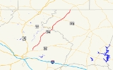
Maryland Route 194
Encyclopedia
Maryland Route 194 is a state highway
in the U.S. state of Maryland
. The state highway runs 23.87 miles (38.4 km) from MD 26
in Ceresville
north to the Pennsylvania
state line near Taneytown
, where the highway continues as Pennsylvania Route 194
(PA 194) toward Hanover
. MD 194 is the main highway between Frederick
and Hanover; the state highway connects the towns of Walkersville
and Woodsboro
in northeastern Frederick County
with Keymar
and Taneytown in northwestern Carroll County
. MD 194 was blazed as a migration route in the 18th century and a pair of turnpikes in Frederick County in the 19th century, one of which was the last private toll road in Maryland. The state highway, which was originally designated MD 71, was rebuilt in Frederick County in the mid-1920s and constructed as Francis Scott Key Highway in Carroll County in the late 1920s and early 1930s. MD 194 received its modern route number in 1956 as part of a three-route number swap. The state highway's bypasses of Walkersville and Woodsboro opened in the early 1980s and mid-1990s, respectively.
on its way toward Frederick. MD 26 heads east from the intersection as a two-lane road toward Libertytown. MD 194 heads north as Woodsboro Pike, which starts as a four-lane divided highway that reduces to two lanes as the highway passes through the suburban communities of Discovery and Spring Garden
, where the state highway passes the historic Woodsboro and Frederick Turnpike Company Tollhouse
. At Walkersville High School
, the state highway enters the town of Walkersville and the highway's old alignment, Frederick Street, splits to the north. MD 194 collects the other end of Frederick Street and passes between residential subdivisions before leaving the town at the highway's intersection with Devilbiss Bridge Road and Daysville Road. The former road heads west toward the historic Harris Farm
; the latter highway leads to the 19th century Crum Road Bridge
.
MD 194 parallels the Maryland Midland Railway
's north–south line, Israel Creek, and Laurel Hill north to Woodsboro. At the south end of the town, Main Street, which is unsigned MD 194A, continues straight north while MD 194 veers northeast to bypass the town. The state highway starts to run concurrently
with MD 550 at Woodsboro Road, which heads east as MD 550 toward Libertytown. On the north side of town, MD 550 heads west as Woodsboro Creagerstown Road, which meets the northern end of Main Street before heading northwest toward Thurmont. MD 194 veers northeast and crosses at grade to the west side of the railroad track at New Midway
, where the highway intersects Legore Road, which leads to the LeGore Bridge
. The state highway passes through the village of Ladiesburg
before crossing Little Pipe Creek into Carroll County.
MD 194 continues as Francis Scott Key Highway through Keymar, where the north–south and east–west lines of the Maryland Midland Railway intersect. The state highway has an at-grade crossing of the east–west rail line and intersects Middleburg Road, which heads west as MD 77. In the hamlet of Bruceville, MD 194 crosses Big Pipe Creek and intersects Keysville Bruceville Road, which heads northwest toward the village of Keysville
and Terra Rubra
, the birthplace of Francis Scott Key
. The state highway passes the historic Winemiller Family Farm
and Keefer-Brubaker Farm
on its way to Taneytown. MD 194, which becomes Frederick Street, crosses a branch of Piney Creek and passes the Ludwick Rudisel Tannery House
. In the center of the Taneytown Historic District
, the state highway intersects MD 140 (Baltimore Street), where MD 194 becomes York Street. After leaving Taneytown, the state highway becomes Francis Scott Key Highway again as it heads through farmland. MD 194 crosses Piney Creek before reaching its northern terminus at the Pennsylvania state line. The roadway continues north as PA 194 (Frederick Pike) toward Littlestown
and Hanover.
and Winchester, Virginia
via York
, Frederick, Boonsboro
, and Williamsport
. The Frederick County portion of the highway later became the path of a pair of turnpikes. The Woodsboro and Double Pipe Creek Turnpike connected the namesake town and creek; the Woodsboro and Frederick Turnpike extended from Woodsboro south to the junction with the Liberty and Frederick Turnpike in Ceresville. The two turnpikes issuing from Ceresville were connected to Frederick by the Frederick and Woodsboro Turnpike. The Woodsboro and Frederick Turnpike was the last privately maintained toll road in Maryland when it was purchased by the Maryland State Roads Commission in 1921.
What is now MD 194 was originally designated MD 71. The roads commission resurfaced the turnpikes' macadam surface from Ceresville to Little Pipe Creek to a width of 15 feet (4.6 m) by 1926. That same year, 1 miles (1.6 km) of concrete road was constructed north from MD 32 (now MD 140) in Taneytown. In 1930, construction began to complete the concrete road that MD 71 would follow through Carroll County. The state highway was completed in five sections from a short distance north of Big Pipe Creek to the Pennsylvania state line in 1933. The Carroll County section of MD 71 was dedicated as Francis Scott Key Highway in 1931. The two sections of MD 71 were separated by a county-maintained segment of highway through Keymar. This gap in the state road system remained through at least 1949.
MD 71 received a new steel I-beam bridge over Big Pipe Creek in 1940; this bridge was replaced in 2005. The state highway was widened through Taneytown in 1948. MD 71's present steel I-beam bridge over Little Pipe Creek at the county line was started in 1953 and completed in 1954 along with 1 miles (1.6 km) of approach roads. The state highway was reconstructed and widened from the Little Pipe Creek Bridge to New Midway in 1952 and 1953. Reconstruction of the highway commenced from New Midway to Woodsboro in 1953, from Woodsboro to Ceresville in 1956, and from Taneytown to the Pennsylvania state line in 1957.
In 1956, MD 71 was involved in a three-route number change involving highways in three different areas of the state. MD 71 was assigned to the Blue Star Memorial Highway then under construction from Queenstown
to the Delaware
state line; this designation lasted only three years before U.S. Route 301
was rerouted onto the highway in 1959. MD 71 was designated MD 194 to match the adjacent numbered highway in Pennsylvania. MD 194 was originally assigned to Flower Avenue in Takoma Park
; Flower Avenue was designated MD 787
.
MD 194's bypass of Walkersville was completed around 1981. The state highway's bypass of Woodsboro was under construction by 1995 and completed in 1997; Main Street through town was designated MD 194A. MD 550, which ran concurrently with MD 194 along Main Street, joined the latter route on the new bypass and on a bypass section of its own at the north end of town. In conjunction with the reconstruction of MD 26 as a divided highway from Market Street (then part of MD 355) to Ceresville in 1997, the MD 26–MD 194 intersection was reconfigured so the primary movement through the intersection is between MD 26 to the west and MD 194 to the north. The southernmost portion of MD 194 was an extension of the MD 26 divided highway. This configuration was chosen because two-thirds of traffic passing through the intersection was between Frederick and Woodsboro.
!County
!Location
!Mile
!Destinations
!Notes
|-
|rowspan=4|Frederick
|Ceresville
|0.00
|
|Southern terminus
|-
|rowspan=3|Woodsboro
|5.65
|Main Street north
|Unsigned MD 194A
|-
|6.46
|
|South end of concurrency with MD 550
|-
|7.01
|
|North end of concurrency with MD 550
|-
|rowspan=3|Carroll
|Keymar
|13.33
|
|
|-
|Taneytown
|18.66
|
|
|-
|
|23.87
|
|Northern terminus; Pennsylvania
state line
State highway
State highway, state road or state route can refer to one of three related concepts, two of them related to a state or provincial government in a country that is divided into states or provinces :#A...
in the U.S. state of Maryland
Maryland
Maryland is a U.S. state located in the Mid Atlantic region of the United States, bordering Virginia, West Virginia, and the District of Columbia to its south and west; Pennsylvania to its north; and Delaware to its east...
. The state highway runs 23.87 miles (38.4 km) from MD 26
Maryland Route 26
Maryland Route 26 is an east–west state highway in the U.S. state of Maryland. Outside of the Baltimore city limits, it is known as Liberty Road; inside the city limits it is known as Liberty Heights Avenue....
in Ceresville
Ceresville, Maryland
Ceresville is an unincorporated community in Frederick County, Maryland....
north to the Pennsylvania
Pennsylvania
The Commonwealth of Pennsylvania is a U.S. state that is located in the Northeastern and Mid-Atlantic regions of the United States. The state borders Delaware and Maryland to the south, West Virginia to the southwest, Ohio to the west, New York and Ontario, Canada, to the north, and New Jersey to...
state line near Taneytown
Taneytown, Maryland
Taneytown is a city in Carroll County, Maryland, United States. The population was 5,128 at the 2000 census. was founded in 1754. Of the town George Washington once wrote "Tan-nee town is but a small place with only the Street through wch. the road passes, built on...
, where the highway continues as Pennsylvania Route 194
Pennsylvania Route 194
Pennsylvania Route 194 is a long north–south state highway located in south-central Pennsylvania. The southern end is at the Maryland State Line and the northern terminus is at the intersection with PA 74 in the town of Dillsburg.-Route description:PA 194 begins at the Maryland border in...
(PA 194) toward Hanover
Hanover, Pennsylvania
Hanover is a borough in York County, Pennsylvania, southwest of York and north-northwest of Baltimore, Maryland.The town is situated in a productive agricultural region. The population was 15,289 at the 2010 census. The borough is served by a 717 area code and the Zip Codes of 17331-34...
. MD 194 is the main highway between Frederick
Frederick, Maryland
Frederick is a city in north-central Maryland. It is the county seat of Frederick County, the largest county by area in the state of Maryland. Frederick is an outlying community of the Washington-Arlington-Alexandria, DC-VA-MD-WV Metropolitan Statistical Area, which is part of a greater...
and Hanover; the state highway connects the towns of Walkersville
Walkersville, Maryland
Walkersville is a town in Frederick County, Maryland, United States. The population was 5,805 per the 2010 census.-History:Crum Road Bridge was listed on the National Register of Historic Places in 1978...
and Woodsboro
Woodsboro, Maryland
Woodsboro is a town in Frederick County, Maryland, United States that was granted to Joseph Wood in 1693. The population was 846 at the 2000 census.-History:...
in northeastern Frederick County
Frederick County, Maryland
Frederick County is a county located in the western part of the U.S. state of Maryland, bordering the southern border of Pennsylvania and the northeastern border of Virginia. As of the 2010 Census, the population was 233,385....
with Keymar
Keymar, Maryland
Keymar is an unincorporated community in Carroll County, Maryland, United States.-References:...
and Taneytown in northwestern Carroll County
Carroll County, Maryland
Carroll County is a county located in the U.S. state of Maryland. In 2010, its population was 167,134. It was named for Charles Carroll of Carrollton , signer of the American Declaration of Independence. Its county seat is Westminster....
. MD 194 was blazed as a migration route in the 18th century and a pair of turnpikes in Frederick County in the 19th century, one of which was the last private toll road in Maryland. The state highway, which was originally designated MD 71, was rebuilt in Frederick County in the mid-1920s and constructed as Francis Scott Key Highway in Carroll County in the late 1920s and early 1930s. MD 194 received its modern route number in 1956 as part of a three-route number swap. The state highway's bypasses of Walkersville and Woodsboro opened in the early 1980s and mid-1990s, respectively.
Route description
MD 194 begins at an intersection with MD 26 (Liberty Road) in Ceresville. The roadway continues south as MD 26, which crosses the Monocacy RiverMonocacy River
The Monocacy River is a free-flowing tributary of the Potomac River, which empties into the Atlantic Ocean via the Chesapeake Bay. The river is long, with a drainage area of about...
on its way toward Frederick. MD 26 heads east from the intersection as a two-lane road toward Libertytown. MD 194 heads north as Woodsboro Pike, which starts as a four-lane divided highway that reduces to two lanes as the highway passes through the suburban communities of Discovery and Spring Garden
Discovery-Spring Garden, Maryland
Discovery-Spring Garden is a census-designated place in Frederick County, Maryland, United States. It is the combination of the two communities of Discovery and Spring Garden...
, where the state highway passes the historic Woodsboro and Frederick Turnpike Company Tollhouse
Woodsboro and Frederick Turnpike Company Tollhouse
The Woodsboro and Frederick Turnpike Company Tollhouse is a historic toll house located at Walkersville, Frederick County, Maryland, United States. It is a two-story brick structure over a stone foundation, with a small interior end chimney at each gable end...
. At Walkersville High School
Walkersville High School
Walkersville High School is a four-year public high school in Walkersville, Frederick County, Maryland, United States. The school's colors are blue and gold and athletic teams are known as the “Lions.”-Overview:...
, the state highway enters the town of Walkersville and the highway's old alignment, Frederick Street, splits to the north. MD 194 collects the other end of Frederick Street and passes between residential subdivisions before leaving the town at the highway's intersection with Devilbiss Bridge Road and Daysville Road. The former road heads west toward the historic Harris Farm
Harris Farm (Walkersville, Maryland)
Harris Farm is a historic home and farm complex located at Walkersville, Frederick County, Maryland, United States. The main house was built in 1855, and is a three-story center plan house in predominantly late Greek Revival syle, with some Italianate elements...
; the latter highway leads to the 19th century Crum Road Bridge
Crum Road Bridge
The Crum Road Bridge is a historic bridge near Walkersville, Frederick County, Maryland, United States. It spans Israel Creek southeast of Walkersville. The bridge is an iron bowstring pony truss bridge that is 62 feet in length and 15.8 feet in width...
.
MD 194 parallels the Maryland Midland Railway
Maryland Midland Railway
The Maryland Midland Railway is a Class III short-line railroad operating about 63 miles of track in central Maryland. It was originally headquartered in the former Western Maryland Railway station in Union Bridge, Maryland, however it is now located in a new facility across the street from the...
's north–south line, Israel Creek, and Laurel Hill north to Woodsboro. At the south end of the town, Main Street, which is unsigned MD 194A, continues straight north while MD 194 veers northeast to bypass the town. The state highway starts to run concurrently
Concurrency (road)
A concurrency, overlap, or coincidence in a road network is an instance of one physical road bearing two or more different highway, motorway, or other route numbers...
with MD 550 at Woodsboro Road, which heads east as MD 550 toward Libertytown. On the north side of town, MD 550 heads west as Woodsboro Creagerstown Road, which meets the northern end of Main Street before heading northwest toward Thurmont. MD 194 veers northeast and crosses at grade to the west side of the railroad track at New Midway
New Midway, Maryland
New Midway is an unincorporated community in Frederick County, Maryland, United States.-References:...
, where the highway intersects Legore Road, which leads to the LeGore Bridge
LeGore Bridge
Begun in 1898 in rural Frederick County, Maryland, the LeGore Bridge was completed and opened to the public in 1900. It was built and maintained by the owners of the LeGore Lime Company, including local businessman James William LeGore and his company advisor, Eugene Hammond. It is 340 feet in...
. The state highway passes through the village of Ladiesburg
Ladiesburg, Maryland
Ladiesburg is an unincorporated community in Frederick County, Maryland, United States.-References:...
before crossing Little Pipe Creek into Carroll County.
MD 194 continues as Francis Scott Key Highway through Keymar, where the north–south and east–west lines of the Maryland Midland Railway intersect. The state highway has an at-grade crossing of the east–west rail line and intersects Middleburg Road, which heads west as MD 77. In the hamlet of Bruceville, MD 194 crosses Big Pipe Creek and intersects Keysville Bruceville Road, which heads northwest toward the village of Keysville
Keysville, Maryland
Keysville is an unincorporated community in Carroll County, Maryland, United States. Terra Rubra was listed on the National Register of Historic Places in 1978.-References:...
and Terra Rubra
Terra Rubra
Terra Rubra is a historic home located near Keysville, Carroll County, Maryland. It was the birth site of Francis Scott Key in 1779. The present Federal-style house was built in the 1850s after the Key residence had become badly deteriorated. The original house was built in the 1770s by Francis...
, the birthplace of Francis Scott Key
Francis Scott Key
Francis Scott Key was an American lawyer, author, and amateur poet, from Georgetown, who wrote the lyrics to the United States' national anthem, "The Star-Spangled Banner".-Life:...
. The state highway passes the historic Winemiller Family Farm
Winemiller Family Farm
The Winemiller Family Farm is a historic home and farm complex located at Taneytown, Carroll County, Maryland, United States. The complex consists of a large two-story brick house built about 1865, a frame bank barn, and several outbuildings...
and Keefer-Brubaker Farm
Keefer-Brubaker Farm
Keefer-Brubaker Farm, also known as the Oscar Fogle Farm, is a historic home and farm complex located at Taneytown, Carroll County, Maryland. It consists of a two-story six-by-two-bay log-and-frame house which is partially encased in brick and rests on a rubble stone foundation Also on the...
on its way to Taneytown. MD 194, which becomes Frederick Street, crosses a branch of Piney Creek and passes the Ludwick Rudisel Tannery House
Ludwick Rudisel Tannery House
The Ludwick Rudisel Tannery House, also known as Motter Place, is a historic home located at Taneytown, Carroll County, Maryland, United States. The main block is constructed of brick on a fieldstone foundation, five bays in length, two deep, with an original slate roof, built about 1807. Attached...
. In the center of the Taneytown Historic District
Taneytown Historic District
Taneytown Historic District is a national historic district at Taneytown, Carroll County, Maryland, United States. The district comprises a cohesive group of houses, churches, commercial buildings and industrial structures reflecting the development of this crossroads town from its initial...
, the state highway intersects MD 140 (Baltimore Street), where MD 194 becomes York Street. After leaving Taneytown, the state highway becomes Francis Scott Key Highway again as it heads through farmland. MD 194 crosses Piney Creek before reaching its northern terminus at the Pennsylvania state line. The roadway continues north as PA 194 (Frederick Pike) toward Littlestown
Littlestown, Pennsylvania
Littlestown is a borough in Adams County, Pennsylvania, United States. The population was 4,434 at the 2010 census.Originally laid out by Peter Klein in 1760, the town was first named "Petersburg". German settlers in the area came to call the town "Kleine Stedtle"...
and Hanover.
History
In the 18th century, the corridor of what is now MD 194 was the Hanover–Frederick portion of the Monocacy Road, a migration route that connected PhiladelphiaPhiladelphia, Pennsylvania
Philadelphia is the largest city in the Commonwealth of Pennsylvania and the county seat of Philadelphia County, with which it is coterminous. The city is located in the Northeastern United States along the Delaware and Schuylkill rivers. It is the fifth-most-populous city in the United States,...
and Winchester, Virginia
Winchester, Virginia
Winchester is an independent city located in the northwestern portion of the Commonwealth of Virginia in the USA. The city's population was 26,203 according to the 2010 Census...
via York
York, Pennsylvania
York, known as the White Rose City , is a city located in York County, Pennsylvania, United States which is in the South Central region of the state. The population within the city limits was 43,718 at the 2010 census, which was a 7.0% increase from the 2000 count of 40,862...
, Frederick, Boonsboro
Boonsboro, Maryland
Boonsboro is a town in Washington County, Maryland, United States, located at the foot of South Mountain. It nearly borders Frederick County and is proximate to the Antietam National Battlefield...
, and Williamsport
Williamsport, Maryland
Williamsport is a town in Washington County, Maryland, United States. The population was 1,868 at the 2000 census and 2,278 as of July 2008.-Geography: Williamsport is located at ....
. The Frederick County portion of the highway later became the path of a pair of turnpikes. The Woodsboro and Double Pipe Creek Turnpike connected the namesake town and creek; the Woodsboro and Frederick Turnpike extended from Woodsboro south to the junction with the Liberty and Frederick Turnpike in Ceresville. The two turnpikes issuing from Ceresville were connected to Frederick by the Frederick and Woodsboro Turnpike. The Woodsboro and Frederick Turnpike was the last privately maintained toll road in Maryland when it was purchased by the Maryland State Roads Commission in 1921.
What is now MD 194 was originally designated MD 71. The roads commission resurfaced the turnpikes' macadam surface from Ceresville to Little Pipe Creek to a width of 15 feet (4.6 m) by 1926. That same year, 1 miles (1.6 km) of concrete road was constructed north from MD 32 (now MD 140) in Taneytown. In 1930, construction began to complete the concrete road that MD 71 would follow through Carroll County. The state highway was completed in five sections from a short distance north of Big Pipe Creek to the Pennsylvania state line in 1933. The Carroll County section of MD 71 was dedicated as Francis Scott Key Highway in 1931. The two sections of MD 71 were separated by a county-maintained segment of highway through Keymar. This gap in the state road system remained through at least 1949.
MD 71 received a new steel I-beam bridge over Big Pipe Creek in 1940; this bridge was replaced in 2005. The state highway was widened through Taneytown in 1948. MD 71's present steel I-beam bridge over Little Pipe Creek at the county line was started in 1953 and completed in 1954 along with 1 miles (1.6 km) of approach roads. The state highway was reconstructed and widened from the Little Pipe Creek Bridge to New Midway in 1952 and 1953. Reconstruction of the highway commenced from New Midway to Woodsboro in 1953, from Woodsboro to Ceresville in 1956, and from Taneytown to the Pennsylvania state line in 1957.
In 1956, MD 71 was involved in a three-route number change involving highways in three different areas of the state. MD 71 was assigned to the Blue Star Memorial Highway then under construction from Queenstown
Queenstown, Maryland
Queenstown is a town in Queen Anne's County, Maryland, United States. The population was 617 at the 2000 census.-Geography:Queenstown is located at ....
to the Delaware
Delaware
Delaware is a U.S. state located on the Atlantic Coast in the Mid-Atlantic region of the United States. It is bordered to the south and west by Maryland, and to the north by Pennsylvania...
state line; this designation lasted only three years before U.S. Route 301
U.S. Route 301 in Maryland
U.S. Route 301 in Maryland is a major highway that runs from Delaware to the Governor Harry W. Nice Memorial Bridge into Virginia. It passes through three of Maryland's four main regions: the Eastern Shore, the Baltimore-Washington Metropolitan Area, and Southern Maryland...
was rerouted onto the highway in 1959. MD 71 was designated MD 194 to match the adjacent numbered highway in Pennsylvania. MD 194 was originally assigned to Flower Avenue in Takoma Park
Takoma Park, Maryland
Takoma Park is a city in Montgomery County, Maryland, United States. It is a suburb of Washington, D.C., and part of the Washington Metropolitan Area. Founded in 1883 and incorporated in 1890, Takoma Park, informally called "Azalea City," is a Tree City USA and a nuclear-free zone...
; Flower Avenue was designated MD 787
Maryland Route 787
Maryland Route 787 is a state highway in the U.S. state of Maryland. Known as Flower Avenue, the state highway runs from Maryland Route 195 in Takoma Park north to Maryland Route 320 in Takoma Park. MD 787 splits the campus of Washington Adventist University and is the main street of the area of...
.
MD 194's bypass of Walkersville was completed around 1981. The state highway's bypass of Woodsboro was under construction by 1995 and completed in 1997; Main Street through town was designated MD 194A. MD 550, which ran concurrently with MD 194 along Main Street, joined the latter route on the new bypass and on a bypass section of its own at the north end of town. In conjunction with the reconstruction of MD 26 as a divided highway from Market Street (then part of MD 355) to Ceresville in 1997, the MD 26–MD 194 intersection was reconfigured so the primary movement through the intersection is between MD 26 to the west and MD 194 to the north. The southernmost portion of MD 194 was an extension of the MD 26 divided highway. This configuration was chosen because two-thirds of traffic passing through the intersection was between Frederick and Woodsboro.
Junction list
{| class=wikitable!County
!Location
!Mile
!Destinations
!Notes
|-
|rowspan=4|Frederick
Frederick County, Maryland
Frederick County is a county located in the western part of the U.S. state of Maryland, bordering the southern border of Pennsylvania and the northeastern border of Virginia. As of the 2010 Census, the population was 233,385....
|Ceresville
Ceresville, Maryland
Ceresville is an unincorporated community in Frederick County, Maryland....
|0.00
|
|Southern terminus
|-
|rowspan=3|Woodsboro
Woodsboro, Maryland
Woodsboro is a town in Frederick County, Maryland, United States that was granted to Joseph Wood in 1693. The population was 846 at the 2000 census.-History:...
|5.65
|Main Street north
|Unsigned MD 194A
|-
|6.46
|
|South end of concurrency with MD 550
|-
|7.01
|
|North end of concurrency with MD 550
|-
|rowspan=3|Carroll
Carroll County, Maryland
Carroll County is a county located in the U.S. state of Maryland. In 2010, its population was 167,134. It was named for Charles Carroll of Carrollton , signer of the American Declaration of Independence. Its county seat is Westminster....
|Keymar
Keymar, Maryland
Keymar is an unincorporated community in Carroll County, Maryland, United States.-References:...
|13.33
|
|
|-
|Taneytown
Taneytown, Maryland
Taneytown is a city in Carroll County, Maryland, United States. The population was 5,128 at the 2000 census. was founded in 1754. Of the town George Washington once wrote "Tan-nee town is but a small place with only the Street through wch. the road passes, built on...
|18.66
|
|
|-
|
|23.87
|
|Northern terminus; Pennsylvania
Pennsylvania
The Commonwealth of Pennsylvania is a U.S. state that is located in the Northeastern and Mid-Atlantic regions of the United States. The state borders Delaware and Maryland to the south, West Virginia to the southwest, Ohio to the west, New York and Ontario, Canada, to the north, and New Jersey to...
state line
Auxiliary routes
MD 194 has four existing auxiliary routes and two that no longer exists. MD 194A and MD 194B are in Woodsboro. MD 194D and MD 194E are north of Taneytown. Former MD 194C and MD 194F were also north of Taneytown.- MD 194A is the designation for Main Street, which runs 1.28 miles (2.1 km) between MD 194 on the south side of Woodsboro and MD 550 on the north side of Woodsboro. MD 194A is municipally maintained for 0.75 miles (1.2 km) from Mt. Hope Cemetery north to Coppermine Road.
- MD 194B is the designation for a 0.09 mile (0.1448406 km) section of Main Street that is now a spur south from MD 194A just north of MD 194's southern end at MD 194.
- MD 194C was the designation for an unnamed 0.03 mile (0.0482802 km) connector between MD 194 and former MD 853D. MD 194C and MD 853D were removed from the state highway system in 2004 due to the roadway being overgrown.
- MD 194D is the designation for an unnamed 0.02 mile (0.0321868 km) connector between MD 194 and MD 853E, the old alignment that parallels the northbound direction of the modern highway south of Angell Road.
- MD 194E is the designation for an unnamed 0.02 mile (0.0321868 km) connector between MD 194 and MD 853A, the old alignment that parallels the southbound direction of the modern highway south of the Pennsylvania state line.
- MD 194F was the designation for an unnamed 0.02 mile (0.0321868 km) connector between MD 194 and former MD 853D. MD 194F and MD 853D were removed from the state highway system in 2004 due to the roadway being overgrown.