
Maryland Route 19
Encyclopedia
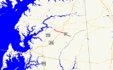
Maryland Route 19 is a state highway
in the U.S. state
of Maryland
. Known for much of its length as Roberts Station Road, the state highway runs 8.6 mi (13.8 km) from MD 213
in Church Hill
east to MD 313
in Ingleside
. MD 19 runs through central Queen Anne's County
, connecting both communities with U.S. Route 301
(US 301) near the road's namesake community. The state highway was one of the original state roads marked for improvement by the Maryland State Roads Commission
in 1909. MD 19 was paved in the mid 1910s. The state highway has been extended on both ends following realignments of MD 313 and MD 213 in the late 1940s and early 1970s, respectively.
(Sudlersville Road). MD 19 continues toward the center of town, where the highway passes in front of historic St. Luke's Episcopal Church, the church that inspired the town's name. MD 19 turns southeast onto Walnut Street, while Main Street continues south toward another junction with MD 213 as unsigned
MD 19A. The state highway passes through a residential area then leaves the town limits heading south. MD 19 curves to the east at the intersection with MD 405
(Price Station Road).
MD 19 continues through farmland as Roberts Station Road. The state highway intersects US 301 (Blue Star Memorial Highway) before crossing the Centreville Branch of the Northern Line of the Maryland and Delaware Railroad
at the hamlet of Roberts Station. MD 19 veers southeast toward Ingleside, where the highway intersects Roe Ingleside Road and crosses Beaverdam Ditch. Shortly after intersecting the old alignment of MD 313, St. Paul Road, the state highway reaches its eastern terminus at current MD 313 (Goldsboro Road).
and Denton
. Paving of the state road was completed in 1915. MD 19 was among the original highways signed when Maryland highways were first signed numerically in 1927. MD 19's eastern terminus was extended east to current MD 313 from St. Paul Road when MD 313 bypassed Ingleside in 1949. MD 19's western terminus was extended north along Main Street in Church Hill, formerly part of MD 213, when MD 213 bypassed Church Hill in 1971.
.
{|class=wikitable
!Location
!Mile
!Roads intersected
!Notes
|-
|rowspan=4|Church Hill
|0.00
|
|Western terminus
|-
|0.47
|
|Officially MD 300A
|-
|1.05
|Main Street south
|MD 19 turns southeast onto Walnut Street; Main Street is unsigned MD 19A
|-
|2.05
|
|
|-
|
|3.93
|, Wilmington
|
|-
|rowspan=3|Ingleside
|8.13
|Roe Ingleside Road south – Roe
|Former MD 305
|-
|8.25
|St. Paul Road north
|Old alignment of MD 313
|-
|8.60
|
|Eastern terminus
State highway
State highway, state road or state route can refer to one of three related concepts, two of them related to a state or provincial government in a country that is divided into states or provinces :#A...
in the U.S. state
U.S. state
A U.S. state is any one of the 50 federated states of the United States of America that share sovereignty with the federal government. Because of this shared sovereignty, an American is a citizen both of the federal entity and of his or her state of domicile. Four states use the official title of...
of Maryland
Maryland
Maryland is a U.S. state located in the Mid Atlantic region of the United States, bordering Virginia, West Virginia, and the District of Columbia to its south and west; Pennsylvania to its north; and Delaware to its east...
. Known for much of its length as Roberts Station Road, the state highway runs 8.6 mi (13.8 km) from MD 213
Maryland Route 213
Maryland Route 213 is a state highway located on the Eastern Shore of Maryland in the United States. The route runs from Maryland Route 662 in Wye Mills, Queen Anne's County north to the Pennsylvania border in Cecil County, where it continues into that state as Pennsylvania Route 841...
in Church Hill
Church Hill, Maryland
Church Hill is a town in Queen Anne's County, Maryland, United States. The population was 530 at the 2000 census. Joshua Seney was born near Church Hill, and is buried on his property near the town.-Geography:...
east to MD 313
Maryland Route 313
Maryland Route 313 is a state highway located on the Eastern Shore of Maryland in the United States. The route runs from U.S. Route 50 in Mardela Springs, Wicomico County north to Maryland Route 213 and Maryland Route 290 in Galena, Kent County...
in Ingleside
Ingleside, Maryland
Ingleside is an unincorporated community in Queen Anne's County, Maryland, United States. Ingleside is located on Maryland Route 19 southeast of Church Hill. Ingleside has a post office with ZIP code 21644....
. MD 19 runs through central Queen Anne's County
Queen Anne's County, Maryland
Queen Anne's County is a county located on the Eastern Shore of the U.S. state of Maryland.As of 2010, the population was 47,798. Its county seat and most populous municipality is Centreville. The census-designated place of Stevensville is the county's most populous place...
, connecting both communities with U.S. Route 301
U.S. Route 301 in Maryland
U.S. Route 301 in Maryland is a major highway that runs from Delaware to the Governor Harry W. Nice Memorial Bridge into Virginia. It passes through three of Maryland's four main regions: the Eastern Shore, the Baltimore-Washington Metropolitan Area, and Southern Maryland...
(US 301) near the road's namesake community. The state highway was one of the original state roads marked for improvement by the Maryland State Roads Commission
Maryland State Highway Administration
The Maryland State Highway Administration is the state agency responsible for maintaining Maryland numbered highways outside of Baltimore City...
in 1909. MD 19 was paved in the mid 1910s. The state highway has been extended on both ends following realignments of MD 313 and MD 213 in the late 1940s and early 1970s, respectively.
Route description
MD 19 begins at an intersection with MD 213 (Church Hill Road) in Church Hill. The state highway heads south as two-lane Main Street into the town limits of Church Hill, intersecting MD 300Maryland Route 300
Maryland Route 300 is a state highway in the U.S. state of Maryland. Known for most of its length as Sudlersville Road, the state highway runs from MD 213 in Church Hill east to the Delaware state line, where the highway continues as Delaware Route 300...
(Sudlersville Road). MD 19 continues toward the center of town, where the highway passes in front of historic St. Luke's Episcopal Church, the church that inspired the town's name. MD 19 turns southeast onto Walnut Street, while Main Street continues south toward another junction with MD 213 as unsigned
Unsigned highway
An unsigned highway is a highway that has been assigned a route number, but does not bear conventional road markings that would normally be used to identify the route with that number...
MD 19A. The state highway passes through a residential area then leaves the town limits heading south. MD 19 curves to the east at the intersection with MD 405
Maryland Route 405
Maryland Route 405 is a state highway in the U.S. state of Maryland. Known as Price Station Road, the state highway runs from MD 304 near Bridgetown north to MD 19 near Church Hill. MD 405 connects Church Hill and Bridgetown with the central Queen Anne's County community of Price, where the...
(Price Station Road).
MD 19 continues through farmland as Roberts Station Road. The state highway intersects US 301 (Blue Star Memorial Highway) before crossing the Centreville Branch of the Northern Line of the Maryland and Delaware Railroad
Maryland and Delaware Railroad
The Maryland and Delaware Railroad Company is a Class III short-line railroad, formed in 1977 to operate several branch lines of the former Penn Central Railroad in both Maryland and Delaware. These branches were omitted from the system plan for Conrail in 1976 and would have been discontinued...
at the hamlet of Roberts Station. MD 19 veers southeast toward Ingleside, where the highway intersects Roe Ingleside Road and crosses Beaverdam Ditch. Shortly after intersecting the old alignment of MD 313, St. Paul Road, the state highway reaches its eastern terminus at current MD 313 (Goldsboro Road).
History
The Church Hill–Ingleside road was designated one of the original state roads to be improved by the Maryland State Roads Commission in 1909, part of the longer highway between ChestertownChestertown, Maryland
Chestertown is a town in Kent County, Maryland, United States. The population was 4,746 at the 2000 census. It is the county seat of Kent County. The ZIP code is 21620 and the area codes are 410 and 443...
and Denton
Denton, Maryland
Denton is a town in Caroline County, Maryland, United States. The population was 2,960 at the 2000 census. It is the county seat of Caroline County. Denton is the birthplace of former Delaware governor Sherman W. Tribbitt and author Sophie Kerr, as well as the long time home of former Maryland...
. Paving of the state road was completed in 1915. MD 19 was among the original highways signed when Maryland highways were first signed numerically in 1927. MD 19's eastern terminus was extended east to current MD 313 from St. Paul Road when MD 313 bypassed Ingleside in 1949. MD 19's western terminus was extended north along Main Street in Church Hill, formerly part of MD 213, when MD 213 bypassed Church Hill in 1971.
Junction list
The entire route is in Queen Anne's CountyQueen Anne's County, Maryland
Queen Anne's County is a county located on the Eastern Shore of the U.S. state of Maryland.As of 2010, the population was 47,798. Its county seat and most populous municipality is Centreville. The census-designated place of Stevensville is the county's most populous place...
.
{|class=wikitable
!Location
!Mile
!Roads intersected
!Notes
|-
|rowspan=4|Church Hill
Church Hill, Maryland
Church Hill is a town in Queen Anne's County, Maryland, United States. The population was 530 at the 2000 census. Joshua Seney was born near Church Hill, and is buried on his property near the town.-Geography:...
|0.00
|
|Western terminus
|-
|0.47
|
|Officially MD 300A
|-
|1.05
|Main Street south
|MD 19 turns southeast onto Walnut Street; Main Street is unsigned MD 19A
|-
|2.05
|
|
|-
|
|3.93
|, Wilmington
Wilmington, Delaware
Wilmington is the largest city in the state of Delaware, United States, and is located at the confluence of the Christina River and Brandywine Creek, near where the Christina flows into the Delaware River. It is the county seat of New Castle County and one of the major cities in the Delaware Valley...
|
|-
|rowspan=3|Ingleside
Ingleside, Maryland
Ingleside is an unincorporated community in Queen Anne's County, Maryland, United States. Ingleside is located on Maryland Route 19 southeast of Church Hill. Ingleside has a post office with ZIP code 21644....
|8.13
|Roe Ingleside Road south – Roe
|Former MD 305
Maryland Route 305
Maryland Route 305 is a state highway in the U.S. state of Maryland. Known as Hope Road, the state highway runs from MD 213 in Centreville east to an intersection with Hayden Road and Dean Road in Hope east of its intersection with U.S. Route 301 in central Queen Anne's County...
|-
|8.25
|St. Paul Road north
|Old alignment of MD 313
|-
|8.60
|
|Eastern terminus