

Marietta Parkway
Encyclopedia
North and South Marietta Parkway form a ring road
in Marietta, Georgia
that was once designated as Georgia State Route 120 Loop before route realignments in 2007. The full loop is approximately 9 miles (14.5 km) in circumference and intersects Interstate 75
twice, once on the north side of Marietta and once on the south side. The southern segment of the road is designated as a part of Georgia State Route 120 and the northern segment forms State Route 120 Alternate.
A portion of SR 5
runs multiplexed with SR 120 Alternate from U.S. Route 41
west to SR 120 mainline.
, the southern part went right through existing neighborhoods, destroying several homes and cutting-off several streets, much like I-75 had just done.
Initially, mainline Georgia 120 followed what is now the northern part of the loop between Roswell Road and U.S. 41: a move that resulted in the removal of the portion of Georgia 120 from U.S. Route 41 at the Big Chicken to the eastern 120 Loop interchange. This was changed in the early 1970s to the configuration still known to locals today. The northern portion of the Loop is distinct in that it ended at a partial diamond interchange
at U.S. Route 41 (then Georgia 3E, now Georgia 3), with the roadway built-up for a future full interchange.
Work did not commence again on the remainder of the highway until the late 1970s. Work to upgrade Clay Street from U.S. Route 41 to Powder Springs Street (Georgia 360
) included a relocation of part of the street to an underpass beneath the Louisville & Nashville (now CSX Transportation
, originally Western & Atlantic) Railroad. When work was completed, it finished the southern half of the route and the highway was extended. Clay Street would later be renamed South Marietta Parkway with exception to Old Clay Street, which remains as a residential street connecting the Loop to Atlanta Street (SR 5
). Northwest of Manget Street, the highway went diagonally through existing neighborhoods, again destroying several homes. Atlanta Street was severed, but Atlanta Road was built next to it on its west side, taking more homes. Part of Powder Springs Street was permanently torn out, leaving the rest of it north to the town square as Old Powder Springs Street. The relocated Powder Springs Street was angled off to the west to become the western section of the Loop, and was extended north just past Whitlock Avenue to Polk Street.
 Work began again in the early 1980s to complete most of the northern quadrant when the roadway was extended from the previously-mentioned diamond interchange to connect to and take over Page Street. The planned overpass of U.S. 41 was never built and an at-grade intersection was put there instead. However, the ramps still curiously remain, with the southern (eastbound) one actually used as an entrance ramp, and the northern (westbound) one connecting to Barnes Mill Road instead. Page Street had previously ended at Fairground Street, and the extension completed all parts of the loop except one final part.
1989 saw completion of the final leg of the loop at its northwestern corner, going west past Church Street (by then a one-way street which at the time was SR 5 southbound). This portion took out the lumberyard of Williams Brothers Lumber Company, and involved building an entrenched roadway with an overpass for Kennesaw Avenue (the original U.S. 41 and SR 3
) and the L&N Railroad, with the roadway tying into the extension of the new Powder Springs Street, which previously ended at Polk Street. The completion of this final leg resulted in the completion of the loop. In addition, SR 5 was relocated out of downtown Marietta onto part of the new loop to the west; it was later rerouted through a completely different city, going down Austell Road instead of Powder Springs Road, and may be rerouted yet again off of the loop and completely away from Marietta onto Barrett Parkway
.
In October 2007, the portion of SR 120 along Roswell Street between U.S. 41 and SR 5 and 120 Loop was downgraded to a local city street, along with portions of SR 5. Since SR 120 required a new routing, Georgia 120 mainline was moved to the southern part of SR 120 Loop, and SR 120 Alternate was created on the north loop. As a result, Georgia 120 Loop no longer exists, though only some of the signs have been changed, leaving a hodgepodge of confusing and contradictory information in different places, in addition to there being no public notice
of the change by the Georgia Department of Transportation
. Compared to the northern route, the new routing takes mainline SR 120 around Marietta the indirect way, making it a longer distance by going out of the way to the south and back north, causing drivers to turn on a different road to stay on the same highway at a third point at Powder Springs Road (in addition to either end where it turns off to original route), and causing further driving
delays with more traffic light
s. In January 2008, Georgia Department of Transportation
(GDOT) crews began discretely changing and removing signs along the 120 Loop and the 120 mainline.
The remaining state-maintained part of Roswell Road between the eastern intersection with the loop and U.S. 41 was renumbered Georgia 3 Connector, the previous designation of a completely different road in Marietta. Georgia 5 currently shares the west end of the Loop, west from Cherokee Street (northbound only) to Church Street (southbound only), southwest to Whitlock Avenue, south to Powder Springs Road, and turning east at that intersection to Atlanta Road. This is a completely roundabout and unnecessary routing, since Atlanta Road turns into Cherokee Street via East Park Square (the street's name for one block along the town square
), and since Church Street / West Park Square / Old Powder Springs Street connects to it at a one-way cross street.
Highway), northeast to Church Street, east to Roswell Road, and southeast to Lower Roswell Road, it is known as North Marietta Parkway. Much of this route used to be known as Page Street. Almost all of it is in the county's northeast quadrant for street addresses, except west of Church Street where it is northwest.
Along the west side from Whitlock Avenue south to the "new" Powder Springs Street, then east to Atlanta Road, southeast to Manget Street, east to Interstate 75, then northeast to Lower Roswell Road, it is known as South Marietta Parkway. Much of this route used to be known as Clay Street. Almost all of it is in the county's southeast quadrant for street addresses, except west of the railroad tracks where it is southwest.
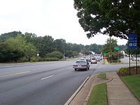
of Marietta, like most loop roads. However, it is also a common surface street
for locals. The two main intersections with Interstate 75
in Marietta are along this road in the eastern part of Marietta.
Traveling east from Powder Springs St:
Traveling north from I-75 (divided highway):
Traveling west from Roswell Road:
Ring road
A ring road, orbital motorway, beltway, circumferential highway, or loop highway is a road that encircles a town or city...
in Marietta, Georgia
Marietta, Georgia
Marietta is a city located in central Cobb County, Georgia, United States, and is its county seat.As of the 2010 census, the city had a total population of 56,579, making it one of metro Atlanta's largest suburbs...
that was once designated as Georgia State Route 120 Loop before route realignments in 2007. The full loop is approximately 9 miles (14.5 km) in circumference and intersects Interstate 75
Interstate 75
Interstate 75 is a major north–south Interstate Highway in the Great Lakes and Southeastern regions of the United States. It travels from State Road 826 and State Road 924 in Hialeah, Florida to Sault Ste. Marie, Michigan, at the Ontario, Canada, border...
twice, once on the north side of Marietta and once on the south side. The southern segment of the road is designated as a part of Georgia State Route 120 and the northern segment forms State Route 120 Alternate.
A portion of SR 5
Georgia State Route 5
State Route 5 is a route that bisects northern Georgia. It passes through the county seats of Blue Ridge, Ellijay, Jasper, Canton, Marietta, and Douglasville. Along the way, it overlaps one of metro Atlanta's freeways, I-575. From the Cherokee/Pickens County line to Blue Ridge, Georgia 5 is...
runs multiplexed with SR 120 Alternate from U.S. Route 41
U.S. Route 41
U.S. Route 41 is a north–south United States Highway that runs from Miami, Florida to the Upper Peninsula of Michigan. Until 1949, the part in southern Florida, from Naples to Miami, was U.S...
west to SR 120 mainline.
History
Georgia 120 Loop was built over an approximately 20-year span from 1967 to 1989. The first sections complete and open to traffic extended east of U.S. Route 41 and included the interchanges with then-new I-75, and with mainline Georgia 120. While the northern part went through what is still farmlandArable land
In geography and agriculture, arable land is land that can be used for growing crops. It includes all land under temporary crops , temporary meadows for mowing or pasture, land under market and kitchen gardens and land temporarily fallow...
, the southern part went right through existing neighborhoods, destroying several homes and cutting-off several streets, much like I-75 had just done.
Initially, mainline Georgia 120 followed what is now the northern part of the loop between Roswell Road and U.S. 41: a move that resulted in the removal of the portion of Georgia 120 from U.S. Route 41 at the Big Chicken to the eastern 120 Loop interchange. This was changed in the early 1970s to the configuration still known to locals today. The northern portion of the Loop is distinct in that it ended at a partial diamond interchange
Diamond interchange
A diamond interchange is a common type of road junction, used where a freeway crosses a minor road. The freeway itself is grade-separated from the minor road, one crossing the other over a bridge...
at U.S. Route 41 (then Georgia 3E, now Georgia 3), with the roadway built-up for a future full interchange.
Work did not commence again on the remainder of the highway until the late 1970s. Work to upgrade Clay Street from U.S. Route 41 to Powder Springs Street (Georgia 360
State Route 360 (Georgia)
State Route 360 is a state highway located in northwest Georgia. The route begins with its intersection with U.S. 278/S.R. 6 near Dallas and travels to the east cosigned with S.R. 120 for a short distance. The routes then diverge, with S.R. 360 routed on Macland Road. The route exits Paulding...
) included a relocation of part of the street to an underpass beneath the Louisville & Nashville (now CSX Transportation
CSX Transportation
CSX Transportation operates a Class I railroad in the United States known as the CSX Railroad. It is the main subsidiary of the CSX Corporation. The company is headquartered in Jacksonville, Florida, and owns approximately 21,000 route miles...
, originally Western & Atlantic) Railroad. When work was completed, it finished the southern half of the route and the highway was extended. Clay Street would later be renamed South Marietta Parkway with exception to Old Clay Street, which remains as a residential street connecting the Loop to Atlanta Street (SR 5
Georgia State Route 5
State Route 5 is a route that bisects northern Georgia. It passes through the county seats of Blue Ridge, Ellijay, Jasper, Canton, Marietta, and Douglasville. Along the way, it overlaps one of metro Atlanta's freeways, I-575. From the Cherokee/Pickens County line to Blue Ridge, Georgia 5 is...
). Northwest of Manget Street, the highway went diagonally through existing neighborhoods, again destroying several homes. Atlanta Street was severed, but Atlanta Road was built next to it on its west side, taking more homes. Part of Powder Springs Street was permanently torn out, leaving the rest of it north to the town square as Old Powder Springs Street. The relocated Powder Springs Street was angled off to the west to become the western section of the Loop, and was extended north just past Whitlock Avenue to Polk Street.
1989 saw completion of the final leg of the loop at its northwestern corner, going west past Church Street (by then a one-way street which at the time was SR 5 southbound). This portion took out the lumberyard of Williams Brothers Lumber Company, and involved building an entrenched roadway with an overpass for Kennesaw Avenue (the original U.S. 41 and SR 3
Georgia State Route 3
State Route 3 runs in a generally north–south orientation from Georgia's northern border to its southern border. Its northern terminus is at the Tennessee state line just southeast of Chattanooga , and its southern terminus is at the Florida state line about twelve miles south-southeast of...
) and the L&N Railroad, with the roadway tying into the extension of the new Powder Springs Street, which previously ended at Polk Street. The completion of this final leg resulted in the completion of the loop. In addition, SR 5 was relocated out of downtown Marietta onto part of the new loop to the west; it was later rerouted through a completely different city, going down Austell Road instead of Powder Springs Road, and may be rerouted yet again off of the loop and completely away from Marietta onto Barrett Parkway
Barrett Parkway
Ernest W. Barrett Parkway is a major thoroughfare in northwest metro Atlanta between western and northern Cobb County, Georgia. It runs from southwest of Marietta, to the north and then northeast near Kennesaw, and continues on in both directions under other names. The portion of Barrett Parkway...
.
In October 2007, the portion of SR 120 along Roswell Street between U.S. 41 and SR 5 and 120 Loop was downgraded to a local city street, along with portions of SR 5. Since SR 120 required a new routing, Georgia 120 mainline was moved to the southern part of SR 120 Loop, and SR 120 Alternate was created on the north loop. As a result, Georgia 120 Loop no longer exists, though only some of the signs have been changed, leaving a hodgepodge of confusing and contradictory information in different places, in addition to there being no public notice
Public notice
Public notice is a notice given to the public regarding certain types of legal proceedings.-By government:Public notices are issued by a government agency or legislative body in certain rulemaking or lawmaking proceeding....
of the change by the Georgia Department of Transportation
Georgia Department of Transportation
The Georgia Department of Transportation is the organization in charge of developing and maintaining all state and federal roadways in the U.S. state of Georgia. In addition to highways, the department also has a limited role in developing public transportation and general aviation programs...
. Compared to the northern route, the new routing takes mainline SR 120 around Marietta the indirect way, making it a longer distance by going out of the way to the south and back north, causing drivers to turn on a different road to stay on the same highway at a third point at Powder Springs Road (in addition to either end where it turns off to original route), and causing further driving
Driving
Driving is the controlled operation and movement of a land vehicle, such as a car, truck or bus.Although direct operation of a bicycle and a mounted animal are commonly referred to as riding, such operators are legally considered drivers and are required to obey the rules of the road...
delays with more traffic light
Traffic light
Traffic lights, which may also be known as stoplights, traffic lamps, traffic signals, signal lights, robots or semaphore, are signalling devices positioned at road intersections, pedestrian crossings and other locations to control competing flows of traffic...
s. In January 2008, Georgia Department of Transportation
Georgia Department of Transportation
The Georgia Department of Transportation is the organization in charge of developing and maintaining all state and federal roadways in the U.S. state of Georgia. In addition to highways, the department also has a limited role in developing public transportation and general aviation programs...
(GDOT) crews began discretely changing and removing signs along the 120 Loop and the 120 mainline.
The remaining state-maintained part of Roswell Road between the eastern intersection with the loop and U.S. 41 was renumbered Georgia 3 Connector, the previous designation of a completely different road in Marietta. Georgia 5 currently shares the west end of the Loop, west from Cherokee Street (northbound only) to Church Street (southbound only), southwest to Whitlock Avenue, south to Powder Springs Road, and turning east at that intersection to Atlanta Road. This is a completely roundabout and unnecessary routing, since Atlanta Road turns into Cherokee Street via East Park Square (the street's name for one block along the town square
Town square
A town square is an open public space commonly found in the heart of a traditional town used for community gatherings. Other names for town square are civic center, city square, urban square, market square, public square, and town green.Most town squares are hardscapes suitable for open markets,...
), and since Church Street / West Park Square / Old Powder Springs Street connects to it at a one-way cross street.
Names
Along the north side from Whitlock Avenue (where Georgia 120 continues west, becoming DallasDallas, Georgia
Dallas is a city in and the county seat of Paulding County, Georgia, United States. As of the 2010 census, the city had a population of 11,544. It was named for George M. Dallas, Vice President of the United States of America under James K. Polk.-History:...
Highway), northeast to Church Street, east to Roswell Road, and southeast to Lower Roswell Road, it is known as North Marietta Parkway. Much of this route used to be known as Page Street. Almost all of it is in the county's northeast quadrant for street addresses, except west of Church Street where it is northwest.
Along the west side from Whitlock Avenue south to the "new" Powder Springs Street, then east to Atlanta Road, southeast to Manget Street, east to Interstate 75, then northeast to Lower Roswell Road, it is known as South Marietta Parkway. Much of this route used to be known as Clay Street. Almost all of it is in the county's southeast quadrant for street addresses, except west of the railroad tracks where it is southwest.
Purpose
Its main purpose is as a bypass route around the central business districtCentral business district
A central business district is the commercial and often geographic heart of a city. In North America this part of a city is commonly referred to as "downtown" or "city center"...
of Marietta, like most loop roads. However, it is also a common surface street
Street
A street is a paved public thoroughfare in a built environment. It is a public parcel of land adjoining buildings in an urban context, on which people may freely assemble, interact, and move about. A street can be as simple as a level patch of dirt, but is more often paved with a hard, durable...
for locals. The two main intersections with Interstate 75
Interstate 75
Interstate 75 is a major north–south Interstate Highway in the Great Lakes and Southeastern regions of the United States. It travels from State Road 826 and State Road 924 in Hialeah, Florida to Sault Ste. Marie, Michigan, at the Ontario, Canada, border...
in Marietta are along this road in the eastern part of Marietta.
Major intersections
Traveling south from Church St. to Powder Springs St:- Whitlock Avenue (Georgia 120 towards DallasDallas, GeorgiaDallas is a city in and the county seat of Paulding County, Georgia, United States. As of the 2010 census, the city had a population of 11,544. It was named for George M. Dallas, Vice President of the United States of America under James K. Polk.-History:...
) - Powder Springs St. (Georgia 360 towards Powder SpringsPowder Springs, GeorgiaPowder Springs is a city in Cobb County, Georgia, United States. The population was 13,940 at the 2010 census.- History :The town of Powder Springs was incorporated as Springville in 1838 in the lands of two Cherokee Indian chiefs, Chief Nose and Chief Ana Kanasta . Gold had been discovered in...
)
Traveling east from Powder Springs St:
- Atlanta Street (Georgia 5 towards AustellAustell, GeorgiaAustell is a city in Cobb County in the U.S. state of Georgia. As of the 2010 census, the city had a population of 6,581.-History:Austell used to be known as Salt Springs, and was frequented by hunters who would trap and hunt game on their way to the salt licks. Some enterprising hunters claimed...
) - Cobb Parkway (U.S. 41 towards SmyrnaSmyrna, Georgia-Demographics:As of the census of 2000, there were 40,999 people, 18,372 households, and 9,498 families residing in the city. The population density was 2,949.9 people per square mile . There were 19,633 housing units at an average density of 1,412.6 per square mile...
) - Interstate 75 (I-75 towards AtlantaAtlanta, GeorgiaAtlanta is the capital and most populous city in the U.S. state of Georgia. According to the 2010 census, Atlanta's population is 420,003. Atlanta is the cultural and economic center of the Atlanta metropolitan area, which is home to 5,268,860 people and is the ninth largest metropolitan area in...
)
Traveling north from I-75 (divided highway):
- Powers Ferry Road (towards Sandy Springs)
- Lower Roswell Road (towards RoswellRoswell, GeorgiaRoswell is a city located in northern Fulton County; it is a suburb of northern Atlanta, Georgia, United States. The 2010 Census population was 88,346. It is the eighth largest city in Georgia...
) - Roswell Road (Georgia 120 towards Roswell)
Traveling west from Roswell Road:
- Interstate 75 (I-75 towards ChattanoogaChattanooga, TennesseeChattanooga is the fourth-largest city in the US state of Tennessee , with a population of 169,887. It is the seat of Hamilton County...
) - Cobb Parkway (U.S. 41 towards KennesawKennesaw, GeorgiaKennesaw is a city in Cobb County, Georgia, United States. It had a population of 29,783 according to the 2010 census. It is part of the Atlanta metropolitan area. Founded in 1887, Kennesaw has a past surrounded with railroad history...
) - Cherokee Street (Georgia 5 northbound towards WoodstockWoodstock, GeorgiaWoodstock is a city in Cherokee County, Georgia, United States. The population was 23,896 at the 2010 census.Originally a stop on the Louisville and Nashville Railroad, Woodstock is now considered part of the Atlanta metropolitan area...
and CantonCanton, GeorgiaCanton is a city in and the county seat of Cherokee County, Georgia, United States. As of the 2010 census, the city had a population of 22,958.-Geography:Canton is located at ....
) - Church Street (Georgia 5 southbound from Woodstock and Canton)