
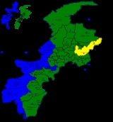
Mansehra District
Encyclopedia
Pakistan
Pakistan , officially the Islamic Republic of Pakistan is a sovereign state in South Asia. It has a coastline along the Arabian Sea and the Gulf of Oman in the south and is bordered by Afghanistan and Iran in the west, India in the east and China in the far northeast. In the north, Tajikistan...
, an area still unofficially known as the Northwest Frontier. Mansehra
Mansehra
Mansehra city is located at in Mansehra District, Khyber-Pakhtunkhwa province of Pakistan. It is very near to Abbottabad city. It is a major stop for tourists on the Karakoram Highway which leads to China...
district and town are named after Man Singh, a leading general of Mughal
Mughal Empire
The Mughal Empire , or Mogul Empire in traditional English usage, was an imperial power from the Indian Subcontinent. The Mughal emperors were descendants of the Timurids...
Emperor Akbar. The Kaghan Valley
Kaghan Valley
The Kaghan Valley is a valley in the north-east of Mansehra District of the Khyber Pakhtunkhwa Province of Pakistan. It attracts many tourists from around the world. The inhabitants were affected by the earthquake disaster on 8 October 2005....
area (a popular tourist destination) and the Karakoram Highway
Karakoram Highway
The Karakoram Highway is the highest paved international road in the world, but at its peak at the China-Pakistan border it is only paved on the Chinese side. It connects China and Pakistan across the Karakoram mountain range, through the Khunjerab Pass, at an altitude of as confirmed by both...
pass through the district.
Alexander the Great and Ashoka
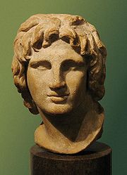
Alexander the Great, after conquering parts of Punjab, established his rule over a large part of Mansehra District. In 327 B.C., Alexander handed this area over to Abisaras
Abisares
Abisares , called Embisarus by Diodorus, was an Indian king of abhira descent beyond the river Hydaspes, whose territory lay in the mountains, sent embassies to Alexander the Great both before and after the conquest of Porus in 326 BC, although inclined to espouse the side of the latter...
(Αβισαρης), the Raja of the Poonch state. Mansehra remained a part of Taxila
Taxila
Taxila is a Tehsil in the Rawalpindi District of Punjab province of Pakistan. It is an important archaeological site.Taxila is situated about northwest of Islamabad Capital Territory and Rawalpindi in Panjab; just off the Grand Trunk Road...
during the rule of the Maurya dynasty. Ashoka the Great was the Governor of this area when he was a prince. After the death of his father, Bindusara
Bindusara
Bindusara was the second Mauryan emperor after Chandragupta Maurya. During his reign, the empire expanded southwards. He had two well-known sons, Susima and Ashoka, who were the viceroys of Taxila and Ujjain...
, around 272 B.C., Ashoka inherited the throne and ruled this area as well as Gandhara
Gandhara
Gandhāra , is the name of an ancient kingdom , located in northern Pakistan and eastern Afghanistan. Gandhara was located mainly in the vale of Peshawar, the Potohar plateau and on the Kabul River...
. Today, the Edicts of Ashoka inscribed on three large boulders on the side of a rocky outcrop near Bareri Hill serve as evidence of his rule here. The Mansehra rocks record fourteen of Ashoka's edicts, presenting aspects of the emperor's dharma or righteous law, and represent the earliest irrefutable evidence of writing in South Asia. Dating to middle of the third century BC, they are written from right to left in the Kharosthi script.
The name Mansehra is a modified form of the name Maan Singh, who once ruled over this area.
The Tanoli territory of Amb State has also been part of Mansehra District, since the State was abolished by the Government of Pakistan in 1969. Amb and its surrounding areas of Hazara have a long history which can be traced to Alexander the Great's invasion of India. Arrian, Alexander's historian, did not indicate the exact location of Embolina, but since it is known that Aoronos was on the right bank of the River Indus, the town chosen to serve as Alexander's base of supplies may with good reason be also looked for there. The mention in Ptolemy's Geography of Embolima as a town of Indo-Scythia situated on the Indus supports this theory.
In 1854 General Abbott, the British frontier officer from whom Abbottabad, administrative centre of Hazara, takes its name, discussed his location of Aornos on the Mahaban range south of Buner. He proposed, as M. Court, one of Ranjit Singh's French
France
The French Republic , The French Republic , The French Republic , (commonly known as France , is a unitary semi-presidential republic in Western Europe with several overseas territories and islands located on other continents and in the Indian, Pacific, and Atlantic oceans. Metropolitan France...
generals had done before him in 1839, to recognize Embolima in the present village of Amb situated on the right bank of the Indus. It lies about eight miles to the east of Mahaban and is the place from which the Nawabs of Amb take their title.
Hindu Shahi dynasty and Kashmiris
In the 2nd century CE, a mythical Hindu king Raja Risalu, son of Raja Salbahan of SialkotSialkot
Sialkot is a city in Pakistan situated in the north-east of the Punjab province at the foothills of snow-covered peaks of Kashmir near the Chenab river. It is the capital of Sialkot District. The city is about north-west of Lahore and only a few kilometers from Indian-controlled Jammu.The...
, brought the area under his control. The local people consider him as their hero and, even today, parents tell their children the stories of Raja Risalu and his wife Rani Konklan on winter nights. When a Chinese pilgrim, Hiun-Tsang
Xuanzang
Xuanzang was a famous Chinese Buddhist monk, scholar, traveler, and translator who described the interaction between China and India in the early Tang period...
, visited this area, it was under the control of Durlabhavardhana, the ruler of Kashmir
Kashmir
Kashmir is the northwestern region of the Indian subcontinent. Until the mid-19th century, the term Kashmir geographically denoted only the valley between the Great Himalayas and the Pir Panjal mountain range...
.
The Turkish Shahi
Shahi
The Shahi , Sahi, also called Shahiya dynasties ruled one of the Middle kingdoms of India which included portions of the Kabulistan and the old province of Gandhara , from the decline of the Kushan Empire in the 3rd century to the early 9th century...
and Hindu Shahi Dynasties ruled Mansehra one after another. Among the Hindu Shahi dynasty rulers, Raja Jayapala
Jayapala
Jayapala Janjua Shahi, the son of Asatapala and father of Anandapal, was the first king and founder of the Hindushahi dynasty of Afghanistan and Northwest Pakistan. He succeeded the last Brahman Shahi king Bhimadeva in about 964 CE, and thus began the Janjua Rajput phase of Shahiya Dynasties...
is the best known. Mehmood of Ghazni
Mahmud of Ghazni
Mahmud of Ghazni , actually ', was the most prominent ruler of the Ghaznavid dynasty who ruled from 997 until his death in 1030 in the eastern Iranian lands. Mahmud turned the former provincial city of Ghazni into the wealthy capital of an extensive empire which covered most of today's Iran,...
defeated Raja Jayapala during his first Indian campaign. However, there is no historical evidence that Mehmood of Ghazni ever visited or passed through Mansehra. After the fall of Hindu Shahi dynasty, in the 11th century, the Kashmiris took control of this area under the leadership of Kalashan (1063 to 1089). From 1112 to 1120, King Susala ruled this area. In the 12th century, Asalat Khan captured this area but soon after Mohammad of Ghor's death the Kashmiris once again regained control of Mansehra.
Turkish rule
In 1399, the great Muslim warrior TimurTimur
Timur , historically known as Tamerlane in English , was a 14th-century conqueror of West, South and Central Asia, and the founder of the Timurid dynasty in Central Asia, and great-great-grandfather of Babur, the founder of the Mughal Dynasty, which survived as the Mughal Empire in India until...
, on his return to Kabul
Kabul
Kabul , spelt Caubul in some classic literatures, is the capital and largest city of Afghanistan. It is also the capital of the Kabul Province, located in the eastern section of Afghanistan...
, stationed his Turk soldiers in Manshera to protect the important route between Kabul and Kashmir. By 1472, Prince Shahab-ud-Din came from Kabul and established his rule over the region. Prince Shahab-ud-Din, a Turk of central Asian origin, founded the state and named it Pakhli Sarkar and chose Village Gulibagh as his capital. During the Mughal rule, these local Turkish chiefs acknowledged Mughal authority. In fact, Mansehra (Pakhli
Pakhli
Pakhli was an ancient sarkar of the Mughal Subah of Punjab, now part of Hazara, Pakistan. It roughly corresponds to the ancient Urasa, the Aρσa or Οΰaρσa which Ptolemy placed between the Bidaspes and the Indus....
) provided the main route to Kashmir and was the most commonly used route for Emperor Akbar to travel to Kashmir. During the last days of Emperor Akbar's rule, the Turkish Chief Sultan Hussain Khan revolted against the Mughals. He claimed that the Mughals were interfering with his internal affairs. After this complaint, he was exiled by the Mughals, but later was pardoned and given back his land. Now, descendants of these Turkish rulers live in village Behali
Behali
Bahali is a village and union council of the Mansehra District in Khyber-Pakhtunkhwa province of Pakistan. Bahali is part of Mansehra Tehsil and is located at the boundary area of the Mansehra district and the Abbottabad district, west from the Karakurram highway at Qalanderabad. It is a valley...
and some other villages of Mansehra, Abbottabad, and Haripur districts.
Afghan rule
Turkish rule came to an end due to the increased aggression of the PashtunsPashtun people
Pashtuns or Pathans , also known as ethnic Afghans , are an Eastern Iranic ethnic group with populations primarily between the Hindu Kush mountains in Afghanistan and the Indus River in Pakistan...
and their allied forces. In 1703, the Turks came under attack by the Swati
Swati (tribe)
The Swatis are a Pashtun tribe based around the Swat valley, in the Khyber-Pakhtunkhwa province of Pakistan. They are the largest tribal group of land owners in the Mansehra and Battagram districts....
s under the leadership of Syed Jalal Baba, who was son in law of last Turkish ruler of Hazara, (Sultan Memud Khurd) took benefit of absence of his father in law and with the help of Swaties succeeded to overthrow the Turks from the throne of Pakhli Sarkar.The Turks were pushed towards the mountainous areas of Tanawel (Behali) and other parts of Hazara, including Haripur (Manakrai). The Turks remained in control of certain small areas, assuming the title of Raja. Raja Amanulla of Manakrai, Haripur, one of the descendants of the Turkish rulers of Hazara, rose to prominence during post-independence era, when he became the Speaker of the Khyber-Pakhtunkhwa assembly in 1985.
When Ahmad Shah Durrani expanded his kingdom to Punjab, Mansehra also came under his control. Durrani
Durrani
Durrani or Abdali is the name of a chief Pashtun tribal confederation in Afghanistan and Pakistan. Originally known by their ancient name Abdali later as Durrani they have been called Durrani since the beginning of the Durrani Empire in 1747. The number of Durranis are estimated to be roughly 16%...
considered it wise to rule the area through local tribal chiefs. The Durranis' rule ended abruptly at the beginning of the 18th century.
Tanoli rule
The Tanolis had already established their authority over Tannawal and thus Tannawal was never annexed by the Durranis. The voluminous Urdu copy of the settlement report of Hazara compiled by Major Wace in 1872 contains many passages in its historical resume of the area. In a number of maps drawn at the time and enclosed in the report, showing Hazara under the Mughals and under the Durranis, the Amb state has been shown as Mulk-i-Tanawal. The original existence of that Mulk is as old as the middle period of the great Afghan invasions of India. Their leader Nawab Khan (Father of Painda Khan) never accepted the Durrani Rule and used to heavily tax the Durrani caravans which passed through the Mulk-e-Tanawal. He defeated the Durranis in battle but met his death at the hands of Sardar Azim Khan Durrani in 1818, who invited him to his camp and killed him by treachery. Upper Tanawal (mostly now in present day District Mansehra) and Lower Tanawal (mostly now in present day district Haripur), covering the greater part of Hazara, have been ruled by Tanolis for centuries.The fall of the Durranis led way for the Sikh
Sikh
A Sikh is a follower of Sikhism. It primarily originated in the 15th century in the Punjab region of South Asia. The term "Sikh" has its origin in Sanskrit term शिष्य , meaning "disciple, student" or शिक्ष , meaning "instruction"...
s to rise to power under Ranjit Singh
Ranjit Singh
Maharaja Ranjit Singh Ji was the first Maharaja of the Sikh Empire.-Early life:...
. The Sikhs gained control of Mansehra in 1818, after stiff resistance from its inhabitants. When Mansehra fell under Sikh control, it was annexed to Punjab. Syed Ahmad Shaheed, with the help of the Mujaheddin, led many revolts and attacks against the Sikhs. At last, in 1831 during a fierce battle at Balakot
Balakot
Balakot , is a town in Mansehra District in the Khyber-Pakhtunkhwa province of Pakistan. The town was destroyed during the 2005 earthquake and later rebuilt with the assistance of the Government of Pakistan and Saudi Public Assistance for Pakistan Earthquake Victims , a Saudi relief organization...
, Syed Ahmad Shaheed
Syed Ahmad Shaheed
Not to be confused with Ahmed Raza Khan BarelviSyed Ahmad Shaheed , also called Syed Ahmed Barelvi, was a Muslim activist from Rae Bareli, India. and founder of the "The Way of the Prophet Muhammad" , a revolutionary Islamic movement...
was killed. This allowed the Sikhs to consolidate their control of Mansehra. After Rajit Singh's death, the Sikh
Sikh
A Sikh is a follower of Sikhism. It primarily originated in the 15th century in the Punjab region of South Asia. The term "Sikh" has its origin in Sanskrit term शिष्य , meaning "disciple, student" or शिक्ष , meaning "instruction"...
empire began to disintegrate. At this time, the British gained control of Punjab, and, through this, gained control of Mansehra.
Painda Khan Tanoli was the tribal chief of the Tanolis at the time of the invasion of Hazara by the Sikhs. Painda Khan is famed for his staunch rebellion against Maharaja Ranjit Singh's Governors of Hazara. From about 1813, he spent a life long rebellion against the Sikhs. Painda Khan's relentless rebellion against the Sikh empire, cost him a major portion of his Kingdom, leaving only his twin capitals Amb and Darband. However, this deterred him less and appeared to increase his resistance against the Sikh government.
Painda Khan son Jehandad Khan also followed the footsteps of his famed father. "Of all the tribal chiefs of Hazara, the most powerful said to be Jehandad Khan of the Tanoli, whose land straddled both banks of the Indus and whose fellow-tribesmen were 'brave and hardy and accounted for the best swordsmen in Hazara'.
When Sikh power was on the fall in 1845 Jehandad Khan blockaded the garrisons of no less than 22 Sikh posts in Upper Tanawal; and when they surrendered at discretion, he spared their lives, as the servants of a fallen Empire.
In the meantime other Chiefs of Hazara rushed to arms to exterminate the Sikhs who were in their country. They invited Syud Akbur, of Sitana (after wards king of Swat), to come over and be King of Hazara, and make a holy war with them. Nawab Khan of Thingri, became Syad Akbur's "Wazir", Pir Khan came down to join with the Jaduns, Khan i Zeman brought the Tarkheylies; the Swatis of Publi, and the Mushwanis, swelled the tumult. For two months they besieged Diwan Mulraj, the Kardar, in the fort of Hurkishengarh; and at last, after several gallant repulses, reduced the garrison to evacuate by cutting off the water.
On 19 March 1846, a peace treaty was signed between the Sikhs and the British according to which Raja Gulab Singh took Kashmir and Hazara from the British for 75,00,000 rupees. But due to widespread civil disorder and resistance movement Raja asked the British government to take over Hazara in exchange of the Jamu-Jehlum belt. The British accepted this offer and took over Hazara from him. They deputed James Abbot to Hazara to restore peace. He defeated Chuttar Singh, a Sikh general, after coming to Hazara and thus completely ousted the Sikhs from power.
British rule
By 1849, the British had gained control of all of Mansehra. However, the western Pashtun tribes remained rebellious. These tribes included the clans of Allai ValleyAllai Valley
Allai Valley is a valley in Battagram District of Khyber-Pakhtunkhwa, Pakistan....
and Nandhiar Valley, and the tribes inhabiting both slopes of the Black Mountain of Hazara
Black Mountain of Hazara
Tor Ghar District or تور غر in Pushto , is one of the 25 districts of Khyber Pakhtunkhwa, Pakistan...
.
In 1852, after three years of relative peace, Zaman Shah of Kaghan turned against the British. James Abbot sent an expedition to Kaghan which deprived Zaman Shah of his territory and he was exiled to Pakhli plain. After four years the British forgave him and he was permitted to get back his lost territory.
However, the British sent many expeditions against the Pashtun tribes to crush the rebellion between 1852 and 1892, especially against the Black Mountains.
To maintain peace in the area the British also took preventive measures by co-opting the local rulers.
The British divided Hazara District
Hazara District
Hazara District was a district of Peshawar Division in the North-West Frontier Province of Pakistan until 1976.The Imperial Gazetteer of India described the district as follows..-Khatris and Khokhran:...
into three Tehsils (administrative subdivisions): Mansehra, Abbottabad
Abbottabad District
Abbottabad is a district in the Khyber Pakhtunkhwa province of Pakistan. The district covers an area of 1,969 km with the city of Abbottabad being the principal town...
, and Haripur
Haripur District
Haripur is a district in the Hazara region of Khyber-Pukhtunkhwa, province of Pakistan with an altitude of around above sea level. Haripur District has the highest Human Development Index of all the districts in the Hazara....
; and decided to annex it to the Punjab
Punjab (British India)
Punjab was a province of British India, it was one of the last areas of the Indian subcontinent to fall under British rule. With the end of British rule in 1947 the province was split between West Punjab, which went to Pakistan, and East Punjab, which went to India...
. In 1901, when the North West Frontier Province (NWFP) (now Khyber-Pakhtunkhwa) was created, Hazara was separated from Punjab and made a part of it. Throughout their rule in Mansehra, the British met fierce resistance from the local Pashtun tribes and declared martial law. Meanwhile, the people of Mansehra's many villages largely governed themselves. Many of Mansehra's citizens joined the Khilafat Movement
Khilafat Movement
The Khilafat movement was a pan-Islamic, political campaign launched by Muslims in British India to influence the British government and to protect the Ottoman Empire during the aftermath of World War I...
.
The British accepted the independence of the Nawab of Amb
Amb (princely state)
Amb was a princely state of the former British Indian Empire. In 1947, by the Indian Independence Act 1947, the British abandoned their supremacy, and following the Partition of India Amb's Nawab decided to give up his state's independence by acceding to the new country of Pakistan...
; within his own territory and thus no writ of the British Government, civil or criminal, was ever enacted within the Tanoli State of Amb. The smaller Tanoli State of Phulra, which was granted by Painda Khan to his brother Madad Khan, was also acknowledged by the Britishers as a semi-independent Princely State. Thus the British Government agreed not to meddle with the affairs of the Tanoli territory of Hazara, with the mutual understanding that the Tanolis would not attack the British controlled territories.
When the Muslim League in Pakistan started its movement for a separate land, the local people joined and struggled for liberation under the leadership of Quaid-i-Azam. Their eventual victory culminated in the creation of Pakistan
Pakistan
Pakistan , officially the Islamic Republic of Pakistan is a sovereign state in South Asia. It has a coastline along the Arabian Sea and the Gulf of Oman in the south and is bordered by Afghanistan and Iran in the west, India in the east and China in the far northeast. In the north, Tajikistan...
, an independent state for the Muslims of the sub-continent.
Nawab Sir Muhammad Zakir Khan (K.B.E) of the Amb State had very good relations with Malik Hussain and Nawabzada Moiz khan. His contributions to the Pakistan movement have been acknowledged by letters from Quaid-i-Azam. In 1947 the Nawab of Amb, Mohammad Farid Khan, acceded to Pakistan by signing the Instrument of Accession
Instrument of Accession
The Instrument of Accession was a legal document created in 1947 to enable each of the rulers of the princely states under British suzerainty to join one of the new dominions of India or Pakistan created by the Partition of British India.-Background:...
of his State, in favour of Pakistan. In 1969, the State was incorporated into the Khyber Pakhtunkhwa Province and in 1971 the royal status of the Nawab was abolished by the Government of Pakistan.
_shergarh,_mansehra.jpg)
Batagram
Battagram is the capital city of Battagram District in Khyber Pukhtoonkhwa Province of Pakistan. It is located at 34°41'N 73°1'E and has an altitude of 1038 metres .-Administration:...
. Later, the Mansehra district had the Balakot
Balakot
Balakot , is a town in Mansehra District in the Khyber-Pakhtunkhwa province of Pakistan. The town was destroyed during the 2005 earthquake and later rebuilt with the assistance of the Government of Pakistan and Saudi Public Assistance for Pakistan Earthquake Victims , a Saudi relief organization...
subdivision added to it.
Geography
Mansehra is located at the eastern border of the Khyber Pakhtunkhwa Province, two hours away from PeshawarPeshawar
Peshawar is the capital of Khyber-Pakhtunkhwa and the administrative center and central economic hub for the Federally Administered Tribal Areas of Pakistan....
and three hours away from Islamabad
Islamabad
Islamabad is the capital of Pakistan and the tenth largest city in the country. Located within the Islamabad Capital Territory , the population of the city has grown from 100,000 in 1951 to 1.7 million in 2011...
. The district is located at 34° - 12' and 35° - 50' and 47° - 07' longitude. It is closely linked to Afghanistan in the west, which has increased the number of Afghan refugees in Mansehra over the past years.
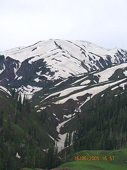
The district of Mansehra has been blessed with wonderful scenery. Some of Mansehra's main features are mountain ranges, plains, valleys, and numerous lakes and rivers.
Bordering districts
Mansehra shares its borders with numerous other districts: the KohistanKohistan District (Pakistan)
Kohistan has two distinct meanings in Pakistan. In Persian "koh" means "peak" and "istaan" means "land of". In its usual modern sense Kohistan District is an administrative district within Pakistan's Khyber-Pakhtunkhwa Province covering an area of 7,492 sq.kilometres; it had a population of...
and Diamir
Diamer District
Diamer District is one of the seven districts of the Northern Areas of Pakistan. It is the district in which the Karakoram Highway enters that territory from the North-West Frontier Province, the capital of the district is Chilas...
districts to the north, Abbottabad District
Abbottabad District
Abbottabad is a district in the Khyber Pakhtunkhwa province of Pakistan. The district covers an area of 1,969 km with the city of Abbottabad being the principal town...
to the south, the Neelum District
Neelum District
Neelum District is one of the eight districts of Azad Jammu and Kashmir, Pakistan. Until recently it was part of Muzaffarabad District. It is bound by the Gilgit to the North, with Kupwara, Baramulla and Bandipore Districts of Indian-administered Kashmir in India to the South and Southeast,...
of Azad Kashmir
Azad Kashmir
Azad Jammu and Kashmir or Azad Kashmir for short, is the southernmost political entity within the Pakistani-administered part of the former princely state of Jammu and Kashmir...
to the west, and the Swat
Swat (Pakistan)
Swat is a valley and an administrative district in the Khyber Pakhtunkhwa Province, located close to the Afghan-Pakistan border. It is the upper valley of the Swat River, which rises in the Hindu Kush range. The capital of Swat is Saidu Sharif, but the main town in the Swat valley is Mingora...
district to the east and Batagram District
Batagram District
Battagram is a district of Hazara in the Khyber Pakhtunkhwa province of Pakistan. It has a total land area of 1301 square kilometres and the estimated population of Battagram District in 2004-2005 was 361,000. .-Etymology:Battagram in Sanskrit means Village of the Brahmins...
to the northeast.
Lakes
There are three lakes in the district: LulusarLulusar
Lulusar is group of mountain peaks and a lake in the Kaghan Valley in the Khyber-Pakhtunkhwa province of Pakistan. The word "sar" means "top" or "peak" in Pashto. The highest peak has a height of above sea level...
Lake, Dudipatsar
Dudipatsar
Dudiptsar Lake or Dudipat Lake is a lake encircled by snow clad peaks in Lulusar-Dudipatsar National Park. The lake lies in the extreme north of the Kaghan Valley, in the Mansehra District, Khyber Pakhtunkhwa province, in northern Pakistan. The word "dudi" means white and "sar" means lake. This...
Lake and Saiful Muluk
Saiful Muluk
Lake Saiful Muluk is a lake located at the northern end of the Kaghan Valley near Naran. It is in the north east of Mansehra District in the Khyber-Pakhtunkhwa province, Pakistan...
Lake. All three are located in the beautiful Kaghan Valley
Kaghan Valley
The Kaghan Valley is a valley in the north-east of Mansehra District of the Khyber Pakhtunkhwa Province of Pakistan. It attracts many tourists from around the world. The inhabitants were affected by the earthquake disaster on 8 October 2005....
and act as a mirror reflecting the snow-clad mountains surrounding them.
Lulusar
Lulusar
Lulusar is group of mountain peaks and a lake in the Kaghan Valley in the Khyber-Pakhtunkhwa province of Pakistan. The word "sar" means "top" or "peak" in Pashto. The highest peak has a height of above sea level...
Lake is approximately 48 kilometres away from Naran and has an altitude of 3325 meters. Surrounded by wildflowers in almost all colours imaginable, this lake is the main source for the Kunhar River
Kunhar River
The Kunhar River also known as ' Persian: "eye's repose" is long river, located primarily in the Khyber Pakhtunkhwa province, northern Pakistan. It is in the Indus River watershed basin.-Route:...
. Lake Lulusar is said to be one of the most tranquil spots on the Kaghan Valley
Kaghan Valley
The Kaghan Valley is a valley in the north-east of Mansehra District of the Khyber Pakhtunkhwa Province of Pakistan. It attracts many tourists from around the world. The inhabitants were affected by the earthquake disaster on 8 October 2005....
, the lake is fenced by snowcapped mountains whose image is reflected on the standstill blue-green waters of the lake.
Dudipat Lake is enclosed with beautiful, high, snow-drizzled peaks, it is one of the hardest places to reach, requiring a tough hike
Dudipatsar Trail
The Dudipatsar Trail is an approximately hiking trail in the Lulusar-Dudipatsar National Park of Khyber-Pakhtunkhwa, in northern Pakistan. The trail goes along a tributary of the Kunhar River in the northern Kaghan Valley. The headwater for the particular tributary is the Dudipat Lake and the...
lasting four to seven hours. The hike is rewarding, as tourists are greeted with green pastures and the lake's blue-green waters.
The most famous of the district's many lakes is Lake Saiful Muluk
Saiful Muluk
Lake Saiful Muluk is a lake located at the northern end of the Kaghan Valley near Naran. It is in the north east of Mansehra District in the Khyber-Pakhtunkhwa province, Pakistan...
, named in a folktale—the Qissa Saiful Muluk—about a romance between a Persian prince and a fairy
Fairy
A fairy is a type of mythical being or legendary creature, a form of spirit, often described as metaphysical, supernatural or preternatural.Fairies resemble various beings of other mythologies, though even folklore that uses the term...
princess. In the folktale, the lake was the meeting site for the two lovers. Lake Saiful Muluk is located at the northern end of the Kaghan valley. At an altitude of 10578 feet (3,224.2 m) above sea level, it is one of the highest lakes in Pakistan. The water is spectacularly clear with a slight green tone. It is accessible by a jeep road during the summer months or can be hiked up from the village below in four to six hours. The clarity of the water comes from the multiple glaciers all around the high basin feeding the lake.
Education
Mansehra is considered a good place for education because of its natural beauty and climate, it is the location of Hazara University and also contains colleges and many good schools.The first primary school in the district was established in 1872 in Behali
Behali
Bahali is a village and union council of the Mansehra District in Khyber-Pakhtunkhwa province of Pakistan. Bahali is part of Mansehra Tehsil and is located at the boundary area of the Mansehra district and the Abbottabad district, west from the Karakurram highway at Qalanderabad. It is a valley...
village. Almost at the same time in Baffa and in 1892 in Mansehra city.
Rivers
The largest river is the Kunhar RiverKunhar River
The Kunhar River also known as ' Persian: "eye's repose" is long river, located primarily in the Khyber Pakhtunkhwa province, northern Pakistan. It is in the Indus River watershed basin.-Route:...
, also known as the Kunnar (not to be confused with the Kunar River
Kunar River
The Kunar River is about 480 km long, located in eastern Afghanistan and north-western Pakistan. The Kunar river system is fed from melting glaciers and snow of the Hindu Kush mountains....
of the Chitral District
Chitral District
Chitral is a district in the Khyber-Pakhtunkhwa province of Pakistan that contains the town of Chitral. It has an area of 14,850 km² and a population of 318,689 at the 1998 Census, which had subsequently risen to about 378,000 people by 2004. It has one of the highest mountains of the world,...
). The river is the gateway to the Kaghan Valley
Kaghan Valley
The Kaghan Valley is a valley in the north-east of Mansehra District of the Khyber Pakhtunkhwa Province of Pakistan. It attracts many tourists from around the world. The inhabitants were affected by the earthquake disaster on 8 October 2005....
and runs through Balakot
Balakot
Balakot , is a town in Mansehra District in the Khyber-Pakhtunkhwa province of Pakistan. The town was destroyed during the 2005 earthquake and later rebuilt with the assistance of the Government of Pakistan and Saudi Public Assistance for Pakistan Earthquake Victims , a Saudi relief organization...
.
Siran is a largest river in the area of Pakhhal it comes from mountain namely Musa Da Masalla and ends in the lake of Tarbela Dam
Tarbela Dam
Tarbela Dam on the Indus River in Pakistan is the second largest dam in the world by structural volume. It is located in Haripur District, Khyber Pakhtunkhwa, about northwest of Islamabad.The dam is high above the riverbed. The dam forms the Tarbela Reservoir, with a surface area of approximately...
.
Subdivisions
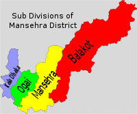
Tehsil
A Tehsil or Tahsil/Tahasil , also known as Taluk and Mandal, is an administrative division of some country/countries of South Asia....
s, which are divided into 59 Union Councils, and two Provincially Administered Tribal Areas
Provincially Administered Tribal Areas
The Provincially Administered Tribal Areas are Pakistani administrative subdivisions designated in the Article 246 of the Constitution of Pakistan...
(PATA):
- Balakot
- MansehraMansehraMansehra city is located at in Mansehra District, Khyber-Pakhtunkhwa province of Pakistan. It is very near to Abbottabad city. It is a major stop for tourists on the Karakoram Highway which leads to China...
- OghiOghi (tehsil)Oghi Tehsil is a sub-district of Mansehra District in the Khyber Pakhtoonkhwa province of Pakistan. The Tehsil takes its name from the main city of the area, Oghi.- Union councils :Oghi Tehsil consists of 11 Union Councils....
- Kala Dhaka
- Upper Tanawal area of Hazara DivisionHazara DivisionOn the dissolution of West Pakistan in 1970, Hazara District and the two tribal agencies were merged to form the new Hazara Division with its capital at Abbottabad...
Balakot
Balakot Tehsil consists of 16 Union Councils:
|
Kewal Kewal is a village and union council of Mansehra District in the Khyber-Pakhtunkhwa province of Pakistan . It is located in the north east of the district and lies in an area that was affected by the 2005 Kashmir earthquake.... Laber Kot Laber Kot is a village and union council of Mansehra District in the Khyber Pakhtunkhwa province of Pakistan . It is located in the south of the district and is to the north-east of Mansehra the district capital, in an area affected by the 2005 Kashmir earthquake.... Mohandri Mohandri is a village and union council of Mansehra District in the Khyber-Pakhtunkhwa province of Pakistan . It is located in the north east of the district and borders the Neelum and Muzaffarabad districts of Azad Kashmir and lies in an area affected by the 2005 Kashmir earthquake.... Pairan Pairan is a village and union council of Mansehra District in the Khyber-Pakhtunkhwa province of Pakistan . It is located in the south of Mansehra and borders Abbottabad District... Sandasar Sandasar is a village and union council of Mansehra District in the Khyber Pakhtunkhwa Province of Pakistan . It is located in the south of the district and lies to the west of the district capital Mansehra.... Satbani Satbani is a village and union council of Mansehra District in the Khyber-Pakhtunkhwa province of Pakistan . It is located in Balakot tehsil and lies in an area that was affected by the 2005 Kashmir earthquake... Shohal Mazullah Shohal Mazullah is a village and union council of Mansehra District in the Khyber-Pakhtunkhwa province of Pakistan... Talhata Talhata is a village and union council of Mansehra District in the Khyber-Pakhtunkhwa province of Pakistan . It is located in the south of the district where it borders Kashmir .... |
Mansehra
Mansehra TehsilMansehra Tehsil
Mansehra Tehsil is a subdivision of Mansehra District in the Khyber-Pakhtunkhwa province of Pakistan.-History:During British Rule, Mansehra was a tehsil of Hazara District, the boundaries of the tehsil were described as follows by the Imperial Gazetteer of India:"Tahsīl of Hazāra District,...
consists of 33 Union Councils:
|
Hilkot Hilkot is a village and union council of Mansehra District in the Khyber Pakhtunkhwa province of Pakistan. It is located to the north of Mansehra the district capital and south west of Batagram city and lies in an area affected by the 2005 Kashmir earthquake.-References:Hilkot is a village and... Icherrian Icherrian is a village and union council of Mansehra District in the Khyber Pakhtunkhwa province of Pakistan. It is located to the north east of Mansehra the district capital and lies in an area affected by the 2005 Kashmir earthquake.... Inayat Abad Inayatabad is a village and union council of Mansehra District in Khyber-Pakhtunkhwa province of Pakistan. It is located in Mansehra Tehsil and lies to the north of the district capital Mansehra and lies in area affected by the 2005 Kashmir earthquake.-Villages:* Bhanda Peeraan* Gandhian* Chitti... Jaborri Jaborri is a small beautiful village in Mansehra District of Khyber-Pakhtunkhwa province of Pakistan surrounded by mountains. The village is also the administrative centre of Jaborri Union Council. The literacy rate is low and unemployment ratio is very high... Labarkot Labarkot is a village and union council of Mansehra District in Khyber-Pakhtunkhwa province of Pakistan . It is located at 34°21'0N 73°13'60E -References:... Lassan Nawab Lassan Nawab is a be valley about 32 kilometers from Mansehra. Lassan Nawab is a village and union council of Mansehra District in Khyber-Pakhtunkhwa province of Pakistan . It is located in the south of the district and borders Haripur and Abbottabad districts.Formerly it was a part of Princely... Lassan Thakral Lassan Thakral is a village and union council of Mansehra District in Khyber-Pakhtunkhwa province of Pakistan . It is located in the south of Mansehra district where it borders Abbottabad District district.... Malik Pur Malik Pur is a village and union council of Mansehra District in the Khyber Pakhtunkhwa province of Pakistan . It is located to the north east the district capital Mansehra.-villages:... |
Perhinna Perhana is a village and union council of Mansehra District in the Khyber Pakhtunkhwa Province of Pakistan . It is located in the south of the district and lies to the west of the district capital Mansehra.... Phulrraa Phulrraa is a village and union council of Mansehra District in Khyber-Pakhtunkhwa province of Pakistan. It is located in the south of the district and lies to the west of the district capital Mansehra.... Khawari Khawari is a village of Mansehra District in the Khyber-Pakhtunkhwa province of Pakistan. It is located at 33°54'25N 72°9'56E and lies about 12 kilometres away from Mansehra city, the district capital with an altitude of 4000 metres. It is a major village of Lassan Thakral Union Council.The... Bandi * Bandi or Gbandi; people of Liberia and Guinea, and their language.* Bandi, a hamlet in the Bandala Valley.* Bandi River, a tributary of the Luni River.* Bandi, a 1957 Indian movie.Fictional name:* Bandi, a fictional race in Star Trek.... Sacha Kalan Sacha Kalan is a village and union council of Mansehra District in the Khyber Pakhtunkhwa province of Pakistan . It is located in the north of the district where it borders Batagram District.... Shinkiari Shinkiari is a Union Council of Mansehra District in the Khyber-Pakhtunkhwa province of Pakistan. Moulana Wasi-ur-Rahman is the Nazim of Shinkiari... Shoukatabad Shoukatabad is a Union Council of Mansehra District in Khyber-Pakhtunkhwa province of Pakistan. It is located to the north-west of the district capital Mansehra.-Notable people:... Sum Alahi Mong Sum Alahi Mong is a village and union council of Mansehra District in Khyber-Pakhtunkhwa province of Pakistan .... Swan Miara Swan Miara is a village and union council of Mansehra District in Khyber-Pakhtunkhwa province of Pakistan . It is located in the south of the district where it borders Abbottabad District.... Trangi Sabir Shah Trangi Sabir Shah is a village and union council of Mansehra District in Khyber-Pakhtunkhwa province of Pakistan. It is located to the north of the district capital Mansehra.... |
Oghi
Tehsil Oghi consists of 11 Union Councils:- Darband
- KaroriKaroriKarori is a suburb located at the western edge of the urban area of Wellington, New Zealand, some 4 km from the city centre.Karori is significantly larger than most other Wellington suburbs, having a population of over 14,000 at the time of the 2006 census.-History:Before the arrival of...
- Nika PaniNika PaniNika Pani is a village and union council of Mansehra District in Khyber-Pakhtunkhwa province of Pakistan . It is located in east of the district .-References:...
- ShergarhShergarh, PakistanShergarh is an historic town, union council and major administrative subdivision of Depalpur Tehsil, Okara District.- History :Sher Garh is one of the most historic towns of the district, along with Haveli Lakha, Hujra Shah Muqeem, Basir Pur, Depalpur & Satghara among others...
- Shinayah
- Shungli Bandi
- Ballian
- Dalbori
- Khatai
- OghiOghiOghi is a town and union council of Mansehra District in the Khyber Pakhtoonkhwa of Pakistan. It is located in Oghi Tehsil and lies to the north-west of the district capital Mansehra.-History:...
- Shamdara
Constituencies
The district is represented in the provincial assemblyProvincial Assembly of the North-West Frontier Province
The Provincial Assembly of Khyber Pakhtunkhwa is the unicameral legislative body of the Khyber Pakhtunkhwa province in Pakistan. It was established under Article 106 of the Constitution of the Pakistan...
by six elected MPAs who represent the following constituencies:
- PF-53 (Mansehra-1)
- PF-54 (Mansehra-2)
- PF-55 (Mansehra-3)
- PF-56 (Mansehra-4)
- PF-57 (Mansehra-5)
- PF-58 (Mansehra-6)
Demographics
Mansehra is home to a diverse group of people: SwatisSwati (tribe)
The Swatis are a Pashtun tribe based around the Swat valley, in the Khyber-Pakhtunkhwa province of Pakistan. They are the largest tribal group of land owners in the Mansehra and Battagram districts....
, Abbasi
Abbasi
Abbasi is a prominent Islamic family name. - Origin :The Abbasid caliphate was founded by the descendants of the Islamic prophet Muhammad's youngest uncle, Abbas ibn Abd al-Muttalib, in Harran in 750 CE and shifted its capital in 762 to Baghdad...
Gujjars, Syeds, Awans
Awans
Awans is a Belgian municipality located in the Walloon province of Liège. On January 1, 2006 Awans had a total population of 8,696. The total area is 27.16 km² which gives a population density of 320 inhabitants per km²....
, Rajputs, Kashmiris, Maliar
Maliar
The Maliar are a tribe found in the Potohar region of Punjab, Pakistan as well as the Peshawar valley of the North West Frontier Province. Many Maliar now refer to themselves as Arain, another well known Punjabi caste.-History and origin:...
s, Yousufzais, Tanolis, Hassanzai, Qureshi, Karlugh Turks
Karlugh Turks
The Karlugh Turks are a prominent Karluk Turkic tribe that resides mainly in the Hazara region of current Pakistan. These Karlugh Turks formed a Turki Shahi dynasty and ruled the state of Pakhli Sarkar for over 200 years from 1472 to 1703.- Arrival:...
, Afghan refugees and many other ethnic groups. Its population in 1998 was 1,152,839.