
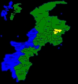
Batagram District
Encyclopedia
Battagram is a district
of Hazara in the Khyber Pakhtunkhwa province of Pakistan
. It has a total land area of 1301 square kilometres and the estimated population of Battagram District in 2004-2005 was 361,000. .
, Rashmera, Chapargram, Banian and Shalkhay etc.
and separated from Mansehra District
. Before Battagram obtained the status of district, it was a Tehsil
of the Mansehra District
. It has geographical borders with Kohistan District
, the Tribal Area of Kala Dhaka (Black Mountain of Hazara), Shangla District
and Malakand Division
. The district consists of two sub-divisions or Tehsil
s, containing 20 in total. Union Councils
:
The district is represented in the provincial assembly
by two MPAs from its constituencies PF-59 (Battagram-1) and PF-60 (Battagram-2).
) or Silk route and hence which is helping the infant industrial base to thrive.
Districts of Pakistan
The Districts of Pakistan are the second order administrative divisions of Pakistan. Districts were the third order of administrative divisions, below provinces and "divisions", until the reforms of August 2000, when "divisions" were abolished...
of Hazara in the Khyber Pakhtunkhwa province of Pakistan
Pakistan
Pakistan , officially the Islamic Republic of Pakistan is a sovereign state in South Asia. It has a coastline along the Arabian Sea and the Gulf of Oman in the south and is bordered by Afghanistan and Iran in the west, India in the east and China in the far northeast. In the north, Tajikistan...
. It has a total land area of 1301 square kilometres and the estimated population of Battagram District in 2004-2005 was 361,000. .
Etymology
Battagram in Sanskrit means Village of the Brahmins. Many other small villages in district Battagram are also named after Sanskrit words or their old Hindu residents e.g. Chohan, AjmeraAjmera
Ajmera is a town, and one of twenty union councils in Battagram District in the Khyber Pakhtunkhwa province of Pakistan.It comprises many small villages. These include Chappargram, Lower Medan, Noshehra, Palango Tamai, and Ajmera itself. It is located at 34°40'20N 73°1'10E and has an altitude of...
, Rashmera, Chapargram, Banian and Shalkhay etc.
Administration
Battagram obtained the status of district in July 1993 when it was upgraded from a TehsilTehsil
A Tehsil or Tahsil/Tahasil , also known as Taluk and Mandal, is an administrative division of some country/countries of South Asia....
and separated from Mansehra District
Mansehra District
Mansehra District is in the Khyber Pakhtunkhwa province of Pakistan, an area still unofficially known as the Northwest Frontier. Mansehra district and town are named after Man Singh, a leading general of Mughal Emperor Akbar...
. Before Battagram obtained the status of district, it was a Tehsil
Tehsil
A Tehsil or Tahsil/Tahasil , also known as Taluk and Mandal, is an administrative division of some country/countries of South Asia....
of the Mansehra District
Mansehra District
Mansehra District is in the Khyber Pakhtunkhwa province of Pakistan, an area still unofficially known as the Northwest Frontier. Mansehra district and town are named after Man Singh, a leading general of Mughal Emperor Akbar...
. It has geographical borders with Kohistan District
Kohistan District (Pakistan)
Kohistan has two distinct meanings in Pakistan. In Persian "koh" means "peak" and "istaan" means "land of". In its usual modern sense Kohistan District is an administrative district within Pakistan's Khyber-Pakhtunkhwa Province covering an area of 7,492 sq.kilometres; it had a population of...
, the Tribal Area of Kala Dhaka (Black Mountain of Hazara), Shangla District
Shangla District
Shangla District ' is located in the Khyber-Pakhtunkhwa province of Pakistan.The district headquarters are located at Alpuri. It was previously a subdivision of Swat District, but was upgraded to the status of a district on July 10, 1995 by the then Chief Minister Aftab Khan Sherpao. The total...
and Malakand Division
Malakand Division
Malakand Division was an administrative division of the North West Frontier Province of Pakistan, until the reforms of 2000 abolished the third tier of government....
. The district consists of two sub-divisions or Tehsil
Tehsil
A Tehsil or Tahsil/Tahasil , also known as Taluk and Mandal, is an administrative division of some country/countries of South Asia....
s, containing 20 in total. Union Councils
Union Councils of Pakistan
A sherwan or village council in Pakistan is an elected local government body consisting of 21 councillors, and headed by a nazim and a naib nazim...
:
| Tehsil | No. of Unions |
|---|---|
| Allai Tehsil | 8 |
| Batagram Tehsil | 12 |
The district is represented in the provincial assembly
Provincial Assembly of the North-West Frontier Province
The Provincial Assembly of Khyber Pakhtunkhwa is the unicameral legislative body of the Khyber Pakhtunkhwa province in Pakistan. It was established under Article 106 of the Constitution of the Pakistan...
by two MPAs from its constituencies PF-59 (Battagram-1) and PF-60 (Battagram-2).
Earthquake 2005
Battagram was one of the areas affected by the Pakistan Earthquake of October 8, 2005 when more than 4,500 people were killed and approximately 35,000 were injured. Many residents of the area were rendered homeless and without shelter. Since October 8, 2005, the NGOs and the Governmental organization ERRA have been engaged in re-construction work but as of 2009,the reconstruction work is not completed. In some cases residents have rebuilt houses themselves.Scenery
This district is noted for its scenic mountain scenery, thick forests, fertile lands and enchanting streams. Most of the population is rural and depends upon agriculture for their day to day living. As a recent phenomenon, fishing has also become a mode of earning due to some modern scientific techniques. Another distinctive feature of this district is the notable presence of Shahrah-e-Resham (Karakoram HighwayKarakoram Highway
The Karakoram Highway is the highest paved international road in the world, but at its peak at the China-Pakistan border it is only paved on the Chinese side. It connects China and Pakistan across the Karakoram mountain range, through the Khunjerab Pass, at an altitude of as confirmed by both...
) or Silk route and hence which is helping the infant industrial base to thrive.
See also
- AjmeraAjmeraAjmera is a town, and one of twenty union councils in Battagram District in the Khyber Pakhtunkhwa province of Pakistan.It comprises many small villages. These include Chappargram, Lower Medan, Noshehra, Palango Tamai, and Ajmera itself. It is located at 34°40'20N 73°1'10E and has an altitude of...
- Madyan
- Shalkhay
- Banian
- Banna
- BateelaBateelaBateela is a town, and one of twenty union councils in Battagram District in the Khyber Pakhtunkhwa province of Pakistan....
- BatkulBatkulBatkul is a town, and one of twenty union councils in Battagram District in the Khyber Pakhtunkhwa province of Pakistan....
- Battagram
- BiariBiariBiari is a town, and one of twenty union councils in Battagram District in Khyber-Pakhtunkhwa province of Pakistan. It is located at 34°38'30N 73°24'0E and has an altitude of 1904 metres .-References:...
- ChappargramChappargramChappargram or Chapargram is a village of Battagram District in Khyber-Pakhtunkhwa province of Pakistan...
- Chohan
- Gurjar
- JamberaJamberaJambera is a town, and one of twenty union councils in Battagram District in the Khyber-Pakhtunkhwa province of Pakistan....
- Kasana (gotra)Kasana (gotra)Kasana or Kushane , derived from Kushan, is a Gujjar clan of Suryavanshi Kshatriyas.Kasana's are mainly found in India, Pakistan and Afghanistan.In India Kasana are found in the states of Jammu & Kashmir, Punjab, Uttar Pradesh, Himachal Pradesh, Delhi, Rajasthan, Haryana, Gujarat &...
- Kala Dhaka
- KotgallaKotgallaKotgala is a village located in Battagram District, Pakistan. It is part of the Peshora union council. The population is approximately 5,000....
- RajdahriRajdahriRajdahri is a town, and one of twenty union councils in Battagram District in Khyber Pakhtunkhwa province of Pakistan. It is located at 34°40'60N 73°5'60E and has an altitude of 1408 metres .-References:...
- RashangRashangRashang is a town, and one of twenty union councils in Battagram District of Khyber-Pakhtunkhwa. It is located at 34°49'10N 73°7'30E and has an altitude of 1970 metres .-References:...
- ShumlaiShumlaiShumlai is a town, and one of twenty union councils in Battagram District, in Khyber Pakhtunkhwa province of Pakistan. It is located at 34°42'20N 73°7'0E and has an altitude of 1567 metres .-References:...
- ThakotThakotThakot is a tribal town on the Indus River in Battagram District of Khyber Pakhtunkhwa, Pakistan. It is also one of twenty Union Councils of Battagram District, and one of twelve in Battagram Tehsil. It is located at 34°45'0N 72°55'0E at an altitude of 1131 m ,Most of the people living here...
- Tikri, Pakistan
- TrandTrandTrand is a town, and one of twenty union councils of Battagram District in Khyber Pakhtunkhwa province of Pakistan. It is located at 34°37'60N 72°58'60E and has an altitude of 1303 metres ....
- soker