
.gif)
M-39 (Michigan highway)
Encyclopedia
M-39 is a state highway
in the US state of Michigan
that runs from Lincoln Park
to Southfield
. The southern terminus of M-39 is at the corner of Southfield Road and Lafayette Boulevard in Lincoln Park, one block southeast of the junction of I-75 (Fisher Freeway) and two blocks northwest of M-85
(Fort Street). The northern terminus is at M-10
(Lodge Freeway) in Southfield.
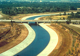
the road turns to the northeast and beyond the junction with I-94 turns into a limited-access freeway and winds its way through Dearborn
. Near Greenfield Village the road curves to the northwest around the Ford Proving Grounds
before turning to the north, a direction it will maintain until the end of its run.
After the proving grounds, M-39 has a cloverleaf interchange with US 12
just to the southeast of the Fairlane Town Center
, quickly after another interchange with M-153
, also known as Ford Road. From there the road continues through the densely populated areas of Detroit. During this time, the road usually has a service drive where the entrances and exits are located. The road continues traveling to the north where it has a stack interchange
with I-96 (Jeffries Freeway) and then another interchange with M-5
(Grand River Ave.). The road then enters the Southfield
area where it has an interchange with M-102
(8 Mile Road) and then terminates at an interchange with M-10
(John C. Lodge Freeway).
 Previously assigned to Schaefer Highway from the intersection of Dix Highway (former US 25) in Melvindale
to the intersection of Grand River Avenue (former US 16) in Detroit
, M-39 was reassigned to Southfield Road, connecting Fort Street
with Northwestern Highway
in 1959.
In the 1960s, the length of Southfield Road from I-94
to Northwestern was rebuilt as the Southfield Freeway, with the service drive retaining the Southfield Road name. The southern portion of M-39 was improved as Southfield Highway. From 1966 to 1969, while I-75
(Chrysler and Fisher Freeways) was still being constructed through Detroit, M-39 also bore a "TO I-75" designation from its junction with I-75 in Lincoln Park to M-102
/8 Mile Road.
In the 1990s, the M-39 designation was truncated slightly, as Lincoln Park officials sought to make modifications along Southfield Highway that were not up to MDOT
's standards. As a result, M-39 no longer officially connects to M-85
. Southfield Road continues southeasterly, ending at West Jefferson Avenue along the Detroit River
.
Beyond M-39's northern terminus, just north of 9 Mile Road in Southfield, Southfield Road continues northward as a local road, intersecting with I-696
(at 11 Mile Road) and ending at Maple (15 Mile) Road in Birmingham
.
The freeway portion is virtually always referred to by locals as the Southfield Freeway, or "the Southfield", rather than by route number. Since 2000, the freeway has undergone a complete overhaul, easing traffic congestion in the metropolitan area.
In 2011, the stretch of M-39 between the Grand River Ave/5 Mile exit north to the interchange with M-10 was closed for resurfacing and bridge replacement. MDOT re-opened this stretch in October 2011.
State highway
State highway, state road or state route can refer to one of three related concepts, two of them related to a state or provincial government in a country that is divided into states or provinces :#A...
in the US state of Michigan
Michigan
Michigan is a U.S. state located in the Great Lakes Region of the United States of America. The name Michigan is the French form of the Ojibwa word mishigamaa, meaning "large water" or "large lake"....
that runs from Lincoln Park
Lincoln Park, Michigan
Lincoln Park is a city in Wayne County in the U.S. state of Michigan. It lies in an area of cities and communities known as Downriver. The population was 38,144 at the 2010 census . The settlement was organized as a village in 1921, and reorganized as a city in 1925. The area was originally home to...
to Southfield
Southfield, Michigan
According to the United States Census Bureau, the city has a total area of , of which 0.04% is water. The main branch of the River Rouge runs through Southfield. The city is bounded to the south by Eight Mile Road, its western border is Inkster Road, and to the east it is bounded by Greenfield Road...
. The southern terminus of M-39 is at the corner of Southfield Road and Lafayette Boulevard in Lincoln Park, one block southeast of the junction of I-75 (Fisher Freeway) and two blocks northwest of M-85
M-85 (Michigan highway)
M-85, also known as Fort Street or Fort Road for its entire length, is a state highway route in the U.S. state of Michigan.In Detroit proper, M-85 consists of West Fort street and South Fort street...
(Fort Street). The northern terminus is at M-10
M-10 (Michigan highway)
M-10, is a state trunkline route in the US state of Michigan. The southernmost portion follows Jefferson Avenue in downtown Detroit, and the southern terminus is at the intersection of Jefferson and Randolph Street leading to the entrance to the Detroit–Windsor Tunnel...
(Lodge Freeway) in Southfield.
Route description
M-39 begins at Lafayette Boulevard a block east of its junction with I-75 in Lincoln Park. From there the road is divided highway as it passes under I-75 and continues to the northwest. In Allen ParkAllen Park, Michigan
Allen Park is a city in Wayne County in the U.S. state of Michigan. As of the 2010 census, the population was 28,210. The suburb of Detroit was recognized in Money Magazine's list of America's Best Small Cities. Allen Park is part of the collection of communities known as DownriverFord Motor...
the road turns to the northeast and beyond the junction with I-94 turns into a limited-access freeway and winds its way through Dearborn
Dearborn, Michigan
-Economy:Ford Motor Company has its world headquarters in Dearborn. In addition its Dearborn campus contains many research, testing, finance and some production facilities. Ford Land controls the numerous properties owned by Ford including sales and leasing to unrelated businesses such as the...
. Near Greenfield Village the road curves to the northwest around the Ford Proving Grounds
Ford Proving Grounds
Ford Motor Company operates several proving grounds worldwide, for development and validation testing of new vehicles.For Ford/Mazda Proving Grounds in Japan see Mazda Proving Grounds- - Wittmann, Arizona:Latitude and Longitude: The opened in 1985...
before turning to the north, a direction it will maintain until the end of its run.
After the proving grounds, M-39 has a cloverleaf interchange with US 12
U.S. Route 12
U.S. Route 12 or US 12 is an east–west United States highway, running from Grays Harbor on the Pacific Ocean, in the state of Washington, to downtown Detroit, for almost . As a thoroughfare, it has mostly been supplanted by I-90 and I-94, but remains an important road for local travel.The...
just to the southeast of the Fairlane Town Center
Fairlane Town Center
Fairlane Town Center is a super-regional shopping mall in the Detroit suburb of Dearborn, Michigan. Its anchor stores are Macy's, JCPenney, and Sears. The mall includes an AMC Theatres multiplex, as well as H&M, DSW Shoe Warehouse and Bally Total Fitness among other major stores...
, quickly after another interchange with M-153
M-153 (Michigan highway)
M-153 is a state trunkline highway in the U.S. state of Michigan. It is also known as Ford Road for nearly its entire length, except for its westernmost portion where it splits from Ford Road and junctions with the M-14 freeway...
, also known as Ford Road. From there the road continues through the densely populated areas of Detroit. During this time, the road usually has a service drive where the entrances and exits are located. The road continues traveling to the north where it has a stack interchange
Stack interchange
A stack interchange is a free-flowing grade separated junction between two roads.In countries where one drives on the right, left turns are handled by semi-directional flyover/under ramps...
with I-96 (Jeffries Freeway) and then another interchange with M-5
M-5 (Michigan highway)
M-5 is a highway in the metro Detroit area of the US state of Michigan.-Route description:M-5's eastern terminus is at the junction of Grand River Avenue and Interstate 96 in western Detroit...
(Grand River Ave.). The road then enters the Southfield
Southfield, Michigan
According to the United States Census Bureau, the city has a total area of , of which 0.04% is water. The main branch of the River Rouge runs through Southfield. The city is bounded to the south by Eight Mile Road, its western border is Inkster Road, and to the east it is bounded by Greenfield Road...
area where it has an interchange with M-102
M-102 (Michigan highway)
M-102 is a state trunkline in the US state of Michigan, running along the northern boundary of Detroit. It is known as 8 Mile Road for most of its length. As part of the land surveying of the state, the road follows the Michigan Baseline, and it is called Base Line Road in places. M-102 is the...
(8 Mile Road) and then terminates at an interchange with M-10
M-10 (Michigan highway)
M-10, is a state trunkline route in the US state of Michigan. The southernmost portion follows Jefferson Avenue in downtown Detroit, and the southern terminus is at the intersection of Jefferson and Randolph Street leading to the entrance to the Detroit–Windsor Tunnel...
(John C. Lodge Freeway).
History
Melvindale, Michigan
Melvindale is a city in Wayne County of the U.S. state of Michigan and a downriver suburb of Detroit. As of the 2010 census, the city population was 10,715. Melvindale's slogan is "The Little City with a Big Heart."-History:...
to the intersection of Grand River Avenue (former US 16) in Detroit
Detroit, Michigan
Detroit is the major city among the primary cultural, financial, and transportation centers in the Metro Detroit area, a region of 5.2 million people. As the seat of Wayne County, the city of Detroit is the largest city in the U.S. state of Michigan and serves as a major port on the Detroit River...
, M-39 was reassigned to Southfield Road, connecting Fort Street
M-85 (Michigan highway)
M-85, also known as Fort Street or Fort Road for its entire length, is a state highway route in the U.S. state of Michigan.In Detroit proper, M-85 consists of West Fort street and South Fort street...
with Northwestern Highway
M-10 (Michigan highway)
M-10, is a state trunkline route in the US state of Michigan. The southernmost portion follows Jefferson Avenue in downtown Detroit, and the southern terminus is at the intersection of Jefferson and Randolph Street leading to the entrance to the Detroit–Windsor Tunnel...
in 1959.
In the 1960s, the length of Southfield Road from I-94
Interstate 94
Interstate 94 is the northernmost east–west Interstate Highway, connecting the Great Lakes and Intermountain regions of the United States. I-94's western terminus is in Billings, Montana at a junction with Interstate 90; its eastern terminus is the U.S...
to Northwestern was rebuilt as the Southfield Freeway, with the service drive retaining the Southfield Road name. The southern portion of M-39 was improved as Southfield Highway. From 1966 to 1969, while I-75
Interstate 75
Interstate 75 is a major north–south Interstate Highway in the Great Lakes and Southeastern regions of the United States. It travels from State Road 826 and State Road 924 in Hialeah, Florida to Sault Ste. Marie, Michigan, at the Ontario, Canada, border...
(Chrysler and Fisher Freeways) was still being constructed through Detroit, M-39 also bore a "TO I-75" designation from its junction with I-75 in Lincoln Park to M-102
M-102 (Michigan highway)
M-102 is a state trunkline in the US state of Michigan, running along the northern boundary of Detroit. It is known as 8 Mile Road for most of its length. As part of the land surveying of the state, the road follows the Michigan Baseline, and it is called Base Line Road in places. M-102 is the...
/8 Mile Road.
In the 1990s, the M-39 designation was truncated slightly, as Lincoln Park officials sought to make modifications along Southfield Highway that were not up to MDOT
Michigan Department of Transportation
The Michigan Department of Transportation is a constitutional government agency in the US state of Michigan. The primary purpose of MDOT is to maintain the Michigan State Trunkline Highway System which includes all Interstate, US and state highways in Michigan with the exception of the Mackinac...
's standards. As a result, M-39 no longer officially connects to M-85
M-85 (Michigan highway)
M-85, also known as Fort Street or Fort Road for its entire length, is a state highway route in the U.S. state of Michigan.In Detroit proper, M-85 consists of West Fort street and South Fort street...
. Southfield Road continues southeasterly, ending at West Jefferson Avenue along the Detroit River
Detroit River
The Detroit River is a strait in the Great Lakes system. The name comes from the French Rivière du Détroit, which translates literally as "River of the Strait". The Detroit River has served an important role in the history of Detroit and is one of the busiest waterways in the world. The river...
.
Beyond M-39's northern terminus, just north of 9 Mile Road in Southfield, Southfield Road continues northward as a local road, intersecting with I-696
Interstate 696
Interstate 696 is an intrastate Interstate Highway entirely within the US state of Michigan. I-696 is also known as the Walter P. Reuther Freeway, named for a prominent figure in early automobile factory labor union activity. I-696 is a spur route, partially circling the city of Detroit, but...
(at 11 Mile Road) and ending at Maple (15 Mile) Road in Birmingham
Birmingham, Michigan
Birmingham is a city in Oakland County of the U.S. state of Michigan and an affluent suburb of Detroit. As of the 2010 census, the population was 20,103...
.
The freeway portion is virtually always referred to by locals as the Southfield Freeway, or "the Southfield", rather than by route number. Since 2000, the freeway has undergone a complete overhaul, easing traffic congestion in the metropolitan area.
In 2011, the stretch of M-39 between the Grand River Ave/5 Mile exit north to the interchange with M-10 was closed for resurfacing and bridge replacement. MDOT re-opened this stretch in October 2011.