
.gif)
M-10 (Michigan highway)
Encyclopedia
M-10, is a state trunkline route
in the US state of Michigan
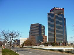
. The southernmost portion follows Jefferson Avenue
in downtown Detroit
, and the southern terminus is at the intersection of Jefferson and Randolph Street
leading to the entrance to the Detroit–Windsor Tunnel. The northern terminus is in West Bloomfield
at the intersection with Orchard Lake Road. M-10 was built in segments throughout much of the 1950s and 1960s. It carried several different names before the entire route was finally officially named The John C. Lodge Freeway in 1987. M-10 was named after John C. Lodge, an influential Detroiter and mayor of Detroit from 1927-1928.
 This freeway, almost always referred to as "the Lodge" rather than by route number or full name runs northwesterly from downtown Detroit
to the Oakland County
suburbs. The freeway portion of M-10 ends at "The Mixing Bowl
", the local name for the sprawling interchange of I-696, US 24/Telegraph Road, the Lodge, Northwestern Highway, Lahser Road and Franklin Road in Southfield
. Beyond this interchange, M-10 continues for several miles as a four to six-lane divided highway
.
The portion of M-10 from "The Mixing Bowl" until its terminus with Orchard Lake Rd and Fourteen Mile Rd is known as Northwestern Highway. It was designed as a scenic divided four to six-lane sloping highway with a wide tree lined center median. Travelling Southbound down the hills gives a scenic view of distant downtown Detroit contrasted with the surrounding woodland area. Unfortunately, the build up of office and medical buildings on Northwestern has lessened the experience over the years.
The first iteration of M-10 utilized the present-day segments of these following highways; US 24
, M-13
, US 23
and M-33
(former alignment of US 23). It also coincided with the Dixie Highway
(east branch) and the Theodore Roosevelt International Highway
for much of its length.
The second iteration of M-10 was, technically, the much-reduced remnant of the original, first iteration of the route in the Flint
area, serving as a business connection for the city as the through route, US 10, bypassed it on the east. It was later re-designated as BUS US 10, then as BUS M-54 in the 1960s before being turned back to local control in the 1980s.
) at Fenton, but was cancelled when I-75
was, instead, routed between Detroit and Flint via Pontiac
.
/8 Mile Road; and the portion north of 8 Mile was named 'Northwestern Highway'. Since then the freeway itself has become known as 'The Lodge' along its complete length and only the service drives running alongside the freeway have retained their original names.
The intersection with the Edsel Ford Freeway, next to Wayne State University
was built in 1953 and was the first full freeway-to-freeway interchange built in the United States. Originally constructed and opened without any state trunkline route designation until it was assigned as a part of US 12
in the 1950s.
The section from the Edsel Ford Freeway (now I-94) into downtown Detroit was designated as US12. Then it was assigned as Business Spur I-696 in 1961 or 1962 immediately before the completion of the first phase of I-696
in 1964. It was signed as a business spur of I-696 as a way to circumvent the elements it had that rendered it substandard to the Interstate Highway System
. Soon after, though, the Lodge became part of US 10 when that route was removed from Woodward Avenue.
An extension to the Northwestern Highway was again proposed in the late 1960s to connect with the proposed I-275
extension. The I-275 project was then cancelled in the late-1970s and the Northwestern extension was ostensibly cancelled as well, although a dispute between the Road Commission for Oakland County and the Michigan Department of Transportation
lasted through the 1990s. Due to the continuing development of the land along the proposed right-of-way (including a strip mall
right at the current terminus of M-10), the Northwestern extension is unlikely to ever be built as planned.
US 10
was truncated at Bay City
in 1986, and the Lodge was redesignated as M-10. The non-freeway Northwestern Highway, until then designated M-4, was also renumbered as M-10 shortly after in 1987. The southernmost portion of the Lodge Freeway was also redesignated as a portion of BS I-375 on paper from I-75 south. When the US 10 shields were removed, they were universally replaced with M-10 shields instead of BS I-375 shields.
With the Michigan Department of Transportation's deemphasization of proper names historically used by Metro Detroiters for the area's Interstates, the Lodge is now one of only three in the Detroit area universally referred to by name rather than route number — the others being the Davison Freeway
(M-8) and the Southfield Freeway
(M-39).
/US 24
to the northern terminus. M-4 was known as Northwestern Highway — back when M-10 was known as US 10 (Lodge Freeway), M-4 extended northwest past where US 10 and US 24 (Telegraph Road) intersected. When US 10 was changed to M-10, the M-4 section became part of M-10.
The Lodge was signed as Business Spur I-696 in 1961 or 1962 immediately before the completion of the first phase of I-696
in 1964. It was signed as a business spur of I-696 as a way to circumvent the elements it had that rendered it substandard to the Interstate Highway System
.
Michigan Highway System
The Michigan State Trunkline Highway System is made up of all the highways designated as Interstates, U.S. Highways and State Highways in the US state of Michigan. The system is maintained by the Michigan Department of Transportation and comprises of trunklines in all 83 counties of Michigan on...
in the US state of Michigan
Michigan
Michigan is a U.S. state located in the Great Lakes Region of the United States of America. The name Michigan is the French form of the Ojibwa word mishigamaa, meaning "large water" or "large lake"....
. The southernmost portion follows Jefferson Avenue
Jefferson Avenue (Detroit)
Jefferson Avenue is a scenic road along the eastern part of the Detroit metropolitan area in the U.S. state of Michigan. It travels alongside Lake Erie, the Detroit River, and Lake Saint Clair. This road also provides access to many recreational facilities in the area...
in downtown Detroit
Detroit, Michigan
Detroit is the major city among the primary cultural, financial, and transportation centers in the Metro Detroit area, a region of 5.2 million people. As the seat of Wayne County, the city of Detroit is the largest city in the U.S. state of Michigan and serves as a major port on the Detroit River...
, and the southern terminus is at the intersection of Jefferson and Randolph Street
M-3 (Michigan highway)
M-3 is a north–south state highway in the US state of Michigan in the Detroit metropolitan area. For most of its length, M-3 is known as Gratiot Avenue...
leading to the entrance to the Detroit–Windsor Tunnel. The northern terminus is in West Bloomfield
West Bloomfield Township, Michigan
West Bloomfield Charter Township is an affluent charter township in Oakland County in the U.S. state of Michigan, within the Detroit metropolitan area. As of the 2010 census, the township had a population of 64,690. As of 2008, West Bloomfield Township was ranked the 8th highest income city in the...
at the intersection with Orchard Lake Road. M-10 was built in segments throughout much of the 1950s and 1960s. It carried several different names before the entire route was finally officially named The John C. Lodge Freeway in 1987. M-10 was named after John C. Lodge, an influential Detroiter and mayor of Detroit from 1927-1928.
Route description
Detroit, Michigan
Detroit is the major city among the primary cultural, financial, and transportation centers in the Metro Detroit area, a region of 5.2 million people. As the seat of Wayne County, the city of Detroit is the largest city in the U.S. state of Michigan and serves as a major port on the Detroit River...
to the Oakland County
Oakland County, Michigan
-Demographics:As of the 2010 Census, there were 1,202,362 people, 471,115 households, and 315,175 families residing in the county. The population density as of the 2000 census was 1,369 people per square mile . There were 492,006 housing units at an average density of 564 per square mile...
suburbs. The freeway portion of M-10 ends at "The Mixing Bowl
Mixing Bowl
Mixing Bowl is a bowl used for mixing of ingredients.It can also be used for nickname for the following United States highway interchanges:*The confluence of Interstate 696/Reuther Freeway, US-24/Telegraph Rd., M-10/Lodge Freeway, 11 Mile Road, Lahser Road and Franklin Road in the suburbs of...
", the local name for the sprawling interchange of I-696, US 24/Telegraph Road, the Lodge, Northwestern Highway, Lahser Road and Franklin Road in Southfield
Southfield, Michigan
According to the United States Census Bureau, the city has a total area of , of which 0.04% is water. The main branch of the River Rouge runs through Southfield. The city is bounded to the south by Eight Mile Road, its western border is Inkster Road, and to the east it is bounded by Greenfield Road...
. Beyond this interchange, M-10 continues for several miles as a four to six-lane divided highway
Divided Highway
Divided Highway is a compilation album by American rock band The Doobie Brothers, released in 2003. . All tracks are taken from the albums Cycles and Brotherhood .-Track listing:...
.
The portion of M-10 from "The Mixing Bowl" until its terminus with Orchard Lake Rd and Fourteen Mile Rd is known as Northwestern Highway. It was designed as a scenic divided four to six-lane sloping highway with a wide tree lined center median. Travelling Southbound down the hills gives a scenic view of distant downtown Detroit contrasted with the surrounding woodland area. Unfortunately, the build up of office and medical buildings on Northwestern has lessened the experience over the years.
Previous incarnations of M-10
Prior to its use as a designation for 'The Lodge Freeway' the M-10 designation was used twice before since Michigan first posted its highway designations in 1918. All incarnations of M-10 also had parts designated as US 10 at one time.The first iteration of M-10 utilized the present-day segments of these following highways; US 24
U.S. Route 24
U.S. Route 24 is one of the original United States highways of 1926. It originally ran from Pontiac, Michigan, in the east to Kansas City, Missouri, in the west. Today, the highway's eastern terminus is west of Clarkston, Michigan, at an intersection with I-75 and its western terminus is near...
, M-13
M-13 (Michigan highway)
M-13 is a north–south state trunkline highway that runs through the Saginaw Bay region of the US state of Michigan. It runs from Interstate 69 south of Lennon to US Highway 23 near Standish. The southern section of the trunkline runs long a pair of county lines in a rural area dominated by farm...
, US 23
U.S. Route 23 in Michigan
US Highway 23 is a United States Numbered Highway that runs from Jacksonville, Florida to Mackinaw City, Michigan. In the US state of Michigan, it is a major north–south state trunkline highway that runs through the Lower Peninsula...
and M-33
M-33 (Michigan highway)
M-33 is a north–south state trunkline highway in the US state of Michigan that runs from Interstate 75 at Alger in Arenac County north to M-27 near Cheboygan. In between, the trunkline runs through rural sections of the northeastern Lower Peninsula including state and national forest areas...
(former alignment of US 23). It also coincided with the Dixie Highway
Dixie Highway
The Dixie Highway was a United States automobile highway, first planned in 1914 to connect the US Midwest with the Southern United States. It was part of the National Auto Trail system, and grew out of an earlier Miami to Montreal highway. The final result is better understood as a small network of...
(east branch) and the Theodore Roosevelt International Highway
Theodore Roosevelt International Highway
The Theodore Roosevelt International Highway was a transcontinental North American highway through the United States and Canada that ran from Portland, Maine, to Portland, Oregon. Its length was about .-Route description:...
for much of its length.
The second iteration of M-10 was, technically, the much-reduced remnant of the original, first iteration of the route in the Flint
Flint, Michigan
Flint is a city in the U.S. state of Michigan and is located along the Flint River, northwest of Detroit. The U.S. Census Bureau reports the 2010 population to be placed at 102,434, making Flint the seventh largest city in Michigan. It is the county seat of Genesee County which lies in the...
area, serving as a business connection for the city as the through route, US 10, bypassed it on the east. It was later re-designated as BUS US 10, then as BUS M-54 in the 1960s before being turned back to local control in the 1980s.
Planning
During the 1950s, this highway was proposed to be extended as far as the Fenton-Clio Expressway (US 23U.S. Route 23 in Michigan
US Highway 23 is a United States Numbered Highway that runs from Jacksonville, Florida to Mackinaw City, Michigan. In the US state of Michigan, it is a major north–south state trunkline highway that runs through the Lower Peninsula...
) at Fenton, but was cancelled when I-75
Interstate 75 in Michigan
Interstate 75 is a part of the Interstate Highway System and runs from Miami, Florida to Sault Ste. Marie in the Upper Peninsula of Michigan. I-75 enters the state from Ohio in the south, just to the north of Toledo. It runs generally north through Detroit, Pontiac and Bay City, crossing the...
was, instead, routed between Detroit and Flint via Pontiac
Pontiac, Michigan
Pontiac is a city in the U.S. state of Michigan named after the Ottawa Chief Pontiac, located within the Detroit metropolitan area. As of the 2010 census, the city had a total population of 59,515. It is the county seat of Oakland County...
.
Construction
The Lodge was originally made up of three legs with unique names: the 'John C. Lodge' ran from Jefferson Avenue in downtown Detroit to Wyoming Avenue; the 'James Couzens' ran from Wyoming to M-102M-102 (Michigan highway)
M-102 is a state trunkline in the US state of Michigan, running along the northern boundary of Detroit. It is known as 8 Mile Road for most of its length. As part of the land surveying of the state, the road follows the Michigan Baseline, and it is called Base Line Road in places. M-102 is the...
/8 Mile Road; and the portion north of 8 Mile was named 'Northwestern Highway'. Since then the freeway itself has become known as 'The Lodge' along its complete length and only the service drives running alongside the freeway have retained their original names.
The intersection with the Edsel Ford Freeway, next to Wayne State University
Wayne State University
Wayne State University is a public research university located in Detroit, Michigan, United States, in the city's Midtown Cultural Center Historic District. Founded in 1868, WSU consists of 13 schools and colleges offering more than 400 major subject areas to over 32,000 graduate and...
was built in 1953 and was the first full freeway-to-freeway interchange built in the United States. Originally constructed and opened without any state trunkline route designation until it was assigned as a part of US 12
U.S. Route 12
U.S. Route 12 or US 12 is an east–west United States highway, running from Grays Harbor on the Pacific Ocean, in the state of Washington, to downtown Detroit, for almost . As a thoroughfare, it has mostly been supplanted by I-90 and I-94, but remains an important road for local travel.The...
in the 1950s.
The section from the Edsel Ford Freeway (now I-94) into downtown Detroit was designated as US12. Then it was assigned as Business Spur I-696 in 1961 or 1962 immediately before the completion of the first phase of I-696
Interstate 696
Interstate 696 is an intrastate Interstate Highway entirely within the US state of Michigan. I-696 is also known as the Walter P. Reuther Freeway, named for a prominent figure in early automobile factory labor union activity. I-696 is a spur route, partially circling the city of Detroit, but...
in 1964. It was signed as a business spur of I-696 as a way to circumvent the elements it had that rendered it substandard to the Interstate Highway System
Interstate Highway System
The Dwight D. Eisenhower National System of Interstate and Defense Highways, , is a network of limited-access roads including freeways, highways, and expressways forming part of the National Highway System of the United States of America...
. Soon after, though, the Lodge became part of US 10 when that route was removed from Woodward Avenue.
An extension to the Northwestern Highway was again proposed in the late 1960s to connect with the proposed I-275
Interstate 275 (Michigan)
Interstate 275 in the US state of Michigan is an Interstate Highway that functions as a western bypass of the Detroit metropolitan area. The Michigan Department of Transportation maintains it as a component of the larger state trunkline highway system. The freeway runs through the western suburbs...
extension. The I-275 project was then cancelled in the late-1970s and the Northwestern extension was ostensibly cancelled as well, although a dispute between the Road Commission for Oakland County and the Michigan Department of Transportation
Michigan Department of Transportation
The Michigan Department of Transportation is a constitutional government agency in the US state of Michigan. The primary purpose of MDOT is to maintain the Michigan State Trunkline Highway System which includes all Interstate, US and state highways in Michigan with the exception of the Mackinac...
lasted through the 1990s. Due to the continuing development of the land along the proposed right-of-way (including a strip mall
Strip mall
A strip mall is an open-area shopping center where the stores are arranged in a row, with a sidewalk in front. Strip malls are typically developed as a unit and have large parking lots in front...
right at the current terminus of M-10), the Northwestern extension is unlikely to ever be built as planned.
US 10
U.S. Route 10
U.S. Route 10 is an east–west United States highway formed in 1926. Though it never became the cross-country highway suggested by the "0" as the last digit of its route number, U.S...
was truncated at Bay City
Bay City, Michigan
Bay City is a city in the U.S. state of Michigan located near the base of the Saginaw Bay on Lake Huron. As of the 2010 census, the city's population was 34,932, and is the principal city of the Bay City Metropolitan Statistical Area, which is included in the Saginaw-Bay City-Saginaw Township North...
in 1986, and the Lodge was redesignated as M-10. The non-freeway Northwestern Highway, until then designated M-4, was also renumbered as M-10 shortly after in 1987. The southernmost portion of the Lodge Freeway was also redesignated as a portion of BS I-375 on paper from I-75 south. When the US 10 shields were removed, they were universally replaced with M-10 shields instead of BS I-375 shields.
With the Michigan Department of Transportation's deemphasization of proper names historically used by Metro Detroiters for the area's Interstates, the Lodge is now one of only three in the Detroit area universally referred to by name rather than route number — the others being the Davison Freeway
M-8 (Michigan highway)
M-8 is a state trunkline highway in the U.S. state of Michigan lying within the cities of Detroit and Highland Park. Much of it is the Davison Freeway, the nation's first urban depressed freeway, which became a connector between the Lodge and the Chrysler Freeways.Named for an English immigrant...
(M-8) and the Southfield Freeway
M-39 (Michigan highway)
M-39 is a state highway in the US state of Michigan that runs from Lincoln Park to Southfield. The southern terminus of M-39 is at the corner of Southfield Road and Lafayette Boulevard in Lincoln Park, one block southeast of the junction of I-75 and two blocks northwest of M-85...
(M-39).
Recent developments
From 2006 to 2007, the Lodge underwent major reconstruction to ease traffic congestion in the metro area temporarily closing down much of the freeway. The $133-million project (equivalent to $ today) included concrete pavement reconstruction and rehabilitation, new barrier walls, repairs or replacements to 50 bridges, upgrades to 22 ramps, utility upgrades, and replacement of freeway signs between Lahser Road in Southfield and Jefferson Avenue in Detroit.Previous designations along M-10
M-4 was the original designation of M-10/Northwestern Highway from I-696Interstate 696
Interstate 696 is an intrastate Interstate Highway entirely within the US state of Michigan. I-696 is also known as the Walter P. Reuther Freeway, named for a prominent figure in early automobile factory labor union activity. I-696 is a spur route, partially circling the city of Detroit, but...
/US 24
U.S. Route 24
U.S. Route 24 is one of the original United States highways of 1926. It originally ran from Pontiac, Michigan, in the east to Kansas City, Missouri, in the west. Today, the highway's eastern terminus is west of Clarkston, Michigan, at an intersection with I-75 and its western terminus is near...
to the northern terminus. M-4 was known as Northwestern Highway — back when M-10 was known as US 10 (Lodge Freeway), M-4 extended northwest past where US 10 and US 24 (Telegraph Road) intersected. When US 10 was changed to M-10, the M-4 section became part of M-10.
The Lodge was signed as Business Spur I-696 in 1961 or 1962 immediately before the completion of the first phase of I-696
Interstate 696
Interstate 696 is an intrastate Interstate Highway entirely within the US state of Michigan. I-696 is also known as the Walter P. Reuther Freeway, named for a prominent figure in early automobile factory labor union activity. I-696 is a spur route, partially circling the city of Detroit, but...
in 1964. It was signed as a business spur of I-696 as a way to circumvent the elements it had that rendered it substandard to the Interstate Highway System
Interstate Highway System
The Dwight D. Eisenhower National System of Interstate and Defense Highways, , is a network of limited-access roads including freeways, highways, and expressways forming part of the National Highway System of the United States of America...
.