
Los Osos, California
Encyclopedia
Los Osos is an unincorporated area
and a census-designated place
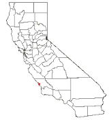
located along the Pacific coast of San Luis Obispo County, California
. The community is part of the 93402 and 93412 ZIP Codes
and area code 805
. The population was 14,276 at the 2010 census.
is a notable natural area at Los Osos.
, which is 10.6 miles east, and to a lesser extent, Morro Bay
, which is 2.3 miles to the north. There is a small business district concentrated in just a few blocks along Los Osos Valley Road, and several shops servicing the Baywood section of Los Osos, near the bay
. The rest of the town is almost entirely residential. Population is approximately 16,000 and total population at build out is limited to approximately 26,000.
There are two roads connecting Los Osos to other communities: South Bay Boulevard, which leads to Morro Bay via Highway 1
, and Los Osos Valley Road, which leads to San Luis Obispo. Inclement weather
and road construction occasionally forces the closure of a route, possibly requiring detours to arrive at one's destination. This has been much less frequent since the Chorro Bridge replaced the Twin Bridges on South Bay Boulevard.
Los Osos serves as the entrance to Montaña de Oro State Park
. Los Osos Valley Road reaches the coast at the south end of Estero Bay
and continues south into the state park. Morro Bay State Park
borders the northeast of the town. South Bay Boulevard travels through the middle of the park after it leaves Los Osos. Los Osos is also home to the Elfin Forrest which sits on the southeast side of the estuary that sits between Los Osos and Morro Bay State Park.
Large groves of non-native eucalyptus
trees attract the annually migrating Monarch butterflies
to Los Osos.
Los Osos' proximity to the Diablo Canyon Power Plant
means that warning siren
s are located throughout the town so that the residents will be warned if the power plant should suffer a meltdown
or other adverse event
. The sirens are also found in other cities nearby, including Morro Bay
, San Luis Obispo
and Avila Beach
. Except for yearly tests, the sirens go largely unused.
, the CDP covers an area of 12.8 square miles (33.1 km²), 99.84% of it land, and 0.16% of it water.
, but they were split into separate CDPs for the 2010 census. The 2010 United States Census reported that Los Osos had a population of 14,276. The population density
was 1,116.7 people per square mile (431.2/km²). The racial makeup of Los Osos was 12,304 (86.2%) White, 79 (0.6%) African American, 97 (0.7%) Native American, 748 (5.2%) Asian, 18 (0.1%) Pacific Islander, 552 (3.9%) from other races
, and 478 (3.3%) from two or more races. Hispanic or Latino of any race were 1,977 persons (13.8%).
The Census reported that 14,191 people (99.4% of the population) lived in households, 74 (0.5%) lived in non-institutionalized group quarters, and 11 (0.1%) were institutionalized.
There were 5,958 households, out of which 1,537 (25.8%) had children under the age of 18 living in them, 3,039 (51.0%) were opposite-sex married couples
living together, 545 (9.1%) had a female householder with no husband present, 252 (4.2%) had a male householder with no wife present. There were 315 (5.3%) unmarried opposite-sex partnerships
, and 67 (1.1%) same-sex married couples or partnerships. 1,595 households (26.8%) were made up of individuals and 717 (12.0%) had someone living alone who was 65 years of age or older. The average household size was 2.38. There were 3,836 families
(64.4% of all households); the average family size was 2.86.
The population was spread out with 2,557 people (17.9%) under the age of 18, 1,162 people (8.1%) aged 18 to 24, 3,056 people (21.4%) aged 25 to 44, 4,827 people (33.8%) aged 45 to 64, and 2,674 people (18.7%) who were 65 years of age or older. The median age was 47.2 years. For every 100 females there were 95.5 males. For every 100 females age 18 and over, there were 92.6 males.
There were 6,488 housing units at an average density of 507.5 per square mile (196.0/km²), of which 4,034 (67.7%) were owner-occupied, and 1,924 (32.3%) were occupied by renters. The homeowner vacancy rate was 1.3%; the rental vacancy rate was 4.7%. 9,345 people (65.5% of the population) lived in owner-occupied housing units and 4,846 people (33.9%) lived in rental housing units.
in Morro Bay or San Luis Obispo High School
in San Luis Obispo. Total population is in excess of 16,000, making it the most populous coastal community between Point Buchon and Monterey County. The community's ultimate build out population is estimated at no more than 26,000.
Chumash were the first inhabitants of the local area. These peoples relied partially on the harvesting of fish and shellfish
(e.g. Macoma nasuta
) from Morro Bay. There is a large Chumash archaeological site on a stabilized sand dune in Los Osos dating to at least as early as 1200 AD. Cabrillo
first encountered the Chumash in the year 1542.
There was also a controversy about where the sewer should be built. A location in the center of Los Osos (once known as the Tri-W site after the names of the previous owners of the property, now called the Mid-Town site), was chosen partly because of a desire for an additional park. The County, Planning Commission and the Coastal Commission approved a sewer at the site after hearing critic's claims.
In August 2005, despite a pending recall election
, the LOCSD began building a sewer at the Mid-Town site, contractors began work on the project and were advanced payments from State Revolving Fund loan. Following a recall election which replaced the majority of the LOCSD board and enactment of an initiative measure that would require relocation of the project, the new board stopped building the sewer, despite a letter warning them of severe consequences from the Regional Water Quality Control Board. However, in late 2006, the LOCSD started to work with Ripley Pacific, a contractor widely known for designing STEP/STEG systems.
In October 2005, the LOCSD defaulted on a low interest State Revolving Fund loan and the state subsequently refused to disburse additional funds and demanded immediate repayment. Project contractors filed suit for more than $23 million in lost profits and costs. The Central Coast Regional Water Quality Control Board has used its enforcement powers to impose fines against the district in the amount of $6.6 million for violation of the discharge prohibition emanating from three LOCSD owned sites. During February 2006 the Regional Water Quality Control Board, threatened it would begin to issue cease and desist orders to citizens of Los Osos, and may require recipients to pump their septic systems every three years, and to stop using them by 2011.
On August 25, 2006, the district filed for Chapter 9 bankruptcy protection in federal court. While the district had enough money to cover day to day needs, they did not have enough money to cover their legal fees and consultant fees. This action stays the legal actions against the district related to money owed. Contractor lawsuits and other actions seeking monetary damages or claims against the district will be held in abeyance while the district addresses its financial situation.
Additionally, legislation has been approved by the California legislature that could return control of construction of the wastewater treatment facility to the County of San Luis Obispo but only after a due diligence period and a resolution by the County to accept the project. The legislation took the project away from the LOCSD. The LOCSD is still providing approximately one half of the town's drinking water, and is in charge of drainage, parks and recreation, street lighting, the contracting of fire, emergency and rescue services as well as solid waste services. The bill, AB 2701, was signed by the governor and went into effect January 1, 2007. A plan has been approved by the County Board of Supervisors, amended by the County Planning Commission pursuant to some of the objections raised by the community and its Community Advisory Council. The California Coastal Commission has denied the County a permit to proceed due to "Substantial Issues" that were cited during an appeals hearing. A De-Novo hearing is still pending. To date (April 2010) with more than $7 million spent the County has not voted to accept the project.
's expedition found large numbers of Grizzly Bear
s in the valley near modern Los Osos. "Osos" being the Spanish word for "Bears", the town was so named. The expedition was part of a plan by Spain to further colonize and map Alta California
due to increasing colonization by the English on the East Coast of North America and the burgeoning presence of Russian traders on the West Coast. (See: Fort Ross, Russian-American Company
.) de Portola's expedition was only one of four mandated by the Spanish Visitor General, José de Gálvez
to map and explore Alta California in greater depth, following up on the previous expeditions, most notably the Cabrillo
party in 1542 and that of Sebastián Vizcaíno
, who vaguely mapped and described the Monterey Bay in 1602-3.
, famous for his stop motion clay animation like Gumby and Davey and Goliath.
Unincorporated area
In law, an unincorporated area is a region of land that is not a part of any municipality.To "incorporate" in this context means to form a municipal corporation, a city, town, or village with its own government. An unincorporated community is usually not subject to or taxed by a municipal government...
and a census-designated place
Census-designated place
A census-designated place is a concentration of population identified by the United States Census Bureau for statistical purposes. CDPs are delineated for each decennial census as the statistical counterparts of incorporated places such as cities, towns and villages...
located along the Pacific coast of San Luis Obispo County, California
San Luis Obispo County, California
San Luis Obispo County is a county located along the Pacific Ocean in the Central Coast of the U.S. state of California, between Los Angeles and the San Francisco Bay Area. As of the 2010 census its population was 269,637, up from 246,681 at the 2000 census...
. The community is part of the 93402 and 93412 ZIP Codes
ZIP Code
ZIP codes are a system of postal codes used by the United States Postal Service since 1963. The term ZIP, an acronym for Zone Improvement Plan, is properly written in capital letters and was chosen to suggest that the mail travels more efficiently, and therefore more quickly, when senders use the...
and area code 805
Area code 805
North American area code 805 is a California telephone area code. Area code 805 includes most or all of the California counties of San Luis Obispo, Santa Barbara, and Ventura, plus southernmost portions of Monterey County....
. The population was 14,276 at the 2010 census.
Geography and ecology
Los Osos is located at 35°19'0" North, 120°50'8" West (35.316795, -120.835605). The Elfin Forest, San Luis Obispo CountyElfin Forest, San Luis Obispo County
The Los Osos Elfin Forest in San Luis Obispo County area consists of stabilized sand dunes abutting a portion of the Morro Bay Estuary. Naturally a harsh location for plants to grow, the California native Coast Live Oak found a special niche among the once shifting sand dunes...
is a notable natural area at Los Osos.
Description
Los Osos is largely a bedroom community for San Luis ObispoSan Luis Obispo, California
San Luis Obispo is a city in California, located roughly midway between San Francisco and Los Angeles on the Central Coast. Founded in 1772 by Spanish Fr. Junipero Serra, San Luis Obispo is one of California’s oldest communities...
, which is 10.6 miles east, and to a lesser extent, Morro Bay
Morro Bay, California
Morro Bay is a waterfront city in San Luis Obispo County, California, United States. As of the 2010 census, the city population was 10,234, down from 10,350 at the 2000 census.- History :...
, which is 2.3 miles to the north. There is a small business district concentrated in just a few blocks along Los Osos Valley Road, and several shops servicing the Baywood section of Los Osos, near the bay
Bay
A bay is an area of water mostly surrounded by land. Bays generally have calmer waters than the surrounding sea, due to the surrounding land blocking some waves and often reducing winds. Bays also exist as an inlet in a lake or pond. A large bay may be called a gulf, a sea, a sound, or a bight...
. The rest of the town is almost entirely residential. Population is approximately 16,000 and total population at build out is limited to approximately 26,000.
There are two roads connecting Los Osos to other communities: South Bay Boulevard, which leads to Morro Bay via Highway 1
California State Route 1
State Route 1 , more often called Highway 1, is a state highway that runs along much of the Pacific coast of the U.S. state of California. It is famous for running along some of the most beautiful coastlines in the world, leading to its designation as an All-American Road.Highway 1 does not run...
, and Los Osos Valley Road, which leads to San Luis Obispo. Inclement weather
Weather
Weather is the state of the atmosphere, to the degree that it is hot or cold, wet or dry, calm or stormy, clear or cloudy. Most weather phenomena occur in the troposphere, just below the stratosphere. Weather refers, generally, to day-to-day temperature and precipitation activity, whereas climate...
and road construction occasionally forces the closure of a route, possibly requiring detours to arrive at one's destination. This has been much less frequent since the Chorro Bridge replaced the Twin Bridges on South Bay Boulevard.
Los Osos serves as the entrance to Montaña de Oro State Park
Montaña de Oro State Park
Montaña de Oro is a state park in California, United States. The park is located six miles southwest of Morro Bay and 2 miles south of Los Osos...
. Los Osos Valley Road reaches the coast at the south end of Estero Bay
Estero Bay (California)
Estero Bay is a bay located on the Pacific Coast of California in the United States. Towns on the bay include Morro Bay and Los Osos. Two state beaches at the edge of the bay are Atascadero State Beach and Morro Strand State Beach.-References:...
and continues south into the state park. Morro Bay State Park
Morro Bay State Park
Morro Bay State Park is a state park in Morro Bay, in western San Luis Obispo County, California. On the bay’s northeastern edge, there is a saltwater marsh that supports a thriving bird population. -Recreation:...
borders the northeast of the town. South Bay Boulevard travels through the middle of the park after it leaves Los Osos. Los Osos is also home to the Elfin Forrest which sits on the southeast side of the estuary that sits between Los Osos and Morro Bay State Park.
Large groves of non-native eucalyptus
Eucalyptus
Eucalyptus is a diverse genus of flowering trees in the myrtle family, Myrtaceae. Members of the genus dominate the tree flora of Australia...
trees attract the annually migrating Monarch butterflies
Monarch butterfly
The Monarch butterfly is a milkweed butterfly , in the family Nymphalidae. It is perhaps the best known of all North American butterflies. Since the 19th century, it has been found in New Zealand, and in Australia since 1871 where it is called the Wanderer...
to Los Osos.
Los Osos' proximity to the Diablo Canyon Power Plant
Diablo Canyon Power Plant
Diablo Canyon Power Plant is an electricity-generating nuclear power plant at Avila Beach in San Luis Obispo County, California. The plant has two Westinghouse-designed 4-loop pressurized-water nuclear reactors operated by Pacific Gas & Electric. The facility is located on about in Avila Beach,...
means that warning siren
Siren
In Greek mythology, the Sirens were three dangerous mermaid like creatures, portrayed as seductresses who lured nearby sailors with their enchanting music and voices to shipwreck on the rocky coast of their island. Roman poets placed them on an island called Sirenum scopuli...
s are located throughout the town so that the residents will be warned if the power plant should suffer a meltdown
Nuclear meltdown
Nuclear meltdown is an informal term for a severe nuclear reactor accident that results in core damage from overheating. The term is not officially defined by the International Atomic Energy Agency or by the U.S. Nuclear Regulatory Commission...
or other adverse event
Nuclear safety
Nuclear safety covers the actions taken to prevent nuclear and radiation accidents or to limit their consequences. This covers nuclear power plants as well as all other nuclear facilities, the transportation of nuclear materials, and the use and storage of nuclear materials for medical, power,...
. The sirens are also found in other cities nearby, including Morro Bay
Morro Bay, California
Morro Bay is a waterfront city in San Luis Obispo County, California, United States. As of the 2010 census, the city population was 10,234, down from 10,350 at the 2000 census.- History :...
, San Luis Obispo
San Luis Obispo, California
San Luis Obispo is a city in California, located roughly midway between San Francisco and Los Angeles on the Central Coast. Founded in 1772 by Spanish Fr. Junipero Serra, San Luis Obispo is one of California’s oldest communities...
and Avila Beach
Avila Beach, California
Avila Beach , pronounced AH-vuh-luh, is a census-designated place in San Luis Obispo County, California, USA and located about 160 miles northwest of Los Angeles, and about 200 miles south of San Francisco. The ZIP Code is 93424. The community is inside area code 805...
. Except for yearly tests, the sirens go largely unused.
Geography
According to the United States Census BureauUnited States Census Bureau
The United States Census Bureau is the government agency that is responsible for the United States Census. It also gathers other national demographic and economic data...
, the CDP covers an area of 12.8 square miles (33.1 km²), 99.84% of it land, and 0.16% of it water.
Demographics
Los Osos formerly was combined with the adjoining unincorporated area of Baywood Park to form the Census Designated Place of Baywood-Los OsosBaywood-Los Osos, California
Baywood-Los Osos is an unincorporated area located in western San Luis Obispo County, California, U.S., near the city of San Luis Obispo. The population was 14,351 at the 2000 census...
, but they were split into separate CDPs for the 2010 census. The 2010 United States Census reported that Los Osos had a population of 14,276. The population density
Population density
Population density is a measurement of population per unit area or unit volume. It is frequently applied to living organisms, and particularly to humans...
was 1,116.7 people per square mile (431.2/km²). The racial makeup of Los Osos was 12,304 (86.2%) White, 79 (0.6%) African American, 97 (0.7%) Native American, 748 (5.2%) Asian, 18 (0.1%) Pacific Islander, 552 (3.9%) from other races
Race (United States Census)
Race and ethnicity in the United States Census, as defined by the Federal Office of Management and Budget and the United States Census Bureau, are self-identification data items in which residents choose the race or races with which they most closely identify, and indicate whether or not they are...
, and 478 (3.3%) from two or more races. Hispanic or Latino of any race were 1,977 persons (13.8%).
The Census reported that 14,191 people (99.4% of the population) lived in households, 74 (0.5%) lived in non-institutionalized group quarters, and 11 (0.1%) were institutionalized.
There were 5,958 households, out of which 1,537 (25.8%) had children under the age of 18 living in them, 3,039 (51.0%) were opposite-sex married couples
Marriage
Marriage is a social union or legal contract between people that creates kinship. It is an institution in which interpersonal relationships, usually intimate and sexual, are acknowledged in a variety of ways, depending on the culture or subculture in which it is found...
living together, 545 (9.1%) had a female householder with no husband present, 252 (4.2%) had a male householder with no wife present. There were 315 (5.3%) unmarried opposite-sex partnerships
POSSLQ
POSSLQ is an abbreviation for "Persons of Opposite Sex Sharing Living Quarters," a term coined in the late 1970s by the United States Census Bureau as part of an effort to more accurately gauge the prevalence of cohabitation in American households....
, and 67 (1.1%) same-sex married couples or partnerships. 1,595 households (26.8%) were made up of individuals and 717 (12.0%) had someone living alone who was 65 years of age or older. The average household size was 2.38. There were 3,836 families
Family (U.S. Census)
A family or family household is defined by the United States Census Bureau for statistical purposes as "a householder and one or more other people related to the householder by birth, marriage, or adoption. They do not include same-sex married couples even if the marriage was performed in a state...
(64.4% of all households); the average family size was 2.86.
The population was spread out with 2,557 people (17.9%) under the age of 18, 1,162 people (8.1%) aged 18 to 24, 3,056 people (21.4%) aged 25 to 44, 4,827 people (33.8%) aged 45 to 64, and 2,674 people (18.7%) who were 65 years of age or older. The median age was 47.2 years. For every 100 females there were 95.5 males. For every 100 females age 18 and over, there were 92.6 males.
There were 6,488 housing units at an average density of 507.5 per square mile (196.0/km²), of which 4,034 (67.7%) were owner-occupied, and 1,924 (32.3%) were occupied by renters. The homeowner vacancy rate was 1.3%; the rental vacancy rate was 4.7%. 9,345 people (65.5% of the population) lived in owner-occupied housing units and 4,846 people (33.9%) lived in rental housing units.
Education
Los Osos has four public schools; Baywood Elementary, Sunnyside Elementary (Which is currently closed), Monarch Grove Elementary, and Los Osos Middle School. To attend high school, Los Osos students must travel to Morro Bay High SchoolMorro Bay High School
Morro Bay High School is located in the City of Morro Bay on the coast of San Luis Obispo County, California. Students of the school are typically residents of Morro Bay and the neighboring town of Los Osos . The school consists of about 900 to 1000 students a year...
in Morro Bay or San Luis Obispo High School
San Luis Obispo High School
San Luis Obispo High School, also referred to as "SLO High", is an American public high school in San Luis Obispo, California. It is the only non-continuation public high school within the city. The school is a member of the San Luis Coastal Unified School District and serves primarily students...
in San Luis Obispo. Total population is in excess of 16,000, making it the most populous coastal community between Point Buchon and Monterey County. The community's ultimate build out population is estimated at no more than 26,000.
Prehistory
Native AmericanNative Americans in the United States
Native Americans in the United States are the indigenous peoples in North America within the boundaries of the present-day continental United States, parts of Alaska, and the island state of Hawaii. They are composed of numerous, distinct tribes, states, and ethnic groups, many of which survive as...
Chumash were the first inhabitants of the local area. These peoples relied partially on the harvesting of fish and shellfish
Shellfish
Shellfish is a culinary and fisheries term for exoskeleton-bearing aquatic invertebrates used as food, including various species of molluscs, crustaceans, and echinoderms. Although most kinds of shellfish are harvested from saltwater environments, some kinds are found only in freshwater...
(e.g. Macoma nasuta
Macoma nasuta
Macoma nasuta is a species of bivalve found along the Pacific Ocean coast of North America. It is often found buried in sands of 10 to 20 centimeters in depth. This rounded clam has no radial ribs and is commonly called the bent-nosed clam...
) from Morro Bay. There is a large Chumash archaeological site on a stabilized sand dune in Los Osos dating to at least as early as 1200 AD. Cabrillo
Juan Rodríguez Cabrillo
Juan Rodriguez Cabrillo was a Portuguese explorer noted for his exploration of the west coast of North America on behalf of Spain. Cabrillo was the first European explorer to navigate the coast of present day California in the United States...
first encountered the Chumash in the year 1542.
Sewer controversy
Since 1983 a section of the community of Los Osos (Prohibition Zone) has been under a septic tank discharge prohibition, Resolution 83-13, issued by the Central Coast Regional Water Quality Control Board in order to obviate the need for septic tanks within the Prohibition Zone because that part of the town's septic tanks are too numerous and concentrated to dissipate nitrates. A building moratorium within the Prohibition Zone became effective in 1989 as part of the discharge prohibition. San Luis Obispo County was the original authority in charge of building the Wastewater Treatment System. Although the design of the County’s selected project was nearly complete they were unable to bring the project to fruition. In July 1997, the County appeared before the California Coastal Commission to address an appeal of the construction permit for the project. Due to voiced opposition at the meeting from members of the Los Osos/Baywood Park Community, the Commission postponed its decision until a full hearing could be held. In 1998 an election was held to form the Los Osos Community Services District (LOCSD) by residents as a response to the high cost of the original sewer proposal. The original billing for the sewer of $50 a month in 1984 and is now (2010) estimated to exceed $200 a month with the current estimated cost of construction of the facilities and collection system to be well over $150 million before tax and interest. On January 1, 1999, the District was established and assumed responsibility for constructing the project.There was also a controversy about where the sewer should be built. A location in the center of Los Osos (once known as the Tri-W site after the names of the previous owners of the property, now called the Mid-Town site), was chosen partly because of a desire for an additional park. The County, Planning Commission and the Coastal Commission approved a sewer at the site after hearing critic's claims.
In August 2005, despite a pending recall election
Recall election
A recall election is a procedure by which voters can remove an elected official from office through a direct vote before his or her term has ended...
, the LOCSD began building a sewer at the Mid-Town site, contractors began work on the project and were advanced payments from State Revolving Fund loan. Following a recall election which replaced the majority of the LOCSD board and enactment of an initiative measure that would require relocation of the project, the new board stopped building the sewer, despite a letter warning them of severe consequences from the Regional Water Quality Control Board. However, in late 2006, the LOCSD started to work with Ripley Pacific, a contractor widely known for designing STEP/STEG systems.
In October 2005, the LOCSD defaulted on a low interest State Revolving Fund loan and the state subsequently refused to disburse additional funds and demanded immediate repayment. Project contractors filed suit for more than $23 million in lost profits and costs. The Central Coast Regional Water Quality Control Board has used its enforcement powers to impose fines against the district in the amount of $6.6 million for violation of the discharge prohibition emanating from three LOCSD owned sites. During February 2006 the Regional Water Quality Control Board, threatened it would begin to issue cease and desist orders to citizens of Los Osos, and may require recipients to pump their septic systems every three years, and to stop using them by 2011.
On August 25, 2006, the district filed for Chapter 9 bankruptcy protection in federal court. While the district had enough money to cover day to day needs, they did not have enough money to cover their legal fees and consultant fees. This action stays the legal actions against the district related to money owed. Contractor lawsuits and other actions seeking monetary damages or claims against the district will be held in abeyance while the district addresses its financial situation.
Additionally, legislation has been approved by the California legislature that could return control of construction of the wastewater treatment facility to the County of San Luis Obispo but only after a due diligence period and a resolution by the County to accept the project. The legislation took the project away from the LOCSD. The LOCSD is still providing approximately one half of the town's drinking water, and is in charge of drainage, parks and recreation, street lighting, the contracting of fire, emergency and rescue services as well as solid waste services. The bill, AB 2701, was signed by the governor and went into effect January 1, 2007. A plan has been approved by the County Board of Supervisors, amended by the County Planning Commission pursuant to some of the objections raised by the community and its Community Advisory Council. The California Coastal Commission has denied the County a permit to proceed due to "Substantial Issues" that were cited during an appeals hearing. A De-Novo hearing is still pending. To date (April 2010) with more than $7 million spent the County has not voted to accept the project.
Origin of name
In 1769, Gaspar de PortolaGaspar de Portolà
Gaspar de Portolà i Rovira was a soldier, governor of Baja and Alta California , explorer and founder of San Diego and Monterey. He was born in Os de Balaguer, province of Lleida, in Catalonia, Spain, of Catalan nobility. Don Gaspar served as a soldier in the Spanish army in Italy and Portugal...
's expedition found large numbers of Grizzly Bear
Grizzly Bear
The grizzly bear , also known as the silvertip bear, the grizzly, or the North American brown bear, is a subspecies of brown bear that generally lives in the uplands of western North America...
s in the valley near modern Los Osos. "Osos" being the Spanish word for "Bears", the town was so named. The expedition was part of a plan by Spain to further colonize and map Alta California
Alta California
Alta California was a province and territory in the Viceroyalty of New Spain and later a territory and department in independent Mexico. The territory was created in 1769 out of the northern part of the former province of Las Californias, and consisted of the modern American states of California,...
due to increasing colonization by the English on the East Coast of North America and the burgeoning presence of Russian traders on the West Coast. (See: Fort Ross, Russian-American Company
Russian-American Company
The Russian-American Company was a state-sponsored chartered company formed largely on the basis of the so-called Shelekhov-Golikov Company of Grigory Shelekhov and Ivan Larionovich Golikov The Russian-American Company (officially: Under His Imperial Majesty's Highest Protection (patronage)...
.) de Portola's expedition was only one of four mandated by the Spanish Visitor General, José de Gálvez
José de Gálvez
José de Gálvez y Gallardo, marqués de Sonora was a Spanish lawyer, a colonial official in New Spain and ultimately Minister of the Indies . He was one of the prime figures behind the Bourbon Reforms...
to map and explore Alta California in greater depth, following up on the previous expeditions, most notably the Cabrillo
Juan Rodríguez Cabrillo
Juan Rodriguez Cabrillo was a Portuguese explorer noted for his exploration of the west coast of North America on behalf of Spain. Cabrillo was the first European explorer to navigate the coast of present day California in the United States...
party in 1542 and that of Sebastián Vizcaíno
Sebastián Vizcaíno
Sebastián Vizcaíno was a Spanish soldier, entrepreneur, explorer, and diplomat whose varied roles took him to New Spain, the Philippines, the Baja California peninsula, the California coast and Japan.-Early career:...
, who vaguely mapped and described the Monterey Bay in 1602-3.
Notable people
Art ClokeyArt Clokey
Arthur "Art" Clokey was a pioneer in the popularization of stop motion clay animation, beginning in 1955 with a film experiment called Gumbasia, influenced by his professor, Slavko Vorkapich, at the University of Southern California.After the Gumbasia project, Art Clokey and his wife Ruth came up...
, famous for his stop motion clay animation like Gumby and Davey and Goliath.