

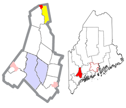
Livermore Falls, Maine
Encyclopedia
New England town
The New England town is the basic unit of local government in each of the six New England states. Without a direct counterpart in most other U.S. states, New England towns are conceptually similar to civil townships in other states, but are incorporated, possessing powers like cities in other...
in Androscoggin County
Androscoggin County, Maine
Androscoggin County is a county located in the U.S. state of Maine. As of the 2010 U.S. census, the county's population was 107,702. Its county seat is Auburn...
, Maine
Maine
Maine is a state in the New England region of the northeastern United States, bordered by the Atlantic Ocean to the east and south, New Hampshire to the west, and the Canadian provinces of Quebec to the northwest and New Brunswick to the northeast. Maine is both the northernmost and easternmost...
, United States
United States
The United States of America is a federal constitutional republic comprising fifty states and a federal district...
. The population was 3,227 at the 2000 census
United States Census, 2000
The Twenty-second United States Census, known as Census 2000 and conducted by the Census Bureau, determined the resident population of the United States on April 1, 2000, to be 281,421,906, an increase of 13.2% over the 248,709,873 persons enumerated during the 1990 Census...
. It is included in both the Lewiston
Lewiston, Maine
Lewiston is a city in Androscoggin County in Maine, and the second-largest city in the state. The population was 41,592 at the 2010 census. It is one of two principal cities of and included within the Lewiston-Auburn, Maine metropolitan New England city and town area and the Lewiston-Auburn, Maine...
-Auburn
Auburn, Maine
Auburn is a city in and the county seat of Androscoggin County, Maine, United States. The population was 23,055 at the 2010 census. It is one of two principal cities of and included in the Lewiston-Auburn, Maine metropolitan New England city and town area and the Lewiston-Auburn, Maine metropolitan...
, Maine Metropolitan Statistical Area and the Lewiston-Auburn, Maine Metropolitan New England City and Town Area
New England City and Town Area
A New England City and Town Area or NECTA is a geographic and statistical entity defined by the U.S. Office of Management and Budget, for use in describing aspects of the New England region of the United States...
. High school students in Livermore Falls attend Livermore Falls High School
Livermore Falls High School
Livermore Falls High School is a public high school in Livermore Falls, Maine. It is part of Regional School Unit 36, which includes the neighboring town of Livermore.-Building:The present home of Livermore Falls High School was built in 1968...
.
History
The area was once part of the Abenaki IndianIndigenous peoples of the Americas
The indigenous peoples of the Americas are the pre-Columbian inhabitants of North and South America, their descendants and other ethnic groups who are identified with those peoples. Indigenous peoples are known in Canada as Aboriginal peoples, and in the United States as Native Americans...
territory called Rockemeka, meaning "great corn place." It would be granted by the General Court
Massachusetts General Court
The Massachusetts General Court is the state legislature of the Commonwealth of Massachusetts. The name "General Court" is a hold-over from the Colonial Era, when this body also sat in judgment of judicial appeals cases...
of Massachusetts
Massachusetts
The Commonwealth of Massachusetts is a state in the New England region of the northeastern United States of America. It is bordered by Rhode Island and Connecticut to the south, New York to the west, and Vermont and New Hampshire to the north; at its east lies the Atlantic Ocean. As of the 2010...
in 1771 as Port Royal, awarded to heirs of veterans who served in the campaign against Port Royal
Port Royal
Port Royal was a city located at the end of the Palisadoes at the mouth of the Kingston Harbour, in southeastern Jamaica. Founded in 1518, it was the centre of shipping commerce in the Caribbean Sea during the latter half of the 17th century...
in Jamaica
Jamaica
Jamaica is an island nation of the Greater Antilles, in length, up to in width and 10,990 square kilometres in area. It is situated in the Caribbean Sea, about south of Cuba, and west of Hispaniola, the island harbouring the nation-states Haiti and the Dominican Republic...
. It was settled in 1786, then incorporated in 1795 as Livermore
Livermore, Maine
Livermore is a town in Androscoggin County, Maine, United States. The population was 2,106 at the 2000 census. It is included in both the Lewiston-Auburn, Maine Metropolitan Statistical Area and the Lewiston-Auburn, Maine Metropolitan New England City and Town Area. High schools students from...
after Deacon Elijah Livermore, one of the first English
English people
The English are a nation and ethnic group native to England, who speak English. The English identity is of early mediaeval origin, when they were known in Old English as the Anglecynn. England is now a country of the United Kingdom, and the majority of English people in England are British Citizens...
settlers. The county line, determined by the Androscoggin River
Androscoggin River
The Androscoggin River is a river in the U.S. states of Maine and New Hampshire, in northern New England. It is long and joins the Kennebec River at Merrymeeting Bay in Maine before its water empties into the Gulf of Maine on the Atlantic Ocean. Its drainage basin is in area...
, divided the town. West of the river was Oxford County
Oxford County, Maine
Oxford County is a county located in the U.S. state of Maine with a population of 57,833 as of the 2010 U.S. census. Its county seat is Paris.Part of Oxford County is included in the Lewiston-Auburn, Maine, metropolitan New England City and Town Area while a different part of Oxford County is...
, and east was Kennebec County. Consequently, East Livermore (which encompassed a quarter of the original Port Royal grant) was set off and incorporated on March 1, 1844. It became part of Androscoggin County on March 31, 1854. In 1930, East Livermore was renamed Livermore Falls.
In the early 19th century, the region was predominantly farmland, with apple
Apple
The apple is the pomaceous fruit of the apple tree, species Malus domestica in the rose family . It is one of the most widely cultivated tree fruits, and the most widely known of the many members of genus Malus that are used by humans. Apple grow on small, deciduous trees that blossom in the spring...
orchard
Orchard
An orchard is an intentional planting of trees or shrubs that is maintained for food production. Orchards comprise fruit or nut-producing trees which are grown for commercial production. Orchards are also sometimes a feature of large gardens, where they serve an aesthetic as well as a productive...
s and dairies
Dairy
A dairy is a business enterprise established for the harvesting of animal milk—mostly from cows or goats, but also from buffalo, sheep, horses or camels —for human consumption. A dairy is typically located on a dedicated dairy farm or section of a multi-purpose farm that is concerned...
supplying markets at Boston and Portland
Portland, Maine
Portland is the largest city in Maine and is the county seat of Cumberland County. The 2010 city population was 66,194, growing 3 percent since the census of 2000...
. It was noted for fine cattle
Cattle
Cattle are the most common type of large domesticated ungulates. They are a prominent modern member of the subfamily Bovinae, are the most widespread species of the genus Bos, and are most commonly classified collectively as Bos primigenius...
. As the century progressed, gristmill
Gristmill
The terms gristmill or grist mill can refer either to a building in which grain is ground into flour, or to the grinding mechanism itself.- Early history :...
s, sawmill
Sawmill
A sawmill is a facility where logs are cut into boards.-Sawmill process:A sawmill's basic operation is much like those of hundreds of years ago; a log enters on one end and dimensional lumber exits on the other end....
s, logging
Logging
Logging is the cutting, skidding, on-site processing, and loading of trees or logs onto trucks.In forestry, the term logging is sometimes used in a narrow sense concerning the logistics of moving wood from the stump to somewhere outside the forest, usually a sawmill or a lumber yard...
, lumber
Lumber
Lumber or timber is wood in any of its stages from felling through readiness for use as structural material for construction, or wood pulp for paper production....
became important industries, operated by water power from falls
Waterfall
A waterfall is a place where flowing water rapidly drops in elevation as it flows over a steep region or a cliff.-Formation:Waterfalls are commonly formed when a river is young. At these times the channel is often narrow and deep. When the river courses over resistant bedrock, erosion happens...
that drop 14 feet. With the arrival of the Androscoggin Railroad in 1852, Livermore Falls developed as a small mill town
Mill town
A mill town, also known as factory town or mill village, is typically a settlement that developed around one or more mills or factories .- United Kingdom:...
. Shoe factories
Shoemaking
Shoemaking is the process of making footwear. Originally, shoes were made one at a time by hand. Traditional handicraft shoemaking has now been largely superseded in volume of shoes produced by industrial mass production of footwear, but not necessarily in quality, attention to detail, or...
and paper mill
Paper mill
A paper mill is a factory devoted to making paper from vegetable fibres such as wood pulp, old rags and other ingredients using a Fourdrinier machine or other type of paper machine.- History :...
s were established, including the Umbagog Pulp Company started by Hugh J. Chisholm
Hugh J. Chisholm
Hugh Joseph Chisholm was a Canadian industrialist who later became a citizen of the United States. He was born in Niagara-on-the-Lake, Ontario, to parents of Scottish ancestry. His early years as an entrepreneur in the news distribution business provided a foundation for his later accomplishments...
. In 1897, the Third Bridge was built across the Androscoggin. It measured 800 feet in length, at that time the longest single-span
Span (architecture)
Span is the distance between two intermediate supports for a structure, e.g. a beam or a bridge.A span can be closed by a solid beam or of a rope...
bridge in New England
New England
New England is a region in the northeastern corner of the United States consisting of the six states of Maine, New Hampshire, Vermont, Massachusetts, Rhode Island, and Connecticut...
.
Geography
According to the United States Census BureauUnited States Census Bureau
The United States Census Bureau is the government agency that is responsible for the United States Census. It also gathers other national demographic and economic data...
, the town has a total area of 20.4 square miles (52.9 km²), of which, 19.8 square miles (51.2 km²) of it is land and 0.7 square miles (1.8 km²) of it (3.33%) is water. Livermore Falls is drained by the Androscoggin River
Androscoggin River
The Androscoggin River is a river in the U.S. states of Maine and New Hampshire, in northern New England. It is long and joins the Kennebec River at Merrymeeting Bay in Maine before its water empties into the Gulf of Maine on the Atlantic Ocean. Its drainage basin is in area...
.
Demographics
See also: Livermore Falls (CDP)Livermore Falls (CDP), Maine
Livermore Falls is a census-designated place in the town of Livermore Falls in Androscoggin County, Maine, United States. The population was 1,626 at the 2000 census.-Geography:Livermore Falls is located at ....
, Maine
Maine
Maine is a state in the New England region of the northeastern United States, bordered by the Atlantic Ocean to the east and south, New Hampshire to the west, and the Canadian provinces of Quebec to the northwest and New Brunswick to the northeast. Maine is both the northernmost and easternmost...
As of the census
Census
A census is the procedure of systematically acquiring and recording information about the members of a given population. It is a regularly occurring and official count of a particular population. The term is used mostly in connection with national population and housing censuses; other common...
of 2000, there were 3,227 people, 1,322 households, and 835 families residing in the town. The population density
Population density
Population density is a measurement of population per unit area or unit volume. It is frequently applied to living organisms, and particularly to humans...
was 163.4 people per square mile (63.1/km²). There were 1,502 housing units at an average density of 76.1 per square mile (29.4/km²). The racial makeup of the town was 97.27% White, 0.50% Black or African American
Race (United States Census)
Race and ethnicity in the United States Census, as defined by the Federal Office of Management and Budget and the United States Census Bureau, are self-identification data items in which residents choose the race or races with which they most closely identify, and indicate whether or not they are...
, 0.62% Native American, 0.22% Asian, 0.03% from other races
Race (United States Census)
Race and ethnicity in the United States Census, as defined by the Federal Office of Management and Budget and the United States Census Bureau, are self-identification data items in which residents choose the race or races with which they most closely identify, and indicate whether or not they are...
, and 1.36% from two or more races. Hispanic or Latino of any race were 1.02% of the population.
There were 1,322 households out of which 33.0% had children under the age of 18 living with them, 44.8% were married couples
Marriage
Marriage is a social union or legal contract between people that creates kinship. It is an institution in which interpersonal relationships, usually intimate and sexual, are acknowledged in a variety of ways, depending on the culture or subculture in which it is found...
living together, 13.2% had a female householder with no husband present, and 36.8% were non-families. 30.8% of all households were made up of individuals and 12.9% had someone living alone who was 65 years of age or older. The average household size was 2.39 and the average family size was 2.95.
In the town the population was spread out with 27.8% under the age of 18, 7.6% from 18 to 24, 27.4% from 25 to 44, 21.8% from 45 to 64, and 15.3% who were 65 years of age or older. The median age was 36 years. For every 100 females there were 96.1 males. For every 100 females age 18 and over, there were 90.4 males.
The median income for a household in the town was $30,102, and the median income for a family was $33,354. Males had a median income of $30,139 versus $22,381 for females. The per capita income
Per capita income
Per capita income or income per person is a measure of mean income within an economic aggregate, such as a country or city. It is calculated by taking a measure of all sources of income in the aggregate and dividing it by the total population...
for the town was $15,935. About 13.2% of families and 15.7% of the population were below the poverty line, including 17.7% of those under age 18 and 13.2% of those age 65 or over.
Transportation
The Bowman FieldBowman Field (Maine)
Bowman Field is a privately owned public-use airport located four nautical miles southeast of the central business district of Livermore Falls, a town in Androscoggin County, Maine, United States.- Facilities and aircraft :...
airport is located four nautical mile
Nautical mile
The nautical mile is a unit of length that is about one minute of arc of latitude along any meridian, but is approximately one minute of arc of longitude only at the equator...
s (5 mi
Mile
A mile is a unit of length, most commonly 5,280 feet . The mile of 5,280 feet is sometimes called the statute mile or land mile to distinguish it from the nautical mile...
, 7 km
Kilometre
The kilometre is a unit of length in the metric system, equal to one thousand metres and is therefore exactly equal to the distance travelled by light in free space in of a second...
) southeast of the central business district
Central business district
A central business district is the commercial and often geographic heart of a city. In North America this part of a city is commonly referred to as "downtown" or "city center"...
of Livermore Falls.