
East Derwent Highway
Encyclopedia
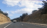
The East Derwent Highway (route number B32) is a highway in Hobart
, Australia
. The highway is a Trunk road
that carries heavy commuter traffic much like the Brooker Highway
, except on the Eastern side of the Derwent River
. The highway starts at the Lindisfarne Interchange
near the eastern side of the Tasman Bridge
, and travels north connecting to the Bowen Bridge
and eventually leading to the Midland Highway at Bridgewater
in the north.
Note: some minor streets excluded
Hobart
Hobart is the state capital and most populous city of the Australian island state of Tasmania. Founded in 1804 as a penal colony,Hobart is Australia's second oldest capital city after Sydney. In 2009, the city had a greater area population of approximately 212,019. A resident of Hobart is known as...
, Australia
Australia
Australia , officially the Commonwealth of Australia, is a country in the Southern Hemisphere comprising the mainland of the Australian continent, the island of Tasmania, and numerous smaller islands in the Indian and Pacific Oceans. It is the world's sixth-largest country by total area...
. The highway is a Trunk road
Trunk road
A trunk road, trunk highway, or strategic road is a major road—usually connecting two or more cities, ports, airports, and other things.—which is the recommended route for long-distance and freight traffic...
that carries heavy commuter traffic much like the Brooker Highway
Brooker Highway
The Brooker Highway is a highway in the State of Tasmania, Australia. Also known as the Northern Outlet, the highway is the major arterial route through Hobart's northern suburbs and is Hobart's major road connection to the cities and towns of Northern Tasmania...
, except on the Eastern side of the Derwent River
Derwent River (Tasmania)
The Derwent is a river in Tasmania, Australia. It was named after the River Derwent, Cumbria by British Commodore John Hayes who explored it in 1793. The name is Brythonic Celtic for "valley thick with oaks"....
. The highway starts at the Lindisfarne Interchange
Lindisfarne Interchange
The Lindisfarne Interchange is a Trumpet interchange which connects the Tasman Bridge to the Tasman Highway and the East Derwent Highway, on the eastern shore of the Derwent River within Hobart, Tasmania...
near the eastern side of the Tasman Bridge
Tasman Bridge
The Tasman Bridge is a five-lane bridge crossing the Derwent River, near the CBD of Hobart, Tasmania. The bridge has a total length of 1,395 metres . It provides the main traffic route from the CBD to the eastern shore - particularly Hobart International Airport and Bellerive Oval...
, and travels north connecting to the Bowen Bridge
Bowen Bridge
The Bowen Bridge is a four-lane road bridge crossing the Derwent River in Tasmania, Australia. The Bridge lies on the river approximately half way between the Tasman Bridge and the Bridgewater Bridge. The Bridge links the East Derwent Highway with the Brooker Highway at Glenorchy some 10...
and eventually leading to the Midland Highway at Bridgewater
Bridgewater, Tasmania
Bridgewater, Tasmania, is one greater Hobart's northern-most suburbs, located 19 km from the city. It is situated on the eastern shore of the Derwent River. It is a suburb of the local government area of the Municipality of Brighton....
in the north.
Exits
East Derwent Highway  |
|||
| Southbound interchanges | Distance from Tasman Highway (km) |
Distance from Midland Highway (km) |
Northbound interchanges |
| End East Derwent Highway continues as Tasman Highway Tasman Highway The Tasman Highway is a highway in Tasmania, Australia. Like the Midland Highway, it connects the major cities of Hobart and Launceston — however it takes a different route, via the north-eastern and eastern coasts of the state. The Highway also acts as a major commuter road to Hobart...  to Hobart Hobart Hobart is the state capital and most populous city of the Australian island state of Tasmania. Founded in 1804 as a penal colony,Hobart is Australia's second oldest capital city after Sydney. In 2009, the city had a greater area population of approximately 212,019. A resident of Hobart is known as... |
0 | 22.3 | Start East Derwent Highway from Tasman Highway Tasman Highway The Tasman Highway is a highway in Tasmania, Australia. Like the Midland Highway, it connects the major cities of Hobart and Launceston — however it takes a different route, via the north-eastern and eastern coasts of the state. The Highway also acts as a major commuter road to Hobart... |
| Sorell Sorell, Tasmania Sorell is a town in Tasmania, Australia, north-east of Hobart. It is on the Tasman Highway which continues up the east coast of Tasmania. At the 2006 census, Sorell had a population of 1,546.... Tasman Highway Tasman Highway The Tasman Highway is a highway in Tasmania, Australia. Like the Midland Highway, it connects the major cities of Hobart and Launceston — however it takes a different route, via the north-eastern and eastern coasts of the state. The Highway also acts as a major commuter road to Hobart... |
Sorell Sorell, Tasmania Sorell is a town in Tasmania, Australia, north-east of Hobart. It is on the Tasman Highway which continues up the east coast of Tasmania. At the 2006 census, Sorell had a population of 1,546.... Tasman Highway Tasman Highway The Tasman Highway is a highway in Tasmania, Australia. Like the Midland Highway, it connects the major cities of Hobart and Launceston — however it takes a different route, via the north-eastern and eastern coasts of the state. The Highway also acts as a major commuter road to Hobart...  |
||
| No Access | 0.2 | 22.1 | Rose Bay Rose Bay, Tasmania Rose Bay is a suburb of City of Clarence in greater Hobart, capital city of Tasmania, Australia.Primarily a residential area serviced by shopping centres at Lindisfarne and Rosny Park.... Yolla Street |
| Rose Bay Rose Bay, Tasmania Rose Bay is a suburb of City of Clarence in greater Hobart, capital city of Tasmania, Australia.Primarily a residential area serviced by shopping centres at Lindisfarne and Rosny Park.... Lenna Street (east) |
0.4 | 21.9 | Rose Bay Rose Bay, Tasmania Rose Bay is a suburb of City of Clarence in greater Hobart, capital city of Tasmania, Australia.Primarily a residential area serviced by shopping centres at Lindisfarne and Rosny Park.... Lenna Street (west) |
| Rose Bay Rose Bay, Tasmania Rose Bay is a suburb of City of Clarence in greater Hobart, capital city of Tasmania, Australia.Primarily a residential area serviced by shopping centres at Lindisfarne and Rosny Park.... Ronnie Street  |
0.6 | 21.7 | Rose Bay Rose Bay, Tasmania Rose Bay is a suburb of City of Clarence in greater Hobart, capital city of Tasmania, Australia.Primarily a residential area serviced by shopping centres at Lindisfarne and Rosny Park.... Ronnie Street |
| Lindisfarne Lindisfarne, Tasmania Lindisfarne is a suburb of Hobart's Eastern Shore, located approximately 6 kilometres from the City Centre and is part of the municipal City of Clarence.-History:... Sunnyside Road, Ballawinnie Road (east) |
0.9-1.4 | 21.4-20.9 | Lindisfarne Lindisfarne, Tasmania Lindisfarne is a suburb of Hobart's Eastern Shore, located approximately 6 kilometres from the City Centre and is part of the municipal City of Clarence.-History:... Shore Street, Ballawinnie Road (west) |
| Lindisfarne Lindisfarne, Tasmania Lindisfarne is a suburb of Hobart's Eastern Shore, located approximately 6 kilometres from the City Centre and is part of the municipal City of Clarence.-History:... Nietta Road .svg.png) |
1.5 | 20.8 | Lindisfarne Lindisfarne, Tasmania Lindisfarne is a suburb of Hobart's Eastern Shore, located approximately 6 kilometres from the City Centre and is part of the municipal City of Clarence.-History:... Nietta Road |
| No Access | 1.8 | 20.5 | Lindisfarne Lindisfarne, Tasmania Lindisfarne is a suburb of Hobart's Eastern Shore, located approximately 6 kilometres from the City Centre and is part of the municipal City of Clarence.-History:... Beach Road |
| Lindisfarne Lindisfarne, Tasmania Lindisfarne is a suburb of Hobart's Eastern Shore, located approximately 6 kilometres from the City Centre and is part of the municipal City of Clarence.-History:... , Rosny Park Rosny Park, Tasmania Rosny Park is a suburb of Hobart, Tasmania, located in the City of Clarence on the eastern shore of the Derwent River. It is about five kilometres from the city centre of Hobart... Gordons Hill Road |
1.8 | 20.5 | Lindisfarne Lindisfarne, Tasmania Lindisfarne is a suburb of Hobart's Eastern Shore, located approximately 6 kilometres from the City Centre and is part of the municipal City of Clarence.-History:... , Rosny Park Rosny Park, Tasmania Rosny Park is a suburb of Hobart, Tasmania, located in the City of Clarence on the eastern shore of the Derwent River. It is about five kilometres from the city centre of Hobart... Gordons Hill Road |
| Lindisfarne Lindisfarne, Tasmania Lindisfarne is a suburb of Hobart's Eastern Shore, located approximately 6 kilometres from the City Centre and is part of the municipal City of Clarence.-History:... Boatta Road, Bay Road |
2.0-2.1 | 20.3-20.2 | Lindisfarne Lindisfarne, Tasmania Lindisfarne is a suburb of Hobart's Eastern Shore, located approximately 6 kilometres from the City Centre and is part of the municipal City of Clarence.-History:... Boatta Road, Bay Road |
| Lindisfarne Lindisfarne, Tasmania Lindisfarne is a suburb of Hobart's Eastern Shore, located approximately 6 kilometres from the City Centre and is part of the municipal City of Clarence.-History:... Lincoln Street |
2.2 | 20.1 | Lindisfarne Lindisfarne, Tasmania Lindisfarne is a suburb of Hobart's Eastern Shore, located approximately 6 kilometres from the City Centre and is part of the municipal City of Clarence.-History:... Lincoln Street |
| Lindisfarne Lindisfarne, Tasmania Lindisfarne is a suburb of Hobart's Eastern Shore, located approximately 6 kilometres from the City Centre and is part of the municipal City of Clarence.-History:... Derwent Avenue (east) |
2.4-2.5 | 19.9-19.8 | Lindisfarne Lindisfarne, Tasmania Lindisfarne is a suburb of Hobart's Eastern Shore, located approximately 6 kilometres from the City Centre and is part of the municipal City of Clarence.-History:... Derwent Avenue (west), Raminea Road (exit only) |
| Lindisfarne Lindisfarne, Tasmania Lindisfarne is a suburb of Hobart's Eastern Shore, located approximately 6 kilometres from the City Centre and is part of the municipal City of Clarence.-History:... Lowanna Road (east) |
2.8 | 19.5 | Lindisfarne Lindisfarne, Tasmania Lindisfarne is a suburb of Hobart's Eastern Shore, located approximately 6 kilometres from the City Centre and is part of the municipal City of Clarence.-History:... Lowanna Road (west) |
| Lindisfarne Lindisfarne, Tasmania Lindisfarne is a suburb of Hobart's Eastern Shore, located approximately 6 kilometres from the City Centre and is part of the municipal City of Clarence.-History:... Lowanna Road (east) |
|||
| Lindisfarne Lindisfarne, Tasmania Lindisfarne is a suburb of Hobart's Eastern Shore, located approximately 6 kilometres from the City Centre and is part of the municipal City of Clarence.-History:... Clunie Close, Broad Street |
2.9-3.0 | 19.4-19.3 | Lindisfarne Lindisfarne, Tasmania Lindisfarne is a suburb of Hobart's Eastern Shore, located approximately 6 kilometres from the City Centre and is part of the municipal City of Clarence.-History:... Clunie Close, Broad Street |
| Geilston Bay Geilston Bay, Tasmania Geilston Bay is a small suburb of Hobart near Lindisfarne, in the City of Clarence located on the Eastern Shore of the Derwent River. Its a nature-rich suburb with houses built right next to bushland. Shag Bay Aboriginal Site and the local Boat Club are two main features of the suburb... Derwent Avenue |
3.2 | 19.1 | Geilston Bay Geilston Bay, Tasmania Geilston Bay is a small suburb of Hobart near Lindisfarne, in the City of Clarence located on the Eastern Shore of the Derwent River. Its a nature-rich suburb with houses built right next to bushland. Shag Bay Aboriginal Site and the local Boat Club are two main features of the suburb... Derwent Avenue |
| Geilston Bay Geilston Bay, Tasmania Geilston Bay is a small suburb of Hobart near Lindisfarne, in the City of Clarence located on the Eastern Shore of the Derwent River. Its a nature-rich suburb with houses built right next to bushland. Shag Bay Aboriginal Site and the local Boat Club are two main features of the suburb... Golf Links Road |
Geilston Bay Geilston Bay, Tasmania Geilston Bay is a small suburb of Hobart near Lindisfarne, in the City of Clarence located on the Eastern Shore of the Derwent River. Its a nature-rich suburb with houses built right next to bushland. Shag Bay Aboriginal Site and the local Boat Club are two main features of the suburb... Golf Links Road |
||
| Geilston Bay Geilston Bay, Tasmania Geilston Bay is a small suburb of Hobart near Lindisfarne, in the City of Clarence located on the Eastern Shore of the Derwent River. Its a nature-rich suburb with houses built right next to bushland. Shag Bay Aboriginal Site and the local Boat Club are two main features of the suburb... Araluen Street |
3.5 | 18.8 | Geilston Bay Geilston Bay, Tasmania Geilston Bay is a small suburb of Hobart near Lindisfarne, in the City of Clarence located on the Eastern Shore of the Derwent River. Its a nature-rich suburb with houses built right next to bushland. Shag Bay Aboriginal Site and the local Boat Club are two main features of the suburb... Araluen Street |
| Geilston Bay Geilston Bay, Tasmania Geilston Bay is a small suburb of Hobart near Lindisfarne, in the City of Clarence located on the Eastern Shore of the Derwent River. Its a nature-rich suburb with houses built right next to bushland. Shag Bay Aboriginal Site and the local Boat Club are two main features of the suburb... Geilston Bay Road |
3.7 | 18.6 | Geilston Bay Geilston Bay, Tasmania Geilston Bay is a small suburb of Hobart near Lindisfarne, in the City of Clarence located on the Eastern Shore of the Derwent River. Its a nature-rich suburb with houses built right next to bushland. Shag Bay Aboriginal Site and the local Boat Club are two main features of the suburb... Geilston Bay Road |
| Geilston Bay Geilston Bay, Tasmania Geilston Bay is a small suburb of Hobart near Lindisfarne, in the City of Clarence located on the Eastern Shore of the Derwent River. Its a nature-rich suburb with houses built right next to bushland. Shag Bay Aboriginal Site and the local Boat Club are two main features of the suburb... Clinton Road |
Geilston Bay Geilston Bay, Tasmania Geilston Bay is a small suburb of Hobart near Lindisfarne, in the City of Clarence located on the Eastern Shore of the Derwent River. Its a nature-rich suburb with houses built right next to bushland. Shag Bay Aboriginal Site and the local Boat Club are two main features of the suburb... Clinton Road |
||
| Risdon Vale Risdon Vale, Tasmania Risdon Vale is an outer suburb of Hobart, capital of Tasmania, Australia.Located on the Eastern Shore of the Derwent River, and adjacent to Risdon Cove, which was the site of the first British settlement in Van Diemen's Land.... Sugarloaf Road |
4.6 | 17.7 | Risdon Vale Risdon Vale, Tasmania Risdon Vale is an outer suburb of Hobart, capital of Tasmania, Australia.Located on the Eastern Shore of the Derwent River, and adjacent to Risdon Cove, which was the site of the first British settlement in Van Diemen's Land.... Sugarloaf Road |
| Richmond Richmond, Tasmania Richmond is a town in Tasmania about 25 km north-east of Hobart, in the Coal River region, between the Midland Highway and Tasman Highway. At the 2006 census, Richmond had a population of 880.... , Risdon Vale Risdon Vale, Tasmania Risdon Vale is an outer suburb of Hobart, capital of Tasmania, Australia.Located on the Eastern Shore of the Derwent River, and adjacent to Risdon Cove, which was the site of the first British settlement in Van Diemen's Land.... Grasstree Hill Road  .svg.png) |
6.5 | 15.8 | Richmond Richmond, Tasmania Richmond is a town in Tasmania about 25 km north-east of Hobart, in the Coal River region, between the Midland Highway and Tasman Highway. At the 2006 census, Richmond had a population of 880.... , Risdon Vale Risdon Vale, Tasmania Risdon Vale is an outer suburb of Hobart, capital of Tasmania, Australia.Located on the Eastern Shore of the Derwent River, and adjacent to Risdon Cove, which was the site of the first British settlement in Van Diemen's Land.... Grasstree Hill Road |
| Risdon Risdon, Tasmania Risdon is a suburb of Hobart, capital city of Tasmania, Australia. It is west of Risdon Vale. Eucalyptus risdonii is native to this location, and is the emblem of Geilston Bay High School.... Saundersons Road |
8.1 | 14.2 | Risdon Risdon, Tasmania Risdon is a suburb of Hobart, capital city of Tasmania, Australia. It is west of Risdon Vale. Eucalyptus risdonii is native to this location, and is the emblem of Geilston Bay High School.... Saundersons Road |
| Glenorchy Glenorchy, Tasmania Glenorchy is a business district and suburb in the northern part of greater Hobart, capital of the state of Tasmania, Australia. The land was originally used for agriculture but is now a largely suburban, working-class area... Goodwood Road Goodwood Road, Tasmania Goodwood Road is a 4 lane link road that connects the City of Glenorchy to the City of Clarence in the greater area of Hobart, Tasmania. Using the Bowen Bridge the road travels over the Derwent River in semi-highway road layout...  |
8.8 | 13.5 | Glenorchy Glenorchy, Tasmania Glenorchy is a business district and suburb in the northern part of greater Hobart, capital of the state of Tasmania, Australia. The land was originally used for agriculture but is now a largely suburban, working-class area... Goodwood Road Goodwood Road, Tasmania Goodwood Road is a 4 lane link road that connects the City of Glenorchy to the City of Clarence in the greater area of Hobart, Tasmania. Using the Bowen Bridge the road travels over the Derwent River in semi-highway road layout... |
| Otago Bay Direction Drive, Otago Bay Road |
9.5-9.9 | 12.8-12.4 | Otago Bay Direction Drive, Otago Bay Road |
| Otago Bay Otago Bay Road, Kandos Drive |
11.9-12.0 | 10.4-10.3 | Otago Bay Otago Bay Road, Kandos Drive |
| Brighton Brighton, Tasmania Brighton is a suburb 27km north of Hobart, in Tasmania, Australia. It lies between Pontville and the outer Hobart suburb of Bridgewater on the Midland Highway. At the 2006 census, Brighton had a population of 3,145.-History:... Baskerville Road |
14.6 | 7.7 | Brighton Brighton, Tasmania Brighton is a suburb 27km north of Hobart, in Tasmania, Australia. It lies between Pontville and the outer Hobart suburb of Bridgewater on the Midland Highway. At the 2006 census, Brighton had a population of 3,145.-History:... Baskerville Road |
| Old Beach Old Beach, Tasmania Old Beach is a suburb of Hobart based in the municipality of Brighton, Tasmania, Australia. It has a population of approximately 2000 which is rising due to Tasmania's housing boom. It is the location of the Baskerville Raceway.-Sources:... Fouche Avenue |
15.0 | 7.3 | Old Beach Old Beach, Tasmania Old Beach is a suburb of Hobart based in the municipality of Brighton, Tasmania, Australia. It has a population of approximately 2000 which is rising due to Tasmania's housing boom. It is the location of the Baskerville Raceway.-Sources:... Fouche Avenue |
| Old Beach Old Beach, Tasmania Old Beach is a suburb of Hobart based in the municipality of Brighton, Tasmania, Australia. It has a population of approximately 2000 which is rising due to Tasmania's housing boom. It is the location of the Baskerville Raceway.-Sources:... Clives Avenue |
Old Beach Old Beach, Tasmania Old Beach is a suburb of Hobart based in the municipality of Brighton, Tasmania, Australia. It has a population of approximately 2000 which is rising due to Tasmania's housing boom. It is the location of the Baskerville Raceway.-Sources:... Clives Avenue |
||
| Old Beach Old Beach, Tasmania Old Beach is a suburb of Hobart based in the municipality of Brighton, Tasmania, Australia. It has a population of approximately 2000 which is rising due to Tasmania's housing boom. It is the location of the Baskerville Raceway.-Sources:... Jetty Road, Jetty Road |
15.5-16.2 | 6.8-6.1 | Old Beach Old Beach, Tasmania Old Beach is a suburb of Hobart based in the municipality of Brighton, Tasmania, Australia. It has a population of approximately 2000 which is rising due to Tasmania's housing boom. It is the location of the Baskerville Raceway.-Sources:... Jetty Road, Jetty Road |
| Old Beach Old Beach, Tasmania Old Beach is a suburb of Hobart based in the municipality of Brighton, Tasmania, Australia. It has a population of approximately 2000 which is rising due to Tasmania's housing boom. It is the location of the Baskerville Raceway.-Sources:... , Brighton Brighton, Tasmania Brighton is a suburb 27km north of Hobart, in Tasmania, Australia. It lies between Pontville and the outer Hobart suburb of Bridgewater on the Midland Highway. At the 2006 census, Brighton had a population of 3,145.-History:... Old Beach Road  |
16.4 | 5.9 | Old Beach Old Beach, Tasmania Old Beach is a suburb of Hobart based in the municipality of Brighton, Tasmania, Australia. It has a population of approximately 2000 which is rising due to Tasmania's housing boom. It is the location of the Baskerville Raceway.-Sources:... , Brighton Brighton, Tasmania Brighton is a suburb 27km north of Hobart, in Tasmania, Australia. It lies between Pontville and the outer Hobart suburb of Bridgewater on the Midland Highway. At the 2006 census, Brighton had a population of 3,145.-History:... Old Beach Road |
| Old Beach Old Beach, Tasmania Old Beach is a suburb of Hobart based in the municipality of Brighton, Tasmania, Australia. It has a population of approximately 2000 which is rising due to Tasmania's housing boom. It is the location of the Baskerville Raceway.-Sources:... Compton Road, Riviera Drive, Stanfield Drive |
16.7-17.7 | 5.6-4.6 | Old Beach Old Beach, Tasmania Old Beach is a suburb of Hobart based in the municipality of Brighton, Tasmania, Australia. It has a population of approximately 2000 which is rising due to Tasmania's housing boom. It is the location of the Baskerville Raceway.-Sources:... Compton Road, Riviera Drive, Stanfield Drive |
| Gagebrook Gagebrook, Tasmania Gagebrook, Tasmania is one of the northern-most suburbs of Hobart, located on the eastern shore of the Derwent River between the suburbs of Bridgewater and Old Beach. It is part of the local government area of the Municipality of Brighton... Lamprill Circle |
18.6 | 3.7 | Gagebrook Gagebrook, Tasmania Gagebrook, Tasmania is one of the northern-most suburbs of Hobart, located on the eastern shore of the Derwent River between the suburbs of Bridgewater and Old Beach. It is part of the local government area of the Municipality of Brighton... Lamprill Circle |
| Gagebrook Gagebrook, Tasmania Gagebrook, Tasmania is one of the northern-most suburbs of Hobart, located on the eastern shore of the Derwent River between the suburbs of Bridgewater and Old Beach. It is part of the local government area of the Municipality of Brighton... Gage Road |
Gagebrook Gagebrook, Tasmania Gagebrook, Tasmania is one of the northern-most suburbs of Hobart, located on the eastern shore of the Derwent River between the suburbs of Bridgewater and Old Beach. It is part of the local government area of the Municipality of Brighton... Gage Road |
||
| Gagebrook Gagebrook, Tasmania Gagebrook, Tasmania is one of the northern-most suburbs of Hobart, located on the eastern shore of the Derwent River between the suburbs of Bridgewater and Old Beach. It is part of the local government area of the Municipality of Brighton... Lamprill Circle (exit only) |
19.5 | 2.8 | Gagebrook Gagebrook, Tasmania Gagebrook, Tasmania is one of the northern-most suburbs of Hobart, located on the eastern shore of the Derwent River between the suburbs of Bridgewater and Old Beach. It is part of the local government area of the Municipality of Brighton... Lamprill Circle |
| JORDAN RIVER BRIDGE Jordan River Bridge The Jordan River Bridge is a two Lane bridge crossing the Jordan River within the greater area of Hobart, Tasmania.The bridge's main function is to carry East Derwent Highway traffic, as well as pedestrians who travel between Bridgewater and Gagebrook.... |
|||
| Green Point Green Point, Tasmania Green Point, Tasmania, is a far northern suburb of Hobart, located south of Bridgewater.-External links:* , a map of the area.... Scott Road |
21.3 | 1.0 | Green Point Green Point, Tasmania Green Point, Tasmania, is a far northern suburb of Hobart, located south of Bridgewater.-External links:* , a map of the area.... Scott Road |
| Bridgewater Bridgewater, Tasmania Bridgewater, Tasmania, is one greater Hobart's northern-most suburbs, located 19 km from the city. It is situated on the eastern shore of the Derwent River. It is a suburb of the local government area of the Municipality of Brighton.... Paice Street |
Bridgewater Bridgewater, Tasmania Bridgewater, Tasmania, is one greater Hobart's northern-most suburbs, located 19 km from the city. It is situated on the eastern shore of the Derwent River. It is a suburb of the local government area of the Municipality of Brighton.... Paice Street |
||
| Bridgewater Bridgewater, Tasmania Bridgewater, Tasmania, is one greater Hobart's northern-most suburbs, located 19 km from the city. It is situated on the eastern shore of the Derwent River. It is a suburb of the local government area of the Municipality of Brighton.... Cove Hill Road |
22.0 | 0.3 | Bridgewater Bridgewater, Tasmania Bridgewater, Tasmania, is one greater Hobart's northern-most suburbs, located 19 km from the city. It is situated on the eastern shore of the Derwent River. It is a suburb of the local government area of the Municipality of Brighton.... Cove Hill Road |
| Green Point Green Point, Tasmania Green Point, Tasmania, is a far northern suburb of Hobart, located south of Bridgewater.-External links:* , a map of the area.... Gunn Street |
22.1 | 0.2 | Green Point Green Point, Tasmania Green Point, Tasmania, is a far northern suburb of Hobart, located south of Bridgewater.-External links:* , a map of the area.... Gunn Street |
| Glenorchy Glenorchy, Tasmania Glenorchy is a business district and suburb in the northern part of greater Hobart, capital of the state of Tasmania, Australia. The land was originally used for agriculture but is now a largely suburban, working-class area... , Hobart Hobart Hobart is the state capital and most populous city of the Australian island state of Tasmania. Founded in 1804 as a penal colony,Hobart is Australia's second oldest capital city after Sydney. In 2009, the city had a greater area population of approximately 212,019. A resident of Hobart is known as... Midland Highway |
22.3 | 0 | Glenorchy Glenorchy, Tasmania Glenorchy is a business district and suburb in the northern part of greater Hobart, capital of the state of Tasmania, Australia. The land was originally used for agriculture but is now a largely suburban, working-class area... , Hobart Hobart Hobart is the state capital and most populous city of the Australian island state of Tasmania. Founded in 1804 as a penal colony,Hobart is Australia's second oldest capital city after Sydney. In 2009, the city had a greater area population of approximately 212,019. A resident of Hobart is known as... Midland Highway |
| Start East Derwent Highway continues from Midland Highway  |
End East Derwent Highway continues as Midland Highway to Brighton Brighton, Tasmania Brighton is a suburb 27km north of Hobart, in Tasmania, Australia. It lies between Pontville and the outer Hobart suburb of Bridgewater on the Midland Highway. At the 2006 census, Brighton had a population of 3,145.-History:... , Launceston Launceston, Tasmania Launceston is a city in the north of the state of Tasmania, Australia at the junction of the North Esk and South Esk rivers where they become the Tamar River. Launceston is the second largest city in Tasmania after the state capital Hobart... |
||
Note: some minor streets excluded
See also
- Highways in AustraliaHighways in AustraliaThis is a list of highways in Australia, listed alphabetically along with each highway's route number and location. Note that some highways service more than one state or territory.-Route numbering systems:...
- List of highways in Tasmania