

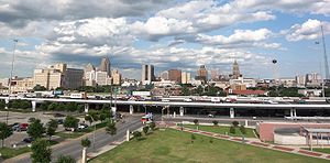
List of highways in San Antonio, Texas
Encyclopedia
This is a list of highways in San Antonio, Texas, consisting of Interstates
, U.S. highways
, state highways
, state highway loops
and spurs
maintained by the Texas Department of Transportation
(TxDOT) within the San Antonio, Texas
city limits. They range from multi-lane freeways that provide high-volume corridors to 2-lane roads. In addition to the four Interstates, which must be freeways per the Interstate Highway standards
, U.S. Highway 90 (US 90), US 281, and State Highway 151 (SH 151) are also freeways in San Antonio. There are also a couple instances where other highways run concurrently with the aforementioned freeways; US 87 and SH 16 run concurrently with Interstate 10
(I-10) and I-410 respectively.
Interstate Highway System
The Dwight D. Eisenhower National System of Interstate and Defense Highways, , is a network of limited-access roads including freeways, highways, and expressways forming part of the National Highway System of the United States of America...
, U.S. highways
United States Numbered Highways
The system of United States Numbered Highways is an integrated system of roads and highways in the United States numbered within a nationwide grid...
, state highways
Texas state highways
Texas state highways are a network of highways owned and maintained by the U.S. state of Texas. The Texas Department of Transportation is the state agency responsible for the day-to-day operations and maintenance of the system. In addition to the nationally-numbered Interstate highways and U.S...
, state highway loops
Loop route
A loop route is a highway or other major road that extends out from a typically longer, more important parents road to enter and circle a large city. A loop can function as a bypass for through traffic and also to service outlying suburbs....
and spurs
Spur route
A spur route is a short road forming a branch from a longer, more important route . A bypass or beltway is never considered a true spur route as it typically reconnects with the major road...
maintained by the Texas Department of Transportation
Texas Department of Transportation
The Texas Department of Transportation is a governmental agency in the U.S. state of Texas. Its stated mission is to "work cooperatively to provide safe, effective and efficient movement of people and goods" throughout the state...
(TxDOT) within the San Antonio, Texas
San Antonio, Texas
San Antonio is the seventh-largest city in the United States of America and the second-largest city within the state of Texas, with a population of 1.33 million. Located in the American Southwest and the south–central part of Texas, the city serves as the seat of Bexar County. In 2011,...
city limits. They range from multi-lane freeways that provide high-volume corridors to 2-lane roads. In addition to the four Interstates, which must be freeways per the Interstate Highway standards
Interstate Highway standards
Standards for Interstate Highways in the United States are defined by the American Association of State Highway and Transportation Officials in the publication A Policy on Design Standards - Interstate System...
, U.S. Highway 90 (US 90), US 281, and State Highway 151 (SH 151) are also freeways in San Antonio. There are also a couple instances where other highways run concurrently with the aforementioned freeways; US 87 and SH 16 run concurrently with Interstate 10
Interstate 10 in Texas
Interstate 10 is the major east–west Interstate Highway in the Southern United States. In the U.S. state of Texas, it runs east from El Paso, near the border with New Mexico, through San Antonio and Houston to the border with Louisiana in Orange, Texas....
(I-10) and I-410 respectively.
Interstates
| Highway | Location | Length | Description | Date established | Notes |
|---|---|---|---|---|---|
.svg.png) I-10 I-10Interstate 10 in Texas Interstate 10 is the major east–west Interstate Highway in the Southern United States. In the U.S. state of Texas, it runs east from El Paso, near the border with New Mexico, through San Antonio and Houston to the border with Louisiana in Orange, Texas.... |
Bexar Bexar County, Texas As of the census of 2000, there were 1,392,931 people, 488,942 households, and 345,681 families residing in the county. The population density was 1,117 people per square mile . There were 521,359 housing units at an average density of 418 per square mile... , Guadalupe Guadalupe County, Texas Guadalupe County is a county located in the U.S. state of Texas. In 2000, its population was 89,023. It is named for the Guadalupe River. The seat of the county is Seguin. It was founded in 1846.... and Kendall Kendall County, Texas Kendall County is a county located on the Edwards Plateau in the U.S. state of Texas. In 2008 census, its population was 32,886. Its seat is Boerne.... Counties |
108 mi (174 km) | Known as the Robert F. McDermott Freeway from Loop 1604 to I-35 in downtown, this section was formally called the Northwest Expressway. Known as the Jose Lopez Freeway from I-35 to I-410. | 1959 | |
| I-35 Interstate 35 in Texas Interstate 35 in Texas is a major north–south Interstate Highway running from Laredo near the United States-Mexico border to the Red River north of Gainesville where it crosses into Oklahoma. Along its route, it passes through the cities of San Antonio, Austin, and Waco before it splits into two... |
Atascosa, Bexar, Comal Comal County, Texas Comal County is a county located on the Edwards Plateau in the U.S. state of Texas. In 2010, its population was 108,472. Its seat is New Braunfels.Comal County is part of the San Antonio Metropolitan Statistical Area.-History Timeline:... , Guadalupe and Medina Counties |
79 mi (127 km) | Known as the Pan Am Expressway from I-410 on the southside to Loop 1604 on the northside. This is the only radial freeway in San Antonio that does not have a name change. | 1959 | |
.svg.png) I-37 I-37Interstate 37 Interstate 37 is a intrastate Interstate Highway located within the U.S. state of Texas. The highway was first designated in 1959 as a route between Corpus Christi and San Antonio. Construction in the urban areas of Corpus Christi and San Antonio began in the 1960s and the segments of the... |
Atascosa and Bexar Counties | 59 mi (95 km) | Known as the Lucell Adams Freeway from I-410 to I-37's terminus at I-35. | 1959 | |
.svg.png) I-410 I-410 |
Bexar County | 49.488 mi (79.643 km) | A loop route of I-10 around San Antonio. It is identified as Connally Loop in honor of former Texas governor Governor A governor is a governing official, usually the executive of a non-sovereign level of government, ranking under the head of state... John B. Connally. |
1959 |
U.S. highways
| Highway | Location | Length | Description | Date established | Notes |
|---|---|---|---|---|---|
 US 87 US 87U.S. Route 87 in Texas In the U.S. state of Texas, U.S. Highway 87 is a north–south U.S. Highway that begins near the Gulf Coast in Port Lavaca, Texas and heads north through San Antonio, Lubbock, and Amarillo to the New Mexico border near Texline.... |
Bexar Bexar County, Texas As of the census of 2000, there were 1,392,931 people, 488,942 households, and 345,681 families residing in the county. The population density was 1,117 people per square mile . There were 521,359 housing units at an average density of 418 per square mile... , Kendall Kendall County, Texas Kendall County is a county located on the Edwards Plateau in the U.S. state of Texas. In 2008 census, its population was 32,886. Its seat is Boerne.... and Wilson Wilson County, Texas Wilson County is a county located in the U.S. state of Texas. In 2000, its population was 32,408. Its county seat is Floresville. The county is named after James Charles Wilson.... Counties |
109 mi (175 km) | US 87 shares an overlap with I-10 for most of its travel through San Antonio. From I-10 to the highway's exit from the city, it is known as Rigsby Avenue. | 1935 | |
 US 90 US 90U.S. Route 90 U.S. Route 90 is an east–west United States highway. Despite the "0" in its route number, U.S. 90 never was a full coast-to-coast route; it has always ended at Van Horn, Texas. A short-lived northward extension to U.S... |
Bexar, Guadalupe Guadalupe County, Texas Guadalupe County is a county located in the U.S. state of Texas. In 2000, its population was 89,023. It is named for the Guadalupe River. The seat of the county is Seguin. It was founded in 1846.... and Medina Counties |
109 mi (175 km) | Known as the Cleto Rodriguez Freeway from Loop 1604 to I-10/35. After this, the highway shares on overlap with I-10 to Seguin Seguin, Texas Seguin is a city in Guadalupe County, Texas, in the United States. It is part of the San Antonio-New Braunfels Metropolitan Statistical Area. As of the 2000 census, the city population was 22,011; the July 1, 2009 Census estimate, however, showed the population had increased to 26,842... |
1927 | |
 US 181 US 181U.S. Route 181 U.S. Highway 181, a north–south route, is one of many intrastate United States Highways in the United States. It lies completely within the state of Texas, and both termini are at Interstate 37, the road that it mainly parallels to the east... |
Bexar and Wilson Counties | 1927 | |||
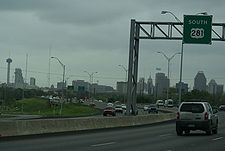
 US 281 US 281U.S. Route 281 U.S. Route 281 is a north–south United States highway. At 1,872 miles long it is the longest continuous three-digit U.S. Route.... |
Atascosa, Bexar and Comal Comal County, Texas Comal County is a county located on the Edwards Plateau in the U.S. state of Texas. In 2010, its population was 108,472. Its seat is New Braunfels.Comal County is part of the San Antonio Metropolitan Statistical Area.-History Timeline:... Counties |
Known as the McAllister Freeway from I-35 to Spur 537. Known as San Pedro Avenue from Spur 537 to Sonterra Boulevard. | 1935 |
State highways
| Highway | Location | Length | Description | Date established | Notes |
|---|---|---|---|---|---|
 SH 16 SH 16 |
Atascosa, Bandera Bandera County, Texas Bandera County, formed in 1856 from Bexar and Uvalde counties, is a county located on the Edwards Plateau in the U.S. state of Texas. As of 2000, the population is 17,645. Its county seat is Bandera. Bandera is named for the Spanish word for flag... , Bexar Bexar County, Texas As of the census of 2000, there were 1,392,931 people, 488,942 households, and 345,681 families residing in the county. The population density was 1,117 people per square mile . There were 521,359 housing units at an average density of 418 per square mile... and Medina Counties |
SH 16 is known as Palo Alto Road from the Bexar-Atascosa County Line to I-410. SH 16 shares an overlap with I-410 for about 20 miles. Known as Bandera Road from I-410 to the Bexar-Medina County Line. | |||
 SH 151 SH 151 |
Bexar County | 10.667 mi (17.167 km) | Known as the Raymond E. Stotzer Jr. Freeway, SH 151 is a state highway that runs from Loop 1604 State Highway Loop 1604 (Texas) Loop 1604, also known as the Charles W. Anderson Loop, is a highway loop that encircles the city of San Antonio, Texas and spanning a total of approximately... to US 90 in San Antonio. SH 151 is a limited access freeway for its entire length with the exception of its junction with Loop 1604 at its western terminus where a traffic light Traffic light Traffic lights, which may also be known as stoplights, traffic lamps, traffic signals, signal lights, robots or semaphore, are signalling devices positioned at road intersections, pedestrian crossings and other locations to control competing flows of traffic... controls the junction. The routing of the freeway was first conceived in 1983 and construction was conducted in phases through the 1980s and 1990s until completion in 2004. The freeway provides access to the western part of San Antonio, the Sea World SeaWorld San Antonio SeaWorld San Antonio is a marine mammal park, oceanarium, and animal theme park, located in the Westover Hills area of San Antonio, Texas. It is the largest of the three parks in the SeaWorld chain owned by SeaWorld Parks & Entertainment, a division of The Blackstone Group, and the world's... theme park, Chase Chase (bank) JPMorgan Chase Bank, N.A., doing business as Chase, is a national bank that constitutes the consumer and commercial banking subsidiary of financial services firm JPMorgan Chase. The bank was known as Chase Manhattan Bank until it merged with J.P. Morgan & Co. in 2000... , and the future site of a Microsoft Microsoft Microsoft Corporation is an American public multinational corporation headquartered in Redmond, Washington, USA that develops, manufactures, licenses, and supports a wide range of products and services predominantly related to computing through its various product divisions... data center. |
1984 | |
 SH 211 SH 211Texas State Highway 211 State Highway 211 or SH 211 is a state highway west of the city of San Antonio in the U.S. state of Texas. This route was designated in 1986 as an access route to the Texas Research Park. Portions of the route were built, but significant landowner opposition kept the connecting section from... |
Bexar and Medina Counties | 11.184 mi (17.999 km) | Known as Texas Research Parkway. There is a gap in the highway between FM 471 and FM 1957. This was originally going to be the outer loop for San Antonio, replacing Loop 1604 and I-410. | 1986 | |
 SH 218 SH 218Texas State Highway 218 State Highway 218 or SH 218 is a short state highway in the U.S. state of Texas connecting Interstate 35 to Randolph Air Force Base at Farm to Market Road 78... |
Bexar County | 3.985 mi (6.413 km) | Known as Pat Booker Road its entire length. Serves as a connecter road from I-35 to FM 78 at Randolph Air Force Base Randolph Air Force Base Randolph Air Force Base is a United States Air Force base located east-northeast of San Antonio, Texas. The base is under the jurisdiction of the 902d Mission Support Group, Air Education and Training Command .... . |
1936 |
State highway loops and spurs
| Highway | Location | Length | Description | Date established | Notes |
|---|---|---|---|---|---|
 Loop 13 Loop 13Texas State Highway Loop 13 Loop 13 is a partial loop route around the city of San Antonio in the U.S. state of Texas. Prior to Interstate 410 , Loop 13 served as the primary loop for the city. Loop 13 follows Military Drive from U.S. Highway 90 through the south side of the city. It then follows W.W. White road after it... |
Bexar County Bexar County, Texas As of the census of 2000, there were 1,392,931 people, 488,942 households, and 345,681 families residing in the county. The population density was 1,117 people per square mile . There were 521,359 housing units at an average density of 418 per square mile... |
21.684 mi (34.897 km) | A partial loop route around the city of San Antonio, Texas San Antonio, Texas San Antonio is the seventh-largest city in the United States of America and the second-largest city within the state of Texas, with a population of 1.33 million. Located in the American Southwest and the south–central part of Texas, the city serves as the seat of Bexar County. In 2011,... . Prior to I-410, Loop 13 served as the primary loop for the city. Loop 13 follows Military Drive from US 90 through the south side of the city. It then follows W.W. White road after it turns to the north through the east side of San Antonio before ending at I-410. The road is still a major arterial for the city, providing access to Lackland Air Force Base Lackland Air Force Base Lackland Air Force Base is a United States Air Force base located west-southwest of San Antonio, Texas. The base is under the jurisdiction of the 802d Mission Support Group, Air Education and Training Command .... , Kelly USA, and Brooks City-Base Brooks City-Base Brooks City-Base was a United States Air Force facility located in San Antonio, Texas, southeast of Downtown San Antonio.In 2002 Brooks Air Force Base was renamed Brooks City-Base when the property was conveyed to the Brooks Development Authority as part of a unique project between local, state,... . |
||
 Spur 53 Spur 53Texas State Highway Spur 53 Spur 53 is a state highway spur in San Antonio, Texas.-Route description:Spur 53 provides access from Interstate 10 to the southern side of the University of Texas at San Antonio. State maintenance begins along UTSA Boulevard at a point approximately west of the main southern entrance of UTSA at... |
Bexar County | 1.576 mi (2.536 km) | Known as UTSA Boulevard. Serves as a connecter route from the southern entrance of University of Texas at San Antonio University of Texas at San Antonio The University of Texas at San Antonio, commonly referred to as UTSA, is a state university in San Antonio, Texas. With an enrollment of more than 30,000 students, it is the third-largest of nine universities and six health institutions in the University of Texas System and the eighth-largest in... to I-10. |
1980 | |
 Spur 66 Spur 66 |
Bexar County | Known as Lone Star Pass. Connects Watson Road to SH 16. | 2003 | ||
 Loop 106 Loop 106 |
Bexar County | 1.76 mi (2.832 km) | An old alignment of US 87 through Sayers Sayers, Texas Sayers is a small unincorporated town located at the intersection of U.S. Route 87 and FM 1628 in eastern Bexar County, Texas, United States. It is part of the San Antonio Metropolitan Statistical Area.-History:... . |
1981 | |
 Loop 107 Loop 107 |
Bexar County | 1.335 mi (2.148 km) | An old alignment of US 87 through Lone Oak Lone Oak, Texas Lone Oak is a city in Hunt County, Texas, United States. The population was 521 at the 2000 census. Although Lone Oak changed from a town to a city in November 1890, the change was not recognized by the Census Bureau until June 2007; consequently, it was listed as a town at the 2000... . |
1981 | |
 Spur 117 Spur 117Texas State Highway Spur 117 Spur 117 is a spur route in the U.S. state of Texas that connects Interstate 410 and Loop 13 in San Antonio in Bexar County. The road is maintained by the Texas Department of Transportation . The spur was designated in 1980 and follows W.W... |
Bexar County | 0.546 mi (0.87869964 km) | A short spur route that connects I-410 and Loop 13 in San Antonio. The spur follows W.W. White Road from I-410 on the southeast side of San Antonio towards the northwest ending at Loop 13. | 1980 | |
 Spur 122 Spur 122Texas State Highway Spur 122 Spur 122 is a spur route in the U.S. state of Texas that follows a former route of U.S. Highway 181 in San Antonio. Spur 122 follows Presa Street from US 181 near the city limits on the southeast side of San Antonio towards the northwest ending at Loop 13 just east of the San Antonio River... |
Bexar County | 5.664 mi (9.115 km) | A spur route that follows a former route of US 181 U.S. Route 181 U.S. Highway 181, a north–south route, is one of many intrastate United States Highways in the United States. It lies completely within the state of Texas, and both termini are at Interstate 37, the road that it mainly parallels to the east... in San Antonio. Spur 122 follows Presa Street from US 181 near the city limits on the southeast side of San Antonio towards the northwest ending at Loop 13 just east of the San Antonio River San Antonio River The San Antonio River is a major waterway that originates in central Texas in a cluster of springs in north central San Antonio, approximately four miles north of downtown, and follows a roughly southeastern path through the state. It eventually feeds into the Guadalupe River about ten miles from... . The spur provides access to Mission San Francisco de la Espada Mission San Francisco de la Espada Mission San Francisco de la Espada was a Roman Catholic mission established by Spain near San Antonio de Bexar in northern New Spain in 1731 to convert local Native Americans to Christianity and solidify Spanish territorial claims in the New World against encroachment from France... and other parks along the banks of the San Antonio River. |
1964 | |
 Loop 345 Loop 345Texas State Highway Loop 345 Loop 345 is a loop route in the U.S. state of Texas that follows a former route of U.S. Highway 87 in San Antonio and Balcones Heights. Loop 345 follows Fredericksburg Road from Interstate 10 northwest of downtown San Antonio towards the northwest, passing through Balcones Heights and ending... |
Bexar County | 8.238 mi (13.258 km) | A loop route that follows a former route of US 87 in San Antonio and Balcones Heights Balcones Heights, Texas Balcones Heights is a city in Bexar County, Texas, United States. The population was 2,941 at the 2010 census. Balcones Heights is considered by locals to be a part of San Antonio, despite the fact that the community was incorporated in 1948 to avoid annexation into the city. Truly, Balcones... . Loop 345 follows Fredericksburg Road from I-10 Interstate 10 in Texas Interstate 10 is the major east–west Interstate Highway in the Southern United States. In the U.S. state of Texas, it runs east from El Paso, near the border with New Mexico, through San Antonio and Houston to the border with Louisiana in Orange, Texas.... northwest of downtown San Antonio towards the northwest, passing through Balcones Heights and ending at another point on I-10 near the USAA USAA United Services Automobile Association is a Fortune 500 financial services company offering banking, investing, and insurance to people and families that serve, or served, in the United States military. In 2011, there were 8.4 million members. The company reported a net worth of $19.3 billion in... headquarters. The road is still a major arterial for the city, providing access to USAA as well as to the South Texas Medical Center South Texas Medical Center The South Texas Medical Center consists of of medical-related facilities in northwest San Antonio.The STMC, which directly serves 38 counties, consists of forty-five medically related institutions; separate medical, dental and nursing schools, five higher educational institutions, twelve... . |
1962 | |
 Loop 353 Loop 353Texas State Highway Loop 353 Loop 353 is a loop route in the U.S. state of Texas that follows a former route of U.S. Highway 81 in San Antonio. Loop 353 follows New Laredo Highway from Interstate 35 on the southwest side of San Antonio towards the northeast and follows Nogalitos Street before ending at another point on... |
Bexar County | 7.875 mi (12.674 km) | A loop route that follows a former route of US 81 in San Antonio. Loop 353 follows New Laredo Highway from I-35 Interstate 35 in Texas Interstate 35 in Texas is a major north–south Interstate Highway running from Laredo near the United States-Mexico border to the Red River north of Gainesville where it crosses into Oklahoma. Along its route, it passes through the cities of San Antonio, Austin, and Waco before it splits into two... on the southwest side of San Antonio towards the northeast and follows Nogalitos Street before ending at another point on I-35 just southwest of downtown San Antonio. The road is still a major arterial for the city, providing access to Kelly USA. |
1961 | |
 Loop 368 Loop 368Texas State Highway Loop 368 Loop 368 is a loop route in the U.S. state of Texas that follows a former route of U.S. Highway 81 in San Antonio. Loop 368 follows Broadway Street from Interstate 35 northeast of downtown San Antonio towards the northeast and follows Austin Highway before ending near the interchange of I-35... |
Bexar County | 8.115 mi (13.06 km) | A loop route that follows a former route of US 81 in San Antonio. Loop 368 follows Broadway Street from I-35 northeast of downtown San Antonio towards the northeast and follows Austin Highway before ending near the interchange of I-35 and I-410 in Fratt Fratt, Texas Fratt, Texas is located in northeastern Bexar County, Texas, near the intersections of Interstate 35 and loop 410.-History:Fratt, Texas was founded by German settlers prior to 1900, later it became a flag station on the Missouri, Kansas and Texas Railroad. In the 1930's the community had a store,... . The road is still a major arterial for the city, providing access to Brackenridge Park Brackenridge Park Brackenridge Park is a 343 acre public park in San Antonio, Texas. It was created in 1899 from land donated to the city by George Brackenridge.-Recreation:... , the San Antonio Zoo San Antonio Zoo -External links:... and the University of the Incarnate Word University of the Incarnate Word The University of the Incarnate Word is a private Catholic university located within the cities of San Antonio and Alamo Heights in Texas, United States.... . |
1962 | |
 Spur 371 Spur 371Texas State Highway Spur 371 Spur 371 is a limited-access spur route in the U.S. state of Texas in San Antonio. Spur 371 follows General Hudnell Drive from the former Kelly Air Force Base to U.S. Highway 90 southwest of downtown San Antonio... |
Bexar County | 1.778 mi (2.861 km) | A limited-access spur route in San Antonio. Spur 371 follows General Hudnell Drive from the former Kelly Air Force Base Kelly Air Force Base Kelly Field Annex and is a former United States Air Force facility located in San Antonio, Texas. In 2001, the runway and land west of the runway became "Kelly Field Annex" and control of it was transferred to the adjacent Lackland Air Force Base, part of Joint Base San Antonio... to US 90 southwest of downtown San Antonio. The highway provides access to the Kelly USA industrial park. |
1962 | |
 Spur 421 Spur 421Texas State Highway Spur 421 Texas State Highway Spur 421 is a state highway spur in the San Antonio, Texas metropolitan area.-Route description:Spur 421 begins at an intersection with IH 10 north of downtown San Antonio. The route follows Culebra Road to the west before turning to the northwest along Bandera Road... |
Bexar County | 6.013 mi (9.677 km) | A connecter route from I-410/SH 16 to I-10. Known as Bandera Road and Culebra Road. | 1965 | |
 Spur 422 Spur 422Texas State Highway Spur 422 Texas State Highway Spur 422 is a state highway spur in San Antonio, Texas. It is known locally as the Poteet-Jourdanton Freeway.-Route description:... |
Bexar County | 1.66 mi (2.67 km) | Connecter road for SH 16. Runs from I-410 to I-35 on the southside. Although it is not a limited access freeway, it is known as the Poteet-Jourdanton Freeway. | 1965 | |
 Spur 536 Spur 536Texas State Highway Spur 536 Texas State Highway Spur 536 is a state highway spur in San Antonio, Texas.-Route description:Spur 536 begins at the intersection of US 281 and Loop 410; northbound US 281 follows Loop 410 to the east, while Spur 536 continues north along Roosevelt Avenue through the mission district of San Antonio... |
Bexar County | 7.035 mi (11.322 km) | An old alignment of US 281. Runs from I-410 on the southside to I-10/35 in Downtown. Known as Roosavelt Avenue and Alamo Street. | 1978 | |
| Spur 537 Texas State Highway Spur 537 Texas State Highway Spur 537 is a state highway spur in San Antonio, Texas.-Route description:Spur 537 begins at an intersection with Loop 410 and San Pedro Avenue in north central San Antonio, near North Star Mall. It follows San Pedro Avenue northbound until its terminus at the US 281 freeway,... |
Bexar County | 1.548 mi (2.491 km) | An old alignment of US 281 on the northside. Runs from I-410 to US 281. Known as San Pedro Avenue. | 1978 | |
 Loop 1604 Loop 1604 |
Bexar County | 94.387 mi (151.901 km) | The current outer loop for San Antonio. The northern section between Braun Road and FM 78 is a limited access freeway. Mainly known as the Charles W. Anderson Loop. Also known as Rockport Road, MacDonia-Somerset Road, Addicks-Kenuper Road, and St. Headwig Road. | 1977 |