

List of highways in Jeff Davis County, Texas
Encyclopedia
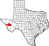
Jeff Davis County, Texas
Jeff Davis County is a county in the U.S. state of Texas. It is named for Jefferson Davis, the president of the Confederate States of America. It is one of the nine counties that comprise the Trans-Pecos region of West Texas. In 2000, its population was 2,207, and 2,258 by 2009...
, Texas
Texas
Texas is the second largest U.S. state by both area and population, and the largest state by area in the contiguous United States.The name, based on the Caddo word "Tejas" meaning "friends" or "allies", was applied by the Spanish to the Caddo themselves and to the region of their settlement in...
maintained by the Texas Department of Transportation
Texas Department of Transportation
The Texas Department of Transportation is a governmental agency in the U.S. state of Texas. Its stated mission is to "work cooperatively to provide safe, effective and efficient movement of people and goods" throughout the state...
. All state highways in Texas are paved.
Interstates
| Route Name | Direction | Termini | Junctions | Length | Remarks |
|---|---|---|---|---|---|
| W/E | Culberson County to Reeves County |
7 miles (11.3 km) |
U.S. highways
| Route Name | Direction | Termini | Junctions | Length | Remarks |
|---|---|---|---|---|---|
| W/E | Culberson County to Presidio County |
near Valentine Valentine, Texas Valentine is a town in Jeff Davis County, Texas, United States. The population was 187 at the 2000 census. It is the only incorporated municipality in Jeff Davis County.... |
26 miles (41.8 km) |
State highways
| Route Name | Direction | Termini | Junctions | Length | Remarks |
|---|---|---|---|---|---|
| S/N | Presidio County to Reeves County |
at Fort Davis Fort Davis, Texas Fort Davis is a census-designated place in Jeff Davis County, Texas, United States. The population was 1,050 at the 2000 census and 1,041 according to a 2007 estimate. It is the county seat of Jeff Davis County... at Fort Davis Fort Davis, Texas Fort Davis is a census-designated place in Jeff Davis County, Texas, United States. The population was 1,050 at the 2000 census and 1,041 according to a 2007 estimate. It is the county seat of Jeff Davis County... |
41.9 miles (67.4 km) | ||
| S/N | Brewster County to Culberson County |
at Fort Davis Fort Davis, Texas Fort Davis is a census-designated place in Jeff Davis County, Texas, United States. The population was 1,050 at the 2000 census and 1,041 according to a 2007 estimate. It is the county seat of Jeff Davis County... at Fort Davis Fort Davis, Texas Fort Davis is a census-designated place in Jeff Davis County, Texas, United States. The population was 1,050 at the 2000 census and 1,041 according to a 2007 estimate. It is the county seat of Jeff Davis County... |
66.2 miles (106.5 km) | ||
| W/E | to |
43.1 miles (69.4 km) |
State highway loops and spurs
| Route Name | Direction | Termini | Junctions | Length | Remarks |
|---|---|---|---|---|---|
| S/N | to Dead end |
0.5 mile (0.80467 km) | McDonald Observatory McDonald Observatory The McDonald Observatory is an astronomical observatory located near the unincorporated community of Fort Davis in Jeff Davis County, Texas, United States. The facility is located on Mount Fowlkes and Mount Locke in the Davis Mountains of West Texas... |
||
| S/N | Dead end to |
1.5 miles (2.4 km) | McDonald Observatory McDonald Observatory The McDonald Observatory is an astronomical observatory located near the unincorporated community of Fort Davis in Jeff Davis County, Texas, United States. The facility is located on Mount Fowlkes and Mount Locke in the Davis Mountains of West Texas... |
||
State park roads
| Route Name | Direction | Termini | Junctions | Length | Remarks |
|---|---|---|---|---|---|
| W/E | Dead end to |
4 miles (6.4 km) | Davis Mountains State Park Davis Mountains State Park Davis Mountains State Park is a state park located in the Davis Mountains in Jeff Davis County, Texas. The closest town is Fort Davis, Texas. The park elevation is between 5000 and 6000 feet above sea level. The original portion of the park was deeded to Texas Parks and Wildlife Department by a... |
Farm and ranch to market roads
| Route Name | Direction | Termini | Junctions | Length | Remarks |
|---|---|---|---|---|---|
| W/E | to |
8.8 miles (14.2 km) | |||
| W/E | Dead end to |
10.9 miles (17.5 km) | Buffalo Trails Boy Scout Boy Scouts of America The Boy Scouts of America is one of the largest youth organizations in the United States, with over 4.5 million youth members in its age-related divisions... Ranch |
||
| W/E | Dead end to |
3.4 miles (5.5 km) | Mitre Peak Girl Scout Girl Scouts of the USA The Girl Scouts of the United States of America is a youth organization for girls in the United States and American girls living abroad. It describes itself as "the world's preeminent organization dedicated solely to girls". It was founded by Juliette Gordon Low in 1912 and was organized after Low... Camp |
||
| W/E | Culberson County to |
5.3 miles (8.5 km) | |||
 FM 3078 FM 3078Farm to Market Road 3078 Farm to Market Road 3078, Farm Road 3078, or FM 3078 is a road maintained by the Texas Department of Transportation that connects Interstate 10 to State Highway 17 in Toyahvale. The route is in Jeff Davis County and Reeves County and connects Toyahvale to points farther west along I-10 including... |
W/E | Reeves County to Reeves County |
4.7 miles (7.6 km) |
Historic roads
| Route Name | Direction | Termini | Remarks |
|---|---|---|---|
| W/E | Culberson County to Reeves County |
Replaced by I-10 Interstate 10 in Texas Interstate 10 is the major east–west Interstate Highway in the Southern United States. In the U.S. state of Texas, it runs east from El Paso, near the border with New Mexico, through San Antonio and Houston to the border with Louisiana in Orange, Texas.... in 1991 |
|
| W/E | Reeves County to Reeves County |
Replaced by FM 3078 Farm to Market Road 3078 Farm to Market Road 3078, Farm Road 3078, or FM 3078 is a road maintained by the Texas Department of Transportation that connects Interstate 10 to State Highway 17 in Toyahvale. The route is in Jeff Davis County and Reeves County and connects Toyahvale to points farther west along I-10 including... in 1992 |
|
 |
W/E | Culberson County to Reeves County |
Replaced by US 80 in 1939 |
| SH 3 | W/E | Culberson County to Presidio County |
Replaced by US 90 U.S. Route 90 in Texas US 90 is a major east-west highway in the US state of Texas with large portions of it running concurrently with I-10. US 90 begins at I-10 in Van Horn, travels through the two largest cities in Texas, San Antonio and Houston, and continues on into the state of Louisiana.-Van Horn to San Antonio:US... in 1939 |
 |
W/E | Reeves County to Reeves County |
Replaced by US 290 U.S. Route 290 U.S. Highway 290 is an east–west U.S. Highway located entirely within the State of Texas. Its current western terminus is at Interstate 10 milepost 477 , southeast of Junction, and its eastern terminus is at Interstate 610 on the northwest side of Houston.-Route Description:West of Austin, U.S... in 1936 |
Adjacent countries and counties
- Reeves County (northeast)
- Pecos County (east)
- Brewster County (southeast)
- Presidio County (southwest)
- Mexico (west)
- Hudspeth County (west)
- Culberson County (northwest)