

List of highways in Hudspeth County, Texas
Encyclopedia
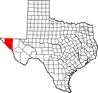
Hudspeth County, Texas
Hudspeth County is a county located in the U.S. state of Texas. It is one of the nine counties that comprise the Trans-Pecos region of West Texas. As of 2000, the population was 3,344. By 2010, the population had increased to 3,476. Its county seat is Sierra Blanca. The largest city is Fort Hancock...
, Texas
Texas
Texas is the second largest U.S. state by both area and population, and the largest state by area in the contiguous United States.The name, based on the Caddo word "Tejas" meaning "friends" or "allies", was applied by the Spanish to the Caddo themselves and to the region of their settlement in...
maintained by the Texas Department of Transportation
Texas Department of Transportation
The Texas Department of Transportation is a governmental agency in the U.S. state of Texas. Its stated mission is to "work cooperatively to provide safe, effective and efficient movement of people and goods" throughout the state...
. All state highways in Texas are paved.
Interstates
| Route Name | Direction | Termini | Junctions | Length | Remarks |
|---|---|---|---|---|---|
| W/E | El Paso County to Culberson County |
 Sierra Blanca, Texas Sierra Blanca is a census-designated place in and the county seat of Hudspeth County, Texas, United States. The population was 533 at the 2000 census, and had decreased to 510 according to a July 2007 estimate.... Sierra Blanca, Texas Sierra Blanca is a census-designated place in and the county seat of Hudspeth County, Texas, United States. The population was 533 at the 2000 census, and had decreased to 510 according to a July 2007 estimate.... |
73.5 miles (118.3 km) | Bypasses Fort Hancock Fort Hancock, Texas Fort Hancock is a census-designated place in Hudspeth County, Texas, United States. The population was 1,713 at the 2000 census. Fort Hancock and El Porvenir, Chihuahua area is connected by the Fort Hancock-El Porvenir International Bridge.-Geography:... , Sierra Blanca Sierra Blanca, Texas Sierra Blanca is a census-designated place in and the county seat of Hudspeth County, Texas, United States. The population was 533 at the 2000 census, and had decreased to 510 according to a July 2007 estimate.... , Allamoore Allamoore, Texas Allamoore is a small, unincorporated community in Hudspeth County, Texas, United States. It is located just north of Interstate 20 and U.S. Highway 80, approximately southeast of Sierra Blanca and west of Van Horn.... |
Interstate business routes
| Route Name | Direction | Termini | Junctions | Length | Remarks |
|---|---|---|---|---|---|
|
W/E | to |
at Sierra Blanca Sierra Blanca, Texas Sierra Blanca is a census-designated place in and the county seat of Hudspeth County, Texas, United States. The population was 533 at the 2000 census, and had decreased to 510 according to a July 2007 estimate.... |
2.7 miles (4.3 km) | Sierra Blanca Sierra Blanca, Texas Sierra Blanca is a census-designated place in and the county seat of Hudspeth County, Texas, United States. The population was 533 at the 2000 census, and had decreased to 510 according to a July 2007 estimate.... business loop |
U.S. highways
| Route Name | Direction | Termini | Junctions | Length | Remarks |
|---|---|---|---|---|---|
| W/E | El Paso County to Culberson County |
near Cornudas Cornudas, Texas Cornudas is an unincorporated community in Hudspeth County, Texas, United States. Cornudas is located near the intersection of Ranch to Market Road 2317 and the concurrent U.S. Highways 62 and 180, northwest of Sierra Blanca.-History:... near Salt Flat Salt Flat, Texas Salt Flat is an unincorporated community in northeastern Hudspeth County, Texas, United States. It lies along the concurrent U.S. Routes 62 and 180 north of the CDP of Sierra Blanca, the county seat of Hudspeth County. Its elevation is 3,730 feet . Although Salt Flat is unincorporated, it... |
65.5 miles (105.4 km) | Overlays US 180 | |
| W/E | El Paso County to Culberson County |
near Cornudas Cornudas, Texas Cornudas is an unincorporated community in Hudspeth County, Texas, United States. Cornudas is located near the intersection of Ranch to Market Road 2317 and the concurrent U.S. Highways 62 and 180, northwest of Sierra Blanca.-History:... near Salt Flat Salt Flat, Texas Salt Flat is an unincorporated community in northeastern Hudspeth County, Texas, United States. It lies along the concurrent U.S. Routes 62 and 180 north of the CDP of Sierra Blanca, the county seat of Hudspeth County. Its elevation is 3,730 feet . Although Salt Flat is unincorporated, it... |
65.5 miles (105.4 km) | Overlays US 62 | |
State highways
| Route Name | Direction | Termini | Junctions | Length | Remarks |
|---|---|---|---|---|---|
| W/E | El Paso County to |
at Fort Hancock Fort Hancock, Texas Fort Hancock is a census-designated place in Hudspeth County, Texas, United States. The population was 1,713 at the 2000 census. Fort Hancock and El Porvenir, Chihuahua area is connected by the Fort Hancock-El Porvenir International Bridge.-Geography:... – El Porvenir, Chihuahua, Mexico Mexico The United Mexican States , commonly known as Mexico , is a federal constitutional republic in North America. It is bordered on the north by the United States; on the south and west by the Pacific Ocean; on the southeast by Guatemala, Belize, and the Caribbean Sea; and on the east by the Gulf of... at McNary McNary, Texas McNary, Texas is a small town at the intersection of Interstate 10 and State Highway 20. It is two miles from the Rio Grande and twenty-three miles west of Sierra Blanca in southwestern Hudspeth County. The area was initially settled in 1921, and named Nulo. The town was renamed McNary, after... |
16.3 miles (26.2 km) | Passes through Acala Acala, Texas Acala, Texas is a ghost town in Hudspeth County, Texas, thirty-four miles northwest of Sierra Blanca and fifty-four miles southeast of El Paso, with a current population of about 25. Acala is located on Highway 20. A Spanish name for a type of cotton is where Acala got its name.-History:The area... |
|
State highway spurs
| Route Name | Direction | Termini | Junctions | Length | Remarks |
|---|---|---|---|---|---|
| W/E | to |
1.4 miles (2.3 km) | Fort Hancock Fort Hancock, Texas Fort Hancock is a census-designated place in Hudspeth County, Texas, United States. The population was 1,713 at the 2000 census. Fort Hancock and El Porvenir, Chihuahua area is connected by the Fort Hancock-El Porvenir International Bridge.-Geography:... spur |
||
Farm and ranch to market roads
| Route Name | Direction | Termini | Junctions | Length | Remarks |
|---|---|---|---|---|---|
| S/N | 2.6 miles (4.2 km) | ||||
| S/N | Ranch Road along Rio Grande Rio Grande The Rio Grande is a river that flows from southwestern Colorado in the United States to the Gulf of Mexico. Along the way it forms part of the Mexico – United States border. Its length varies as its course changes... at McNary McNary, Texas McNary, Texas is a small town at the intersection of Interstate 10 and State Highway 20. It is two miles from the Rio Grande and twenty-three miles west of Sierra Blanca in southwestern Hudspeth County. The area was initially settled in 1921, and named Nulo. The town was renamed McNary, after... |
25.4 miles (40.9 km) | Passes through Esperanza Esperanza, Hudspeth County, Texas Esperanza is an unincorporated community in Hudspeth County, Texas, United States. Esperanza is located on Farm to Market Road 192 west of Sierra Blanca.-History:... , Fort Quitman |
||
| S/N |  Mexico The United Mexican States , commonly known as Mexico , is a federal constitutional republic in North America. It is bordered on the north by the United States; on the south and west by the Pacific Ocean; on the southeast by Guatemala, Belize, and the Caribbean Sea; and on the east by the Gulf of... |
0.9 miles (1.4 km) | |||
| S/N | Indian Hot Springs Road and Cowan Road to near Cornudas Cornudas, Texas Cornudas is an unincorporated community in Hudspeth County, Texas, United States. Cornudas is located near the intersection of Ranch to Market Road 2317 and the concurrent U.S. Highways 62 and 180, northwest of Sierra Blanca.-History:... |
Fort Hancock, Texas Fort Hancock is a census-designated place in Hudspeth County, Texas, United States. The population was 1,713 at the 2000 census. Fort Hancock and El Porvenir, Chihuahua area is connected by the Fort Hancock-El Porvenir International Bridge.-Geography:... , Allamoore Allamoore, Texas Allamoore is a small, unincorporated community in Hudspeth County, Texas, United States. It is located just north of Interstate 20 and U.S. Highway 80, approximately southeast of Sierra Blanca and west of Van Horn.... , Van Horn Van Horn, Texas Van Horn is a town in and the county seat of Culberson County, Texas, United States. The population was 2,435 at the 2000 census.-Geography:Van Horn is located at .... at Sierra Blanca Sierra Blanca, Texas Sierra Blanca is a census-designated place in and the county seat of Hudspeth County, Texas, United States. The population was 533 at the 2000 census, and had decreased to 510 according to a July 2007 estimate.... |
47 miles (75.6 km) | ||
| S/N | to CR 2025 |
at Dell City Dell City, Texas Dell City is a city in Hudspeth County, Texas, United States. The population was 413 at the 2000 census.It was incorporated in 1948 shortly after the discovery of an underground water supply by oil prospectors, which attracted farmers to the area... |
16.4 miles (26.4 km) | ||
| S/N | to Otero County Otero County, New Mexico -2010:Whereas according to the 2010 U.S. Census Bureau:*72.7% White*3.5% Black*6.7% Native American*1.2% Asian*0.2% Native Hawaiian or Pacific Islander*4.2% Two or more races*11.2% Other races*34.5% Hispanic or Latino -2000:... , New Mexico New Mexico New Mexico is a state located in the southwest and western regions of the United States. New Mexico is also usually considered one of the Mountain States. With a population density of 16 per square mile, New Mexico is the sixth-most sparsely inhabited U.S... local road |
23.9 miles (38.5 km) | |||
| S/N | 1.3 miles (2.1 km) | ||||
| W/E | CR 2009 and CR 2030 to |
at Dell City Dell City, Texas Dell City is a city in Hudspeth County, Texas, United States. The population was 413 at the 2000 census.It was incorporated in 1948 shortly after the discovery of an underground water supply by oil prospectors, which attracted farmers to the area... |
5.1 miles (8.2 km) | ||
| W/E | near Cornudas Cornudas, Texas Cornudas is an unincorporated community in Hudspeth County, Texas, United States. Cornudas is located near the intersection of Ranch to Market Road 2317 and the concurrent U.S. Highways 62 and 180, northwest of Sierra Blanca.-History:... |
12.3 miles (19.8 km) |
Historic roads
| Route Name | Direction | Termini | Remarks |
|---|---|---|---|
 |
W/E | El Paso County Culberson County |
Replaced by I-10 Interstate 10 Interstate 10 is the fourth-longest Interstate Highway in the United States, after I-90, I-80, and I-40. It is the southernmost east–west, coast-to-coast Interstate Highway, although I-4 and I-8 are further south. It stretches from the Pacific Ocean at State Route 1 in Santa Monica,... , SH 20, and Bus. I-10-C in 1991 |
 |
W/E | El Paso County Culberson County |
Replaced by US 80 U.S. Route 80 U.S. Route 80 is an east–west United States highway, much of which was once part of the early auto trail known as the Dixie Overland Highway. As the "0" in the route number indicates, it was originally a cross-country route, from the Atlantic to the Pacific... in 1939 |
| SH 130 | W/E | El Paso County Culberson County |
Replaced by US 62 U.S. Route 62 U.S. Route 62 runs from the US-Mexico border at El Paso, Texas to Niagara Falls, New York, near the United States-Canada border. It is the only east-west US Route that connects Mexico and Canada.Parts of U.S... in 1939 |
Adjacent counties
- New Mexico (north)
- Culberson County (east)
- Jeff Davis County (southeast)
- Mexico (south)
- El Paso County (west)