

List of highways in Brewster County, Texas
Encyclopedia
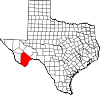
Brewster County, Texas
Brewster County is a county located in western part of the US state of Texas, along the border with Mexico. It is one of the nine counties that comprise the Trans-Pecos region of West Texas. As of the 2000 census, the population is 8,866. In 2009, the population was estimated to be 9,481. Its...
, Texas
Texas
Texas is the second largest U.S. state by both area and population, and the largest state by area in the contiguous United States.The name, based on the Caddo word "Tejas" meaning "friends" or "allies", was applied by the Spanish to the Caddo themselves and to the region of their settlement in...
maintained by the Texas Department of Transportation
Texas Department of Transportation
The Texas Department of Transportation is a governmental agency in the U.S. state of Texas. Its stated mission is to "work cooperatively to provide safe, effective and efficient movement of people and goods" throughout the state...
. All state highways in Texas are paved.
U.S. highways
| Route Name | Direction | Termini | Junctions | Length | Remarks |
|---|---|---|---|---|---|
| S/N | Presidio County to Presidio County |
1.3 miles (2.1 km) | Overlays US 90 and briefly leaves county | ||
| S/N | Presidio County to Pecos County |
– Study Butte Study Butte-Terlingua, Texas Study Butte-Terlingua is a census-designated place in Brewster County, Texas, United States. The population was 267 at the 2000 census.-Geography:Study Butte-Terlingua is located at .... |
37.2 miles (59.9 km) | Passes through Alpine Alpine, Texas Alpine is a city in and the county seat of Brewster County, Texas, United States. The population was 5,786 people at the 2000 census, and had increased to 5,905 by 2010.-History:... |
|
| W/E | Presidio County to Presidio County |
1.3 miles (2.1 km) | Overlays US 67 and briefly leaves county | ||
| W/E | Presidio County to Pecos County |
– Study Butte Study Butte-Terlingua, Texas Study Butte-Terlingua is a census-designated place in Brewster County, Texas, United States. The population was 267 at the 2000 census.-Geography:Study Butte-Terlingua is located at .... |
70.8 miles (113.9 km) | Passes through Alpine Alpine, Texas Alpine is a city in and the county seat of Brewster County, Texas, United States. The population was 5,786 people at the 2000 census, and had increased to 5,905 by 2010.-History:... , Marathon Marathon, Texas Marathon is a census-designated place in Brewster County, Texas, United States. The population was 470 in 2007, after growing from 455 in 2000, but had decreased to 430 by 2010.-Geography:Marathon is located at .... |
|
| S/N |  Big Bend National Park Big Bend National ParkBig Bend National Park Big Bend National Park is a national park located in the U.S. state of Texas. Big Bend has national significance as the largest protected area of Chihuahuan Desert topography and ecology in the United States, which includes more than 1,200 species of plants, more than 450 species of birds, 56... Persimmon Gap Entrance to Pecos County |
59.1 miles (95.1 km) | Passes through Marathon Marathon, Texas Marathon is a census-designated place in Brewster County, Texas, United States. The population was 470 in 2007, after growing from 455 in 2000, but had decreased to 430 by 2010.-Geography:Marathon is located at .... |
State highways
| Route Name | Direction | Termini | Junctions | Length | Remarks |
|---|---|---|---|---|---|
| S/N | Big Bend National Park Big Bend National Park Big Bend National Park is a national park located in the U.S. state of Texas. Big Bend has national significance as the largest protected area of Chihuahuan Desert topography and ecology in the United States, which includes more than 1,200 species of plants, more than 450 species of birds, 56... Maverick Entrance to Jeff Davis County |
89.7 miles (144.4 km) | Passes through Study Butte Study Butte-Terlingua, Texas Study Butte-Terlingua is a census-designated place in Brewster County, Texas, United States. The population was 267 at the 2000 census.-Geography:Study Butte-Terlingua is located at .... , Alpine Alpine, Texas Alpine is a city in and the county seat of Brewster County, Texas, United States. The population was 5,786 people at the 2000 census, and had increased to 5,905 by 2010.-History:... |
||
| S/N | to |
1.6 miles (2.6 km) | Partial loop around northeast quadrant of Alpine Alpine, Texas Alpine is a city in and the county seat of Brewster County, Texas, United States. The population was 5,786 people at the 2000 census, and had increased to 5,905 by 2010.-History:... |
Farm and ranch to market roads
| Route Name | Direction | Termini | Junctions | Length | Remarks |
|---|---|---|---|---|---|
| W/E | Presidio County to |
18 miles (29 km) | Passes through Lajitas Lajitas, Texas Lajitas is an unincorporated community in Brewster County, Texas, United States, in proximity to the Big Bend National Park.-Government:For many years the mayor of Lajitas was Clay Henry III, a "beer-drinking" goat... , Terlingua Terlingua, Texas Terlingua is a mining district in southwestern Brewster County, Texas, United States. It is located near the Rio Grande and the Texas villages of Lajitas and Study Butte, Texas,as well as the Mexican village of Santa Elena. The discovery of cinnabar, from which the metal mercury is extracted, in... to Study Butte Study Butte-Terlingua, Texas Study Butte-Terlingua is a census-designated place in Brewster County, Texas, United States. The population was 267 at the 2000 census.-Geography:Study Butte-Terlingua is located at .... |
||
| S/N | to Wagon Road |
3.9 miles (6.3 km) | Serves rural subdivision near Alpine Alpine, Texas Alpine is a city in and the county seat of Brewster County, Texas, United States. The population was 5,786 people at the 2000 census, and had increased to 5,905 by 2010.-History:... |
||
| S/N | La Linda International Bridge La Linda International Bridge La Linda International Bridge is an international bridge that crosses the Rio Grande on the United States–Mexico border in the Big Bend region of Texas. It is the southern terminus of Ranch to Market Road 2627 in Heath Canyon and connects Brewster County with the village of La Linda in Acuña... to |
28 miles (45.1 km) |
Historic roads
| Route Name | Direction | Termini | Remarks |
|---|---|---|---|
| SH 3 | W/E | Presidio County to Pecos County |
Replaced by US 90 U.S. Route 90 in Texas US 90 is a major east-west highway in the US state of Texas with large portions of it running concurrently with I-10. US 90 begins at I-10 in Van Horn, travels through the two largest cities in Texas, San Antonio and Houston, and continues on into the state of Louisiana.-Van Horn to San Antonio:US... in 1939 |
| S/N | Pecos County to Big Bend National Park Big Bend National Park Big Bend National Park is a national park located in the U.S. state of Texas. Big Bend has national significance as the largest protected area of Chihuahuan Desert topography and ecology in the United States, which includes more than 1,200 species of plants, more than 450 species of birds, 56... |
Replaced by US 385 in 1959 | |
| S/N | to Santa Elena Canyon |
Portion in Big Bend National Park Big Bend National Park Big Bend National Park is a national park located in the U.S. state of Texas. Big Bend has national significance as the largest protected area of Chihuahuan Desert topography and ecology in the United States, which includes more than 1,200 species of plants, more than 450 species of birds, 56... dropped from description in 1946 Replaced by SH 51 in 1956 |
|
| W/E | to Terlingua Terlingua, Texas Terlingua is a mining district in southwestern Brewster County, Texas, United States. It is located near the Rio Grande and the Texas villages of Lajitas and Study Butte, Texas,as well as the Mexican village of Santa Elena. The discovery of cinnabar, from which the metal mercury is extracted, in... |
Former Terlingua Terlingua, Texas Terlingua is a mining district in southwestern Brewster County, Texas, United States. It is located near the Rio Grande and the Texas villages of Lajitas and Study Butte, Texas,as well as the Mexican village of Santa Elena. The discovery of cinnabar, from which the metal mercury is extracted, in... spur of SH 227 in Big Bend National Park Big Bend National Park Big Bend National Park is a national park located in the U.S. state of Texas. Big Bend has national significance as the largest protected area of Chihuahuan Desert topography and ecology in the United States, which includes more than 1,200 species of plants, more than 450 species of birds, 56... before 1946 |
|
| S/N | Pecos County to |
Replaced by SH 51 in 1956 |
Adjacent countries and counties
- Pecos County (northeast)
- Terrell County (east)
- Mexico (south)
- Presidio County (west)
- Jeff Davis County (northwest)