

List of highways in Pecos County, Texas
Encyclopedia
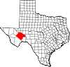
Pecos County, Texas
Pecos County is a county located in Texas which is named for the Pecos River. It is one of the nine counties that comprise the Trans-Pecos region of West Texas. In 2000, its population was 16,809. The county seat is Fort Stockton....
, Texas
Texas
Texas is the second largest U.S. state by both area and population, and the largest state by area in the contiguous United States.The name, based on the Caddo word "Tejas" meaning "friends" or "allies", was applied by the Spanish to the Caddo themselves and to the region of their settlement in...
maintained by the Texas Department of Transportation
Texas Department of Transportation
The Texas Department of Transportation is a governmental agency in the U.S. state of Texas. Its stated mission is to "work cooperatively to provide safe, effective and efficient movement of people and goods" throughout the state...
. All state highways in Texas are paved.
Interstates
| Route Name | Direction | Termini | Junctions | Length | Remarks |
|---|---|---|---|---|---|
| W/E | Reeves County to Crockett County |  Fort Stockton, Texas Fort Stockton is a city in Pecos County, Texas, United States. The population was 7,846 at the 2000 census. It is the county seat of Pecos County.-Geography:Fort Stockton is located at ....  Marathon, Texas Marathon is a census-designated place in Brewster County, Texas, United States. The population was 470 in 2007, after growing from 455 in 2000, but had decreased to 430 by 2010.-Geography:Marathon is located at .... , Fort Stockton Fort Stockton, Texas Fort Stockton is a city in Pecos County, Texas, United States. The population was 7,846 at the 2000 census. It is the county seat of Pecos County.-Geography:Fort Stockton is located at .... |
100.5 miles (161.7 km) | Bypasses Fort Stockton Fort Stockton, Texas Fort Stockton is a city in Pecos County, Texas, United States. The population was 7,846 at the 2000 census. It is the county seat of Pecos County.-Geography:Fort Stockton is located at .... , Bakersfield Bakersfield, Texas Bakersfield is an unincorporated community in Pecos County, Texas, United States. According to the Handbook of Texas, the dispersed community had an estimated population of 30 in 2000.-Georgraphy:Bakersfield is located at... |
Interstate business routes
| Route Name | Direction | Termini | Junctions | Length | Remarks |
|---|---|---|---|---|---|
|
W/E | to | 1.4 miles (2.3 km) | Fort Stockton Fort Stockton, Texas Fort Stockton is a city in Pecos County, Texas, United States. The population was 7,846 at the 2000 census. It is the county seat of Pecos County.-Geography:Fort Stockton is located at .... business loop |
U.S. highways
| Route Name | Direction | Termini | Junctions | Length | Remarks |
|---|---|---|---|---|---|
| S/N | Brewster County to Crockett County | Fort Stockton, Texas Fort Stockton is a city in Pecos County, Texas, United States. The population was 7,846 at the 2000 census. It is the county seat of Pecos County.-Geography:Fort Stockton is located at .... Marathon, Texas Marathon is a census-designated place in Brewster County, Texas, United States. The population was 470 in 2007, after growing from 455 in 2000, but had decreased to 430 by 2010.-Geography:Marathon is located at .... , Fort Stockton Fort Stockton, Texas Fort Stockton is a city in Pecos County, Texas, United States. The population was 7,846 at the 2000 census. It is the county seat of Pecos County.-Geography:Fort Stockton is located at .... |
74.6 miles (120.1 km) | Passes through Fort Stockton Fort Stockton, Texas Fort Stockton is a city in Pecos County, Texas, United States. The population was 7,846 at the 2000 census. It is the county seat of Pecos County.-Geography:Fort Stockton is located at .... , Girvin Girvin, Texas Girvin is an unincorporated community in Pecos County, Texas, United States. According to the Handbook of Texas, the community had an estimated population of 30 in 2000.... |
|
| W/E | Brewster County to Terrell County | 10.7 miles (17.2 km) | Passes through Longfellow | ||
| W/E | to Crockett County | 15.2 miles (24.5 km) | Passes through Iraan Iraan, Texas Iraan is a city in Pecos County, Texas, United States. The population was 1,238 at the 2000 census. The correct pronunciation is "Eye-ruh-ann"; it was named for Ira and Ann Yates, owners of the ranchland upon which the town was built.-Geography:... |
||
| S/N | Terrell County to Reeves County | Ozona, Texas Ozona is a census-designated place in and the county seat of Crockett County, Texas, United States. The population was 3,436 at the 2000 census... , McCamey McCamey, Texas McCamey is a city in Upton County, Texas, United States. The population was 1,805 at the 2000 census. The Texas legislature has declared McCamey "the Wind Energy Capital of Texas" because of the many wind farms that have been built in the area. Its history, however, is primarily that of an oil... Balmorhea, Texas Balmorhea is a city in Reeves County, Texas, United States. The population was 527 at the 2000 census.-Geography:Balmorhea is located at .According to the United States Census Bureau, the city has a total area of , all land... |
80.8 miles (130 km) | Passes through Fort Stockton Fort Stockton, Texas Fort Stockton is a city in Pecos County, Texas, United States. The population was 7,846 at the 2000 census. It is the county seat of Pecos County.-Geography:Fort Stockton is located at .... |
|
| S/N | Brewster County to Crockett County |  Balmorhea, Texas Balmorhea is a city in Reeves County, Texas, United States. The population was 527 at the 2000 census.-Geography:Balmorhea is located at .According to the United States Census Bureau, the city has a total area of , all land... , Pecos Pecos, Texas Pecos is the largest city in and the county seat of Reeves County, Texas, United States. It is situated in the river valley on the west bank of the Pecos River at the eastern edge of the Chihuahuan Desert and the Trans-Pecos region of west Texas and near the southern border of New Mexico...   Interstate 10 in Texas Interstate 10 is the major east–west Interstate Highway in the Southern United States. In the U.S. state of Texas, it runs east from El Paso, near the border with New Mexico, through San Antonio and Houston to the border with Louisiana in Orange, Texas.... east / Bus. I-10-G east terminus / US 67 south – Balmorhea Balmorhea, Texas Balmorhea is a city in Reeves County, Texas, United States. The population was 527 at the 2000 census.-Geography:Balmorhea is located at .According to the United States Census Bureau, the city has a total area of , all land... , Alpine Alpine, Texas Alpine is a city in and the county seat of Brewster County, Texas, United States. The population was 5,786 people at the 2000 census, and had increased to 5,905 by 2010.-History:... , McCamey McCamey, Texas McCamey is a city in Upton County, Texas, United States. The population was 1,805 at the 2000 census. The Texas legislature has declared McCamey "the Wind Energy Capital of Texas" because of the many wind farms that have been built in the area. Its history, however, is primarily that of an oil... |
75.8 miles (122 km) | Passes through Fort Stockton Fort Stockton, Texas Fort Stockton is a city in Pecos County, Texas, United States. The population was 7,846 at the 2000 census. It is the county seat of Pecos County.-Geography:Fort Stockton is located at .... , Girvin Girvin, Texas Girvin is an unincorporated community in Pecos County, Texas, United States. According to the Handbook of Texas, the community had an estimated population of 30 in 2000.... |
State highways
| Route Name | Direction | Termini | Junctions | Length | Remarks |
|---|---|---|---|---|---|
| S/N | Balmorhea, Texas Balmorhea is a city in Reeves County, Texas, United States. The population was 527 at the 2000 census.-Geography:Balmorhea is located at .According to the United States Census Bureau, the city has a total area of , all land... , Bakersfield Bakersfield, Texas Bakersfield is an unincorporated community in Pecos County, Texas, United States. According to the Handbook of Texas, the dispersed community had an estimated population of 30 in 2000.-Georgraphy:Bakersfield is located at... , Sanderson Sanderson, Texas Sanderson is a census-designated place in and the county seat of Terrell County, Texas, United States. The population was 861 at the 2000 census. Sanderson was created in 1882 as a part of neighboring Pecos County... , Pecos Pecos, Texas Pecos is the largest city in and the county seat of Reeves County, Texas, United States. It is situated in the river valley on the west bank of the Pecos River at the eastern edge of the Chihuahuan Desert and the Trans-Pecos region of west Texas and near the southern border of New Mexico... to Ward County |
28.7 miles (46.2 km) | Ends at Fort Stockton | ||
| W/E | to Crockett County | 8.7 miles (14 km) | Passes through Sheffield Sheffield, Texas Sheffield is an unincorporated community in Pecos County, Texas, United States. According to the Handbook of Texas, the community had an estimated population of 600 in 2000.-Geography:... |
||
| S/N | Terrell County to Crockett County | 31.8 miles (51.2 km) | Passes through Sheffield Sheffield, Texas Sheffield is an unincorporated community in Pecos County, Texas, United States. According to the Handbook of Texas, the community had an estimated population of 600 in 2000.-Geography:... , Iraan Iraan, Texas Iraan is a city in Pecos County, Texas, United States. The population was 1,238 at the 2000 census. The correct pronunciation is "Eye-ruh-ann"; it was named for Ira and Ann Yates, owners of the ranchland upon which the town was built.-Geography:... |
State highway loops and spurs
| Route Name | Direction | Termini | Junctions | Length | Remarks |
|---|---|---|---|---|---|
| S/N | Old Alpine Road to | 1.4 miles (2.3 km) | |||
| S/N | I-10 Interstate 10 in Texas Interstate 10 is the major east–west Interstate Highway in the Southern United States. In the U.S. state of Texas, it runs east from El Paso, near the border with New Mexico, through San Antonio and Houston to the border with Louisiana in Orange, Texas.... frontage road to I-10 Interstate 10 in Texas Interstate 10 is the major east–west Interstate Highway in the Southern United States. In the U.S. state of Texas, it runs east from El Paso, near the border with New Mexico, through San Antonio and Houston to the border with Louisiana in Orange, Texas.... frontage road |
3.2 miles (5.1 km) | Passes through Bakersfield Bakersfield, Texas Bakersfield is an unincorporated community in Pecos County, Texas, United States. According to the Handbook of Texas, the dispersed community had an estimated population of 30 in 2000.-Georgraphy:Bakersfield is located at... |
Farm and ranch to market roads
| Route Name | Direction | Termini | Junctions | Length | Remarks |
|---|---|---|---|---|---|
| W/E | Ward County to | 44.2 miles (71.1 km) | Passes through Bakersfield Bakersfield, Texas Bakersfield is an unincorporated community in Pecos County, Texas, United States. According to the Handbook of Texas, the dispersed community had an estimated population of 30 in 2000.-Georgraphy:Bakersfield is located at... and Imperial Imperial, Texas Imperial is a census-designated place in Pecos County, Texas, United States. The population was 428 at the 2000 census.-Geography:Imperial is located at... |
||
| S/N | to Crockett County | 8.6 miles (13.8 km) | |||
| S/N | Balmorhea, Texas Balmorhea is a city in Reeves County, Texas, United States. The population was 527 at the 2000 census.-Geography:Balmorhea is located at .According to the United States Census Bureau, the city has a total area of , all land... , Bakersfield Bakersfield, Texas Bakersfield is an unincorporated community in Pecos County, Texas, United States. According to the Handbook of Texas, the dispersed community had an estimated population of 30 in 2000.-Georgraphy:Bakersfield is located at... , Sanderson Sanderson, Texas Sanderson is a census-designated place in and the county seat of Terrell County, Texas, United States. The population was 861 at the 2000 census. Sanderson was created in 1882 as a part of neighboring Pecos County... , Pecos Pecos, Texas Pecos is the largest city in and the county seat of Reeves County, Texas, United States. It is situated in the river valley on the west bank of the Pecos River at the eastern edge of the Chihuahuan Desert and the Trans-Pecos region of west Texas and near the southern border of New Mexico... , Marathon Marathon, Texas Marathon is a census-designated place in Brewster County, Texas, United States. The population was 470 in 2007, after growing from 455 in 2000, but had decreased to 430 by 2010.-Geography:Marathon is located at .... , McCamey McCamey, Texas McCamey is a city in Upton County, Texas, United States. The population was 1,805 at the 2000 census. The Texas legislature has declared McCamey "the Wind Energy Capital of Texas" because of the many wind farms that have been built in the area. Its history, however, is primarily that of an oil... to Ward County |
33.3 miles (53.6 km) | Begins in Fort Stockton Fort Stockton, Texas Fort Stockton is a city in Pecos County, Texas, United States. The population was 7,846 at the 2000 census. It is the county seat of Pecos County.-Geography:Fort Stockton is located at .... , passes through Imperial Imperial, Texas Imperial is a census-designated place in Pecos County, Texas, United States. The population was 428 at the 2000 census.-Geography:Imperial is located at... |
||
| W/E | Reeves County to | 20.7 miles (33.3 km) | |||
| S/N | to Ward County | 34 miles (54.7 km) | Passes through Coyanosa Coyanosa, Texas Coyanosa is a census-designated place in Pecos County, Texas, United States. The population was 138 at the 2000 census.-Geography:Coyanosa is located at... |
||
| S/N | to Crockett County | 9.3 miles (15 km) | |||
| S/N | Puckett Creek Road to | 11.9 miles (19.2 km) | |||
| S/N | Dead end to | 9.8 miles (15.8 km) | Passes through Belding | ||
| W/E | to Terrell County | 6 miles (9.7 km) | |||
| S/N | to | 5.4 miles (8.7 km) | |||
| S/N | Terrell County to | 23.5 miles (37.8 km) |
Historic Roads
| Route Name | Direction | Termini | Remarks |
|---|---|---|---|
| W/E | Reeves County to Crockett County | Replaced by I-10 Interstate 10 in Texas Interstate 10 is the major east–west Interstate Highway in the Southern United States. In the U.S. state of Texas, it runs east from El Paso, near the border with New Mexico, through San Antonio and Houston to the border with Louisiana in Orange, Texas.... , Bus. I-10-G, and SH 290 Texas State Highway 290 State Highway 290 or SH 290 is a state highway maintained by the Texas Department of Transportation that runs from Interstate 10 near Sheffield east to another connection with I-10 about east of Sheffield. The route was designated in 1992 as a replacement for U.S. Route 290 when it was... in 1992 |
|
| SH 3 | W/E | Brewster County to Terrell County | Replaced by US 90 U.S. Route 90 in Texas US 90 is a major east-west highway in the US state of Texas with large portions of it running concurrently with I-10. US 90 begins at I-10 in Van Horn, travels through the two largest cities in Texas, San Antonio and Houston, and continues on into the state of Louisiana.-Van Horn to San Antonio:US... in 1939 |
 |
W/E | Reeves County to Crockett County | Replaced by US 290 U.S. Route 290 U.S. Highway 290 is an east–west U.S. Highway located entirely within the State of Texas. Its current western terminus is at Interstate 10 milepost 477 , southeast of Junction, and its eastern terminus is at Interstate 610 on the northwest side of Houston.-Route Description:West of Austin, U.S... in 1939 |
| SH 51 | W/E | Brewster County to Crockett County | Replaced by SH 349 Texas State Highway 349 State Highway 349 or SH 349 is a 194.43 mile state highway in the western part of Texas.-History:The original formation of the highway in 1943 included only the section from Rankin to Midland, replacing a former route of . In 1947 and FM 306 were redesignated to form the part of SH 349 from... in 1957Redesignation replaced by US 385 in 1959 |
| SH 82 | S/N | Terrell County to Ward County | Replaced by US 285 U.S. Route 285 U.S. Route 285 is a north–south United States highway, running 845 miles through the states of Texas, New Mexico and Colorado. The highway's northern terminus is in Denver, Colorado, at exit 201 on Interstate 25. Its southern terminus is in Sanderson, Texas at an intersection with U.S.... south of Fort Stockton Fort Stockton, Texas Fort Stockton is a city in Pecos County, Texas, United States. The population was 7,846 at the 2000 census. It is the county seat of Pecos County.-Geography:Fort Stockton is located at .... in 1939Replaced by TX 18 north of Fort Stockton Fort Stockton, Texas Fort Stockton is a city in Pecos County, Texas, United States. The population was 7,846 at the 2000 census. It is the county seat of Pecos County.-Geography:Fort Stockton is located at .... in 1958 |
| SH 99 | S/N | Brewster County to Crockett County | Replaced by US 67 U.S. Route 67 in Texas U.S. Route 67 is a major U.S. highway in the state of Texas. It runs from the US-Mexico Border south of Presidio to Texarkana at the Texas-Arkansas border. US 67 is part of the La Entrada al Pacifico international trade corridor from its southern terminus to US 385 in McCamey.-US-Mexico Border to... in 1939 |
| SH 192 | S/N | |
Replaced by US 285 U.S. Route 285 U.S. Route 285 is a north–south United States highway, running 845 miles through the states of Texas, New Mexico and Colorado. The highway's northern terminus is in Denver, Colorado, at exit 201 on Interstate 25. Its southern terminus is in Sanderson, Texas at an intersection with U.S.... in 1939 |
| S/N | to |
Replaced by in 1951 | |
| S/N | Brewster County to | Replaced by SH 51 in 1956 | |
| S/N | Terrell County to | Replaced by SH 349 Texas State Highway 349 State Highway 349 or SH 349 is a 194.43 mile state highway in the western part of Texas.-History:The original formation of the highway in 1943 included only the section from Rankin to Midland, replacing a former route of . In 1947 and FM 306 were redesignated to form the part of SH 349 from... in 1990 |
Adjacent counties
- Ward County (north)
- Crane County (northeast)
- Crockett County (east)
- Terrell County (southeast)
- Brewster County (southwest)
- Jeff Davis County (west)
- Reeves County (northwest)