

List of crossings of the Snake River
Encyclopedia
Bridge
A bridge is a structure built to span physical obstacles such as a body of water, valley, or road, for the purpose of providing passage over the obstacle...
s and other crossings of the Snake River
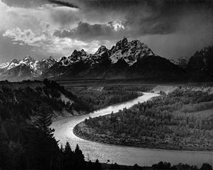
Snake River
The Snake is a major river of the greater Pacific Northwest in the United States. At long, it is the largest tributary of the Columbia River, the largest North American river that empties into the Pacific Ocean...
, from the Columbia River
Columbia River
The Columbia River is the largest river in the Pacific Northwest region of North America. The river rises in the Rocky Mountains of British Columbia, Canada, flows northwest and then south into the U.S. state of Washington, then turns west to form most of the border between Washington and the state...
upstream to the its source in Yellowstone National Park
Yellowstone National Park
Yellowstone National Park, established by the U.S. Congress and signed into law by President Ulysses S. Grant on March 1, 1872, is a national park located primarily in the U.S. state of Wyoming, although it also extends into Montana and Idaho...
.
Washington
|-|Railroad bridge
|Burlington Northern Railroad
Burlington Northern Railroad
The Burlington Northern Railroad was a United States-based railroad company formed from a merger of four major U.S. railroads. Burlington Northern operated between 1970 and 1996....
|Pasco
Pasco, Washington
Pasco is a city in and the county seat of Franklin County, Washington, United States.Pasco is one of three cities that make up the Tri-Cities region of the state of Washington...
|46°12′24.76"N 119°1′49.54"W
|-
|Vaughn Hubbard Bridge
|
 U.S. Route 12
U.S. Route 12 in Washington
U.S. Route 12 is a major east-west U.S. Highway, running from Aberdeen, Washington, to Detroit, Michigan. It spans across the state of Washington, and is the only numbered highway to span the entire state from west to east, starting near the Pacific Ocean, and crossing the Idaho state line near...
|Pasco
Pasco, Washington
Pasco is a city in and the county seat of Franklin County, Washington, United States.Pasco is one of three cities that make up the Tri-Cities region of the state of Washington...
|46°12′56.68"N 119°1′21.19"W
|-
|Ice Harbor Lock and Dam
Ice Harbor Lock and Dam
Ice Harbor Lock and Dam is a hydroelectric, concrete gravity run-of-the-river dam on the Snake River in Walla Walla and Franklin counties in the U.S. state of Washington. The dam is located 8 miles northeast of the town of Burbank and 12 miles east of Pasco, river mile 9.2...
|Ice Harbor Rd./Monument Dr.
|Franklin/Walla Walla counties
|46°14′54.61"N 118°52′47.96"W
|-
|Railroad bridge
|Union Pacific Railroad
Union Pacific Railroad
The Union Pacific Railroad , headquartered in Omaha, Nebraska, is the largest railroad network in the United States. James R. Young is president, CEO and Chairman....
|Lyons Ferry, Franklin/Walla Walla counties
|46°35′36.79"N 118°13′42.64"W
|-
|Lyons Ferry Bridge
|
 State Route 261
Washington State Route 261
State Route 261 is a state route in the U.S. state of Washington.-Route description:Route 261 begins at U.S. Route 12 near Starbuck. After this, it passes through Starbuck. It travels northwest, passing by Lyons Ferry Park. It then intersects State Route 260 southeast of Washtucna...
|Lyons Ferry, Franklin/Columbia counties
|46°35′22.88"N 118°13′9.89"W
|-
|Railroad bridge
|Union Pacific Railroad
Union Pacific Railroad
The Union Pacific Railroad , headquartered in Omaha, Nebraska, is the largest railroad network in the United States. James R. Young is president, CEO and Chairman....
|Whitman
Whitman County, Washington
Whitman County is a county located in the U.S. state of Washington. As of the 2010 census, the population was 44,776, with the majority living in its largest city, Pullman, home to Washington State University, the state's land-grant university. The county seat is at Colfax.Whitman County was...
/Columbia counties
|46°33′53.97"N 118°10′56.83"W
|-
|Little Goose Lock and Dam
Little Goose Lock and Dam
Little Goose Lock and Dam is a hydroelectric, concrete, run-of-the-river dam in Columbia and Whitman counties in the state of Washington, on the Snake River. The dam is located northeast of the town of Starbuck, and north of Dayton....
|Little Goose Dam Rd.
|Whitman
Whitman County, Washington
Whitman County is a county located in the U.S. state of Washington. As of the 2010 census, the population was 44,776, with the majority living in its largest city, Pullman, home to Washington State University, the state's land-grant university. The county seat is at Colfax.Whitman County was...
/Columbia counties
|46°35′7.17"N 118°1′37.91"W
|-
|Elmer Huntley Bridge
|
 State Route 127
Washington State Route 127
State Route 127 is a state highway in the U.S. state of Washington, running from U.S. Route 12 near Pomeroy north to a junction with State Route 26 near Lacrosse.- Route description :...
|Central Ferry State Park, Whitman
Whitman County, Washington
Whitman County is a county located in the U.S. state of Washington. As of the 2010 census, the population was 44,776, with the majority living in its largest city, Pullman, home to Washington State University, the state's land-grant university. The county seat is at Colfax.Whitman County was...
/Garfield counties
|46°37′33.85"N 117°47′53.75"W
|-
|Lower Granite Lock and Dam
Lower Granite Lock and Dam
Lower Granite Lock and Dam is a concrete gravity run-of-the-river dam on the Snake River, and bridges Whitman County and Garfield County, in the U.S. state of Washington. The dam is located 22 miles south of the town of Colfax, and 35 miles north of Pomeroy.Lower Granite Dam is part of the...
|Almota Rd.
|Whitman
Whitman County, Washington
Whitman County is a county located in the U.S. state of Washington. As of the 2010 census, the population was 44,776, with the majority living in its largest city, Pullman, home to Washington State University, the state's land-grant university. The county seat is at Colfax.Whitman County was...
/Garfield counties
|46°39′37.84"N 117°25′42.23"W
|-
|Red Wolf Crossing
|
 State Route 128
Washington State Route 128
State Route 128 is a Washington state highway located in Asotin and Whitman counties, west of the Idaho state line. The long route runs north from in Clarkston to cross the Snake River and turn east after intersecting to terminate at on the Idaho state line...
 State Route 193
Washington State Route 193
State Route 193 is a state highway in the U.S. state of Washington, running from SR 128 in Clarkston to Wilma. The route was established, but most was never built...
|Clarkston
Clarkston, Washington
Clarkston is a city in Asotin County in the southeastern part of the U.S. state of Washington. It is part of the Lewiston ID-WA Metropolitan Statistical Area. The population was 7,229 in 2010....
|46°25′28.37"N 117°4′18.38"W
|-
!colspan=4|
Washington - Idaho
|-|Interstate Highway Bridge
|
U.S. Route 12U.S. Route 12
U.S. Route 12 or US 12 is an east–west United States highway, running from Grays Harbor on the Pacific Ocean, in the state of Washington, to downtown Detroit, for almost . As a thoroughfare, it has mostly been supplanted by I-90 and I-94, but remains an important road for local travel.The...
|Clarkston, Washington
Clarkston, Washington
Clarkston is a city in Asotin County in the southeastern part of the U.S. state of Washington. It is part of the Lewiston ID-WA Metropolitan Statistical Area. The population was 7,229 in 2010....
–Lewiston, Idaho
Lewiston, Idaho
Lewiston is a city in and also the county seat of Nez Perce County in the Pacific Northwest state of Idaho. It is the second-largest city in the northern Idaho region, behind Coeur d'Alene and ninth-largest in the state. Lewiston is the principal city of the Lewiston, ID - Clarkston, WA...
|46°25′13.67"N 117°2′9.53"W
|-
|Southway Bridge
|Fleshman Way (Clarkston)–
Bryden Canyon Rd. (Lewiston)
|Clarkston, Washington
Clarkston, Washington
Clarkston is a city in Asotin County in the southeastern part of the U.S. state of Washington. It is part of the Lewiston ID-WA Metropolitan Statistical Area. The population was 7,229 in 2010....
–Lewiston, Idaho
Lewiston, Idaho
Lewiston is a city in and also the county seat of Nez Perce County in the Pacific Northwest state of Idaho. It is the second-largest city in the northern Idaho region, behind Coeur d'Alene and ninth-largest in the state. Lewiston is the principal city of the Lewiston, ID - Clarkston, WA...
|46°23′44.51"N 117°2′26.99"W
|-
!colspan=4|
Oregon - Idaho
|-|Hells Canyon Dam
Hells Canyon Dam
Hells Canyon Dam is a concrete gravity dam on the Snake River in Hells Canyon on the Idaho-Oregon border. The dam impounds the Snake River in Hells Canyon Reservoir; its spillway elevation is above sea level....
|Local access road
|Wallowa County, Oregon
Wallowa County, Oregon
Wallowa County is a county located in the U.S. state of Oregon. It is included in the 8 county definition of Eastern Oregon. According to Oregon Geographic Names, the origins of the county's name are uncertain, with the most likely explanation being that it is derived from the Nez Perce term for a...
–Adams County, Idaho
Adams County, Idaho
Adams County is a rural county located in the state of Idaho. As of the 2010 census the county had a population of 3,976. The county seat and largest city is Council.Adams County was established in 1911 and was named in honor of President John Adams...
|45°14′34.86"N 116°42′6.4"W
|-
|Bridge
|Local access road
|Oxbow, Oregon
Oxbow, Oregon
Oxbow is an unincorporated community in Baker County, Oregon, United States. Oxbow is located on Oregon Route 86 next to the Snake River near the Oxbow Dam on the Oregon-Idaho border, about 17 miles northeast of Halfway. Oxbow is just south of the site of the former mining town of Copperfield...
–Adams County, Idaho
Adams County, Idaho
Adams County is a rural county located in the state of Idaho. As of the 2010 census the county had a population of 3,976. The county seat and largest city is Council.Adams County was established in 1911 and was named in honor of President John Adams...
|44°58′30.87"N 116°51′21.11"W
|-
|Oxbow Dam
Oxbow Dam
Oxbow Dam is a hydroelectric run-of-the-river rockfill dam on the Snake River on the Idaho-Oregon border, in Hells Canyon . It is part of the Hells Canyon Project that also includes Hells Canyon Dam and Brownlee Dam, built and operated by Idaho Power Company.The dam's powerhouse contains four...
|Local access road
|Baker County, Oregon
Baker County, Oregon
Baker County is a county located in the U.S. state of Oregon. It is included in the 8 county definition of Eastern Oregon. It is named for Edward Dickinson Baker, a senator from Oregon who was killed at Ball's Bluff, a battle of the Civil War in Virginia in 1861. It was split from the eastern part...
–Adams County, Idaho
Adams County, Idaho
Adams County is a rural county located in the state of Idaho. As of the 2010 census the county had a population of 3,976. The county seat and largest city is Council.Adams County was established in 1911 and was named in honor of President John Adams...
|44°58′14.56"N 116°50′8.07"W
|-
|Bridge
|Brownlee-Oxbow Highway (Oregon)
–
 Idaho State Highway 71
|Baker County, Oregon
Baker County, Oregon
Baker County is a county located in the U.S. state of Oregon. It is included in the 8 county definition of Eastern Oregon. It is named for Edward Dickinson Baker, a senator from Oregon who was killed at Ball's Bluff, a battle of the Civil War in Virginia in 1861. It was split from the eastern part...
–Adams County, Idaho
Adams County, Idaho
Adams County is a rural county located in the state of Idaho. As of the 2010 census the county had a population of 3,976. The county seat and largest city is Council.Adams County was established in 1911 and was named in honor of President John Adams...
|44°50′42.79"N 116°53′49.89"W
|-
|Brownlee Dam
Brownlee Dam
Brownlee Dam is a hydroelectric earth fill embankment dam on the Snake River on the Idaho-Oregon border, in Hells Canyon . It impounds the Snake River in the long Brownlee Reservoir...
|No road
|Baker County, Oregon
Baker County, Oregon
Baker County is a county located in the U.S. state of Oregon. It is included in the 8 county definition of Eastern Oregon. It is named for Edward Dickinson Baker, a senator from Oregon who was killed at Ball's Bluff, a battle of the Civil War in Virginia in 1861. It was split from the eastern part...
–Adams County, Idaho
Adams County, Idaho
Adams County is a rural county located in the state of Idaho. As of the 2010 census the county had a population of 3,976. The county seat and largest city is Council.Adams County was established in 1911 and was named in honor of President John Adams...
|44°50′11.93"N 116°54′5.3"W
|-
|Railroad bridge
|Railroad
|Baker County, Oregon
Baker County, Oregon
Baker County is a county located in the U.S. state of Oregon. It is included in the 8 county definition of Eastern Oregon. It is named for Edward Dickinson Baker, a senator from Oregon who was killed at Ball's Bluff, a battle of the Civil War in Virginia in 1861. It was split from the eastern part...
–Washington County, Idaho
Washington County, Idaho
Washington County is a county in the U.S. state of Idaho. Established in 1879 when Idaho was a territory, it was named after U.S. president George Washington. As of the 2000 Census, the county had a population of 9,977; it is estimated to have risen to 10,147 by 2007...
|44°21′48"N 117°14′20"W
|-
|Bridge
|
|Baker County, Oregon
Baker County, Oregon
Baker County is a county located in the U.S. state of Oregon. It is included in the 8 county definition of Eastern Oregon. It is named for Edward Dickinson Baker, a senator from Oregon who was killed at Ball's Bluff, a battle of the Civil War in Virginia in 1861. It was split from the eastern part...
-Weiser, Idaho
Weiser, Idaho
Weiser is a city in the rural western part of the U.S. state of Idaho and the county seat of Washington County. With its mild climate, the city supports farm, orchard, and livestock endeavors in the vicinity. The city sits at the confluence of the Weiser River with the great Snake River, which...
|44°14′40"N 116°58′47"W
|-
|Bridge
|
 State Highway 52
Idaho State Highway 52
State Highway 52 is a state highway in the U.S. State of Idaho that travels along the Payette River from the Oregon State Line and Snake River to Horseshoe Bend.-Route description:...
|Malheur County, Oregon
Malheur County, Oregon
Malheur County is a county located in the southeast corner of the U.S. state of Oregon. It is included in the eight-county definition of Eastern Oregon. Most of the county observes the Mountain Time Zone, although the southern quarter of the county observes the Pacific Time Zone along with the...
-Payette, Idaho
Payette, Idaho
Payette is a city in and the county seat of Payette County, Idaho, United States. The population was 7,054 at the 2000 census. It is part of the Ontario, OR–ID Micropolitan Statistical Area....
|44°05′57"N 116°56′54"W
|-
|Railroad bridge
|
|Ontario, Oregon
Ontario, Oregon
Ontario is the largest city in Malheur County, Oregon, United States. It lies along the Snake River at the Idaho border. The population was 10,985 at the 2000 census, with an estimated population of 11,245 in 2006...
-Payette County, Idaho
Payette County, Idaho
Payette County is a county located in the U.S. state of Idaho. The county was established in 1917, and at the 2000 Census the county had a population of 20,578 . The county seat is Payette....
|44°02′04"N 116°57′22"W
|-
|Bridge
|
 U.S. Route 30
U.S. Route 30
U.S. Route 30 is an east–west main route of the system of United States Numbered Highways, with the highway traveling across the northern tier of the country. It is the third longest U.S. route, after U.S. Route 20 and U.S. Route 6. The western end of the highway is at Astoria, Oregon; the...
|Ontario, Oregon
Ontario, Oregon
Ontario is the largest city in Malheur County, Oregon, United States. It lies along the Snake River at the Idaho border. The population was 10,985 at the 2000 census, with an estimated population of 11,245 in 2006...
-Fruitland, Idaho
Fruitland, Idaho
Fruitland is a city in Payette County, Idaho, United States. It lies along U.S. Route 95 in the Treasure Valley of southwest Idaho, about 50 miles west of Boise and near the border with Oregon. Fruitland is named after the apple orchards that surround the community, and its slogan is "The Big...
|44°01′30"N 116°56′10"W
|-
|Bridge
|
 Interstate 84
Interstate 84 (west)
Interstate 84 is an Interstate Highway in the Western United States that runs from Portland, Oregon, to a junction with Interstate 80 near Echo, Utah. The highway originally served as a fork of I-80 to serve the Pacific Northwest, and was originally numbered Interstate 80N.The highway serves and...
|Ontario, Oregon
Ontario, Oregon
Ontario is the largest city in Malheur County, Oregon, United States. It lies along the Snake River at the Idaho border. The population was 10,985 at the 2000 census, with an estimated population of 11,245 in 2006...
-Fruitland, Idaho
Fruitland, Idaho
Fruitland is a city in Payette County, Idaho, United States. It lies along U.S. Route 95 in the Treasure Valley of southwest Idaho, about 50 miles west of Boise and near the border with Oregon. Fruitland is named after the apple orchards that surround the community, and its slogan is "The Big...
|44°00′25"N 116°56′29"W
|-
|Bridge
|

 U.S. Route 20
U.S. Route 20
U.S. Route 20 is an east–west United States highway. As the "0" in its route number implies, US 20 is a coast-to-coast route. Spanning , it is the longest road in the United States, and the route sparsely parallels Interstate 90...
, U.S. Route 26
U.S. Route 26
U.S. Route 26 is an east–west United States highway. It started in Ogallala, Nebraska, and gradually grew to reach the West Coast in Oregon. When the U.S. highway system was first defined, it was limited to Nebraska and Wyoming; by the 1950s, it continued into Idaho and Oregon. The...
|Nyssa, Oregon
Nyssa, Oregon
Nyssa is a city in Malheur County, Oregon, United States. The population was 3,163 at the 2000 census. The city is located along the Snake River on the Idaho border, in the region of far eastern Oregon known as the "Treasure Valley"...
-Payette County, Idaho
Payette County, Idaho
Payette County is a county located in the U.S. state of Idaho. The county was established in 1917, and at the 2000 Census the county had a population of 20,578 . The county seat is Payette....
|43°52′37"N 116°58′57"W
|-
|Railroad bridge
|potentially impassable
|Nyssa, Oregon
Nyssa, Oregon
Nyssa is a city in Malheur County, Oregon, United States. The population was 3,163 at the 2000 census. The city is located along the Snake River on the Idaho border, in the region of far eastern Oregon known as the "Treasure Valley"...
-Payette County, Idaho
Payette County, Idaho
Payette County is a county located in the U.S. state of Idaho. The county was established in 1917, and at the 2000 Census the county had a population of 20,578 . The county seat is Payette....
|43°51′56"N 116°59′00"W
|-
!colspan=4|
Oregon
|-|Bridge
|Roswell Road
|Adrian
Adrian, Oregon
Adrian is a city in Malheur County, Oregon, United States, near the confluence of the Snake River and the Owyhee River. The population was 147 at the 2000 census and a census estimated population of 140 in 2009. It is part of the Ontario, OR–ID Micropolitan Statistical Area.-History:In 1913,...
|43°43′51"N 117°03′57"W
|-
!colspan=4|
Idaho
|-|Bridge
|

 U.S. Route 95
U.S. Route 95 in Idaho
In the U.S. state of Idaho, U.S. Route 95 is a north–south highway near the western border of the state, stretching from Oregon to British Columbia for over .-Route description:...
, State Highway 19
|Homedale
Homedale, Idaho
Homedale is a city in Owyhee County, Idaho, United States. The population was 2,528 at the 2000 census. The town name was chosen by drawing names from a hat...
|43°37′16.5"N 116°55′45.0"W
|-
|Bridge
|
 State Highway 55
Idaho State Highway 55
State Highway 55 is an Idaho highway from Marsing to New Meadows, connecting with US-95 at both ends.From Marsing it travels east to Nampa, Meridian, and Eagle, then north to Horseshoe Bend. SH-55 then climbs the Payette River to Banks, then its north fork to the Long Valley, through the towns of...
|Marsing
Marsing, Idaho
Marsing is a city in Owyhee County, Idaho, United States. The population was 890 at the 2000 census. It is part of the Boise City–Nampa, Idaho Metropolitan Statistical Area.-Geography:Marsing is located at ....
-Huston
Huston, Idaho
Huston is an unincorporated community in Canyon County, Idaho, United States. Huston is north-northeast of Marsing. Huston has a post office with ZIP code 83630....
|43°32′53"N 116°47′58"W
|-
|Bridge
|
 State Highway 45
|Owyee County
Owyhee County, Idaho
Owyhee County is a county located in the southwestern corner of the U.S. state of Idaho. In area it is the second largest county in Idaho, behind Idaho County. As of the 2000 Census, Owyhee County had a population of 10,644...
-Canyon County
Canyon County, Idaho
Canyon County is a county located in the U.S. state of Idaho. As of the 2010 Census the county had a population of 188,923. The county seat is Caldwell, and its largest city is Nampa.. Canyon County is part of the Boise City–Nampa, Idaho Metropolitan Statistical Area.- History :The county was...
|43°20′31"N 116°36′08"W
|-
|Bridge
|
 State Highway 67
|Grand View, Idaho
Grand View, Idaho
Grand View is a city in Owyhee County, Idaho, United States. The population was 470 at the 2000 census. It is part of the Boise City–Nampa, Idaho Metropolitan Statistical Area.-Geography:Grand View is located at ....
|42°59′44"N 116°06′18"W
|-
|C.J. Strike Dam
|
|Owyhee County
Owyhee County, Idaho
Owyhee County is a county located in the southwestern corner of the U.S. state of Idaho. In area it is the second largest county in Idaho, behind Idaho County. As of the 2000 Census, Owyhee County had a population of 10,644...
-Elmore County
Elmore County, Idaho
Elmore County is a county located in the U.S. state of Idaho. As of the 2010 Census the county had a population of 27,038, down 7.2% from 29,130 in 2000. The largest city and county seat is Mountain Home....
|42°56′54"N 115°58′36"W
|-
|Bridge
|
 State Highway 51
Idaho State Highway 51
State Highway 51 is a 92 mile road in southwestern Idaho from Mountain Home south to the Nevada border, where it continues as State Route 225 to Elko. At its northern terminus in Mountain Home, SH-51 connects at the junction of U.S. Highway 20 and Interstate 84...
|Bruneau
Bruneau, Idaho
Bruneau is an unincorporated community in Owyhee County in the southwestern part of the U.S. state of Idaho. Located at , the community sits at an altitude of 2549 feet ....
-Elmore County
Elmore County, Idaho
Elmore County is a county located in the U.S. state of Idaho. As of the 2010 Census the county had a population of 27,038, down 7.2% from 29,130 in 2000. The largest city and county seat is Mountain Home....
|42°56′18"N 115°45′03"W
|-
|Bridge
|
 State Highway 78
|Hammett
Hammett, Idaho
Hammett is an unincorporated community in Elmore County, Idaho, United States. Hammett is located on Idaho State Highway 78 west of Glenns Ferry. Hammett has a post office with ZIP code 83627....
|42°56′32"N 115°29′36"W
|-
|Bridge
|
Interstate 84Interstate 84 in Idaho
In the U.S. state of Idaho, Interstate 84 heads southeast from the Oregon state line, it spurs to Interstate 184 in Boise. Eventually I-84 spurs Interstate 86 and mainline I-84 heads southeast towards Utah and I-86 is continues due east and heads to Pocatello, meeting with Interstate 15.-Future:...
, U.S. Route 26, U.S. Route 30
|Glenns Ferry
Glenns Ferry, Idaho
Glenns Ferry is a city in Elmore County, Idaho, United States. The population was 1,611 at the 2000 census. The city is adjacent to Interstate 84 and the Snake River.-History:Glenns Ferry was one of the most famous river crossings on the Oregon Trail...
|42°57′07"N 115°17′21"W
|-
|Bridge
|
Interstate 84Interstate 84 in Idaho
In the U.S. state of Idaho, Interstate 84 heads southeast from the Oregon state line, it spurs to Interstate 184 in Boise. Eventually I-84 spurs Interstate 86 and mainline I-84 heads southeast towards Utah and I-86 is continues due east and heads to Pocatello, meeting with Interstate 15.-Future:...
, U.S. Route 26, U.S. Route 30
|Glenns Ferry
Glenns Ferry, Idaho
Glenns Ferry is a city in Elmore County, Idaho, United States. The population was 1,611 at the 2000 census. The city is adjacent to Interstate 84 and the Snake River.-History:Glenns Ferry was one of the most famous river crossings on the Oregon Trail...
|42°57′10"N 115°10′11"W
|-
|Bliss Dam
Bliss Dam
Bliss Dam is a concrete gravity-type hydroelectric dam on the Snake River, in the U.S. state of Idaho. The dam is located near Bliss, Idaho.Along with the Upper Salmon Falls and Lower Salmon Falls dam projects, Bliss Dam is part of Idaho Power Company's Mid-Snake Projects. The Mid-Snake Projects in...
|service road
|Twin Falls County
Twin Falls County, Idaho
Twin Falls County is a county in the south central part of the U.S. state of Idaho. As of the 2000 Census, the county had a population of 64,284 . The county seat and largest city is Twin Falls....
- Gooding County
Gooding County, Idaho
Gooding County is a county located in the U.S. state of Idaho. As of the 2000 Census the county had a population of 14,155...
|42°54′49"N 115°04′14"W
|-
|Dam
|
|Hagerman
Hagerman, Idaho
Hagerman is a town in Gooding County, Idaho, United States. The population was 768 at the 2007 census.-Geography:Hagerman is located at .According to the United States Census Bureau, the city has a total area of , all of it land....
|42°50′31"N 114°54′14"W
|-
|Bridge
|
U.S. Route 30|Hagerman
Hagerman, Idaho
Hagerman is a town in Gooding County, Idaho, United States. The population was 768 at the 2007 census.-Geography:Hagerman is located at .According to the United States Census Bureau, the city has a total area of , all of it land....
|42°45′25"N 114°52′25"W
|-
|Bridge
|Clear Lakes Lane
|Twin Falls County
Twin Falls County, Idaho
Twin Falls County is a county in the south central part of the U.S. state of Idaho. As of the 2000 Census, the county had a population of 64,284 . The county seat and largest city is Twin Falls....
- Gooding County
Gooding County, Idaho
Gooding County is a county located in the U.S. state of Idaho. As of the 2000 Census the county had a population of 14,155...
|42°40′15"N 114°45′35"W
|-
|Bridge
|Blue Lakes Grade Road
|Twin Falls
Twin Falls, Idaho
Twin Falls is the county seat and largest city of Twin Falls County, Idaho, United States. The population was 44,125 at the 2010 censusTwin Falls is the largest city of Idaho's Magic Valley region...
|42°36′24"N 114°28′32"W
|-
|Perrine Bridge
Perrine Bridge
The I. B. Perrine Bridge at Twin Falls, Idaho, United States is a truss arch four-lane bridge carrying U.S. Highway 93 over the Snake River Canyon. Perrine Bridge is approximately long and above the Snake River...
|
 U.S. Route 93
U.S. Route 93 in Idaho
U.S. Route 93 is a north–south U.S. Highway in the U.S. state of Idaho.-Route description:US 93 enters Idaho from a point immediately north of the border casino town of Jackpot, Nevada....
|Twin Falls
Twin Falls, Idaho
Twin Falls is the county seat and largest city of Twin Falls County, Idaho, United States. The population was 44,125 at the 2010 censusTwin Falls is the largest city of Idaho's Magic Valley region...
|42°36′01"N 114°27′14"W
|-
|Bridge
|
 State Highway 50
|Twin Falls
Twin Falls, Idaho
Twin Falls is the county seat and largest city of Twin Falls County, Idaho, United States. The population was 44,125 at the 2010 censusTwin Falls is the largest city of Idaho's Magic Valley region...
|42°34′00"N 114°18′03"W
|-
|Bridge
|local road
|Murtaugh
Murtaugh, Idaho
Murtaugh is a city in Twin Falls County, Idaho, United States. The population was 139 at the 2000 census. It is part of the Twin Falls, Idaho Micropolitan Statistical Area...
|42°29′58"N 114°09′08"W
|-
|Bridge
|local road
|Burley
Burley, Idaho
Burley is a city in Cassia and Minidoka counties in the southern portion of the U.S. state of Idaho. The population was 10,345 at the 2010 census. The city is the county seat of Cassia County....
|42°31′42"N 114°00′51"W
|-
|Milner Dam
Milner Dam
Milner Dam is a rockfill dam near Burley in south central Idaho. It impounds the Snake River in a reservoir named Milner Lake. The dam spans the river across two islands, with three embankments....
|service road
|Burley
Burley, Idaho
Burley is a city in Cassia and Minidoka counties in the southern portion of the U.S. state of Idaho. The population was 10,345 at the 2010 census. The city is the county seat of Cassia County....
|42°31′31"N 114°00′35"W
|-
|Bridge
|
 State Highway 27
|Burley
Burley, Idaho
Burley is a city in Cassia and Minidoka counties in the southern portion of the U.S. state of Idaho. The population was 10,345 at the 2010 census. The city is the county seat of Cassia County....
- Heyburn
Heyburn, Idaho
Heyburn is a city in Minidoka County, Idaho, United States. The population was 2,899 at the 2000 census. It is part of the Burley, Idaho Micropolitan Statistical Area.The city was named after Weldon Heyburn, a U.S. Senator from Idaho from 1903-12....
|42°32′17"N 113°48′29"W
|-
|Railroad bridge
|
|Burley
Burley, Idaho
Burley is a city in Cassia and Minidoka counties in the southern portion of the U.S. state of Idaho. The population was 10,345 at the 2010 census. The city is the county seat of Cassia County....
- Heyburn
Heyburn, Idaho
Heyburn is a city in Minidoka County, Idaho, United States. The population was 2,899 at the 2000 census. It is part of the Burley, Idaho Micropolitan Statistical Area.The city was named after Weldon Heyburn, a U.S. Senator from Idaho from 1903-12....
|42°32′54"N 113°45′53"W
|-
|Bridge
|
U.S. Route 30|Burley
Burley, Idaho
Burley is a city in Cassia and Minidoka counties in the southern portion of the U.S. state of Idaho. The population was 10,345 at the 2010 census. The city is the county seat of Cassia County....
- Heyburn
Heyburn, Idaho
Heyburn is a city in Minidoka County, Idaho, United States. The population was 2,899 at the 2000 census. It is part of the Burley, Idaho Micropolitan Statistical Area.The city was named after Weldon Heyburn, a U.S. Senator from Idaho from 1903-12....
|42°32′42"N 113°45′51"W
|-
|Bridge
|
Interstate 84Interstate 84 in Idaho
In the U.S. state of Idaho, Interstate 84 heads southeast from the Oregon state line, it spurs to Interstate 184 in Boise. Eventually I-84 spurs Interstate 86 and mainline I-84 heads southeast towards Utah and I-86 is continues due east and heads to Pocatello, meeting with Interstate 15.-Future:...
, U.S. Route 30
|Cassia County
Cassia County, Idaho
Cassia County is a county located in the U.S. state of Idaho. As of the 2010 Census the county had a population of 22,952. The county seat and largest city is Burley.-History:...
- Minidoka County
Minidoka County, Idaho
Minidoka County is a county located in the U.S. state of Idaho. The county seat and largest city is Rupert. As of the 2000 Census the county had a population of 20,174 ....
|42°34′08"N 113°37′46"W
|-
|Bridge
|

 State Highway 25
Idaho State Highway 25
Idaho State Highway 25 is a 58.05 mi state highway in Idaho that runs east-west from Jerome, Idaho in the west to Interstate 84 north of Declo in the east. Idaho State Highway 25 also passes through Eden, Hazleton, Paul and Rupert....
, State Highway 77
|Cassia County
Cassia County, Idaho
Cassia County is a county located in the U.S. state of Idaho. As of the 2010 Census the county had a population of 22,952. The county seat and largest city is Burley.-History:...
- Minidoka County
Minidoka County, Idaho
Minidoka County is a county located in the U.S. state of Idaho. The county seat and largest city is Rupert. As of the 2000 Census the county had a population of 20,174 ....
|42°34′52"N 113°37′35"W
|-
|Bridge
|Baseline Road
|Cassia County
Cassia County, Idaho
Cassia County is a county located in the U.S. state of Idaho. As of the 2010 Census the county had a population of 22,952. The county seat and largest city is Burley.-History:...
- Minidoka County
Minidoka County, Idaho
Minidoka County is a county located in the U.S. state of Idaho. The county seat and largest city is Rupert. As of the 2000 Census the county had a population of 20,174 ....
|42°37′10"N 113°35′15"W
|-
|Minidoka Dam
Minidoka Dam
The Minidoka Dam is an earthfill dam on the Snake River in south central Idaho. The dam, originally completed in 1906, is east of Rupert on county highway 400; it is 86 feet high and nearly a mile in length, with a wide overflow spillway section. The dam and power plant were listed on the...
|no road
|Cassia County
Cassia County, Idaho
Cassia County is a county located in the U.S. state of Idaho. As of the 2010 Census the county had a population of 22,952. The county seat and largest city is Burley.-History:...
- Minidoka County
Minidoka County, Idaho
Minidoka County is a county located in the U.S. state of Idaho. The county seat and largest city is Rupert. As of the 2000 Census the county had a population of 20,174 ....
|42°40′08"N 113°29′04"W
|-
|Railroad bridge
|Oregon Short Line Railroad
Oregon Short Line Railroad
The Oregon Short Line Railroad was a railroad in the U.S. states of Wyoming, Idaho, Utah, Montana and Oregon. The line was as organized the Oregon Short Line Railway in 1881 as a subsidiary of Union Pacific Railway. Union Pacific intended the line to be the shortest route from Wyoming to Oregon...
|American Falls
American Falls, Idaho
American Falls is a city in and the county seat of Power County, Idaho, United States. The population was 4,111 at the 2000 census. It is part of the Pocatello, Idaho Metropolitan Statistical Area.-History:...
|42°46′38"N 112°52′32"W
|-
|Bridge
|
 State Highway 39 (South)
|American Falls
American Falls, Idaho
American Falls is a city in and the county seat of Power County, Idaho, United States. The population was 4,111 at the 2000 census. It is part of the Pocatello, Idaho Metropolitan Statistical Area.-History:...
|42°46′42"N 112°52′32"W
|-
|American Falls Dam
American Falls Dam
The American Falls Dam is a concrete gravity-type dam located near the town of American Falls, Idaho, on river mile 714.7 of the Snake River. The dam and reservoir are a part of the Minidoka Project on the Snake River Plain and are used primarily for flood control, irrigation, and recreation...
|
State Highway 39 (North)|American Falls
American Falls, Idaho
American Falls is a city in and the county seat of Power County, Idaho, United States. The population was 4,111 at the 2000 census. It is part of the Pocatello, Idaho Metropolitan Statistical Area.-History:...
|42°46′43"N 112°52′32"W
|-
|Bridge
|local road
|Pingree
Pingree, Idaho
Pingree is an unincorporated community in Bingham County, Idaho, United States. Pingree is located on Idaho State Highway 39 southwest of Blackfoot and northwest of Pocatello....
|
|-
|Bridge
|local road
|Blackfoot
Blackfoot, Idaho
Blackfoot is a city in Bingham County, Idaho, United States. The population was 10,419 at the 2000 census. The city is the county seat of Bingham County. Blackfoot is self-designated the "Potato Capital of the World", because it claims to have the largest potato industry in the world...
|
|-
|Railroad bridge
|
|Blackfoot
Blackfoot, Idaho
Blackfoot is a city in Bingham County, Idaho, United States. The population was 10,419 at the 2000 census. The city is the county seat of Bingham County. Blackfoot is self-designated the "Potato Capital of the World", because it claims to have the largest potato industry in the world...
|
|-
|Bridge
|
U.S. Route 26|Blackfoot
Blackfoot, Idaho
Blackfoot is a city in Bingham County, Idaho, United States. The population was 10,419 at the 2000 census. The city is the county seat of Bingham County. Blackfoot is self-designated the "Potato Capital of the World", because it claims to have the largest potato industry in the world...
|43°11′58"N 112°21′56"W
|-
|Bridge
|
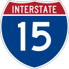 Interstate 15
|Blackfoot
Blackfoot, Idaho
Blackfoot is a city in Bingham County, Idaho, United States. The population was 10,419 at the 2000 census. The city is the county seat of Bingham County. Blackfoot is self-designated the "Potato Capital of the World", because it claims to have the largest potato industry in the world...
|43°13′20"N 112°20′36"W
|-
|colspan=4|eastern Idaho
|-
|Railroad bridge
|Union Pacific Railroad
Union Pacific Railroad
The Union Pacific Railroad , headquartered in Omaha, Nebraska, is the largest railroad network in the United States. James R. Young is president, CEO and Chairman....
|Idaho Falls
|
|-
|Bridge
|John Holes
|Idaho Falls
|
|-
|Bridge
|
U.S. Route 20(Broadway St)|Idaho Falls
|
|-
|Railroad bridge
|Eastern Idaho Railroad
Eastern Idaho Railroad
The Eastern Idaho Railroad started running on November 21, 1993, as a collection of two disconnected clusters of former Union Pacific branches. EIRR is owned by Watco, Inc , of Pittsburg, Kansas, a short line operator...
|Idaho Falls
|
|-
|Bridge
|Pancheri Dr.
|Idaho Falls
|
|-
|Bridge
|
|Idaho Falls
|
|-
|Palisades Dam
Palisades Dam
thumb|300px|Palisades Reservoir in winterPalisades Dam is an earth-fill dam on the Snake River in Bonneville County in the U.S. state of Idaho. The dam was completed in 1957 and provides irrigation water, flood control, and recreation; it features a four-turbine hydroelectric power plant. The dam...
|
|Swan Valley
Swan Valley, Idaho
Swan Valley is a city in Bonneville County, Idaho, United States. It is part of the Idaho Falls, Idaho Metropolitan Statistical Area. The population was 213 at the 2000 census.-Geography:Swan Valley is located at ....
|
|-
|Bridge
|
|Swan Valley
Swan Valley, Idaho
Swan Valley is a city in Bonneville County, Idaho, United States. It is part of the Idaho Falls, Idaho Metropolitan Statistical Area. The population was 213 at the 2000 census.-Geography:Swan Valley is located at ....
|
|-
!colspan=4|
Wyoming
|-|Jackson Lake Dam
Jackson Lake Dam
Jackson Lake Dam is a concrete and earth-fill dam at the outlet of Jackson Lake in northwestern Wyoming, USA. The lake and dam are situated within Grand Teton National Park in Teton County. The Snake River emerges from the dam and flows about through Wyoming, Idaho, Oregon, and Washington to its...
|Teton Park Road
|Grand Teton National Park
Grand Teton National Park
Grand Teton National Park is a United States National Park located in northwestern Wyoming, U.S. The Park consists of approximately and includes the major peaks of the long Teton Range as well as most of the northern sections of the valley known as Jackson Hole. Only south of Yellowstone...
|43°51′27.53"N 110°35′22.34"W
|}