
.gif)
List of county routes in Rockland County, New York (41-75)
Encyclopedia
The following is a list of county routes in Rockland County, New York from 41 to 75. Most of the routes act as primary roads in the less developed areas and also serve to interconnect the various villages and hamlets of the county. All routes are maintained by the Rockland County
highway department. Across the county, routes are numbered such that odd-numbered routes are north–south and increase in number from east to west, while even-numbered routes are east–west and increase from south to north.
There are 22 routes in this segment, the lowest being Route 41 and the highest being Route 75. The farthest north route is Route 53 in Tomkins Cove, while the farthest south is Route 41 in Chestnut Ridge. The farthest west is Route 72 in Sloatsburg and the farthest east is Route 44 in West Nyack. The longest route is Route 74, stretching for 5.3 miles (8.5 km) while the shortest route is Route 49 at .4 of a mile.

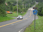
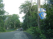
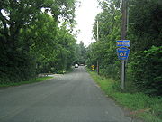
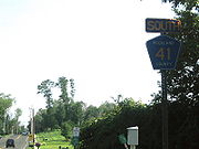 County Route 41 is a 1.5 miles (2.4 km) south–north county route in the southern part of Rockland County, New York
.
Route 41 begins at the New Jersey border in Chestnut Ridge and Upper Montvale, New Jersey, and ends at NY 45. CR 41 is the only Rockland County Route to directly intersect the Garden State Parkway
. However it is only a limited exchange. Drivers from CR 41 can only go northbound on the GSP to link up with the New York State Thruway
(I-87/I-287). Only southbound drivers from the GSP can exit on to CR 41. Drivers who want to go southbound on the GSP must proceed to Montvale
to get on the parkway. CR 41 passes a few horse farms just north of the New York/New Jersey border. After CR 41's interchange with the Garden State Parkway, it runs through some business area in Chestnut Ridge.

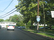
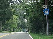 County Route 42 is a 2 miles (3.2 km) west–east county route in the southern part of Rockland County, New York
.
Route 42 begins at CR 33 in Nanuet, and ends at CR 23 in West Nyack. CR 42 runs through Nanuet and West Nyack. CR 42 has an intersection with the Palisades Interstate Parkway
(exit 7). Every summer there is a Greek Festival just off of Exit 7 of the Palisades, near CR 42. CR 42 is the link to Lake Nanuet and Manhattan Woods Golf Course, which is a private course designed by PGA
great, Gary Player
. CR 42 is best known for running along the Clarkstown/Orangetown border for most of its route, hence the name Townline Road.
 County Route 43, now Old Schoolhouse Road, was a 0.5 mile (0.80467 km) south–north route in the central part of Rockland County, New York
Former route 43 began and ended at NY 45. CR 43 ran exclusively through New Hempstead. CR 43 gave drivers from CR 80 to reach NY 45 northbound or vice versa without having to travel to the congested CR 80/NY 45 interchange. The southern half of CR 43 was a one-way road only traveling about one-tenth of a mile. After a tricky intersection with CR 80, CR 43 was a two-way, two-laned road through residential areas of New Hempstead. CR 43 ran very close to the Palisades Interstate Parkway
during its run, and was located very close to Exits 11 & 12.

 County Route 44 is a 0.6 mile (0.965604 km) west–east county route in the eastern part of Rockland County, New York
.
Route 44 begins at CR 23, and ends at CR 15. CR 44 runs exclusively through West Nyack. CR 44 gives drivers the opportunity to bypass tricky exits on NY 59
when going from Sickletown Road to Western Highway. South of CR 44 is mostly undeveloped, while NY 59 and Palisades Center
hover to the north.

 County Route 46 is a 1.3 miles (2.1 km) west–east county route in the central part of Rockland County, New York
.
Route 46 begins at CR 35, and ends at CR 33 in downtown Nanuet. CR 46 runs exclusively through the southern parts of Nanuet. CR 46 begins near the Spring Valley
line, and heads east proceeding into downtown Nanuet ending near the Nanuet Mall. CR 46 used to end at CR 33A, but overtook the route for the northern 0.2 mile (0.321868 km) of Old Middletown Road. The southern 0.1 mile (0.160934 km) of CR 33A still remains. CR 46 passes Saint Agatha Home along its route. The home houses juveniles who run away from home or need a place to stay due to other problems. Other than the group of homes at Saint Agatha's, south of CR 46 is mostly undeveloped.

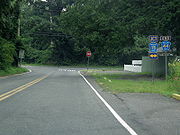
 County Route 47 is a 4.2 miles (6.8 km) south–north county route in the northern part of Rockland County, New York
.
Route 47 begins at US 202 in Mount Ivy, and ends at CR 108 in Stony Point. CR 47 runs through the villages of Mount Ivy, Thiells, and Stony Point. CR 47 has a limited junction with the Palisades Interstate Parkway
(at exit 13), as only PIP northbound passengers can directly access CR 47. In fact, CR 47 parallels the PIP for most of its route, and comes close to Exits 14 & 15. In Mount Ivy, CR 47's southern terminus also comes close to NY 45
's northern terminus. CR 47, while mostly in residential, does pass Phillip J Rotella Golf Course and North Rockland High School along its route. Just before CR 47's northern terminus, the route intersects Old NY 210
(now CR 106) in Stony Point. CR 47 and CR 23 are the only two Rockland County routes that have two concurrencies
with other county routes for a certain amount of time.

 County Route 49 is a 0.4 mile (0.643736 km) south–north county route in the central part of Rockland County, New York
. CR 49 is the shortest, non-child, south–north county route in Rockland County.
Route 49 begins at CR 86, and ends about a half-mile north at a dead end. CR 49 runs exclusively in Pomona. CR 49 is one of the newest county routes in Rockland County. CR 49 is home to the Rockland County Fire Training Center, which is seconds away from NY 45
. CR 49's northern terminus is at a dead end, but if the driver turns left, there is a fairly large animal shelter. Straight beyond CR 49's northern terminus is a hazardous waste collection area, with a private road continuing north for another third of a mile.

 County Route 51 is a 1.2 miles (1.9 km) south–north county route in the central part of Rockland County, New York
.
Route 51 begins at CR 80, and ends at NY 45. CR 51 runs exclusively in New Hempstead. CR 51 has somewhat similar route to CR 67, as both provide key south–north routes in New Hempstead. Unlike CR 67, CR 51 turns east and ends at NY 45. Summit Park Road continues south of CR 80 as Hempstead Road. It provides a link to CR 74
in Spring Valley. The Dr Robert L Yeager Health Center and other county government buildings are located on the Sanatorium Road portion of CR 51.

 County Route 52 is a 1.6 miles (2.6 km) west–east county route in the southern part of Rockland County, New York
.
Route 52 begins at CR 73 in Monsey, and ends at South Central Avenue in Spring Valley. CR 52 runs through the southern parts of Monsey and Spring Valley. CR 52 ends shortly after it crosses NY 45 because Old Nyack Turnpike switches direction heading north into downtown Spring Valley. CR 37 used to take over for CR 52, as Old Nyack Turnpike turns north as South Central Avenue, and continued to its northern terminus at NY 59
. The piece of Old Nyack Turnpike in Nanuet used to be designated as CR 52. So at one time, there were two disjointed pieces of CR 52 in Rockland County.
CR 52 was originally designated as CR 62

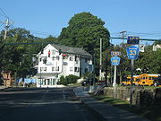
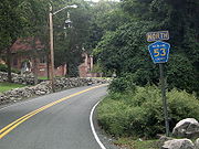 County Route 53 is a 1.5 miles (2.4 km) south–north county route in the northern part of Rockland County, New York
.
Route 53 runs through Stony Point and Tomkins Cove. CR 53 begins at US 9W/US 202 in Stony Point, and ends at CR 118 in Tomkins Cove. CR 53 is relatively close to the historic Battle of Stony Point
battlefield of the Revolutionary War
, which lies along the Hudson River
. CR 53's northern terminus comes close to Bear Mountain State Park
. CR 53 is the northern most south–north Rockland County Route. CR 53 is one of the more quiet Rockland County routes as it simply serves a few blocks of residential areas along its route.

 County Route 60 is a 1.1 miles (1.8 km) west–east county route in the central part of Rockland County, New York
.
Route 60 begins at CR 35, and ends at CR 33. CR 60 runs exclusively through Nanuet. CR 60 shares a terminus with CR 35 at its western terminus. CR 60 quickly intersects CR 35A during its route. After that intersection, CR 60 passes Airport Executive Park, which used to be an old, historic airport field in Rockland County. CR 60 then passes an entrance to the Hamlets, which is a very large condominium complex. CR 60 ends at CR 33 just about a half-mile south of CR 33's intersection with the Palisades Parkway.
 County Route 62 is now designated CR 52.

 County Route 64 is a 2.8 miles (4.5 km) west–east county route in the western part of Rockland County, New York
.
Route 64 begins at CR 93 in Montebello, and ends at West Maple Avenue in Monsey. CR 64 runs through the villages of Montebello, Airmont, and Monsey. CR 64 is an alternate route for CR 74
and NY 59
, as it runs parallel with each for its entire run. CR 64's western terminus is also CR 93's northern terminus. CR 64 comes close to the New York State Thruway
(I-87/I-287) at Exit 14B, and can be reached via CR 89 within a quarter-mile of CR 64's intersection with CR 89. CR 64's eastern terminus ends at Maple Avenue just shy of NY 306
. Beyond CR 64's western terminus, Montebello Road continues to Lake Road and Memorial Drive, which are links to US 202.

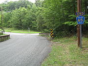 County Route 65 is a 1.6 miles (2.6 km) south–north county route in the northern part of Rockland County, New York
.
Route 65 begins at CR 112 in Stony Point, and ends at CR 118 in Bulsontown. CR 65 runs through Stony Point and Bulsontown. CR 65's southern terminus is close to Old NY 210
(CR 106
). But more notably is that CR 65's southern terminus is almost immediately after CR 112's eastern terminus, and within a quarter-mile of CR 108's eastern terminus. The spot seems to be a popular ending spot. CR 65's northern terminus comes close to Bear Mountain State Park
. CR 65's northern terminus is also CR 118's western terminus. Actually, the intersection used to be a tri-terminus for CR 65, CR 118, and former CR 69 at Bullova Lake. This is also a popular camping spot on the Bear Mountain State Park border.

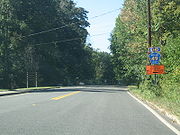
 County Route 67 is a 1.3 miles (2.1 km) south–north county route in the central part of Rockland County, New York
.
Route 67 begins at CR 86 in Pomona, and ends at CR 80 in New Hempstead. CR 67 runs through New Hempstead, and touches the Pomona border at its northern terminus. CR 67 runs through mainly residential areas. CR 67 runs parallel, directly between NY 306
and NY 45
. CR 67 is a very similar route to CR 51. CR 67's southern terminus actually comes into CR 80 at a west–east direction. This is because CR 80 dips south briefly at this point in its route. CR 67 provides a link to a few recreational areas, including Sandy Brook Town Park, Mount Ivy County Park, and Minisceongo Golf Club.

 County Route 68 is a 0.4 mile (0.643736 km) west–east county route in the western part of Rockland County, New York
. CR 68 is the shortest, non-child, county route in Rockland County.
Route 68 begins at CR 72 near the Orange County border, and ends at the Sloatsburg village line along Eagle Valley Road. CR 68 travels exclusively outside the more populated areas of Sloatsburg. CR 68 actually runs in a south–north direction, but is labeled west–east because Eagle Valley Road, after CR 68's eastern terminus, runs mainly in a west–east direction. CR 68 actually crosses the official Orange County line, but is still funded by Rockland County. In fact, some maps place CR 68 in Tuxedo Park
, which is the town in Orange County just north of the county line. Beyond CR 68's northern terminus, Eagle Valley Road continues into downtown Sloatsburg, ending at NY 17
.
 County Route 69, now just Cedar Falls Road, was a 1.8 miles (2.9 km) south–north route in northern Rockland County, New York
.
Former route 69 began at CR 106, in Stony Point, and ended at CR 118 & CR 65, in Bulsontown, near Bear Mountain State Park
. CR 69 ran through residential and rural areas in the western portion of the town of Stony Point. Cedar Falls Road has a hidden intersection with the Palisades Interstate Parkway
. It is actually just an extension of Exit 15. Drivers can reach the PIP northbound from former CR 69 without having to travel south to CR 106. Drivers from the PIP cannot reach Cedar Falls Road directly.
CR 69 had one suffixed route, CR 69A. It was a 0.1 mile (0.160934 km) route that began at CR 69 and ended at a dead end at the entrance of Bear Mountain State Park
in Bulsontown.

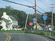
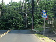 County Route 71 is a 1.5 miles (2.4 km) south–north county route in the southern part of Rockland County, New York
.
Route 71 begins close to the New Jersey border at NY 45 in Chestnut Ridge, and ends at CR 52 in Spring Valley, just after crossing over the New York State Thruway
(I-87/I-287). CR 71 runs through Chestnut Ridge and Spring Valley. CR 71's southern terminus comes close to CR 41's northern terminus, which is just north of CR 71 on NY 45. Just before its northern terminus, CR 71 crosses the New York State Thruway, near the Spring Valley toll, but does not intersect the interstate. CR 71 provides a cut-through route from Monsey to the Garden State Parkway
, without having to get on the Thruway or NY 59
. CR 71 runs mainly through residential areas.
 County Route 72 is a 1.6 miles (2.6 km) west–east county route in the western part of Rockland County, New York
.
Route 72 begins at the Orange County line in Sloatsburg and Eagle Valley, and ends at NY 17. CR 72 runs exclusively in Sloatsburg. CR 72 is the only Rockland County Route to intersect NY 17. After the western terminus, CR 72 continues as Orange County Route 72 until reaching the New Jersey border. CR 72 is the only road in Rockland County that eventually leads into Passaic County, New Jersey
. After crossing the New Jersey border, Sloatsburg Road proceeds south through Ringwood Manor State Park before ending at Passaic CR 511
.
CR 72 is one of two county routes that are shared by Rockland and Orange County. The other is County Route 106
. The total length combined for Orange CR 72 and Rockland CR 72 is 3.4 miles (5.5 km) (1.8 miles or 2.9 km in Orange). CR 72 is the western most county route in Rockland.

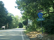 County Route 73 is a 2.3 miles (3.7 km) south–north route in the southern part of Rockland County.
Route 73 begins at the New Jersey border in Monsey and Upper Saddle River, New Jersey
, and ends at NY 59. CR 73 runs through the southern part of Monsey. CR 73 used to be the southern extension of NY 306 before 1980. CR 73 begins at the current end of NY 306 at the NY 59 intersection in Monsey. CR 73 passes Ascension Cemetery and the Saddle River Town Pool just north of the New York/New Jersey border. CR 73 passes under the New York State Thruway
(I-87/I-287) just before its northern terminus at NY 59. Monsey Glen County Park is just left of CR 73's end on NY 59.

 County Route 74 is a 5.3 miles (8.5 km) west–east county route in the central part of Rockland County, New York
.
Route 74 begins at US 202 in Montebello, near Harriman State Park, and ends at CR 35A in New City. CR 74 is an alternate route to (CR 80
), as it runs parallel with it for its entire run. CR 74 runs through Montebello, Viola, Monsey, Spring Valley, before ending just inside the New City town limits. CR 74 is a key route in Rockland as it has intersections with a few north–south state highways in the county. CR 74 passes several schools along its route, including Rockland Community College
, Suffern High School, Ramapo High School, and a few elementary schools. The CR 74 and NY 45 intersection has some meaning as it is referred to as "The Hill" by individuals living in Spring Valley.

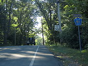
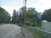
 County Route 75 is a 2.8 miles (4.5 km) south–north county route in the northern part of Rockland County, New York
. The local name of Route 75 is Call Hollow Road.
Route 75 begins at Ladentown Rd in Pomona, and ends at CR 98 in Stony Point. CR 75 runs through Pomona and Stony Point. CR 75's southern terminus comes very close to US 202
and the northern terminus of NY 306
. CR 75 does not directly connect to NY 306 as CR 73 does on NY 306's southern end. This is probably because several Rockland County Routes end as they hit the town/village limits of whatever town they are headed toward. CR 75 runs along the eastern border of Harriman State Park for most of its route, and actually runs through a brief portion of the park that extends out east toward the Palisades Interstate Parkway
. CR 75's northern terminus is close to Exit 14 of the Palisades in Stony Point. CR 75 is home to Deer Mountain Day Camp, which is located at about the midway point of CR 75.
Rockland County, New York
Rockland County is a suburban county 15 miles to the northwest of Manhattan and part of the New York City Metropolitan Area, in the U.S. state of New York. It is the southernmost county in New York west of the Hudson River, and the smallest county in New York outside of New York City. The...
highway department. Across the county, routes are numbered such that odd-numbered routes are north–south and increase in number from east to west, while even-numbered routes are east–west and increase from south to north.
There are 22 routes in this segment, the lowest being Route 41 and the highest being Route 75. The farthest north route is Route 53 in Tomkins Cove, while the farthest south is Route 41 in Chestnut Ridge. The farthest west is Route 72 in Sloatsburg and the farthest east is Route 44 in West Nyack. The longest route is Route 74, stretching for 5.3 miles (8.5 km) while the shortest route is Route 49 at .4 of a mile.
| Rockland (NY) County Routes (41–75) |
|---|
| CR 41 • CR 42 • CR 43 • CR 44 • CR 46 • CR 47 • CR 49 • CR 51 • CR 52 • CR 53 • CR 60 • CR 62 • CR 64 • CR 65 • CR 67 • CR 68 • CR 69 • CR 71 • CR 72 • CR 73 • CR 74 • CR 75 |
| Other lists: CRs 1–38 • CRs 76–118A |
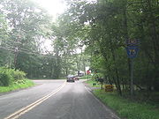
Route 41
Rockland County, New York
Rockland County is a suburban county 15 miles to the northwest of Manhattan and part of the New York City Metropolitan Area, in the U.S. state of New York. It is the southernmost county in New York west of the Hudson River, and the smallest county in New York outside of New York City. The...
.
Route 41 begins at the New Jersey border in Chestnut Ridge and Upper Montvale, New Jersey, and ends at NY 45. CR 41 is the only Rockland County Route to directly intersect the Garden State Parkway
Garden State Parkway
The Garden State Parkway is a 172.4-mile limited-access toll parkway that stretches the length of New Jersey from the New York line at Montvale, New Jersey, to Cape May at New Jersey's southernmost tip. Its name refers to New Jersey's nickname, the "Garden State." Most New Jersey residents refer...
. However it is only a limited exchange. Drivers from CR 41 can only go northbound on the GSP to link up with the New York State Thruway
New York State Thruway
The New York State Thruway is a system of limited-access highways located within the state of New York in the United States. The system, known officially as the Governor Thomas E. Dewey Thruway for former New York Governor Thomas E. Dewey, is operated by the New York State Thruway Authority and...
(I-87/I-287). Only southbound drivers from the GSP can exit on to CR 41. Drivers who want to go southbound on the GSP must proceed to Montvale
Montvale, New Jersey
Montvale is a borough in Bergen County, New Jersey, United States. As of the 2010 United States Census, the borough population was 7,844.Montvale was incorporated as a borough on August 31, 1894, from portions of Orvil Township and Washington Township, at the height of the "Boroughitis" craze then...
to get on the parkway. CR 41 passes a few horse farms just north of the New York/New Jersey border. After CR 41's interchange with the Garden State Parkway, it runs through some business area in Chestnut Ridge.
Route 42
Rockland County, New York
Rockland County is a suburban county 15 miles to the northwest of Manhattan and part of the New York City Metropolitan Area, in the U.S. state of New York. It is the southernmost county in New York west of the Hudson River, and the smallest county in New York outside of New York City. The...
.
Route 42 begins at CR 33 in Nanuet, and ends at CR 23 in West Nyack. CR 42 runs through Nanuet and West Nyack. CR 42 has an intersection with the Palisades Interstate Parkway
Palisades Interstate Parkway
The Palisades Interstate Parkway is a long limited-access highway in the U.S. states of New Jersey and New York. The parkway is a major commuter route into New York City from Rockland and Orange counties in New York and Bergen County in New Jersey...
(exit 7). Every summer there is a Greek Festival just off of Exit 7 of the Palisades, near CR 42. CR 42 is the link to Lake Nanuet and Manhattan Woods Golf Course, which is a private course designed by PGA
PGA Tour
The PGA Tour is the organizer of the main men's professional golf tours in the United States and North America...
great, Gary Player
Gary Player
Gary Player DMS; OIG is a South African professional golfer. With his nine major championship victories, he is widely regarded as one of the greatest players in the history of golf. He was inducted into the World Golf Hall of Fame in 1974. Player has won 165 tournaments on six continents over six...
. CR 42 is best known for running along the Clarkstown/Orangetown border for most of its route, hence the name Townline Road.
Route 43
Rockland County, New York
Rockland County is a suburban county 15 miles to the northwest of Manhattan and part of the New York City Metropolitan Area, in the U.S. state of New York. It is the southernmost county in New York west of the Hudson River, and the smallest county in New York outside of New York City. The...
Former route 43 began and ended at NY 45. CR 43 ran exclusively through New Hempstead. CR 43 gave drivers from CR 80 to reach NY 45 northbound or vice versa without having to travel to the congested CR 80/NY 45 interchange. The southern half of CR 43 was a one-way road only traveling about one-tenth of a mile. After a tricky intersection with CR 80, CR 43 was a two-way, two-laned road through residential areas of New Hempstead. CR 43 ran very close to the Palisades Interstate Parkway
Palisades Interstate Parkway
The Palisades Interstate Parkway is a long limited-access highway in the U.S. states of New Jersey and New York. The parkway is a major commuter route into New York City from Rockland and Orange counties in New York and Bergen County in New Jersey...
during its run, and was located very close to Exits 11 & 12.
Route 44
Rockland County, New York
Rockland County is a suburban county 15 miles to the northwest of Manhattan and part of the New York City Metropolitan Area, in the U.S. state of New York. It is the southernmost county in New York west of the Hudson River, and the smallest county in New York outside of New York City. The...
.
Route 44 begins at CR 23, and ends at CR 15. CR 44 runs exclusively through West Nyack. CR 44 gives drivers the opportunity to bypass tricky exits on NY 59
New York State Route 59
New York State Route 59 is an east–west state highway in southern Rockland County, New York, in the United States. The route extends for from NY 17 in Hillburn to U.S. Route 9W in Nyack. In Suffern, it has a concurrency with US 202 for . NY 59 runs parallel to the New...
when going from Sickletown Road to Western Highway. South of CR 44 is mostly undeveloped, while NY 59 and Palisades Center
Palisades Center
The Palisades Center Mall, often referred to as the Palisades Mall, in West Nyack, New York is the eighth largest shopping mall in the United States by total area, and sixth largest by gross leasable space...
hover to the north.
Route 46
Rockland County, New York
Rockland County is a suburban county 15 miles to the northwest of Manhattan and part of the New York City Metropolitan Area, in the U.S. state of New York. It is the southernmost county in New York west of the Hudson River, and the smallest county in New York outside of New York City. The...
.
Route 46 begins at CR 35, and ends at CR 33 in downtown Nanuet. CR 46 runs exclusively through the southern parts of Nanuet. CR 46 begins near the Spring Valley
Spring Valley, New York
Spring Valley, incorporated on July 9, 1902 is a village spanning the Town of Ramapo and Town of Clarkstown in Rockland County, New York, United States located north of Nanuet; east of Airmont and Monsey; south of Hillcrest and west of West Nyack...
line, and heads east proceeding into downtown Nanuet ending near the Nanuet Mall. CR 46 used to end at CR 33A, but overtook the route for the northern 0.2 mile (0.321868 km) of Old Middletown Road. The southern 0.1 mile (0.160934 km) of CR 33A still remains. CR 46 passes Saint Agatha Home along its route. The home houses juveniles who run away from home or need a place to stay due to other problems. Other than the group of homes at Saint Agatha's, south of CR 46 is mostly undeveloped.
Route 47
Rockland County, New York
Rockland County is a suburban county 15 miles to the northwest of Manhattan and part of the New York City Metropolitan Area, in the U.S. state of New York. It is the southernmost county in New York west of the Hudson River, and the smallest county in New York outside of New York City. The...
.
Route 47 begins at US 202 in Mount Ivy, and ends at CR 108 in Stony Point. CR 47 runs through the villages of Mount Ivy, Thiells, and Stony Point. CR 47 has a limited junction with the Palisades Interstate Parkway
Palisades Interstate Parkway
The Palisades Interstate Parkway is a long limited-access highway in the U.S. states of New Jersey and New York. The parkway is a major commuter route into New York City from Rockland and Orange counties in New York and Bergen County in New Jersey...
(at exit 13), as only PIP northbound passengers can directly access CR 47. In fact, CR 47 parallels the PIP for most of its route, and comes close to Exits 14 & 15. In Mount Ivy, CR 47's southern terminus also comes close to NY 45
New York State Route 45
New York State Route 45 is a north–south state highway in central Rockland County, New York, United States. It spans from the village of Chestnut Ridge at the New Jersey – New York border, where it becomes County Route 73 in Bergen County, New Jersey, to U.S. Route 202 in...
's northern terminus. CR 47, while mostly in residential, does pass Phillip J Rotella Golf Course and North Rockland High School along its route. Just before CR 47's northern terminus, the route intersects Old NY 210
New York State Route 210
New York State Route 210 is a state highway in Orange County, New York, in the United States. It runs north from the New Jersey state line—where it continues south as Passaic County Route 511 —along the west shore of Greenwood Lake to the eponymous village of Greenwood Lake, where it...
(now CR 106) in Stony Point. CR 47 and CR 23 are the only two Rockland County routes that have two concurrencies
Concurrency (road)
A concurrency, overlap, or coincidence in a road network is an instance of one physical road bearing two or more different highway, motorway, or other route numbers...
with other county routes for a certain amount of time.
Route 49
Rockland County, New York
Rockland County is a suburban county 15 miles to the northwest of Manhattan and part of the New York City Metropolitan Area, in the U.S. state of New York. It is the southernmost county in New York west of the Hudson River, and the smallest county in New York outside of New York City. The...
. CR 49 is the shortest, non-child, south–north county route in Rockland County.
Route 49 begins at CR 86, and ends about a half-mile north at a dead end. CR 49 runs exclusively in Pomona. CR 49 is one of the newest county routes in Rockland County. CR 49 is home to the Rockland County Fire Training Center, which is seconds away from NY 45
New York State Route 45
New York State Route 45 is a north–south state highway in central Rockland County, New York, United States. It spans from the village of Chestnut Ridge at the New Jersey – New York border, where it becomes County Route 73 in Bergen County, New Jersey, to U.S. Route 202 in...
. CR 49's northern terminus is at a dead end, but if the driver turns left, there is a fairly large animal shelter. Straight beyond CR 49's northern terminus is a hazardous waste collection area, with a private road continuing north for another third of a mile.
Route 51
Rockland County, New York
Rockland County is a suburban county 15 miles to the northwest of Manhattan and part of the New York City Metropolitan Area, in the U.S. state of New York. It is the southernmost county in New York west of the Hudson River, and the smallest county in New York outside of New York City. The...
.
Route 51 begins at CR 80, and ends at NY 45. CR 51 runs exclusively in New Hempstead. CR 51 has somewhat similar route to CR 67, as both provide key south–north routes in New Hempstead. Unlike CR 67, CR 51 turns east and ends at NY 45. Summit Park Road continues south of CR 80 as Hempstead Road. It provides a link to CR 74
County Route 74 (Rockland County, New York)
County Route 74 is a long west–east county route in the central part of Rockland County, New York. CR 74 begins at US 202 in Montebello, near Harriman State Park, and ends at CR 35A in New City. CR 74 is an alternate route to County Route 80, as it runs...
in Spring Valley. The Dr Robert L Yeager Health Center and other county government buildings are located on the Sanatorium Road portion of CR 51.
Route 52
Rockland County, New York
Rockland County is a suburban county 15 miles to the northwest of Manhattan and part of the New York City Metropolitan Area, in the U.S. state of New York. It is the southernmost county in New York west of the Hudson River, and the smallest county in New York outside of New York City. The...
.
Route 52 begins at CR 73 in Monsey, and ends at South Central Avenue in Spring Valley. CR 52 runs through the southern parts of Monsey and Spring Valley. CR 52 ends shortly after it crosses NY 45 because Old Nyack Turnpike switches direction heading north into downtown Spring Valley. CR 37 used to take over for CR 52, as Old Nyack Turnpike turns north as South Central Avenue, and continued to its northern terminus at NY 59
New York State Route 59
New York State Route 59 is an east–west state highway in southern Rockland County, New York, in the United States. The route extends for from NY 17 in Hillburn to U.S. Route 9W in Nyack. In Suffern, it has a concurrency with US 202 for . NY 59 runs parallel to the New...
. The piece of Old Nyack Turnpike in Nanuet used to be designated as CR 52. So at one time, there were two disjointed pieces of CR 52 in Rockland County.
CR 52 was originally designated as CR 62
Route 53
Rockland County, New York
Rockland County is a suburban county 15 miles to the northwest of Manhattan and part of the New York City Metropolitan Area, in the U.S. state of New York. It is the southernmost county in New York west of the Hudson River, and the smallest county in New York outside of New York City. The...
.
Route 53 runs through Stony Point and Tomkins Cove. CR 53 begins at US 9W/US 202 in Stony Point, and ends at CR 118 in Tomkins Cove. CR 53 is relatively close to the historic Battle of Stony Point
Battle of Stony Point
The Battle of Stony Point was a battle of the American Revolutionary War fought on the night of July 15–16, 1779. A select force of Continental Army infantry made a coordinated surprise night attack and stormed a fortified position of the British Army on the Hudson River south of West Point, New...
battlefield of the Revolutionary War
American Revolutionary War
The American Revolutionary War , the American War of Independence, or simply the Revolutionary War, began as a war between the Kingdom of Great Britain and thirteen British colonies in North America, and ended in a global war between several European great powers.The war was the result of the...
, which lies along the Hudson River
Hudson River
The Hudson is a river that flows from north to south through eastern New York. The highest official source is at Lake Tear of the Clouds, on the slopes of Mount Marcy in the Adirondack Mountains. The river itself officially begins in Henderson Lake in Newcomb, New York...
. CR 53's northern terminus comes close to Bear Mountain State Park
Bear Mountain State Park
Bear Mountain State Park is located on the west side of the Hudson River in Orange and Rockland counties of New York. The park offers biking, hiking, boating, picnicking, swimming, cross-country skiing, cross-country running, sledding and ice skating...
. CR 53 is the northern most south–north Rockland County Route. CR 53 is one of the more quiet Rockland County routes as it simply serves a few blocks of residential areas along its route.
Route 60
Rockland County, New York
Rockland County is a suburban county 15 miles to the northwest of Manhattan and part of the New York City Metropolitan Area, in the U.S. state of New York. It is the southernmost county in New York west of the Hudson River, and the smallest county in New York outside of New York City. The...
.
Route 60 begins at CR 35, and ends at CR 33. CR 60 runs exclusively through Nanuet. CR 60 shares a terminus with CR 35 at its western terminus. CR 60 quickly intersects CR 35A during its route. After that intersection, CR 60 passes Airport Executive Park, which used to be an old, historic airport field in Rockland County. CR 60 then passes an entrance to the Hamlets, which is a very large condominium complex. CR 60 ends at CR 33 just about a half-mile south of CR 33's intersection with the Palisades Parkway.
Route 62
Route 64
Rockland County, New York
Rockland County is a suburban county 15 miles to the northwest of Manhattan and part of the New York City Metropolitan Area, in the U.S. state of New York. It is the southernmost county in New York west of the Hudson River, and the smallest county in New York outside of New York City. The...
.
Route 64 begins at CR 93 in Montebello, and ends at West Maple Avenue in Monsey. CR 64 runs through the villages of Montebello, Airmont, and Monsey. CR 64 is an alternate route for CR 74
County Route 74 (Rockland County, New York)
County Route 74 is a long west–east county route in the central part of Rockland County, New York. CR 74 begins at US 202 in Montebello, near Harriman State Park, and ends at CR 35A in New City. CR 74 is an alternate route to County Route 80, as it runs...
and NY 59
New York State Route 59
New York State Route 59 is an east–west state highway in southern Rockland County, New York, in the United States. The route extends for from NY 17 in Hillburn to U.S. Route 9W in Nyack. In Suffern, it has a concurrency with US 202 for . NY 59 runs parallel to the New...
, as it runs parallel with each for its entire run. CR 64's western terminus is also CR 93's northern terminus. CR 64 comes close to the New York State Thruway
New York State Thruway
The New York State Thruway is a system of limited-access highways located within the state of New York in the United States. The system, known officially as the Governor Thomas E. Dewey Thruway for former New York Governor Thomas E. Dewey, is operated by the New York State Thruway Authority and...
(I-87/I-287) at Exit 14B, and can be reached via CR 89 within a quarter-mile of CR 64's intersection with CR 89. CR 64's eastern terminus ends at Maple Avenue just shy of NY 306
New York State Route 306
New York State Route 306 is a north–south state highway in western Rockland County, New York in the United States. NY 306 runs from NY 59 in the hamlet of Monsey to U.S. Route 202 in Ladentown, on the western boundary of the village of Pomona...
. Beyond CR 64's western terminus, Montebello Road continues to Lake Road and Memorial Drive, which are links to US 202.
Route 65
Rockland County, New York
Rockland County is a suburban county 15 miles to the northwest of Manhattan and part of the New York City Metropolitan Area, in the U.S. state of New York. It is the southernmost county in New York west of the Hudson River, and the smallest county in New York outside of New York City. The...
.
Route 65 begins at CR 112 in Stony Point, and ends at CR 118 in Bulsontown. CR 65 runs through Stony Point and Bulsontown. CR 65's southern terminus is close to Old NY 210
New York State Route 210
New York State Route 210 is a state highway in Orange County, New York, in the United States. It runs north from the New Jersey state line—where it continues south as Passaic County Route 511 —along the west shore of Greenwood Lake to the eponymous village of Greenwood Lake, where it...
(CR 106
County Route 106 (Rockland County, New York)
County Route 106 is the continuation of Orange County Route 106 in Rockland County, New York. The route is long and heads east–west through Harriman State Park. The route originated as New York State Route 210 and as County Highway 416 back in the 1920s and 1930s...
). But more notably is that CR 65's southern terminus is almost immediately after CR 112's eastern terminus, and within a quarter-mile of CR 108's eastern terminus. The spot seems to be a popular ending spot. CR 65's northern terminus comes close to Bear Mountain State Park
Bear Mountain State Park
Bear Mountain State Park is located on the west side of the Hudson River in Orange and Rockland counties of New York. The park offers biking, hiking, boating, picnicking, swimming, cross-country skiing, cross-country running, sledding and ice skating...
. CR 65's northern terminus is also CR 118's western terminus. Actually, the intersection used to be a tri-terminus for CR 65, CR 118, and former CR 69 at Bullova Lake. This is also a popular camping spot on the Bear Mountain State Park border.
Route 67
Rockland County, New York
Rockland County is a suburban county 15 miles to the northwest of Manhattan and part of the New York City Metropolitan Area, in the U.S. state of New York. It is the southernmost county in New York west of the Hudson River, and the smallest county in New York outside of New York City. The...
.
Route 67 begins at CR 86 in Pomona, and ends at CR 80 in New Hempstead. CR 67 runs through New Hempstead, and touches the Pomona border at its northern terminus. CR 67 runs through mainly residential areas. CR 67 runs parallel, directly between NY 306
New York State Route 306
New York State Route 306 is a north–south state highway in western Rockland County, New York in the United States. NY 306 runs from NY 59 in the hamlet of Monsey to U.S. Route 202 in Ladentown, on the western boundary of the village of Pomona...
and NY 45
New York State Route 45
New York State Route 45 is a north–south state highway in central Rockland County, New York, United States. It spans from the village of Chestnut Ridge at the New Jersey – New York border, where it becomes County Route 73 in Bergen County, New Jersey, to U.S. Route 202 in...
. CR 67 is a very similar route to CR 51. CR 67's southern terminus actually comes into CR 80 at a west–east direction. This is because CR 80 dips south briefly at this point in its route. CR 67 provides a link to a few recreational areas, including Sandy Brook Town Park, Mount Ivy County Park, and Minisceongo Golf Club.
Route 68
Rockland County, New York
Rockland County is a suburban county 15 miles to the northwest of Manhattan and part of the New York City Metropolitan Area, in the U.S. state of New York. It is the southernmost county in New York west of the Hudson River, and the smallest county in New York outside of New York City. The...
. CR 68 is the shortest, non-child, county route in Rockland County.
Route 68 begins at CR 72 near the Orange County border, and ends at the Sloatsburg village line along Eagle Valley Road. CR 68 travels exclusively outside the more populated areas of Sloatsburg. CR 68 actually runs in a south–north direction, but is labeled west–east because Eagle Valley Road, after CR 68's eastern terminus, runs mainly in a west–east direction. CR 68 actually crosses the official Orange County line, but is still funded by Rockland County. In fact, some maps place CR 68 in Tuxedo Park
Tuxedo Park, New York
Tuxedo Park is a village in Orange County, New York, United States. The population was 731 at the 2000 census. It is part of the Poughkeepsie–Newburgh–Middletown, NY Metropolitan Statistical Area as well as the larger New York–Newark–Bridgeport, NY-NJ-CT-PA Combined...
, which is the town in Orange County just north of the county line. Beyond CR 68's northern terminus, Eagle Valley Road continues into downtown Sloatsburg, ending at NY 17
New York State Route 17
New York State Route 17 is a state highway that extends for through the Southern Tier and Downstate regions of New York in the United States...
.
Route 69
Rockland County, New York
Rockland County is a suburban county 15 miles to the northwest of Manhattan and part of the New York City Metropolitan Area, in the U.S. state of New York. It is the southernmost county in New York west of the Hudson River, and the smallest county in New York outside of New York City. The...
.
Former route 69 began at CR 106, in Stony Point, and ended at CR 118 & CR 65, in Bulsontown, near Bear Mountain State Park
Bear Mountain State Park
Bear Mountain State Park is located on the west side of the Hudson River in Orange and Rockland counties of New York. The park offers biking, hiking, boating, picnicking, swimming, cross-country skiing, cross-country running, sledding and ice skating...
. CR 69 ran through residential and rural areas in the western portion of the town of Stony Point. Cedar Falls Road has a hidden intersection with the Palisades Interstate Parkway
Palisades Interstate Parkway
The Palisades Interstate Parkway is a long limited-access highway in the U.S. states of New Jersey and New York. The parkway is a major commuter route into New York City from Rockland and Orange counties in New York and Bergen County in New Jersey...
. It is actually just an extension of Exit 15. Drivers can reach the PIP northbound from former CR 69 without having to travel south to CR 106. Drivers from the PIP cannot reach Cedar Falls Road directly.
CR 69 had one suffixed route, CR 69A. It was a 0.1 mile (0.160934 km) route that began at CR 69 and ended at a dead end at the entrance of Bear Mountain State Park
Bear Mountain State Park
Bear Mountain State Park is located on the west side of the Hudson River in Orange and Rockland counties of New York. The park offers biking, hiking, boating, picnicking, swimming, cross-country skiing, cross-country running, sledding and ice skating...
in Bulsontown.
Route 71
Rockland County, New York
Rockland County is a suburban county 15 miles to the northwest of Manhattan and part of the New York City Metropolitan Area, in the U.S. state of New York. It is the southernmost county in New York west of the Hudson River, and the smallest county in New York outside of New York City. The...
.
Route 71 begins close to the New Jersey border at NY 45 in Chestnut Ridge, and ends at CR 52 in Spring Valley, just after crossing over the New York State Thruway
New York State Thruway
The New York State Thruway is a system of limited-access highways located within the state of New York in the United States. The system, known officially as the Governor Thomas E. Dewey Thruway for former New York Governor Thomas E. Dewey, is operated by the New York State Thruway Authority and...
(I-87/I-287). CR 71 runs through Chestnut Ridge and Spring Valley. CR 71's southern terminus comes close to CR 41's northern terminus, which is just north of CR 71 on NY 45. Just before its northern terminus, CR 71 crosses the New York State Thruway, near the Spring Valley toll, but does not intersect the interstate. CR 71 provides a cut-through route from Monsey to the Garden State Parkway
Garden State Parkway
The Garden State Parkway is a 172.4-mile limited-access toll parkway that stretches the length of New Jersey from the New York line at Montvale, New Jersey, to Cape May at New Jersey's southernmost tip. Its name refers to New Jersey's nickname, the "Garden State." Most New Jersey residents refer...
, without having to get on the Thruway or NY 59
New York State Route 59
New York State Route 59 is an east–west state highway in southern Rockland County, New York, in the United States. The route extends for from NY 17 in Hillburn to U.S. Route 9W in Nyack. In Suffern, it has a concurrency with US 202 for . NY 59 runs parallel to the New...
. CR 71 runs mainly through residential areas.
Route 72
Rockland County, New York
Rockland County is a suburban county 15 miles to the northwest of Manhattan and part of the New York City Metropolitan Area, in the U.S. state of New York. It is the southernmost county in New York west of the Hudson River, and the smallest county in New York outside of New York City. The...
.
Route 72 begins at the Orange County line in Sloatsburg and Eagle Valley, and ends at NY 17. CR 72 runs exclusively in Sloatsburg. CR 72 is the only Rockland County Route to intersect NY 17. After the western terminus, CR 72 continues as Orange County Route 72 until reaching the New Jersey border. CR 72 is the only road in Rockland County that eventually leads into Passaic County, New Jersey
Passaic County, New Jersey
Passaic County is a county located in the U.S. state of New Jersey. As of the 2010 Census, the population was 501,226. Its county seat is Paterson...
. After crossing the New Jersey border, Sloatsburg Road proceeds south through Ringwood Manor State Park before ending at Passaic CR 511
County Route 511 (New Jersey)
County Route 511 is a county highway in the U.S. state of New Jersey. The highway extends 37.44 miles from Columbia Avenue in Morris Township to the New York state line in West Milford....
.
CR 72 is one of two county routes that are shared by Rockland and Orange County. The other is County Route 106
County Route 106 (Rockland County, New York)
County Route 106 is the continuation of Orange County Route 106 in Rockland County, New York. The route is long and heads east–west through Harriman State Park. The route originated as New York State Route 210 and as County Highway 416 back in the 1920s and 1930s...
. The total length combined for Orange CR 72 and Rockland CR 72 is 3.4 miles (5.5 km) (1.8 miles or 2.9 km in Orange). CR 72 is the western most county route in Rockland.
Route 73
Route 73 begins at the New Jersey border in Monsey and Upper Saddle River, New Jersey
Upper Saddle River, New Jersey
Upper Saddle River is an affluent borough in Bergen County, New Jersey, United States. As of the 2010 United States Census, the borough population was 8,208. It is not to be confused with the neighboring borough of Saddle River.-History:...
, and ends at NY 59. CR 73 runs through the southern part of Monsey. CR 73 used to be the southern extension of NY 306 before 1980. CR 73 begins at the current end of NY 306 at the NY 59 intersection in Monsey. CR 73 passes Ascension Cemetery and the Saddle River Town Pool just north of the New York/New Jersey border. CR 73 passes under the New York State Thruway
New York State Thruway
The New York State Thruway is a system of limited-access highways located within the state of New York in the United States. The system, known officially as the Governor Thomas E. Dewey Thruway for former New York Governor Thomas E. Dewey, is operated by the New York State Thruway Authority and...
(I-87/I-287) just before its northern terminus at NY 59. Monsey Glen County Park is just left of CR 73's end on NY 59.
Route 74
Rockland County, New York
Rockland County is a suburban county 15 miles to the northwest of Manhattan and part of the New York City Metropolitan Area, in the U.S. state of New York. It is the southernmost county in New York west of the Hudson River, and the smallest county in New York outside of New York City. The...
.
Route 74 begins at US 202 in Montebello, near Harriman State Park, and ends at CR 35A in New City. CR 74 is an alternate route to (CR 80
County Route 80 (Rockland County, New York)
County Route 80 is a west–east county route in the central part of Rockland County, New York. CR 80 serves as an alternative route for NY 59 and the New York State Thruway . In fact, CR 80 is the only route besides those two major routes that runs completely from the...
), as it runs parallel with it for its entire run. CR 74 runs through Montebello, Viola, Monsey, Spring Valley, before ending just inside the New City town limits. CR 74 is a key route in Rockland as it has intersections with a few north–south state highways in the county. CR 74 passes several schools along its route, including Rockland Community College
Rockland Community College
Rockland Community College is a two-year college in the State University of New York system, located in hamlet of Viola within the Village of Suffern from the Town of Ramapo in Rockland County, New York. The college began in 1959 in the former county almshouse. The college offers 48 programs and...
, Suffern High School, Ramapo High School, and a few elementary schools. The CR 74 and NY 45 intersection has some meaning as it is referred to as "The Hill" by individuals living in Spring Valley.
Route 75
Rockland County, New York
Rockland County is a suburban county 15 miles to the northwest of Manhattan and part of the New York City Metropolitan Area, in the U.S. state of New York. It is the southernmost county in New York west of the Hudson River, and the smallest county in New York outside of New York City. The...
. The local name of Route 75 is Call Hollow Road.
Route 75 begins at Ladentown Rd in Pomona, and ends at CR 98 in Stony Point. CR 75 runs through Pomona and Stony Point. CR 75's southern terminus comes very close to US 202
U.S. Route 202
U.S. Route 202 is a highway stretching from Delaware to Maine, also passing through the states of Pennsylvania, New Jersey, New York, Connecticut, Massachusetts, and New Hampshire....
and the northern terminus of NY 306
New York State Route 306
New York State Route 306 is a north–south state highway in western Rockland County, New York in the United States. NY 306 runs from NY 59 in the hamlet of Monsey to U.S. Route 202 in Ladentown, on the western boundary of the village of Pomona...
. CR 75 does not directly connect to NY 306 as CR 73 does on NY 306's southern end. This is probably because several Rockland County Routes end as they hit the town/village limits of whatever town they are headed toward. CR 75 runs along the eastern border of Harriman State Park for most of its route, and actually runs through a brief portion of the park that extends out east toward the Palisades Interstate Parkway
Palisades Interstate Parkway
The Palisades Interstate Parkway is a long limited-access highway in the U.S. states of New Jersey and New York. The parkway is a major commuter route into New York City from Rockland and Orange counties in New York and Bergen County in New Jersey...
. CR 75's northern terminus is close to Exit 14 of the Palisades in Stony Point. CR 75 is home to Deer Mountain Day Camp, which is located at about the midway point of CR 75.
See also
- List of county routes in Rockland County, New York
- List of county routes in Rockland County, New York (1–38)
- List of county routes in Rockland County, New York (76–118A)